But I understand Wikiloc is good for Europe and South America.
I use Komoot for bikepacking and have been very happy with that product. Is it any good for hiking?
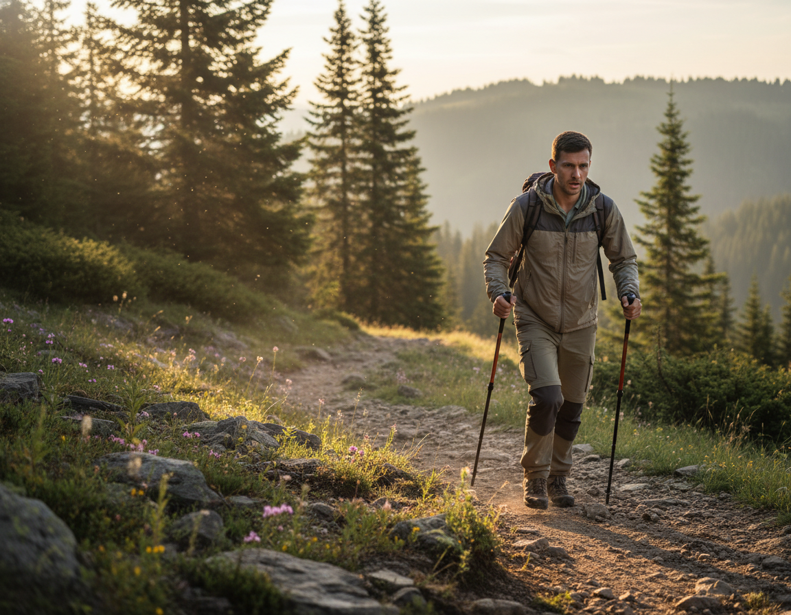
In this post I compare offline navigation for the paid subscriptions.
For discovering trails nearbyme (Parksville, Vancouver Island) on their websites, I felt Komoot was weakest. AllTrails best, by far.
On the other hand, one problem with AllTrails is displaying too many options. Too many variations in the same hiking area can be confusing. Since there is a lot of user generated content, quality is mixed.
When I decided on a well known, popular hiking area ➙ Little Qualicum Falls, again AllTrails was by far best at giving me hiking options.
In terms of description, the AllTrails preview graphic video is most useful for me. I make a lot of decisions on which hike to choose based on these preview videos.
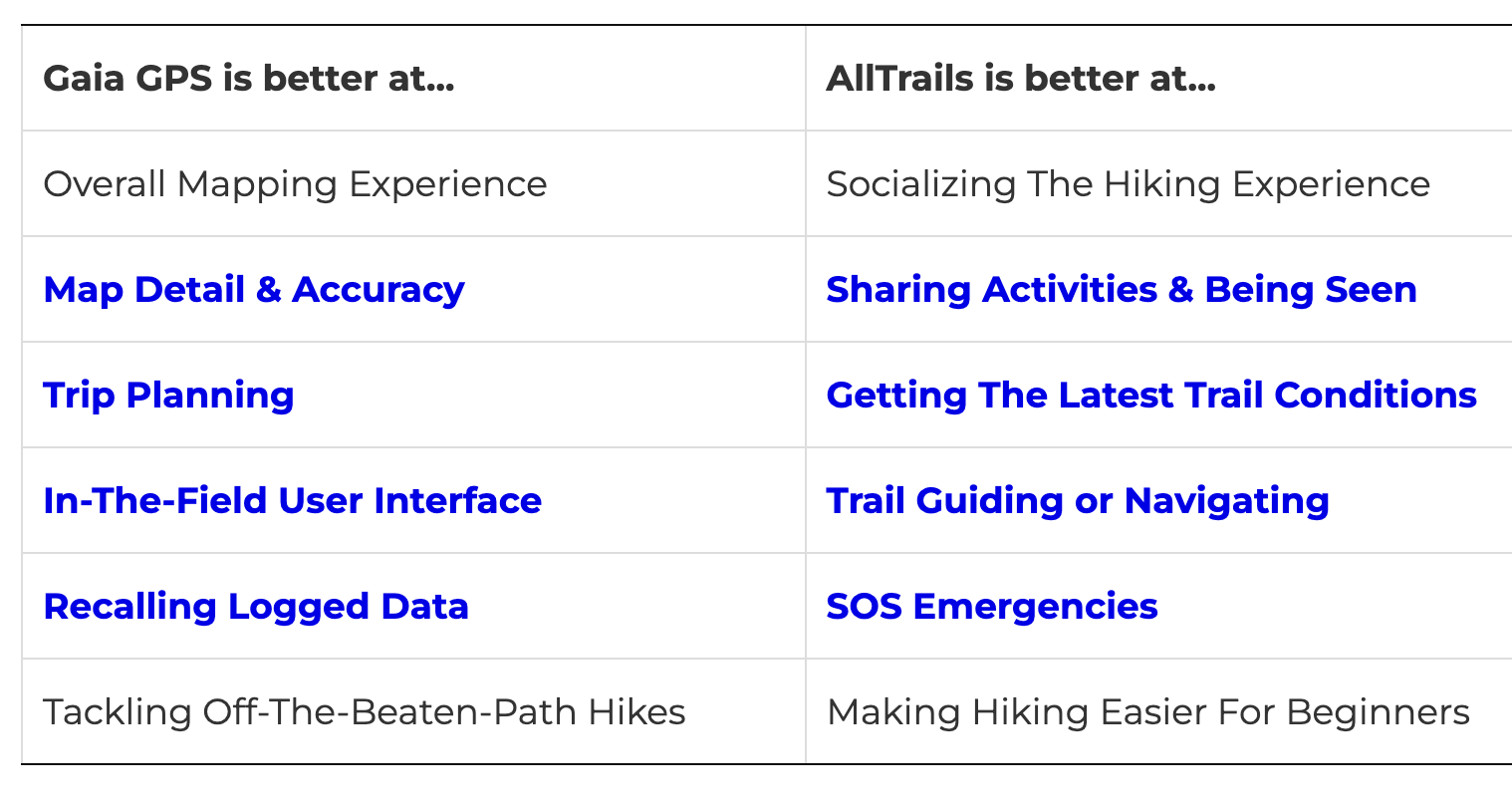
So far, AllTrails is by far my favourite of the three.
Next I went to my iPhones.
Logged into all 3 apps, I searched for “Englishman River Falls“. This is one of the most popular and well established hikes nearby. Komoot identified the trail on a map, but didn’t offer a way to SAVE and download.
I did the hike simultaneously using Gaia and AllTrails on two phones. Both worked well at the basic function of navigation.
I won’t use many of the functions, including Lifeline on AllTrails.
IF I want to make a record of any particular hike, I use the free version of the ReLiveapp. I’ve had a paid subscription in the past, but find the free features enough for my purposes.
Most mornings I take coffee down to Rathtrevor Beach Provincial Park, my favourite walk in the area.
Again,
Johnny Cheng did a deep dive into both apps, concluding that more inexperienced hikers would probably like AllTrails better. That hunters and those going off trail would appreciate the enhanced mapping features of Gaia GPS.
I’ll search for hikes using a number of different sources as AllTrails can be confusing.
Look at the video preview on AllTrails.
Mostly use AllTrails for navigation. And compare with Gaia if there is any confusion.
Honestly, for the majority of trails I hike I follow signage. And check the free offline Maps.me app to confirm I’m still on popular trails. It’s all I used on the challenging Laugevagur Trail in Iceland, for example, summer 2023.
Mostly, I use my Apple Watch as a remote for taking PHOTOS and VIDEOS on the trail.
Most of the time, the watch shows a low resolution image so I can better frame the shot.
For example, I took this photo of myself in a Prambanan temple using the watch. Typical range is 33 feet (10 meters) — but I find it varies quite a bit.
One downside ➙ doing this does kill the watch battery quickly. MUST remember to bring the charging cable with me on the hike. 😀
I was inspired by Kurt Papke to better organize how I use my Apple Watch while hiking.
Singapore offers a plethora of trails that showcase its rich biodiversity and stunning landscapes. The trails range from serene coastal paths to lush forest routes …
Among the must-visit trails is the Southern Ridges, a 10-kilometer stretch that connects several parks and offers breathtaking views of the city’s skyline and the harbor.
Another popular choice is the MacRitchie Reservoir Loop, where hikers immerse themselves in the sights and sounds of native wildlife while navigating a canopy walk that elevates them above the forest floor. Here are a few more trails to consider:
Bukit Timah Nature reserve – Home to Singapore’s tallest hill.
Coney Island - Explore unique flora and fauna in a rustic setting.
Labrador Nature Reserve – A past site with tranquil sea views.
Distance is a minimum of 86.4 km. Elevation gain 4,661m.
Stingy Nomads hiked about 100km. Average walking time 7 hours per day, between 14-20 km.
Getting a permit can be problematic.
You can hike the trail all year round though in winter (June to August) days are shorter and temperatures are lower. Snowfalls can occur high in the mountains.
Summer months (December to February) are known as rainy months; it’s warmer than in winter and days are longer but heavy rains can be a pain.
December is as well a peak season due to the Christmas holidays so it can be crowded and you’ll probably have to book the trail beforehand.
October and November is a good time for hiking; the weather is nice and there are very few people on the trail.
We did it at the end of November – beginning of December and were the only people on the trail. It was very easy to book we did it just 2 days before the hike. In 6 days we didn’t see any other hikers or even people (only locals from far away). The trail is well-marked and easy to follow just always check for yellow footprints that you can find painted on trees or rocks.
Accommodation on the trail
Every night you sleep in a hut so no need to carry a tent and sleeping pad. All huts have beds with mattresses, showers, toilets, running water, fireplace, rubbish bin, and outside or inside dining area. No electricity on the trail don’t expect to charge your devices or read with electric light. …