Eric is one of the top hiking YouTubers. One of the reasons I signed up instantly when he posted this trip is for the superb video documentation.
Before you sign up for Kili, watch his 43 minute documentary in 4K.
Sure Kili is one of the easiest trekking peaks close to 6000m — but it ain’t easy.
This guided trek on the highest mountain in Africa is as good as it gets. Eric worked with Zara Tours, the biggest outfitter on the mountain. TrovaTrip handled logistics.
BUT climbing one of the many alternatives might be better and far less expensive.
Eibhlis Gale-Coleman lays out some of the options:
Mount Kenya
Mount Meru, Tanzania
Mount Ololokwe, Kenya
Mount Ras Dashen, Ethiopia
Mount Ngaliema (Mount Stanley), Uganda
Oldoinyo Lesatima (Mount Satima), Kenya
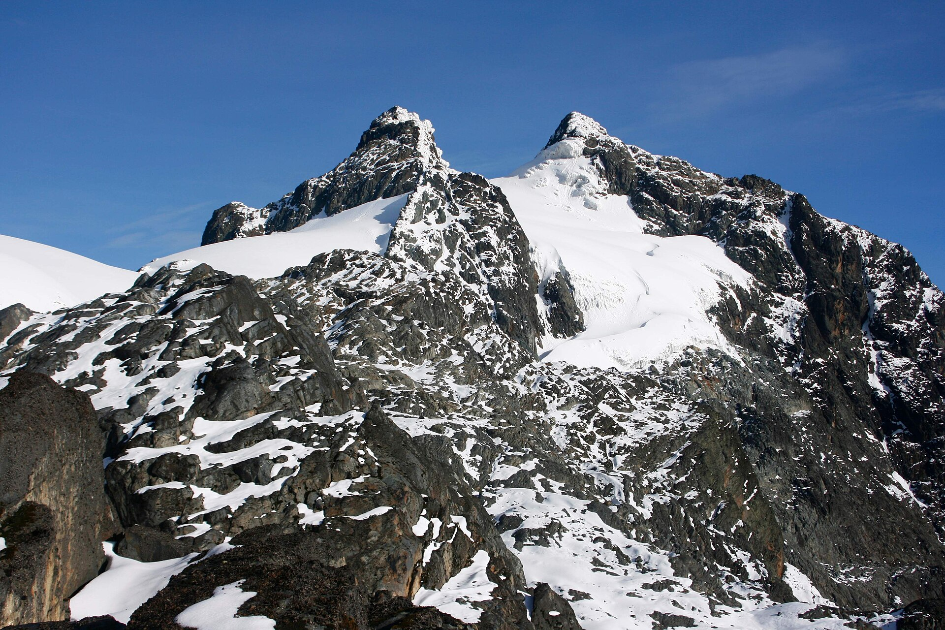
Mount Ngaliema is no mean feat. Perched in the Rwenzori Mountains National Park, it stands at 16,761 feet (5,109 meters), and is the third-highest peak in Africa. The terrain begins in rainforest and ends with a glacier traverse that necessitates crampons: Arrive expecting a pole-assisted trudge, and you’ll be overwhelmed. …
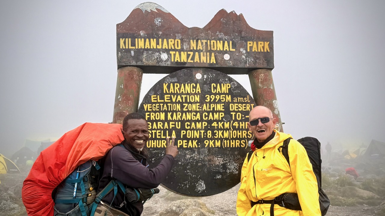
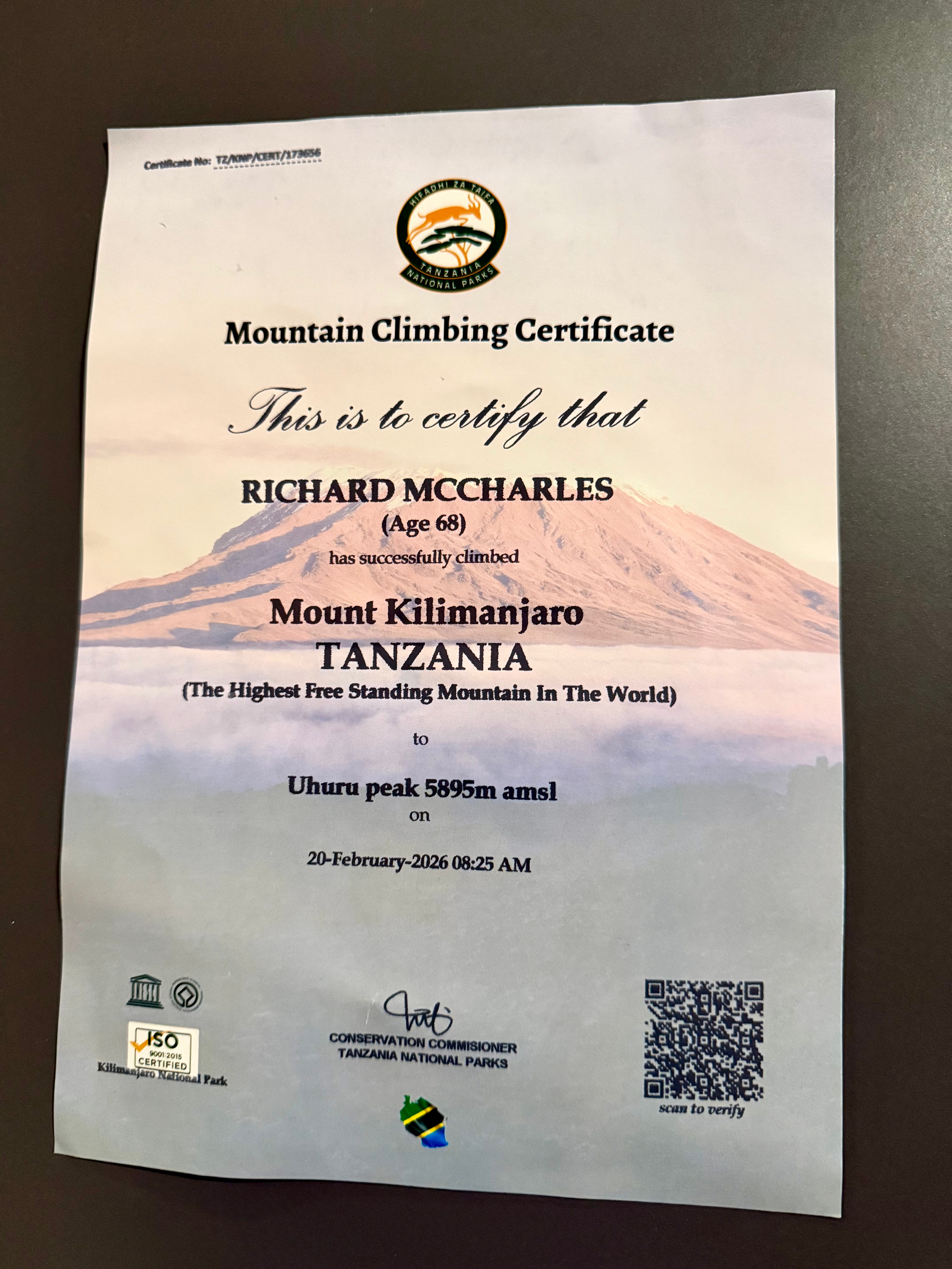
We had 22 hikers. 18 of us made both summits. That’s about typical for the Machame Route. It went well for me. My 3 weeks training & acclimatizing in Ecuador prior to this trip was a good idea.
Kili Summit Ridge
Age & fitness matter much less than the ability to acclimatize to altitude.
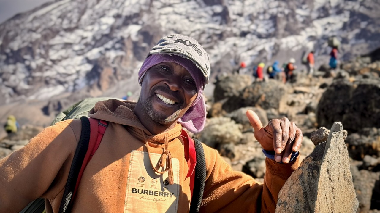
It took me 68-years to finally get to Kilimanjaro. The eldest my African guide got to the summit was 79.
We had another in our group age-66.
Truly impressive is one of our assistant guides who’s been to the summit over 200 times over 31 years. He’s age 64.
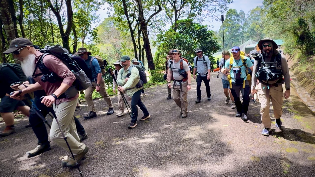
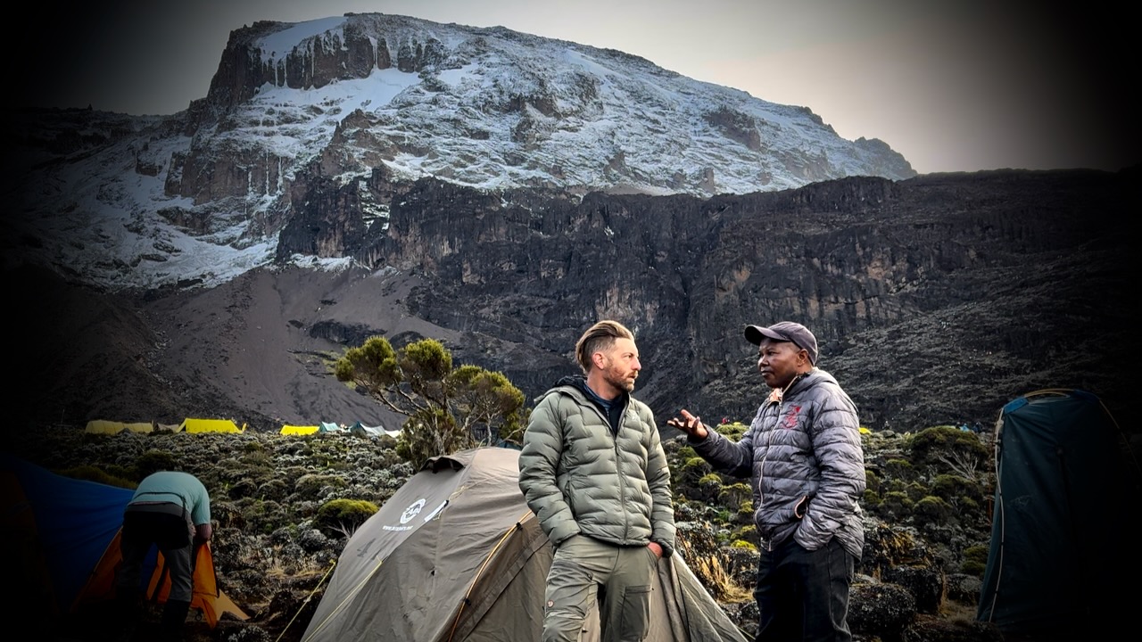
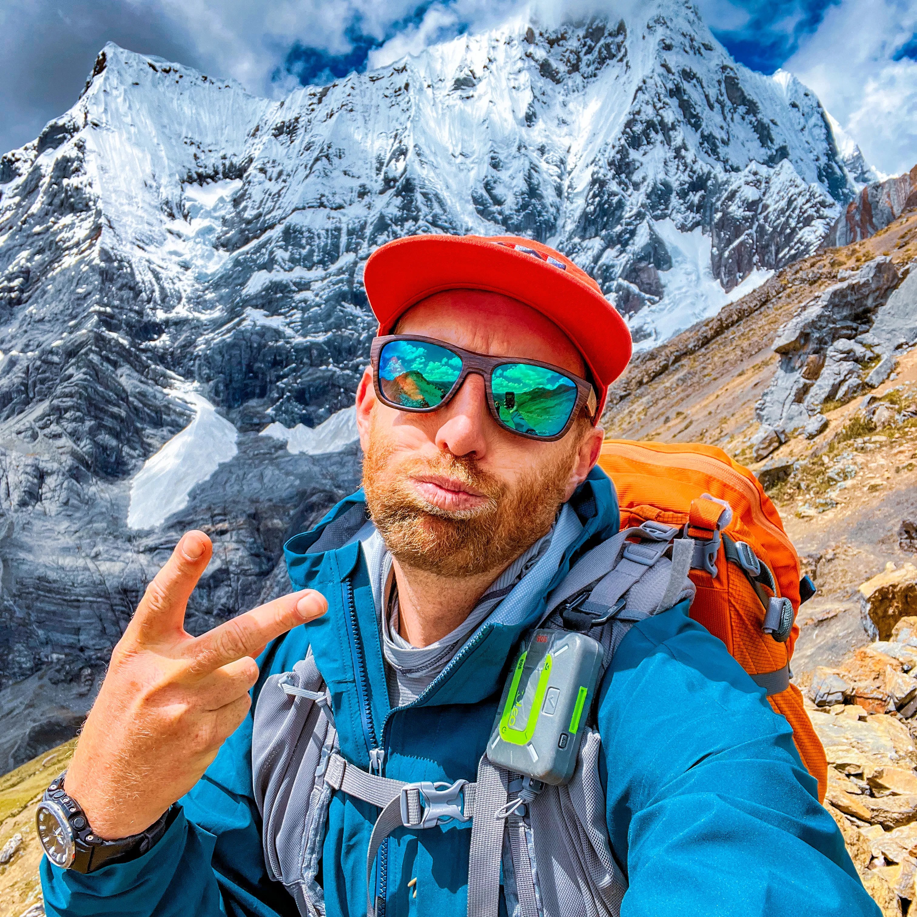
Here we are — clean & keen — at the start of the 7 day adventure.
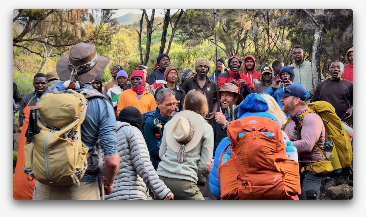
In fact, it was a party from the start as many who had hiked with Eric in the past joined for Kili. I was simply an addition to a large group, many who knew one another. This is a very social adventure ➙ shared suffering.
Eric was our American guide. Freddy our African guide. Both responsible for keeping us safe. It was these two who’d make the decision whether or not you were healthy enough to keep climbing.
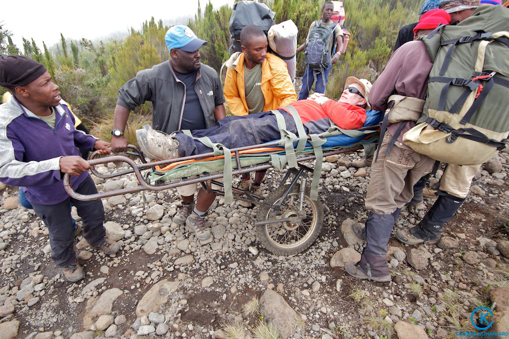
Those who decided to go down were unable to acclimatize quickly enough. We had daily blood oxygen tests.
Three decided to walk out. One took a helicopter, hoping she will recoup the $4100 cost through insurance.
New to me on a trail was the singing and dancing. Non-stop. To the top.
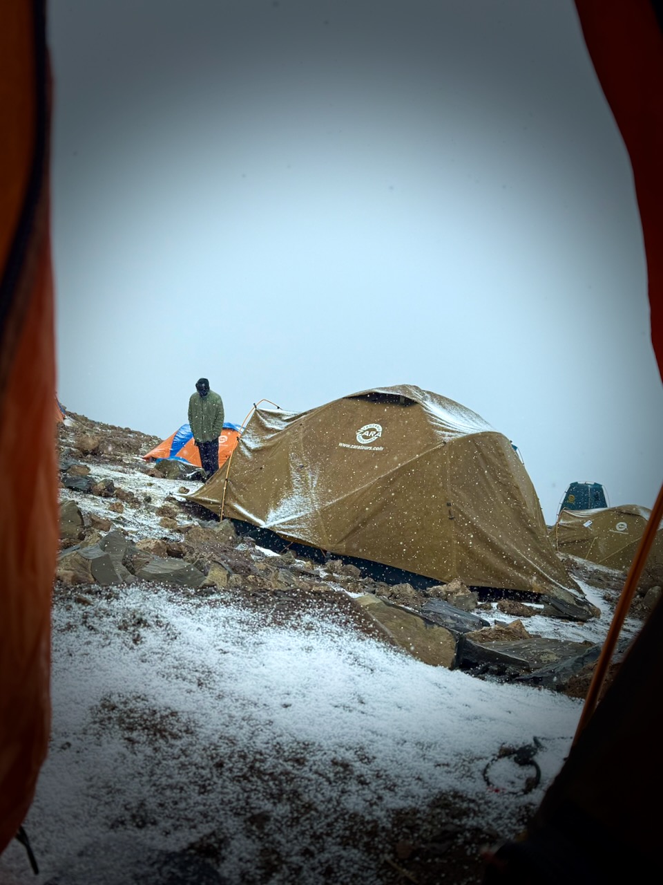
Oddly, all 7 days we had the same weather. Some sort of micro-climate.
Morning clear. Sunny to start the hiking day. Snow, sleet, and hail in the early afternoon. Clearing by dinner time. Clear skies at night. Kili summit clear at dawn.
We added and removed layers non-stop during the day.
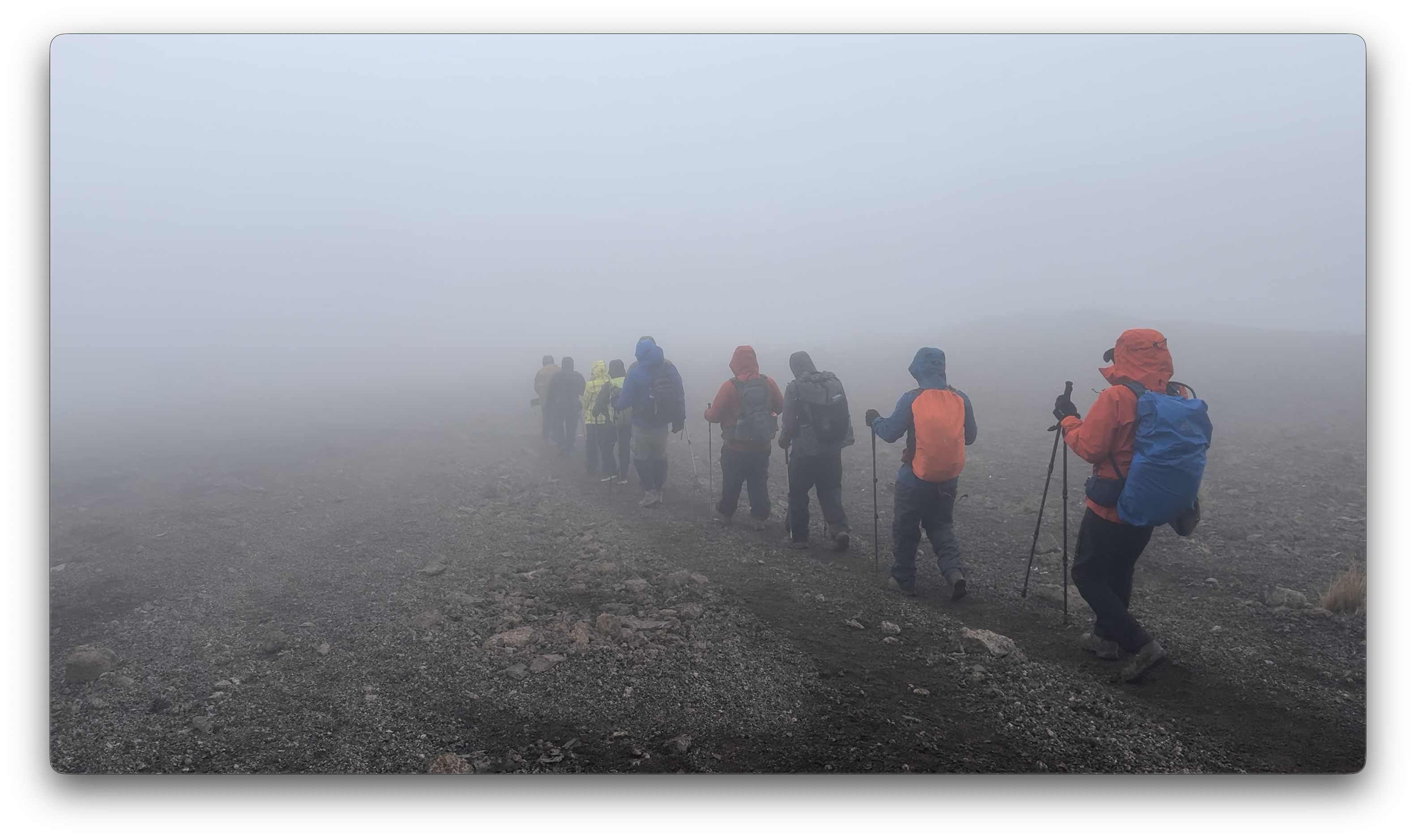
Each day we spent some time hiking through clouds.
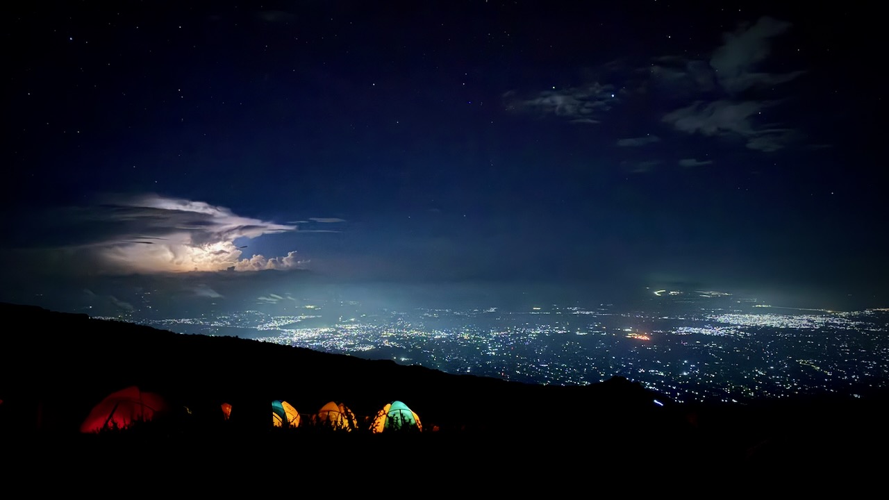
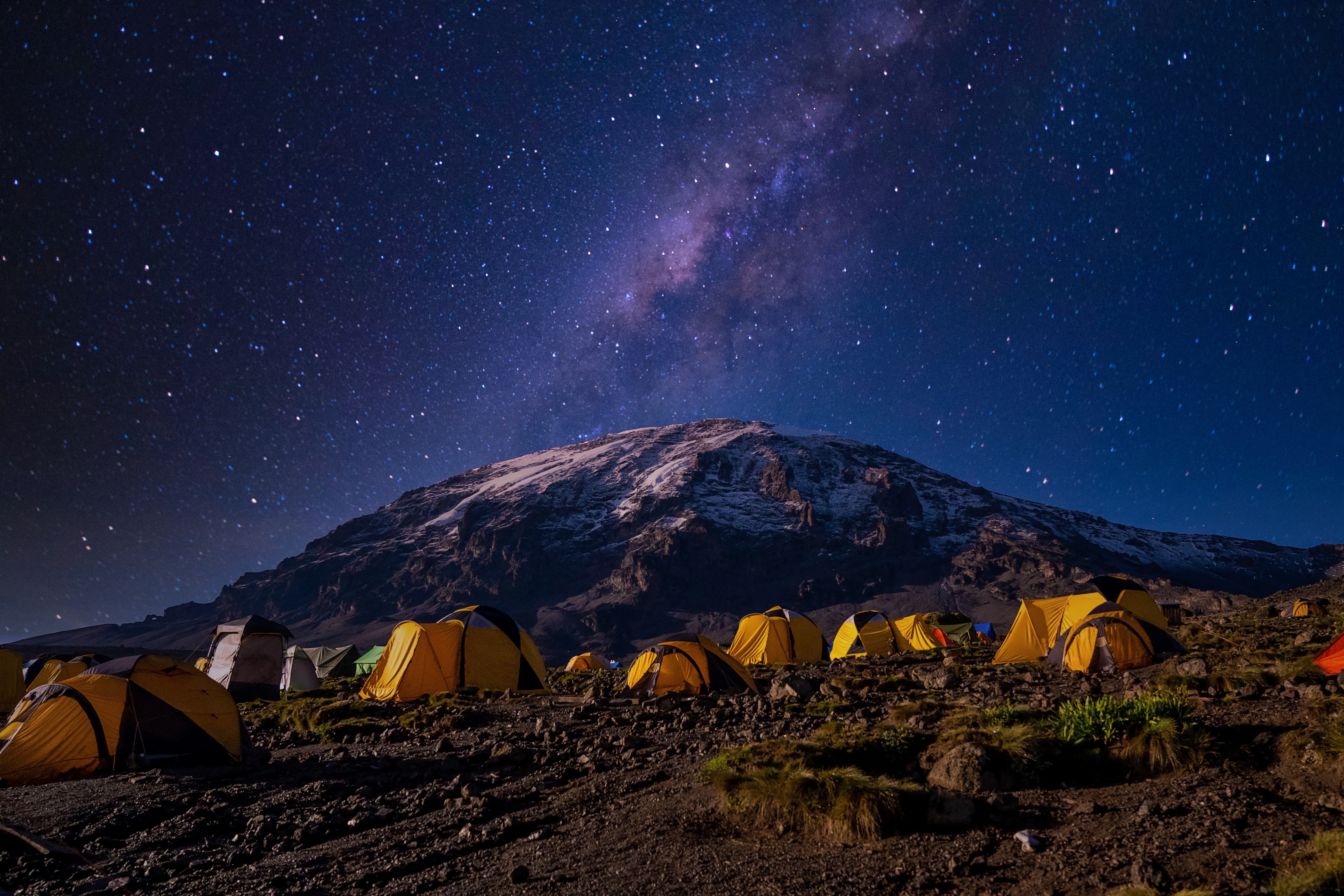
We mostly had clear skies at night. The iPhone 16 Pro is terrific at night photography on a tripod.
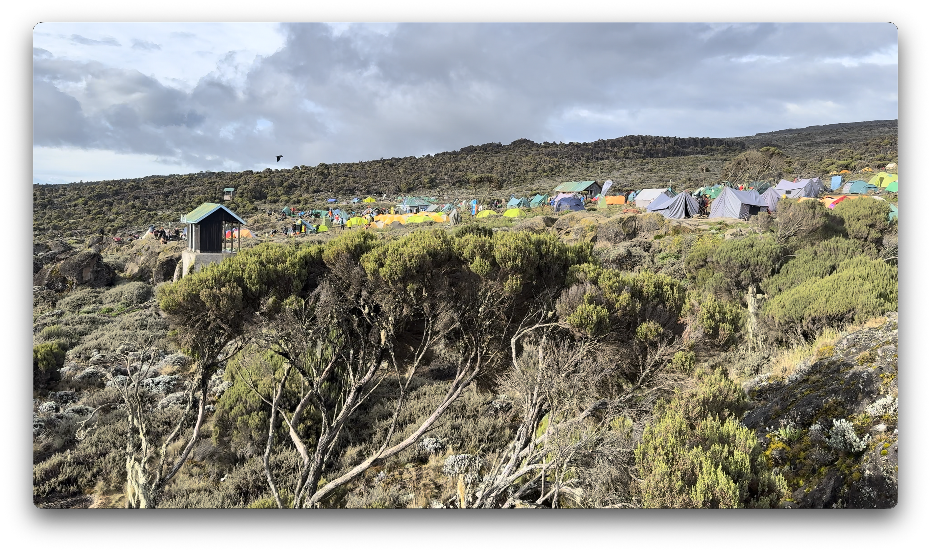
I’d paid a little extra to have a tent to myself. It was fairly comfortable — though many of our tent sites were far from level. 😀
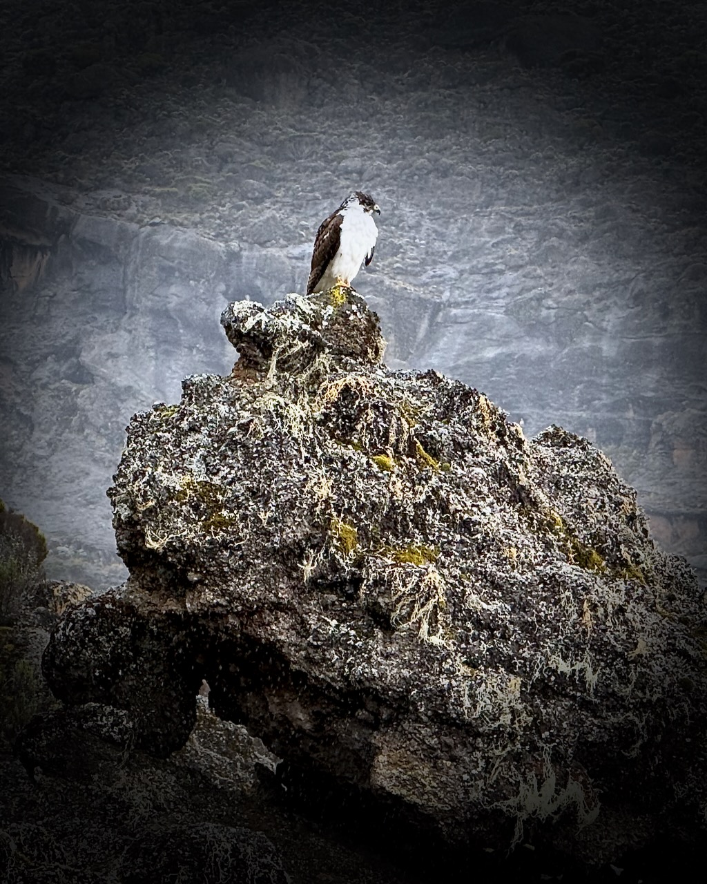
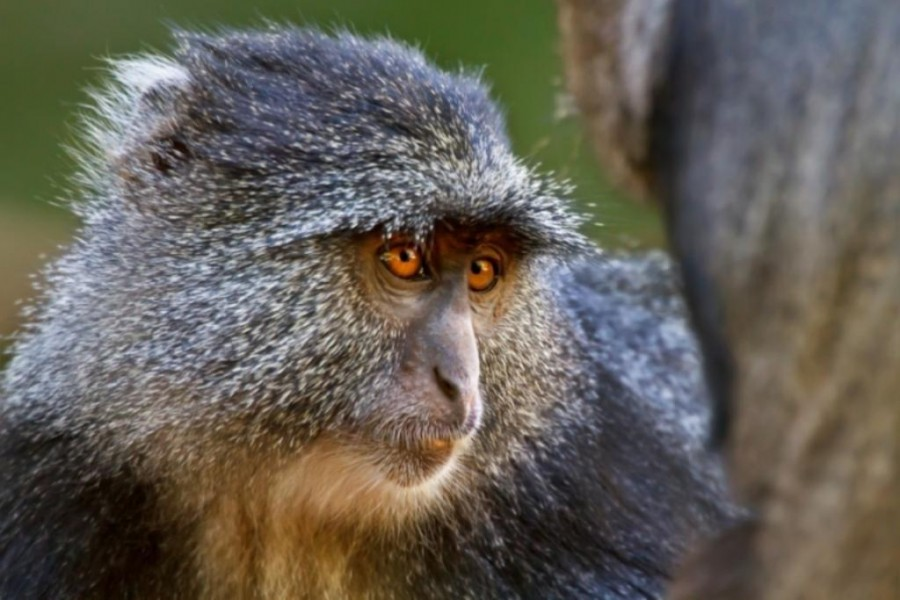
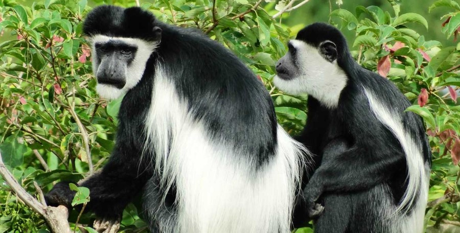
We were happy to see two kinds of monkeys. But both were at lower slopes, close to the start and finishing gates.
Blue Monkey.Black-and-white Colobus.
Baboons and velvet monkeys have been spotted, but rarely.
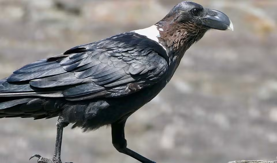
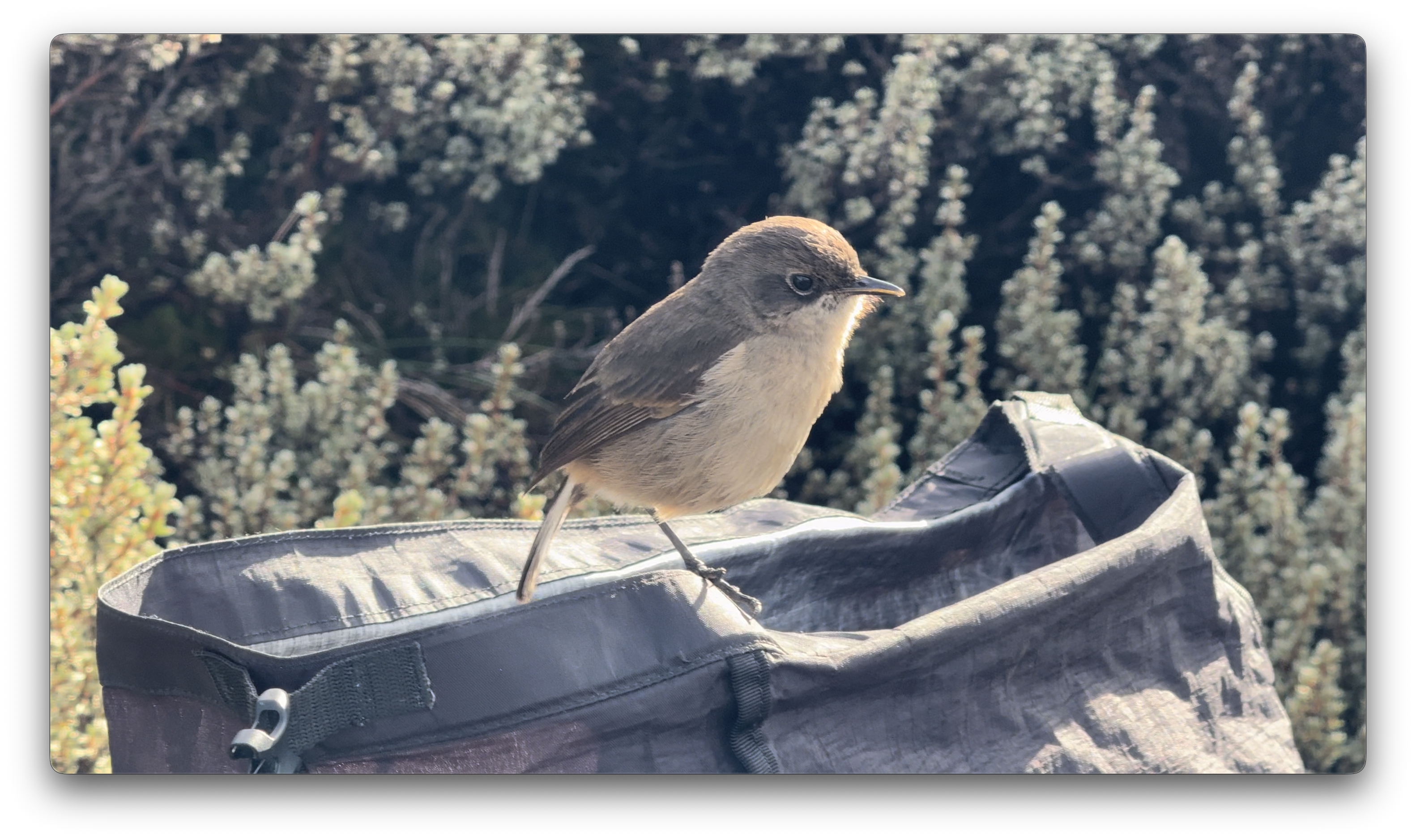
This bird took a dump in my backpack. 😀
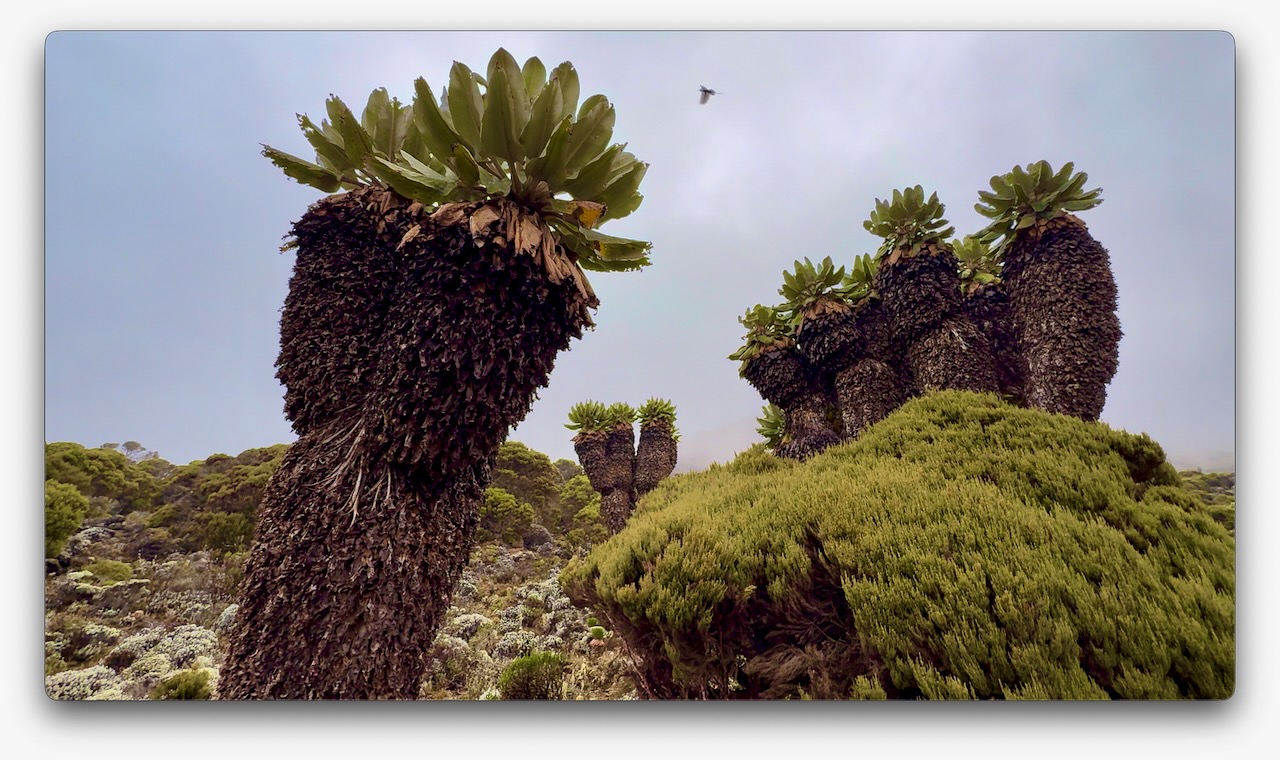
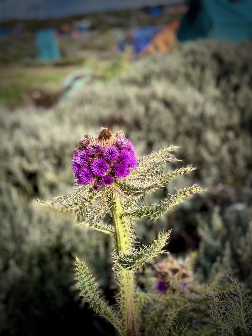
Vegetation was much more interesting as we climbed through so many different ecological zones.
I do love thistles.
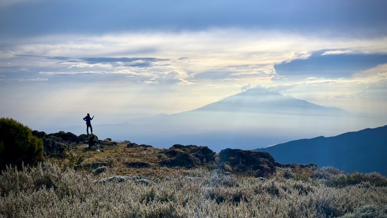
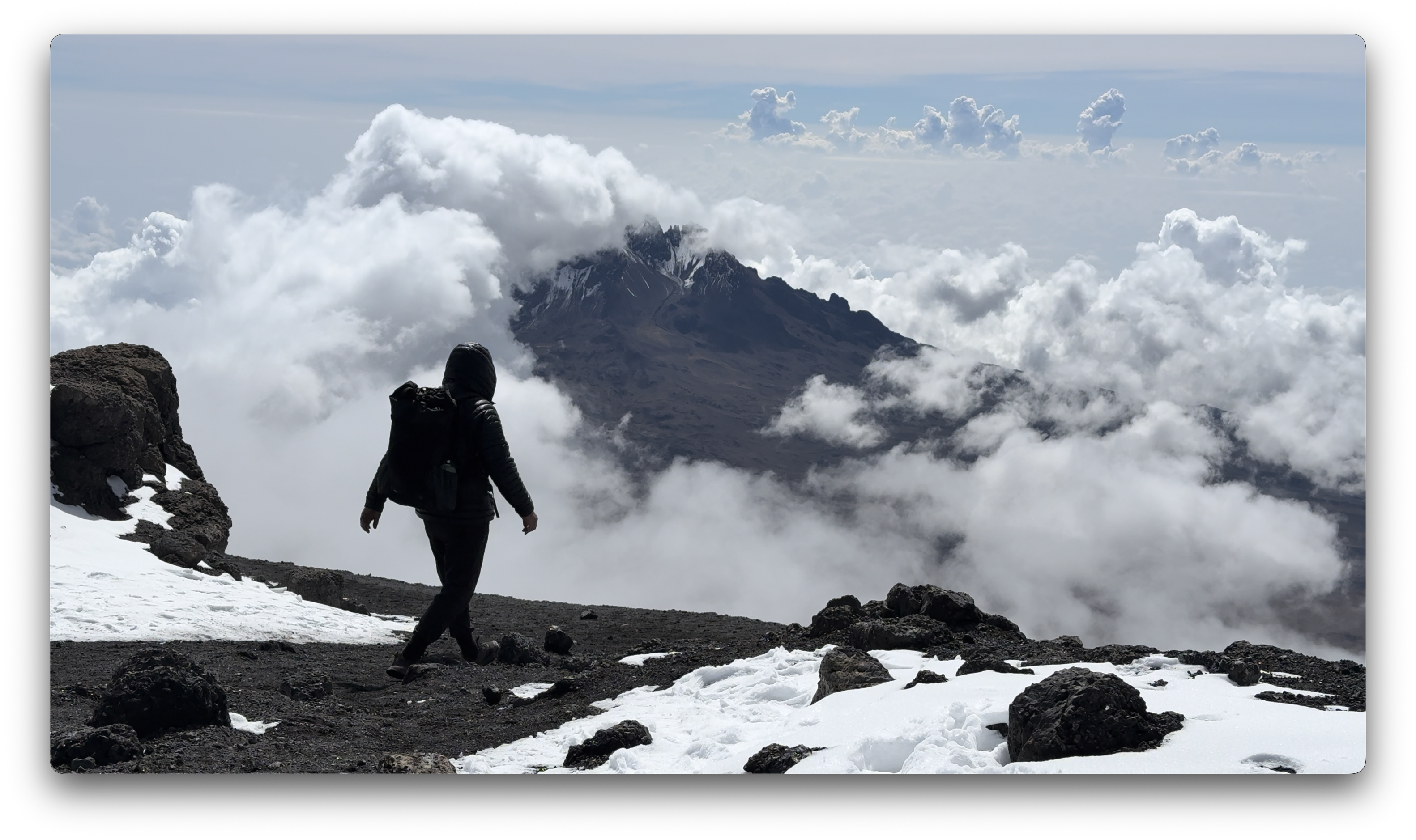
We had great views over to nearby Meru volcano. When you see hikers posed like this, you know they are searching for line-of-sight mobile phone reception. 😀
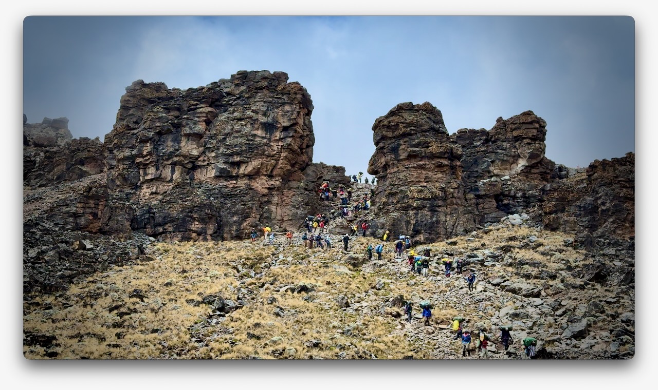
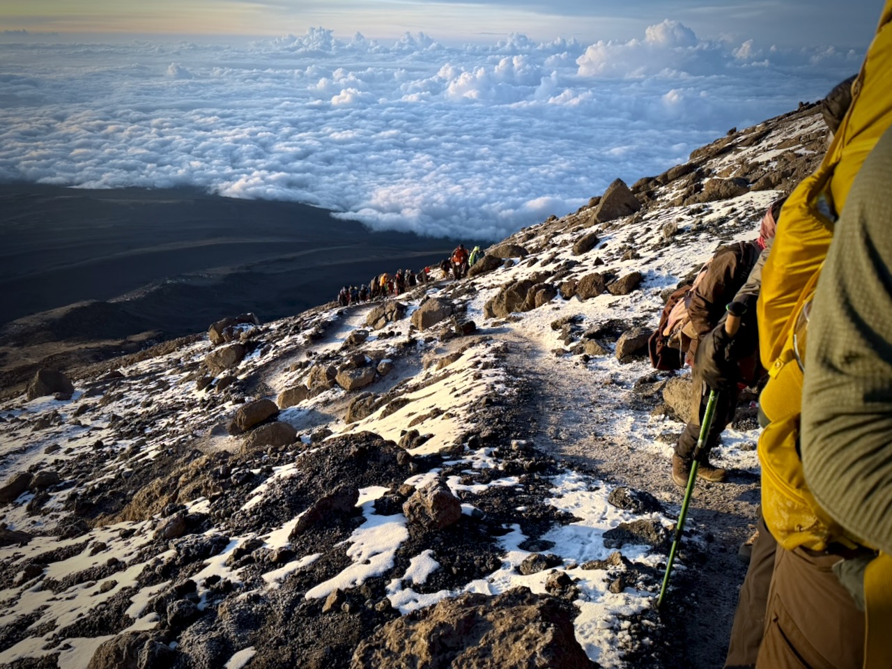
The Machame Route was crowded when I was there. We often had long lines of hikers & porters.
Camps are crowded and littered.
Personally, I felt the portable toilets provided weren’t great. I preferred squatting over a hole in the concrete in the permanent toilet buildings.
Hygiene is not top of mind for any of the guiding companies. In particular, I was surprised alcohol gel was not constantly provided.
That said, nobody in my group got sick from water or food.
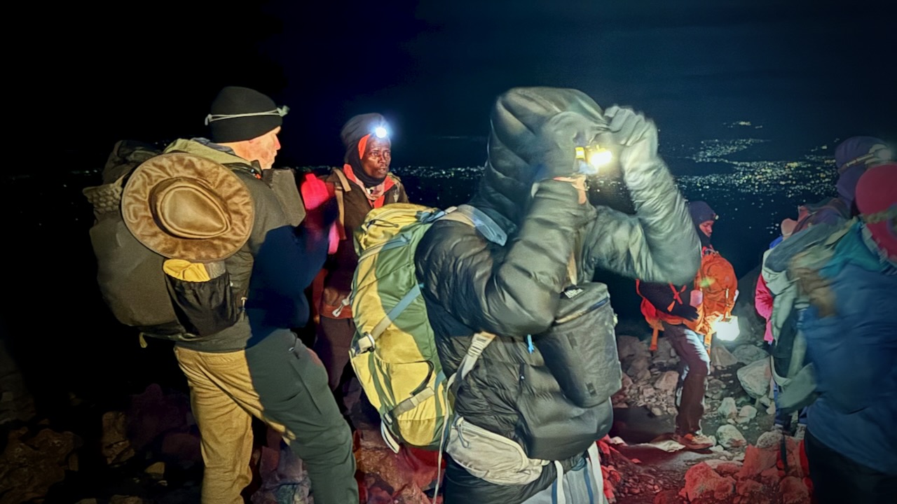
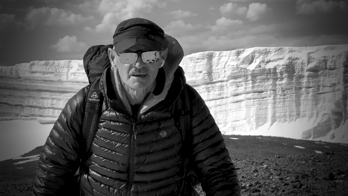
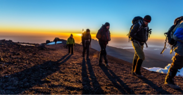
CRUX of Kilimanjaro is summit night. One of the toughest hiking days any of us could recall. I felt perfect. No pain. No problems … when starting.
Wake at midnight. Hot drinks 12:30pm. Start up at 1am.
It was a slow, cold trudge until dawn.
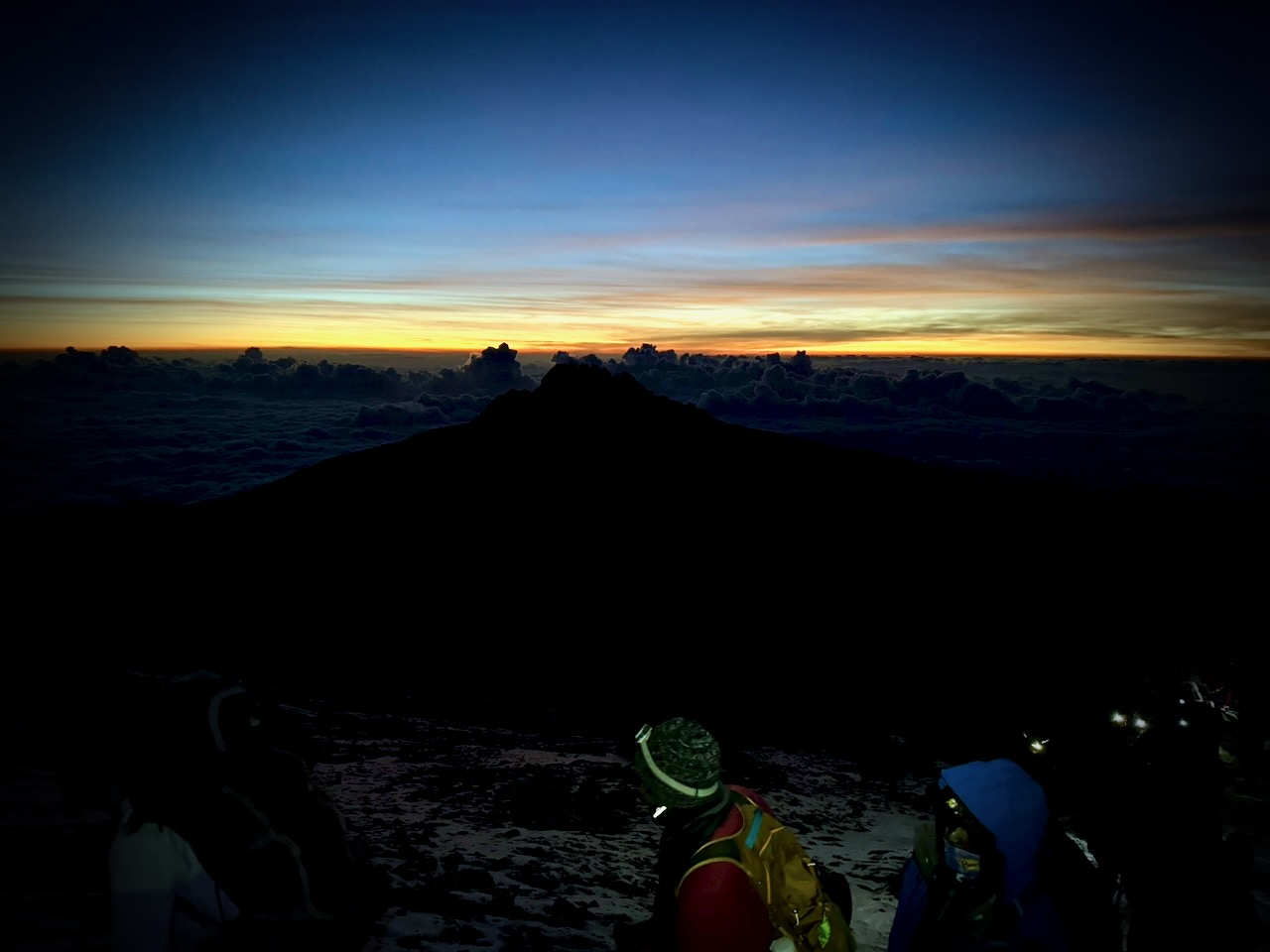
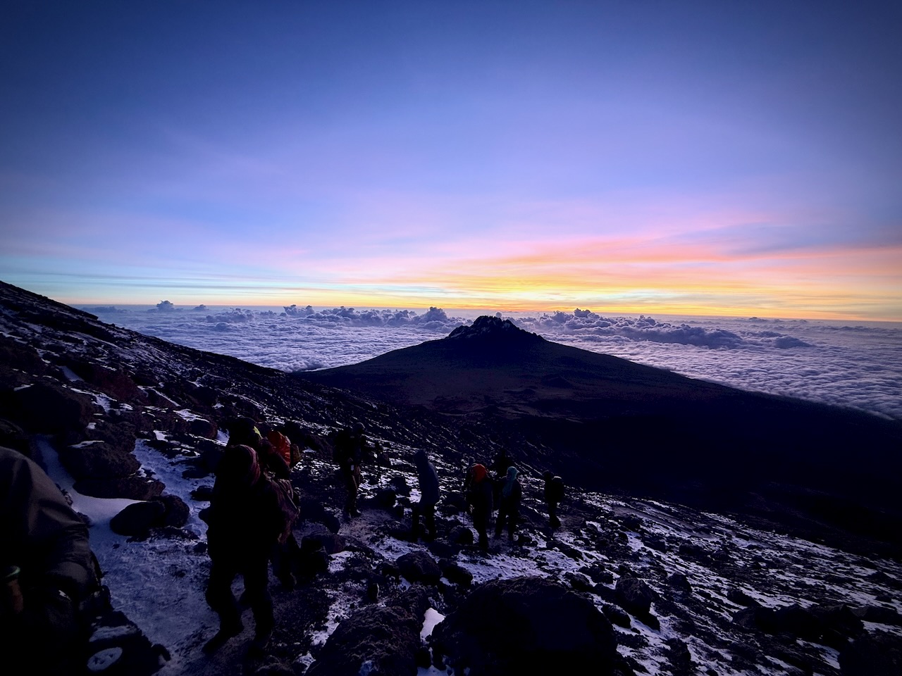
We had an ideal view of the changing light.
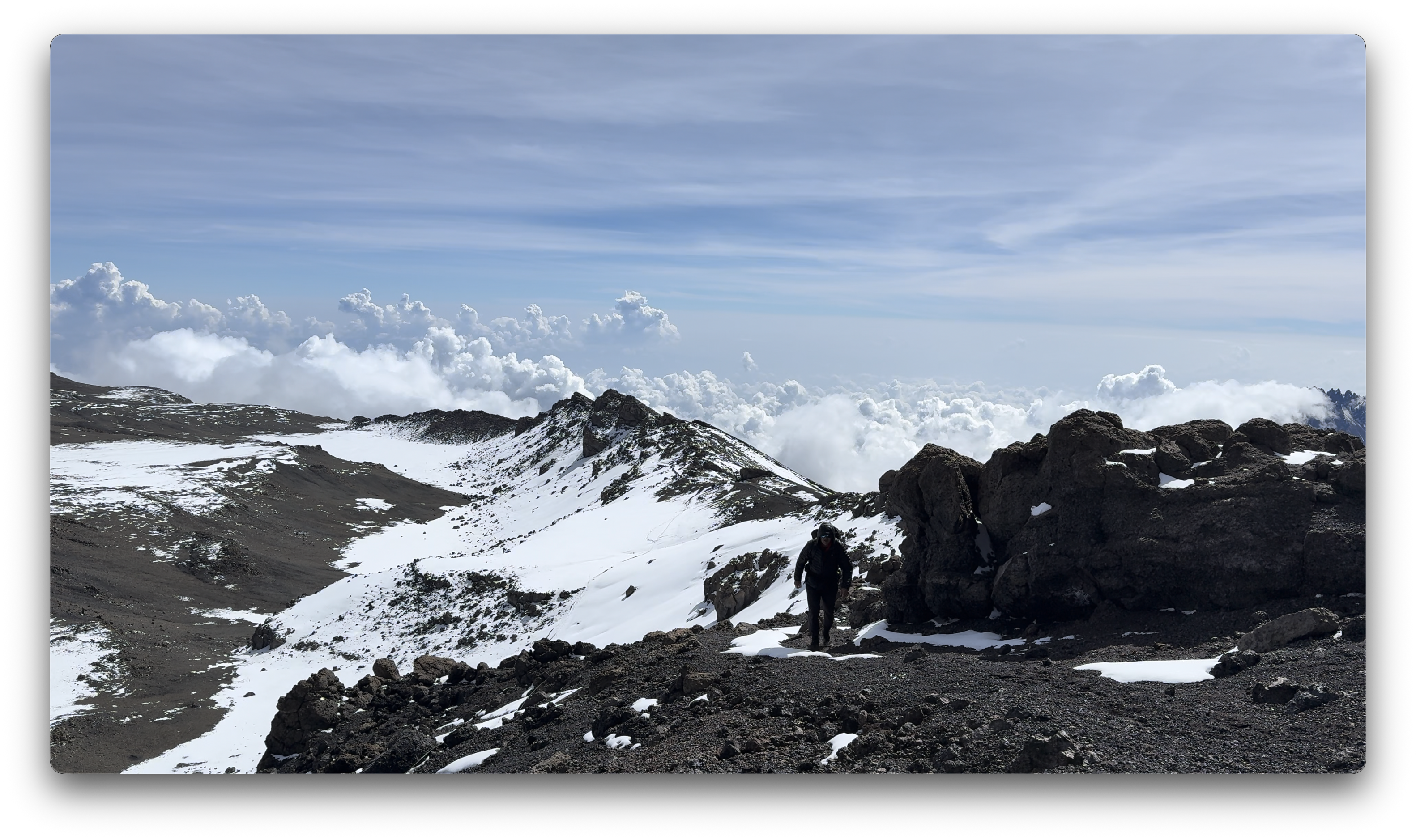
Way above the clouds.
We finally reached the first summit peak. And on perhaps another 35 minutes to the highest peak.
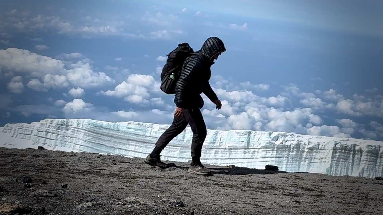
I took a LOT of photos and video up there. Most impressive were the odd, receding glaciers.
That was the FUN part.
Guides hustled us down as quickly as possible to avoid altitude sickness. We climbed down 8000 feet, not getting into low camp until 6pm or so. I ascended & descended for 16 hours, grabbing 1 hour sleep around noon.
Sore knees. Sore toes. And cramping quads.
Highlight?
Most would agree that the porters, guides, and staff were the most impressive takeaway from this adventure. We probably had over 100 staff taking care of us over the week. And these folks will do positively anything you request.
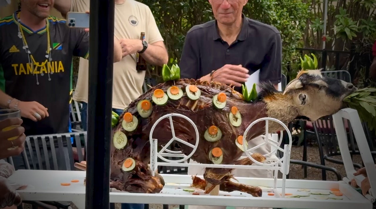
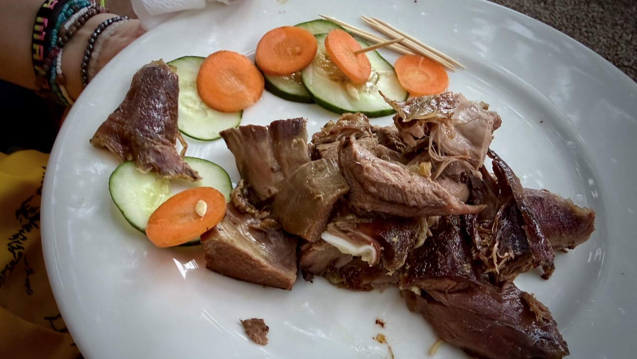
Back at the hotel, we celebrated with alcohol and devoured a full roast goat. Delicious.
A hiker died on Kilimanjaro while I was there. Reported heart attack.
On December 24, 2025, a rescue helicopter crashed, killing all 5 people on board. Two were hikers being evacuated.
10–20 deaths annually out of 30,000+ climbers.
I wrongly thought Kilimanjaro would be easy for me. It wasn’t.
I’ll be joining the expedition organized by friends David Adlard and Kraig Becker.
Cost is $5480 including everything from arrival to departure in Tanzania.
We’ll be taking the longer, less traveled Lemosho Route to maximize our chances of getting to the top.
How Do You Sign Up?
You can sign up for the trek on the Tusker website or by calling them at 800-231-1919 or +1-775-833-9700.
You can also email them directly with questions or comments as well. When you do sign up, be sure to mention that you are joining The Adventure Podcast/Blog Kilimanjaro Expedition. A $1000 deposit is due when you make your reservation.
Guest post by Carley Fairbrother who climbed in 2017:
At a Glance
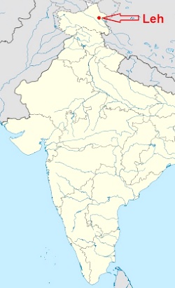
Location: Ladakh, India
Distance: 20 km, one way
Elevation Gain: 2,686 m (8,812 ft)
Maximum Elevation: 6154 m (20,190 ft)
Hiking Time: 3 – 4 days plus at least a week to acclimatize.
Best times to hike: June – September
Highlights
An incredible sense of accomplishment
Amazing views
Easy to access (compared to other 6000+ m Himalayan Peaks)
Mountaineering skills not required (unless going unguided)
Meeting adventurers from around the world
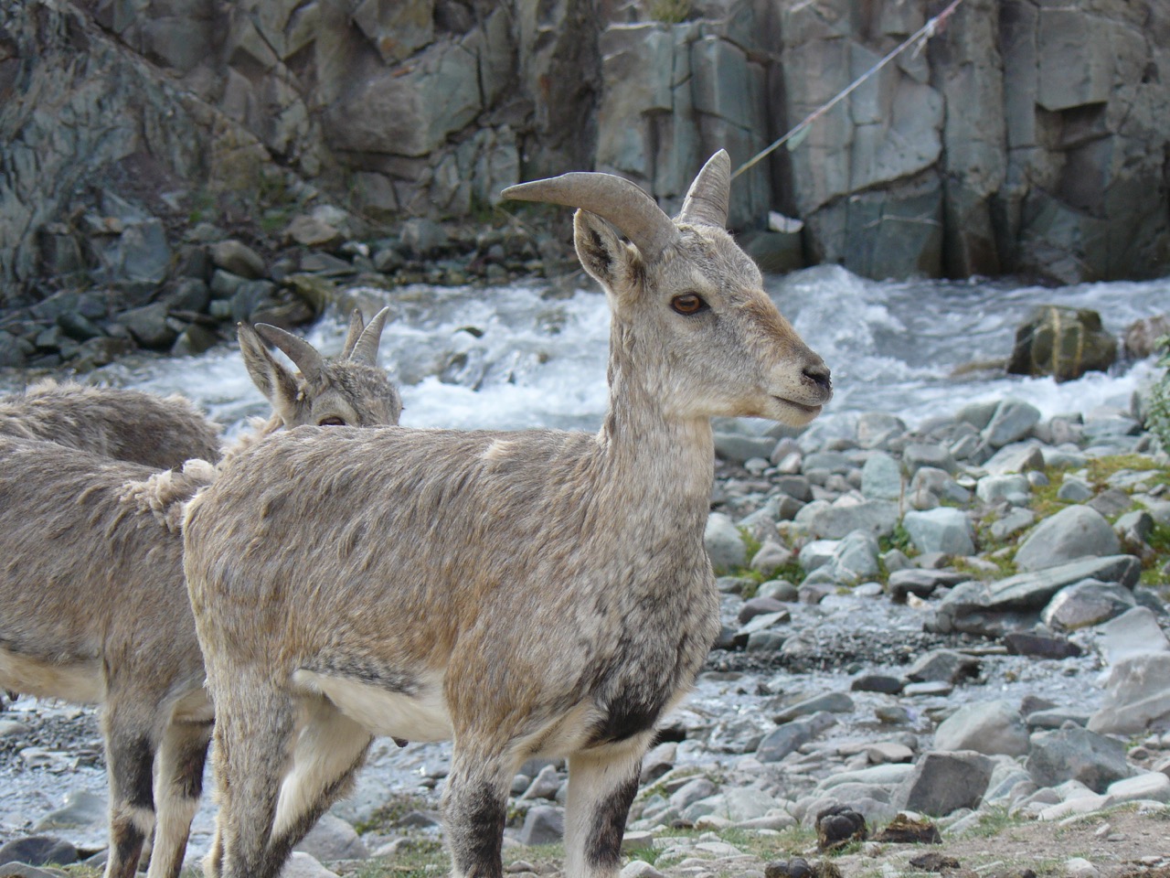
Close encounter with wild blue sheep
Clay in the last few feet before the summit
Considerations
Elevation: Take time to acclimatize and consider packing acetazolamide (Diamox). Learn the signs of Acute Mountain Sickness (AMS) and be prepared to cut your trip short or postpone it until you are acclimatized. AMS can progress into the deadly High-altitude pulmonary edema (HAPE) or High-altitude cerebral edema (HACE). Also, bear in mind that the scant oxygen will slow you down a lot.
Weather: Less oxygen makes everything seem colder and the temperature felt like it was around -10 ° C (14° F) at the top. Don’t be fooled by reports that Ladakh is a desert. Bring a rain jacket. It can also get very hot, so come prepared to protect yourself from the sun.
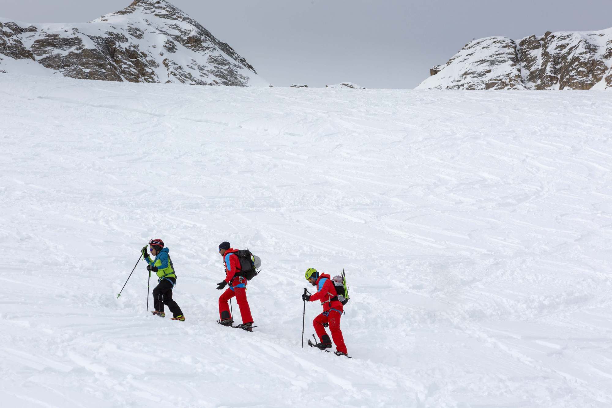
Glacier Travel and Steep Terrain: There is a short glacier crossing followed by a lot of steep, exposed terrain. Use rope, crampons, and an ice axe, and either learn how to use them or hire a guide.
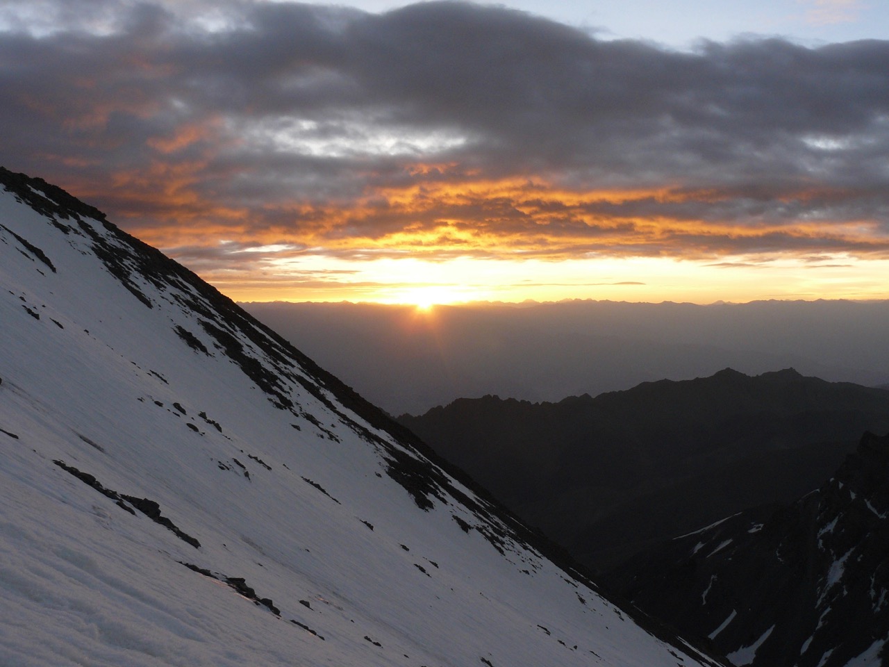
Dawn was welcomed as we approach the ridge after a long night of climbing
Dark: A midnight start is required to take advantage of the glacier while it’s hard and icy. Travelling on the aforementioned terrain in the dark carries some obvious risks.
Water: The camps provide boiled water, but bringing your own filter or water treatment tablets/drops will give you more options.
Logistics
Getting There
To get to Leh (Ladakh’s largest town), either fly or drive overland from Delhi. The cheapest way is to catch a bus to Manali, then another bus on the Leh-Manali highway to Leh. The bus ride from Manali to Leh takes 17 hours and is best split into two days. A nonstop bus costs Rs 833 (12 USD) and the 2-day trip costs Rs 2900 (40 USD).
If you don’t want to sit on a crowded bus as you go over some of the world’s highest motorable passes, you can hire a private or shared taxi from Manali for around Rs 20 000 – 30 000 (290-420 USD. Manali is a nice town and worth a few days’ visit.
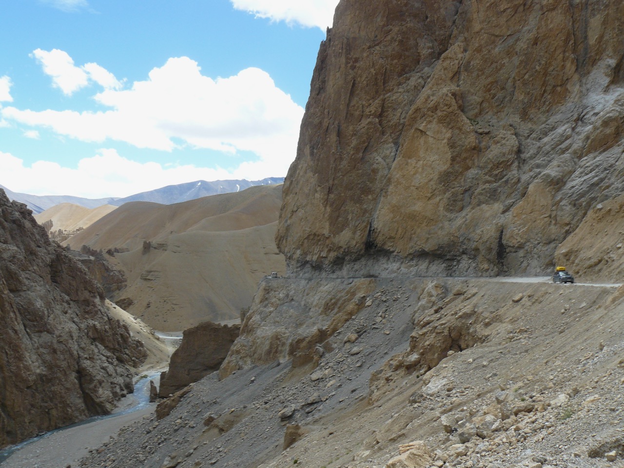
Leh – Menali Highway
The road is open in the summer months and is prone to closures from landslides and flooding. It is narrow, rough, and windy – not for the faint of heart. It also contains one of the world’s highest motorable passes, and several more over 5000 m. Pretty much everyone I know (myself included) got altitude sickness going over the passes. Leh can also be accessed via the Srinagar Leh highway, but the road is longer and subject to the same closures.
Flying is the easiest and cheaper than hiring a private taxi. A one-way flight from Delhi to Leh will be around $100 – $200 USD and will take 1 hour 20 minutes. We went overland on the way there and flew out.
Getting from Leh to the trailhead at Stok Village is a quick taxi or bus ride.
Food and Accommodation
Accommodation and restaurants are plentiful in Stok Village and Leh.
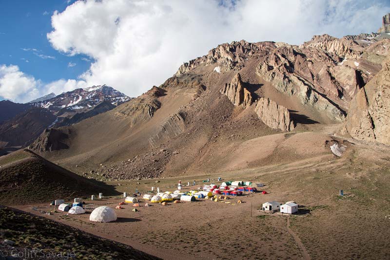
There are three camps on the way up Stok Kangri: Chang Ma, Mankorma, and Base Camp. All serve food and have tents available for trekkers. The tents all have sleeping pads, but they aren’t very warm or comfortable. Bring your own sleeping bag. Also, Chang Ma only had a few tents available.
Guide or No Guide?
Most people choose to hire a guide for climbing Stok Kangri. You can hire one at base camp or in Leh, and it is fairly inexpensive. Whether you hire a guide in Leh or base camp, the cost will be roughly the same for a 4-day trek. Ask around in Leh for current costs of both, as things can fluctuate from year to year. You can also join an expedition complete with ponies, cooks, and comfortable tent.
Join an Expedition if:
You don’t want to waste time planning.
You don’t want to carry your stuff.
You want to be comfortable.
Get a guide if:
You have no mountaineering experience.
You prefer being safe.
You haven’t had much time to acclimatize (they can help you down if you get AMS).
The climbing conditions aren’t great.
Consider skipping a guide if:
You have mountaineering experience.
You are confident that you are well acclimatized.
You like the independence of hiking alone.
The conditions are good.
Gear
Rope, harnesses, crampons, gaiters, and ice axes can be rented in Leh or at the base camp. It’s slightly cheaper to rent from Leh, and the gear is probably better, but that means lugging it uphill at high altitudes for two days. You can rent sleeping bags too, but I’d advise bringing your own.
Your boots should be ankle high with a fairly stiff sole so they can be worn with crampons. Mountaineering boots are not needed. Also, do not forget your headlamp and extra batteries. You’ll be climbing in the dark for most of the summit day.
Permit
Get the permit from the Indian Mountaineering Foundation (IMF) office in the Mentokling restaurant for 50 USD. You need to go right into the restaurant to find the office. It is cheaper at the IMF office, but buying it at base camp might save you some money if you don’t end up climbing. You can find current permit prices here.
Our Cost Breakdown
For 2 people in 2017
Taxi from Leh to Stok Village: Rs 1900 (27 USD)
Tent stay, including food: Rs 6000 (87 USD)
Rentals of rope, harness, ice axe, and crampons: Rs 1500 (22 USD)
Total: Rs 8400 (121 USD)
Hiring a guide from base camp would have cost and additional Rs 8000 (115 USD)
The Route
We had been in Ladakh for nearly a month at this point, and had been trekking for most of that time, so we opted to do it in three days. Actually, we had planned four, but dragged ourselves all the way back to Stok Village on summit day. Despite the short days, the night at Mankorma is essential to acclimatization.
Day 1 – Stok Village to Mankorma camp
Elevation Gain: 823 m (2,700 ft)
Distance: 9 km (5.6 miles)
Hiking Time: 4 hours
Chang Ma Camp is at 5.5 km (3.4 miles) and makes a good spot to stop for lunch or tea
Photo: Pack ponies were more common than people along the trail.
Day 2 – Mankorma camp to base camp
Elevation Gain: 610 m (2000 ft)
Distance: 4 km (2.5 miles)
Hiking Time: 2 hours
Woke up to blue sheep lingering near our tent.
We took an acclimatization walk to the ridge above camp though most people opted to go all the way to the glacier.
Blue sheep at Mankorma Camp.
Day 3 – Base camp to summit and back to Stok Village
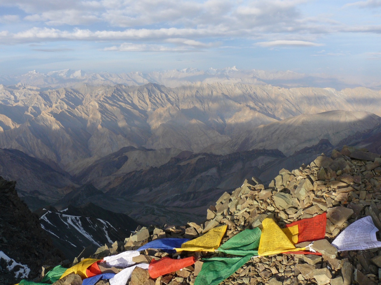
The view from the top. We speculated that the larger peak in the very pack might be K2.
Elevation Gain: 1,223 m (4012 ft) ascent, 2,629 m (8,625 ft) descent
Distance: 7 km(4.3 miles) to the summit, 20 km (12.4 miles) return to Stok
Hiking Time: 12 hours to summit, 16 hours total
12:00 AM departure from base camp to cross the glacier before it softens up
We planned to stay another night, but I was having trouble breathing and loitering around all day didn’t seem like fun.
You can find the whole story of our Stok Kangri climb on Review Outdoors here.
… At the age of four, he was advised to start using a wheelchair, which he refused. He told the world he was going to learn to walk.
Age 5, nothing. Age 6, nothing.
Age 7, Getulio took his first steps. This in itself was an achievement no one saw possible, but in his own words, “the impossible does not exist”.
His sheer determination has inspired people around the world, giving people hope when they had lost it. …
… climbing Marmolada involves crossing a glacier with huge crevasses and then a steep climb requiring ropes, crampons, and ice axes. Just to add to the difficulty, there was a deep snowpack …
Accompanying Getúlio on this journey were Pedro McCardell, creator of Lyfx, an app that conects travelers to local guides, Alessio Nardellotto, an experienced climber from the Dolomites, Alberto Benchimol and Stefano Fabris, who worked as a separate support team for safety and image capture.