While visiting the must see tourist attraction of Bourke’s Luck Potholes in Blyde Canyon, I checked details on the not-so-popularBelevedere hike.
You must register at Bourke’s Luck. Pay a trail fee of about $5 in addition to the parking fee of $5. Start the hike before Noon and be back by 4pm.
I talked them into letting me start well past 1pm, promising to do a trail run to make up the time. I ended up checking out at about 4:30pm.
The trail down into Blyde River canyon is easy to navigate.
Follow the blue footprints.
Promoted as “strenuous”, I’d more call it “overgrown” and “non-maintained“. Only the most agile will be able to avoid all the spider webs.
It is pretty, though.
Not many tourists get down off the rim into the canyon. I saw nobody else on the trail this day.
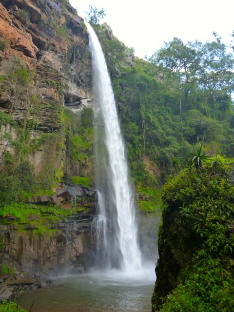
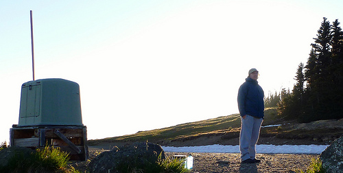
The now defunct Belevedere hydro-electric power station is 400m below the Bourke’s Luck Potholes. Built in 1911, it was once the largest of its kind in the southern hemisphere.
I would have loved to trek famed multi-day Fanie Botha Trail in South Africa.
But the best I could do was to day hike sections:
• Lone Creek Falls
• Bridal Veil Falls
• Mac Mac Falls
• Mac Mac Pools
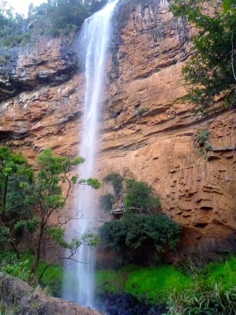
Lone Creek Falls, a National monument, is yet another of the dozens of impressive waterfalls close to Graskop, South Africa.
Nearby are the equally impressive, but much more popular, Bridal Veil Falls.
I parked at Ceylon Hut on the Fanie Botha, then ran to Bridal Veil. The trail here is signed for mountain bikes, as well.
From the base of the falls, there’s a rough scramble up the escarpment. Scenic and challenging.
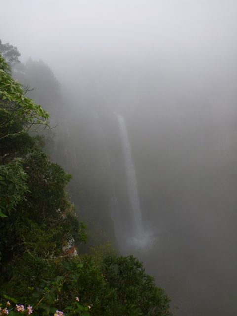
Mac Mac Falls is another National monument. I’d been warned the weather here is often misty and/or rainy. But this was the only day I got the typical slogging in the fog.
Parking at Mac Mac Falls, I hiked both directions on the Fanie Botha. Towards President Burger Hut (… yep, that’s the real name) is was mellow forest trail.
Towards Graskop Hut you walk the top of a cliff. It must be very scenic, when the clouds are not so low.
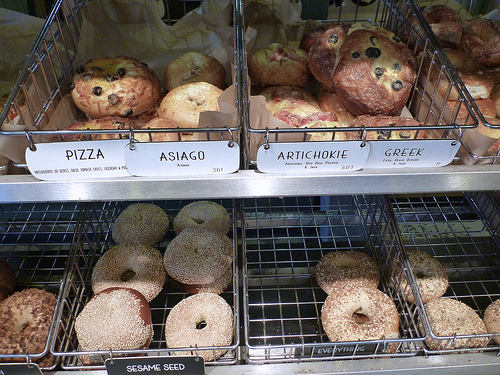
En route to the (easy to find) trailhead we stopped at the excellent Olympic Bagel in Port Angeles.
CARBO loading
13 miles … how tough could it be?
… a low-elevation peak located in the northern region of the Olympic Mountains. … Clallam County …
Mount Muller is, however, the county’s point of greatest prominence (also known as the COGPP) and the county’s only peak with over 2000′ of prominence. …
… If the Mount Muller summit is the only goal, it can be reached in 5.3 miles from the west end of the trail system, or it can be reached in 7.5 miles from the east end of the trail system.
Many trail users opt to hike the entire 12.8-mile loop. The mountain is accessible year-round, and the Mount Muller Trail is open to non-motorized use only (i.e. hikers, bicyclists, equestrians, snowshoers).
… The ridgetop of the peak is primarily comprised of thick evergreen forests on its west side and rocky outcrops interspersed with forests on its east side …
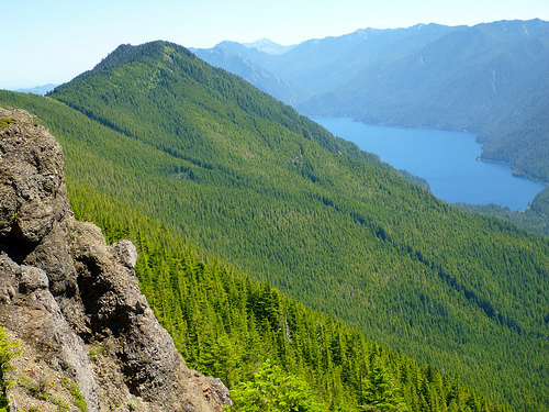
… views from the mountaintop can be spectacular. Mount Olympus, Lake Crescent, the Strait of Juan de Fuca, Sol Duc Valley, among other notable areas …
A recreational use pass is required for each vehicle parking at/near the Mount Muller Trailhead.
This hike was a labour of love for Forest Service employee Molly Erickson. She and a crew of friends designed and built the trail, naming many of the landmarks after themselves. 🙂
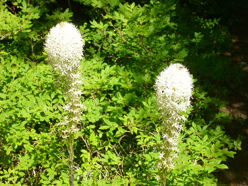
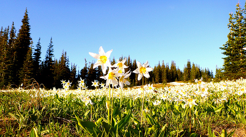
The wildflowers are GREAT. I was surprised to see beargrass this far west.
Turns out it’s …
… found mostly in western North America from British Columbia south to California and east to Wyoming, in subalpine meadows and coastal mountains, and also on low ground in the California coastal fog belt. It is common on the Olympic Peninsula and in the Cascades, northern Sierra Nevada and Rockies. …
The famed 7.7mi road from the Visitor’s Center to Obstruction Point trailhead 6150ft (1875m) was CLOSED for 2013 due to budget cuts. Lucky us.
A road’s a road.
But this CLOSED road is a wonderful ridge walk.
Non-stop magnificence.
Once departed the Visitor’s Center at Hurricane Ridge, I saw only 3 other people over 2 days. Two of those were trail runners.
Starting late in the day, I decided to stop at an unofficial campground near the P.J. Lake Trail turnoff. A nice quiet spot but one without water. We’re too high here.
Next morning I arrived Obstruction Point Campground.
Campground?
It’s nothing but a parking lot with a toilet.
No water. But I found a nice snow melt runoff stream nearby. No mosquitoes. 🙂
On the bright side, it was nice to stash pack with food in the biffy. Away from critters.
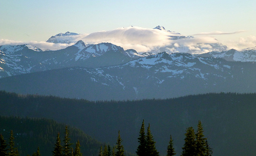
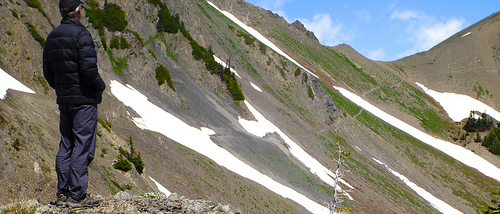
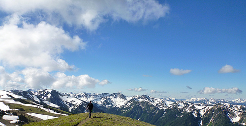
Ridge hiking out of Obstruction is unbelievable. I’ll let the photos prove my point.
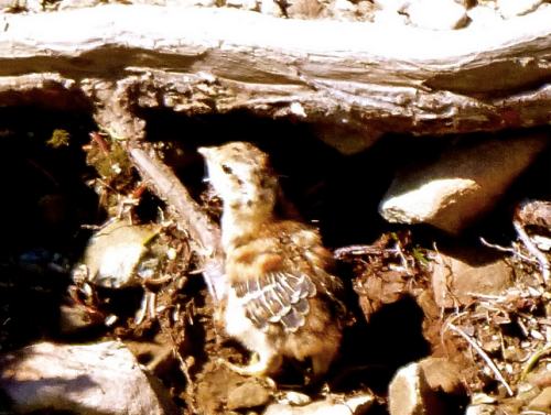
Ptarmagin must be the stupidest birds on the planet. How do they survive?
This dumb mother was doing a terrible job of protecting her new chicks.
The only other hiker tenting at Obstruction that night was from Denmark. With the good weather report, he’d bought gear at REI and driven straight to Hurricane Ridge.
Found himself in Heaven.
Next morning I enjoyed coffee with a superb vista.
I’d hoped to take the GRAND Ridge Trail in the direction of Deer Park. … But Rangers had warned that it was probably impassable without an ice ax.
Yep.
After making an attempt to climb over the steep snow. And under the steep snow. I gave up.
I’ve always thought that a person needs to do one thing every year that scares the crap out of them. I’m very happy to have checked that item off my to do list for this year!
Helen and I arrived at the Gordon river by 5:45 am on Sunday morning, and I quietly slipped the cheap $29 inflatable dingy into the dead-calm Gordon river in pitch darkness by the light of the rental car head lights, and my triple A battery powered head lamp. …
… “What the hell am I doing here?” was the question I was asking myself as I started to struggle up the extremely technical trail at 6:15 am by the light of my little headlamp. It was so dark, and I could only see a few feet in front of me – and, it was TOUGH going! The first section is a 600 foot climb through roots, mud, fallen tress, jagged rocks, boulders, puddles – yikes! …
The west coast trail either runs inland through the forest, or along the beach, or both. By both, I mean either, as in the hiker or runner must choose. Sometimes a beach section is faster if the forest trail is muddy, or log strewn, or excessively hilly, or requires climbing up huge ravines by a system of numerous ladders …
… all of which are exhausting and time consuming. Sometimes the beach sections are difficult due to soft, unrunnable sand, sea weed covered slippery rock shelves, impassable headlands due to high tides, or just downright dangerous with evil surge channels that must be vaulted over. Each time I was faced with the forest or beach option, I had to weigh the pros and cons, dangers and advantages, then commit to my decision and go. …
Tarahumara Sandal Shoe — GoLite Footwear’s Tara Lite running shoe is said to have been inspired by the Tarahumara tribes of Mexico, a native group known for their distance running skills who wear minimal thong-style sandals.
What makes the GoLite shoe unique is its flat, “zero-drop” heel, flexible sole, and a soft upper. The kicker: Inside the shoe, separating your big toe from the rest, there’s an internal sandal post that keeps your foot from moving too much and helps the flexible shoe fit snug.
The Tara Lite will come in men’s and women’s models for $115.
In a desperate last minute attempt to get into shape for my 14km leg of the Klondike Road Relay this weekend, I ran a leisurely 20km on a warm, sunny Fall day in the Yukon.
I’d done it years ago on mountain bike. But running is slower. It gave me more time to enjoy the scenery.
Highlight? …
For sure the Rim Trail along Miles Canyon.
(The last time I was at Shwatka Lake was for the Mock wedding in 2007.)