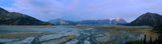
Jökulsárlón glacial lagoon, Iceland

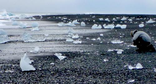
Jökulsárlón (lit. “Glacier Lagoon”) is the largest glacier lagoon or lake in Iceland.

… it evolved into a lagoon after the glacier started receding from the edge of the Atlantic Ocean. The lake has grown since then at varying rates because of melting of the Icelandic glaciers. The lagoon now stands 1.5 kilometres (0.93 mi) away from the ocean’s edge and covers an area of about 18 km2 (6.9 sq mi). …

The size of the lagoon has increased fourfold since the 1970s. It is considered as one of the natural wonders of Iceland.
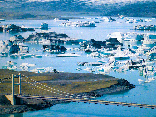
tourism promo photo

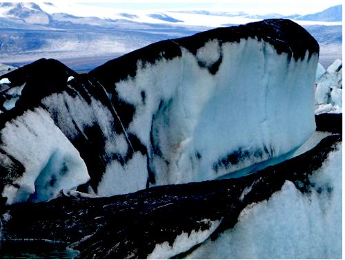
Some are ash covered, from recent eruption.
… The Jökulsárlón lagoon provides outstanding views of the Ice Cap, which is a vast dome of ice that rises to a height of 3,000 feet (910 m). It spills to the lagoon 12 miles (19 km) away from the jagged glacier hill to the edge of the water line. …

Iceland is a photographer’s dream. And this lagoon may just be the single most photogenic site on the island.
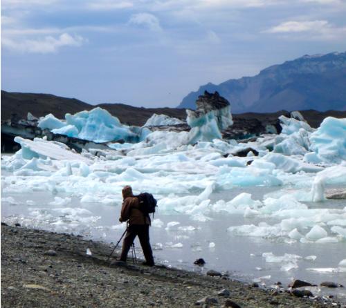
I do love icebergs.
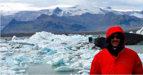
click for larger image

Don’t miss the ocean shoreline, the other side of the bridge, far less visited than the lagoon.
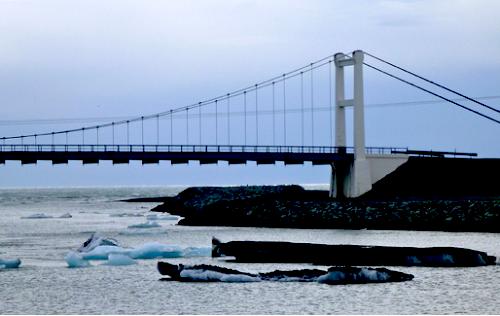
See more photos of this incredible place.

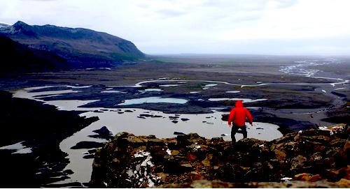
hiking Kjos, Skaftafell, Iceland

trip report by site editor Rick McCharles

Kjós (‘Dell’)

Distance: 24 km

Walking time: 8 hrs.

Skaftafell, is part of Vatnajökull, the largest National Park in Europe.

Skaftafell Visitor Centre
is the most popular access. Indeed, this is the most popular campground in Iceland.

… OK, it’s EARLY in the season (June 13-14). The hordes have not yet arrived. It was closed 4 days not so long ago due to eruption of the Grímsvötn volcano, a fairly frequent occurrence, actually.

There are plenty of hiking & glacier walk options from this trailhead. Most are headed to Svartifoss.

hikers consulting the Trails map

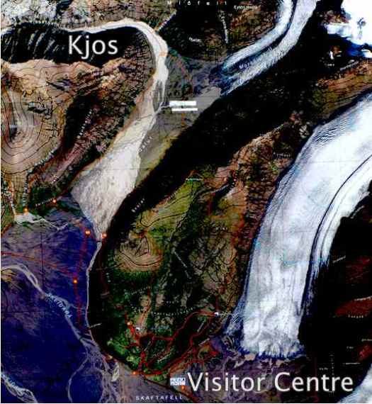
The only backcountry tenting allowed out of Skaftafell Visitor Centre is Kjos (see map below), at the start of an unusual glacial flood plain valley called Morsárdalur.

One of the bridges had been washed out, so I needed to go in-and-out to Kjos via the same ‘route’ (It’s not signed all the way.)

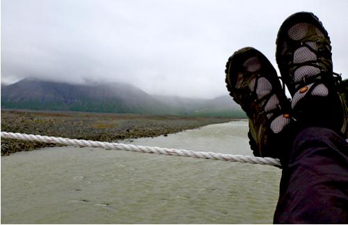
Here I’m taking the easiest Morsá river crossing.

Water crossings are the biggest challenge when hiking this island. I can see why Alastair Humphreys took a packraft on his crossing of Iceland, unsupported.

Aside from the route finding, Kjos is a pretty easy walk without much elevation gain.

There’s the campsite, just coming into view.

I set up here instead, under a rock overhang.

Instead of scrambling adjacent peaks, I relaxed in the tent. The weather was a continuous drizzle. Visibility was poor, anyway.

I was quite content listening to my audio book, The Girl Who Played with Fire.

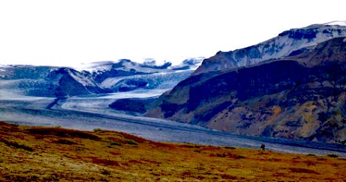
This hike reminded me of similar walks towards glaciers in the Yukon. But a big difference here are the big, black desolate areas of volcanic ash. Stark and photogenic.

I’d love to do a long walk over the ash black wasteland one day. It would be like crossing salt flats.

See more photos from this hike on flickr.

hiking Svartifoss, Iceland

trip report by site editor Rick McCharles

Svartifoss (Black Fall) is a waterfall in Skaftafell … Iceland, and is one of the most popular sights in the park.

It is surrounded by dark lava columns, which give rise to its name. The hexagonal columns were formed inside a lava flow which cooled extremely slowly, giving rise to crystallization. Similar well-known lava formations are seen at the Giant’s Causeway in Northern Ireland, and on the island of Staffa in Scotland. …

After seeing the unique falls, I continued on to the Skaftafellsjökull glacier overlook.

I left a Summit Stone at the base of this sign.

From there you can walk up and alongside the big ice.

It was a tad bit windy, as you may be able to tell from this photo. (I might have been able to BASE jump using just my jacket.)

See more photos from this day hike.

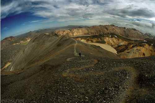
no go Landmannalaugar

The most famous hike in Iceland opens June 15th. Or 17th. Or 20th. Or later.

It’s been a hard, cold Spring.

I had hoped to do the trek before the official opening, to avoid the hordes. That’s not going to happen.

Today I drove to the campground at Skogar, one of the trailheads. Two young German guys had just come out. There’s still a LOT of snow and mud. It’s not fun.

They convinced me not to go.

… so I’m looking for an alternative backcountry hike, perhaps 75km, over the next few days.

I fly out on the 17th.

trekking the ice fields of Patagonia

Following Dan’s terrific 3 days at Fitz Roy, they immediately headed for the Ice Fields:

… At 16,800 square kilometers, the Ice Field is the second largest in the world and I’m completely awe-struck when we arrive at the high point of the ominously named Paso Del Viento (Pass of the wind). The view in every direction is pure ice, with amazing swirls and patterns …

Crossing a glacier-melt river was their biggest challenge.

read the blow-by-blow … Hiking to The Southern Patagonian Ice Field

Photos by SAULIUS DAMULEVICIUS.

hiking Jostedalsbreen, Norway

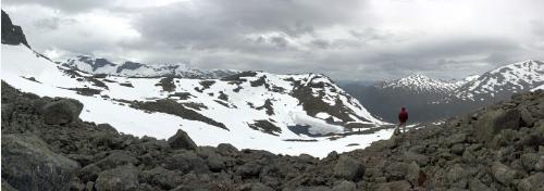
Jostedalsbreen National Park, in the Sognefjord region of central Norway, is home to continental Europe’s largest ice sheet – the Jostedal glacier – which spills over from a high plateau into a succession of dramatic lake-filled valleys and fjords.

Although Jostedalsbreen is a popular tourist destination (you’ll see plenty of tour buses at the best-known spots) the hiking trails in the region – which given the forbidding topography tend to be steep and strenuous – don’t seem to be well-known outside Norway. …

A few good day hikes:

• Climbing the Skala
• Briksdalsbreen
• Storevatnet trail from Briksdalen

… Norway is expensive, …

Prices range from the merely high (hotel rooms, rental cars) to the eyewateringly exorbitant (restaurant meals, alcohol of any kind).

Camping is very popular in Norway (in addition to official campgrounds, you see impromptu campsites in many rural areas) so for a visit on the cheap you might consider taking a tent and buying food in supermarkets.

… read more

That’s all from the excellent site by Phil Armitage, landscape photographer.

Start on his home page.

Yukon – Slims River to Kaskawulsh Glacier

Phil Armitage posted an excellent trip report of their 2010 adventures on the Slims West trail, 64km (40mi) return.

Here’s their view from Canada Creek campsite:

… From the campsite at Canada Creek it’s 19km (12 miles) roundtrip, with 1200 meters (3,900 feet) of climbing, to the summit of Observation Mountain.

That doesn’t sound like a particularly strenuous day hike, but there’s Canada Creek to cross (twice, with the second crossing likely be harder than the one on the way out, as the water level rises during the day) and no trail for most of that distance.

The summer days are long at these high latitudes but still, don’t underestimate the time required. Most of the parties we met found the hike to be harder and longer than they had anticipated. …

read more – hiking the slims river west trail to the kaskawulsh glacier overlook on observation mountain

Their photos are STUNNING.

… On my trip I never made it past the first creek crossing.

Route finding is tricky. You might need gills to cross some streams in flood. And know that there’s been at least one hiker killed by bear there. Parks Canada shuts it down when the bears are sighted.

Phil recommends special footwear for the water and mud.

what is Frazil ice?

Frazil ice is a collection of loose, randomly oriented needle-shaped ice crystals in water. It resembles slush and has the appearance of being slightly oily when seen on the surface of water.

It sporadically forms in open, turbulent, supercooled water, which means that it usually forms in rivers, lakes and oceans, on clear nights when the weather is colder, and air temperature reaches –6°C or lower. Frazil ice is the first stage in the formation of sea ice. …

Click PLAY or watch it on YouTube. The most amazing bit is seeing the creek STOP flowing at 1min 50sec.

Thank George for sending us the link to this natural phenomenon.

rest in peace Mark and Rob

Terrible terrible news. I’m still bewildered, angry and in denial.

Lifelong friends, Rob and Mark Glaser, were killed in an avalanche on Saturday, January 15, 2011 in the area of Burstall Pass, Peter Lougheed Provincial Park, Kananaskis Country, Alberta.

Here’s the official notice:

The families of Mark and Rob Glaser are in deep shock at the news of their tragic passing. Both were loving husbands and fathers and will be greatly missed by their families and legions of friends. Both were seasoned back country hikers and skiers who shared a deep passion for the outdoors.

Mark lived in Calgary and was in the oil and gas industry for over 25 years including senior management positions in recent years. Rob lived in Bragg Creek and was a captain in the Calgary Fire Department.

The family respectfully requests privacy at this time. Please direct all media contacts through Ed Glaser (brother) at 403-470-3904.

Phone Ed or contact me. I’ll post updates here.

Mark Glaser

On this trip a few years ago Mark and Rob trained me in snow rescue techniques.

Rob was a firefighter, expert in all things backcountry. They had left their avalanche beacons in the car making family speculate that this ski was intended to be simply a short warm-up.

Saskatchewan Glacier

Over 30 years (1978–2007), avalanches have been responsible for 329 deaths in Canada, with a recent rate of 14 deaths per year. …

Avalanche accounts for over 90% of outdoor recreation deaths, most of those in Alberta or B.C.

Damn.

snow in Death Valley

Jim Burnett on national parks traveler:

… the first words you read on the park website—”Hottest, Driest, Lowest“—don’t sound much like winter. That makes the park scene on January 3, 2011, a bit out of the ordinary. …

The snow level was at 2,000 feet in the hottest, driest, and lowest region in the Western Hemisphere.”

The lower elevations of Death Valley rarely get snow—only about once a decade on the valley floor—and that’s usually just a dusting. In contrast, the neighboring community of Pahrump, about 60 miles away, had four to six inches of snow from the recent storm. …

Snow-capped Mountains Offer a Different Look at Death Valley National Park

It even snowed in Vegas.