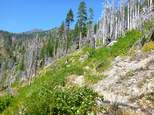
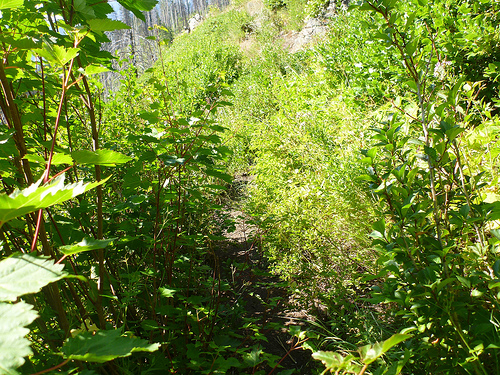
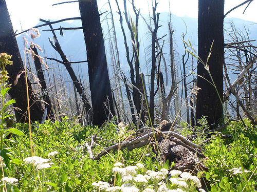
GR20 Trek Corsica – day 1

trip report by besthike editor Rick McCharles

» day 1 | day 2 | day 3 | cirque | day 4 | day 5 | day 6 | day 7 | advice |

Saturday, June 25th, 2011

A mountain range rising from the sea, Corsica holds the most arrestingly beautiful landscapes in the Mediterranean. From its cobalt blue gulfs and shell-sand beaches, hillsides of evergreen maquis give way to pristine oak, chestnut and pine forests, awesome gorges, alpine lakes and a spine of snow-streaked peaks and passes. Among the many trails that penetrate its remotest corners, the GR20, following the island’s watershed, is a high-level route that has won an international reputation as being Europe’s most challenging long-distance path.
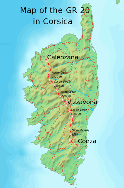
I decided to hike north to south because both of the best guidebooks in English describe it that way:

• Trailblazer Corsica Trekking GR20 by David Abram (2008)
• Cicerone GR20: Corsica: The High-level route by Paddy Dillon (2010)

The best way to get to Corsica is by air, as inexpensive flights are offered by EasyJet and others.

But I took an enjoyable (relatively expensive) train to Nice. And from there a relatively inexpensive ferry (33EU) to Calvi, the closest port to the northern trailhead. (Leaving my extra luggage in the Nice Train Station lockers.)
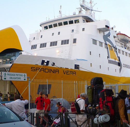
P1000872

Conveniently, it set sail Saturday night.

departing Nice.jpg

I found a quiet spot under the stars and slept soundly on my air mat, the last person on the ship to wake next morning.

Sunrise Calvi

Sunday, June 26th, 2011

Here I am repacking for the trek, waiting on shops and Tourist Information to open.
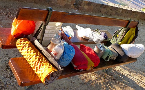
gear on park bench

Morning coffee on the harbour.

coffee

I’ll be hiking up there, in the snowy peaks, in a couple of days.
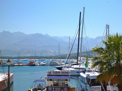
Calvi Harbour

I picked up a few last minute items.

The last piece of the puzzle was stove fuel. In Calvi, Camping Gaz and white gas are available, but I couldn’t find the threaded cannisters popular in North America. Happily Mr. Costa Patrick of Hotel du Centre gifted me a couple that had been left behind by former guests. (That’s the best inexpensive place to stay in Calvi, by the way. It’s not in Lonely Planet.)

The only public transportation to the trailhead is the “school bus”, not operating on Sunday. I was forced to take a taxi charging an even higher rate on the Holy Day. (37EU for the 17km, or so, one way from Calvi to Calenzana.)

Here’s the official start, Oratoire Sant’ Antoine chapel. Say your prayers. You’re going to need all the help you can get.
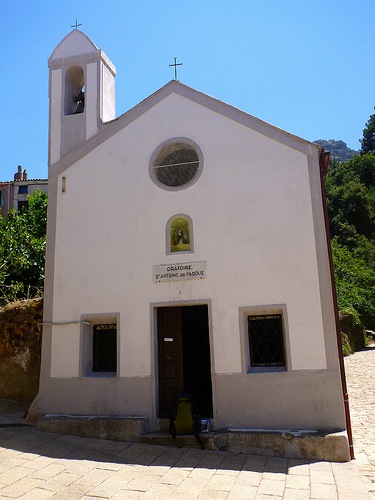
P1000888

Calenzana, by the way, is a bit infamous amongst Corsicans. Some claim that Milieu gangsters from Marseille have homes here. (They ignore trekkers, happily.)

photo of Calenzana by Trek Earth

David Abram:

The first day’s walk on the GR20 can be a shock to the system. You leave Calenzana with everything on your back, probably in hot weather, with a question mark over the availability of water along the way. You learn which plants in the maquis are the thorniest. Lizards scuttle for cover as you approach. The ascent is unremitting – uphill all the way. You climb higher than anywhere in Britain, then climb even further, scrambling across a rocky mountainside with a big pack on your back. You carefully ration your water and wonder if it will last. When you finally reach the refuge, you take the accommodation and services as you find them, knowing there is nowhere else you can go. This day is a fine introduction to the rigours and the delights of the GR20 – it’s your baptism of fire!

12km (71⁄2 miles) 1550m (5085 feet) in elevation gain.
Calenzana is at 275m.

GR 20 is blazed with red and white paint.

P1000891

Water IS critical at higher altitudes. I was carrying 4 litres of liquid (4kgs!) to start the trek. This source will be gone in a few weeks.
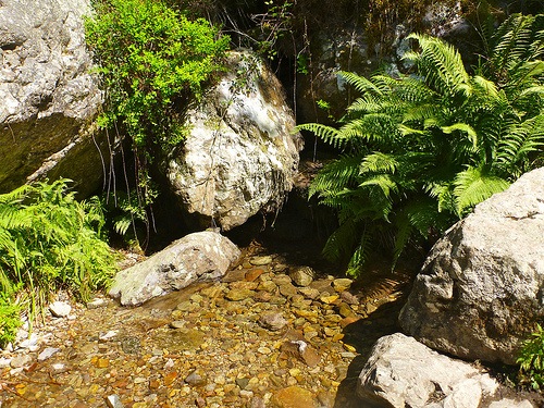
Heat emergency is a big risk too. I was happy to be here in June, not end of July.

P1000900

… I didn’t reach Refuge d’Ortu di u Piobbu. Instead, I set up my tent in a discrete cow patch just above Bocca a u Bazzichellu (1478m).
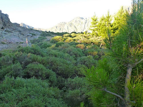
P1000923

This seemed to be one of the hardest hiking days of my life, for some reason.

I was worried. Worried about pack weight. Worried whether my feet would hold up. Worried about ‘the toughest hike in Europe’. Certain that my plan to hike 180km (110mi) in about 8 days was IMPOSSIBLE.

… Chilled from overheating, I only had energy enough to munch some chocolate and dry Ramen noodles before crashing into deep sleep.
See more annotated photos of day 1.

California through his lens

California Through My Lens is dedicated to the “great state of California and the wonderful beauty it has to offer to the photographer and traveler“.

It’s well done. I’ve just subscribed.

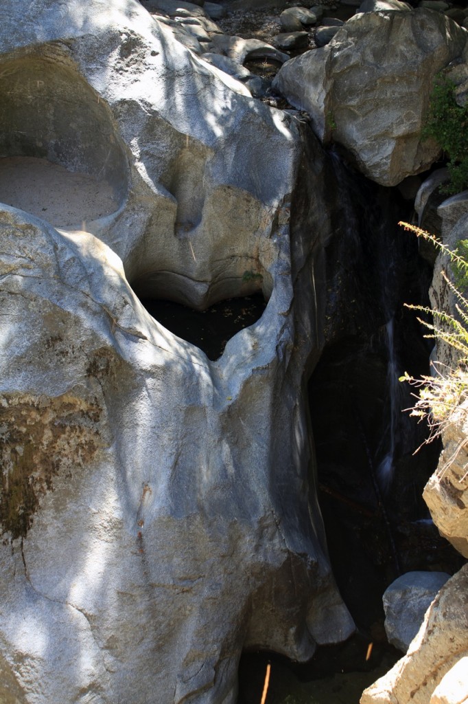
Check out some hiking trip reports. For example, Heart Rock Waterfall in Crestline, CA:

… the true draw of this hike is the fact that the waterfall has an almost perfect cut out of a heart right alongside of it. The heart itself looks small in the photos, but could easily hold two adults in each of its halves. This is a little gem nestled in the San Bernardo mountains that I recently stumbled upon on world of waterfalls but had never heard of even after I had lived in this area of CA for my whole life. …

Heart Waterfall Hike (Seeley Creek Falls) in Crestline, CA

homepage – californiathroughmylens.com

Howe Sound Crest Trail to the Lions

trip report by besthike editor Rick McCharles

The Lions are a pair of pointed peaks (West Lion – 1,646 m (5,400 ft); East Lion – 1,606 m (5,269 ft)) along the North Shore Mountains in Metro Vancouver, British Columbia, Canada. They can be seen from much of the Greater Vancouver area …

The city’s BC Lions CFL football team is also named in their honour. …

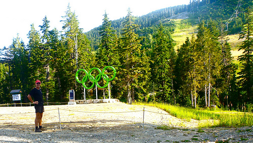
On the September long weekend, a friend dropped me off at Cypress Bowl Ski Resort, only 20min from North Vancouver.

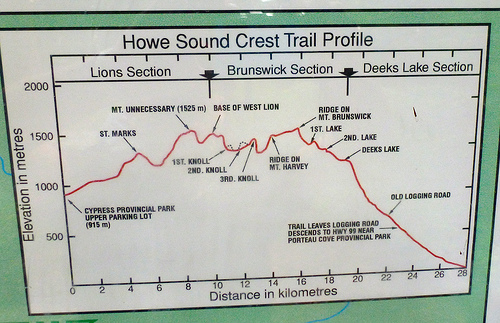
Of several trailhead options to visit the Lions, I recommend this one. Check the elevation profile:

(Most hikers, instead, start closer to sea level on the Binkert Trail, a long slog uphill.)

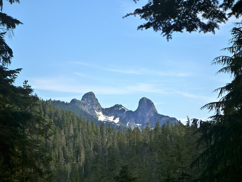
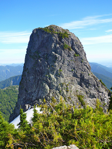
Here’s my first view of the Lions:

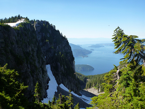
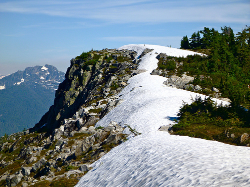
The first hour or so climbing up out of Cypress is tree locked. But you soon find yourself on a wonderful ridge walk with vistas like this:

In early September the #1 question was still: “How’s the snow?”

No problem when I was there. In fact, where the trail crossed snow the footing was good, progress just as fast as on ground.

For lunch I decided to set up the tent on a warm rock.

I read my book. Listened to audiocasts on my iPod. And had a nap. The tent was essential to escape the voracious mosquitoes and bothersome noseeems, unusual on the west coast, especially in September. There were none at lower elevations.
Look closely and you’ll see people atop the west Lion:

There are helicopter rescues nearly every summer weekend. And hikers do fall.

On arriving at the base of the west Lion I instantly decided not to scramble up. It looks sketchy. And there were all kinds of inexperienced, unprepared idiots crowding the route.

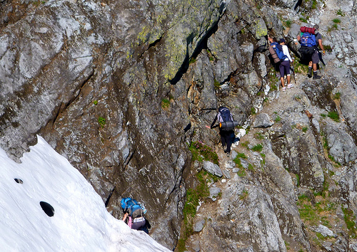
Instead I continued on the Howe Sound Crest Trail between the Lions. This traverse section was the trickiest of all. Considerable exposure.

The views of the Lions are stunning from every angle.

east Lion

Past the Lions there are very few hikers. The trail is indistinct, to say the least.

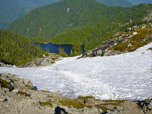
Here I glissaded down towards the lake.

… Unfortunately, the actual trail stays high on the ridge. I need to bushwhack back up to find it.

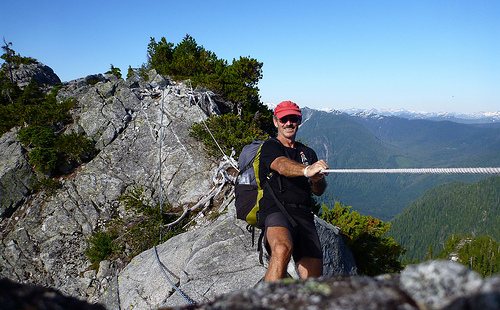
At this point someone had installed a chain and comfort rope, not needed in this ideal weather.

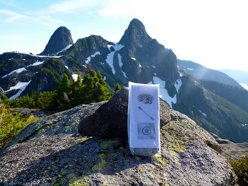
In a nearby cairn, I left a Summit Stone.

Soon after that chain, the trail gets very rough. One hiker with a dog decided to turn around. It was canine impassible.

I got fed up myself after one particularly steep, ugly down scramble. And decided to finally set up my tent for the night.

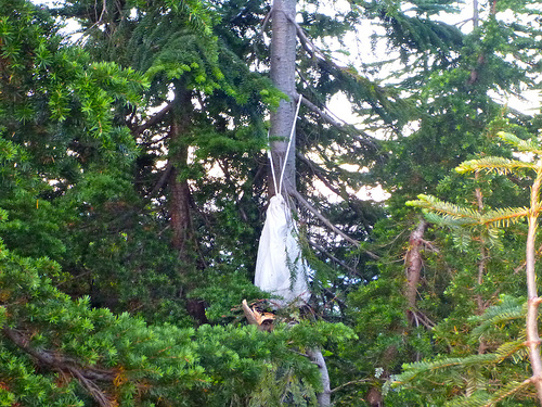
There was no suitable cliff nor tree limb for hanging my food, so I used the Ursack system for the first time.

… 45min later I could hear some animal clawing a tree. I assumed a bear had taken my food.

I stayed the night as it was impossible to find the faint trail in the dark. When morning dawned I went to photograph the damage, and found the food untouched. One small tree nearby had been broken though. (… I’m still not sure what animal had caused the ruckus I heard the night before.)

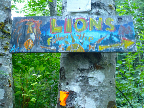
Due to too rough trail, I decided to escape the Howe Sound Crest Trail early. The nearest exit was via some new (wet) trail recently hacked out of the woods. It was flagged but poorly signed. People had created home made signage to compensate. This was the most artistic:

I ended up in Lions Bay after connecting to the Binkert. From there you can find a bus back to Vancouver.

_____

Leave a comment if you have a recommendation on the best trail back down to Highway 99. Is it worth continuing to the end of the HSC trail?

In the end, I’d still rank this as one of the best hikes in B.C.

On a clear day, the vistas are stunning.

I have 80 annotated photos posted from the 2 day hike.

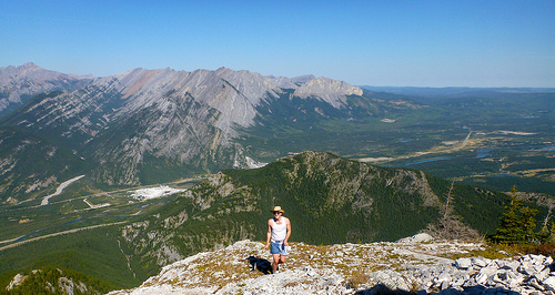
Heart Mountain Loop, Alberta

trip report by site editor Rick McCharles

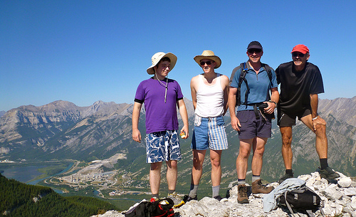
A friend’s son and his buddy arrived in Calgary on a Jack Kerouac inspired road trip across Canada.

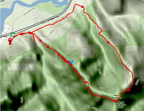
My first inclination was to take them on a hike in the Rockies. We arranged it late night on Facebook and organized an early rendezvous next morning near Canmore at the Heart Creek Trail parking lot.

Our fearless leader, Kelly Mock, lives less than 10min away. He recommended we try for the Heart Mountain Loop.

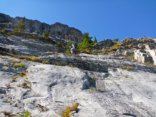
We got immediately lost, having to bushwhack up through trees and scramble to get up on the correct ridge.

Weather perfect, the views were amazing once we got up high.

Here’s Aiden, with the Trans Canada highway in the background.

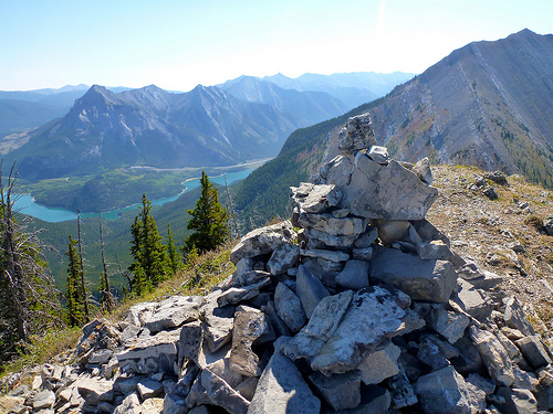
On the summit.

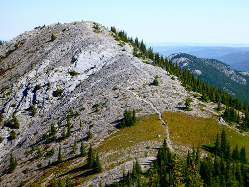
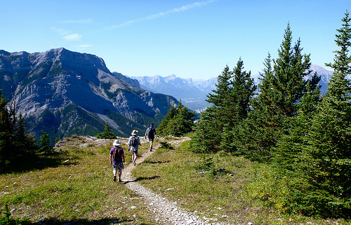
I loved this hike for the long, easy, gorgeous ridge walks around the horseshoe.

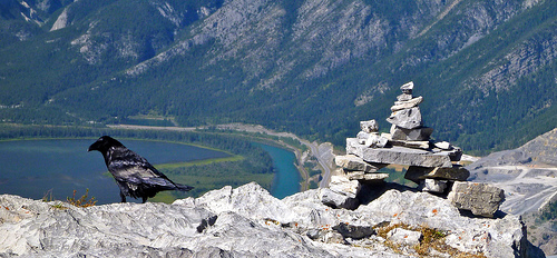
This mountain was crowded on a sunny Saturday in September. Raven was waiting on leftover hiker’s lunches.

Without having gotten lost, we would have been about 5hrs on the loop. It’s a scramble — you’ll get your hands dirty. But there are only a few technical sections, slight exposure.

Highly recommended in good weather.

See all my photos from this day hike.

_____

This same beautiful day friends were hiking nearby.

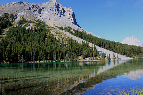
more photos – Ptramigan Cirque and Elbow Lake

besthike photos

by site editor Rick McCharles

I’ve finished catching up our collection of besthike photos. (830)

Alpamayo Trek, Peru

See ALL of our best besthike photos.

Those are a subset of our thousands of photos, from over 200 hiking photo sets.

All are Creative Commons licensed. You can use them so long as credit and link back to besthike.com are included.

Enchantments (double) Traverse, WA

… continued from – Day 1 – Permit lottery and getting to Snow Lakes
_____
trip report by besthike editor Rick McCharles

Day 2 – Snow Lakes to Aasgard Pass. And back.

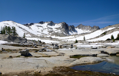
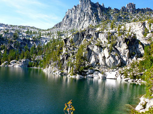
The Enchantment Lakes …

… (are) located entirely within the Alpine Lakes Wilderness about 15 miles (24 km) southwest of Leavenworth, Washington in the United States. The Enchantments is regarded as one of the most spectacular locations in the Cascade Range. …

Dawn broke clear and calm. But I did not get out of the tent early, fearing mosquitoes. It’s buggy close to these lakes, even in August. Climbers told me that mosquitoes chase them all the way to the windy summits.

Once on foot, I needed to keep moving briskly to stay ahead of the bloodsuckers. The scenery was gorgeous, though.

This was the only time I got my feet wet all day. (Lucky, I thought, considering I was trekking ‘alpine lakes’.)

The many waterfalls are impressive.

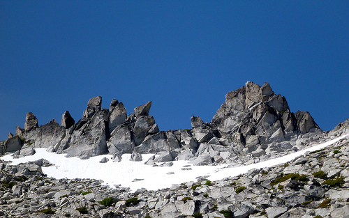
But for me and most, the highlight are the high, stark lakes. And craggy ridges.

I hiked directly to Aasgard Pass. Then — for FUN — returned by scrambling off-trail high above the regular route.

Surprisingly, I made even better time on the return trip … and suffered no roadblocks … until this point …

I tried descending to the far side of the lake and walking the shoreline. It would not go.

Rather than backtrack I scrambled up the cliff. Not too smart. I was lucky I didn’t splash down in the cold lake.

From there it was an easy out back down to my tent. The double traverse took me about 10hrs walking.

See all my photos from this adventure.

_____

Hiking the Enchantments in Autumn (PHOTOS) is highly recommended. The Larch are golden. And there are NO BUGS.

_____

The most unusual thing about the Enchantments are the tame mountain goats.

In recent years, they have become a little too friendly with people, in some cases acting aggressively. These are large, powerful animals, and need to be treated with caution. Enjoy them from a distance and don’t encourage them. They are also very attracted to human urine; please use the toilets where provided, or urinate into gaps between boulders or other places that will prevent them from pawing up plants and soils …

I got plenty of closeup video of the beasts.

hiking the Enchantments, WA

trip report by besthike editor Rick McCharles

Day 1 – Permit lottery and getting to Snow Lakes

The Enchantments Traverse is one of our best hikes in the world.

Many call it the best hike in Washington State. High praise!


A.H. Sylvester
who explored the area for the forest service in the early part of the 20th century, was so impressed with the chain of high alpine tarns and lakes that he named them the ‘Enchantments‘.

Super popular, you need a Permit to camp anywhere near the Enchantments.

Applications are accepted online from February 28 through March 20 for the following summer. A lottery decides the lucky few. (The website also provides a way to decide permits later in the year as cancellations occur.)

As I had none, I tried for the “Walk-in” Permit available 7:45am each morning, excluding Sundays, at the Ranger Station in Leavenworth. Hiking solo, I felt my odds were pretty good.

Unfortunately, my name was not drawn.


Other hikers explained that I could get a Permit for Snow Zone (still available) and day hike the adjacent Enchantments. That’s what I did.

It’s cheap: $5 per person per day (per day, not per night) which funds the on the ground management of the permit area, plus a $6 per permit fee, which funds the reservation system.

From the Snow Creek trailhead to my campsite was less than 6mi, less than 4000ft elevation gain, so I didn’t start until late afternoon.

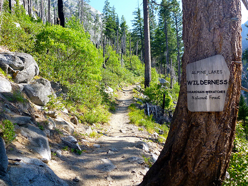
Snow Lakes Trail #1553

I found it quite a mellow trail to get up to elevation. Certainly easier than the dread Aasgard Pass alternative.

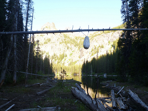
I hung my bear bag almost over the water, lifting it up there with a long branch.

Fishers should bring a rod. The trout were jumping. Washington State license required.

Everything was set for a BIG day on the Enchantments Traverse next morning. …

See all my photos from this adventure.

_____

Many avoid the Permit hassle doing the Enchantments as a long day hike. I’d say starting at the Snow Lakes trailhead, hiking down and out Aasgard Pass to the Colchuck trailhead, is easier than the other way around.

The two trailheads are miles apart so you’ll have to hitchhike unless you stash a mountain bike at the far end. Or have two vehicles.

… read on – Enchantments (double) Traverse, WA

4th of July to Icicle Ridge, WA

trip report by besthike editor Rick McCharles

One of the best hikes in Washington State out of Leavenworth.

… Don’t let this hike’s bad reputation dissuade you from reaping its good views. Sure, it’s one of the snakiest trails in the Icicle Valley-save it for a cool day. And yeah, it’s one of the steepest trails in the valley-hottest too-best to save it for a cool day. And total vertical feet-oh boy, you’ll gain plenty-so save it for a cool day when the serpents are sedate.

Are you getting the picture?

But the views are amazing: from the Chiwaukum to the Entiat to the Stuart ranges and beyond-savor the panorama on any day! …

Washington Trails Association

With warnings like this, I decided to start late in the afternoon on a hot August day. Temperature turned out to be no problem.

I parked my vehicle at the Icicle Ridge trailhead on (the paved) Icicle Creek Road (Forest Road 76) and cycled from there to the 4th of July trailhead, perhaps 7mi further into the mountains.

I saw no snakes.

Steepness was not really a problem, either.

Sections of the two trails were overgrown in places, though. 4th of July is a nice grade.

Once intersection with the Ridge, it’s plenty pretty. Often wide open with big views. Lots of flowers, even in August.

It was a pleasure working my way back down the ridge towards Leavenworth.

More photos from my Icicle Ridge Trail hike.

I underguestimated my slowness this day, finishing in the dark (PHOTO) without headlamp. Oops.

No shout out for the busy, grumpy (and even misinformed) staff at the Leavenworth Ranger station. Only one, a younger female, I found helpful and pleasant.

Coyote Buttes – The Wave

Bill has a website dedicated to one of our best hikes in the world, The Wave on the Utah / Arizona border:

… There are two great photographic locations in Coyote Buttes North (The Wave and The Second Wave) and numerous minor ones including Top Rock Arch, Melody Arch and the Grotto, the Hooters, The Alcove, Sand Cove, and Fatali’s Boneyard.

The Wave is best photographed midday so as to minimize the extensive shadows, the other areas listed above are best photographed mid-late afternoon. …

Due to the fragile nature of this natural resource, it’s very difficult to get a hiking permit.

Bill’s site offers this advice:

… Your chances are better if you’re going alone, or in December – February. If you do not win the lottery I suggest you get one for Coyote Buttes South, or go to the White Pocket which is east of Coyote Buttes South.

I know of one person who was lost overnight in Coyote Buttes South, so use a GPS, mark the trailhead, and stay with your party. While a two wheel drive vehicle is adequate for the North Buttes, four wheel drive is required for the South due to deep sand. …

read more on TheWave.info

Bill adds this bit of news:

The upcoming 2012 Disney film “John Carter” was shot in the area across Wahweap Creek near the town of Bigwater. Other locations include Canyonlands and Factory Butte (near Capitol Reef). A 3D movie. The arid region will stand in for Mars.