This is cool.
It was put together to show how deep they were drilling with the Deepwater Horizon oil rig.

via Jason Mortimer on Facebook

Best hikes, treks, tramps in the world.
This is cool.
It was put together to show how deep they were drilling with the Deepwater Horizon oil rig.
via Jason Mortimer on Facebook
Click PLAY or watch an EveryTrail app review on YouTube.
It’s available for iPhone, Android, Windows Mobile and Blackberry.
I want to duplicate Caldiper’s High Sierra Trail.
Dean Potter is one of the most interesting extreme athletes in history.
Death wish? … Or does Dean have it all figured out?
Dean Potter is characterized by creativity, commitment and challenge. He started climbing as a child, with a free solo fall from a stone wall as one of his earliest memories. Since that time, he has speed soloed Half Dome and El Capitan, Cerro Torre, and Fitzroy. He was the first to make a one-day free ascent of El Cap and Half Dome, and a one-day speed linkup of both of those big walls and Mount Watkins, Yosemites third Grade VI wall. He has also established testpiece crack routes in the Utah desert and highball boulder problems in Yosemite.
Dean has walked the longest highlines, often without a safety leash, though he has dedicated over a decade of engineering and testing to create the safest highline systems currently used. Most recently, he has combined BASE jumping skill with highlining and free soloing, using a specially engineered ultralight BASE rig as his backup system. …
Click PLAY or watch it on YouTube.
trip report by site editor Rick McCharles
The most popular overnight hikes in the Grand Canyon require a permit for the Bright Angel campground.
I didn’t have one. You need reserve 4 months in advance!
So first stop was the National Park South Rim Backcountry Office.

Here I got a number (#4), some paperwork, and instructions to be standing in front of the door next morning when it opened at 8AM.
Happily that worked. I snagged a last-minute camping permit for departure the following day. Of the 3 buses to the Kaibab trailhead, I took the latest, 7AM.
My plan: descend the Kaibab Trail, camp one night, ascend the Bright Angel Trail. That would bring me back to my parked vehicle.
Here we are at the South Kaibab Rim Trailhead 7:30AM.

It’s a Switchback marathon, but worth it, I thought, as the trail follows a ridge crest right to the bottom. Great views!

I was there in early May, wildflowers a definite highlight.


It was an easy 2hr descent to the river. Why does my guidebook call it 5-6 1/2 hours?

By 11AM I was in my tent. Siesta time.

At Noon I headed over to the nearby Phantom Ranch. Ordered a coffee and read a picture book on the reintroduction of the California Condor. A success story, so far.
These locals didn’t have much to say. They stood in the sun, silent.
The most exciting animal I saw was a bushy tailed fox, slinking through Phantom Ranch at dusk. His regular route, I was told.
Already feeling some kind of a wimp, finished hiking so early in the day. I felt even worse after talking to this character.

On an 800mi Arizona Trail bike race, he’d been required to carry the bike through the National Park.
What to do with the rest of my afternoon? …
I was tempted to dash up to the North rim and back with just a day pack. But one toe had taken some damage, jammed into the front of my shoe on the descent.
Instead I did a short, intensely scenic day hike, a loop around the two bridges.
I had time to stop and smell the flowers.


I spent a fair bit of time waiting on one of the passing rafts to overturn.

No luck.
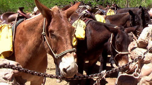
After having lunch with these Mulies, I entrusted them with a secret. …

It had amused me to place a Summit Stone conspicuously under the Bright Angel bridge. The anti-summit, the very lowest point on my rim-to-rim hike.
Next morning I left in no hurry. The Bright Angel Trail is much easier than Kaibab South, though longer.

It’s green. And lush, in the Spring. With plenty of shade and water.

Again I felt personally lazy … after watching these trail runners buzz by.

Marathon runner Margaret Bradley died doing exactly the same thing in 2004, but on a lesser used trail. It was July, not May.
In fact, a number of people die in the Grand Canyon every year. If worried, stay home, and read Over the Edge: Death in Grand Canyon, instead.
Mine was a wonderful hike, my first in the Grand Canyon.
Next time I’ll do something much more challenging. Perhaps rim-to-rim in one day, taking the shuttle back to my vehicle. No permit required.
But I won’t hike in Summer. No way. I don’t want to collapse like George Novak did. That would be embarrassing. My reputation as a best hiker would be ended.
See the rest of my photos from this 2-day hike.
It’s easy to criticize the parents for letting their “child” do something so dangerous.
A 13-Year-Old Kid Has Summited Everest
But this kid is no rookie. He’s already completed 6 of the 7 summits. In December he’s scheduled to attempt Vinson Massif in Antarctica.

There’s some age that’s “too young” for high altitude mountaineering. But I’m not sure what age that would be. It depends on the child, I’m thinking.
trip report by site editor Rick McCharles
My best hike so far on this Southwest U.S.A. road trip was a little visited slot canyon in Capitol Reef National Park.
It’s now high on our list of the best hikes in North America.
Over a 24hr period I saw no hikers, nor did I see any motor vehicles while tenting at nearby Cedar Mesa campground. The trailhead register showed one or two hiking groups a day, on average.
… a deep, narrow, twisting canyon with large alcoves. The canyon offers many opportunities for side trips and exploring.
From 1881 to 1884, the canyon served as a wagon route for Mormon pioneers traveling south toward San Juan County. The canyon was thought to be narrow enough to “twist a mule” hence the name Muley Twist. The Post cutoff trail is marked with rock cairns and signs, but carrying a topographic map is recommended. It is extremely hot in summer and water sources are unreliable; carry adequate water. Use caution in narrow canyons particularly during flash flood season (typically July-September). …
Best season for hike: Spring and Fall
The first decision to make is trailhead. I chose the Post parking area. That makes for a perfect “loop” hike of about 15mi.

The trail into the wilderness is well marked.

Looking back one last time at my vehicle. Would I be lost in the canyons, never to return?

Actually, I did not get lost. (much)
Stone cairns led me to the signed intersection with the main canyon trail. If confused, you could always ask one of the locals.

Wildflowers are a good reason to hike the desert in the Spring. They were fantastic when I was there.


But the main attraction of Muley are the massive rock alcoves, as impressive as any I’ve seen anywhere.


You can’t help but wonder how this tiny stream could have carved them.
There is enough water to support some BIG trees.

Here’s where the canyon finally narrows enough to “twist a mule”.

Exiting the “narrows”, you should immediately scramble left out of the canyon. I missed it, wandering further.
Checking my Lonely Planet Hiking USA guidebook, I had to backtrack to continue the loop back to my vehicle.
The final section out in the open is much different, but still interesting …

… and colourful.

Next time … Upper Muley Twist Canyon. Or, perhaps a thru hike connecting the two.
See all my photos of Lower Muley Twist Canyon on Flickr.
All in all, I’d call this a perfect hike. Highly recommended, especially if you don’t like crowds.
The Notom to Bullfrog access road is scenic and (normally) quite safe, even for low clearance vehicles. Don’t let access dissuade you from going.
trip report by site editor Rick McCharles
Though May is reckoned to be the best month to hike Capitol Reef, rather than set up a tent I fled to this little “camping cabin“.

Good call. Morning dawned well below zero with plenty of snow on the ground.

The Visitor Center is everyone’s first stop. From there it’s only a few miles to Hickman Bridge trailhead where you have the option of 4 hikes:
• Hickman Bridge
• Rim Overlook
• Navajo Knobs – 9mi return, 1649ft ascent
• Cohab Canyon
These range from “easy” (Hickman Bridge) to “challenging” (The Knobs), ideal for a mixed ability group.
The route is well marked with cairns.

Views are wonderful throughout though there’s not much protection from wind and sun.
Pectols Pyramid is the first highlight of many.


My first rattlesnake ever! (They’ve seen me, but I’ve never seen one of them.)

… Apparently it’s too early in the Spring for this guy. And a Ranger told me they are only very rarely found on this trail.
Was he looking for this guy?

The route climbs parallel with the highway. Here’s the valley far below:

That’s them?
The Navajo Knobs?

A bit of a let down. They’re simply 2 bumps of limestone atop the Waterpocket Fold. The main reason to go the extra miles is to see around the corner. It’s impressive!
I left a Summit Stone atop one Knob, reward for anyone keen enough to get up there.
Rangers were pushing this guidebook: Capitol Reef National Park – The Complete Hiking and Touring Guide.
I used my trusty Lonely Planet Hiking in the USA.
As both a driving tour, and hiking destination, I highly recommend Capitol Reef.
See the rest of my photos from this day hike.
A good list from divine caroline by Vicki Santillano:
Kalalau Trail, Hawaii
Half Dome, California
Conundrum Creek Trail, Colorado
Bright Angel Trail, Arizona
The Hollywood Trail, California
Mount Riga State Park Trail, Connecticut
OldRag Mountain Hike, Virginia
Raven Cliff Falls Trail, Georgia
Mount Whitney Trail, California
… The ends of these popular hikes can replenish the most tired and weary of walkers and instill an invigorating sense of accomplishment in them. … the more motivation you’ll have to keep walking when the trails get tough …
click through for details and photos of each – Nine U.S. Hikes with Gorgeous Finales
(via Chris Weiss on uncooped who adds Angel’s Landing, Utah)
I’m liking Conundrum Hot Springs.
… located at a staggering 11,200′ within the famous Maroon Bells in the Snowmass wilderness. These steamy pools are 8.5 miles up the Conundrum Creek trail just outside of Aspen. …

trip report by site editor Rick McCharles
As beautiful a slot canyon as any other on earth.
How could I resist?
That claim made by one of my guidebooks, Afoot and Afield Las Vegas, the best of those I used.
Simple.
Drive to this trailhead. …

An easy 2.5mi out-and-back.
Unfortunately, I didn’t do that.
Instead I parked on the highway, not trusting my low clearance vehicle to make it to the trailhead. This added about 2.5mi to the trip.
En route a couple of hikers told me I was off-route. They could not find the trailhead. (It was there.)
I diverted to the only other possible watercourse, following footprints down a dry creek. It looked feasible.
WRONG.
I circumambulated a minor peak on a scramble soon dubbed the DANGER MINE trail.

There must have been a dozen old mine shafts up there, right to the top of the peak.
Finally I spied hikers far below. On my original, correct route.

Anniversary Narrows are lovely.


Recommended. But another cautionary tale of how easy it is to get lost in the desert. It’s possible to fall into an abandoned mine shaft out there, too.
The crumbling ruins of the mining operation are a historical attraction.

see all my photos from this trip
