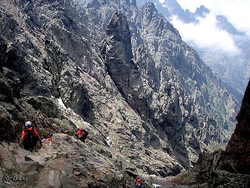
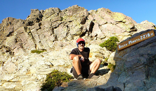
The Cirque de la Solitude is the crux of the GR20, one of the best and toughest hikes in the world.
Certainly it was the toughest trek of my life.
Tom Fordyce in The Guardian:
… The Cirque de la Solitude is the most notorious single section of the entire GR20. People are so scared of it that they huddle in petrified groups the night before, exchanging horror stories …
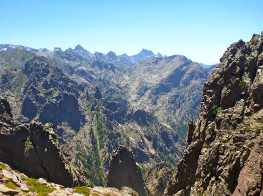
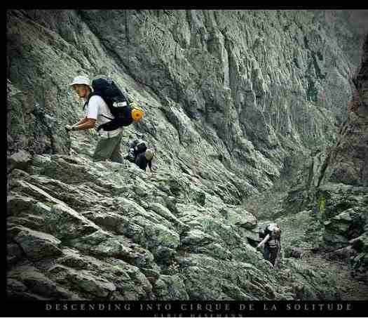
The Cirque turns out to be both gorgeous and terrifying at the same time. After 800m of rope-free climbing up, there’s 300m of straight down – straight down as in sheer rock-face, without even any pretense of a path. As a sop to the cowardly, there are some old chains bracketed into the smooth granite. … there’s nothing but the occasional spiky outcrop between you and the valley floor 1,200m below. …
Yet the feared Cirque of Solitude turned out to be the highlight of my GR20.
Tuesday, June 28th, 2011
I arrived late afternoon, the last 3 hikers (rock climbers) of the day having just finished crossing from the opposite direction. Each warned me of the seriousness of the traverse … in multiple languages.
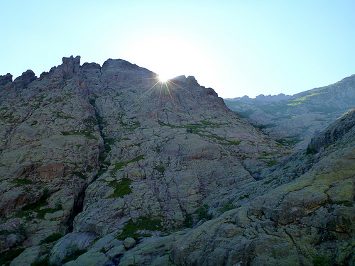
Finally, alone, I dropped into the chasm.
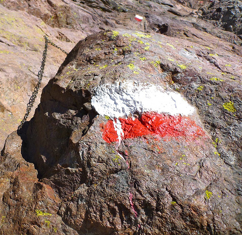
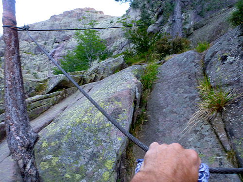
Chain assistance is essential when the rock is wet.
In perfect conditions, I didn’t need them.
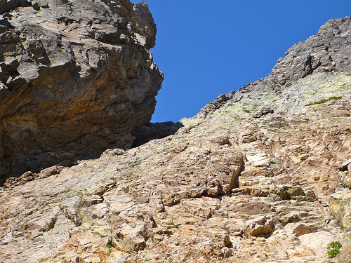
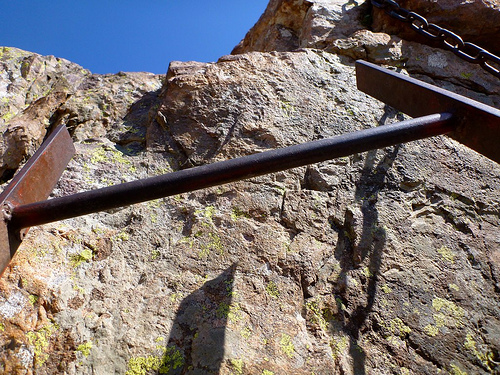
But I did need this on the ascent of the far side cliff, a steel ladder.
Moving slowly, carefully, I took about 2hrs to make the crossing, arriving at the far side just in time to ‘turn out the lights’.
Relieved to have achieved and survived, I was even more elated to have done it solitary.
Hikers joke about the name — Cirque of Solitude — as there is normally a log jam of folks bottle-necked at critical points. The main risk, in fact, is rock fall from someone above your fall line.
_____
This VIDEO gives a better idea of the challenge. Or this VIDEO (1min 30sec), in bad weather.
I awoke feeling surprisingly refreshed. But standing up reminded me that my hamstrings had cramped in the middle of the night, in the tent. Severely.
It was essential that I not strain hiking today. That I relax.
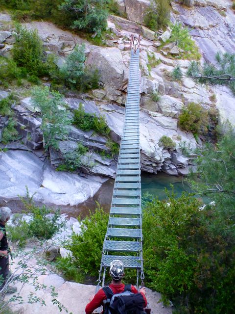
… Unfortunately the very start of the day was tough. Crossing the creek on a suspension bridge … and looking at the 750m climb to Bocca a i Stagnu.
This exact spot is where many hikers quit. (There’s an exit back down to the coast via Bonifatu.)
I persisted, scrambling the Spasimata slabs.
You can see that many from the Refuge started together. These kind of rush hour crowds are another reason I prefer tenting in the wild.
There are cables to assist, not needed when dry, but essential when the granite is wet.
It’s a good idea to start up the slabs early, taking advantage of the morning shade.
My obligatory photo of the North American Indian rock …
At the top the GR20 drops down to a ski resort and road — forget that. The high line, instead, is a route finding challenge along the Muvrella Ridge.
I LOVED this section though it was very slow going. That’s the normal GR20 route far below …
Once (eventually) down in the valley, I enjoyed the easiest hiking so far, even taking time to cool my feet.
During the afternoon I pretty much had the trail south to myself as there’s no Refuge before the infamous Cirque de la Solitude, the crux of the GR20.
I was thrilled to be walking so much better today. (It would have been a crushing disappointment to travel all the way to Corsica and miss the Cirque.)
… I planned to wild camp somewhere high and make the famous traverse next morning. It looks pretty thrilling from the photos.
I “wild camped” (technically illegal) awaking to the gorgeous vistas of the High Corse.
At this point, I wasn’t sure how strict were the prohibitions against tenting. When I reached the first Refuge, it would be obvious that I must have slept out.
Happily, nobody seems to care on the GR20. There are no “Park Rangers”. But be discrete.
Mountain huts are spaced at regular intervals on the GR20. Hikers are asked to stay at either a Refuge, or at other official accommodation. Bivouacking is not allowed. Surprisingly, I saw no sign that anyone else but me wild camped. People seem to like the Refuges.
Personally, I found Refuge Ortu di u Piobbu quite unappealing. The building sleeps 30. Or you can cram into the cattle proof enclosure with your tent.
Water availability, however, often decides where you can and cannot camp. It’s ill advised ever to walk past one of these water sources …
The trail seeks to stay as high as possible. Wonderful. But physically challenging, especially with a heavy pack. In sunshine, everyone takes the high route. (Low level alternatives are used in winter and foul weather.)
Hot and dry, I cursed my stupidity at carrying so much food when (somewhat expensive) delicious meals are available at the Refuges. It’s very easy to eat at Refuges without sleeping there.
End of June, wild flowers are still a highlight on the GR20.
Day 2 had much less elevation gain, but many tricky scrambling sections, most notably the traverse of Capu Ladroncellu’s south face.
The GR 20 was envisioned as a ridge walk along the spine of the island. As such, the trail often switches from one side of a rocky ridge to the next, maximizing views on both sides.
… slippery rock slabs, through tight corridors, past wind-eroded breaches, overlooking dizzying drops, and down stretches of precipitous, loose shale …
I had hoped to bypass the next campground, Refuge de Carrozzu, but couldn’t quickly find a flat alternative out of sight of the trail. Exhausted, I backtracked and took a tent site.
That Refuge is swarming with ants! Those sleeping under the stars were bothered, but my 1-man coffin (MSR Hubba tent) is secure from insects.
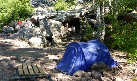
It’s possible to rent-a-tent in case of bad weather … or ant attack. Most rentals are Quechua brand.
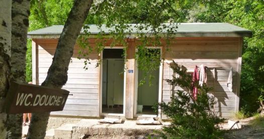
At Carrozzu I learned that Refuges are not all bad. Most provide cold showers, for one perk. …
This suspension bridge over an excellent swimming hole is the signature photo op of this Refuge.
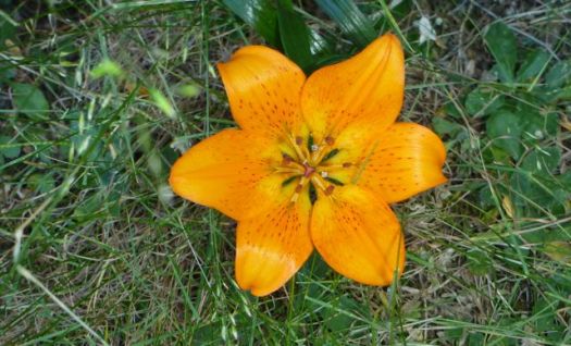
It was here too that I saw my first Orchid. Lovely.
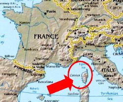
A mountain range rising from the sea, Corsica holds the most arrestingly beautiful landscapes in the Mediterranean. From its cobalt blue gulfs and shell-sand beaches, hillsides of evergreen maquis give way to pristine oak, chestnut and pine forests, awesome gorges, alpine lakes and a spine of snow-streaked peaks and passes. Among the many trails that penetrate its remotest corners, the GR20, following the island’s watershed, is a high-level route that has won an international reputation as being Europe’s most challenging long-distance path.
I decided to hike north to south because both of the best guidebooks in English describe it that way:
The best way to get to Corsica is by air, as inexpensive flights are offered by EasyJet and others.
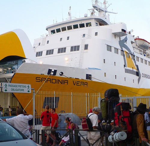
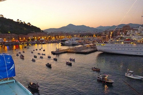
But I took an enjoyable (relatively expensive) train to Nice. And from there a relatively inexpensive ferry (33EU) to Calvi, the closest port to the northern trailhead. (Leaving my extra luggage in the Nice Train Station lockers.)
Conveniently, it set sail Saturday night.
I found a quiet spot under the stars and slept soundly on my air mat, the last person on the ship to wake next morning.
Sunday, June 26th, 2011
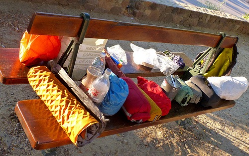
Here I am repacking for the trek, waiting on shops and Tourist Information to open.
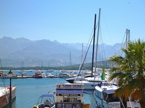
Morning coffee on the harbour.
I’ll be hiking up there, in the snowy peaks, in a couple of days.
I picked up a few last minute items.
The last piece of the puzzle was stove fuel. In Calvi, Camping Gaz and white gas are available, but I couldn’t find the threaded cannisters popular in North America. Happily Mr. Costa Patrick of Hotel du Centre gifted me a couple that had been left behind by former guests. (That’s the best inexpensive place to stay in Calvi, by the way. It’s not in Lonely Planet.)
The only public transportation to the trailhead is the “school bus”, not operating on Sunday. I was forced to take a taxi charging an even higher rate on the Holy Day. (37EU for the 17km, or so, one way from Calvi to Calenzana.)
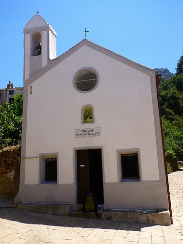
Here’s the official start, Oratoire Sant’ Antoine chapel. Say your prayers. You’re going to need all the help you can get.
Calenzana, by the way, is a bit infamous amongst Corsicans. Some claim that Milieu gangsters from Marseille have homes here. (They ignore trekkers, happily.)
photo of Calenzana by Trek Earth
David Abram:
The first day’s walk on the GR20 can be a shock to the system. You leave Calenzana with everything on your back, probably in hot weather, with a question mark over the availability of water along the way. You learn which plants in the maquis are the thorniest. Lizards scuttle for cover as you approach. The ascent is unremitting – uphill all the way. You climb higher than anywhere in Britain, then climb even further, scrambling across a rocky mountainside with a big pack on your back. You carefully ration your water and wonder if it will last. When you finally reach the refuge, you take the accommodation and services as you find them, knowing there is nowhere else you can go. This day is a fine introduction to the rigours and the delights of the GR20 – it’s your baptism of fire!
12km (71⁄2 miles) 1550m (5085 feet) in elevation gain. Calenzana is at 275m.
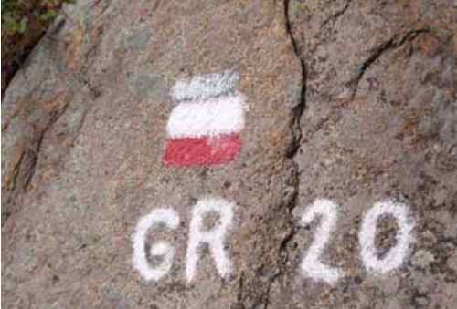
GR 20 is blazed with red and white paint.
Water IS critical at higher altitudes. I was carrying 4 litres of liquid (4kgs!) to start the trek. This source will be gone in a few weeks.
Heat emergency is a big risk too. I was happy to be here in June, not end of July.
… I didn’t reach Refuge d’Ortu di u Piobbu. Instead, I set up my tent in a discrete cow patch just above Bocca a u Bazzichellu (1478m).
This seemed to be one of the hardest hiking days of my life, for some reason.
I was worried. Worried about pack weight. Worried whether my feet would hold up. Worried about ‘the toughest hike in Europe’. Certain that my plan to hike 180km (110mi) in about 8 days was IMPOSSIBLE.
… Chilled from overheating, I only had energy enough to munch some chocolate and dry Ramen noodles before crashing into deep sleep.
… Corsica is a mountainous island in the Mediterranean and its GR20 is reputed to be the toughest waymarked trail in Europe. It is an ambitious route for fit and agile walkers, covering 190km in about two weeks as it makes a complete traverse through the high mountains, backpacking the whole way, sometimes with hands-on scrambling. …
Starting tomorrow I’ll post my day-by-day trip report with annotated photos. It turned out to be the toughest hike of my life.
Lonely Planet:
1. GR20, France
2. Inca Trail, Peru
3. Pays Dogon, Mali
4. Everest Base Camp, Nepal
5. Indian Himalayas, India
6. Overland Track, Australia
7. Routeburn Track, New Zealand
8. The Narrows, USA
9. The Haute Route, France-Switzerland
10. Baltoro Glacier & K2, Pakistan
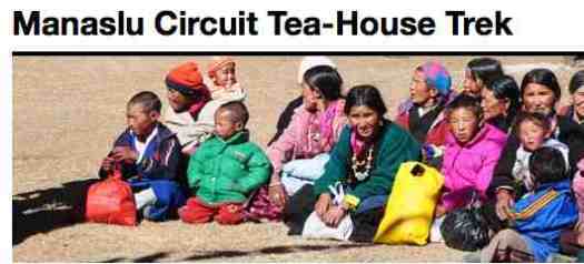
Check out a new website edited by Richard Bull – ManasluCircuittrek.com
It’s about 170km hiked over 2-3 weeks.
… the Manaslu Circuit Trek takes you from just 700m altitudes at Arughat (or Gorkha Bazar) up to 5160m on the pass – a tremendous range of altitudes, temperatures and micro-climates. …
Manaslu circuit is now a tea-house trek. Camping is not required unless you go off the beaten track. Here is a rough outline of the route with some information about where the tea-houses and lodges are. …
Robin Boustead (Great Himalayan Trail pioneer) says:
“Many would argue that the Manaslu Circuit trail is the best general trek in the country, with colourful cultures and dramatic valleys against a backdrop of classic Himalayan peaks.”
Richard has mixed feelings about promoting this excellent alternative to Annapurna and Everest Base Camp. But I feel progress is inevitable. Best it be managed for the maximum benefit of the local peoples.
I hiked half the GR20 in June — trip report — and can confirm it’s bloody tough.
Guidebook author Kev Reynolds calls the GR20 high-level route across Corsica one of the toughest 3 treks in Western Europe.
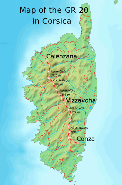
GR stands for Grande Randonnée, which means big excursion in French. It is a network of long-distance footpaths in Europe, mostly in France, Belgium, the Netherlands and Spain. GR20 is considered to be the most difficult of all the GR routes. Its Corsican name is Fra li monti (sometimes spelled wrong as Fra li monte), what means “across the mountains” in Corsican. …
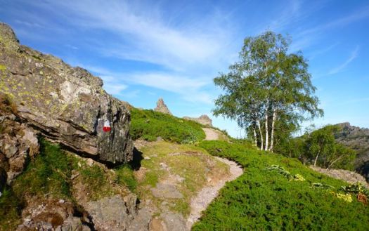
The trail is well marked with red and white rectangles on rocks, boulders and trees. Feeder paths are marked with one colour. There are also small stone heaps along the path. It’s still easy to get on a feeder path or to lose the way, so having a good map is necessary.
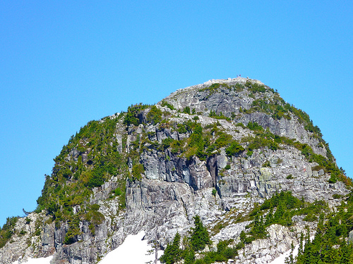
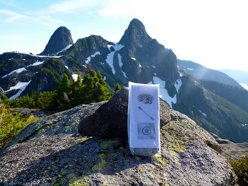
The Lions are a pair of pointed peaks (West Lion – 1,646 m (5,400 ft); East Lion – 1,606 m (5,269 ft)) along the North Shore Mountains in Metro Vancouver, British Columbia, Canada. They can be seen from much of the Greater Vancouver area …
The city’s BC Lions CFL football team is also named in their honour. …
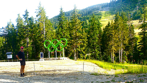
On the September long weekend, a friend dropped me off at Cypress Bowl Ski Resort, only 20min from North Vancouver.
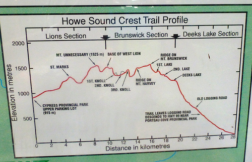
Of several trailhead options to visit the Lions, I recommend this one. Check the elevation profile:
(Most hikers, instead, start closer to sea level on the Binkert Trail, a long slog uphill.)
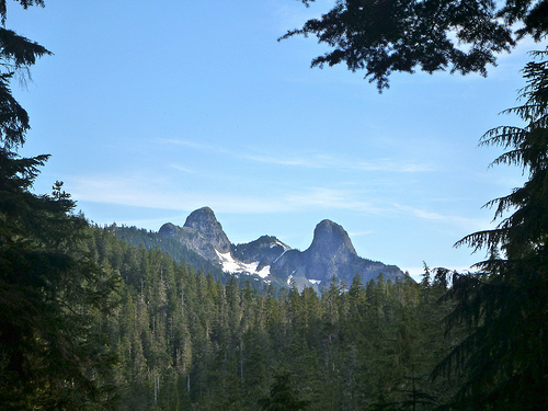
Here’s my first view of the Lions:
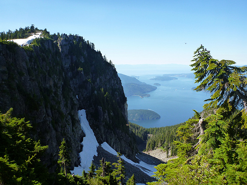
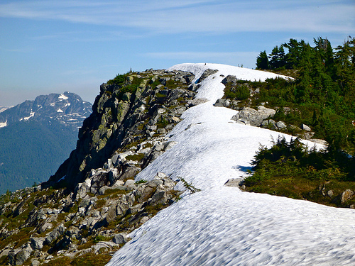
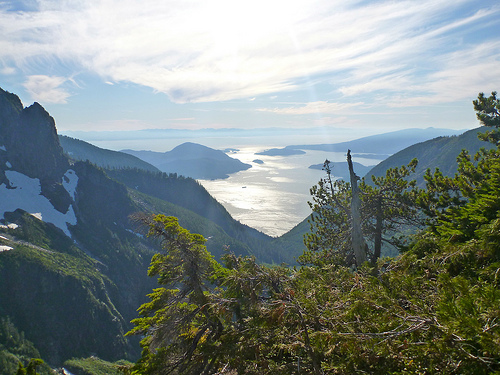
The first hour or so climbing up out of Cypress is tree locked. But you soon find yourself on a wonderful ridge walk with vistas like this:
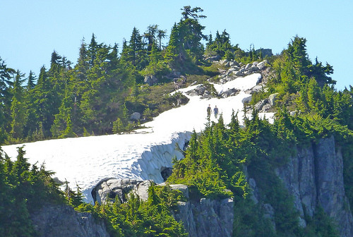
In early September the #1 question was still: “How’s the snow?”
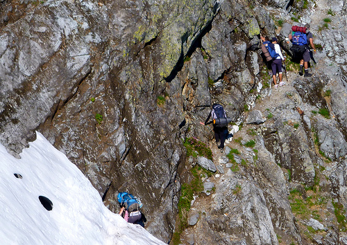
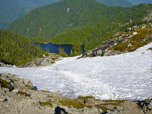
No problem when I was there. In fact, where the trail crossed snow the footing was good, progress just as fast as on ground.
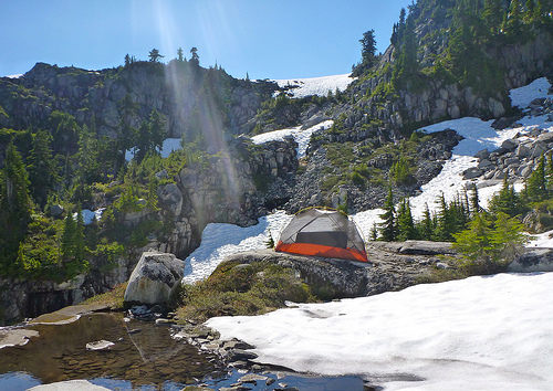
For lunch I decided to set up the tent on a warm rock.
I read my book. Listened to audiocasts on my iPod. And had a nap. The tent was essential to escape the voracious mosquitoes and bothersome noseeems, unusual on the west coast, especially in September. There were none at lower elevations.
Look closely and you’ll see people atop the west Lion:
There are helicopter rescues nearly every summer weekend. And hikers do fall.
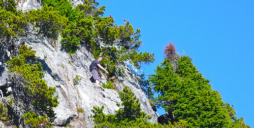
On arriving at the base of the west Lion I instantly decided not to scramble up. It looks sketchy. And there were all kinds of inexperienced, unprepared idiots crowding the route.
Instead I continued on the Howe Sound Crest Trail between the Lions. This traverse section was the trickiest of all. Considerable exposure.
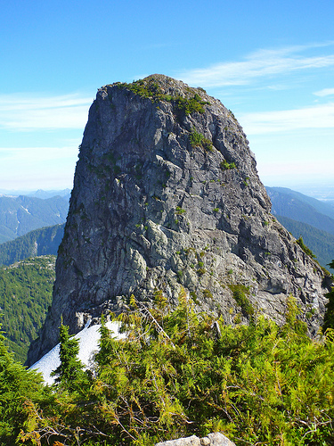
The views of the Lions are stunning from every angle.
east Lion
Past the Lions there are very few hikers. The trail is indistinct, to say the least.
Here I glissaded down towards the lake.
… Unfortunately, the actual trail stays high on the ridge. I need to bushwhack back up to find it.
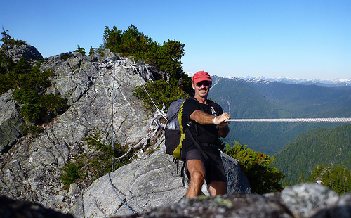
At this point someone had installed a chain and comfort rope, not needed in this ideal weather.
Soon after that chain, the trail gets very rough. One hiker with a dog decided to turn around. It was canine impassible.
I got fed up myself after one particularly steep, ugly down scramble. And decided to finally set up my tent for the night.
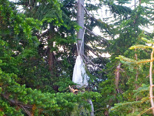
There was no suitable cliff nor tree limb for hanging my food, so I used the Ursack system for the first time.
… 45min later I could hear some animal clawing a tree. I assumed a bear had taken my food.
I stayed the night as it was impossible to find the faint trail in the dark. When morning dawned I went to photograph the damage, and found the food untouched. One small tree nearby had been broken though. (… I’m still not sure what animal had caused the ruckus I heard the night before.)
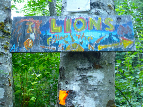
Due to too rough trail, I decided to escape the Howe Sound Crest Trail early. The nearest exit was via some new (wet) trail recently hacked out of the woods. It was flagged but poorly signed. People had created home made signage to compensate. This was the most artistic:
I ended up in Lions Bay after connecting to the Binkert. From there you can find a bus back to Vancouver.
_____
Leave a comment if you have a recommendation on the best trail back down to Highway 99. Is it worth continuing to the end of the HSC trail?
In the end, I’d still rank this as one of the best hikes in B.C.


 trip report by besthike editor Rick McCharles