Greater Patagonian Trail warnings
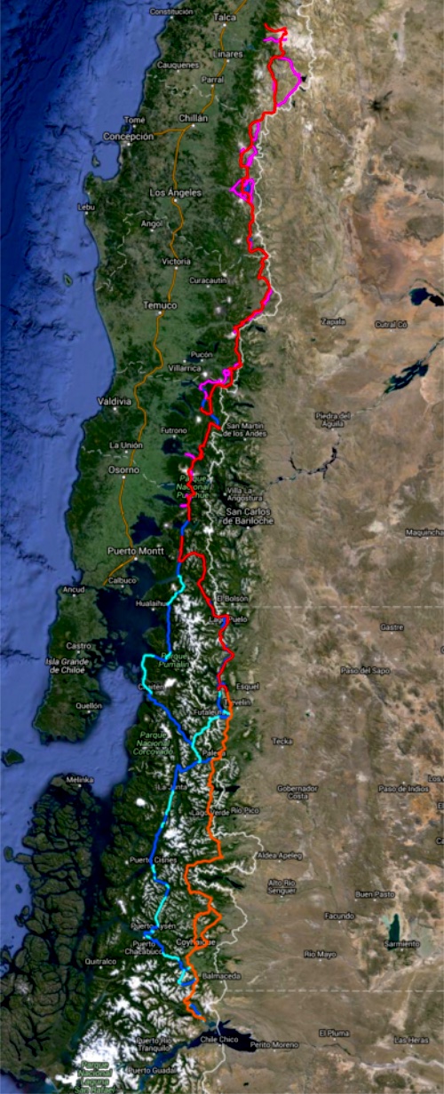
Fidgit shares some advice on the NEW Greater Patagonian Trail — Routes would be more accurate — in the Andes:
SO YOU WANNA HIKE THE GPT
The Greater Patagonian is not an official trail but rather 1500km or more of connected best routes. You’ll be lost for sure unless you have KMZ and GPX files downloaded from wikiexplora.
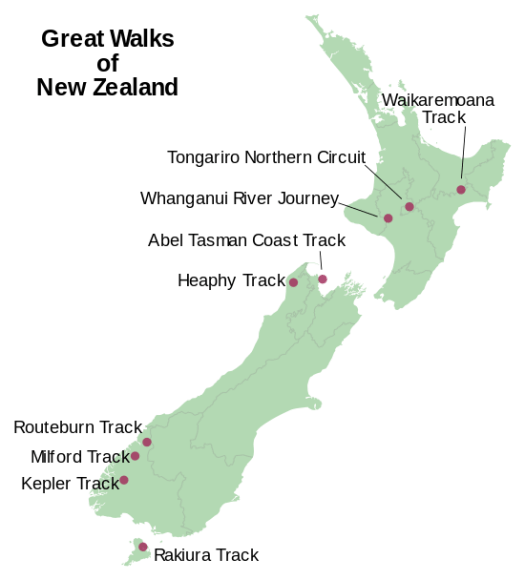
New Zealand’s 9 Great Walks in 9 days
WHAT!?
One is a river paddle, the Whanganui Journey, 145 kilometres (90 mi).
Is this even possible?
Click through to see if these guys made it — AND THEN THERE WERE NINE
hiking across Mojave Reserve, California
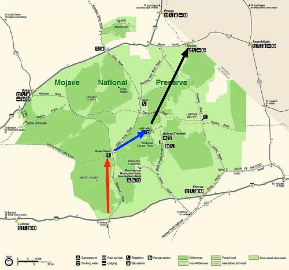
Next time I get to Vegas I plan to cross the Mojave National Reserve south to north.
I’ll start from highway 40 heading towards the Granite Mountains. Refill at Kelso Depot. Hike on to Mid Hills Campground , refilling my water bottles. And exiting at Nipton.
Surprisingly, water will not be a problem.

I won’t count on natural springs, however. Let’s leave that for the wildlife.
I’ll carry the Tom Harrison map. Wish me luck.
Epic Grand Canyon Hike
Have you been following Peter McBride & Kevin Fedarko?
Epic Grand Canyon Hike: A 650-Mile Challenge (Part 1)
Epic Grand Canyon Hike: Frozen Shoes and Low on Food (Part 2)
I liked the 3rd and final instalment best.
Click PLAY or watch Thirst and Threats in the Godscape on YouTube.
scramble Siphon Draw to Flatiron, Phoenix
trip report by site editor Rick McCharles
- Length: 6 miles (round trip)
- Trailhead Elevation: 2,080 ft.
- Gain/Loss: +2,900 ft.
- Difficulty: Difficult
Flatiron, aka Siphon Draw, is one of the most popular and exhilarating hikes in the Superstition Wilderness. This trail puts you on top of one of the most prominent rock features of the range called Flatiron due to the fact it looks like an upside down iron. …
The Flatiron trail begins at the westernmost side of the Superstition Wilderness at the Lost Dutchman’s State Park.

Lost Dutchman’s is a lovely Park and campground. Up and up.

It doesn’t take long to reach the big cliffs.

The Siphon Draw Trail is not much of a trail. It’s mostly a scramble up the rocky chute.


As you can see, it’s very popular on a nice January day. A number of these folks were challenged by the physical demands. A few had poor footwear.
The crux of the scramble is at the very top. No doubt a few turn back there. 😦
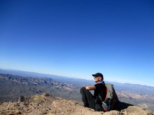
Top of Flatiron. Here’s the view over the Phoenix sprawl.


I continued up into these weird eroded towers.


I left a Summit Stone atop a cairn. Then made my way down as rapidly as possible.

The descent is much more dangerous than the climb. I fell once. Most people fall more than once.
The sun was dropping rapidly by the time I reached the trailhead. Beautiful light.


We’ve added Siphon Draw to Flatiron to our list of the best hikes in North America. It’s highly memorable and unique.
Hunter Trail to Picacho Peak, Arizona
trip report by site editor Rick McCharles
Like many others driving between Phoenix and Tuscon, I’d always wanted to climb this unique volcanic plug.
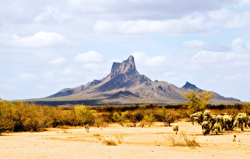
It looks challenging, but I found it not too bad.
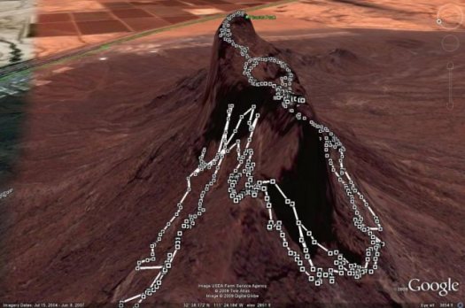
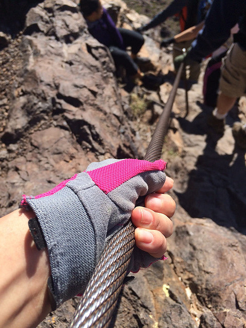
It’s not via ferrata, but there are cables and other assistance everywhere needed.
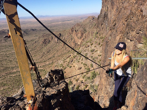
Bring gloves.
As a former gymnast, I was certainly overconfident on arrival at the trailhead.
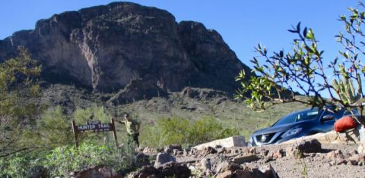
I’d already embarrassed myself pronouncing the name of the peak as Pikachu. That’s wrong.

Though one hiker cried 4 times getting up and down, I found it fun.
I love the giant, individually unique saguaro cactus.
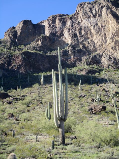
On the way up it’s difficult to imagine there’s actually a hiking route.
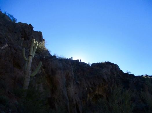
This beautiful day attracted many to the peak. Everyone made it to the top so far as I could see. Myself included.
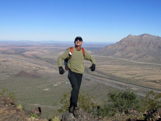
Certain birds and animals make a good living waiting on lunch crumbs here.

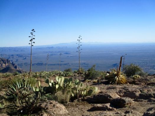
The vista from the top is not all that spectacular.

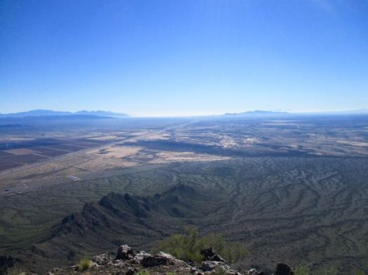
I made a sidetrip to a smaller peak. Here’s the vista looking back to the summit.
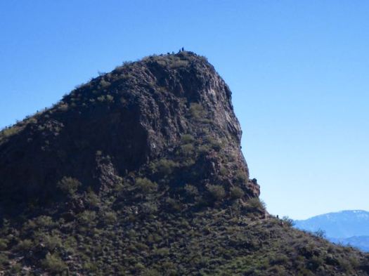
Still, Hunter Trail to Picacho Peak is unique and interesting enough to be added to our list of best hikes in North America.
If you have two vehicles consider climbing up via Hunter Trail, returning via Sunset Trail.

Thru-Hiking Will Break Your Heart …
An Adventure on the Pacific Crest Trail by Carrot Quinn
I’ve read a number of books on the PCT. I believe this is my favourite.
Carrot Quinn was raised in Alaska on welfare by a schizophrenic single mother. A rough life. In fact, she became a hobo riding the rails.
This book reads as a blog. That’s because it started as blog posts from the trail.

If you are one of those who disliked Cheryl Strayed’s memoir Wild … because it had too little actual hiking … know that this extended trip report is all about the hiking. 🙂
It’s funny. It’s real. It’s surprising. Carrot makes no apologies.She’s a big advocate of trail romance. Even sex.
I’ll certainly buy any of her other books that get released on audio.
related – Carrot did not love the Continental Divide Trail. She did love the Hayduke Route.
hiking White Sands National Monument
New Mexico
trip report by site editor Rick McCharles
Length: 2 miles (3.5 km), round-trip
The White Sands National Monument … at an elevation of 4,235 feet (1,291 m). …
It is the largest gypsum dune field in the world. …
The Monument is completely surrounded by military installations (White Sands Missile Range and Holloman Air Force Base) and has always had an uneasy relationship with the military …
Located on the northernmost boundaries of White Sands Missile Range, the Trinity Site can be found, where the first atom bomb was detonated. …

There are non-stop warnings about dehydration.

Let’s go.

I wore these lightweight camp shoes. They turned out to be perfect for the soft sand.

It was VERY windy.

Deserts are always interesting.

There are 10 backcountry campsites available.

details on Backcountry Camping
Following my hike, I joined the sunset dunes walk led by a Ranger.

It was very interesting and entertaining. This entire structure was created by that plant.

Sunsets are wonderful in the desert.

The Ranger noted that any President could remove National Monument status. Potentially this land could be given to the military. 😦
details – Backcountry Camping Trail
There’s a longer (5 mile) Dunes hike called the Alkali Flat Trail. If you want more.
Last Chance Canyon, New Mexico
trip report by site editor Rick McCharles
Story goes that ranchers in 1881 got lost in the deserts. Had no water. With their horses failing they spotted the limestone walls of one more canyon. This would be their last chance.
My guidebook author called this “one of my favourite spots in all of New Mexico”.
It has plenty of water year round. A rarity in this part of the world.
I started late in the afternoon as it was only 2.7 miles to the recommended campsites.

The light gorgeous.

Here’s that water that saved the ranchers.

Obviously this canyon floods at times.
I checked out the campsites. Too exposed. It was very, very windy.
Instead I hunkered down in this more sheltered spot.

Having forgotten my bear bag rope, I instead tossed my food bag up into a tree attached to a loose branch. Ingenious improvisation I thought … at the time.
The wind blew it down during the night. Happily my food stayed undisturbed lying on the ground.
Next morning I had the option to try to loop to famed Sitting Bull Falls.
But to save time I opted to backtrack from here, visiting the falls via the front door.

As you probably would guess, the Sioux medicine man Sitting Bull never visited New Mexico.
This is a great hike. Highly recommended. We’ve added it to our list of best hikes in North America.