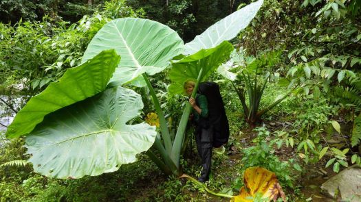
Otter Olshansky: A lonely death on New Mexico’s Continental Divide Trail
Super experienced, Otter pushed the limits one time too many. He died sometime after January 18th, 2016 in Lower Lagunitas Campground, New Mexico.
Rest in peace.

Best hikes, treks, tramps in the world.
Super experienced, Otter pushed the limits one time too many. He died sometime after January 18th, 2016 in Lower Lagunitas Campground, New Mexico.
Rest in peace.
Yep. One of the world’s great day hikes.
Click PLAY or watch it on Facebook.
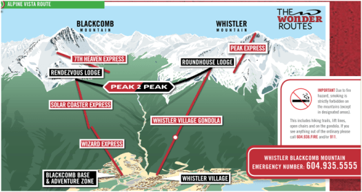
• 3.2km loop
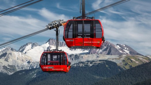
• start and finish Whistler Mountain Gondolas
An old hiker’s argument – “Is it cheating to take the Gondola?”
I rode the Whistler’s Peak Express Gondola. It was great to arrive at the very top of a mountain. (day pass C$53.95)
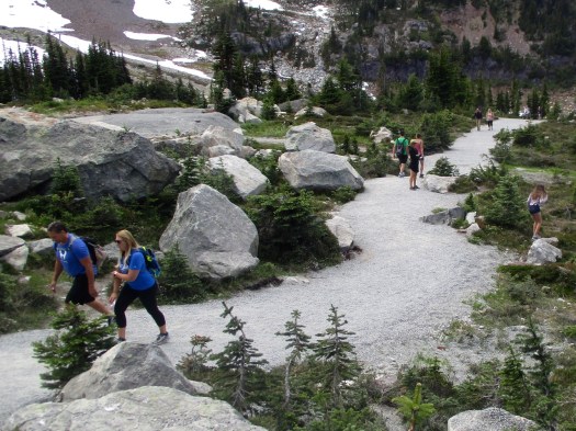
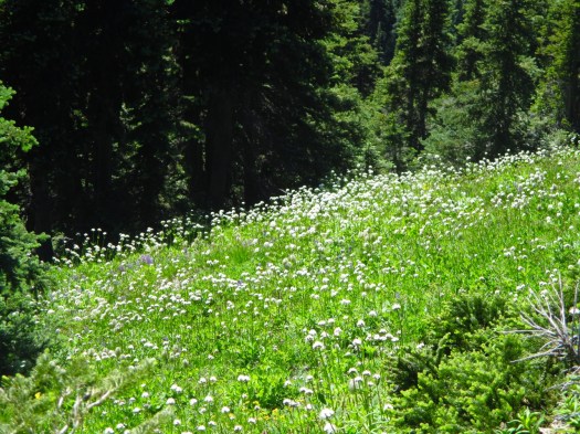
Hot down in the village, it was much cooler on Whistler Summit well above the tree line. Many tourists were under dressed. Some wore flip-flops.
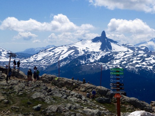
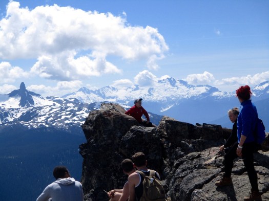
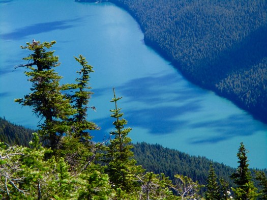
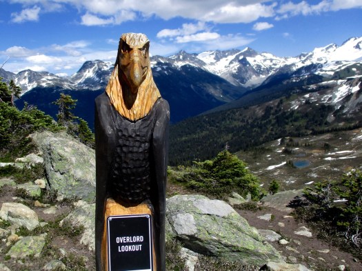
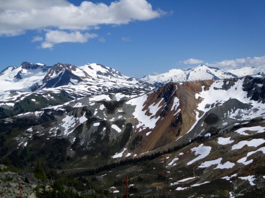
The BIG view is over to Black Tusk.
The High Note trail formerly started at the Inukshuk
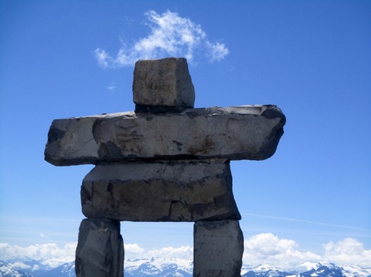
When I was there it had been changed to start at the (very popular) short road hike called Mathews’ Traverse.
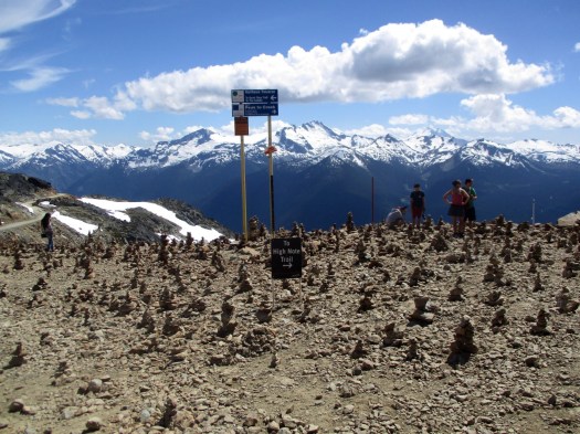
Turn left for Mathews’. Turn right for the High Note Trail, a long traverse leading to the Musical Bumps (Piccolo, Flute and Oboe ridge summits).
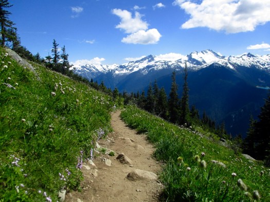
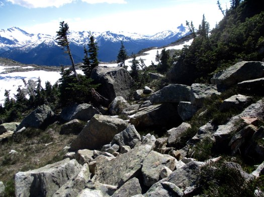
After a steep descent (hard on the toes) Half Note is mostly a pretty traverse high up on the mountain.
In perfect weather like this the High Note was easy. I’m sure it can be horror show in bad weather, however.
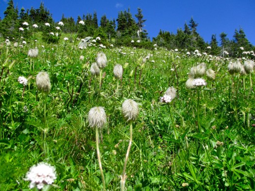
Many on the trail were her for wildflowers.
Black Tusk watches from on high.
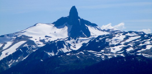
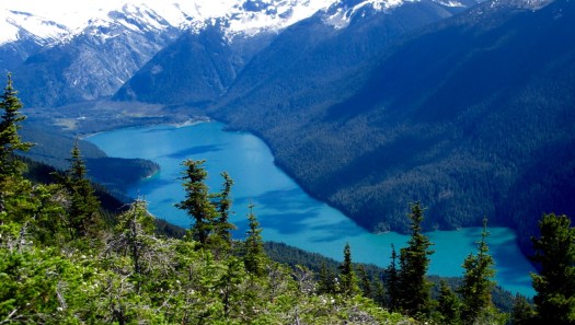
Last time I hiked to Black Tusk I came up via impressive Cheakamus Lake.
Decision time …
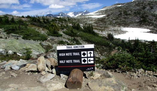
I opted to take the shorter version called Half Note. High Note from this point is 3.7km longer.
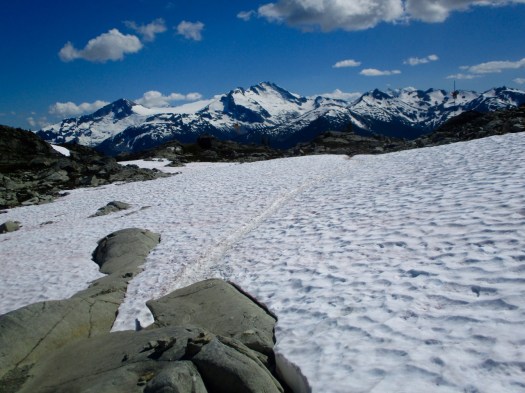
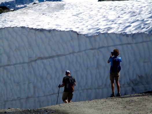
Though July had been very dry, there’s still plenty of snow on this mountain.
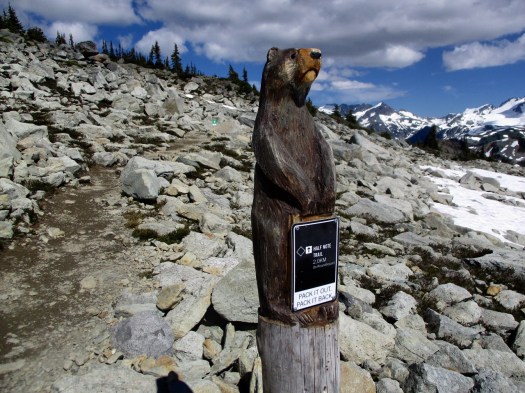
These have to be the cutest trail signs anywhere.
After so much good trail I was surprised to end up on some rocky scrambles.
The last section rejoins Mathews’ Traverse road.
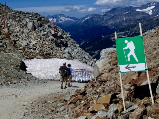
Here’s an example of just how much snow they get in Whistler.
All in all a beautiful and very easy hike if you have good weather.
Half Note ends up at Roundhouse Lodge. I caught the Peak 2 Peak. Then descended to Blackcomb Base and found a $55 parking ticket on my rent-a-car. I’d love to be indignant … but I totally deserved it. There was simply no legal parking of any kind available in Whistler on a sunny Friday. I waited a half hour in the big lots before giving up the legal option.
See all my high resolution photos on flickr.
_____
I’d originally planned to do Musical Bumps trail from the top of Whistler’s Peak Express Gondola.
On the way up I noticed a sign saying Musical Bumps was closed. No reason given, not unusual in Canada.
It turned out to be too ambitious for me in any case that day. I’ll do it in future 2 days / 1 night camping at Russet Lake.
Kraig Becker:
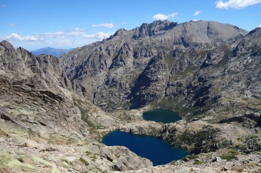
Twelve hundred miles off the southernmost tip of South America, there is a legendary place among travelers and historians. They speak of South Georgia Island in hushed, almost reverent terms.
This small and mountainous island, with peaks above 9,000 feet, is located hundreds of miles from the closest beaten path. But the rugged and remote wilderness is famous for another reason. South Georgia Island served as the final stage in one of the greatest survival stories of all time: Ernest Shackleton’s voyage to the southern seas aboard the Endurance. …
I hiked part of the very route that Shackleton, Crean, and Worsley trekked when they crossed the island a century ago. Hiking through the overgrown mountain trails and snowy paths, I finally arrived at the remains of the Stromness whaling station where the 19th century explorers’ desperate march came to an end. …
The interior of South Georgia is rugged and demanding to say the least, with towering peaks, steep valleys, and crystal-blue alpine lakes frequently presenting impassable barriers.
High winds, rain, and snow, coupled with rough terrain, made my walk a challenging one, even equipped with modern hiking gear and a clear path to follow. The men from the Endurance did it in clothing that was practically threadbare, wearing boots with screws tapped into the sole to provide extra traction. …
While wandering in silence through that wild landscape, I could almost feel the ghost of Shackleton trudging along beside me …
Popular Mechanics – Chasing Ernest: A Journey to South Georgia to Find the Ghost of Shackleton
(via Adventure Blog)
Sabbalot Photography:
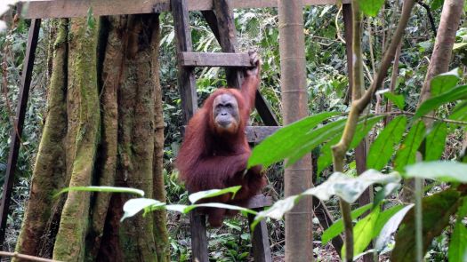
… the largest wilderness area in South-East Asia and an UNESCO world heritage area since 2004. It is further part of the tropical rain forest heritage of Sumatra, allowing for spectacular experiences in this fortunately still widely untouched nature.
The hike itself is a unique experience for several reasons:
No trails are available and one totally has to rely on the guide to find the way through the jungle (mainly following former rebel trails).
4-6 porters accompany you and provide you with the most delicious hiking food you’ll ever get to taste (don’t forget to tip).
You will not see ANYONE other than your party during the whole hike.
The wilderness of the jungle and its inhabitants is just breathtaking.
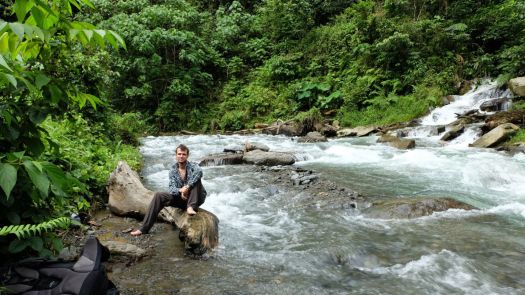
The river crossings are an adventure itself.

They recommend local guides Expedition Jungle.
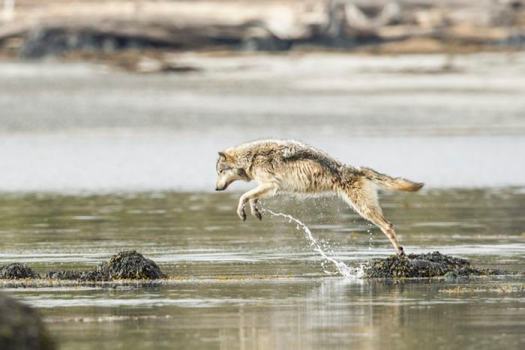
Some wolves on the Canadian west coast get 90% of their food along the water.
I saw a mother and her young feeding on a dead whale on my 2012 North Coast Trail hike. Sightings are quite common on that coastline.
Wolves were trying to take black bear cubs too. Momma Bear wasn’t too happy about that. (VIDEO)
 more photos
related – British filmmaker Bertie Gregory – Meet the Rare Swimming Wolves That Eat Seafood
Click PLAY or watch it on YouTube.
Sean Tevebaugh:
A tough trip in 3 nights, 4+ nights is recommended for easier and more relaxed hiking …
… we were lucky enough to have bluebird days all 4 days!
Routefinding can be challenging as this hike has many social trails woven through the rugged tundra. There is one (unmarked) trail that is most often used and offers the fastest hiking, but is tough to follow and easy to lose track of at times.
This hike involves a crossing of the McKinley River, a potentially very dangerous river crossing! It’s crucial to be informed and prepared for this river crossing- knowledge of advanced river crossing techniques, the best current crossing routes, as well as current weather & water level conditions is all critical info for a safe crossing.
Click PLAY or watch it on YouTube.
Read an excellent trip report.
The Meandering Mayans just posted their 2017 trip report:
Though the trail doesn’t offer the “classic” high Alpine experience, it makes up for it with crazy amounts of bare rock, stunning sunsets and mountain top sea views. …
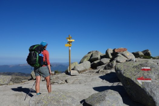
It’s hard to imagine a more beautiful setting for a trail than the semi-autonomous French island of Corsica.
With a single mountain chain occupying almost two-thirds of the island, Corsica is a rugged place that hosts miles of beautiful beaches and untamed wilderness. The GR 20 spans roughly 180km, North to South …
Charcuterie, Wine and Hard Miles: A Walk Across Corsica – the GR 20
Most hike north to south. The Mayans preferred south to north.
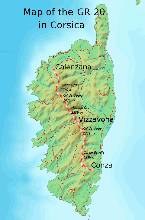
With this information we’ve updated our GR 20 information page.

