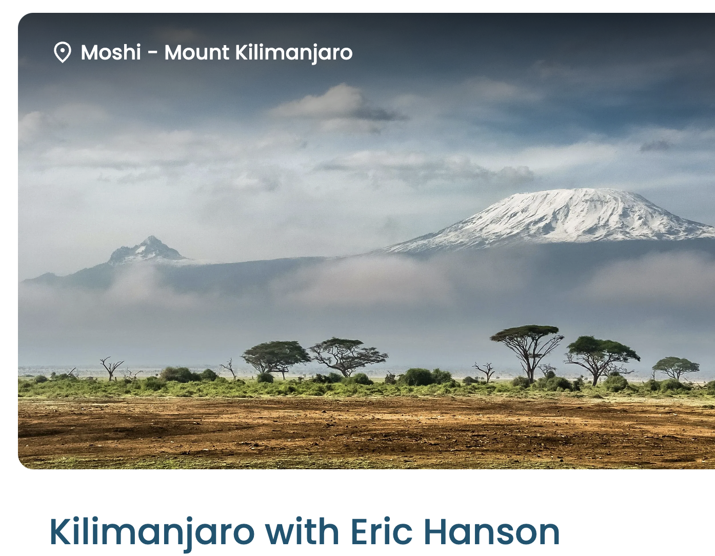
Kraig Adams calls this adventure perhaps the hardest and longest hike of his life.
It’s high on my own life list. Cost and logistics are challenging.
By coincidence, I met guide Ian Taylor, the both of us finishing Kilimanjaro on the same day. I talked to him about possibly signing up for one of his K2 & Gondogoro La adventures in 2027.
Eric is one of the top hiking YouTubers. He’ll be documenting our trip in coming weeks.
In the meantime, I’m posting some photos here.
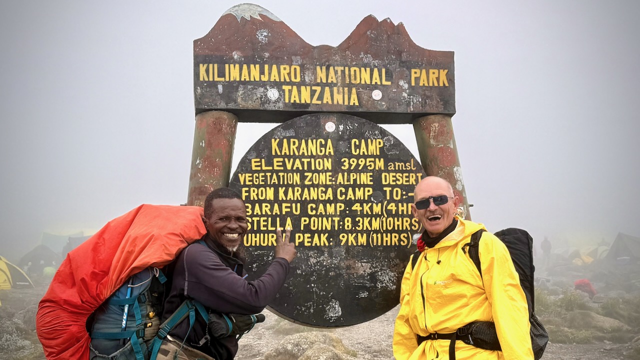
We had 22 hikers. 18 of us made both summits. That’s about typical for the Machame Route. It went well for me. My 3 weeks training & acclimatizing in Ecuador prior to this trip was a good idea.
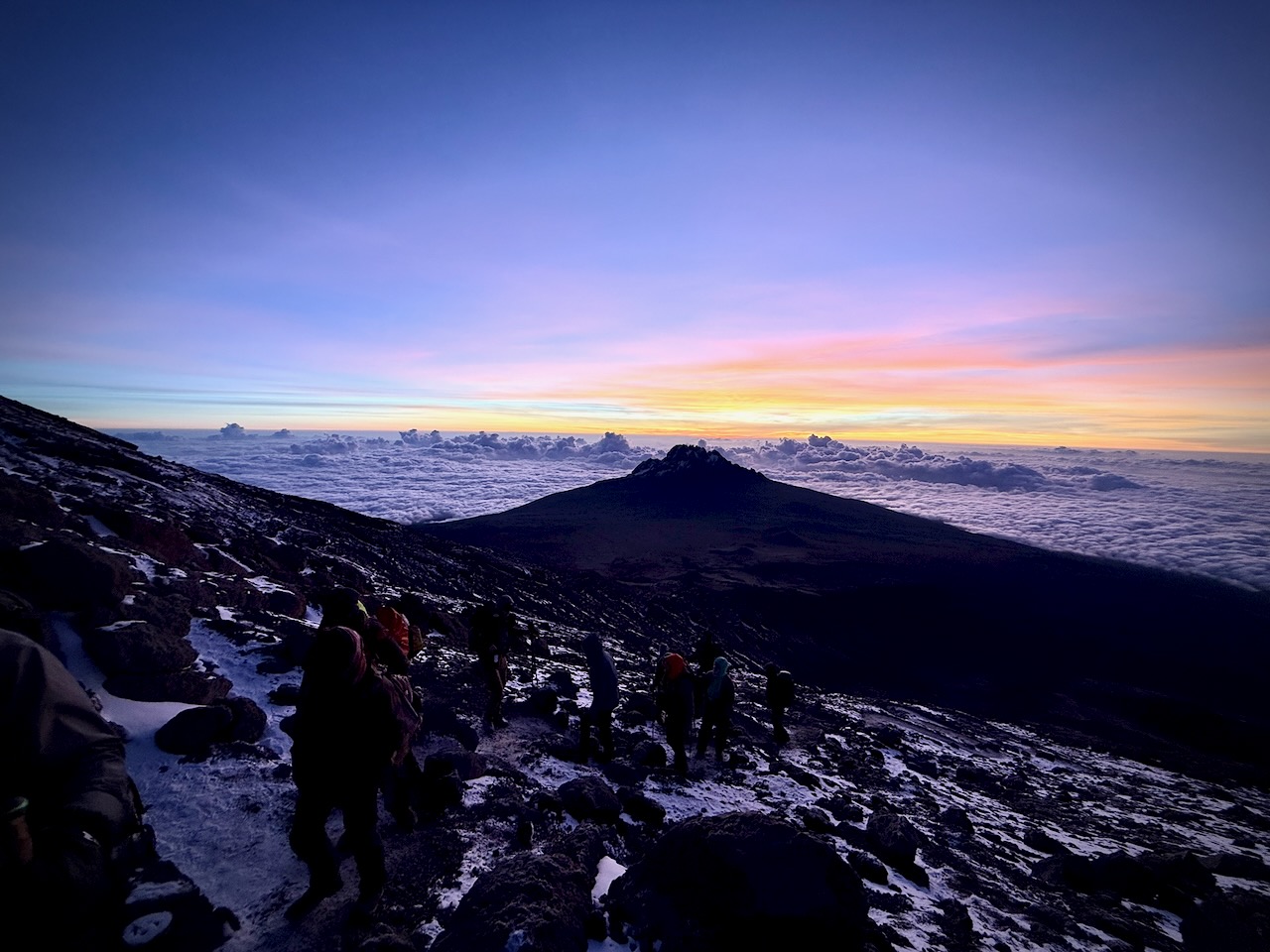
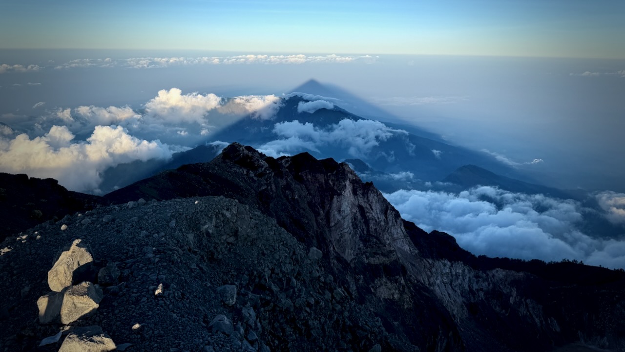
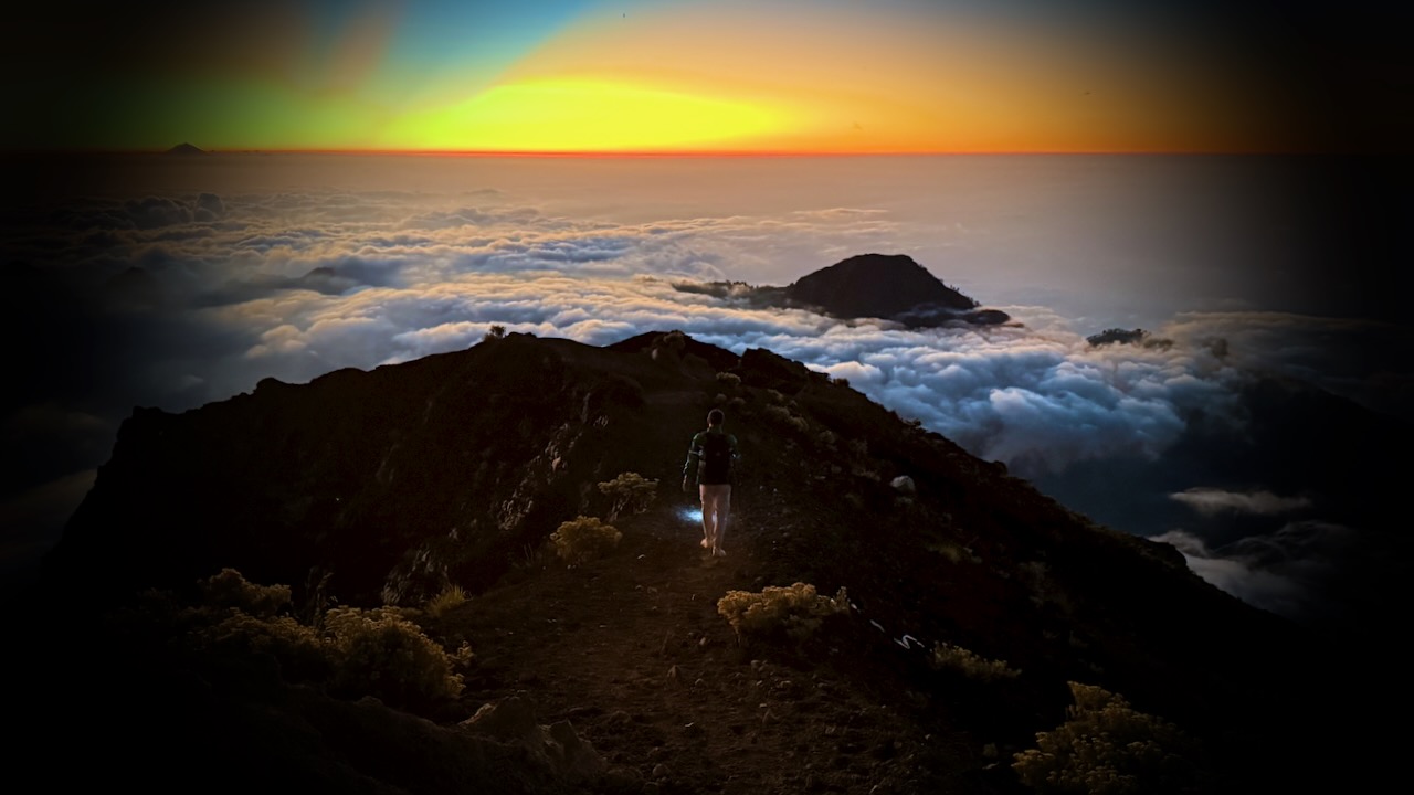
Kili Summit Ridge
Age & fitness matter much less than the ability to acclimatize to altitude.
It took me 68-years to finally get to Kilimanjaro. The eldest my African guide got to the summit was 79.
We had another in our group age-66.
Truly impressive is one of our assistant guides who’s been to the summit over 200 times over 31 years. He’s age 64.
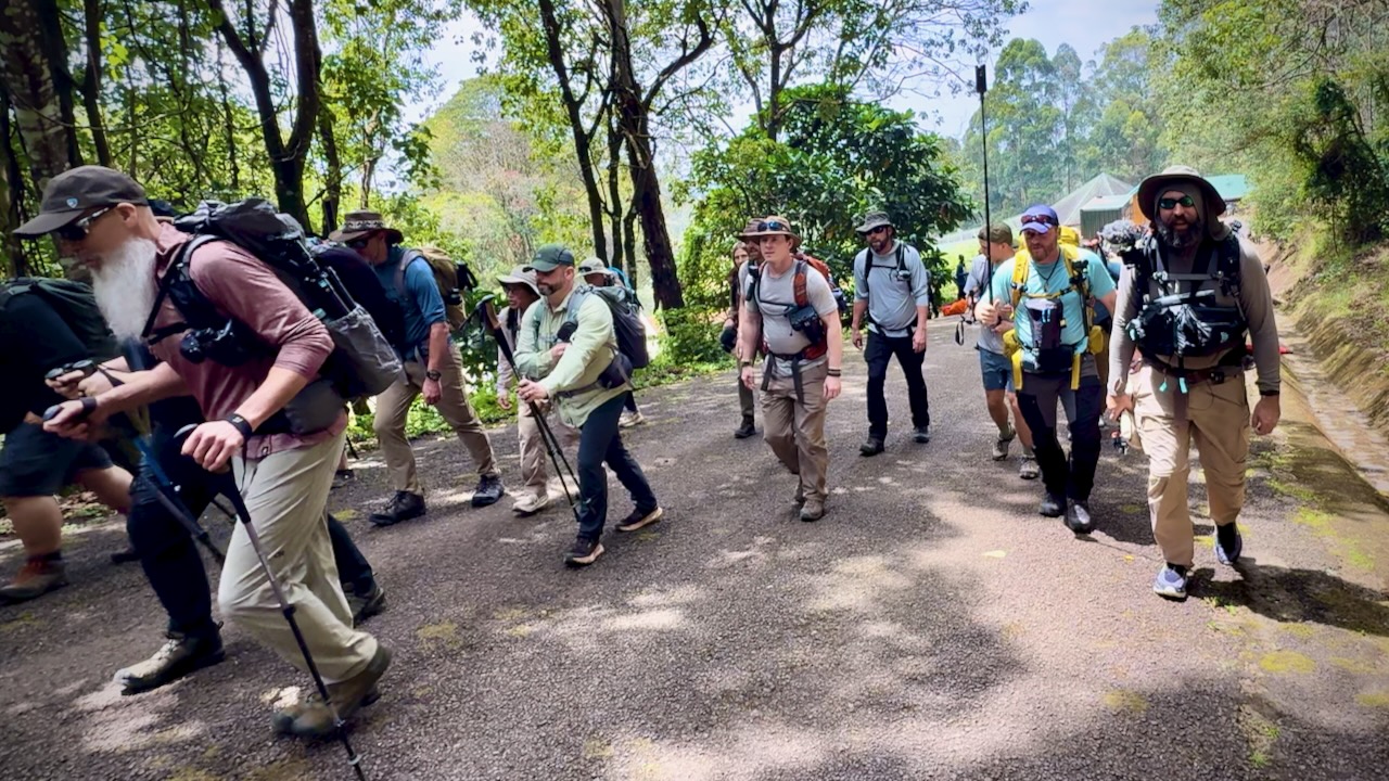
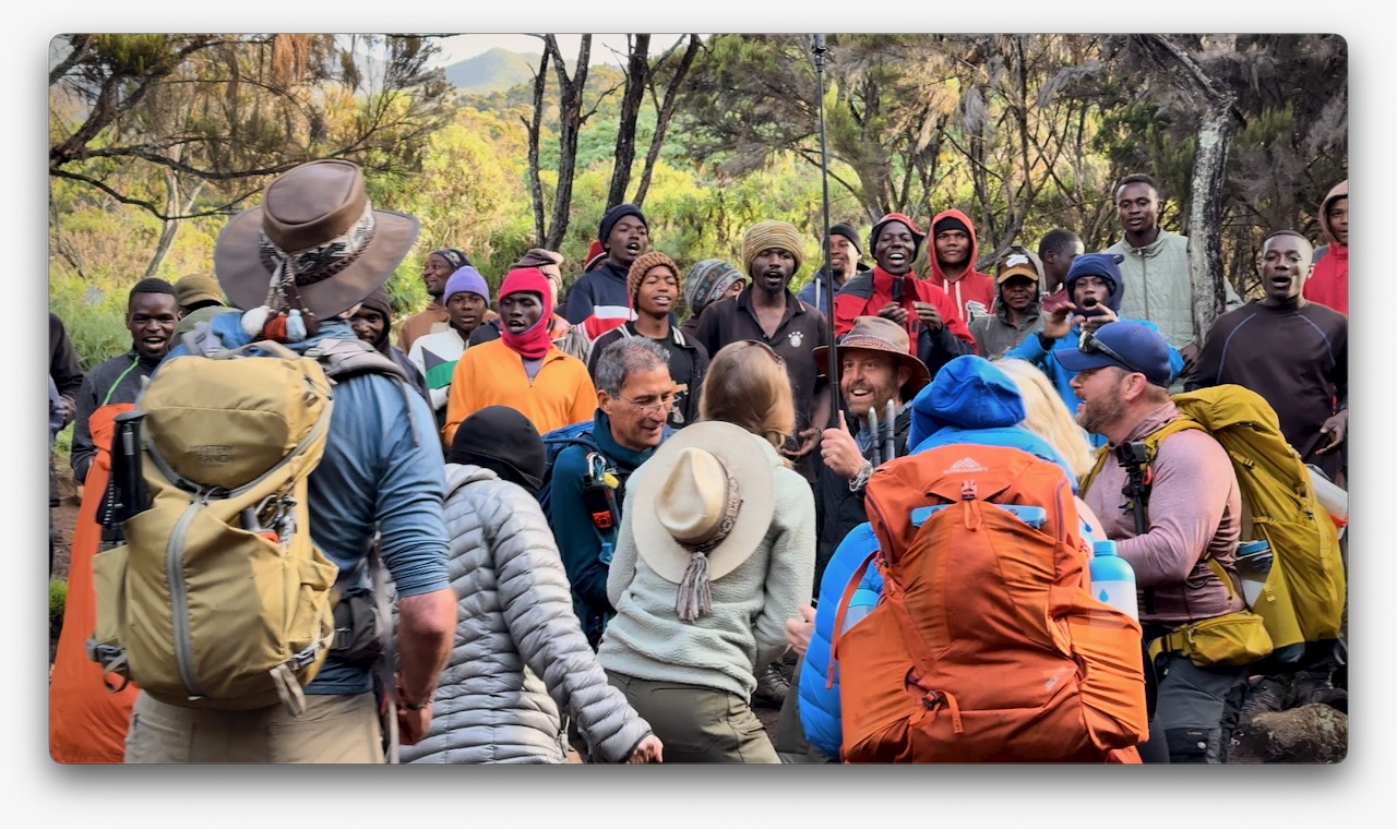
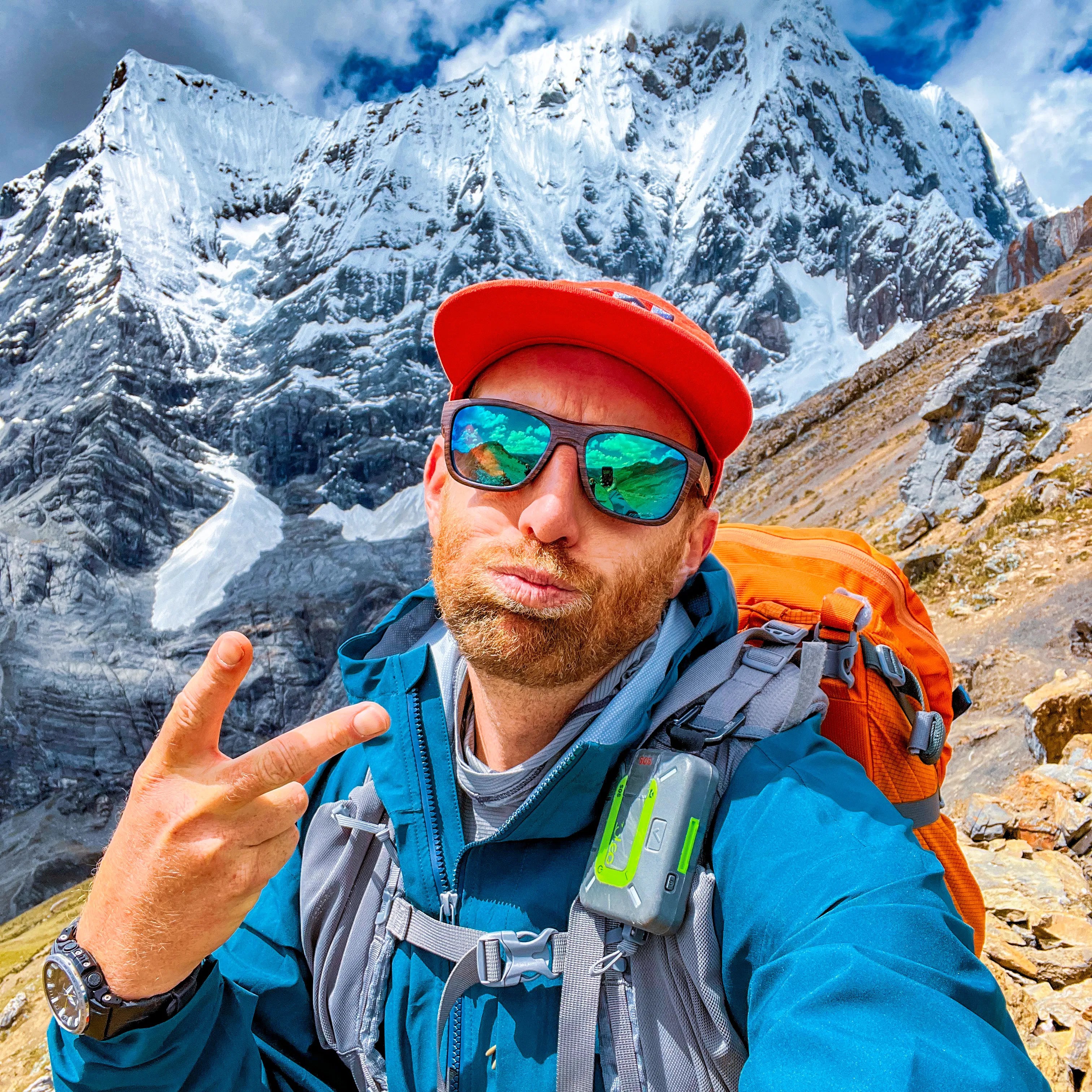
Here we are — clean & keen — at the start of the 7 day adventure.
In fact, it was a party from the start as many who had hiked with Eric in the past joined for Kili. I was simply an addition to a large group, many who knew one another. This is a very social adventure ➙ shared suffering.
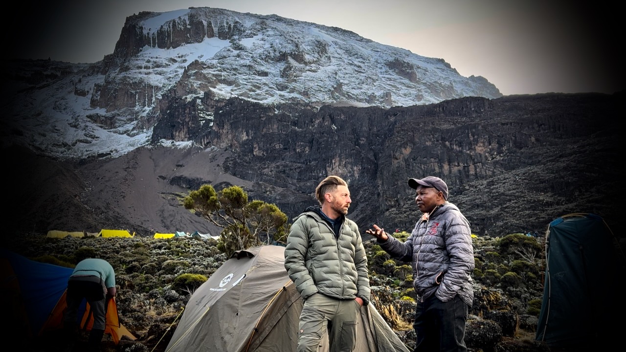
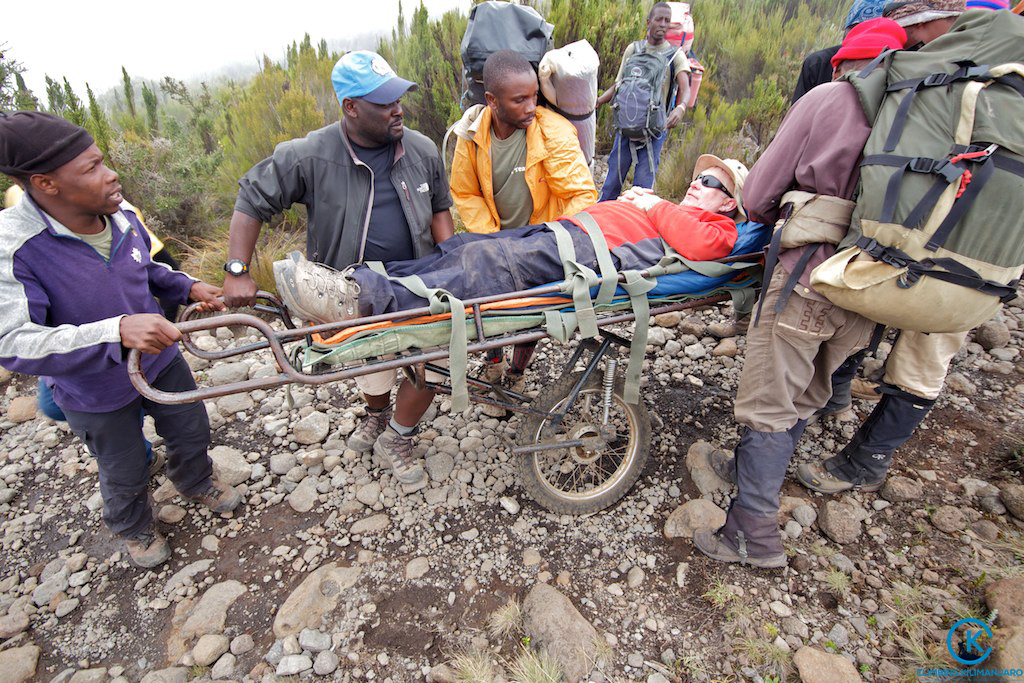
Eric was our American guide. Freddy our African guide. Both responsible for keeping us safe. It was these two who’d make the decision whether or not you were healthy enough to keep climbing.
Those who decided to go down were unable to acclimatize quickly enough. We had daily blood oxygen tests.
Three decided to walk out. One took a helicopter, hoping she will recoup the $4100 cost through insurance.
New to me on a trail was the singing and dancing. Non-stop. To the top.
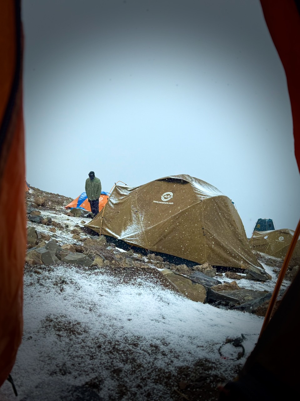
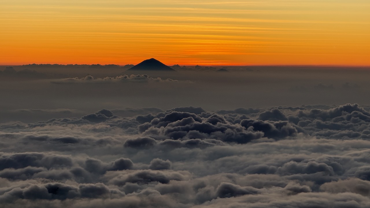
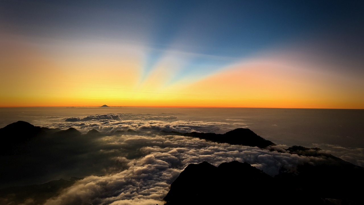
Oddly, all 7 days we had the same weather. Some sort of micro-climate.
Morning clear. Sunny to start the hiking day. Snow, sleet, and hail in the early afternoon. Clearing by dinner time. Clear skies at night. Kili summit clear at dawn.
We added and removed layers non-stop during the day.
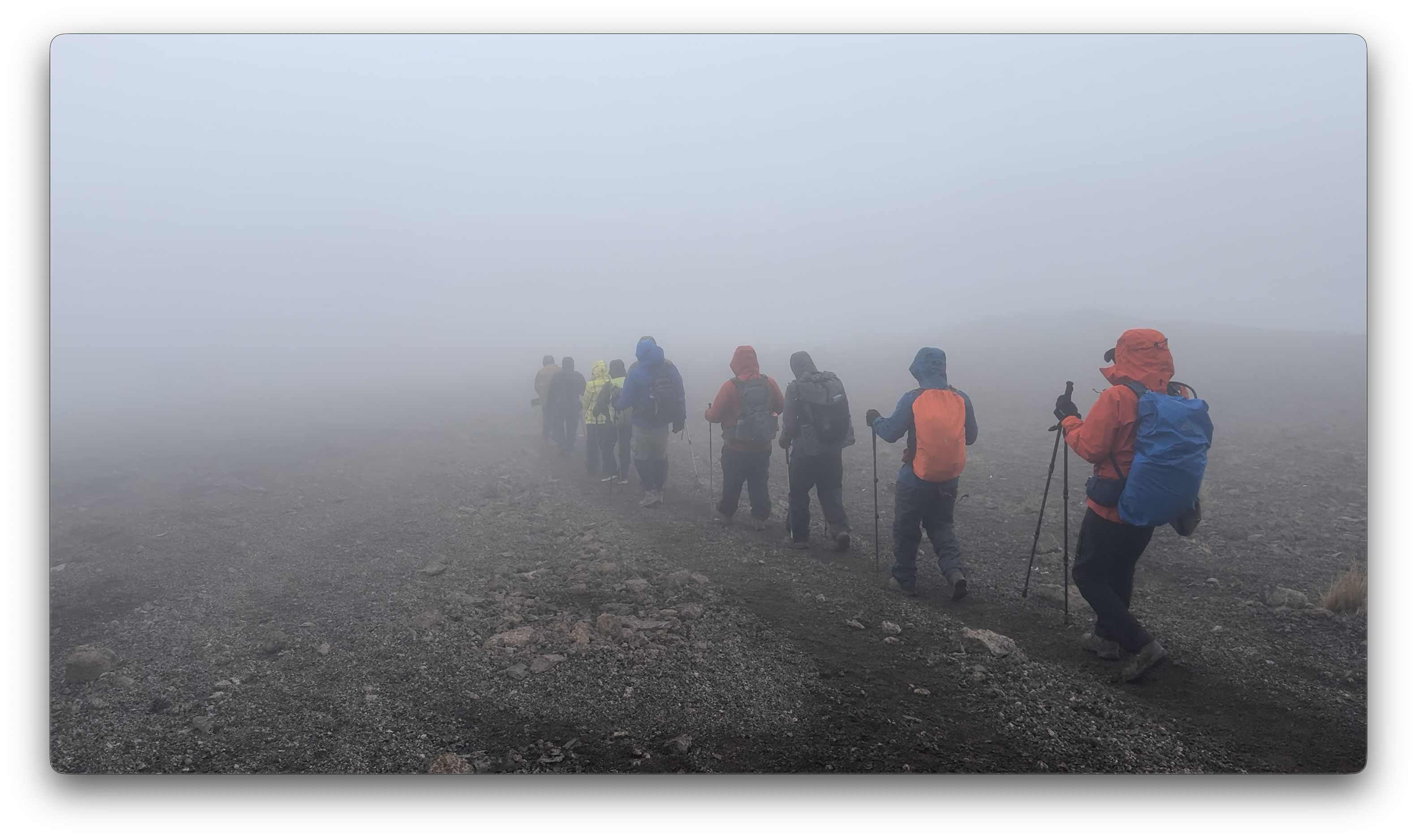
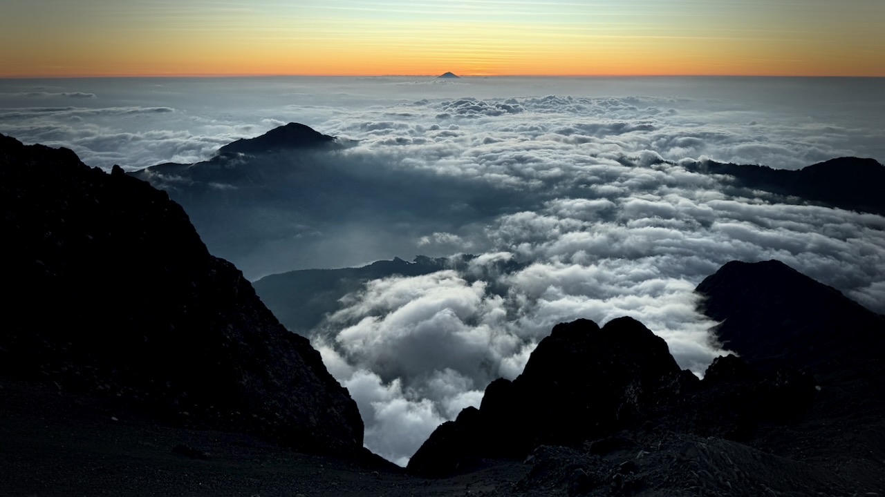
Each day we spent some time hiking through clouds.
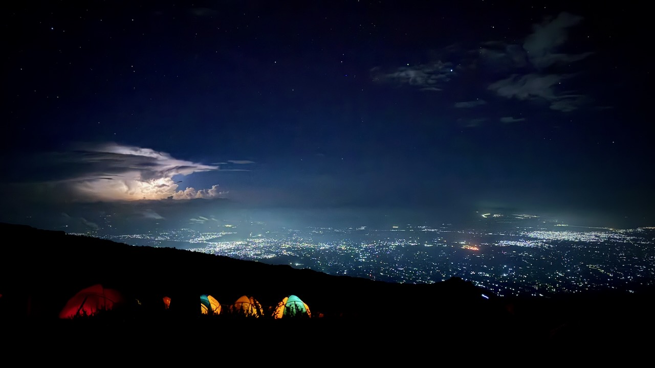
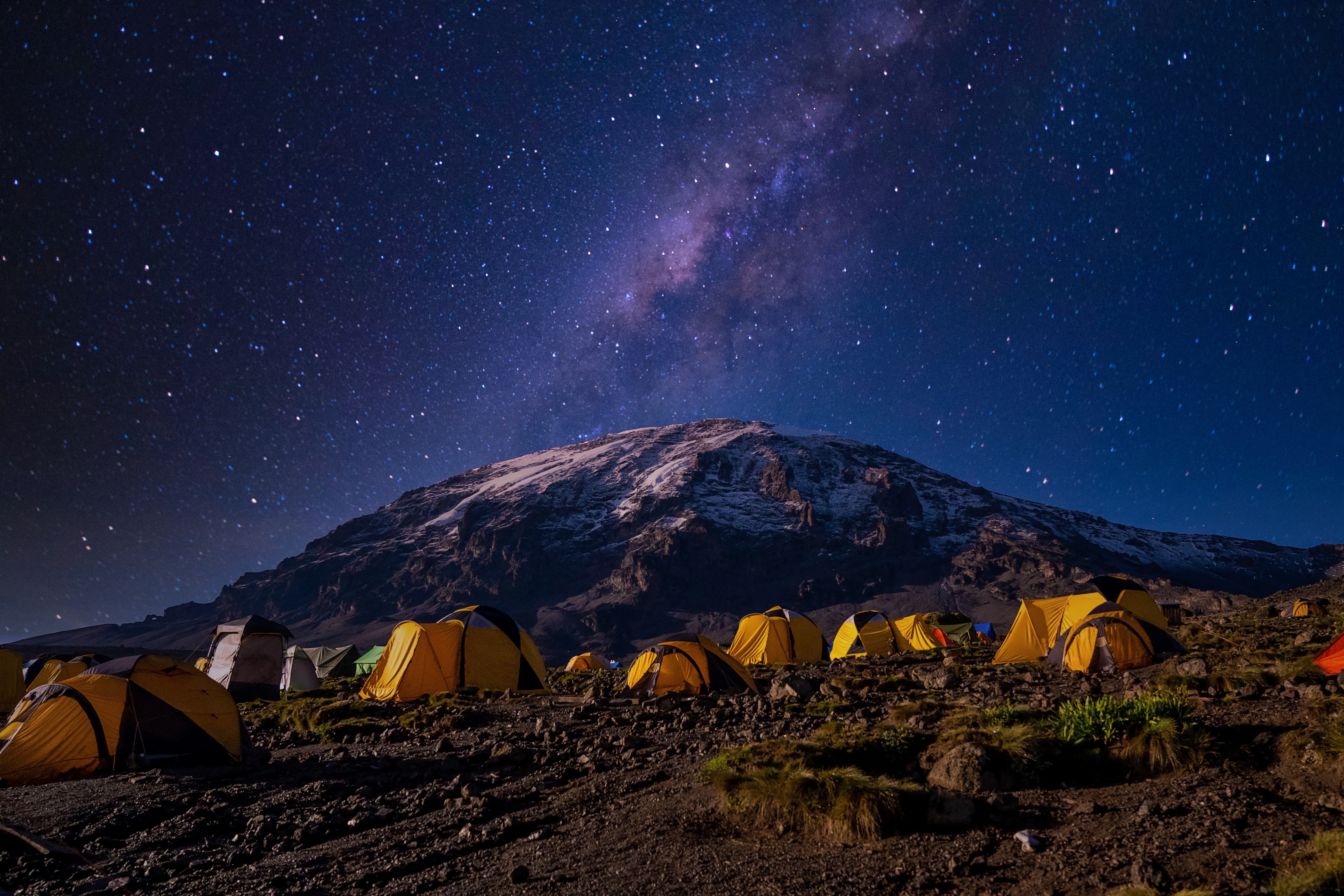
We mostly had clear skies at night. The iPhone 16 Pro is terrific at night photography on a tripod.
I’d paid a little extra to have a tent to myself. It was fairly comfortable — though many of our tent sites were far from level. 😀
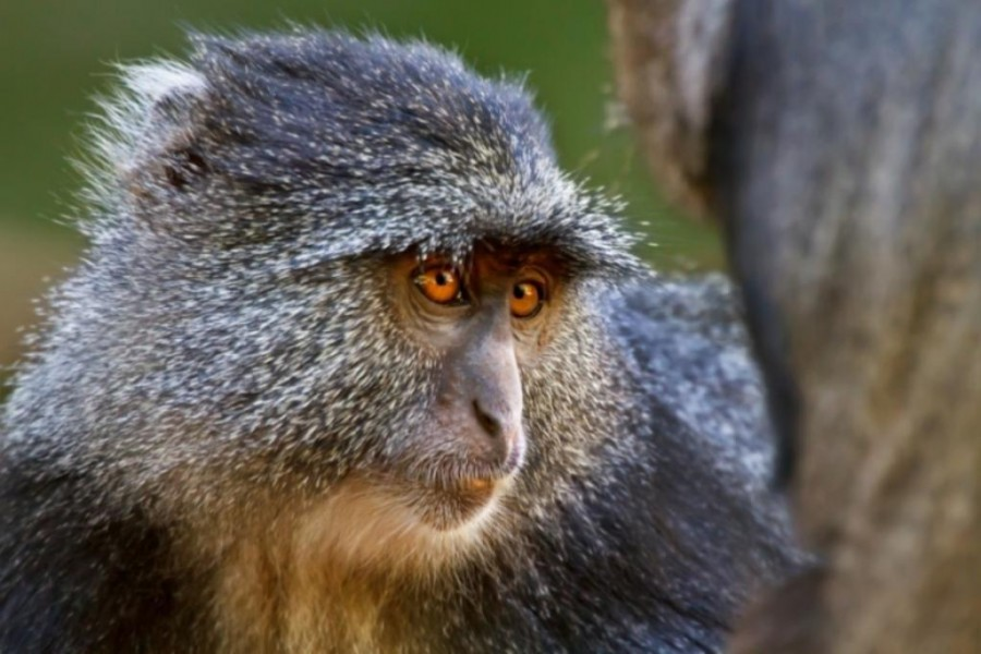
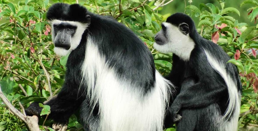
We were happy to see two kinds of monkeys. But both were at lower slopes, close to the start and finishing gates.
Blue Monkey.Black-and-white Colobus.
Baboons and velvet monkeys have been spotted, but rarely.
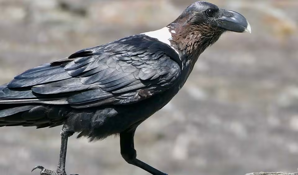
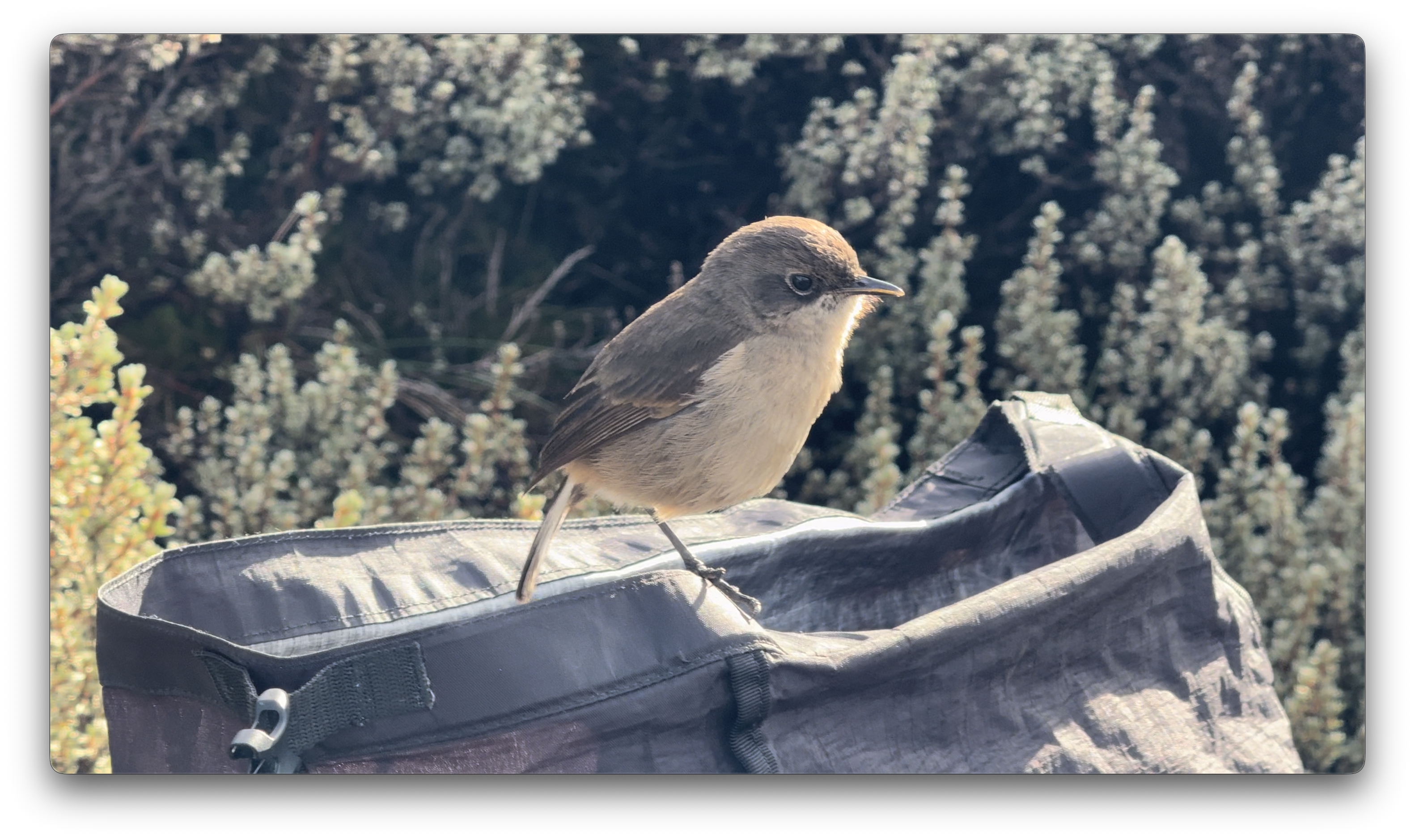
This bird took a dump in my backpack. 😀
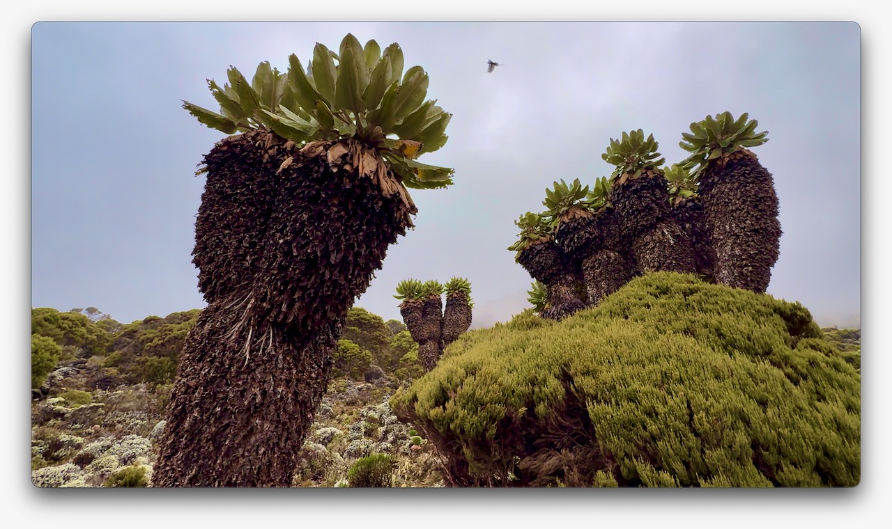
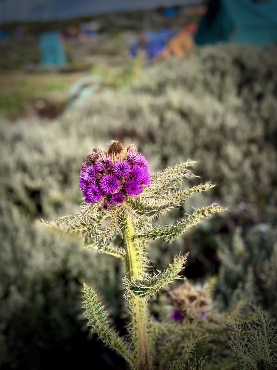
Vegetation was much more interesting as we climbed through so many different ecological zones.
I do love thistles.
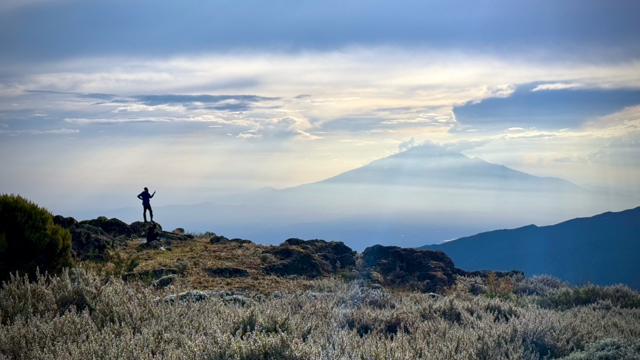
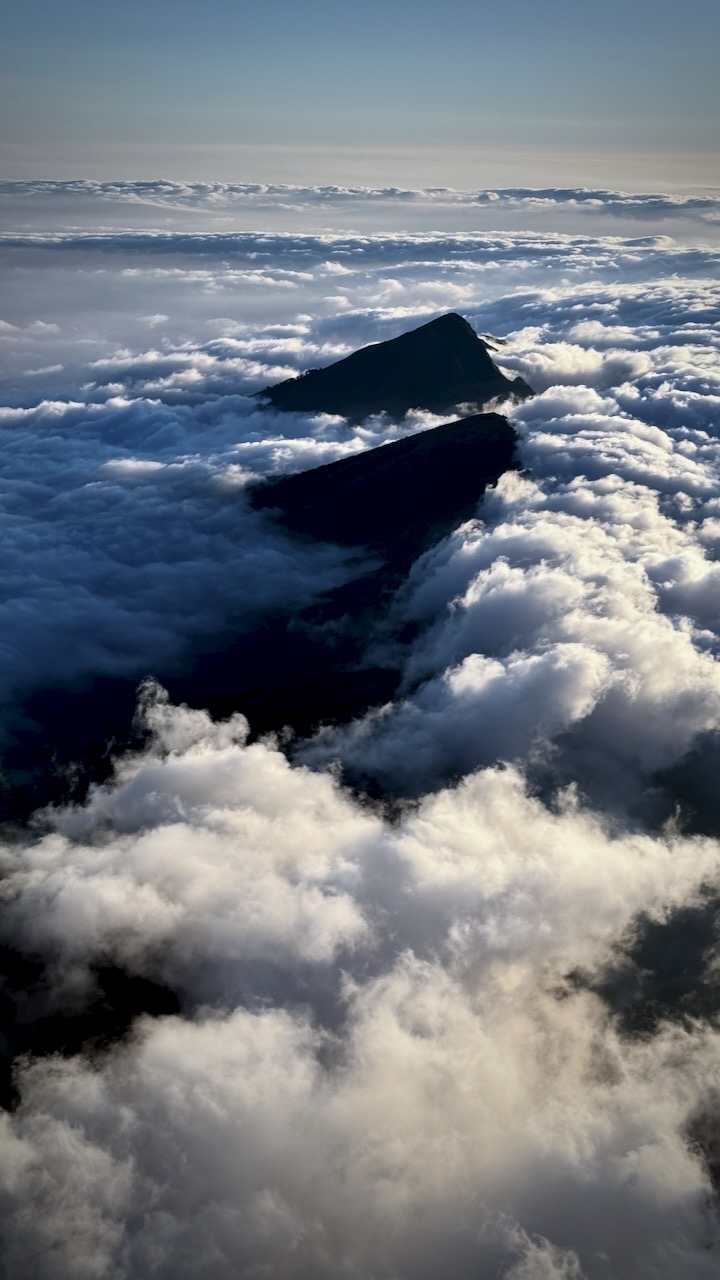
We had great views over to nearby Meru volcano. When you see hikers posed like this, you know they are searching for line-of-sight mobile phone reception. 😀
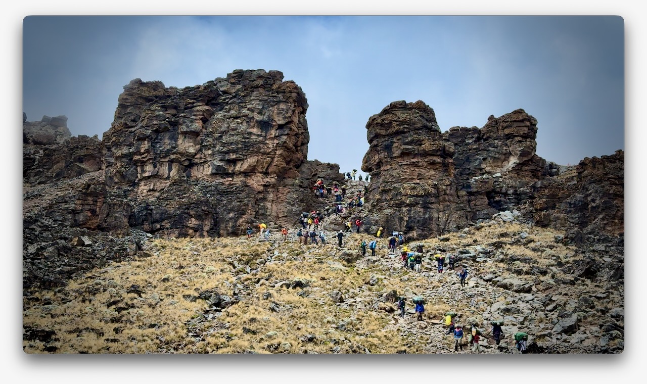
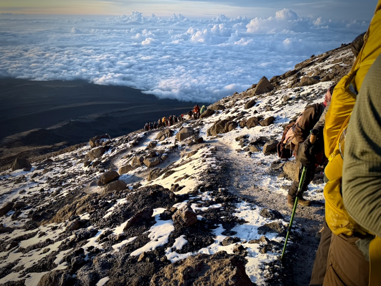
The Machame Route was crowded when I was there. We often had long lines of hikers & porters.
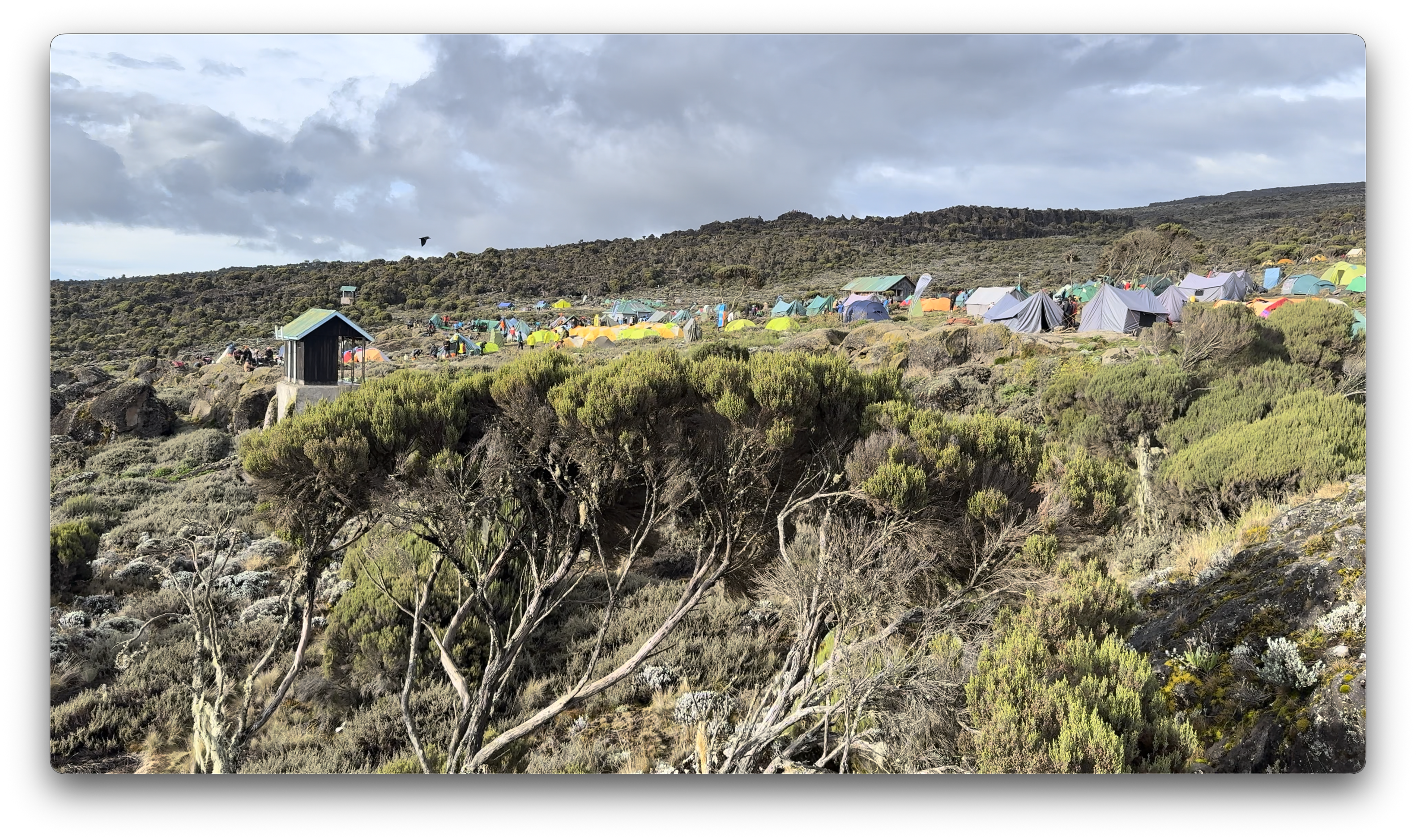
Camps are crowded and littered.
Personally, I felt the portable toilets provided weren’t great. I preferred squatting over a hole in the concrete in the permanent toilet buildings.
Hygiene is not top of mind for any of the guiding companies. In particular, I was surprised alcohol gel was not constantly provided.
That said, nobody in my group got sick from water or food.
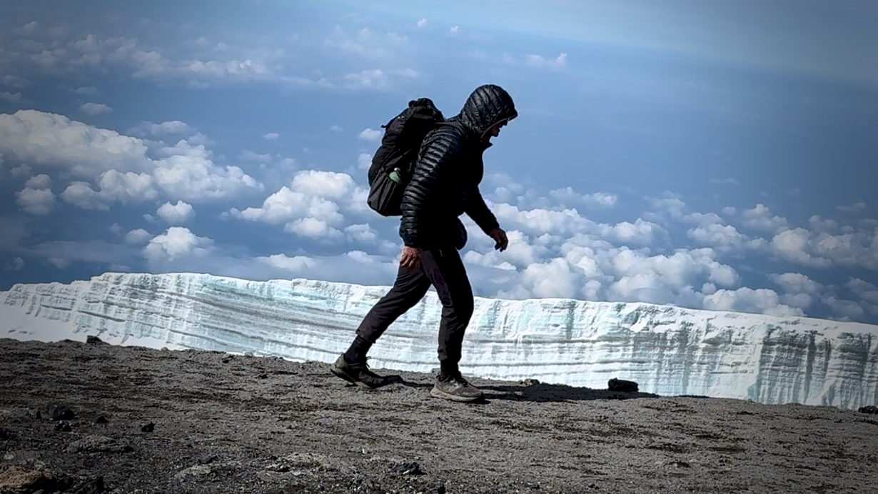
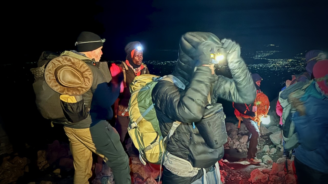
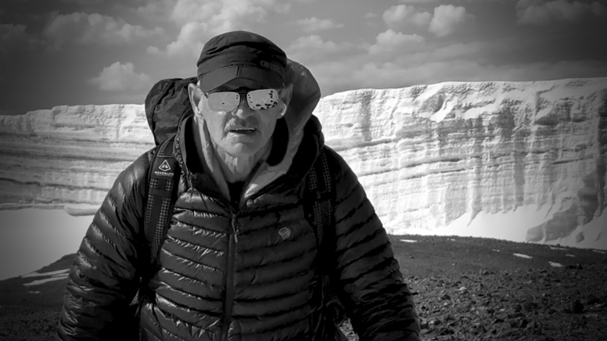
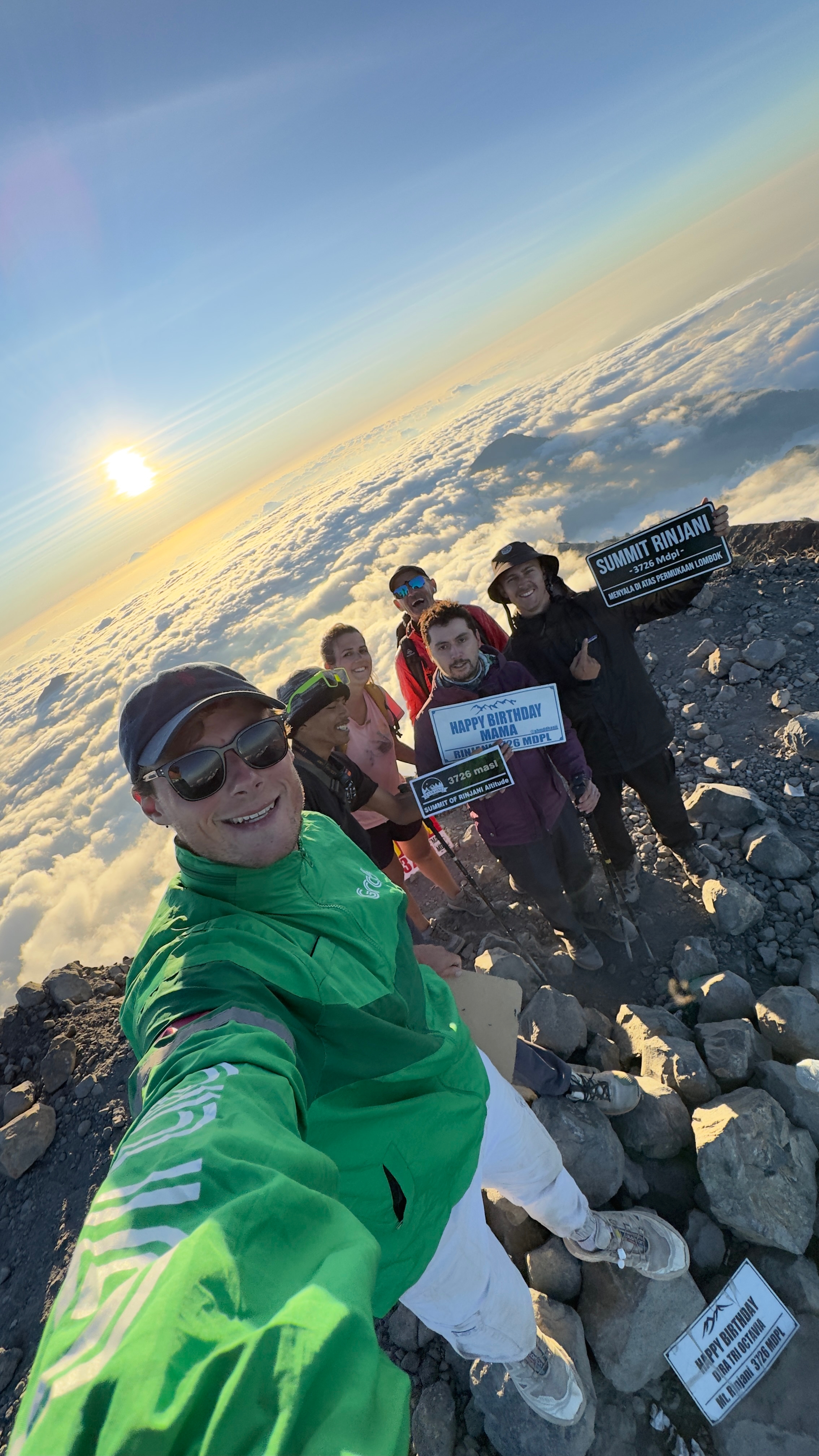
CRUX of Kilimanjaro is summit night. One of the toughest hiking days any of us could recall. I felt perfect. No pain. No problems … when starting.
Wake at midnight. Hot drinks 12:30pm. Start up at 1am.
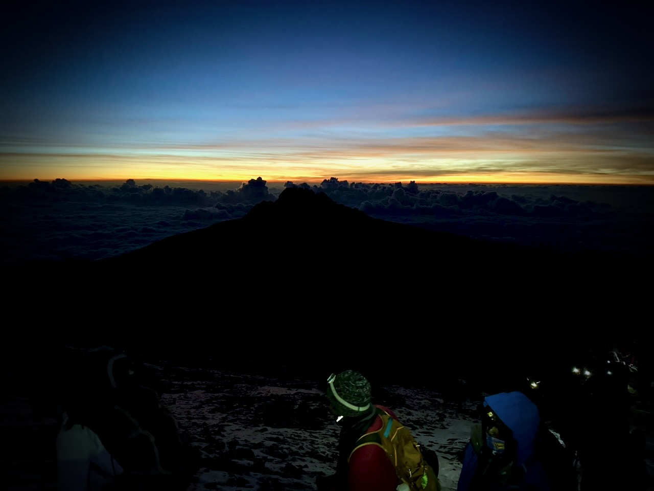
It was a slow, cold trudge until dawn.
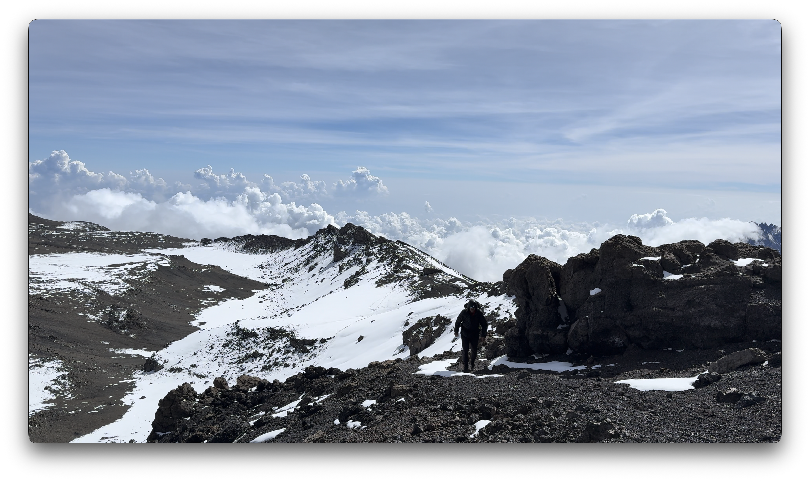
We had an ideal view of the changing light.
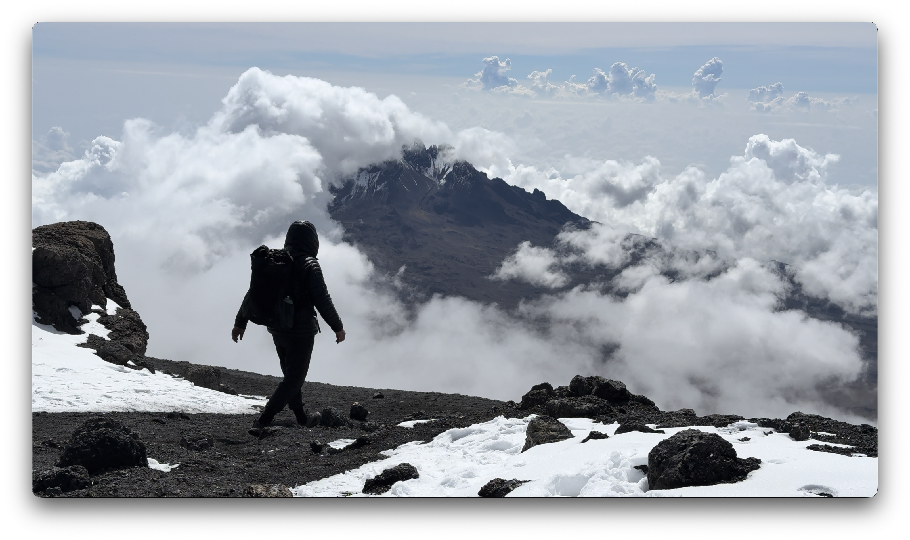
Way above the clouds.
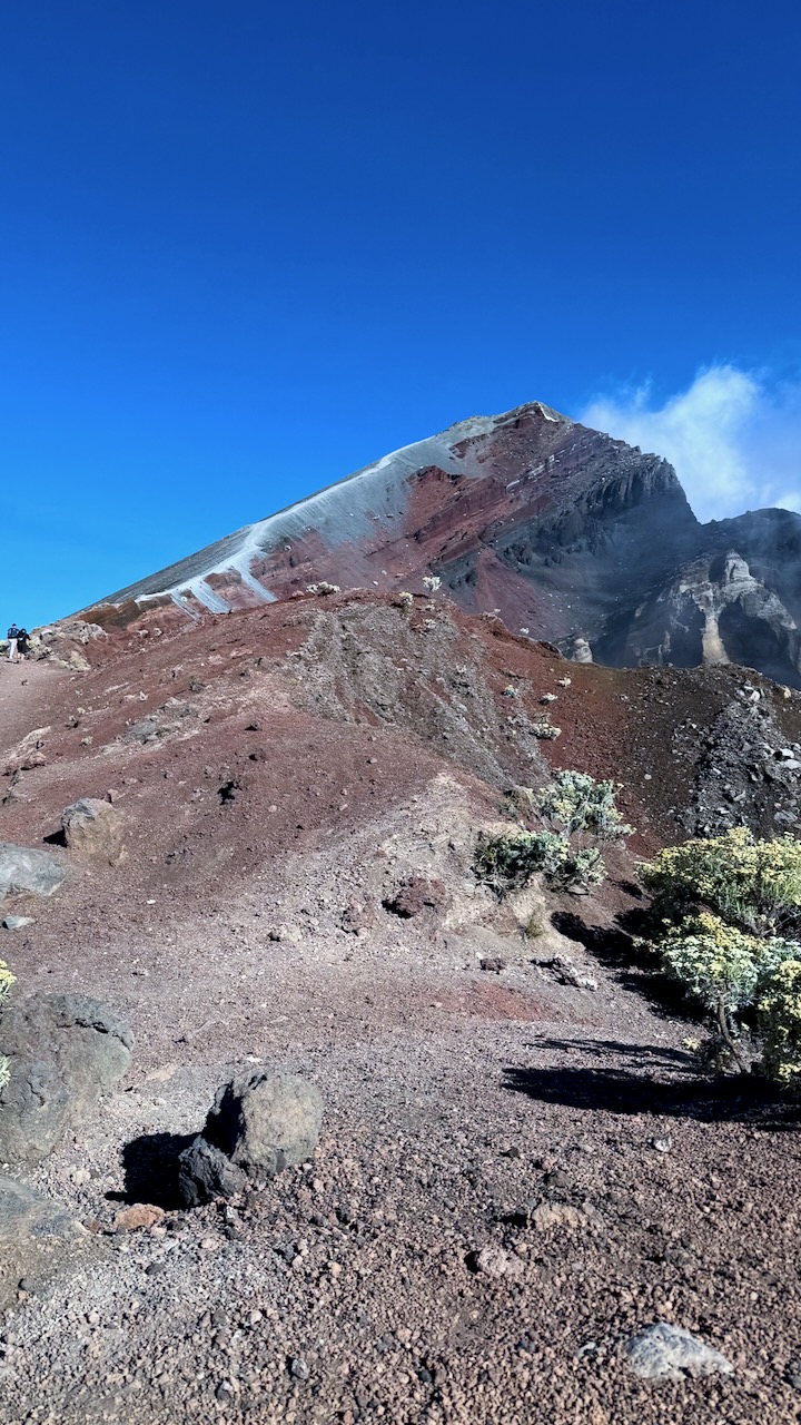
We finally reached the first summit peak. And on perhaps another 35 minutes to the highest peak.
I took a LOT of photos and video up there. Most impressive were the odd, receding glaciers.
That was the FUN part.
Guides hustled us down as quickly as possible to avoid altitude sickness. We climbed down 8000 feet, not getting into low camp until 6pm or so. I ascended & descended for 16 hours, grabbing 1 hour sleep around noon.
Sore knees. Sore toes. And cramping quads.
Highlight?
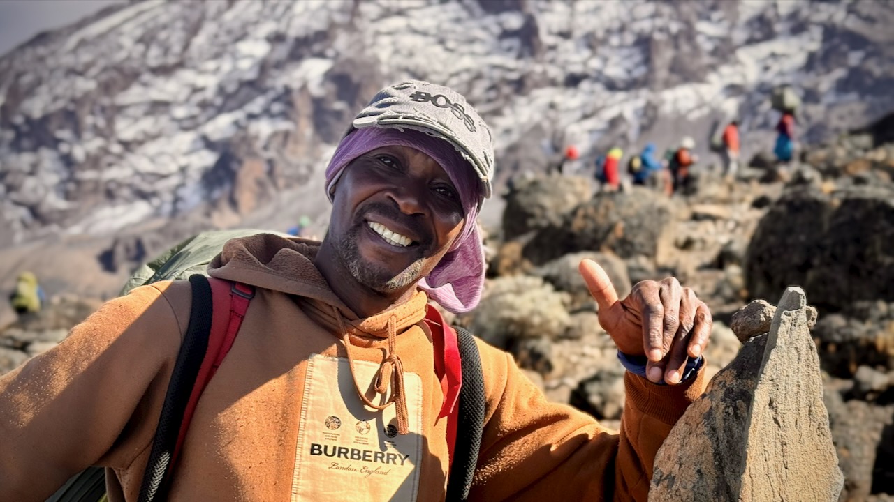
Most would agree that the porters, guides, and staff were the most impressive takeaway from this adventure. We probably had over 100 staff taking care of us over the week. And these folks will do positively anything you request.
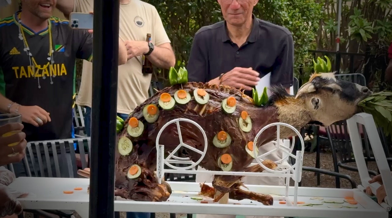
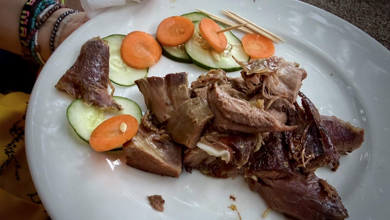
Back at the hotel, we celebrated with alcohol and devoured a full roast goat. Delicious.
A hiker died on Kilimanjaro while I was there. Reported heart attack.
On December 24, 2025, a rescue helicopter crashed, killing all 5 people on board. Two were hikers being evacuated.
10–20 deaths annually out of 30,000+ climbers.
I wrongly thought Kilimanjaro would be easy for me. It wasn’t.
60 Minutes has much been in the news of late. New CBS News editor-in-chief, Bari Weiss pulled a segment on President Trump’s deportations just hours before broadcast. It was widely seen as political pandering to Trump. His move to deport people from the USA to the El Salvador prison CECOT, is likely a human rights abuse and potentially criminal.
If you believe in Freedom of the Press as guaranteed by the U.S. Constitution, know that the episode showed on Global TV Canada and was widely available around the world. By trying to protect the President, Bari Weiss ended up bringing even more attention to the potential criminal act.
BUT their feature on the Sherpas of Everest is quite good, bringing public attention to these important guides and porters.
Joining a group on the trip makes it much less expensive than booking privately. And more fun.
I’d sent in passport and a doctor’s letter confirming my health — but LFC still couldn’t put me on Pinatubo.
Who knows why? In my mind, just another example of how so many things don’t work in the Philippines.
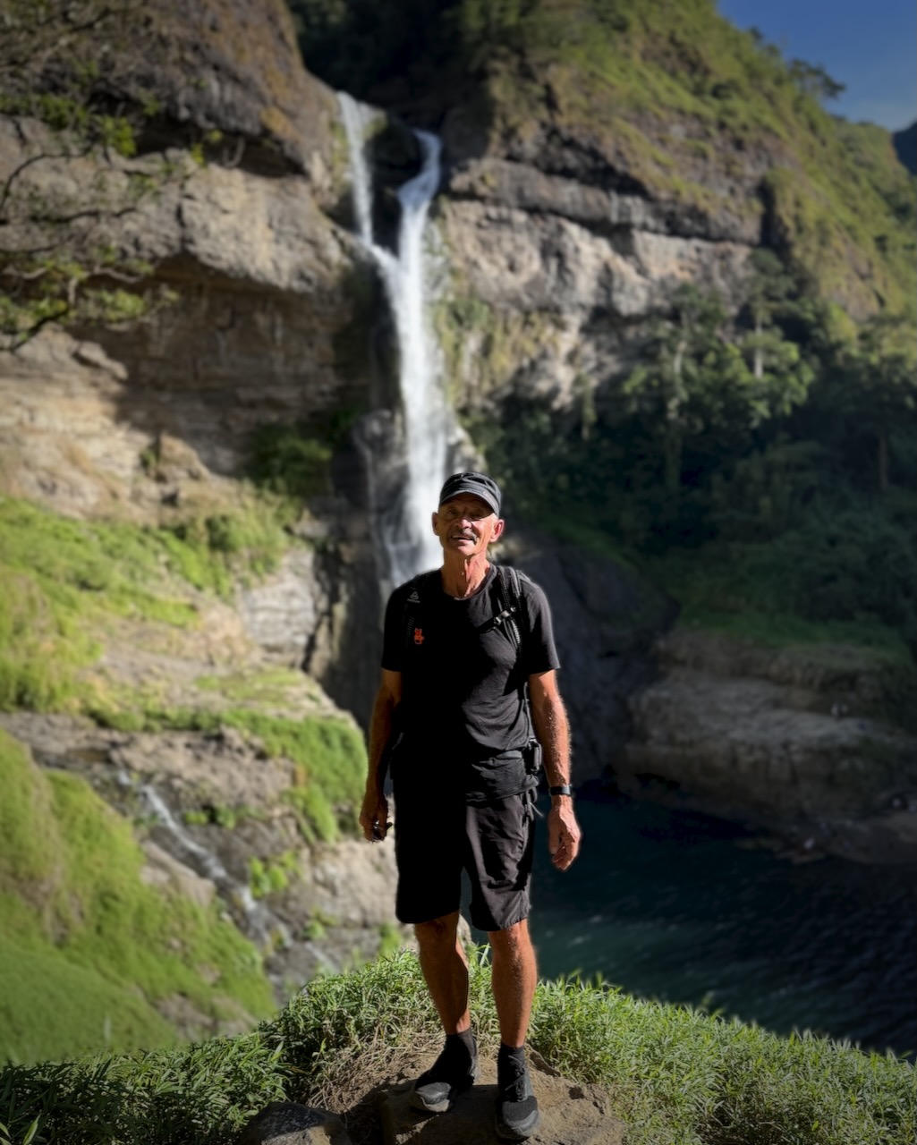
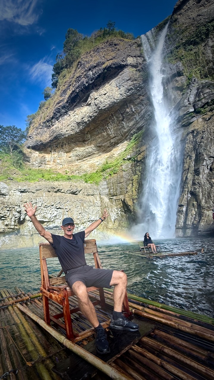
LFC offered me an alternative for the next day ➙ Aw-Asen Falls at 142 feet (43 meters).
I signed on, still irked that it wasn’t Pinatubo.
Hikers are picked up in the middle of the night in a Hiace van.
Delivered to the parking lot first thing in the morning. About 5 hours of not sleeping / dozing for me coming from Clark. It’s about 8 hours from Manila!
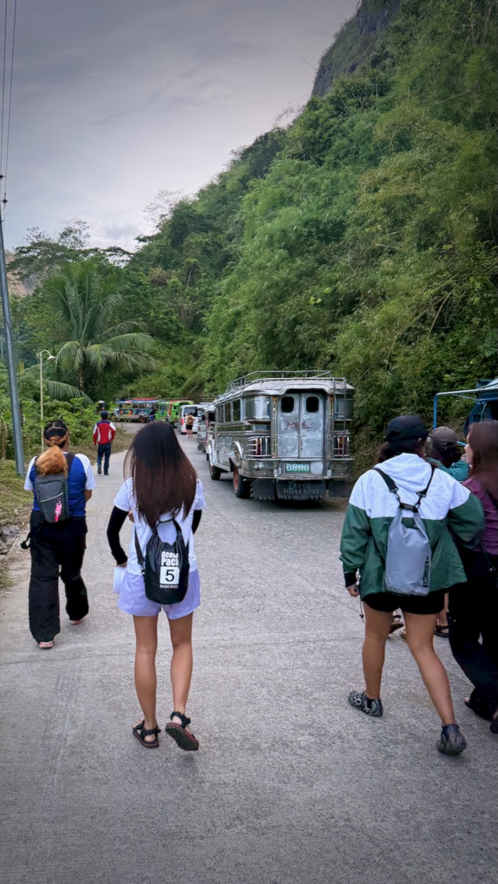
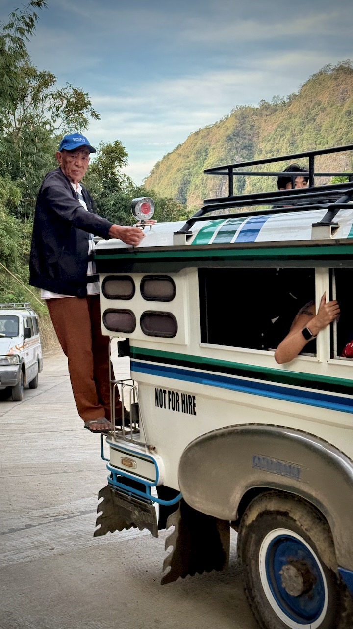
Switched to the worst possible vehicle for the final 17km to the trailhead ➙ an underpowered Jeepney with not much suspension.
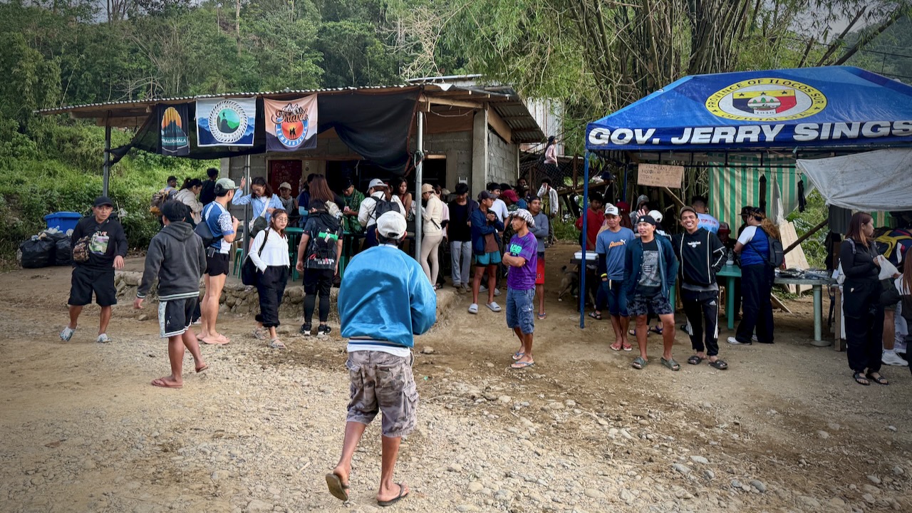
I was shocked to see a couple of hundred hikers out here on a Sunday morning.
I’d say 80% were women. Mostly young women.
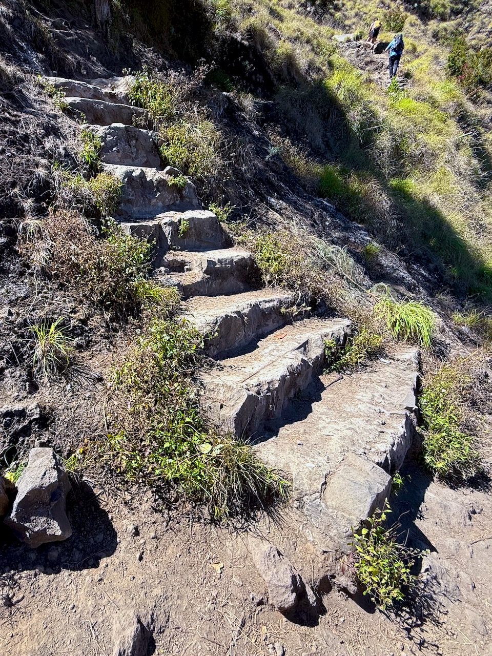
It’s not a long hike. BUT there are 919 stone steps up and 919 down. 😀
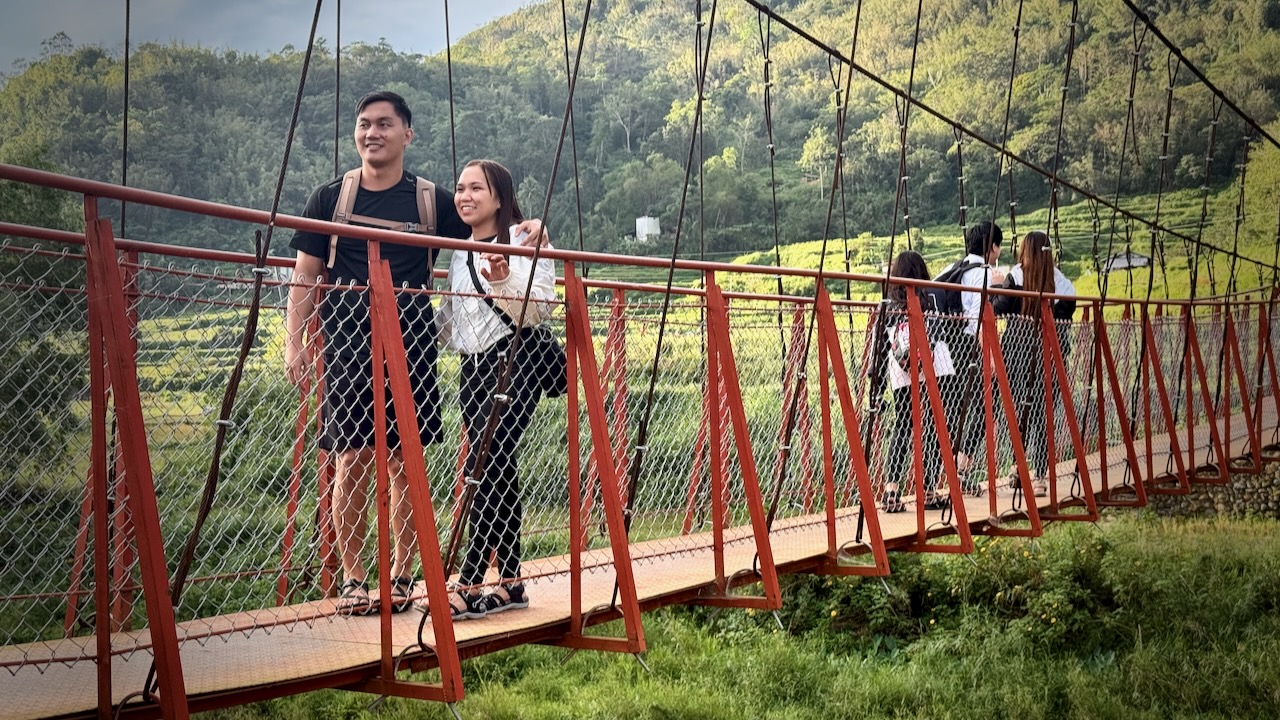
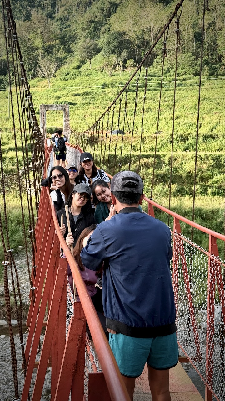
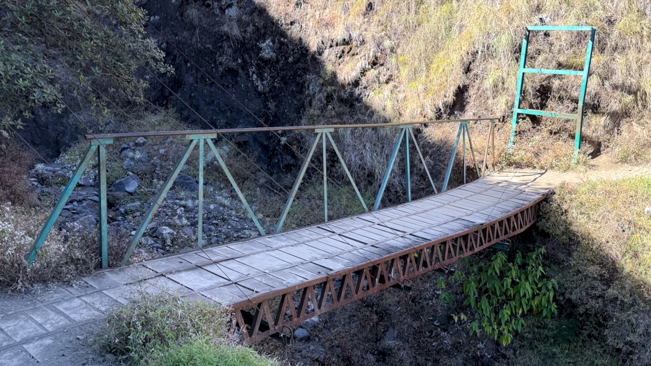
First you cross 2 suspension bridges.
YES, Filipinos love a photo op.
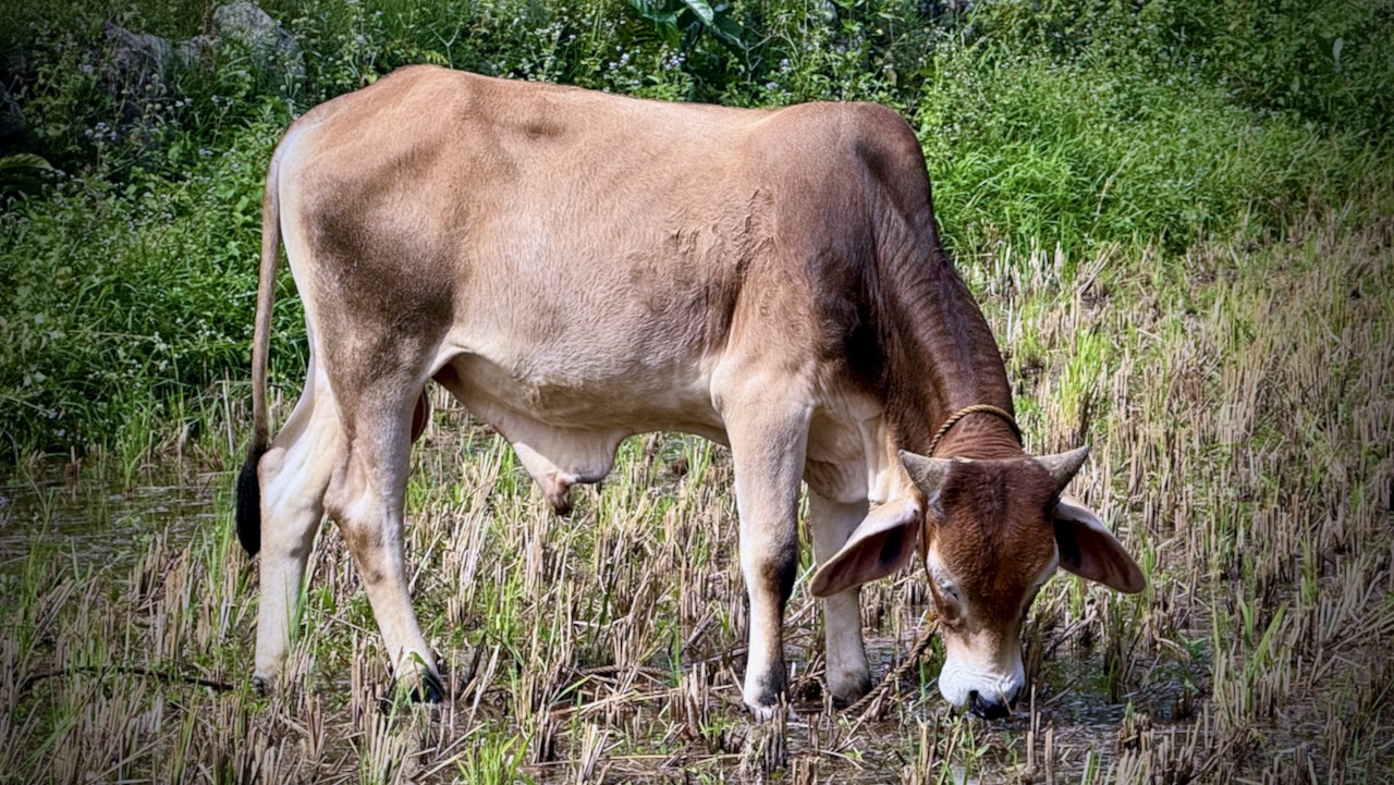
We marched through some paddies.
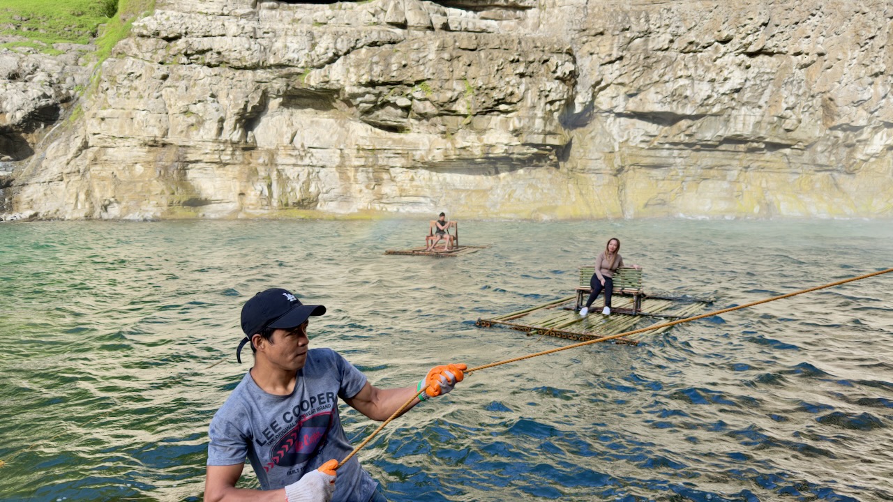
Reaching the Falls, people relaxed for a couple of hours. We’d all arrived early in the day.
Drones are allowed. So there is plenty of footage on YouTube. And even more on TikTok.
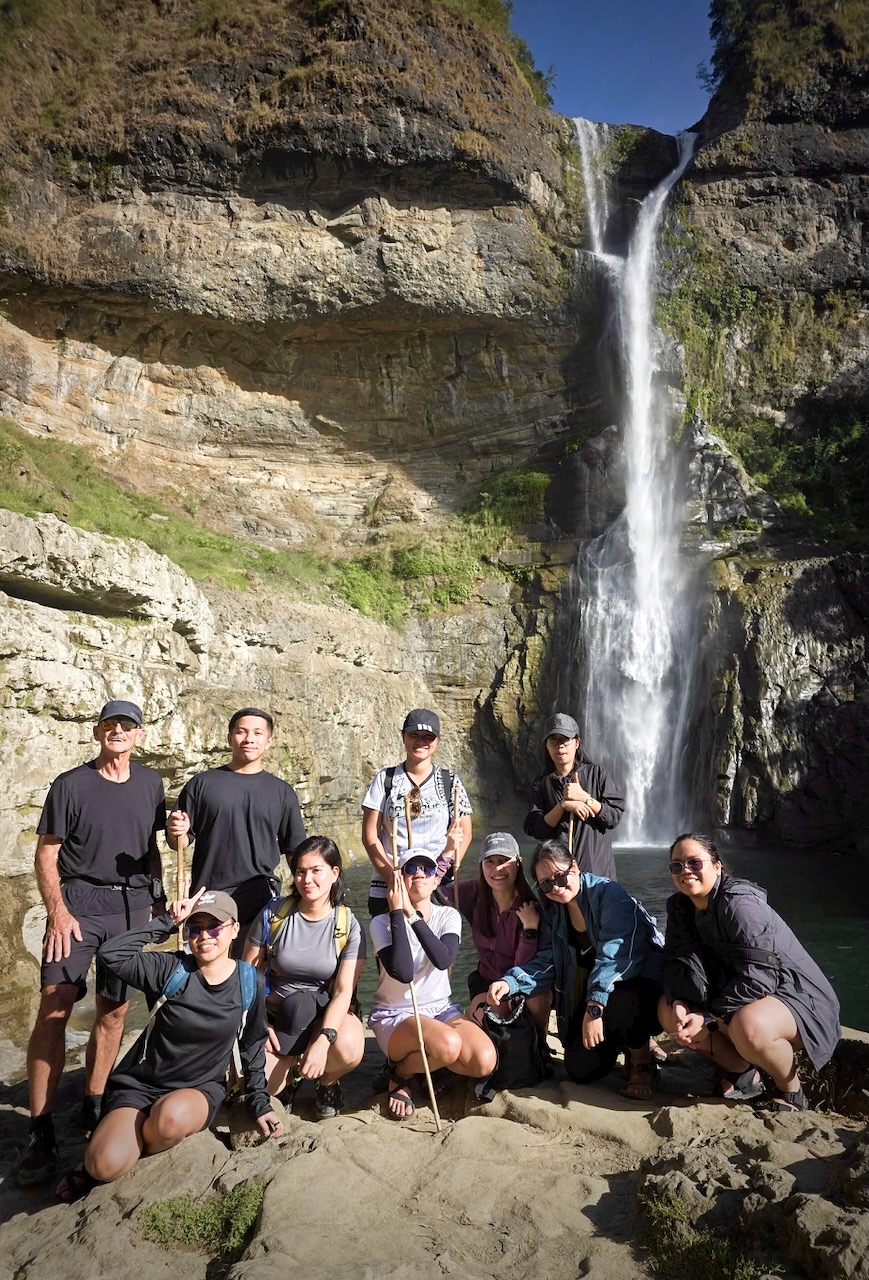
Here’s our group. I only saw one other foreigner at the Falls. This hike seems to be quite unknown outside the nation. It’s not even on AllTrails.
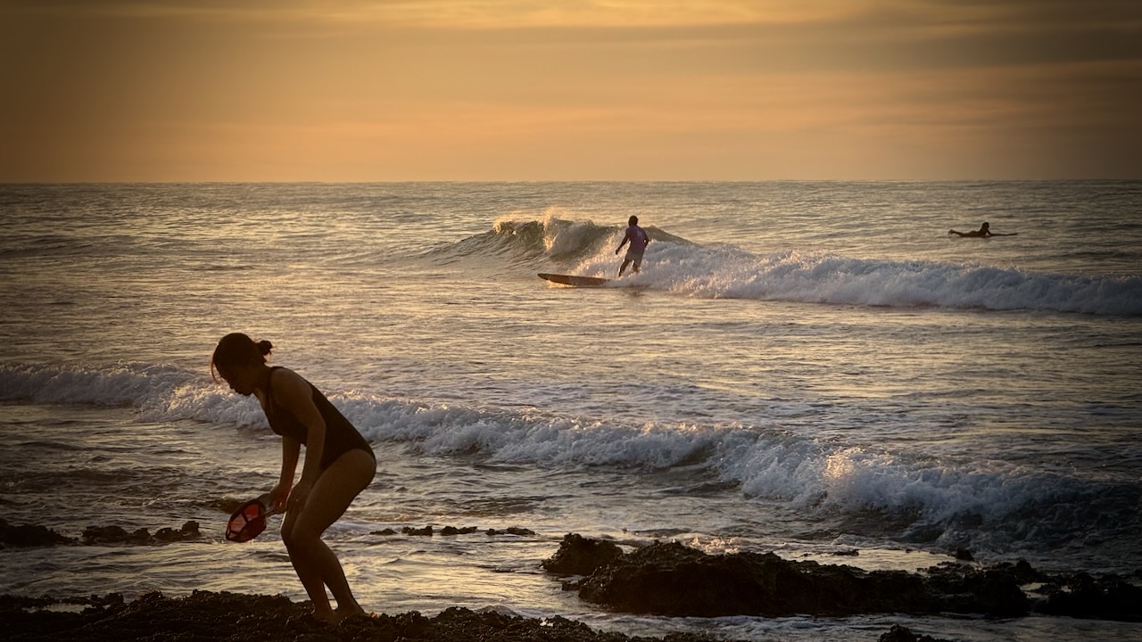
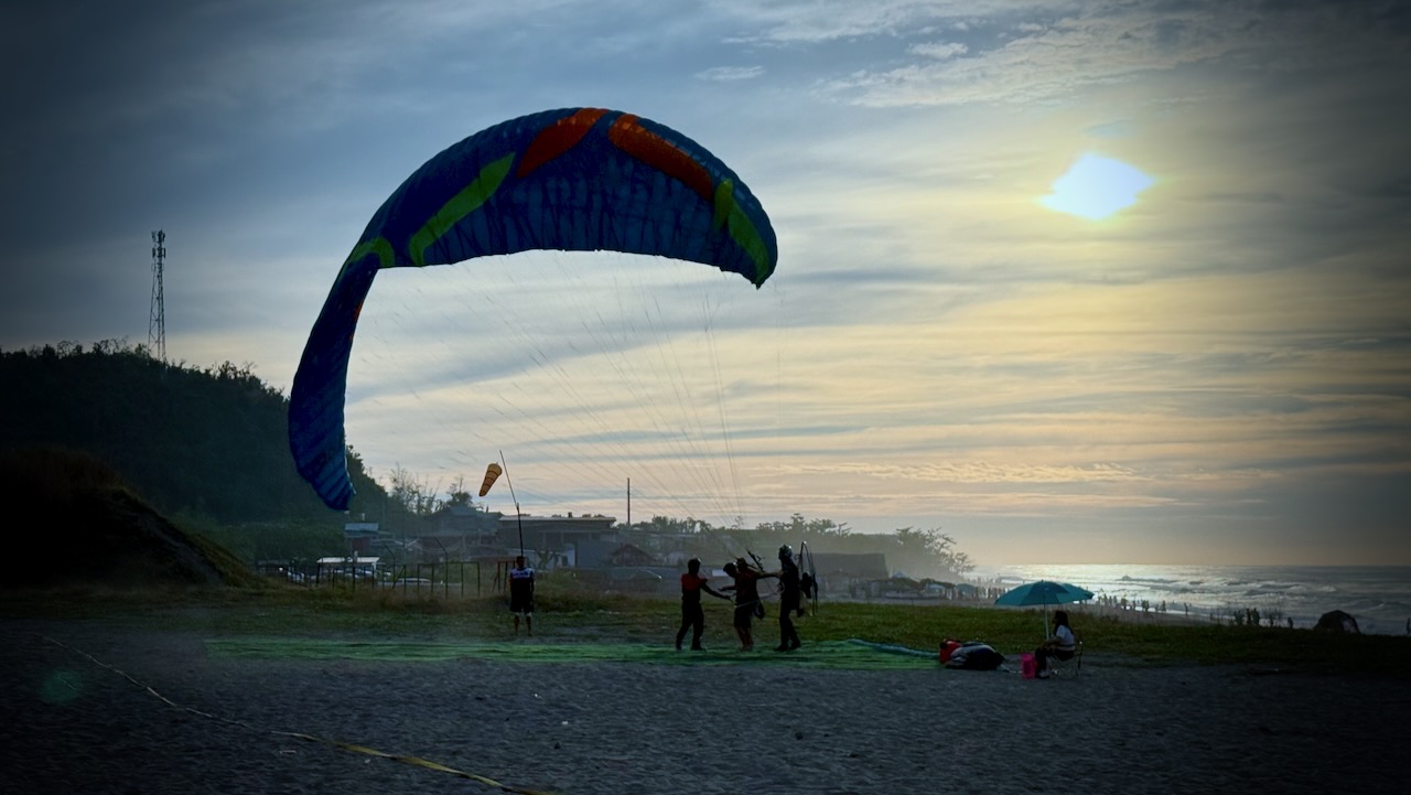
On the return drive, we stopped for sunset at San Juan, La Union, a famed surfer beach. Consistent intermediate quality waves make it ideal for beginners.
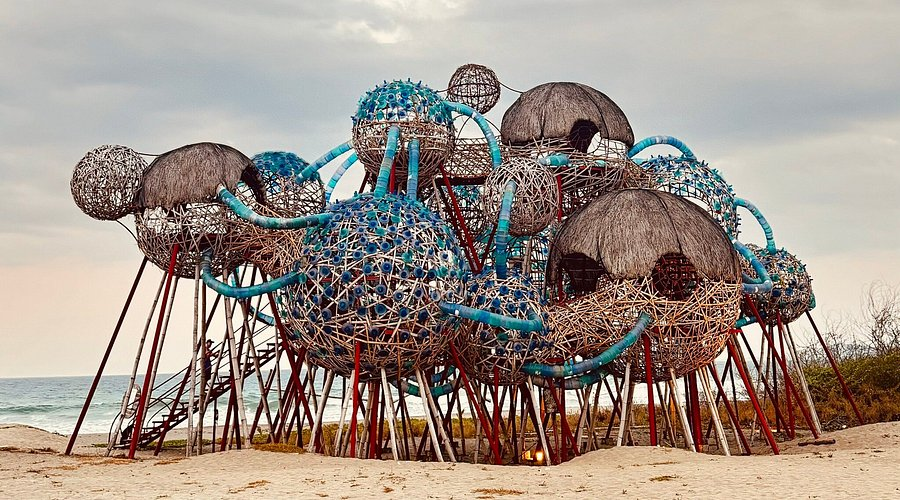
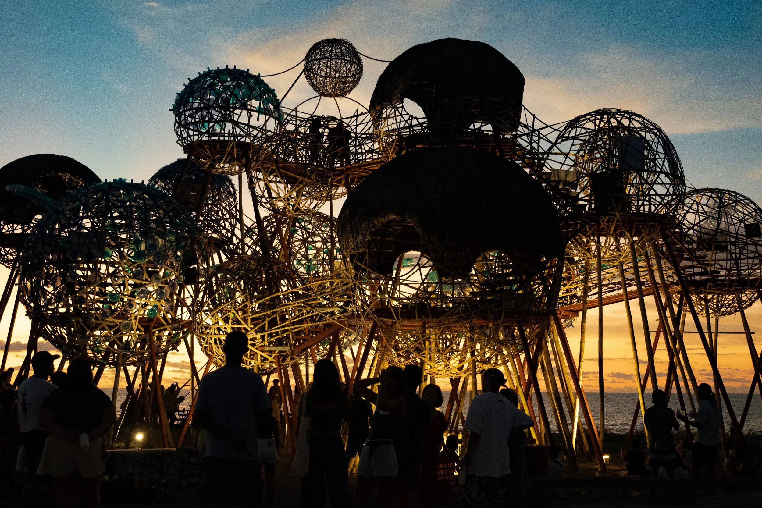
Mebuyan’s Vessel, an homage to the Bagobo goddess of the underworld, is an installation of 21 interconnected, inhabitable pods.
Signage said it could be climbed — but it was inexplicably closed. I must be in the Philippines.
A good trip, all in all.
Plenty of night driving, however. Those coming from Manila got very little sleep 2 nights in a row.
I’ve long wanted to climb astonishing Mount Rinjani not far from Bali, Indonesia.
I took the local boat from Gili Trawangan to Lombok island for the start of our guided climb of Rinjani. I could see it in the distance.
Our group met up at a local restaurant close to Bangsal Port ➙ then we were efficiently (if dangerously) driven up to Senaru village at 400m.
Screenshot
We had a typical Indonesian lunch based on rice or noodles.
We dropped bags in our surprisingly interesting rooms.
Then set off to see two local waterfalls.
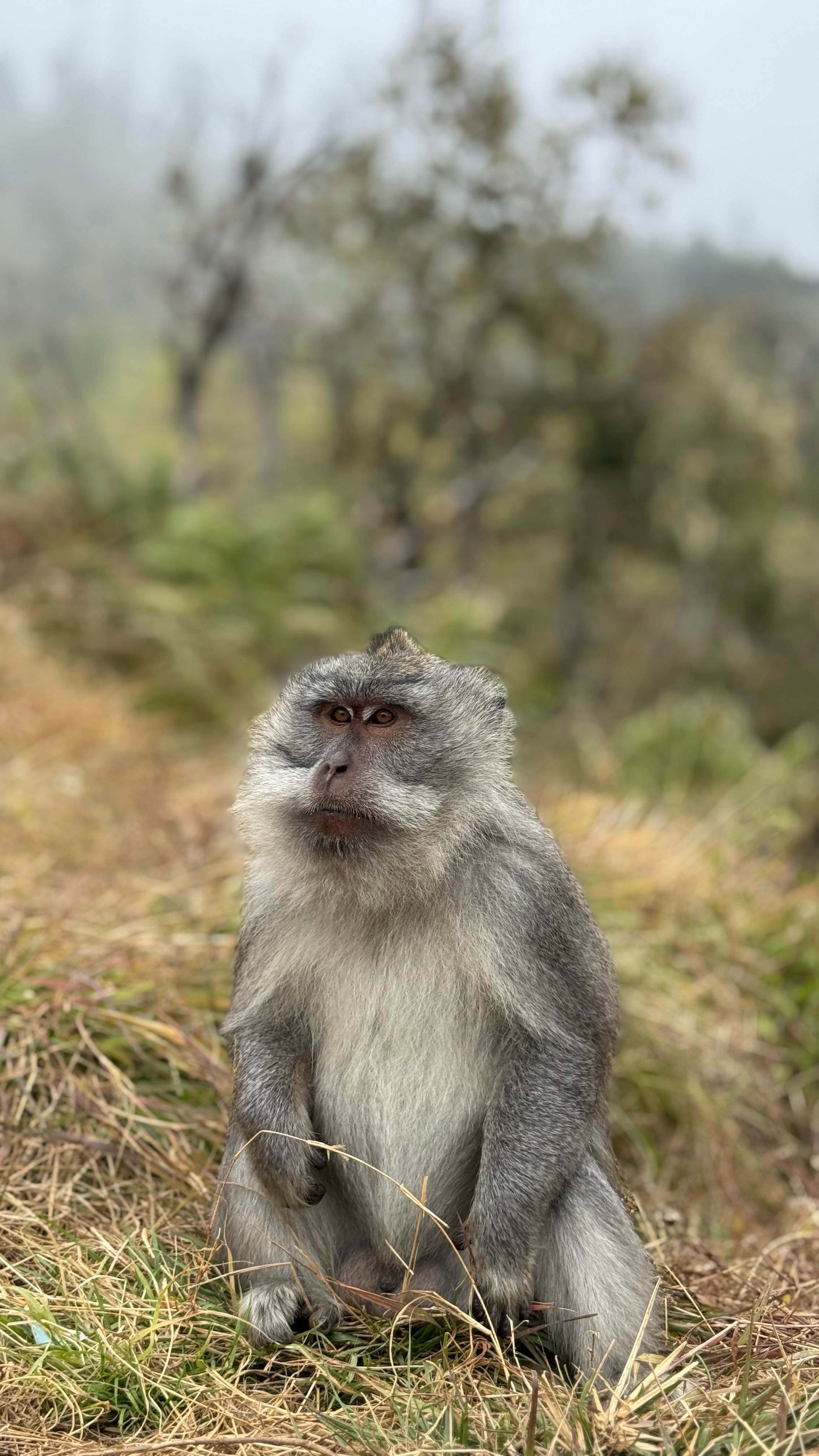
Plenty of macaques await ready to grab at your purse, backpack, or any kind of plastic bag.
Here’s the 1st waterfall.
MOST interesting here is a fun tire tube ride underground through the irrigation channel. I’d be too chicken, myself. 😀
Here’s the 2nd even more impressive falls.
Back at the guesthouse we did our introductory briefing on the volcano climb. We had hoped two more would join us. One was in hospital for some reason. The other cancelled last minute.
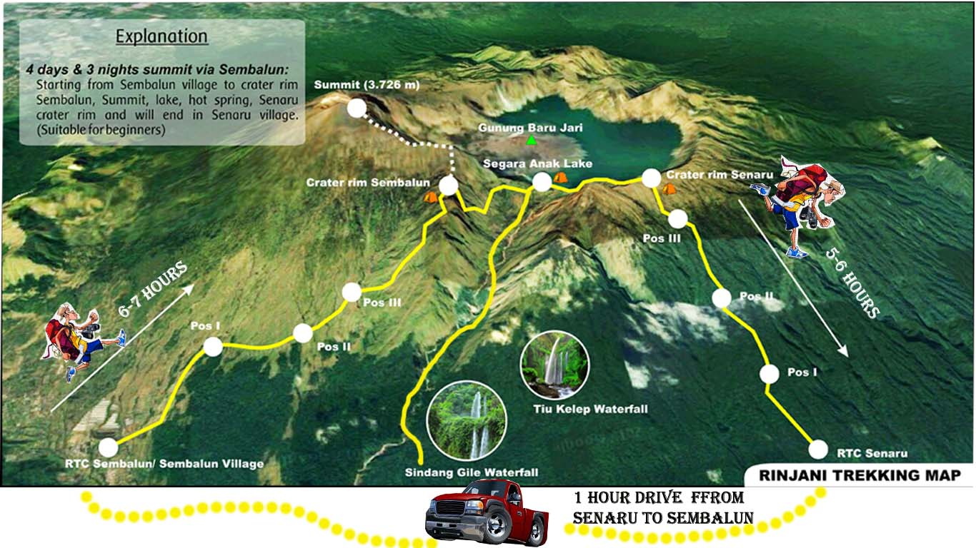
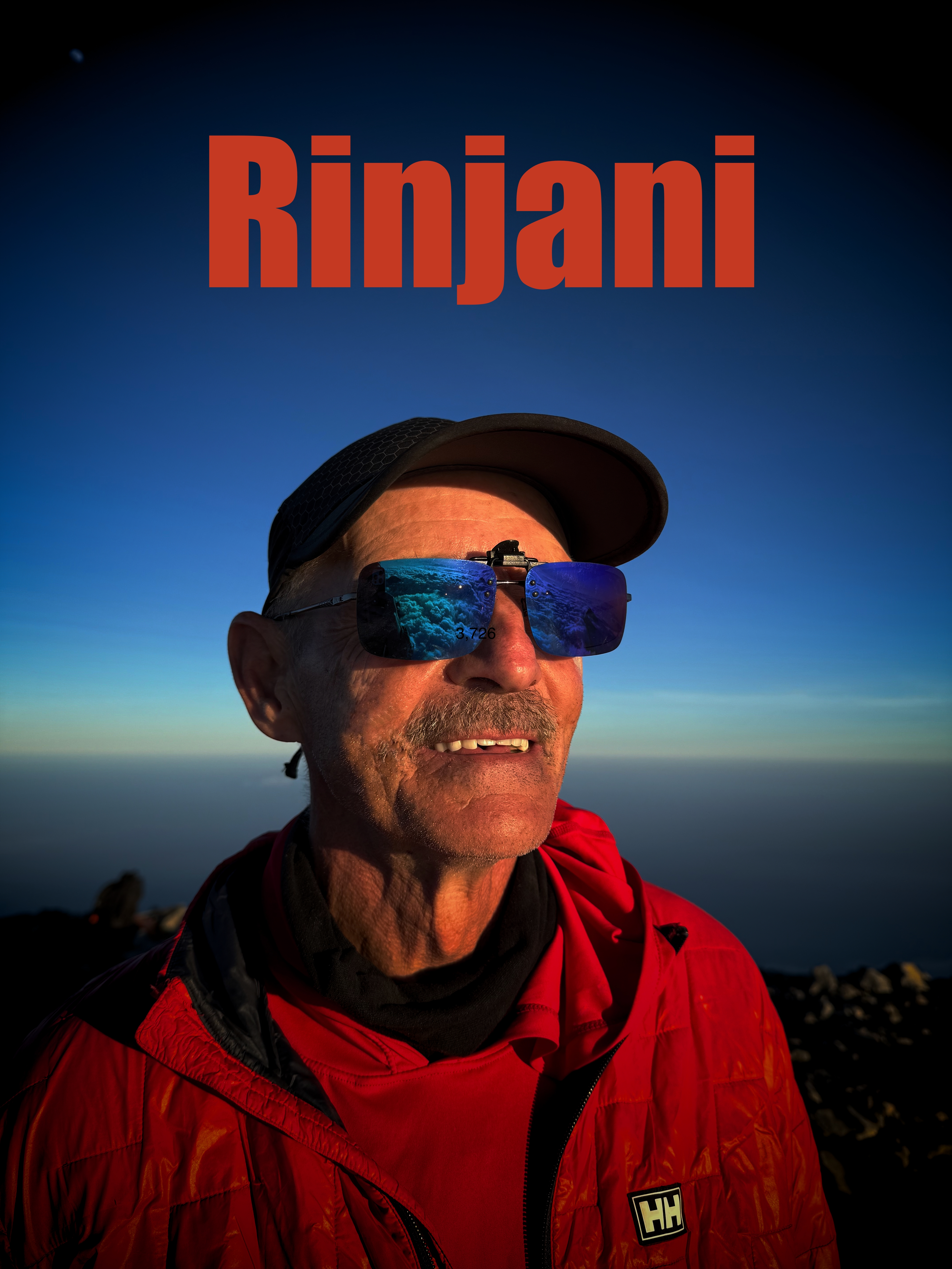
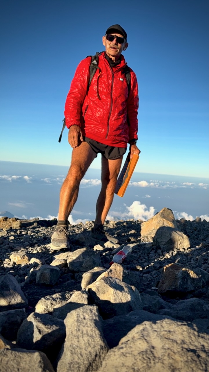
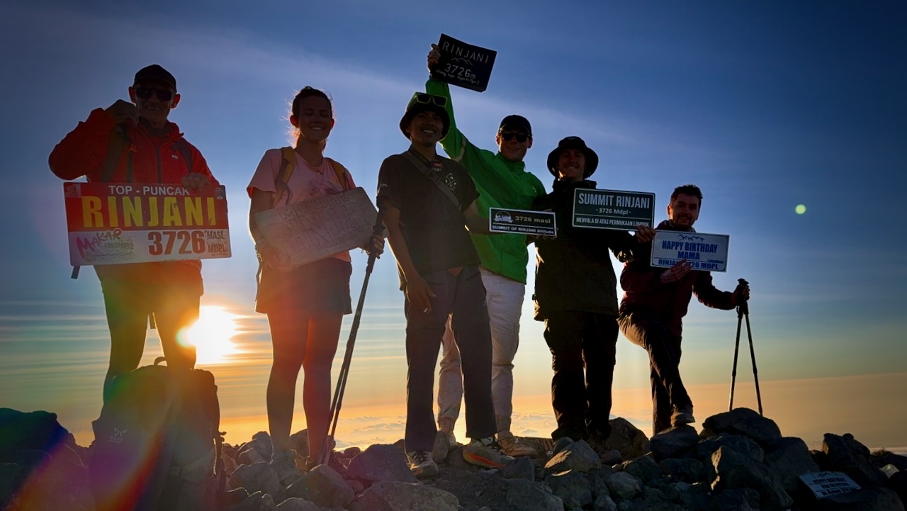
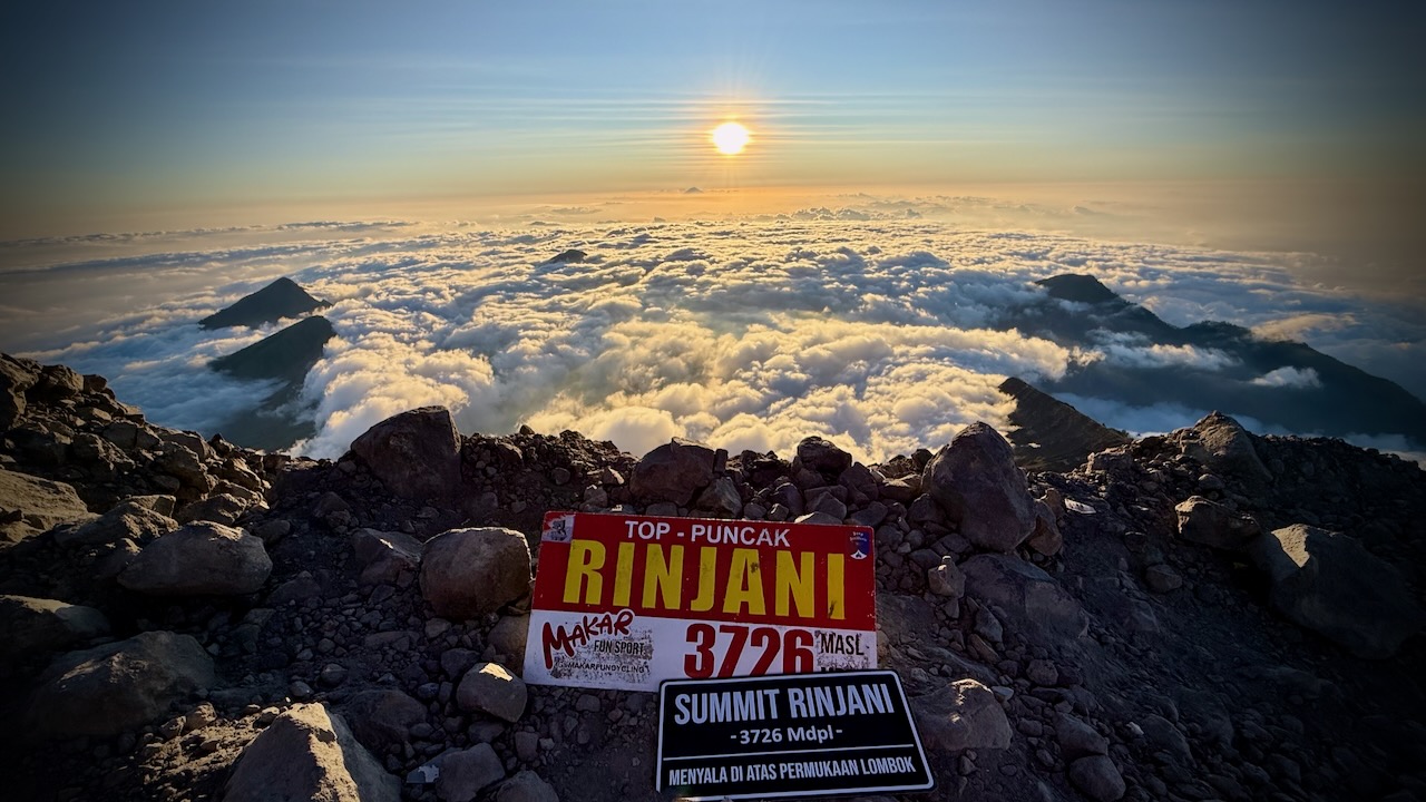
Rinjani is 3,726 metres (12,224 ft), making it the second-highest volcano in Indonesia.
We had signed up for the longer 3 days, 2 nights in the tent option.
That turned out to be the right decision. Our itinerary the BEST HIKE.
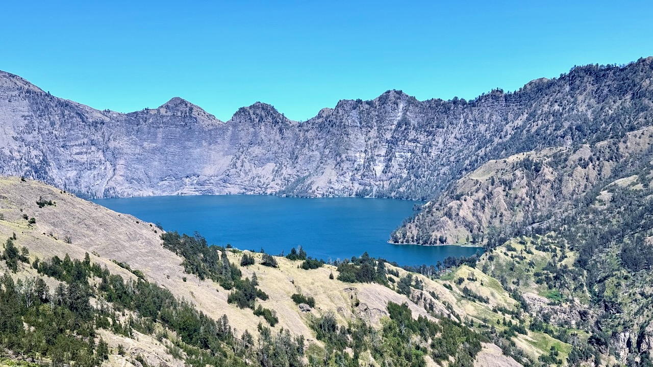
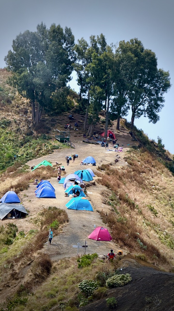
MOST groups on our itinerary camp on the 1st volcano ridge day 1. Our guide offered us the chance to descend 3 hours to camp at the lake, instead. Super tough 1st day — but we were all glad we did it.
Mount Rinjani Crater Rim 1st night on the 3 day trek.
We were up for the dawn. I added milk powder to my brutal black instant coffee.
Banana pancakes excellent, as always.
Driving up to the start at 600m we stopped for a blessing. An important tradition with the local Sasak people as well as Hindus.
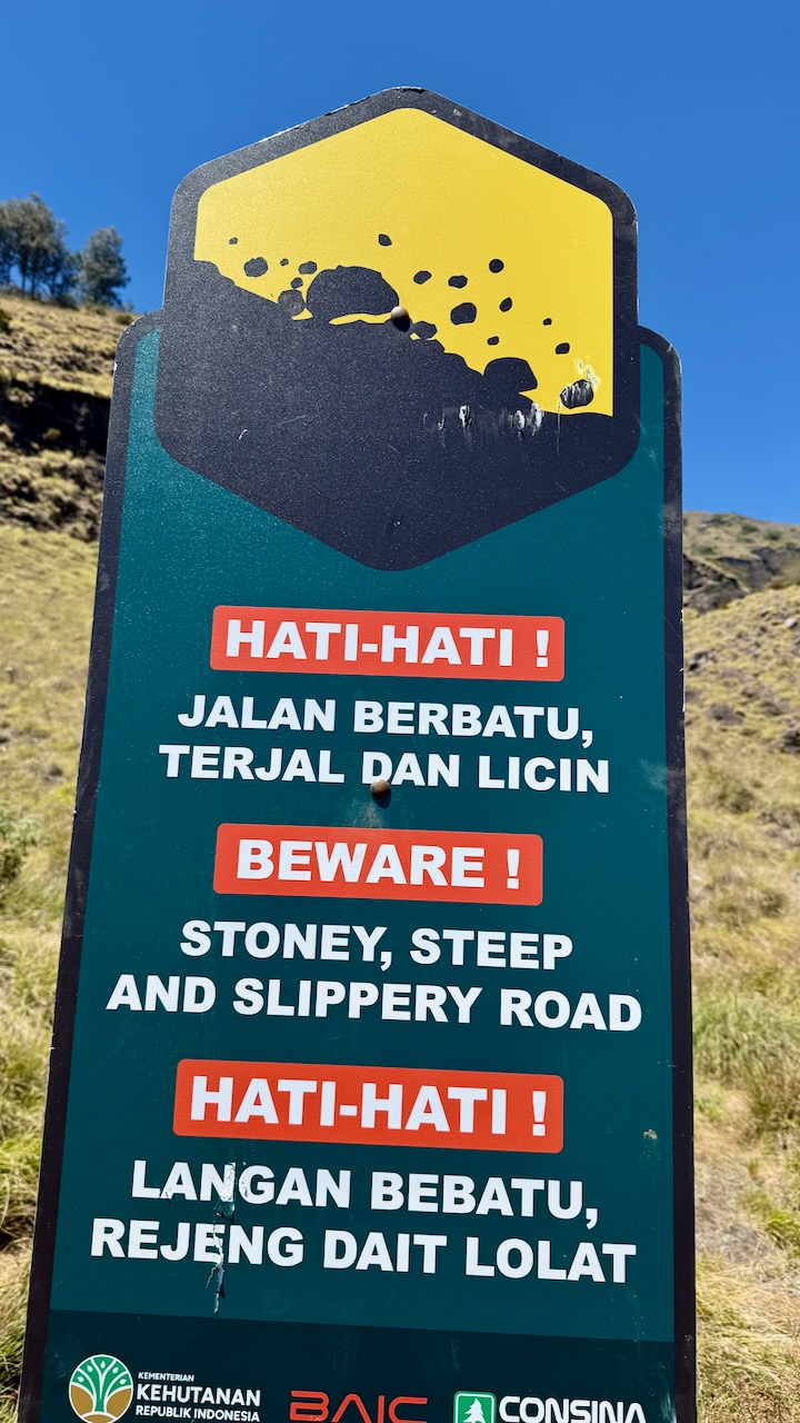
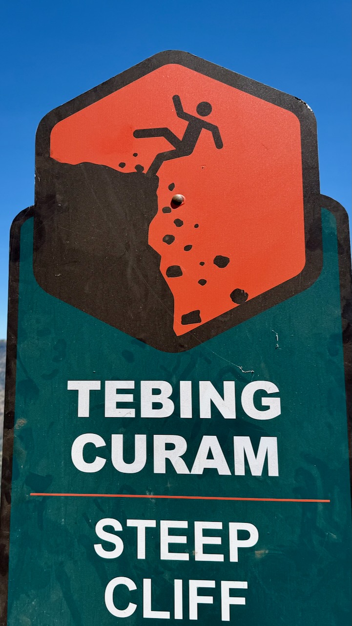
We each had to register with photo ID. The Gunung Rinjani National Park, established 1997, is trying to make this adventure safer — but they have a long way to go. It’s dangerous.
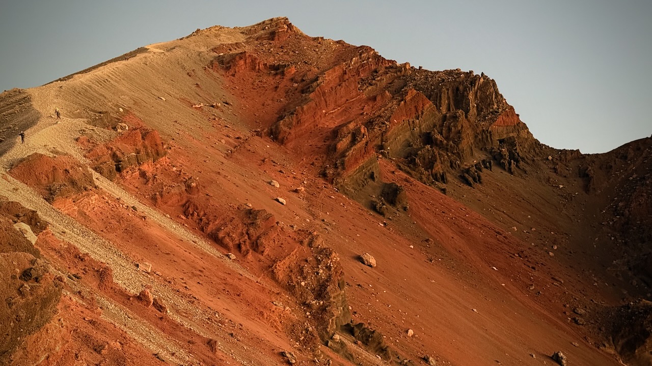
Our goal was the 1st crater rim — only 6.9km. Sounds easy until you calculate you need gain 2km in elevation over that short distance!
We started on the far right of this map.
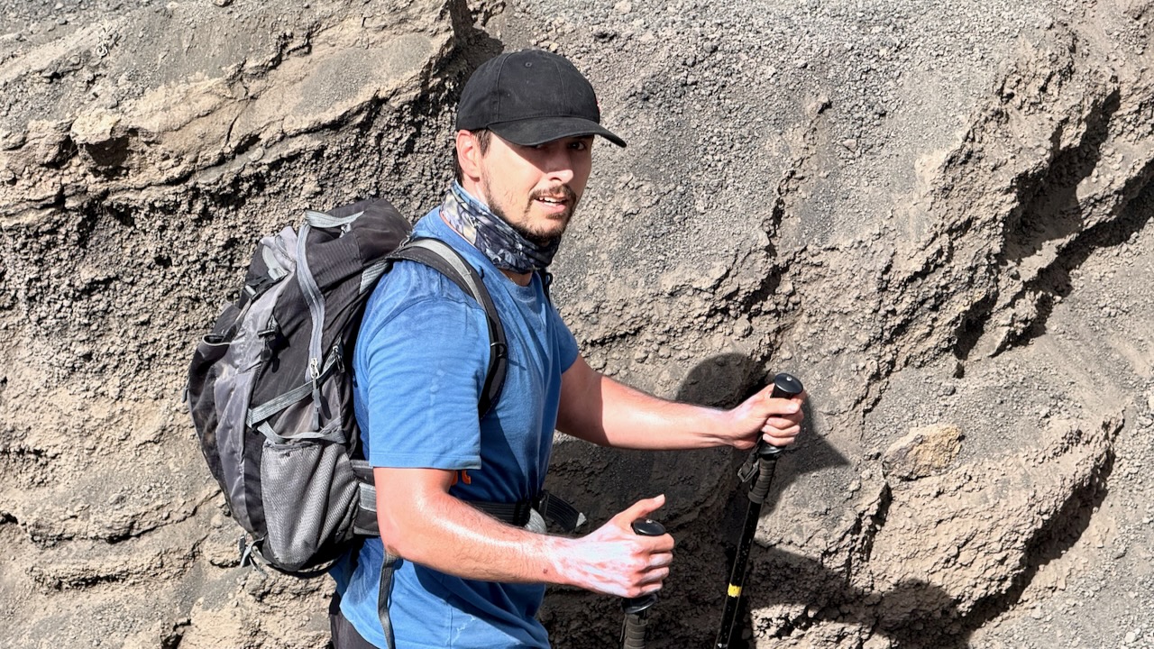
The start through jungle was relatively easy. THEN it got steep and challenging.
These wild cousins are more worrisome than the ‘tame’, well-fed ones in the Monkey Forest, Ubud.
Breakfast !
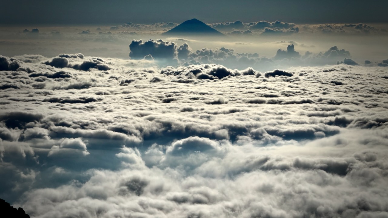
We hiked into and out of clouds.
Crater rim beckons.
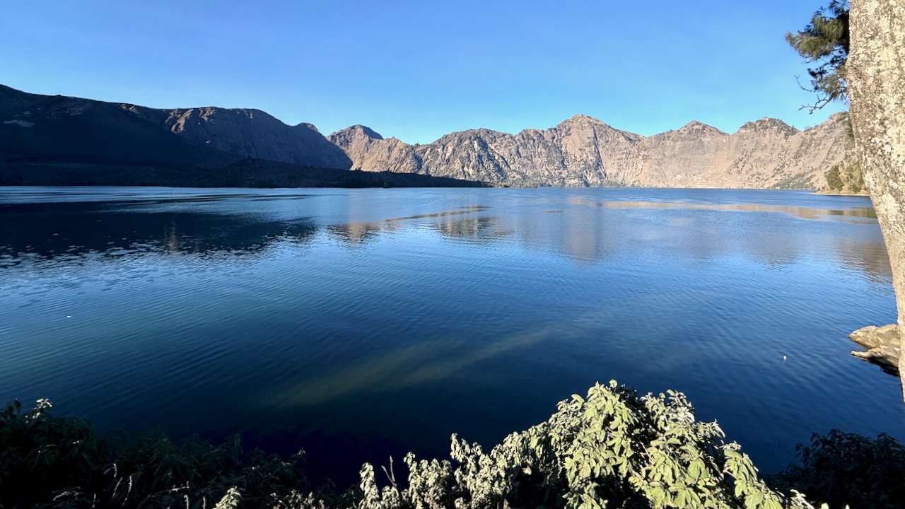
This — really — is the best vista on the hike. Crater lake Sagara Anak is huge, the colour unforgettable. The volcano’s eruption in 1257 is considered one of the most powerful global volcanic events of the last 2,000 years.
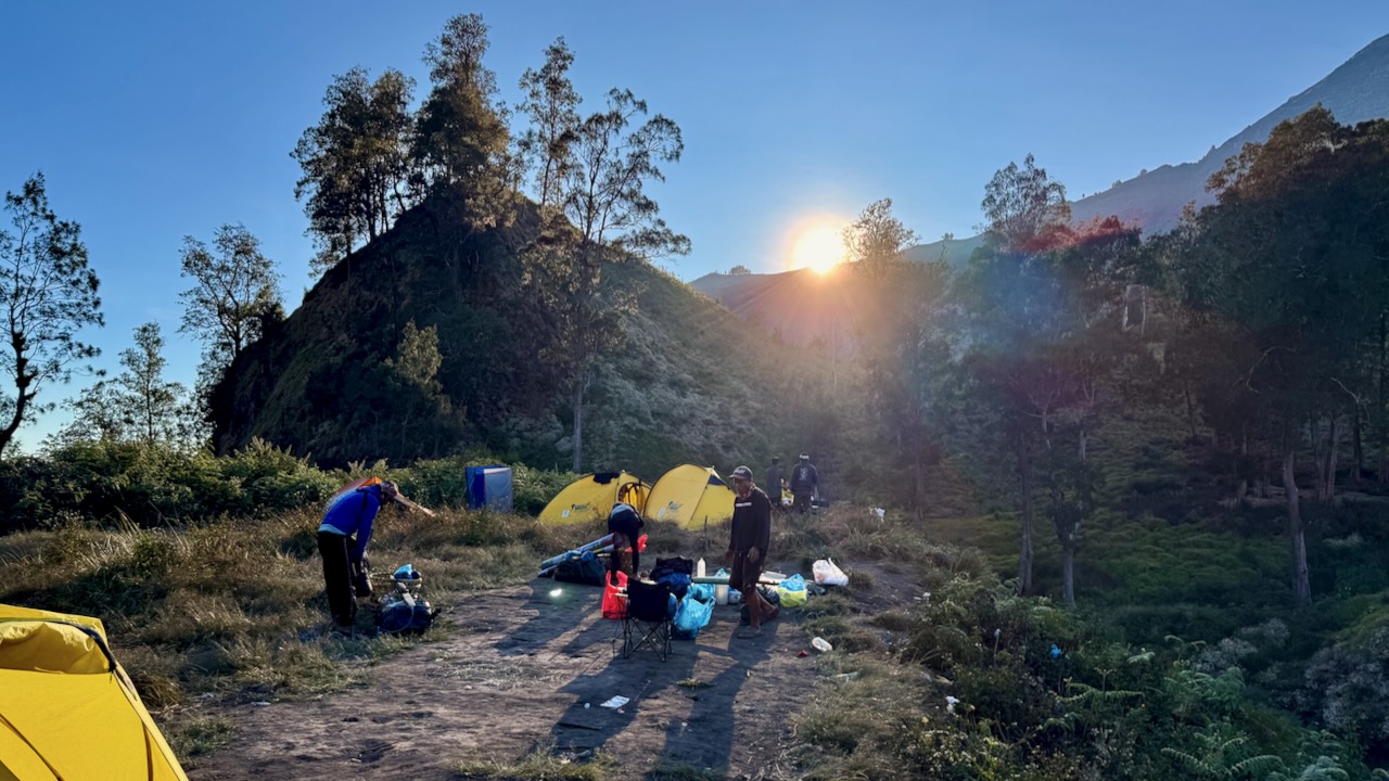
We were scheduled to set up our camp on the ridge here at 2,600m.
But we opted, instead, to hike down to the lake at 2000m, saving us 3-4 hours on day 2.
We all agreed to go for it.
OUCH …
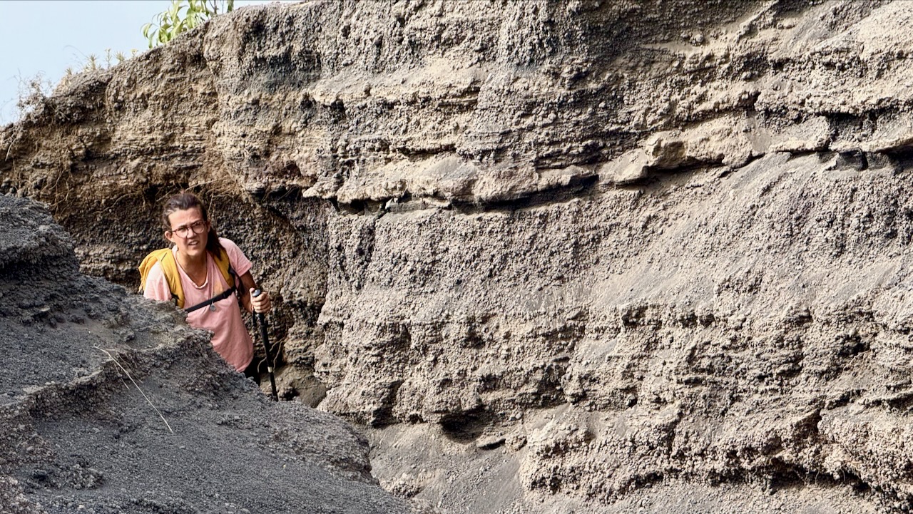
That decent is awful and dangerous. I took no photos. We had to concentrate on every technical step.
It was a relief to finally get to the lake. This one of my toughest hiking days of all time.
We arrived just before dusk.
Alpenglow time.
Each group has their own toilet tent.
The alternative at major camps are these good looking public toilets. This one was filthy! But some are quite new. Fairly clean.
Major camps have emergency shelters. I don’t doubt they are used frequently. The trek is risky.
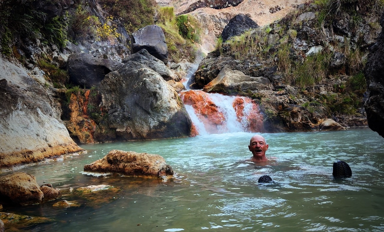
Our guide sent us to the hotsprings with one of the porters. Fantastic. A highlight of the entire trip.
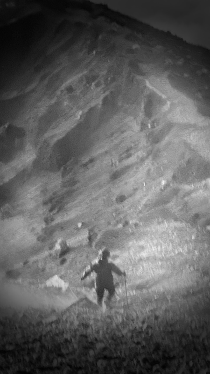
Tim (tim_de_bruijn on Instagram) was a full-time social media manager for a major Dutch soccer team. He showed us fantastic photography tips on his iPhone, including these two. It was pitch dark at the hotsprings!
Pitch dark at camp, as well.
tim_de_bruijn
Most amazing of all was his capture of the night stars. Very few of these were visible to the human eye. This from an iPhone 16 Pro Max.