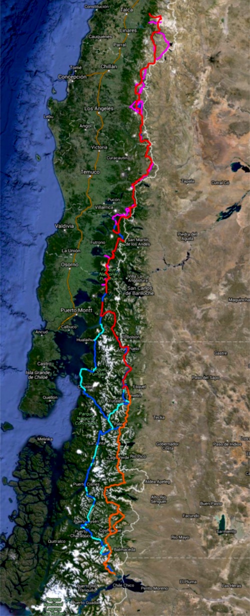
‘Unbounded’ is an adventure-travel documentary following an unaided crew of four hailing from different corners of the globe as they hike and pack-raft roughly 1,500 km through the Patagonia region of South America.
The expedition will take place from mid-December to mid-April, documenting the extreme and unique conditions in Patagonia and the surrounding area.
The crew will base their trip along the “Greater Patagonian Trail” and make they’re way to Patagonia National Park. The film will focus on discovering the indescribable factors of Patagonia, learning the history and culture of the people living in the area, and bringing to light the incredible beauty of the region – all in an effort to help raise awareness of the need to preserve this untamed, but delicate area.
A significant portion of the film’s proceeds will go towards Conservacion Patagonica to help protect and maintain this incredibly vast and beautiful landscape.
I was up at 3:30am to check out of my hostel in Xela and walk over to Quetzaltrekkers through dark streets.
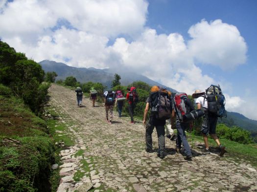
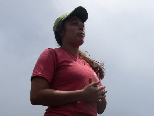
4:45am rendezvous. Our group of 10 included two guides, hikers from Canada, the States, England, Switzerland and Germany.
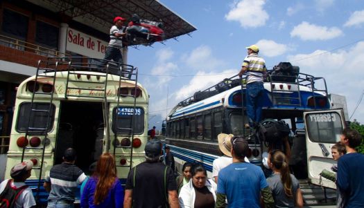
At 5:15am we climbed into a pick-up to get to the hectic Minerva bus depot. We were first to get seats on the chicken bus.
Arriving about 7:30am, we ate a good breakfast at a San Marcos bus station comedor.
Next was an even more crowded bus to Tuichan. By around 10:00am we started up.
Quetzaltrekkers have no employees. Everyone is a volunteer.
Volunteer guide, Jordan, from Canada.Volunteer guide, Rachael, from the USA.
All proceeds go to a children’s charity.
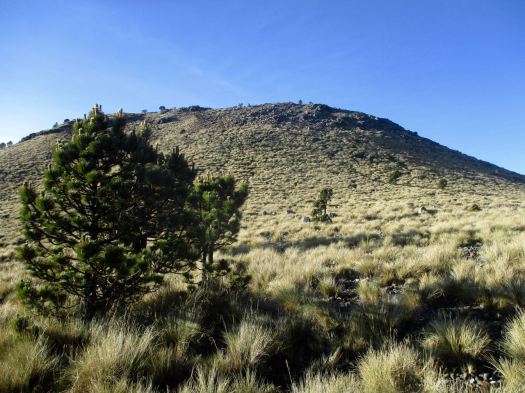
Being a volcano, I feared it would be an unrelenting slog at the same angle. Happily there is a fair bit of variation in the trail – though it is unrelentingly UP.
A highlight are the Hartweg’s pine, a very high altitude species
Spooky in the clouds.
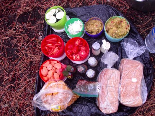
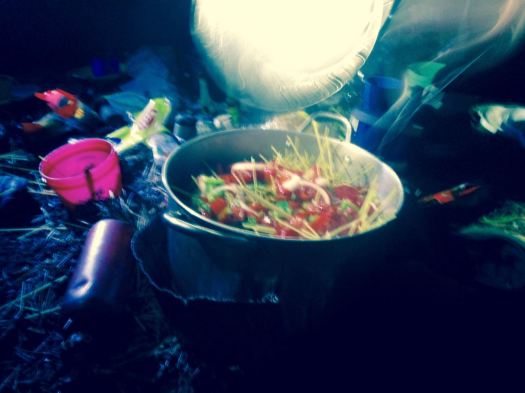
Finally arriving at “base camp” after 4-5 hours, we enjoyed a healthy lunch of local fare.
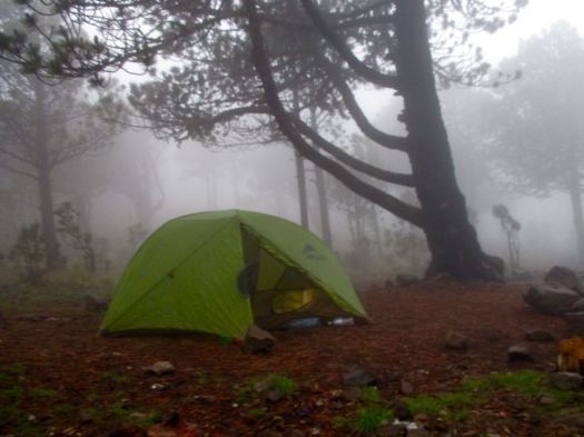
That was 1000m elevation gain over 4km. Sleeping at about 4000m (13100ft), there’s a real risk of altitude sickness.
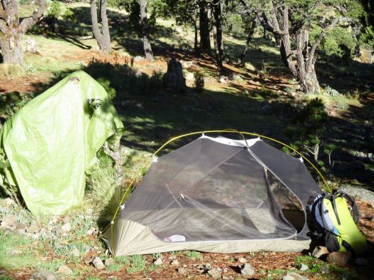
Everyone slept in provided 4 person tents aside from Jordan (who slept in a hammock) and myself who brought my own gear.
We all crashed for siesta, knowing we wouldn’t get much sleep tonight.
We’d planned to climb up to Tajumulco’s second summit, Cerro Concepcion, for sunset. But afternoon rains had come. We stayed in our tents.
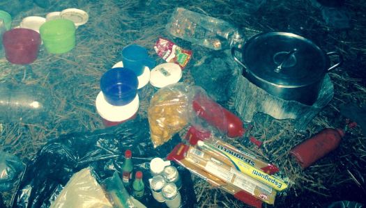
By 6:30pm the rain had stopped. We had dinner and hot drinks, hoping the morning would be clear. This was the second trip for one girl – her first summit clouded over.
A brazen mouse ran around the cook area.
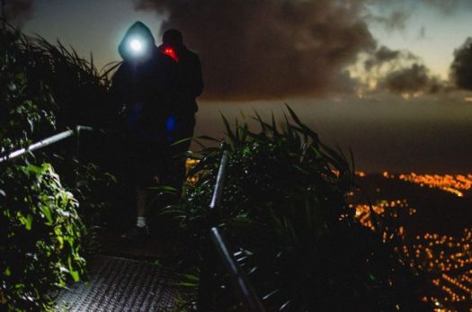
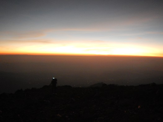
___ My alarm went off at 3:30am. I’d not slept particularly well.
Though we had clear skies and near a full moon, it was dark. My borrowed headlamp died quickly. I followed the lead guide closely to take advantage of her lamp.
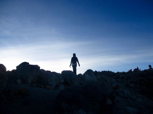
The final 200m is a scramble. Gloves are useful for grabbing stone in the dark.
It went well. All 10 of us at the top before dawn. We huddled in our sleeping bags.
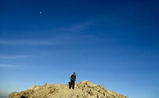
Dawn at 5:30am was gorgeous.
Everyone – at this point – was super happy they had joined the trip.
We stayed on top as long as we could handle the cold wind.
Rick the highest man in Central America
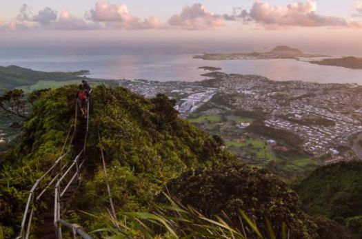
There are views to Mexico. And many other volcanos.
This is volcano shadow.
We descended by a different route, first circumambulating the crater.
Quickly into grassland, we started to get hungry.
The water was boiling for breakfast by the time we got back to camp.
This very popular hike is – sadly – quite littered and vandalized. Instead of leaving my Summit Stone at the summit, I left it in one of the excellent climbing trees at camp. 🙂
No rush. We dried the tents, the sun already very hot at 8am.
I was impressed with the toilets provided. Happily there are very few insects this high up.
The descent was relaxed. Our climb already a success.
It’s slippery, however. We had numerous falls on the way down. This could be treacherous in the rain.
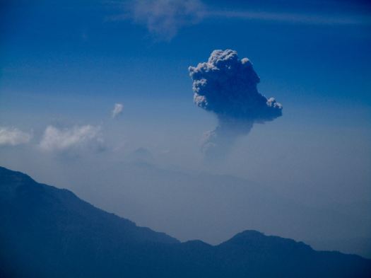
One highlight was seeing the eruption of another volcano – Santiaguito. It’s a near daily occurrence. In fact I’d climbed up another volcano, Santa María, to see that eruption on another hike, 10 years earlier.
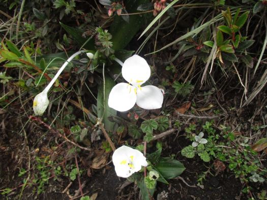
The National flower of Guatemala, Lycaste skinneri, are everywhere. Another highlight.
About Noon we got back to the road. The peak was already clouding up. No doubt it would rain again late afternoon.
We were hungry again for a big lunch at this village restaurant. Most had the fried chicken. And Gallo beer.
We reversed our route. First a bus back to San Marcos. Our driver parked close to our next so they could throw our packs roof-to-roof. (I’d never seen this before.)
In Xela we again climbed into a pick-up truck to return to Quetzaltrekkers by about 4:30pm
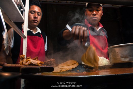
A shower. Some rest. To celebrate some of us got together for street tacos and cheap beer at the Plaza Central.
Tajumulco is highly recommended, so long as you have clear skies in the morning. You can do it on your own, but finding all right buses may be a hassle.
Pumalín Park (Spanish: Parque Pumalín) is a … private nature reserve in the Palena Province of Chile, created by the United States environmental foundation The Conservation Land Trust, which was endowed and led by the American business magnate Douglas Tompkins. …
We dropped into to the head office of this private park in Puerto Varas to get an update on progress.
Facilities have expanded since I visited Pubalin 11 years ago. The official map now has 17 campsites, 12 official short trails, 4 hotsprings. We were told there are no official overnight hikes. Yet.
On December 8, 2015, Tompkins was kayaking with five others on General Carrera Lake in southern Chile when strong waves caused their kayaks to capsize. Tompkins spent a “considerable amount of time” in waters 40 °F (4 °C) below. He was flown via helicopter to a hospital in nearby Coyhaique, where he died hours later from severe hypothermia. He was 72 years old …
Sorrow for the earthquake victims is one reason I went to Ladakh in 2015 rather than Nepal.
But Nepal is open for business.
In August, the US and UK lifted their country-wide travel advisories against travel to Nepal, meaning that travellers and companies can once again get travel insurance for upcoming trips. Most western travel companies plan to run trekking trips as normal for the 2015/16 winter and spring seasons and some companies are even offering special reconstruction treks …
In many ways now is a great time for tourists to visit Nepal. The infrastructure that travellers need is in place, but tourism is down by over 50%, which means fewer crowds on the popular trekking routes and discounts for hotels and airfares. More importantly, the money you spend when hiring a guide or porter, staying in a lodge or hotel, or eating in a restaurant will directly help local people. Given that 500,000 Nepalis work directly in tourism, the country needs travellers more than ever to rebuild its economy and bounce back stronger for the future.
The Elwha Dam was a 108-ft (33 m) high dam located in the United States, in the state of Washington, on the Elwha River approximately 4.9 miles (7.9 km) upstream from the mouth of the river on the Strait of Juan de Fuca.
It was taken out in an effort to restore the original habitat, especially for fish breeding.
Looks pretty good in 2015. I did a short day hike from the viewpoint.
You didn’t want to be downstream when the floodgates were unleashed.
Backpacker magazine – Tomás Dinges Jan 2015 trip report:
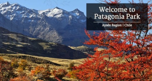
My route on the 13.5-mile Lagunas Altas Trail (translation: high lagoons) would take me to the top of a 4,872-foot peak and along a chain of eight lakes high in the southeastern section of the 200,000-acre park. I was far from the dense rainforests of northern Patagonia, but not yet enveloped by the never-ending steppe common to Argentina and southern Chile. Marked with fluorescent ribbons and colored rebar, the trail, like much of the park, was a work in progress. …
“You are walking around a park that you have to yourself,” said McDivitt-Tompkins, founder and president of Conservación Patagonica, the nonprofit organization created to oversee the park’s development. “Just imagine what John Muir felt when he was in Yosemite before it was Yosemite. You are in a place before anybody goes.” …
After 4.5 hours and 3,780-feet of climbing along the Lagunas Altas Trail, I emerged above treeline and onto the bald peak of Cerro Tamanguito. To the north stood the glaciated peaks and snowfields of the Jeinimeni Mountains. Below me were the distinct yellow and coffee-brown landscapes of the Chacabuco Valley I had hiked through. …
Chacabuco Valley
Applying the U.S. national park model, Conservación Patagonica has developed two campgrounds (with 60 tent sites and eight cook shelters), a lodge, a restaurant, and a new visitor center that’s scheduled to open in early 2015. There are six trails in place, totaling some 77 miles, and crews are busy planning and cutting more every day.
By 2020, Conservación Patagonica hopes to hand the land to the Chilean government to connect the now-separate operations of icy Jeinimeni and forested Tamango and privately held Patagonia Park to create a 610,000-acre Patagonia National Park, a preserve larger than our Great Smoky Mountains National Park. …
It’s been ten days since a large-scale earthquake shook Nepal. It’s been a hard time for everyone, with the loss of family members, homes, entire savings, and historical landmarks. On the other hand, it’s brought the people of Nepal together in the face of adversity and strengthened bonds with those from outside Nepal who offered aid.
Still, with the death toll estimated at 7500, along with 10,000 injured and 1.4 million in need of food assistance, there is still a need for assistance.
We’ve spent the last few days compiling a list of reliable, effective groups working hard to bring support to the people of Nepal. If you’re able, please consider donating time, money, or volunteering via the links below.
What’s Needed Now
Remote villages are still in need of relief;
Because of sanitation problems, there is a high risk of disease;
Lack of electricity and water supply;
The monsoon season is a month away, making shelter an urgnet need;
Basic necessities like food, water purification tablets, medicine, blankets, and tents are still needed;
Support for the long-term rebuilding of homes, villages, and historical landmarks.
Effective Ways To Donate
If you are in a position to donate, here is a list of local, grassroot initiatives working hard to provide relief. By donating to these groups, your money will go directly to the people that need it most via local channels mobilized by local experts:
Rebuild Langtang Campaign Langtang village, in particular, will need rebuilding support after the first weeks have passed. After first medical care has been delivered it will take large efforts to re-establish community life back in the valley.
Lokesh Todi’s Relief Fund to support and sustain the work of local NGOs and first responders on the ground.
Mountain People’s Initiative to provide assistance to those in need around Kathmandu. They’ve set up a temporary relief centre in Thamel functioning as shelter/store/aid post for local Galdunga people.
Sherpa Gear’s CrowdRise Campaign. 100% of your donation will go for immediate relief on the ground through our Paldorje Education Fund network, already set up to benefit the children of Sherpa families in remote villages.
GlobalGiving’s Campaign to help address the immediate needs for food, fuel, clean water, hygiene products, and shelter. Once initial relif work is complete, remaining funds will transition to support longer-term recovery efforts run by loca, vetted organizations.
Karma Foundation is a non-profit branch of socialtours & Karma Coffee working on responsible philanthropy disbursement to projects in Nepal, now for Quake relief.
Seva Foundation is working to supply tents to those in need of shelter.
To Da Loo Community toilet builders initiative in the wake of the earthquake. Toilets or latrine pits are raised in densely populated communities.
Helter Shelter Shelter relief effort for those left homeless.
Other Ways To Help
There will be long-term rebuilding projects that will need volunteer support. If you’re planning a trip to Nepal in the future, consider volunteering as an option. When the media spotlight shifts to another problem in the world, there will still be people in Nepal working to rebuild and regain what was lost.
Continued News, Updates, Photos…
Kathmandu Living Labs has been crowdsourcing technologies and social platforms to map the relief effort and access to local villages.
Gallery of photos taken by Lokesh Todi who has been documenting the aftermath of the Nepal earthquake on the ground.
Photographer Thomas Kelly is actively documenting the aftermath of massive Earthquake that rattled Nepal on 25th of April, 2015.