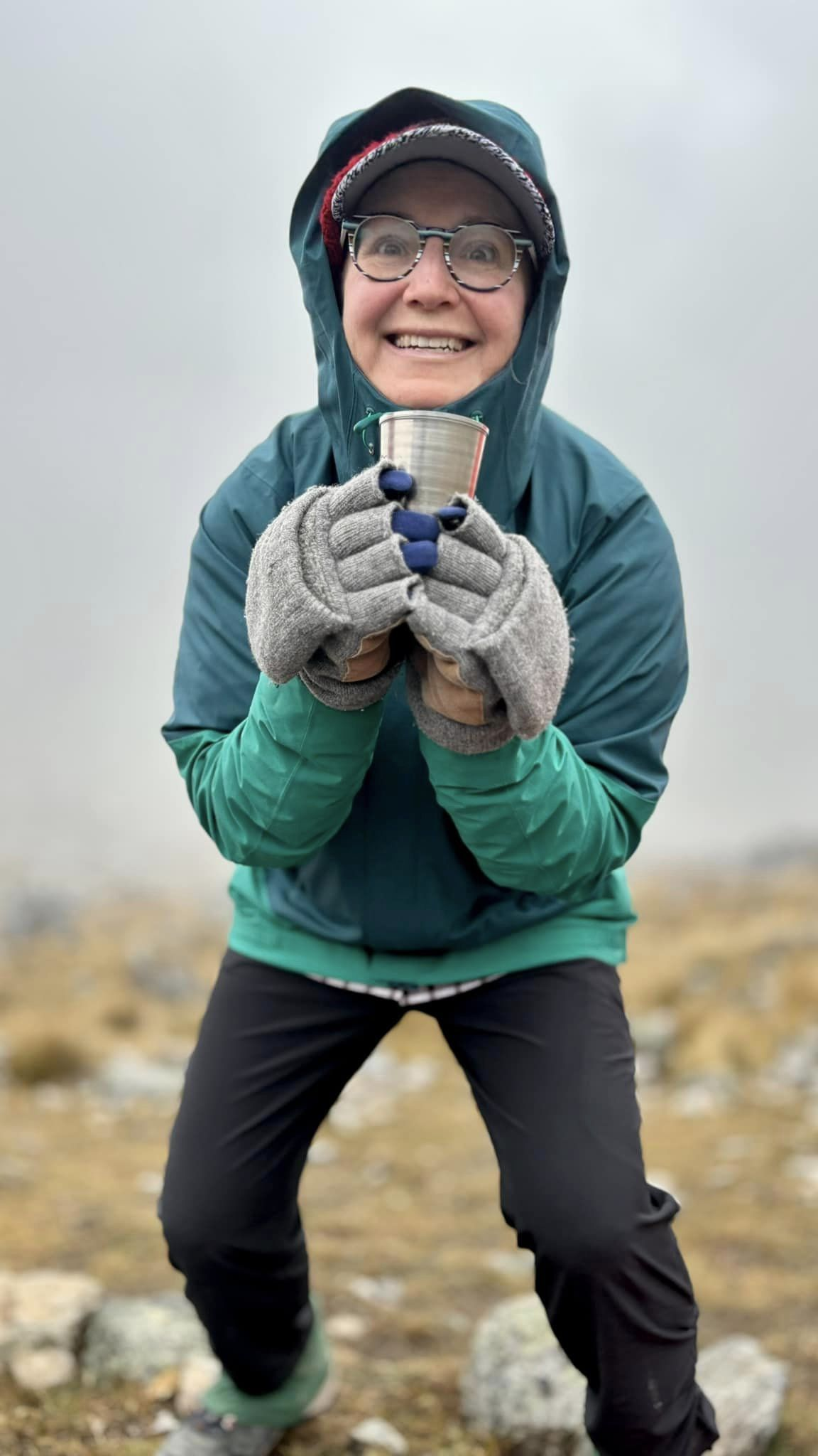
Good advice from one of the most experienced hiking vloggers.
Of course if you aren’t in the USA, some of these items will be more difficult to get.
Click PLAY or watch it on YouTube.

Best hikes, treks, tramps in the world.
Good advice from one of the most experienced hiking vloggers.
Of course if you aren’t in the USA, some of these items will be more difficult to get.
Click PLAY or watch it on YouTube.
Every year it gets more difficult to get a reservation for hikes and front country campgrounds in Canadian National Parks.
Here’s HOW to make a booking for 2025.
The window is January 17 to February 12, 2025
Know that Parks Canada has already had problems with their online booking systems.
Click PLAY or watch it on YouTube.
My friend Krista just finished the Salcantay trek guided by Salkantay Trekking.
Salcantay, Salkantay, or Sallqantay (in Quechua) are all commonly used.
Salcantay’s proximity to Machu Picchu makes this trek to the town of Machupicchu (Aguas Calientes) a better alternative to the oversubscribed Inca Trail.
Krista loved the adventure. But definitely found it challenging.
The longer you have in advance to acclimatize to altitude, the better.
If planning on Salcantay, research the hike in advance.
Not mentioned in this video are the biting insects. They are not always a nuisance — but for me they were the biggest consideration. I had them on the trail. And at Machu Picchu.
Click PLAY or watch it on YouTube.
Trip report by BestHike editor Rick McCharles
Almost every tourist to the Faroe Islands goes to see the lake hanging over the ocean. Unique and spectacular.
Sørvágsvatn is the largest lake in the Faroe Islands.
… surface is about 40 m (130 ft) above the level of the sea.
It is surrounded by a higher cliff which prevents it from emptying fully into the ocean, the waterfall Bøsdalafossur being the outlet.
The greater height of the cliffs on either side of Bøsdalafossur can give the illusion from certain perspectives that the lake is higher above sea level than it is.
The waterfall vista is great. But personally I liked even better walking the Trælanípan cliff — aka the ‘Slave Cliff’. Supposedly where slaves were pushed to their deaths.
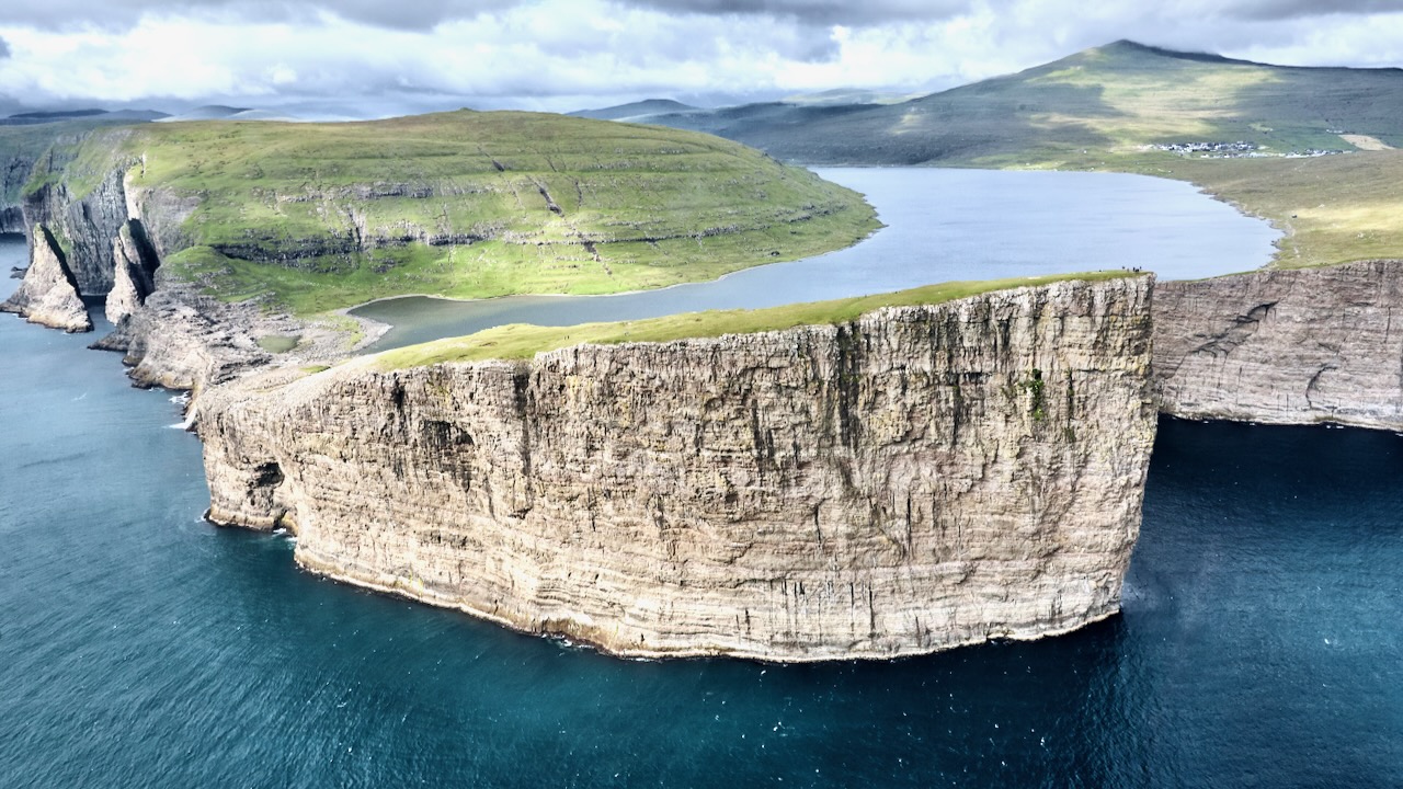
There are many, many birds nesting on those vertical sides.
Click PLAY or watch it on YouTube.
In 2024 the hiking fee was 450 kr (USD $42) / adult (ages 15+) for a guided walk. 200 kr (USD $20) / adult (ages 15+) to hike on your own, as I did.
Price is $teep. And has been going up in recent years. Know that there are other great cliff walks free in the Faroe Islands. 😀
official website – tralanipan.fo

related – Moon and Honey – Lake Sørvágsvatn (Floating Lake above the Ocean) and the Trælanípa Hike, Faroe Islands

Moon and Honey – entrance
Now that Nepal required you hire a guide for almost all high altitude treks, Peru might offer the easiest logistics for similar independent adventures.
Of many great options in Peru, we like the Ausangate Circuit best. You can side trip to the Rainbow mountain, if you like. And nearby Red Valley. AND Red Lake.
Megs from Wisconsin has traveled over 70 nations. Here’s how she trekked Ausangate independently.
The most popular time to hike Ausangate is between the months of April to October. Peru has two main seasons, dry and rainy. In general, dry season is from May to October, while rainy season is from November until April. …
The altitude of the Ausangate trek is insane. Remember, this trek never drops below 14,000 feet!
Many of the passes are grueling and top out at over 16,000 feet. The mountains are Apus, or Gods, to the Indigenous, so go in with the mindset of respecting them. By the way, the mighty mountain of Ausangate is a staggering 20,945 feet (6,384 m).
Acclimation is key …
How To Hike the Epic Ausangate Trek Without A Guide | 6 Days

Aug. 26, 2024
The National Park Foundation (NPF) today announced a historic $100 million grant from Lilly Endowment Inc.
This transformative grant — the largest ever received by NPF and the largest grant benefitting national parks — celebrates a pivotal moment in safeguarding the future of America’s treasured national parks. …
Lilly Endowment’s grant will serve as a catalyst to scale and accelerate NPF’s impact. Working together with the National Park Service and park partners, NPF will allocate the funds to four key priority areas:
To learn more about the National Park Foundation’s mission and donate today, visit nationalparks.org.
Click PLAY or watch it on YouTube.
Lilly Endowment Inc., headquartered in Indianapolis, Indiana, is one of the world’s largest private philanthropic foundations.
… historically focused on three primary grant areas: community development, education, and Christianity. …
It has given to some politically and religiously conservative causes, especially in the 1960s.
The best way to travel the 500km of roads over 17 islands is by personal vehicle. This gives you the flexibility to go when the weather forecast looks … better. 😀
Otherwise you are limited by the infrequent public buses and ferries. AND ferries often don’t run when it’s too windy.
On the other hand, with a motor vehicle, you pay a fee for every undersea tunnel you drive through, and any ferry you need to take. It adds up quickly.
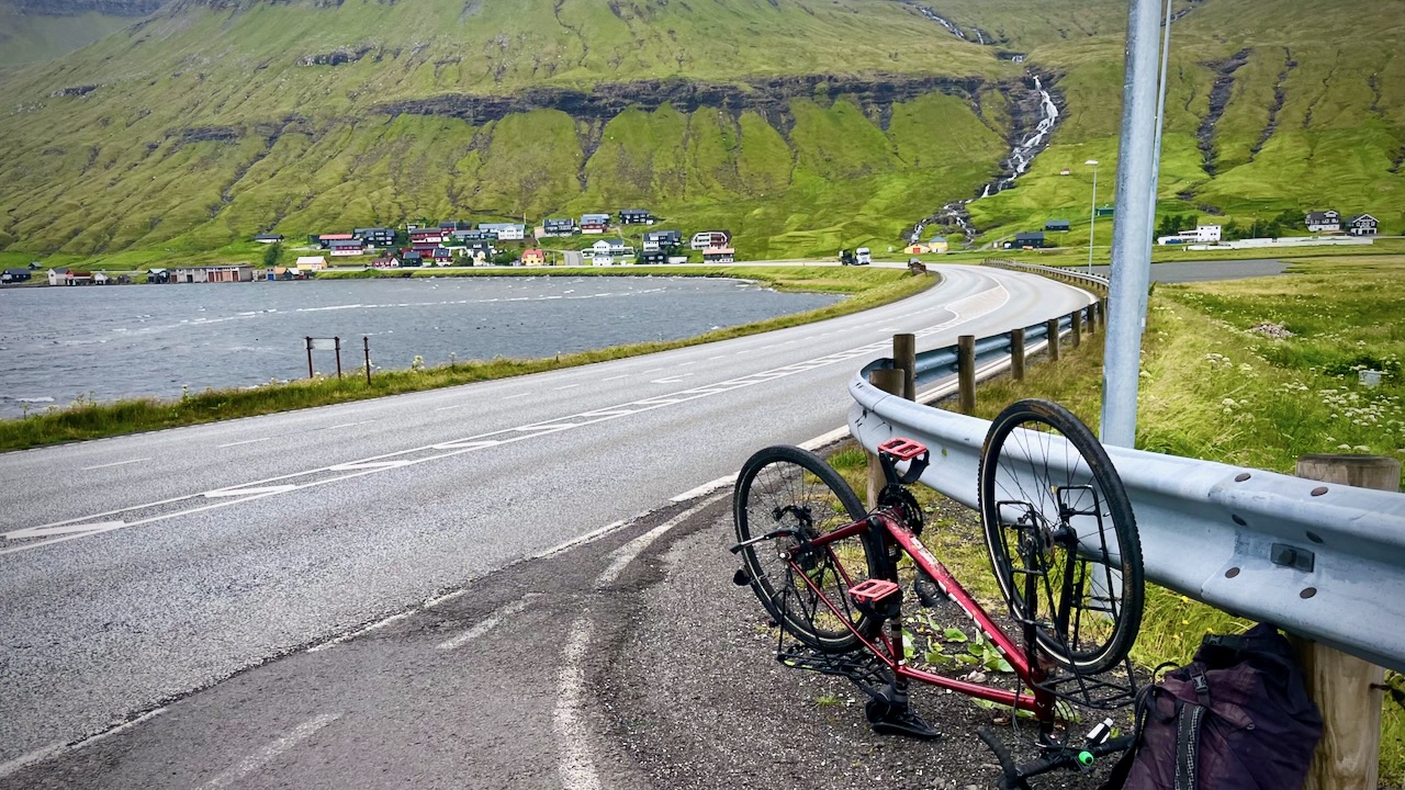
I went with gravel bike — but was too cowardly to cycle through most of the many narrow tunnels. It is allowed, however. Locals told me they don’t mind bikes in tunnels.
I did cycle 2 of them.
It’s easy to put your bike under the bus — and I did it every day.
BUT the buses run infrequently, especially on weekends and holidays. There are very few locals on them, only a few cheapskate tourists.
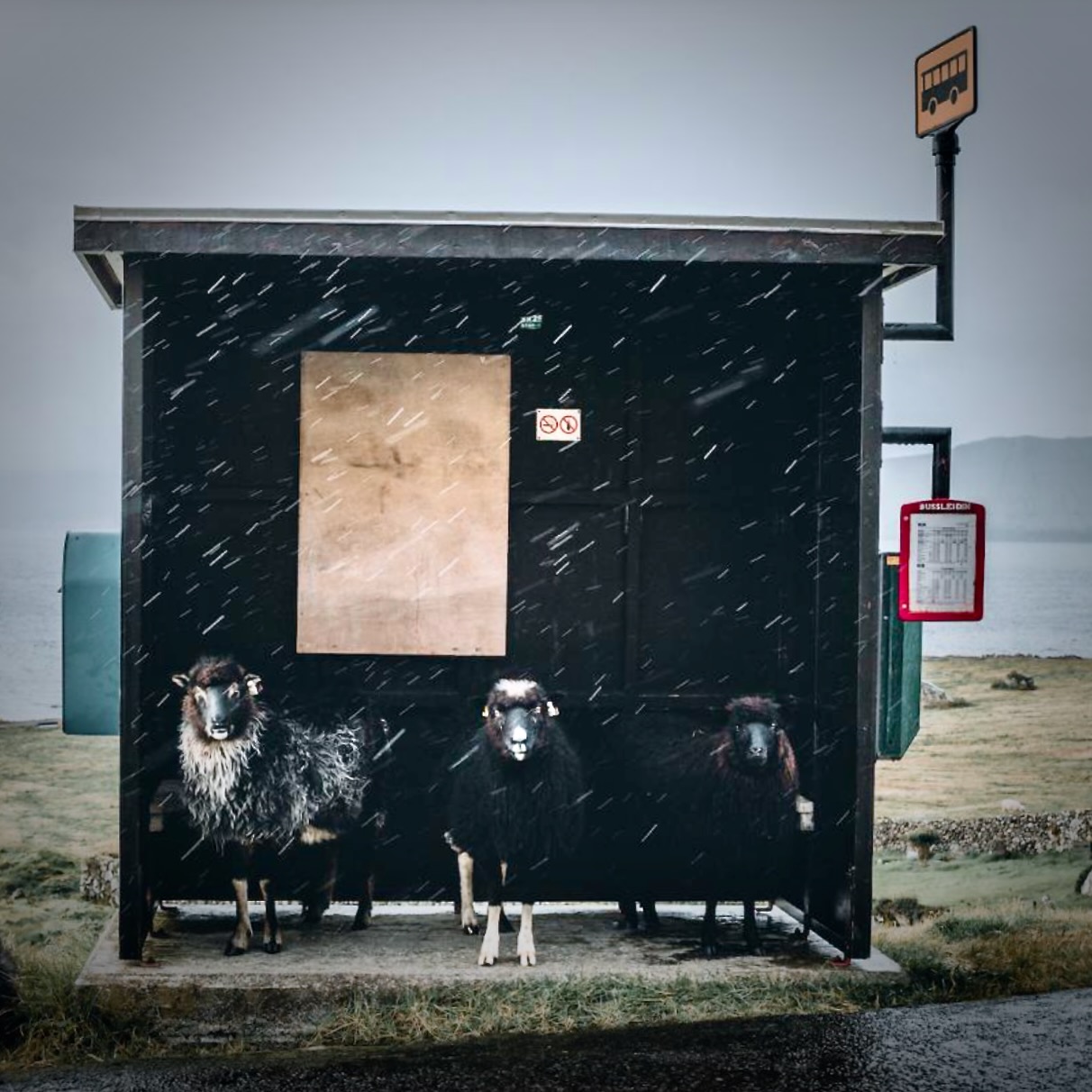
If you like coastal scenery, there is no place on the Faroe Islands more than 5km from the seas.
I had a bike shop in the capital do a tune-up and replaced the chain. Bike ran great — until the new chain broke. It was Sunday and there was no bus service. I had to hitchhike with my disabled transport.
Note: A number of the most famous hikes on the Faroe Islands cross privately owned land and have expensive fees. Similar attractions in Norway and Iceland are free.
There are campgrounds, but I’d recommend booking a roof over your head. I had an inexpensive room in a Vestmanna guesthouse, happy to be warm and dry my clothing every night.
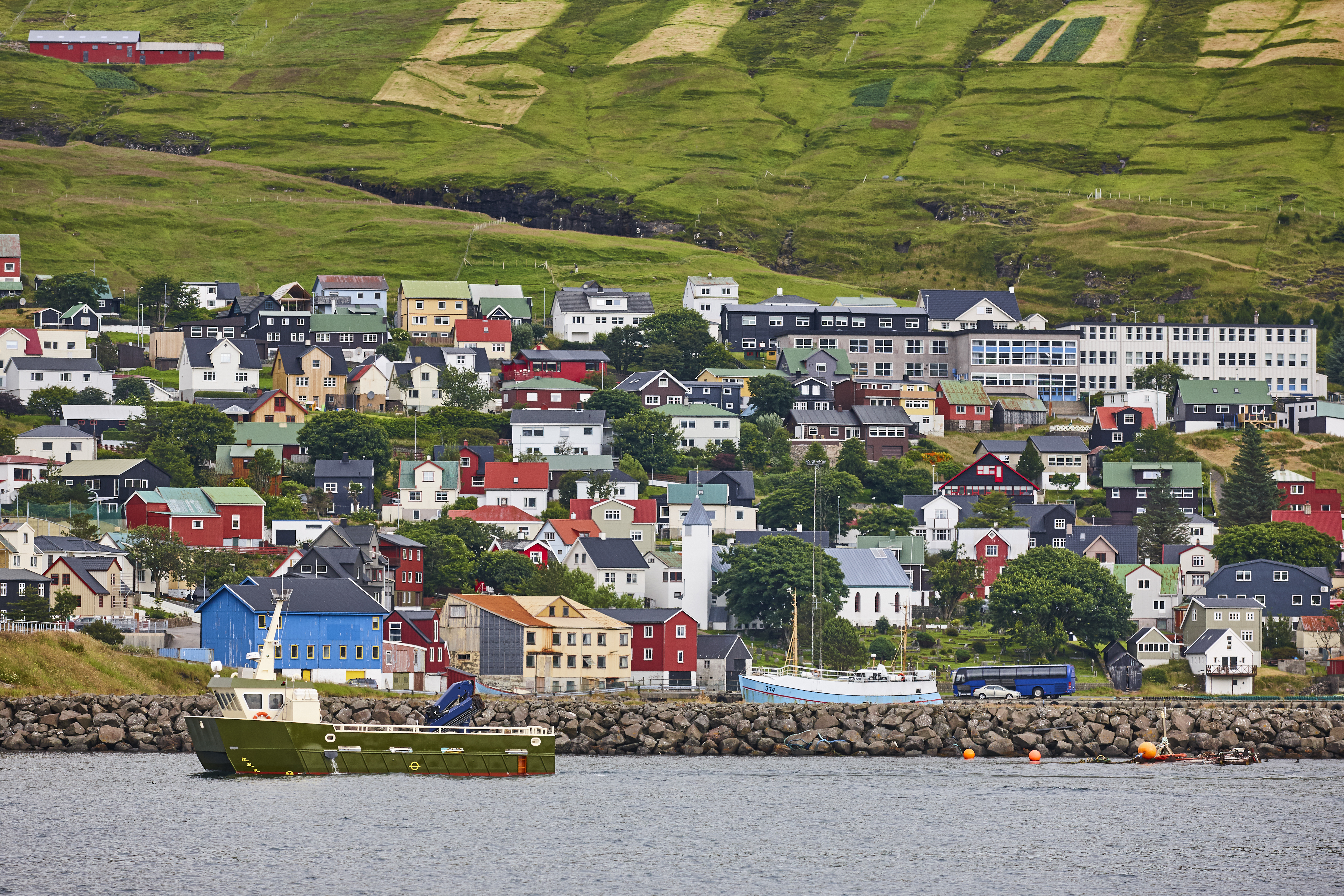
The Faroe Islands are great. But logistics are challenging. Book as many days as possible.
The easiest way to hike is with your own motor vehicle. Either rent — or take the only ferry to the Faroe Islands.
Click PLAY or watch it on YouTube.
related – 15 things to know before visiting the Faroe Islands
Trip report by BestHike editor Rick McCharles
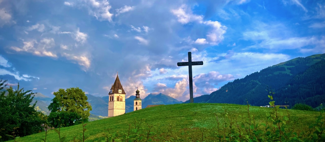
You’ve head of Hahnenkamm above Kitzbühel as it hosts one of the top downhill ski races every January.
The Hahnenkammrennen is the classic downhill course, the Streif (streak, or stripe), which many regard as the most demanding on the World Cup circuit.
One section has a slope of 85 degrees!
Like many hikes in the Alp, you can catch a cable car in the summer. Hike near the top of the mountain, and either ride down — or WALK down, as I did.
Click PLAY or watch it on YouTube.
I generally followed Hahnenkamm – Seidlalm – Ganslernalm on AllTrails. But diverged a number of times if any other trail heading downhill looked more interesting.
The Seidlalm reservoirs were a highlight, slightly off that route.
With good weather I did find it an easy day. Starting at the top of the mountain (2000m) and finishing in Kitzbühel (762m), it IS a lot of downhill. 😀
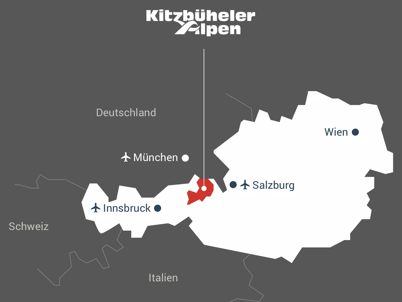
IF headed for Austria, do some research into tourist passes.
For example, many hostels and hotels can give you a FREE tourist card.
Out of Kitzbühel, that means free train and bus travel.
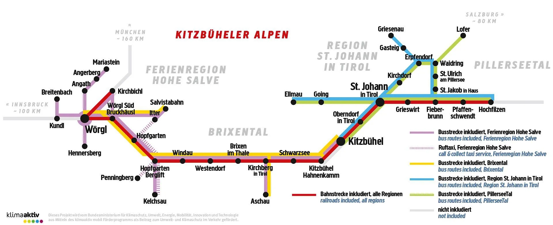
Free transportation over this area.
With that card, next check for deals on lift tickets. Over 3 days. Over 5 days. Etc.
Summer is PACKED.
Therefore it’s recommended to go shoulder season, either Spring or Autumn.
Want to trek the Tour du Mont Blanc but don’t have the money to book accomodations along the way or to pay for a guided tour?
Want to hike the TMB this summer and but everything is already booked?
Last summer I hiked the TMB on a last minute whim, with no planning, and no budget. And I still had the time of my life on this bucket-lis hike. So I’ve distilled what I learned into this video to help you make it happen tomorrow.
Click PLAY or watch it on YouTube.
One of the BEST reasons for signing on with a Guiding Company is how they take care of your toilet needs.
When toilets are available, they plan stops. When tenting away from civilization, they provide excellent and sheltered toilets.
Click PLAY or watch it on YouTube.
