hike Lake O’Hara in the Canadian Rockies

I was born in Calgary, Alberta. Banff and the Canadian Rockies are my back yard.

When people ask me to name the most beautiful location of all, I tell them Lake O’Hara.

Lake OHara

Getting a reservation to camp in Lake O’Hara is difficult. The few tent sites very much in demand.

Lake O’Hara Reservations must be made starting 8am Mountain Standard Time 3 months (not 90 days) before you want to camp.

250-343-6433

If you wanted to Camp Aug 10,11,12 you’d telephone May 10th at 8am. For example.

When you call, please have the following information ready:

Day or dates requested: maximum of 3 nights for camping

Number of people: maximum of 6 people per party for day use

Number of campsites: maximum of 2 sites per party and 1 tent per site

Preferred in-going bus time: reservations are not required for an outgoing bus

Mastercard, Visa, or American Express number: all fees are collected at the time of booking

details

The much more expensive Lake O’Hara Lodge and cabins are an alternative.

Elizabeth Parker Hut is another alternative. Available only by lottery, a year in advance of your stay.

Dientes Circuit, Chile

The Dientes Circuit in Chile is of the best hikes in the world.

It’s also called:

Isla Navarino Circuit
• Circuito Dientes de Navarino
• the teeth of Navarino

Dientes

Leo Turpan via email:

Just got finished with the Dientes trek yesterday. Pretty amazing stuff out there.

Got a bunch of snow, but it made for a beautiful christmas and even more beautiful landscape. …

Getting to Puerto Williams:

Option 1- Boat from Ushuaia (doesn´t leave everyday, need to check departures at Ushuaia dock) $750 Argentinian Pesos, about $115

Option 2- Ferry from Punta Arenas (leaves only once or twice a week, Tranbordadora Austrual Broom, takes 30 hours but is highly recommended) $90,000 Chilean Pesos, $170 US

Option 3- Flight from Punta Arenas (one flight everyday, I think.) $60,000 Chilean, $115 US

Town/Trek Info:

-There is one map of the trek, not professional, but does have contour lines and GPS markers. The map can be purchased from a small camping store near the center of town. The store also stocks some types of gas, knives, tents, sleeping bags, etc. You can also rent a GPS there that has the circuit route already uploaded

-There are two supermarkets in the center of town that stock all the basic food necessities

-Multiple hostels in town, all priced at 10,000 Pesos or more. All have info about trek

-Register for hike at the police station, no rangers or servicemen on this trek

Trek/Logistics:

-31 Km route, 4 days 3 nights recommended, some do it in 5 days but pace is slow

-clockwise direction starting from Puerto Williams; do NOT reverse the route, you will not have a good time.

-A decent amount of trailfinding will need to be done, do not underestimate the mileage, miles are long due to weather, trailfinding, and trail conditions

-The route can be extremely muddy and wet, gaiters and gortex are a good idea

-Can camp virtually anywhere

-Tons of water

-can extend the trek with a connection to the Lago Windhond trek

-2 hour walk back to Puerto Williams on the road once you reach the end of the trail, but Chile is known as an easy place to hitchhike

map


Check out Dientes information page.

Nepal’s Great Himalaya trail in 152 days

If I could do ANY thru hike in the world, it would be this one.

GreatHimalayanTrail-Map-600

… one continuous trek. The 152 day trek commences in the far east in the Kanchenjunga region where the world’s third highest peak stretches skyward, and traverses the country to the high plateaus on the Tibetan borderlands in the far west.

Along this 1700km trail you’ll encounter some of the wildest and most remote mountain environments imaginable. You’ll see all of Nepal’s 8000 metre peaks, cross tens of passes ranging from moderate to extreme and witness villages where the culture has remained intact for centuries.

It’s a trek that should only be considered by those with extensive trekking and mountaineering experience, a high level of fitness and a flexible approach as there will be the need to adapt to a range of situations throughout the trek. …

World Expeditions

Cost is about $35,000 / person, I’ve heard.

UPDATE:

Another agency — Adventure Geo Treks Deutschland — is offering the adventure over 167 days for about 16,000 euro or $23,000. Danke Dieter.

Kuari Pass trek – day 0

by site editor Rick McCharles

day 0 | day 1 | day 2 | day 3 | day 4 | day 5 | day 6

The trek over the Kuari (“doorway“) Pass in the Indian Himalaya was the route followed by Shipton and Tilman and other early mountaineers en route to the peaks on the Indo-Tibetan border.

It is also called the Curzon Trail as the famous former Viceroy of India traveled this route in 1905. (Some say Curzon abandoned that adventure after being attacked by wild bees.)

Frank Smythe:

We breasted the slope and halted, silent on the path. No words would express our delight. The Himalayas were arrayed before us in a stupendous arc“. (1931)

The tag line for Kuari is “best mountain vista in the Himalayas“.

Kuari panorama

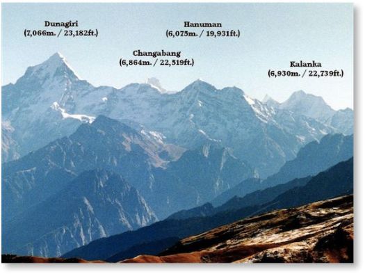
Click over to kuaripass.co.uk to see the entire panorama, the best I’ve seen online. 7000m peaks are lined up like soldiers for your inspection.

Kuari, as well, is one of the best two treks for those, like me, who want to see famed, mysterious Nandi Devi. Not quite visible from the Pass.

Nanda Devi

This is Arnaldur Indridason from Norway.

Kuari day 5

Call him Alf.

Alf and I both signed on separately for the Kuari Trek with Red Chilli Adventure out of Rishikesh. (trip details PDF)

Red Chilli’s Vipin Sharma returned our emails. Gave us clear answers and specific prices. That’s a very professional company.

Cost $600 each for 2 hikers. (Price drops up to a maximum of 10 hikers.)

• 82km over 6 days of hiking
• 8 days all inclusive (Oct 18-25, 2013)
• 34,000 rupees + 3.1% because I paid with credit card
• tips to 2 drivers, 2 mule drivers, cook and guide

Animal trackers, gun bearers and skinners are extra. 😦

Note: Lonely Planet recommends this hike in the opposite direction. LP got that WRONG. There’s not one single reason to start in Joshimath. Especially if you are not acclimatized to altitude.

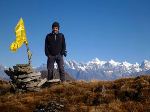
We wisely started at Ghat 1330m, slowly and steadily working our way up to over 3500m.

Alf and I did not meet until the morning of departure. Always a gamble, it turned out that Alf and I had many common interests. We were both travellers. Both hikers. We’d both done Milford Track in New Zealand and Huayhuash in Peru, for example.

Red Chili provided an excellent vehicle and a safe driver for the 8hr trip up into the Himalayan foothills.

P1230622

I stayed awake for almost all of that. There are many interesting sites en route.

P1230606

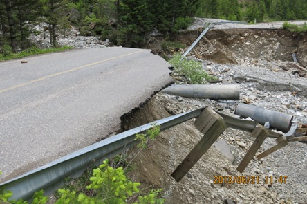
Well past monsoon, the roads were in good repair. We had no delay longer than a few minutes.

P1230612

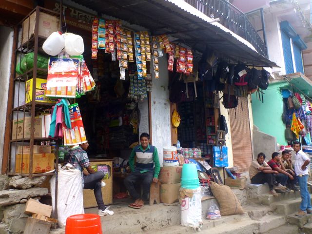
It’s rare to find a valley in the Indian Himalayas without people. During the trip we bought last minute provisions at roadside villages.

P1230616

P1230615

It began to rain as we arrived at our trailhead campsite.

P1230624

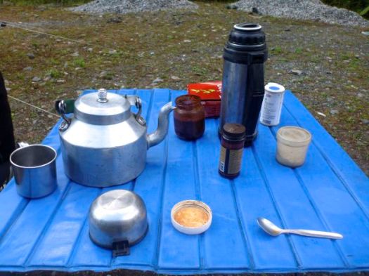
First order of business in all things India is … Chai.

P1230625

This fellow needed to climb to turn on the Village electricity for the evening.

P1230623

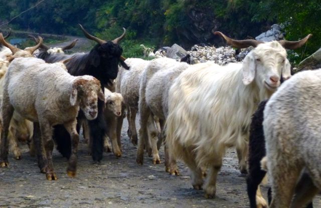
Road repair and animal grazing. Those seem to be the two main industries in roadside Himalayan villages.

P1230636

P1230644

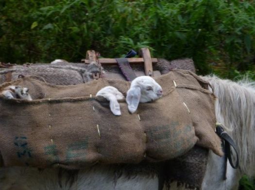
The youngest babies rode along on mules.

P1230633

So far, so good … 🙂

See all high resolution photos from this day.

day 0 | day 1 | day 2 | day 3 | day 4 | day 5 | day 6

TrekkingPartners.com

Founded in October of 2010 in Kathmandu, TrekkingPartners helps people find like-minded partners for their outdoor activities.

People can post a trip for others to join or join someone else’s, whether it be hiking in the mountains or biking across the country.

TrekkingPartners helps people share costs, promotes safety, and find a companion to share the adventure with.

Trips are listed from all over the world. But Himalayan adventures are front and centre.

They have about 2000 members.

I’m #2001, having just joined. 🙂

Trekking Partners

Check out TrekkingPartners.com.

donating to Washington State National Parks

Money is tight.

Downsides of budget cuts at Olympic National Park were obvious to me when I was there.

State residents have this option. A vanity mountain license plate.

NationalParkPlate

… The sale of each plate results in a $28 contribution to support Mount Rainier, North Cascades, and Olympic National Parks. Last year, more than $120,000 was donated to the parks …

details

Of course you can make a straight donation to the Washington’s National Park Fund, if you prefer.

Long term we need to move management and funding of Parks from government to users.

Friends of Olympic National Park needs to do more as the taxpayers cut funding.

Waterton – Akamina Parkway Repair

On June 19, 2013, Waterton Lakes National Park received over 200 mm of rain in less than 24 hours, twice the amount which normally triggers a flood watch.

Most facilities that were damaged by the June 19 storm were quickly repaired and re-opened. This includes all campgrounds, most trails and bridges, the Red Rock Parkway and the sewage lagoons.

The Akamina Parkway sustained the heaviest damage … and repairs began July 1. …

The Akamina Parkway remains closed during reconstruction. …

read more – Akamina Parkway Repair Updates

We were there this past week. Akamina Parkway is still closed.

That means road access to about ⅓ of the most popular hikes in Waterton have been inaccessible this season.

That means I was once again not able to complete the Fantastic Four hiking challenge, a sponsor of this site. 😦

Akamina Parkway repairs have actually been going well. Everything will be open again for 2014.

Parks Canada operates three vehicle-accessible campgrounds in Waterton:

• Townsite Campground
• Crandell Mountain Campground
• Belly River Campground

Right now — due to BEAR activity — you can only tent at Townsite.

We wanted to tent so opted instead for Crooked Creek Campground outside the Park, privately-operated, less expensive.

Why Nepal is the world’s best destination for solo trekking

That’s the sub-title of an August 2012 post by Mark Horrell:

Mark

So the government of Nepal has u-turned on a decision made earlier this year to ban solo trekking in the country. It’s a victory for common sense. Nepal is currently the best place in the world for solo trekking, and to ban it would have been a bit like the Jamaican Olympic team forgetting to register their athletes for the 100 metres. …

The ban was supposedly intended for security reasons after the decapitated remains of a female Belgian trekker were found in the Langtang region in June. This followed a number of other incidents involving solo trekkers in the area.

But leaving aside arguments that a solo trekking ban punishes the victims rather than targets the criminals, not everyone thinks security was the only consideration behind the decision. TAAN represents trekking agencies who provide porters, guides and logistics to trekkers. The biggest cash cow for agencies are organised trekking groups with many clients, and some independent travel bloggers have suggested the government may have been under pressure from organisations such as TAAN to implement a solo trekking ban in the misguided belief that it would encourage solo trekkers to hire guides or sign up for group treks instead.

A ban on solo trekking would certainly have been bad for Nepal’s tourism industry

Why Nepal is the world’s best destination for solo trekking

I hiked Everest independently in 2009. No problem.

But there’s some Nepali confusion in 2013 as to exactly where one can trek independently. And where you can trek solo.

If I get to Nepal in November I’ll check current regulations in Kathmandu. Most likely end up starting independently and solo in Langtang & Helambu.

Choquequirao to Machu Picchu guided

The best way to get to Machu Picchu is via CHOQUEQUIRAO.

choquequirao-cover

If you want to be guided, here’s one recommended option.

Choquequirao trek to Machu Picchu Trek Private Service, 8 Days/7 Nights Program

Prices are per person : 2 people US$840, 3 people US$790, 4-5 people US$740, 6-8 people US$620, 9-11 people US$590, 12-16 people US$550.

details on Mythical Trails Peru

You can do that independently, of course.

And NOT CHEAT by taking the bus up from Aguas Calientes. Instead you climb in the dark, be waiting for the Gates to open. Then rush up to take photos before the hordes arrive.

Insect repellant essential at some times of the year.