Trip report by BestHike editor Rick McCharles
I flew to Tromsø — well above the Arctic Circle — to begin a long bikepacking tour of the west coast.
In good weather there are MANY great hikes out of Tromsø — but the best close to town looked to be Brosmetinden.
I was inspired by the post by local hiker Maria Wulff Hauglann:
7 Easy Hikes With Spectacular Views In Tromso, Norway
I followed Maria’s recommendations, using AllTrails for navigation.
The 1-hour drive (from downtown Tromso) out to where the Brosmetind walking path starts is fantastic too.
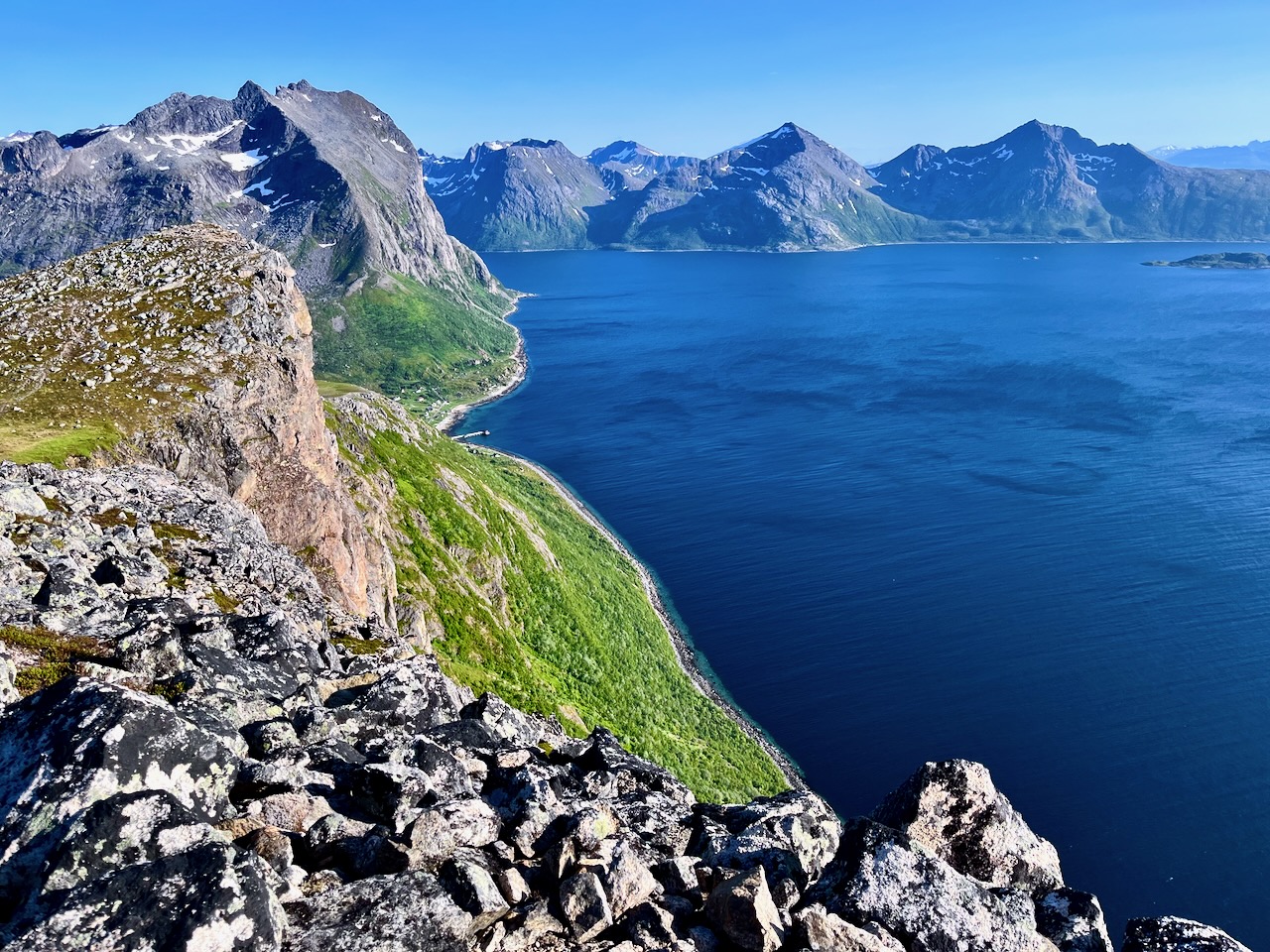
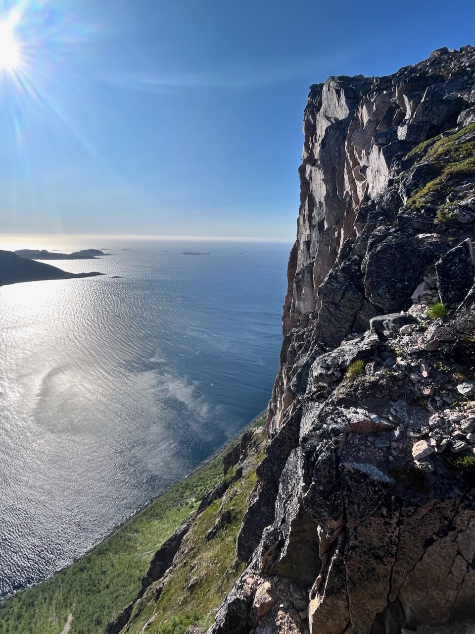
… valleys with tall peaky mountains that go straight into the sea.
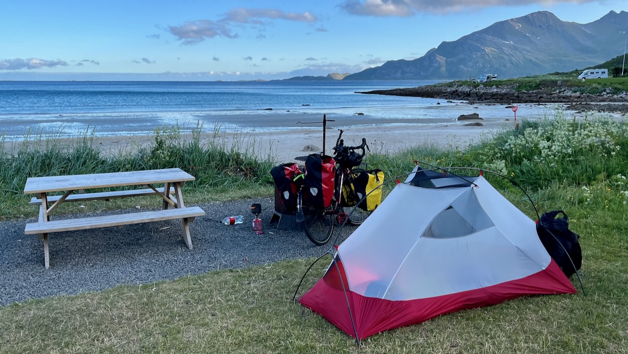
One of these fjords is Grotfjord. You should make a stop in Grotfjord and walk along the huge white-sandy beach.
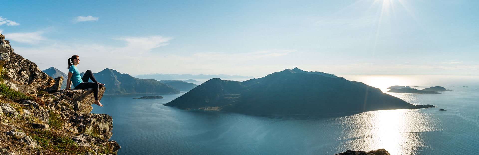
You will have an awesome panoramic view from the start to finish. So if you don’t have to go all the way to the top to get a great view. You can turn around whenever you want …
- Height: 525 meters above sea level
- Distance to walk: 4 km both ways
- Time: 1-2 hours (round-trip)
How to get there by bus: Take the district bus no. 425 to Tromvik or Rekvik, and walk from there to the starting point of the hiking path to Brosmetinden. Tell the driver that you want to hike Brosmetinden and he will let you off at the right place.
You can purchase tickets on board the bus, but cash payments only, or you can buy a ticket through the app “Troms Billett”. You can check the bus schedule HERE (search the Travel Planner from “Tromsø Prostneset” to “Rekvikvegen (Tromsø)” or through the app “Troms Reise”.
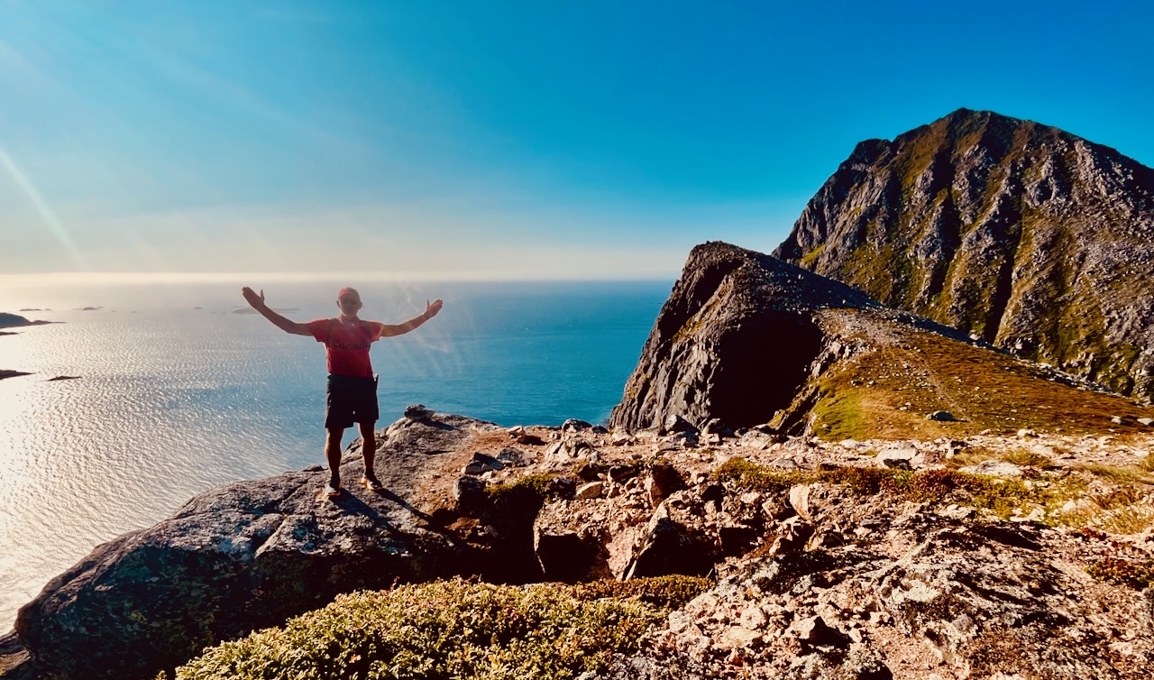
I hiked on Canada Day – July 1st. Wore my CANADA clothing. 🇨🇦
Weather was sunny — but super windy. Too windy to fly the drone. But it was nice to have enough wind to blow away the mosquitoes and horseflies.
It’s a quick hike to reach the sea cliffs. And a scenic scramble up to the top.
I camped at Grotfjord beach, on Maria’s recommendation.
An excellent short day hike — but quite a detour off the usual tourist route.
I cycled an extra 64km to get there.