Walking Norway: Skjeggedal to Trolltunga

The Michelin company created a ‘content hub’ called Sole Power, which regularly creates and shares inspiring and helpful content for sports people into their hiking, trail running, snowboarding etc.

Amy Chetwynd sent a link to their interactive map of 10 superb European hikes.

On my request Michelin Lifestyle put together a more detailed guest post on one of those ten. It includes some links they wish to promote. All good.

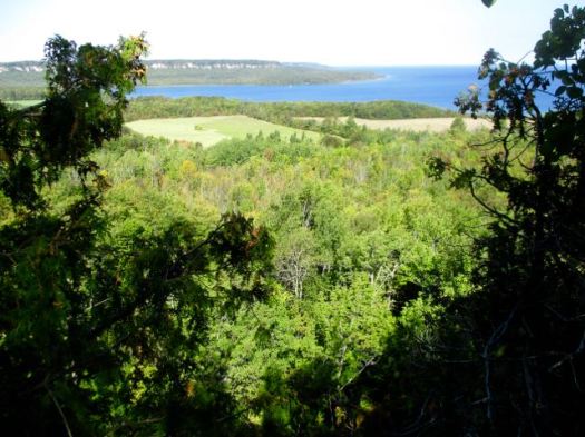
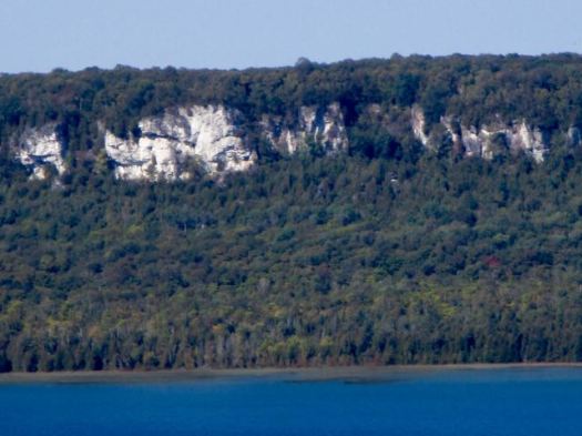
Snaking from the North Sea to the northernmost point of Scandinavia, Norway has always been known for its diverse landscapes and epic wilderness. One of the most geographically unique countries in the world, it’s home to icy blue fjords, expansive alpine tundra and palatial mountain networks.

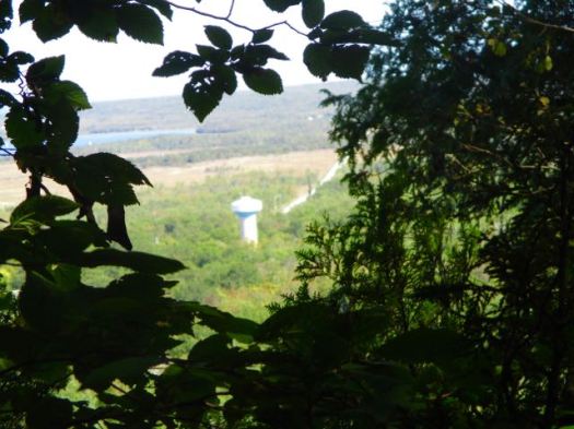
For hikers it’s a take your pick and run with it kind of situation. There’s so much out there to explore. From Vest-Agder to the farthest reaches of Trom, trails and adventure appear wherever you look, and no two hikes are ever the same.

However, if we’re talking about one particular Norwegian pilgrimage that’s caught fire over the last decade (not literally), it’s Skjeggedal to Trolltunga.

EXPLORE 10 EPIC EUROPEAN HIKING ADVENTURES HERE [INTERACTIVE MAP]

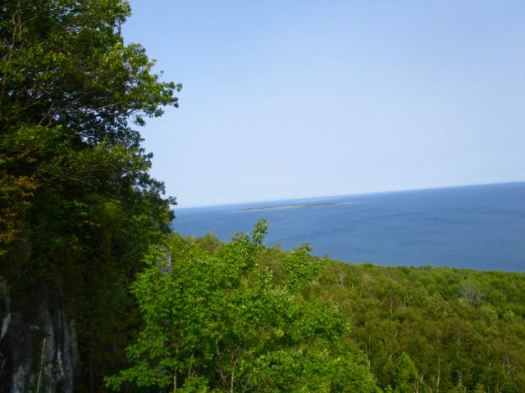
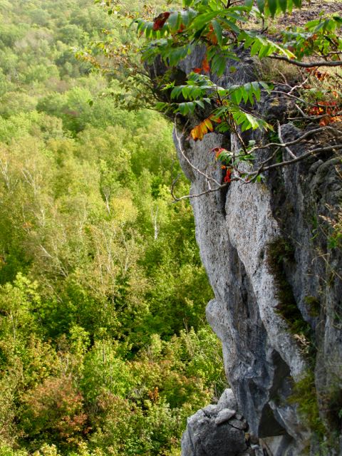
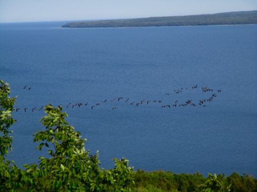
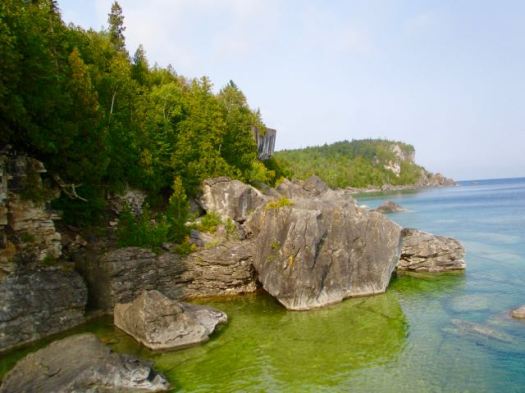
Situated 25km northeast of Odda, in the county of Hordaland, is the famous protruding cliff edge, Trolltunga (Troll Tongue). Knowledge of this natural landmark has grown tenfold thanks to the globetrotting Instagram generation. Once a little-known locals’ secret, now a bucket-list destination, Trolltunga welcomes more than 80,000 people every year (that’s up from just 800 in 2010, by the way).

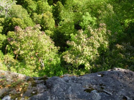
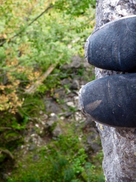
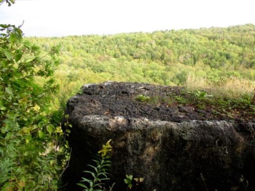
Eye-watering backdrops and a daredevil shuffle out onto the cliff edge, which juts out from bedrock at altitudes of over 1000m, are the pull of this place for most tourists. But for dogged hikers the journey is just as important.

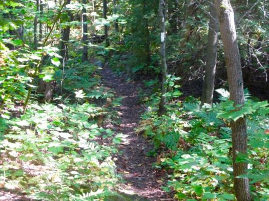
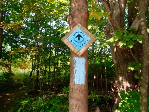
The 10-12 hour hike takes you from an unassuming parking lot in the tiny village of Skjeggedal, up stone steps, out into the vastness of the Norwegian high mountains, through winding paths, and all the way to the northern side of lake Ringedalsvatnet.

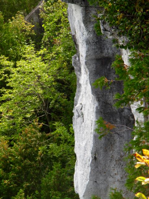
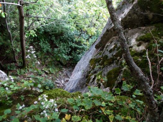
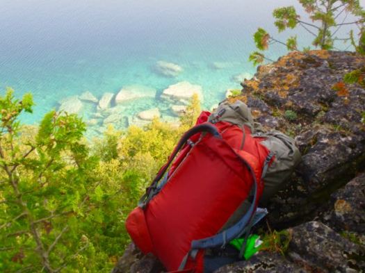
It’s a tough trek that demands plenty of prep and caution from even the most the hardiest of hikers. This isn’t a countryside stroll, expect technical ascents and challenging scrambles throughout. Proper hiking gear is definitely a must.

It shouldn’t be a solo adventure either. For those with less experience, we recommend you enlist the help of a guide to get you there, although this isn’t essential in the summer months.

Be sure to visit at the right time of year, or risk serious disappointment.

When winter rolls around, this hike becomes perilous. High winds, ice sheets and heavy snowfall transform the route into a real no-go danger zone. Due to seasonal changes, it’s pretty much completely off limits between October and March, so plan your journey with this in mind. Mid-March to June is prime time.

Get it right and you’ll find out what it’s like to walk in the skies.

Skjeggedal to Trolltunga has it all, stunning panoramic views, mixed challenges and the freshest air that’ll ever hit the back of your lungs.

Looking for accommodation? There are a few AirBnB properties in the area. You can also book into a hotel in Odda, although rooms are in high demand in peak season, so get your name down early.

Key information:

Terrain type: Mountain

Highest altitude: 1,100m

Time to complete: 10-12hrs

Total distance: 27.5km

Average temperature:

  • Summer: 12°c
  • Winter: -5

Difficulty: Advanced

Want to explore more European destinations like this one? Click here to jump into Sole Power’s interactive hiking map and take the tour. It’s one hell of a journey!

Three Capes Track, Tasmania

46km, 4 days

Maximum 48 hikers starting each day.

When the Three Capes Track opened two days before Christmas 2015, it immediately set a new benchmark for Australian bushwalks, creating a hike that’s both heady and hedonistic, combining the raw beauty of the southern hemisphere’s highest sea cliffs with comforts and interpretation unsurpassed by any other trail in the country.

… its finest moments come when the track teeters along the cliff edge on its approach to Cape Pillar and the Blade. As the Roaring 40s winds inevitably howl in from the Southern Ocean, there’s a humbling sense of being poised at the edge of the world. …

How to walk Tasmania’s Three Capes Track

3CT Map

Before you get too excited know that this is a private hike – cost AU$495.

Book here.

The Bruce – Wiarton to Tobermory 2018

by site editor Rick McCharles

I spent a week hiking some of the best sections of the 890 km (550 mi) Bruce Trail in Ontario. I called it research.

Wiarton to Tobermory on the Bruce Peninsula is the best week long section, I reckon. That’s 165.7 km / 8-9 days averaging 16-20 km per day. Additional time is needed for recommended side trips.

I like the cliff top views over farmland and Georgian Bay.

September / early October looks to be the best time as mosquitoes have almost disappeared and accommodation is less booked up.

I’m planning to hike this section September 2018.

details – Wiarton to Tobermory

Best of The Bruce – Jones Bluff

trip report by best hike editor Rick McCharles

Parking at Jones Bluff Side Trail parking offers a 7.1 km loop most of which is on The Bruce.

It skirts the Niagara Escarpment looking down hundreds of feet to farmland.

This hike is a little more overgrown than the others I walked.

A long way down.

For the first time I notices autumn colours arriving. It was September 16th.

This hike is all good. I enjoyed every step. Carried no backpack.

Highly recommended.

See my photos on Flickr.

The Bruce Trail is more than 890 km (550 mi) long and there are over 400 km (250 mi) of associated side trails. I spent a week hiking some of the best sections.

Explore the Bruce – Jones Bluff Loop

related:

• 10 Best Hikes of the Bruce Trail

• Bruce Trail app | Bruce Trail Reference Guide – 29th Ed

• BruceTrail.org

Best of The Bruce – Jackson’s Cove

trip report by site editor Rick McCharles

A nice little day hike. Birders like this area. Hikers come for wild flowers in the Spring.

I’m happiest hiking in the autumn, however. Very few mosquitoes. The harvest done.

I put on the long pants in fear of Poison Ivy.

Leaves of three, let it be …

This was a peaceful and relaxing loop. I did see other hikers out enjoying it on a Saturday in good weather.

Amazing views off the Niagara Escarpment.

Geese are already on the move.

Lovely.

White blazes are The Bruce. Blue are Bruce side trails.

See my photos on Flickr.

The Bruce Trail is more than 890 km (550 mi) long and there are over 400 km (250 mi) of associated side trails. I spent a week hiking some of the best sections.

Explore the Bruce – Jackson’s Cove

related:

• 10 Best Hikes of the Bruce Trail

• Bruce Trail app | Bruce Trail Reference Guide – 29th Ed

• BruceTrail.org

Best of The Bruce – Lion’s Head

trip report by site editor Rick McCharles

I enjoyed my meal and fast wifi at Rachel’s Bakery and 50’s Diner. Too much.

Turned out I stayed too long.

To make it to McKay’s Harbour Overnight Rest Area I’d need to hike fast.

I parked at the Cemetery Road trailhead and dashed into the … apple trees.

The Bruce here is a gorgeous hike along the Niagara Escarpment with views out to Barrow Bay.

The footing is tricky. Especially approaching cliff edge.

It was getting dark far too quickly.

Finally I decided to wild camp rather than risk stumbling on in the dark. This spot was excellent, actually. (The cross pole on my tent broke, however. Design failure for the Hubba NX.)

Next morning — at the turnoff — the name changes to the Cotswold Way – Bruce Friendship Trail.

No rush this morning. I stopped to enjoy the views much more often than the previous evening.

The Lion’s Head is one of these jutting overhangs.

This is a pothole in a glacial erratic.

I took the Ilse Hanel to loop back to my vehicle. There are many options on the Lion’s Head. And it’s so well signed you never need to pull out your map.

Happy to be back at the trailhead after about 15km total. No damage done to the vehicle overnight.

See my photos on Flickr.

The Bruce Trail is more than 890 km (550 mi) long and there are over 400 km (250 mi) of associated side trails. I spent a week hiking some of the best sections.

Explore the Bruce – Lion’s Head

related:

• 10 Best Hikes of the Bruce Trail

• Bruce Trail app | Bruce Trail Reference Guide – 29th Ed

• BruceTrail.org

Best of The Bruce – High Dump

trip report by site editor Rick McCharles

Bruce Peninsula National Park was busy, even in September.

Still Canada 150. All National Parks free in 2017.

Having driven up from Toronto it was 3:30pm before I went to book a backcountry campsite.

Stormhaven was full. I could book High Dump … but it there was a chance I couldn’t hike in by dark. The Ranger recommended I access by Crane Lake trailhead.

Instead I drove to Bartley Lake trailhead, a much more scenic approach.

The trailhead sign said 6.7 km to the campground turnoff. But this is considered the “most challenging hiking along the entire length of the Bruce Trail”.

I was immediately confused by these gold on white signs. They appear to be km markers. But are not.

Though rushed I couldn’t resist side tripping over to the first half dozen or so cliff edge viewpoints.

The Bruce follows the top of the Niagara Escarpment.

Though the waters look tropical, they are freezing.

The first sign of humanity. A woman collecting water from Georgian Bay. I was nearly there.

It was still light by the time I lowered myself (on a comfort rope) down to High Dump camp. (It’s rarely easy to climb or descend these cliffs.)

Though I’d paid for (CAD$21.50) a dark inland site I set up my tent instead close to the beach.

What a gorgeous evening.

Next morning was foggy. But soon cleared.

Here’s a properly cooked bagel.

Backtracking to my rent-a-van I was in no rush. The light was better, too, for enjoying the unique scenery.

All in all, a great adventure.

See my photos on Flickr.

The Bruce Trail is more than 890 km (550 mi) long and there are over 400 km (250 mi) of associated side trails. I spent a week hiking some of the best sections.

related:

• 10 Best Hikes of the Bruce Trail

• Bruce Trail app | Bruce Trail Reference Guide – 29th Ed

• BruceTrail.org

Best of The Bruce – Georgian Bay Trail

trip report by site editor Rick McCharles

To research the best sections of the Bruce Trail I drove to the northern end – Bruce Peninsula National Park (established 1987).

My first visit.

Very popular. Well run. Rangers gave me good information on hiking.

There’s a tall viewing platform just outside the Visitor Centre.

“A sea of forest.”

I come from western Canada. The wild west is the best. The east … is not. More often than not I refer to this Province as On-terrible.

Still, I was excited to finally get on to the most famous hiking trail in the most populous Province.

Pretty much every visitor heads directly to the Cyprus Lake trailhead.

I did one of the standard short loops – Georgian Bay Trail out, Mar Lake Trail back.

It’s pretty. But pretty crowded. I didn’t stop long at any of the recommended stops.

See my photos on Flickr.

The Bruce Trail is more than 890 km (550 mi) long and there are over 400 km (250 mi) of associated side trails. I spent a week hiking some of the best sections.

related:

• 10 Best Hikes of the Bruce Trail

• Bruce Trail app | Bruce Trail Reference Guide – 29th Ed

• BruceTrail.org