Matthew Lettington did the notoriously wet and muddy North Coast Trail in 2014. And loved it.


Read the detailed trip report of his 94 km, 6-day wilderness adventure.

Best hikes, treks, tramps in the world.
Matthew Lettington did the notoriously wet and muddy North Coast Trail in 2014. And loved it.
Read the detailed trip report of his 94 km, 6-day wilderness adventure.
My Feet Hurt:
I hiked the North Coast Trail from August 27 to September 1 in 2014. I spent 5 nights and 6 days on the trail.


The North Coast Trail might be very, very tough.
We recommend easier alternatives to the standard route. There are other similar hikes on Vancouver Island of course, all easier than the NCT.

Click PLAY or watch it on Vimeo.
(via Outside Online)
Adventure queen Jenny Tough and her Dad do our favourite hike.
Click PLAY or watch it on YouTube.
related – WCT information page
Canada – The Wild West
The Nature of Things – Season 53, Episode 16
Click PLAY or watch the documentary on YouTube. (45min)
trip report by site editor Rick McCharles
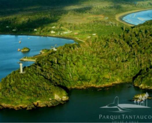
Most hikers bypass the island of Chiloe en route to bigger adventure destinations in Patagonia.
Click PLAY or get a glimpse of my hike on YouTube.
That’s the Chiloé National Park. The southern section near the village of Cucao. Entrance fee $3 in 2018.
It includes zones of dunes, Valdivian temperate rain forests, swamps, and peat bogs. The huge beach was easily my favourite part.
No need to make a trip only to hike. But if you get close, it’s definitely worth a day.
On the same trip hike nearby Tantauco Park.
Learn more about Parque Nacional Chiloe on YouTube.
trip report by site editor Rick McCharles
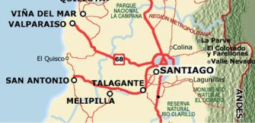
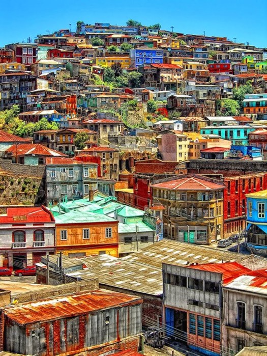
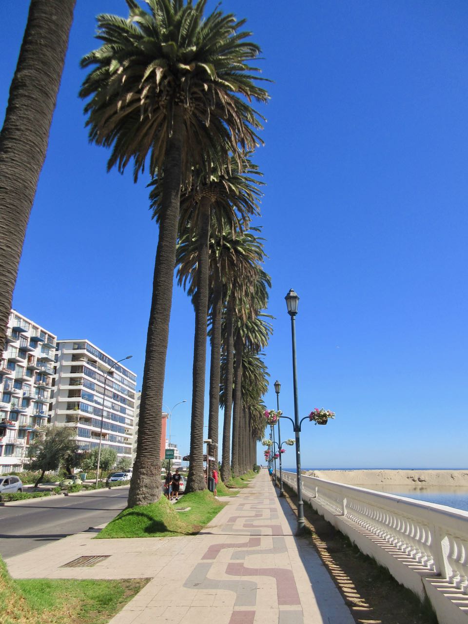
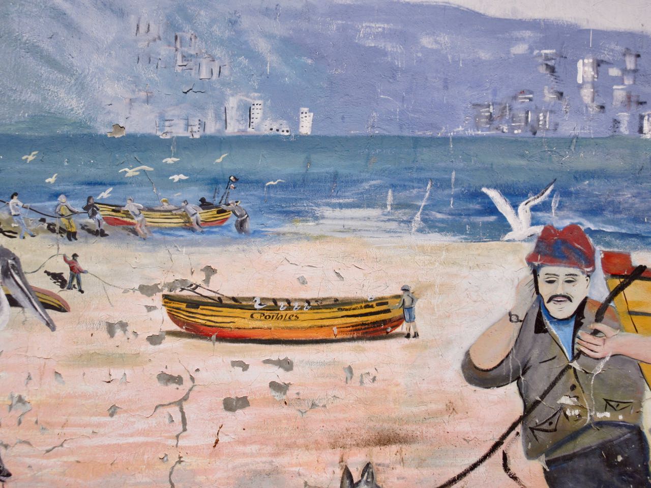
People from the BIG CITY of Santiago love to escape to Valparaíso on the coast.
Valpo is popular with tourists who enjoy the city’s labyrinth of cobbled alleys and colorful buildings.
It has a a mild Mediterranean climate.
In 1996, the World Monuments Fund declared Valparaíso’s unusual system of funicular lifts (steeply inclined carriages) one of the world’s 100 most endangered historical treasures.
Valparaíso is protected as a UNESCO World Heritage Site.
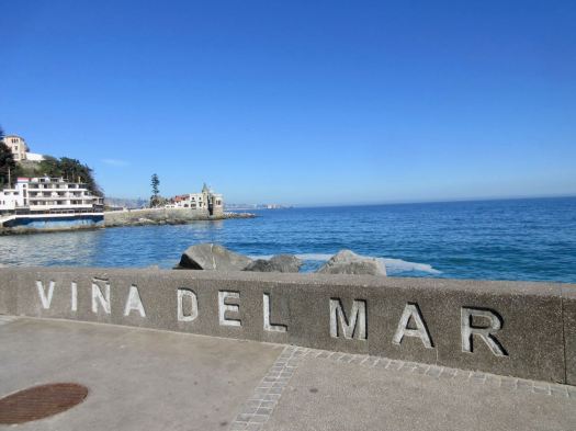
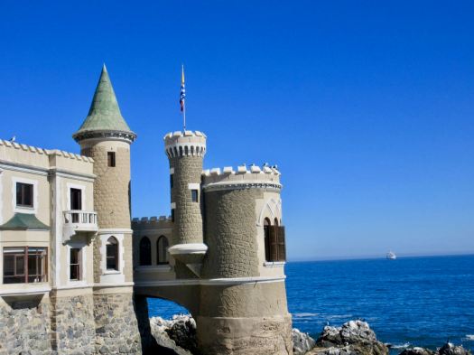
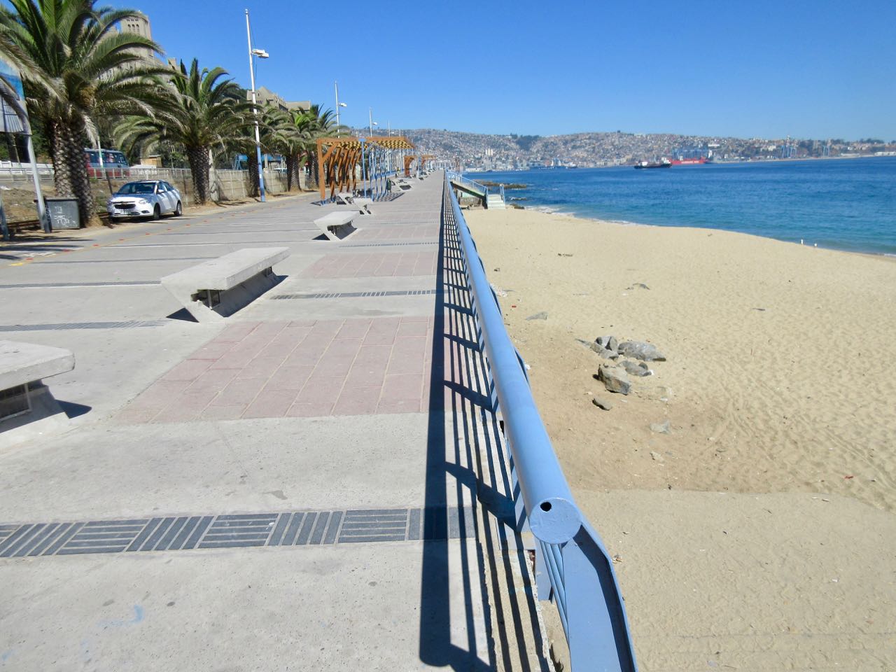
I decided to walk to Valpo along the coast from Viña del Mar, an upscale suburb to the north famed for great beaches.
Having walked the beaches the previous evening, I started near the castle.
There were plenty of runners and cyclists, but not many walkers.
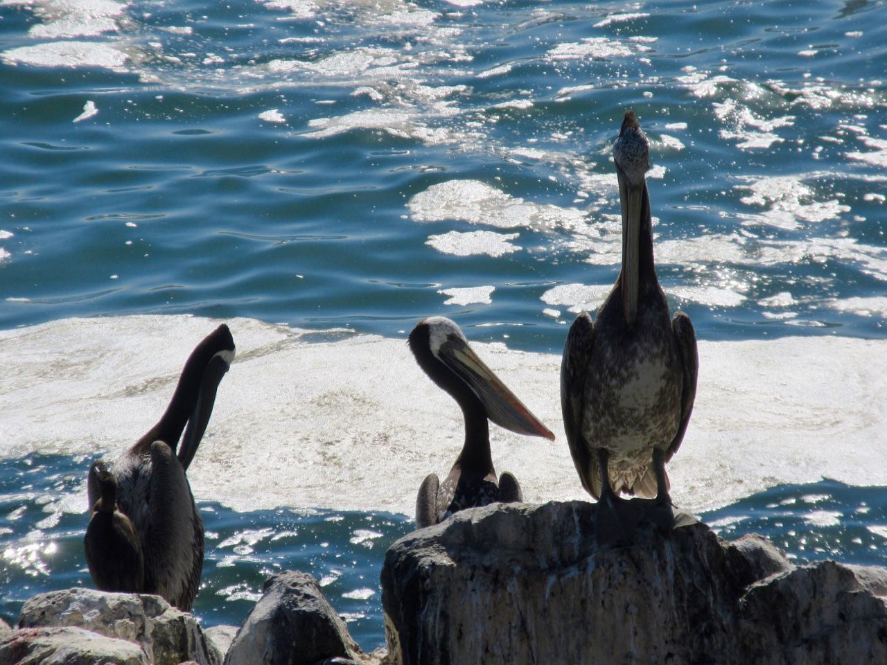
Birds are always a highlight in Chile. Pelicans have always been some of my favourites.
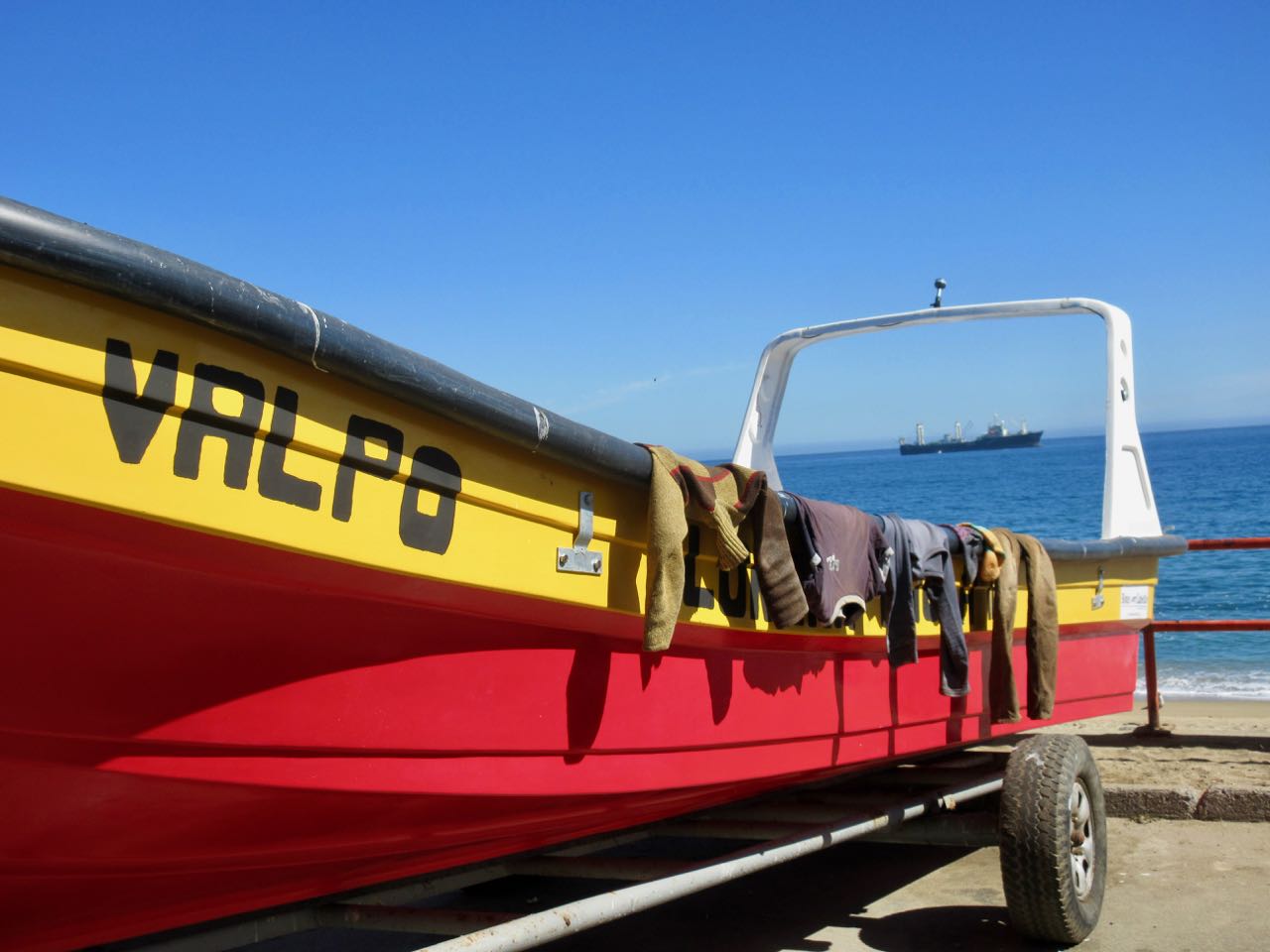
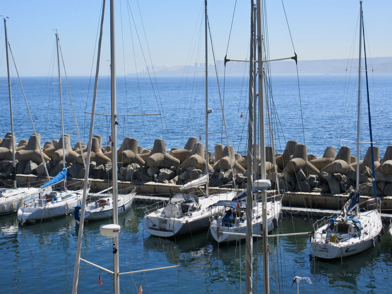
Originally a port and fishing centre, much of the coast has not been improved for pedestrians.
Some has.
Fishermen use mobile phones now.
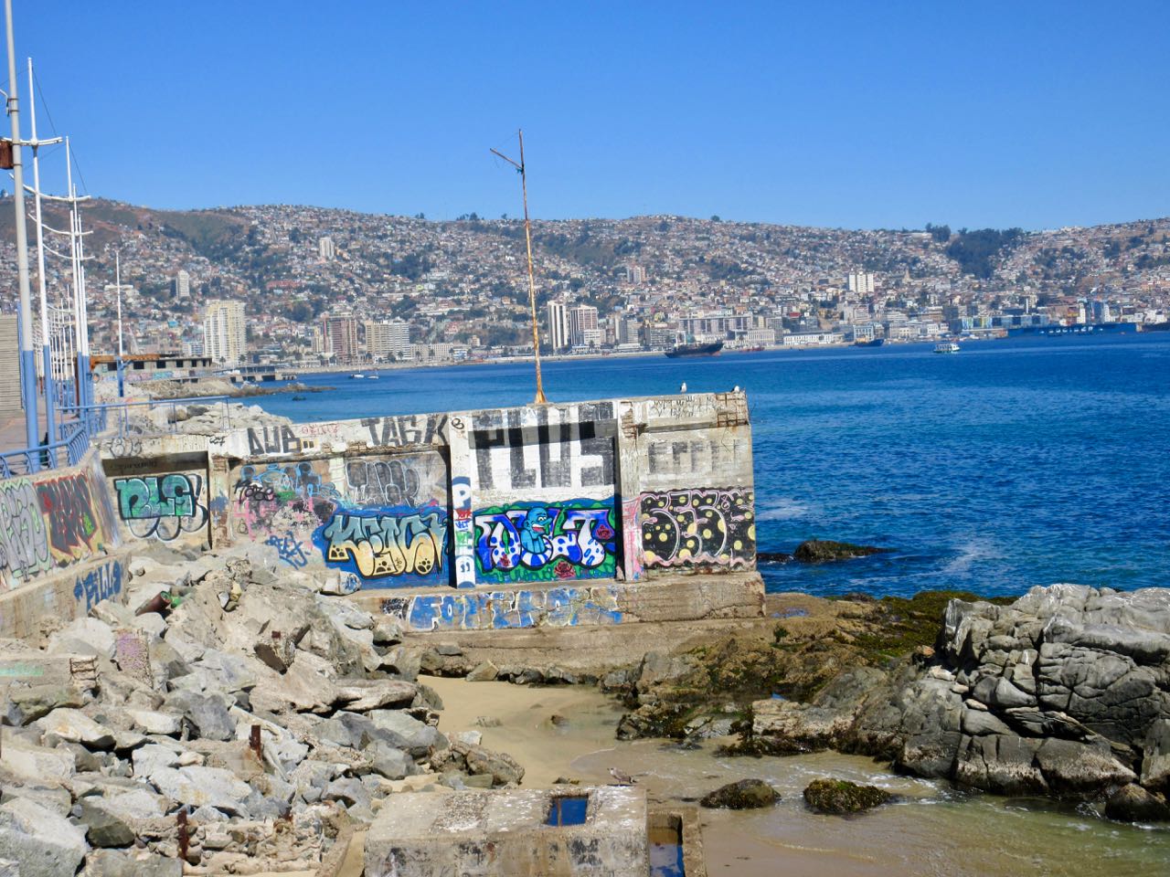
There’s a lot of traffic on the coastal road. At one point you are pushed inland by train tracks.

Parts of this 3 hour walk I did enjoy.
Other sections I found annoying. Graffiti EVERYWHERE was starting to bother me.
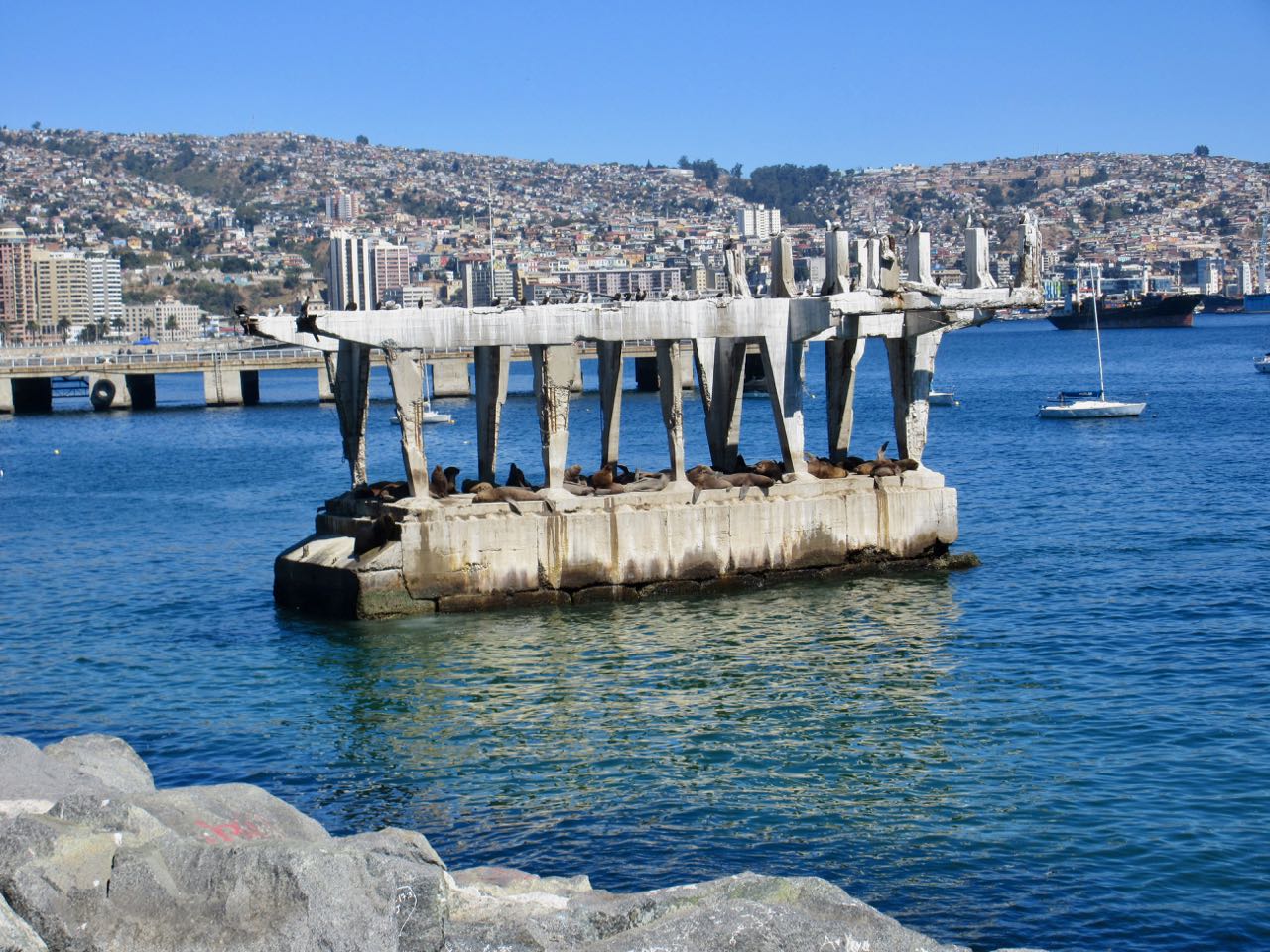
A real highlight near Valpo is watching sea lions close up on this abandoned concrete structure. It’s amazing they can get up there. It’s entertaining to watch them negotiate who gets the prime real estate. And who gets pushed off back into the sea.
The best part was arriving in Valparaíso and joining a free (for tips) walking tour. The daughter of one of the gentlemen in our group had tons of fun sliding down a cement ramp.

All in all I wished I’d — instead — spent my time hiking out at Parque Nacional La Campana.
Tantauco Park (Spanish: Parque Tantauco) is a 1,180 km2 (456 sq mi) private natural reserve on the south end of Chiloé Island in Chile.
The park was created by Chilean business magnate and President of Chile Sebastián Piñera in 2005 …
The park is open to the public with two campgrounds and a 150 km (93 mi) network of hiking trails. …
Tantauco Park is an attractive ecotourist destination due to the remarkable biodiversity of its nearly untouched Valdivian temperate rainforest and the rather easy public access. Precipitations in the area average about 2,500 mm (98 in) annually. …
official website – parquetantauco.cl/en/
If interested, stop first at their administrative headquarters & information center in Quellón. Get up-to-date trail conditions. Making bookings there based on the weather forecast
Only about 7700 visited the Park in 2017. It’s not crowded. There are a number of huts available for shelter.
Unlike many other parts of Chile, this is a rainy cold temperate maritime climate.
Click PLAY or watch SOME of this video on YouTube. You’ll get the idea.
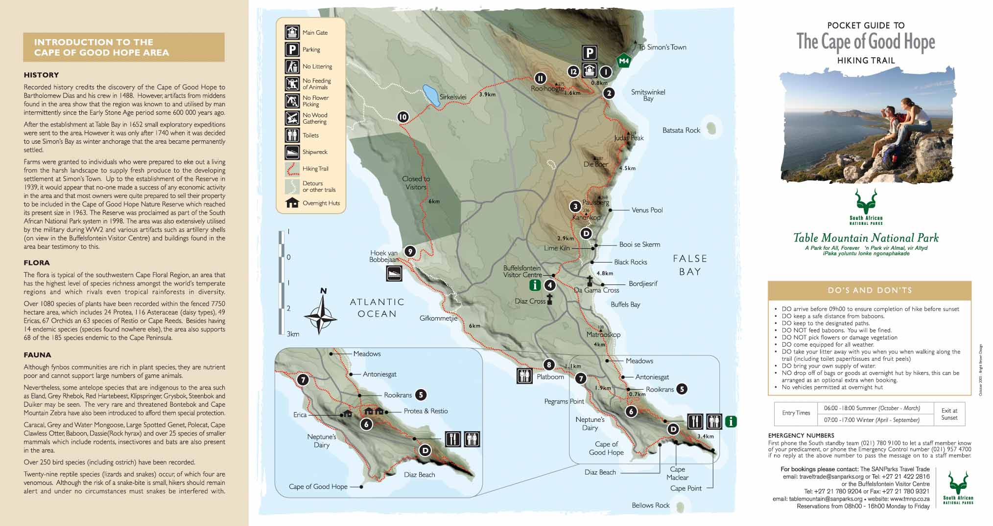
VERY south South Africa.
… 33,8km (you can add 10-12km extra by walking around Cape Point and taking longer routes and loops).
… you need 2 days and 1 night. It’s a circular route that starts and ends at the Main gate of Cape of Good Hope. …

The Michelin company created a ‘content hub’ called Sole Power, which regularly creates and shares inspiring and helpful content for sports people into their hiking, trail running, snowboarding etc.
Amy Chetwynd sent a link to their interactive map of 10 superb European hikes.
On my request Michelin Lifestyle put together a more detailed guest post on one of those ten. It includes some links they wish to promote. All good.
Snaking from the North Sea to the northernmost point of Scandinavia, Norway has always been known for its diverse landscapes and epic wilderness. One of the most geographically unique countries in the world, it’s home to icy blue fjords, expansive alpine tundra and palatial mountain networks.
For hikers it’s a take your pick and run with it kind of situation. There’s so much out there to explore. From Vest-Agder to the farthest reaches of Trom, trails and adventure appear wherever you look, and no two hikes are ever the same.

However, if we’re talking about one particular Norwegian pilgrimage that’s caught fire over the last decade (not literally), it’s Skjeggedal to Trolltunga.
EXPLORE 10 EPIC EUROPEAN HIKING ADVENTURES HERE [INTERACTIVE MAP]
Situated 25km northeast of Odda, in the county of Hordaland, is the famous protruding cliff edge, Trolltunga (Troll Tongue). Knowledge of this natural landmark has grown tenfold thanks to the globetrotting Instagram generation. Once a little-known locals’ secret, now a bucket-list destination, Trolltunga welcomes more than 80,000 people every year (that’s up from just 800 in 2010, by the way).
Eye-watering backdrops and a daredevil shuffle out onto the cliff edge, which juts out from bedrock at altitudes of over 1000m, are the pull of this place for most tourists. But for dogged hikers the journey is just as important.

The 10-12 hour hike takes you from an unassuming parking lot in the tiny village of Skjeggedal, up stone steps, out into the vastness of the Norwegian high mountains, through winding paths, and all the way to the northern side of lake Ringedalsvatnet.
It’s a tough trek that demands plenty of prep and caution from even the most the hardiest of hikers. This isn’t a countryside stroll, expect technical ascents and challenging scrambles throughout. Proper hiking gear is definitely a must.
It shouldn’t be a solo adventure either. For those with less experience, we recommend you enlist the help of a guide to get you there, although this isn’t essential in the summer months.

Be sure to visit at the right time of year, or risk serious disappointment.
When winter rolls around, this hike becomes perilous. High winds, ice sheets and heavy snowfall transform the route into a real no-go danger zone. Due to seasonal changes, it’s pretty much completely off limits between October and March, so plan your journey with this in mind. Mid-March to June is prime time.
Get it right and you’ll find out what it’s like to walk in the skies.
Skjeggedal to Trolltunga has it all, stunning panoramic views, mixed challenges and the freshest air that’ll ever hit the back of your lungs.

Looking for accommodation? There are a few AirBnB properties in the area. You can also book into a hotel in Odda, although rooms are in high demand in peak season, so get your name down early.
Key information:
Terrain type: Mountain
Highest altitude: 1,100m
Time to complete: 10-12hrs
Total distance: 27.5km
Average temperature:
- Summer: 12°c
- Winter: -5
Difficulty: Advanced
Want to explore more European destinations like this one? Click here to jump into Sole Power’s interactive hiking map and take the tour. It’s one hell of a journey!
