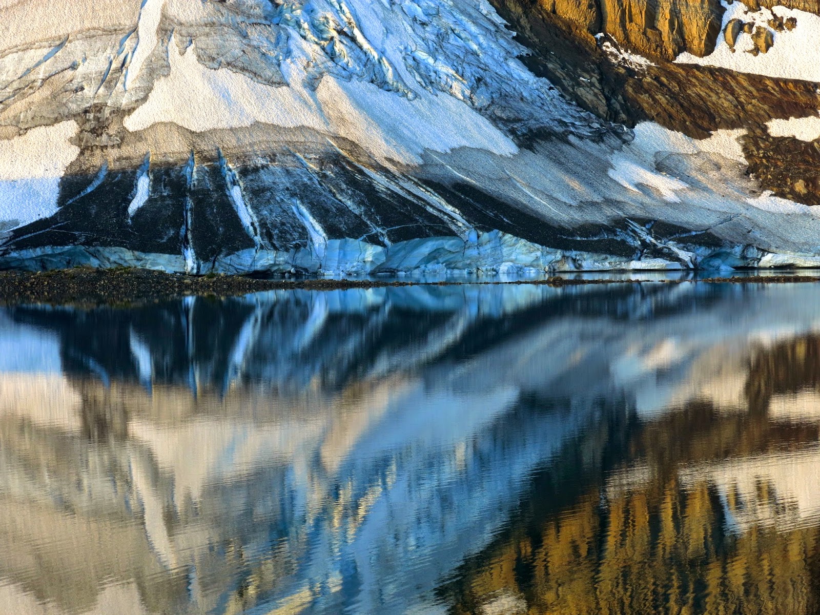
This is a trek to Guichala pass at 4950m, in the state of Sikkim, India, for a clear view of Mt Kangchenjunga, the 3rd highest mountain in the world. In Part 2 we make move from lookout to lookout with confusion and frustration until we decide to throw caution to the wind and just do it …
Ross, Jon and Guillermo get together every year for an outdoor adventure. Something they call the annual Pollard Memorial Trip.
For 2014 it was Mt. Shark trailhead near Canmore, Alberta to Assiniboine, Sunshine meadows, Egypt lake, Ball pass, Flow lake, Rockwall and finally the Ottertail river trail to exit near Field, BC.
The GDT runs as close as possible to the continental Divide (the BC/Alberta border) from the US border adjoining Waterton Park to Kakwa Lake some 1200 km north. …
For this trip we chose to hike a popular and well-travelled section in the middle running through two provincial parks and three national parks. …
I had identified this route as a possible solo hike option, but when both Jon and Ross expressed interest, we attempted it in 2013.That summer saw many trails destroyed by spring flooding and later some portions of the Rockwall were closed due to fires and bear problems. In addition, a worrying knee problem which I misdiagnosed as a torn meniscus forced us to abort our hike on the first day. Our 2014 attempt went much more smoothly …
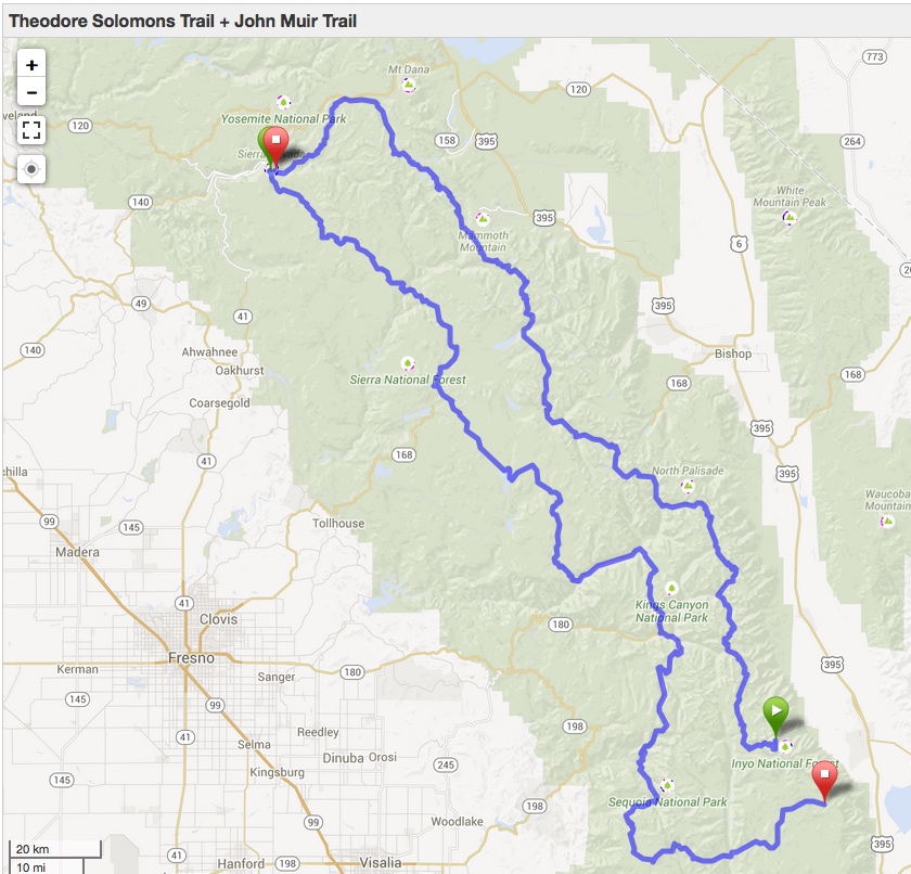
The Theodore Solomons Trail was designed as an alternative to the more heavily traveled John Muir Trail. Sadly, the trail seems to have largely fallen off the map (so to speak). The last guidebook to the TST was published in 1992, and some of the trails appear to be no longer maintained and difficult to follow.
I’m collecting research on the trail to potentially come up with a viable route …
If you’ve got feedback on the route or suggestions for improving it, leave a comment. If I can come up with a good plan, I may organize a thru-hike in 2016.
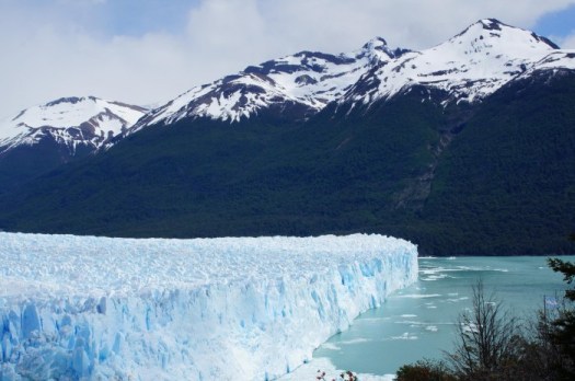
Patagonia off season: winter hiking in Torres del Paine
Tourists flock to the Torres del Paine in the southern summer, but our writer finds hiking there in winter brings a different set of snowy rewards
Andrew Gilchrist:
It’s minus five outside. Not great conditions for roughing it. The previous night, in an unheated, near-deserted refuge covered in snow, we had bedded down in extreme-weather sleeping bags, complete with hoods. But tonight, after a thrilling 20-mile hike through some of the finest scenery on the planet, we are warm, dry and, frankly, ecstatic beneath polar blankets in a chic ecodome that feels more penthouse than campsite. Steam rises from our boots as they dry by the log-burning stove and, through the round windows in the curved ceiling, I can pick out what seems like every star in the southern sky.
“This is sublime,” I think, as I ease myself off my furry headboard and pour another glass of velvety Chilean red. “Where is everyone?” …
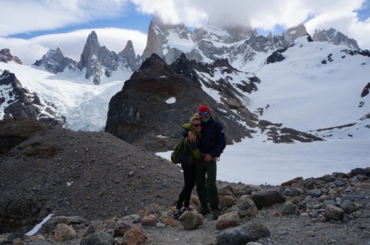
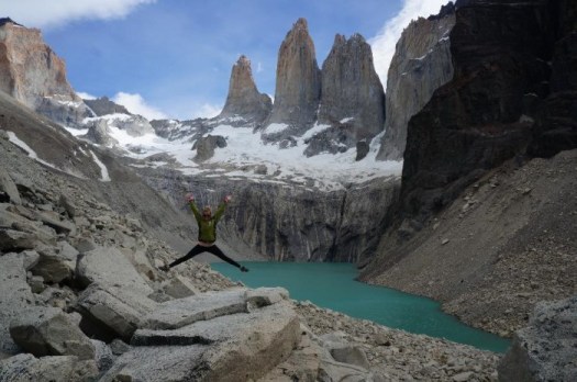
Of the two best hikes in Patagonia, which should you trek?
… you can’t decide between El Chalten (Argentina) and Torres del Paine (Chile), the self-proclaimed “trekking capitals” of their respective countries …
The good news is you can’t go wrong. Both options provide incredible access to some of the most spectacular mountain scenery you’ll ever see.
We can’t really recommend one over the other purely based on natural beauty as they are both equally stunning national parks. However, there are definitely distinct differences between the two trekking meccas that may push you toward one or the other. Here are some things to think about based on our experience in both locations that will help you decide (although the best decision is to do both!)
If you’re looking for world-class mountain scenery, in an area that doesn’t get a lot of attention, then head to the Tombstone Mountain Range in the Yukon Territory. Starting at KM 58.5 on the Dempster Highway, the three to five day backpacking trip takes you first to Grizzly Lake, and then to Divide and Talus Lakes. It’s a wild, desolate, truly memorable landscape. …
The landscape though, is extraordinary – and I can safely say like nowhere else you’ve seen.
Try to arrange your trip for late August when the boreal forest and alpine meadows combine to deliver a rainbow of fall colours. But go prepared for cold temperatures and snow. I had both. …
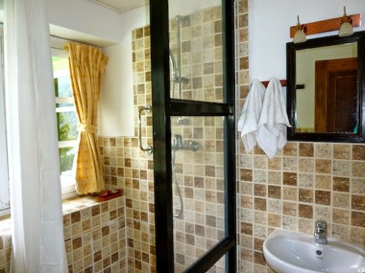
… Although I love hiking, I also love comfort so I started searching on-line for an “Everest Luxury Trek” and found the Yeti Mountain Homes, a group of luxury lodges located on the classic trekking route in the Khumbu area. I contacted them and as from that moment I was blown away by the Yeti Mountain Home experience … a lovely lady called Pasang patiently and very professionally answered all my questions and created a customized itinerary for us. …
Unfortunately there are no Yeti Mountain Homes (yet) all the way up till Everest Base Camp but Pasang made sure that we had the best possible accommodation in every place. …
Gros Morne is a member of the Long Range Mountains, an outlying range of the Appalachian Mountains, stretching the length of the island’s west coast. …
Hiking the trails is a popular activity at Gros Morne. There are about 20 marked day trip trails, exploring coastal and interior areas of the park. …
The interior of the park can also be accessed, notably through the multi-day Long Range Traverse between Western Brook Pond and Gros Morne Mountain. …
Leigh McAdam:
Before you even get a whiff of the Long Range Traverse, the premier backpacking trail on Canada’s east coast, you must pass a serious navigation test and get a full orientation by staff at the Gros Morne National Park Visitor Center.
The navigation test is nothing to sneeze at. You must understand declination and know how to take a compass bearing from the map. Although you can take along a GPS, and it might help in foggy situations, it’s your map and compass skills that are of utmost importance. It’s the only place in Canada that I am aware of that requires you to pass a navigation test. I guess what happened in the past, is too many backpackers set out, only to get lost – as there is no marked trail – and ended up needing a rescue.