Egypt Lake 2001 photos

by site editor Rick McCharles

The Lakes and Larches hike to Egypt Lake in the Canadian Rockies out of Banff was fantastic.

In bright sunshine, one day temperatures approached 30 degrees Celsius!

Most of these photos are close-ups as those tend to turn out best from (the fairly low resolution) camcorder. I included some of the amazing wild flowers and many of the animals we saw.

000_sign_egypt

001_sheep_lick

002_sheep_young

004_mark

005_rob_packin

006_ron_sunglasses

The hat has a disgusting collection of flies stuck to it — a failed gear innovation..

007_hat_flies

008_flower_yellow

010_heally_haze

011_larches_and_lakes

012_rons_vista

013_rob_old_cheesie

014_les

015_john

016_elaine_lake

017_rick_bits

018_rob

019_elaine_flowers

020_wolf

021_les_lunker

022_les_happy_camper

The deer is a surprising illusion — it’s made of deadfall and underbrush.

023_deer

024_whiskeyjack

025_marmot_attack

026_group_whistler

027_rick_summit

028_rick_summit2

029_summit

030_peak_profile

031_brian

032_grouse

033_goats

034_rob_pissin

035_john_bigrock

036_mark_finishing

trekking the Everest region, Nepal

Click PLAY or watch it on YouTube.

Cost is about $40 / day / person in 2016 staying and eating in Tea Houses. Carrying your own pack. There’s no earthquake damage in that part of the Himalaya.

Everest

Check our Everest Base Camp / 3 Passes information page.

(via The Longer, The Better – Three Pass Trek)


1997 trek to the Lost City,

trip report by besthike editor Rick McCharles

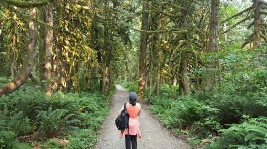
Santa Marta, the oldest city in Colombia (1525), is pretty & undeveloped. Backpackers love this place. Cobble-stoned houses, overhanging balconies, churches and military fortresses. Kids, dogs, pool halls, power failures and loud music.

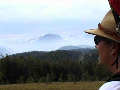
It is the jumping off point for the Lost City trek.

I was psyched.

jlost_river
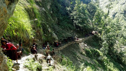
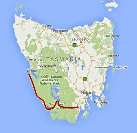
Six-day return treks to the ruins of La Ciudad Perdida are only allowed through a government agency. Guides arrange transport, food and accommodation — essential because the area is a significant marijuana and coca-growing region.

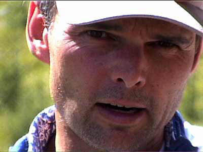
I, like the other backpackers in Santa Marta, was nervous about making the trip.

A selling point, however, was that hikers of all nationalities were allowed to trek except Americans — they make too attractive kidnap victims.

k_guideOur guide was most famous and experienced having made the trip over 500 times since the Lost City had been rediscovered in 1976.

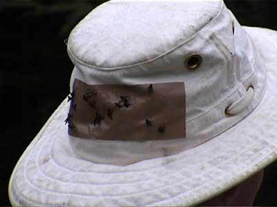
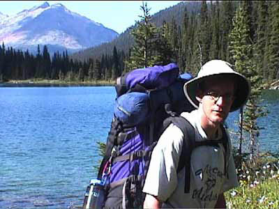
I carried my tent on the trek, much to the consternation of my old guide. He insisted we sleep in hammocks in the South American tradition.

read more

remote Mount Edziza, British Columbia

This is a relatively unknown trek in British Columbia, maybe receiving around 30 visitors each season.

Every day of the trek is different from the other, passing through mountain valleys of incredible orange and red mineralizations to volcanic plateaus littered with cinder cones and fine sandy pumice.

Mt. Edziza and the Spectrum range are located in the Mt. Edziza Provincial Park in the Tahltan First Nation territory of northern British Columbia, 35 km. west (by air) of Highway 37 at Tatogga Lake. From the air, you can see where the lava poured across the plateau and down through the trees to the lakes and creeks below. Normally, trekkers undertake one section at a time – either a 5-day trip along the Edziza plateau or a 5-day trip through the Spectrum range. For either one of these 5-day treks, most people fly out from Mowdade lake which is roughly the dividing line between the Edziza and Spectrum regions.

Trekking Partners – One of the most beautiful treks in BC

mt-edziza-provincial-park-02-alex-buri mt-edziza-provincial-park-07-alex-buri

From the Vancouver airport you might be able to drive to Telegraph Creek, BC in 24 hours.   This adventure truly is remote.

Edziza


Borneo’s Mount Kinabalu

… Bisected by the equator and set between Peninsular Malaysia and the Philippines, Borneo is the third-largest island on Earth. Three countries share this landmass — Indonesia, Brunei and Malaysia …

I’ve joined a G Adventures group for their 10-day Borneo-Sabah Adventure. With wildlife-seeking along the Kinabatagan River, a visit to an orang-utan preserve and touring Turtle Islands National Park on the horizon (see sidebar), I’m now primed for the premier alpine hike in this storied region of Asia — a setting that’s still very much a frontier, yet on the cusp of tourism greatness. …

Kinabalu is climbed in two legs — the first is a 1,270-vertical-metre ascent to Laban Rata, a guesthouse at 3,270 metres …

Explore – Travel: Climbing Malaysian Borneo’s Mount Kinabalu

Kinabalu

related:

• Mount Kinabalu, 2 Tough Days in Borneo

• The Highest I’ve Ever Been: Trekking Mount Kinabalu

360 mile Bigfoot Trail, California

The Bigfoot Trail … begins in the Yolla Bolly-Middle Eel Wilderness and ends in Redwood National Park at the Pacific Ocean near Crescent City, California. …

Northwest California’s Klamath Mountains foster one of the most diverse temperate coniferous forests on Earth and this route is a celebration of that biodiversity. …

Due to the strenuous nature of the trail and the fact that some section have been un-maintained for many years it is not a trail that can be hiked quickly. Experience using map and compass as well as the ability to read the landscape are necessary for a successful thru-hike. The Bigfoot Trail was originally proposed by Michael Kauffmann in 2009 …

Bigfoot-Trail-Route

Get the map from the official website.

Social-Image

Sage Clegg hiked it in 2014.

Adventure Junkies – Huayhuash trek, Peru

… The snow-capped peaks here are really high (many well over 6.000 mts – 19,500 ft) and the feeling of remoteness is fantastic. …

The whole circuit takes anywhere from 8 to 14 days to complete as there are different routes available. There is only one small town where you can re-stock on supplies which means you will need to carry all your food for 7-8 days if walking independently.

For that reason, most of the hikers decide to go with an organized tour. But hey, we are the Adventure Junkies. We can’t let a donkey carry our stuff up the mountain!

HIKING THE INCREDIBLE HUAYHUASH CIRCUIT IN PERU

Day-2-Laguna-Camp-Amanda-1-of-1

Check out our Huayhuash Circuit information page.

Manaslu Circuit after the earthquake

Nepal Explore Summit Treks reports Manasulu is back in business.

From Manaslu Conservation Area Project (MCAP) entry point Jaget, only 25 tourists made it to Manaslu circuit since the earthquake happened …

However, as the trail improved in the area, by middle of November (2015), this number already went up to more than 5000.  And to date, based on statistics, approximately 40 trekkers enter the Jaget point on a daily basis. …

… Bridges wiped out by the landslides have been rebuilt by the villagers.  The trail is open again for trekkers to explore. …

read more

repairing the trail
repairing the trail

toughest hike of the year?

Southwest Tasmania Traverse

Cam Honan:

Between February 27 and March 22 of this year, I completed a traverse of the southwestern region of the state. One of the wildest, most pristine backcountry areas on the planet, it was a hike I had dreamed of doing for almost two decades. …

200 miles (322 km) approx. …

Time: 24 days

Daily Average: 8 miles (13 km) approx. This included one rest/resupply day. Hiking, scrambling, bushwhacking, climbing, paddling, crawling, swimming, rock hopping…………yep……..the terrain really was that challenging …

The Hiking Life

SW-Tassie-overview

thirteen days food
13 days food

Lake-Oberon

Celebrating after paddling the 150 metres crossing between Piners and Settlement Points on my Thermarest NeoAir. My backpack floated behind, attached with some guyline to my right leg.


Wallace Falls Trail – Gold Bar, WA

trip report by site editor Rick McCharles

5.6 miles, roundtrip
Elevation Gain: 1300 ft.
Highest Point: 1500 ft.

I camped at Flowing Lake Park. Tried to get an early start. But the trail was busy, busy, busy even on a Friday in April.

Wallace Falls map

Washington Trails Association has the best write-up:

Despite the foot traffic Wallace Falls sees as one of Washington’s most popular attractions, those who get out early on the trailhead will be rewarded with a serene tranquility that few other hikes in the area can offer. And unlike many trails, which sacrifice peripheral scenery on the journey for the prospect of a grand summit view, the Woody Trail is consistently gorgeous as you wind your way along the Wallace River and approach the nine dazzling falls. …

Wallace Falls

lower-wallace-falls2

wallace-falls-state-park

Trip Advisor