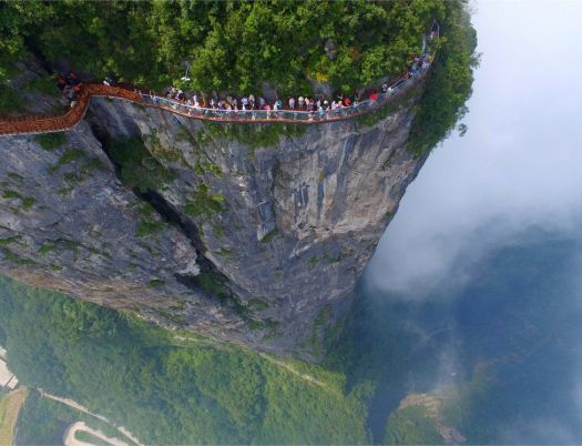
Our favourite hike in South America is getting easier. Locals are developing a guided trip where you could sleep under a roof every night.
Click over to Adventure Junkies — HIKING THE AUSANGATE TREK IN PERU
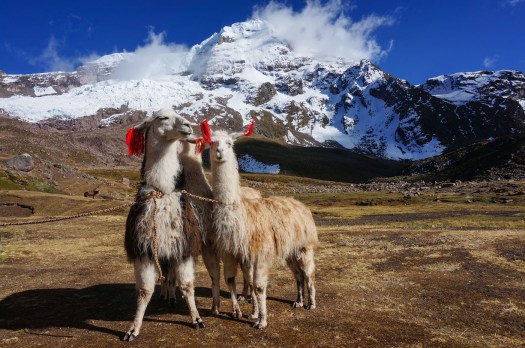


Best hikes, treks, tramps in the world.
Our favourite hike in South America is getting easier. Locals are developing a guided trip where you could sleep under a roof every night.
Click over to Adventure Junkies — HIKING THE AUSANGATE TREK IN PERU
Geoff Bedeck:
Swarms of aqua-blue butterflies, foaming waterfalls, hidden swimming lagoons, lime-green parakeets and chirping songbirds high up in the trees – this was what I’d come to find in the verdant Colombian jungle, along the winding trail to the Lost City.
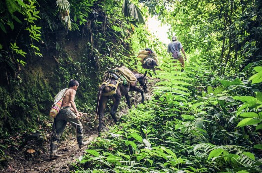
One of our best hikes in South America.
Khopra Ridge (aka Chopra Danda) looks like an ideal first acclimatizing hike for those arriving in Nepal. It can be done guided or independently.
See one guided itinerary from Epic Adventures.
It’s new so carrying a tent as backup for teahouses is recommended for independents.
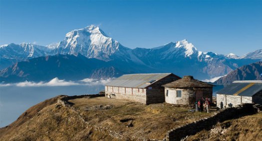

KimKim independent trip report.
Sunday 10 September 2017.
Check out the scenery. Click PLAY or watch it on Vimeo.
The Khardung La Challenge (72 km) is the Highest Ultra Marathon in the World. … you will be running approximately 60km of the race at above 4000m ( 14,000ft) …
guest post by Louise Brown
Japan offers many beautiful hiking trails. After all, the land is full of mountains, volcanic peaks, valleys, and many other landscapes.
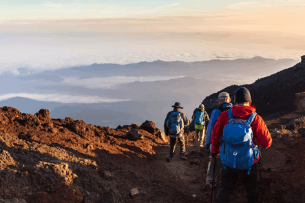
What’s more is that most of these places have some significant religious and cultural influence that will make your journey even richer.
Kumano Kodo is a network of pilgrimage routes in South Kansai Region, particularly in the mountainous Kii Peninsula. The trails on each course vary in difficulty level and will lead you to any of the Kumano shrines.
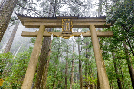
Though the intention is to reach these shrines, the trails in themselves are quite a religious experience.
There are five different routes: Nakahechi, Ohechi, Iseji, Kohechi, and Omine Okugake.
• Nakahechi is somewhat an easy hike that ends an extraordinary view of the shine and the torii gate. The trail goes through hills, forested landscapes, and some local villages. It starts from Tanabe and is about 35 kilometers to Hong.
• Ohechi is an entirely different view because it follows the coast of the Kii Peninsula. However, parts of the original route no longer exist because of modern roads being built. Still, it offers quite an amazing view of the Pacific Ocean. It starts from Tanabe and ends in Nachi Taisha.
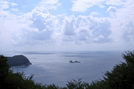
• The Iseji trails start from the east coast of Ki Peninsula. It connects Ise shrine to the Kumano. Like Ohechi, parts of the original trail were replaced with modern roads, but you will still encounter many scenic views. It will bring you through a bamboo forest, rice fields, and some beaches.
• Kohechi is a trail that connects Kumano with Mount Koya. This trail is 70 kilometers long and is quite challenging because of the many steep slopes. There are hardly any lodging or villages along the way, so better not do it alone.
• The Omine Okugake trail is another challenging and dangerous, even to the most experienced hikers. It connects Kumano to Mount Omine and Yoshina, which is in the Nara Prefecture. Like Kohechi, this trail barely passes any towns or villages.
One of Japan’s most famous places is an almost perfectly shaped volcano, Mt. Fuji.
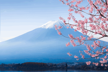
It’s also the highest peak of the country, rising to 3776 meters. Many people climb this active volcano each year, especially during July and August (hiking season). Outside of these months are not a safe time to hike up the volcano, but there are some shorter trails around the area. Of course, it’s nothing like reaching the summit of Mt. Fuji, but they’re still pretty amazing trails.
The climb to the summit doesn’t require any particular skill. It has some steep and rocky points, as well as areas where there may be falling rocks and sudden gusts of wind. However, the most challenging part of the climb is that it is exhausting. Also, the air gets thinner as you get higher up, which doesn’t help with the exhaustion.
Other than that, the ascent will be relatively manageable. You may not need to hire a guide because you’ll probably be hiking with many other people. There are four different trails up to the summit and with ten different stations. Overall, it takes roughly about 5-10 hours to ascend, and about 2-6 hours to descend, depending on your route. For more information, you can go here.
Japan is full of beautiful places, but Yakushima has got to be one of the best ones. After all, it isn’t a UNESCO World Heritage site for nothing. On the coast are beautiful beaches and onsens (hot springs), while the deeper parts of the island are mountainous. With the diversity it offers, it’s got to be one of the best places to hike in Japan.
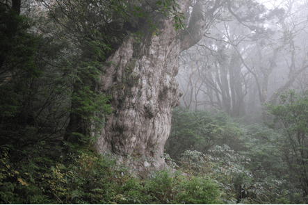
There are many trails all throughout the island. One of the most popular ones is the one that takes you to the oldest cedar tree in the Isle, Jomonsugi. It’s only 25 meters tall, but the trunk is huge – 5 meters in diameter! On your way to Jomonsugi, you will see other famous trees, including the Meotosugi, which looks like a couple embracing. Then there’s Diosugi, one of the largest ones on the island, and Wilson’s Stump, which is a hollow remains of a giant cedar.
Aside from hiking, the island also offers other activities and attractions. To name a few, there’s snorkeling, waterfalls, hot springs, and scuba diving. Around the months of June and July, you might be able to see some sea turtles come ashore to lay eggs. But you will need to make special arrangements or guided tours to see them.
Now, most of these trails are not for the faint-of-heart. It will require some levels of fitness and preparation. You will need a backpack and comfortable footwear fit for the hike and the weather. You will also need proper protective clothes, especially for rain and for the cold.
So, there you have it – three of the most beautiful places in Japan for hiking. There is so much more, but this is what we’ve got. We’d love to hear about your experiences and your favorite trails too. So, let us know by commenting below.
 Louise is the founder of TheAdventureLand.com, where she and her associates blog about Outdoor experiences, tips & tricks that will help you have an exciting adventure. She is also a tour guide of travel company where she learned many things about wilderness. “Let’s pack our bags and explore the world!”. Follow me on Twitter and on Google+.
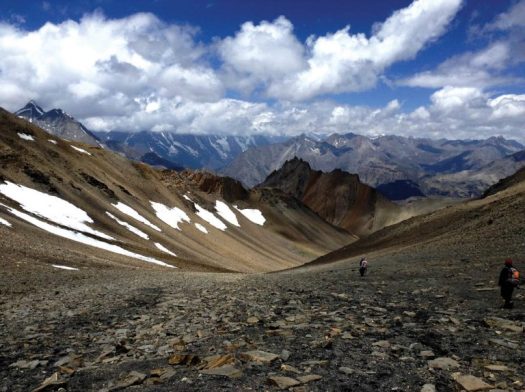
World Expeditions will guide your 152 day trek,1700km.
Three trekkers are just setting out on this year’s thru hike walking until July 27, 2017.
(via Adventure Blog)
trip report by site editor Rick McCharles
You’ve heard of Gila Cliff Dwellings National Monument.
It’s adjacent to the Gila Wilderness.
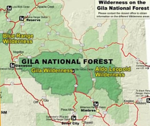
Gila Wilderness was designated the world’s first wilderness area on June 3, 1924. … part of New Mexico’s Gila National Forest. …
The Mogollon Mountains traverse an arc across the wilderness. The tallest peak within this range, Whitewater Baldy at 10,895 ft (3,321 m) …
I headed for the most popular Baldy trailhead – Crest Trail #182.
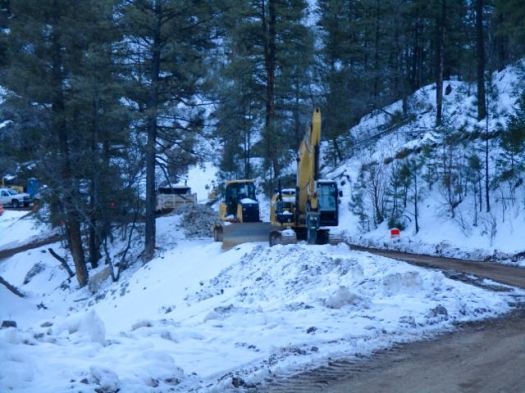
I never made it due to mountain road improvements January 2017. ROAD CLOSED.
So I read some of the Peakbagger trip reports instead.
The consensus was not good: bad roads, snow into July, forest fire recovery sections, hunters. It will not go on our list of the best hikes in North America.
The most popular hike in Gila Wilderness is the Catwalk – “… a one-mile trail suspended above a rushing stream in a gorge only a few feet wide.”
It had been rebuilt over a period of 2 years costing over $4.4 million dollars. And opened again in 2016.
I’d been advised by a Ranger that only the catwalk part of the trail was open. Hikers often continue on to #207. I would have wild camped if it had been open.
Sadly, that Ranger was wrong. It was all closed due to flooding.
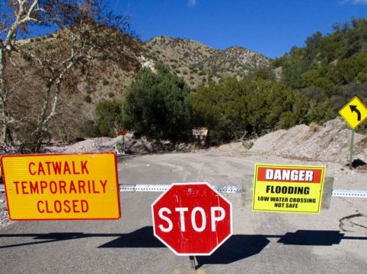
Still, the Catwalk does look very cool.
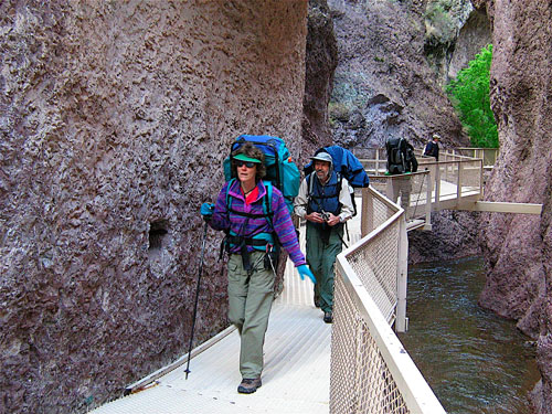
The 1.1-mile Catwalk National Recreation Trail winds through the canyon’s steep, pink walls of volcanic rock, following the path of a pipeline built in the early 1890s to provide water and electricity for the mining town of Graham. …
LESSON LEARNED — Before driving out to hike the Gila Wilderness, phone first to be sure your trail is open.
trip report by site editor Rick McCharles
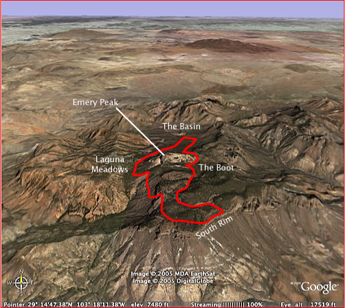
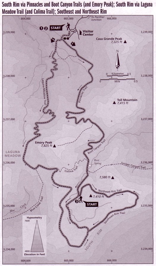
I feel the best hike in Big Bend National Park for most people is one of the South Rim Loop options. You can do those as long day hikes, but I’d recommend one night in a tent on the Rim.
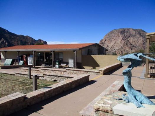
Pick up your camping permit ($12 / night 2017) at the Ranger station near the Chisos Mountain Lodge. There’s a good store for last minute provisions.
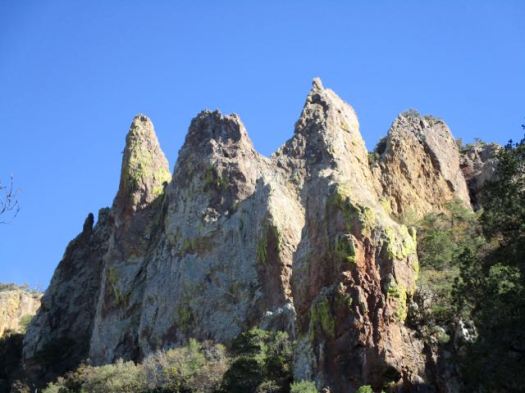
The trailhead is right there. I started up the Pinnacles Trail.

Everywhere is scenic up this high. Great vistas in every direction.

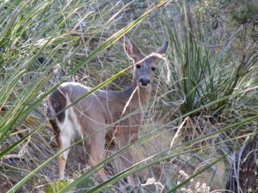
A hiker showed me a photo of a bear he’d seen earlier in the morning. Cougar and bear sightings are frequent. They are confined to a small geographic area.
Cougars hunt the Carmen Mountain Whitetail. For the deer it’s either cougars in the National Park or hunters outside the Park.
Are these the Pinnacles?
Weather was good so I opted for the Emory Peak side trip. It’s the highest mountain in the Park.
Emory is dangerous. A teenager fell 450 feet to his death in 1999. Many turn back at the final scramble to the summit.
For me it was FUN getting up.
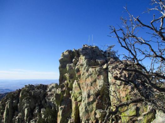
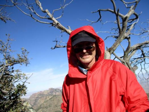
I left a Summit Stone. Enjoyed the vistas … though it was very windy.

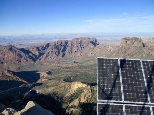

Down climbing is often more difficult. It is here.
Foolishly I’d not really paid any attention to my line on the way up. Several times I had to backtrack on the descent to find the safest route.
I picked up my pack on getting back to the Pinnacles Trail. Then carried on up the Boot Canyon Trail.

I’ve never seen so many Bear Boxes before. As a result, Big Bend has very few problem bears.
It was late in the day. I needed to hurry to get to the South Rim if I wanted to set up my tent in daylight.


There are standing pools of water here. You don’t want to drink from them.
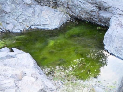
I started with 3.5 litres of liquids.
Big Bend does an excellent job maintaining trails. #respect

At last light I reached the most scenic part of the trip.

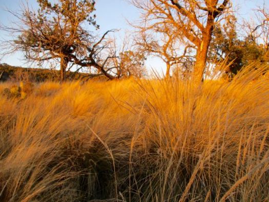
Here’s the vista from the S.E. Rim.

In January it was very cold this high. And very windy. I had to cocoon in my sleeping bag to stay warm enough.
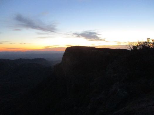
I woke early next morning. The weather forecast was for rain. I hurried down over the Laguna Meadows Trail taking only about 2 hours to complete the loop.
Recommended.
related – trip report – Patrick Dearen 2007
The guided Manaslu Circuit trek in Nepal is one of the very best hikes in the world.
Some good news.
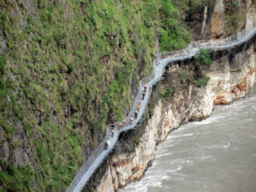
The April 2015 earthquake triggered landslides that destroyed many sections of the Budi Gandaki Trail, cutting off Upper Gorkha, affecting the movement of local people and trekkers on the Manaslu Circuit.
Now, engineers have used cantilever technology to restore damaged sections of the trail along the narrowest and steepest parts of the Budi Gandaki gorge. …

(via Manaslu Circuit Trek)