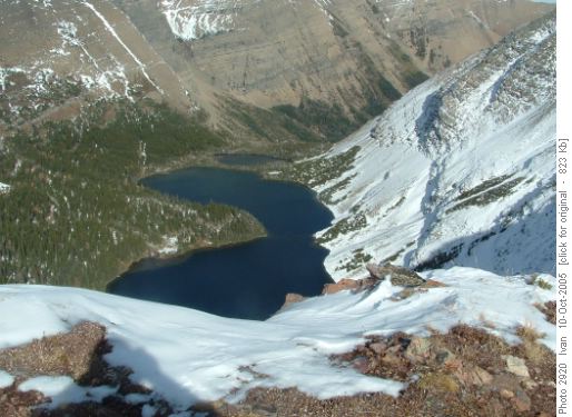
hiking above Chephren Lake

I had never heard of Waterfowl Lakes Campground, 57km north of Lake Louise on the Icefields Parkway between Banff and Jasper in the Canadian Rockies.

It seems to be mainly populated with visitors from Germany and Austria.

If you are car camping this is a good choice.

We camped beside pretty Mistaya River close to the hiking trailhead. Though the walk in was longer than we wanted, we had great fun playing in the snow fields and waterfalls above the lake.

Chephren.jpg

More photos on Flickr.

Tamarack Trail, Canada

Lucas Rojek has a great adventure in mind. It’s a very challenging variation on one of our favourite hikes — the Tamarack Trail in Waterton National Park, Alberta:

Our plan is to follow the standard trail (Rowe Lakes up to Lineham ridge) then drop into the Lineham Lakes, set up camp and if we still have the legs scramble back up again and do Hawkins Horseshoe. That’s day 1. Day 2 we scramble out and continue on Tamarack to Twin Lakes. I expect that to be a very long day. Day 3 we plan to hit Avion Ridge to Goat Lake. Day 4 we hike out from Goat Lake to Red Rock canyon parking lot.

Good luck Lucas! If you survive the off-trail scramble down to Lineham Lakes, the Avion Ridge should be a breeze.

view down to the lake from atop Lineham Ridge – RMRA trip report photos

want to see alpine animals?

Our vote for the best National Park in North America for sighting wildlife is tiny Waterton National Park in Alberta, Canada. (Adjacent to Glacier National Park in Montana.)

In Waterton you are more likely than not to see bear on any given day.

Charming Waterton Townsite is overrun with deer. You can play hide and go seek with them as we did.

Rick-deer.jpg
photo – George Novak

During the winter hungry cougars will come right into town after the deer. Locals told us the record was 5 cougars within town limits at one time!

If you need an excuse to visit Waterton, come for one of the world’s best hikes: The Tamarack Trail. 3 days, 2nights 36km (22.4mi)

Grand Teton National Park, Wyoming

The photogenic Teton Range extends from Jackson Hole, Wyoming 40mi (65km) in an impressive sweep.

We did just one dayhike off the Jenny Lake boat — and wished we had enough time for the Teton Crest trail.

The highlight of the Tetons for us was cycling the Park and taking photos of Bison. We’ve posted 24 pictures on Flickr.

tetons.jpg

scrambling Storm mountain

Rated as “moderate” in Alan Kane’s Scrambles in the Canadian Rockies — we had a particularly gruelling day. Alan’s trip description is very confusing.

UPDATE – Dave Stephens has posted a trip report which will help you decide on the best route.

Dave’s goal is to scramble every mountain in Kane’s book.

Lesson learned? Bring the GPS and topo even on an easy scramble.

storm1.jpg

More Storm photos on Flickr

video & photos – climbing Crowsnest

UPDATE – added photos from the climb to Flickr

Scott Whiteside organized 6 hikers to scramble his favourite mountain in the Crowsnest Pass. We needed no climbing gear but be warned there are a few tricky spots on this mountain.

We took our time spending almost 8hrs on the adventure. All returned unscathed — except for 1 thumb squashed by a falling rock. Rock fall is the biggest danger when scrambling the rotten Rockies.

For evidence that we actually reached the summit, click PLAY on the video below or watch the clip on YouTube.

hiking solitude

Something in the Wikipedia entry for hiking got me thinking about how to find solitude on crowded trails.

When two groups of hikers meet on a steep trail … the group moving uphill has the right-of-way. In other situations the larger of the two groups will yield to the smaller.

To avoid traffic as much as possible, I try to hike early or late in the day. Trying to stay well ahead or well behind the mass of hikers.

Of course hiking early or late in the season solves the congestion problem.

We were pretty much swamped with people on the most popular day hike in Grand Teton National Park on the 4th of July weekend. Bad choice of trail on a busy day.
bison-GT.jpg
photo – FirstPeople.us

Ausangate Circuit, Peru

Of the many great established hikes in Peru, Ausangate is the least known.

When we were there in 2005 we saw no other hikers and only a few seasonal Alpaca herders once we were on the far side of the mountain.

Why is it not more visited?

The main reason is that public transport is difficult. Plan on a rough bus ride 6hrs or longer one way from Cuzco to reach the trailhead.

Also, this trek is high. The first night we slept at over 4700m (15,419ft). If you suffer altitude sickness — it is difficult to descend.

But if you like challenge, this trek is one of the very best in the world: 70km (43.5mi) plus sidetrips, tent 4-5 nights. Hot springs at the start and finish!

Ausangate.jpg

Ausangate Circuit on besthike.com

Tour de Mont Blanc

On our list of the best hikes of the world (as of this date) Europe is the least complete.

We do not have many contributors from that part of the world (yet). Email the editor of this blog if you find any of your favourite hikes are missing.

But if you are going to hike there for the first time, we suggest the TMB — a romp around Mont Blanc, the highest peak in Europe: 9-14 days, 170+kms (106mi).

It sounds serious — but consider the great wine and food available en route!

Tour of Mont Blanc on besthike.com

tmb.jpg
more ParaScubaSailor’s photos tagged tourdumontblanc