Triple Crown of Waterton, Akamina

by site editor Rick McCharles

Day 2 of my last ditch attempt to complete the Triple Crown of hikes in Waterton National Park.

(If you missed it, click back to Day 1.)

I’d have to complete Akamina Ridge first, then go back to finish Alderson-Carthew:

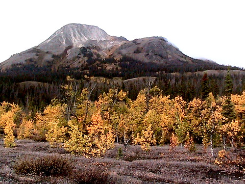
Akamina Ridge is a round trip hike of about 20km and the maximum elevation is 8600ft. A lollypop loop trail.

Your journey starts at the Akamina Pass trailhead about 1km from Cameron Lake along the Akamina Parkway. The trail starts out on a gentle slope. About 2km in you enter Akamina-Kishinena Provincial Park, shortly after this point and once you have taken the necessary pictures at the “Welcome to BC” sign …

Akamina Ridge hike, Waterton

… you will have the options to go to either Forum Lake or Wall Lake to continue your hike. The Ridge is accessible from both but the difficulty upwards vary. This is where the trail really begins. The choice varies from the constant but relatively steady uphill trail to and from Forum Lake or the gentle long trail to Wall lake and then the sudden steep rise all the way up to the trail. …

To save time I tented on the trail.

Akamina Ridge hike, Waterton

Like most other hikers, I chose to climb up the Forum Lake trail to access the ridge, descending to Wall Lake. That’s safer I was advised at the Park information centre.

Here’s Forum.

Akamina Ridge hike, Waterton

The ridge was signed. No problem.

… until I got to the final scree approach. The trail was covered with wind swept snow. I literally had no idea how to get on top of the ridge, having never done this hike before.

Blast!

Instead I made a frantic scramble back down the mountain to Wall Lake, thinking I would reverse direction, if possible.

That turned out to be a mistake. Time consuming and somewhat dangerous.

I was quite relieved to get to the bottom without injury.

Akamina Ridge hike, Waterton

And I’d run out of time.

I dropped a Summit Stone at this cairne, far side of the lake.

Akamina Ridge hike, Waterton

And turned back.

My Triple Crown attempt for 2010 was over.

Akamina Ridge hike, Waterton

Too bad.

Next year.

Triple Crown of Waterton, Alderson-Carthew

by site editor Rick McCharles

Third time lucky?

My first two attempts this past summer to hike the Triple Crown: Akamina Ridge, Alderson-Carthew and Crypt Lake … went awry.

This was to be my last chance. Snow was threatening.

Arriving mid-day, Alderson-Carthew was first on my rushed itinerary:

… One-Way hike from Cameron Lake to the Waterton townsite. It is about 16km long and takes between 5 to 7 hours depending on your urgency.

The highest elevation is about 7500ft(2300m) …. It is recommended that you take a shuttle from the townsite or have a friend drive you to the start of the trail. …

Unfortunately for me, the shuttle only runs with a minimum of 4 people. And I was friendless.

No matter, I would dash up the trail from Waterton town, return. Then do the other half return next day from the other end.

It starts at pretty Cameron Falls.

Cameron Falls, Waterton

Those are my two chocolate milk “hand weights” (nutrition and hydration). I would do it as a trail run to save time. … OK, a trail run down. I walked most of the way up.

Despite the snow, it was a gorgeous Autumn day.

Alderson-Carthew hike, Waterton

I love the Fall colours.

Alderson-Carthew hike, Waterton

It climbed up, and up, and up.

Alderson-Carthew hike, Waterton

At my highest point it was, as the last time I was here (VIDEO), very WINDY.

Alderson-Carthew hike, Waterton

see more photos from my half hike of Alderson-Carthew.

… I STILL have a chance to finish the Triple Crown this hiking season.

Reel Rock Film Tour

This is the 5th year that the Banff Mountain Film Festival has sent a mini-festival of their best climbing films on the road.

Click PLAY or watch the extreme trailer on YouTube.

Ueli Steck, Paul Robinson, Daniel Woods, Lisa Rands, Dean Potter, Peter Croft, Chris Sharma, Cedar Wright, …

international calendar

official home page

another death on Longs Peak

When I scrambled the 15th highest mountain in Colorado in August, I was surprised at how DANGEROUS it is:

… It gets hairy, quickly. Exposure. Potential rockfall. … Many have been killed on this mountain.
I slipped badly on black ice here, the rock still frozen. …

In fact, I slipped badly just past the Keyhole. (The sun had not reached the other side.)

climbing Longs Peak, Rocky Mtn National Park

According to the National Park Service:

A hiker along the Keyhole Route of Longs Peak has been killed in a fall of about 300 feet …

The was at least the third fatality on Longs Peak this summer, and the second that occurred near the Keyhole …

National Parks Traveler

Rawson Lake Trail, Alberta

Eric on Scenic Travel Canada posted a hike in my own backyard … that I’d never heard about.

The Rawson Lake Trail is an easy hike to a scenic and secluded mountain lake in Kananaskis Country, Alberta. Perched in the front ranges of the Rocky Mountains, the Rawson Lake hike is a 5 kilometer trek with a rewarding view of a picturesque green lake at the base of a towering peak – a quintessential Canadian postcard picture.

Rating – Easy
Distance – 5 kilometers
Elevation Gain – 320 meters
Duration – 3 hours round trip
When to go – mid-summer to early fall (mid July to October); snowshoe in mid-winter (December – March) …

details – Rawson Lake Trail – An Easy & Rewarding Hike in Kananaskis

future hike – Cottonwood, Yukon

I’ve only hiked once before, years ago, out of Kathleen Lake in Kluane National Park. My memories are of distant views of Mt. Logan, alcohol buzz and lower body nudism on the summit of the King’s Throne.

Pantless.jpg

Next time to the Yukon I’ll budget 4 days for this, perhaps the best hike of all in the Park.

The Cottonwood Trail is a difficult alpine route finding adventure that sees more Grizzlies than people.

• 85km (53mi) loop
• 520m (1700ft) elevation gain

Here’s the pretty Kathleen Lake trailhead:

Kathleen Lake, Yukon

Kathleen Lake, Yukon

More Cottonwood Trail photos on Webshots.

… hiking Akamina Ridge, Waterton

Tomorrow.

Part of the Triple Crown of Waterton challenge.

Wish me luck. … It’s late in the season. But the weather forecast looks pretty good.

Akamina Ridge is a round trip hike of about 20km and the maximum elevation is 8600ft. …

Triple Crown of Waterton – Akamina Ridge

related – TrailPeak – Akamina Ridge

hike Alaska or Yukon?

I’ve been several times to both.

I’d recommend Yukon over Alaska for most serious backcountry hikers:

A. Fly into Whitehorse, Yukon.

B. hike #1 – Chilkoot Trail (permit required)

C. hike #2 – Slim’s River (trip) or Cottonwood, Kluane National Park

D. hike #3 – Tombstone (besthike video)

That would be a fantastic 2wk hiking holiday with very little time lost to travel or logistics. Yukon is dryer than Alaska. Has a better infrastructure. … In fact, you might even be able to do this itinerary on public transport.

Best weeks would be August / mid-September.

Leave a comment if you can dream up an itinerary as good in Alaska.

best hikes Kluane National Park, Yukon

The two most popular trailheads are:

1. Kathleen Lake
2. A’äy Chù Trailhead on Kluane Lake

A larger version (PDF) with established trails is available via the Parks Canada web page. Here’s a screenshot:

Best established hikes are:

1. Kathleen Lake
– Cottonwood Trail
– King’s Throne

2. A’äy Chù Trailhead
– Slim’s River West (trip)
– Sheep Creek
– Bullion Plateau

I drove out to look at the Dän Zhu (Donjek Route) trailhead. It looked pretty harsh. (Trip report.) I’m not so sure I’m up for that.

kluane-hiking-guidebook

Kluane National Park Hiking Guide by Vivien Lougheed.

Leave a comment if you have other best hikes in this Park.

hiking Slim’s River West, Yukon

humerous trip report by site editor Rick McCharles

An attempt to be funny:

My original plan was 45km (27.4mi) return to the Glacier. And perhaps on to the Observation Mountain lookout, camping one night at Canada Creek.

I’d read the official Parks Canada description – A’äy (SLIM’S) WEST TRAIL & ROUTE

Arriving at the Tachàl Dhäl (Tachal Dhal) Information Centre, I was surprised to find it already locked up for the season. Nobody in Whitehorse had warned me about that.

Never mind. … Who needs to get updated on local conditions before setting out on a multi-day hike?

Check the trailhead map. And GO.

hiking Slim's River West, Yukon (A'äy Chù)

Amazing. A super highway through the mountains to the toe of Kaskawulsh Glacier. The elevation gain is less than 100m over 22km.

Within an hour I came upon this memorial to a hiker killed by Grizzly in 1996.

hiking Slim's River West, Yukon (A'äy Chù)

Why didn’t someone warn me there were Grizzlies in Kluane National Park?

… Aren’t the males hungry for a meat feed just before hibernation?

Oops. All this flat tundra is pretty soupy. This was the only boardwalk across the marsh.

hiking Slim's River West, Yukon (A'äy Chù)

Why didn’t someone warn me to bring a second pair of footwear for water?

The Autumn scenery was other worldly. I felt lucky to be there on Sept. 11th.

hiking Slim's River West, Yukon (A'äy Chù)

hiking Slim's River West, Yukon (A'äy Chù)

A few hours in I ran into this river crossing:

hiking Slim's River West, Yukon (A'äy Chù)

In the Fall water levels should be very low. … Right?

I backtracked to a ridge and relaxed watching 3 other hikers try to find the best place to cross.

hiking Slim's River West, Yukon (A'äy Chù)

Eventually (tiring of that entertainment) I set up my tent and took an afternoon nap in the bright sunshine.

hiking Slim's River West, Yukon (A'äy Chù)

My Slim’s River hike was over. I wouldn’t make it to the Kaskawulsh Glacier.

Next day I returned to my vehicle early, on to more Yukon adventures.

more photos – hiking Slim’s River West, Yukon (A’äy Chù)