The Hollyford Track is one of our best hikes in Australasia.

Check the Department of Conservation home page.

Best hikes, treks, tramps in the world.
The Hollyford Track is one of our best hikes in Australasia.
Check the Department of Conservation home page.
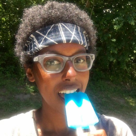
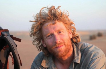 Alastair Humphreys believes we should live a little more adventurously:
When I first got a taste for adventure it was simply for the fun of it. Climbing hills and looking around at the view from the top, riding a mountain bike downhill as fast as you can, leaning hard in a heeling dinghy: these things are fun and exciting …
By the time I was in my 20’s, however, my relationship with adventure had changed. “It doesn’t have to be fun to be fun” was my mantra. “Miles not smiles!” …
Adventure became about the challenge. Pushing my body and my mind …
After the masochistic personal challenges came the curiosity phase. I wonder if it’s possible to hitch a lift on a yacht across the Atlantic? What is running an ultramarathon in the Sahara like? Can I go have a look at life in a random part of India, far from the nearest tourist hotspot? …
The answer, time after time, was ‘yes’. …
Anderson and Mattson of Epic Trip Adventures hike glorious Akamina Ridge.
They take the big scree descent.
Click PLAY or watch it on YouTube.
Waterton is our favourite Canadian National Park. That hike is one of the Waterton Triple Crown challenge routes.
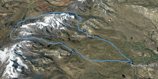
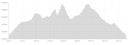
Drew posted the best Ausangate page we’ve yet seen.
Ausangate is one of our top 10 hikes in the world.
Distance: 42.8 miles
Elevation Gain: 9406 ft
Minimum Elevation: 12498 ft
Maximum Elevation: 16,828 ft
Time: 5 days
Permits: No
Visa: Single entry tourist visa to Peru for US citizens
Trail Condition: Wide fired road on the start which narrows to single track and alpaca trails
Cell Phone Reception: None
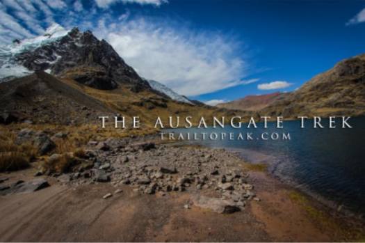
Trail to Peak – A COMPLETE GUIDE TO THE AUSANGATE TREK
If you are considering this amazing adventure, that page is MUST READ.
Rahawa Haile:
What happens when an African American woman decides to solo-hike the Appalachian Trail from Georgia to Maine during a summer of bitter political upheaval? Everything you can imagine, from scary moments of racism to new friendships to soaring epiphanies about the timeless value of America’s most storied trekking route.
related – 4 Things Female Thru-Hikers Need to Hear
Kolby Kirk really likes this Pacific Crest Trail video by Peter H from Austria. A skillful edit.
Click PLAY or watch it on Vimeo. (10min)
Trip report by site editor Rick McCharles | day 1 | day 2
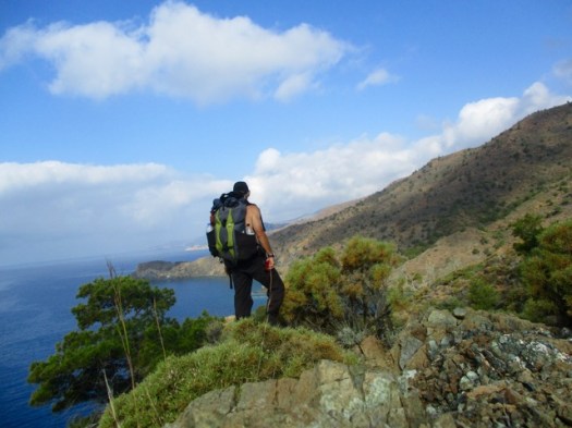
day 2 – 6:45 am I hoisted the pack.
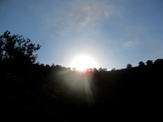
Unsure of exactly how I was going to get back for my 4pm ferry departure , best get an early start.
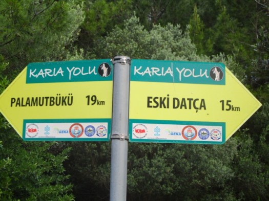
In my dreams I’d hoped to get all the way to Palamutbuku … but there is one earlier exit if I am running out of time.
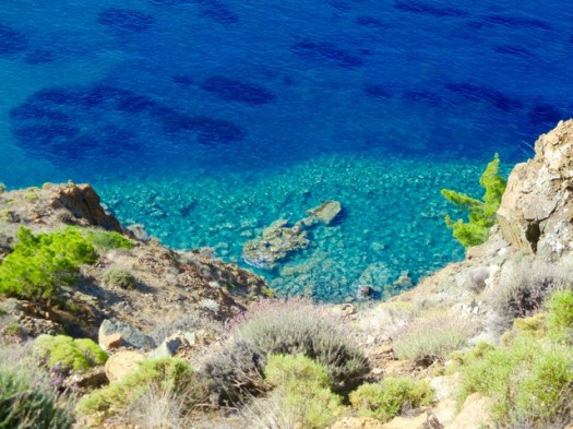
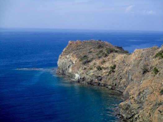
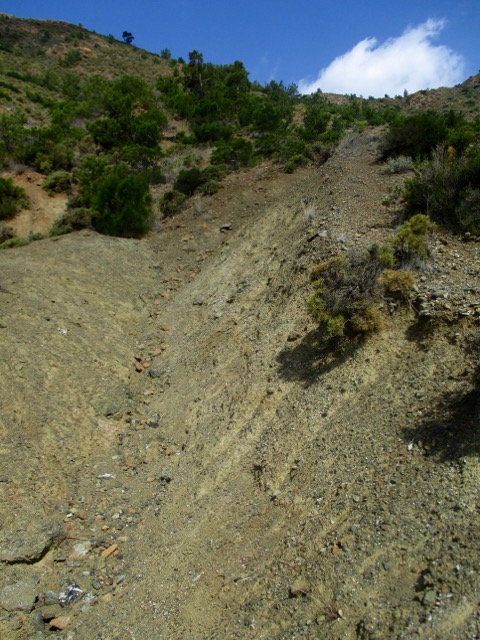
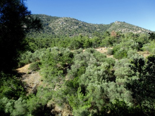
The first section is scrambling over headlands. A series of deserted coves.
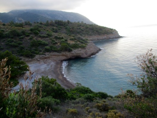
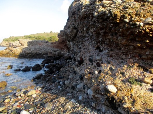
Rocky beaches. Much of the stone is conglomerate.
I was lost briefly several times. The official guidebook and map are not sufficient to keep you on the trail. GPS is pretty much essential on the Carian Trails. And I didn’t bring my GPS to Turkey. Doh!
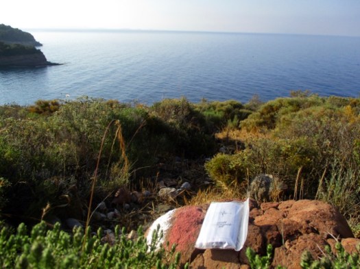
So few hikers pass this point I left the next one a Summit Stone. There’s no way to miss it.
If you like this kind of solitude and scenery, plan a hiking trip to Turkey.
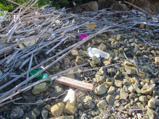
The beaches are not littered. But they are full of plastic and junk washed ashore.
Here’s the toughest headland. My guidebook authors nicknamed this scramble Death Valley.
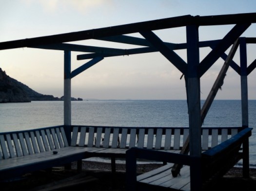
Whew. Civilization.
I was slow getting here. But the only other walkers I saw on the trail were even slower.
This village was the end for me. I’d need to find the mini-bus back to town to be sure not to miss my ferry.
During lunch at a pleasant restaurant I learned that the mini-bus does not run on Sundays. I’d need to hitchhike. A crazy dentist in a beat-up van picked me up.
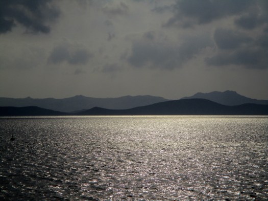
I was tired on the ferry home. The two days had taken more out of me than they should.
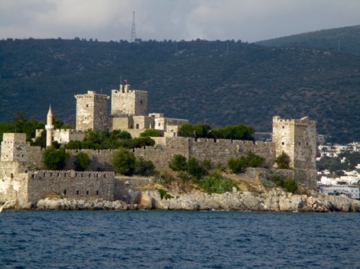
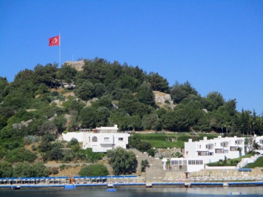
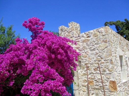
Bodrum castle is most impressive from the sea.
Trip report by site editor Rick McCharles | day 1 | day 2
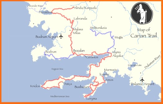
Only 2 days on the Carian Trails. But it was enough.
I decided to return April / May 2019 for 2-3 weeks most likely on the even more remote Bozburun Peninsula section. (141km)
I’ll have two GPS devices and several downloaded routes. I’ll carry the right gear. And I’ll bring some of my food from home. Turns out they don’t sell dehydrated mashed potatoes in Turkey.
related – our Carian Trails information page
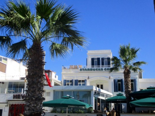
Trip report by site editor Rick McCharles | day 1 | day 2
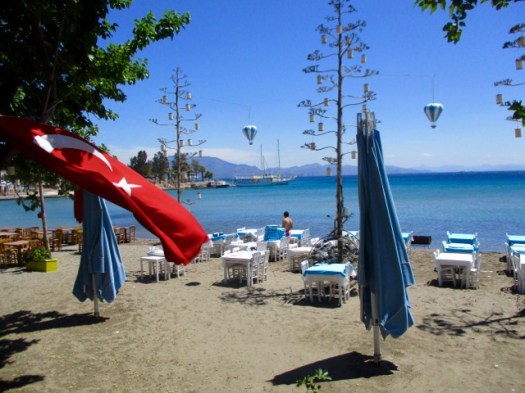
day 1 – 8am Starbucks, Bodrum.
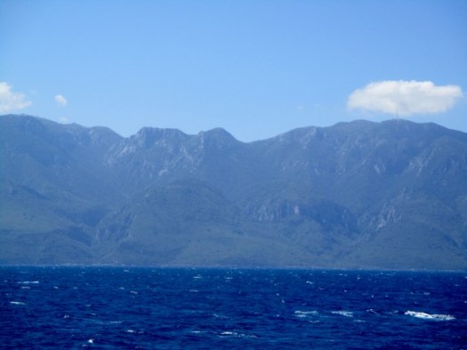
9:30am – ferry to Datça.
You pass the Greek island of Kos en route.
11am – arrive at the new ferry terminal.
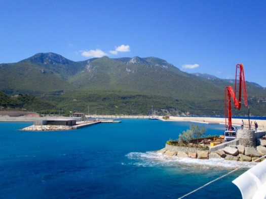
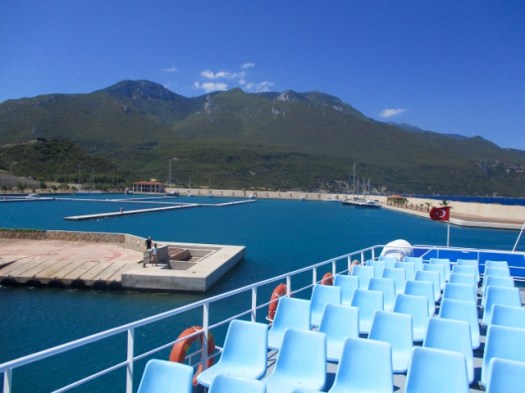
Free shuttle bus to town.
I wandered Datça town for an hour enjoying the peace and quiet after busy Bodrum.
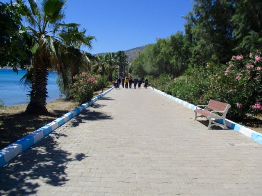
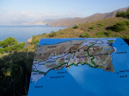
Eventually I found the official trailhead in Eski Datça. This is the start of the 240km Datça Peninsula section.
People visit to see traditional old stone houses on cobbled streets.
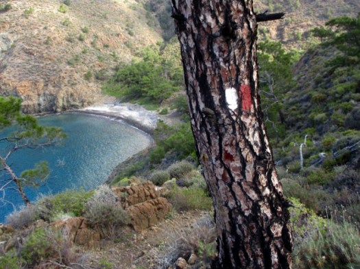
Follow the red & white paint.
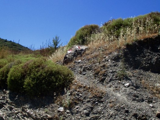
There are some signs on the Carian Trails, but not many.
I wore long pants due to thorny, stinging vegetation on the overgrown trails. In fact I should have had even thicker pants.
Traditionally this region is famous for fish, almonds and honey.
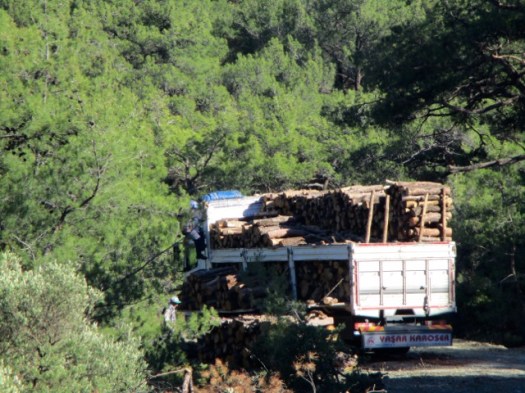
Most of the day was on logging roads. Good footing.
Alarmingly, the only water source was swarming with wasps. I couldn’t get close.
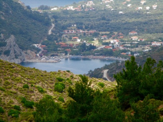
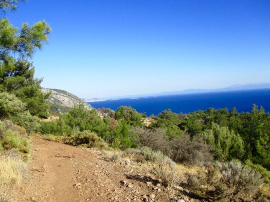
First glimpse of the ocean.
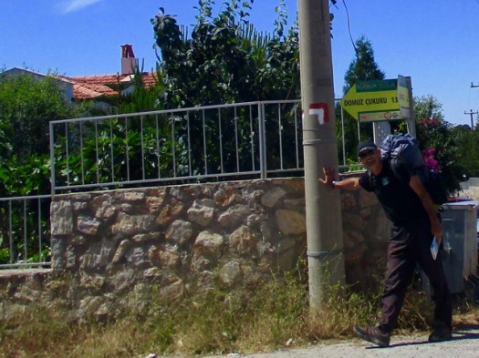
I was very happy to see my destination — Pig’s Hollow Camp (Dumuzcukuru). Wild boars visit occasionally.
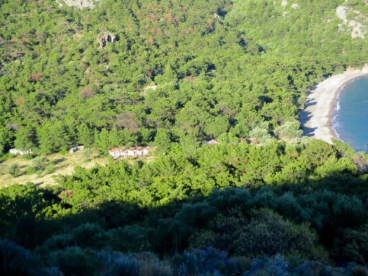
It’s something of a commune. When I was there 3 Turks were in residence. One had been coming for 6 years.
They take care of the garden. Keep the place clean. Maintain the solar power rig and water purification system.
Anyone can stay and probably eat dinner with the guys. By donation.
My pasta dinner, home grown salad and wine were excellent. I was HAPPY to donate.
The guys told me very few Carian Trail hikers pass by. It truly has not caught on yet in Turkey though the nearby Lycian Way is booming. The Carian Trail was only launched in 2013.
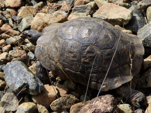
I saw one big black snake. They guys said they see about one snake a day at the Camp.
My last night in the tent in Turkey. A nice spot. I had the beach to myself.
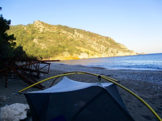
I read my kindle as dusk fell.
Trip report by site editor Rick McCharles | day 1 | day 2
Kilimanjaro, Tanzania
Mount Rainier, Washington
Mount Elbrus, Russia
Cotopaxi, Ecuador
Mount Fuji, Japan
Mount Shasta, California
6 Iconic Hikes You Should Do Before You Die
I believe Kili is the only one of those 6 that you MUST do with a guide.

Check our list of best trekking peaks. Kili and Ranier are on it.
trip report by besthike editor Rick McCharles
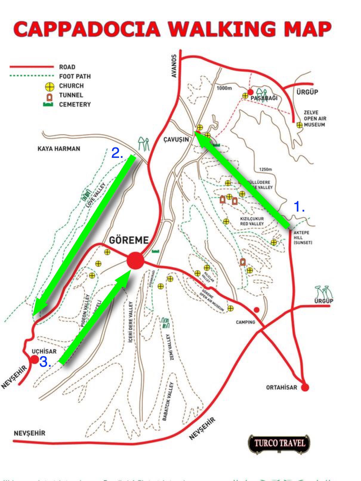
Panoramic viewpoint > Rose Valley > Çavuşin > Love Valley > Uchisar Castle > Pigeon Valley > Göreme
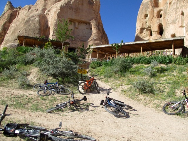
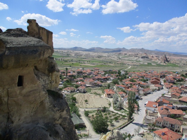
For hikers Göreme is probably the best base for Cappadocia. You can literally go off hiking in any direction. It’s got a good variety of restaurants and accommodation too.
On arrival in Göreme someone will hand you a FREE hiking map.
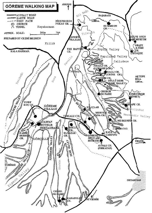
Most wander around with this thing … frequently getting lost. We could find no decent map nor guidebook in 2017.
For 6 days I hiked and cycled many of these trails, often lost, before finally deciding on what I felt was the best hike.
Ask the people at your accommodation in Göreme how to get to the Rose Valley Panoramic viewpoint. They’ll likely recommend a taxi and tell you the price. It’s about a 15 minute drive uphill from town.
There is a small entry fee for Panoramic viewpoint. The taxi may drop you outside the gates.
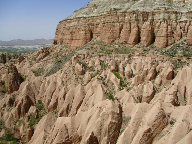
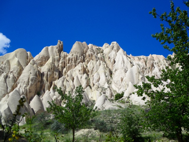
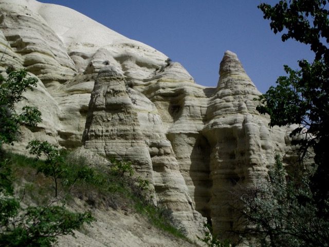
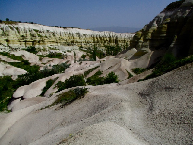
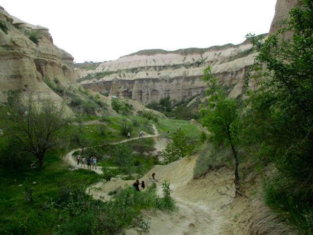
Most feel Rose Valley trail. 5km to Caveusin is the best hike of all. And I’d agree.
Note that most of the trail signage is in Turkish.
There are many twisting and turning trail options. All are good but the very bottom of the valley might be muddy.
Rose is popular with cyclists, too.
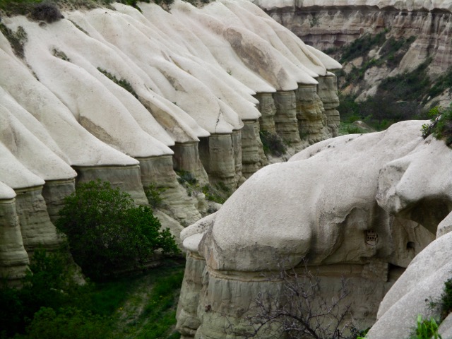
Gorgeous, surreal scenery.
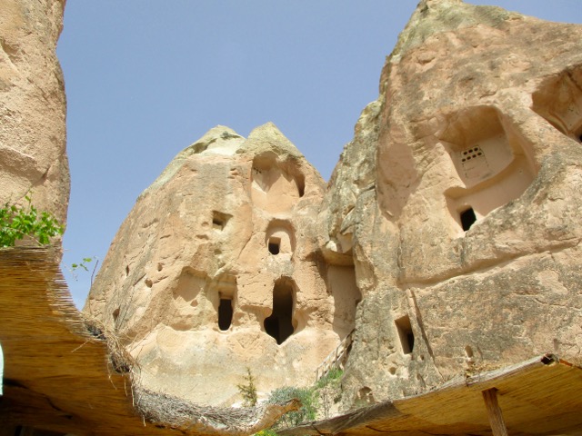
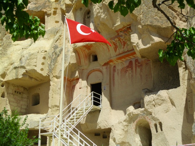
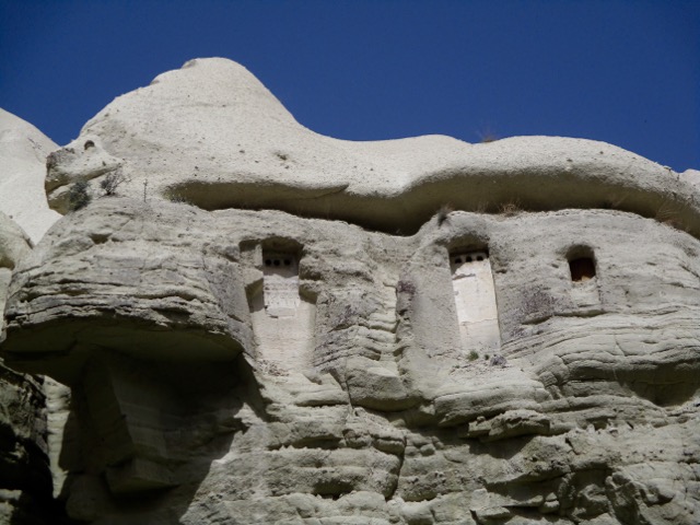
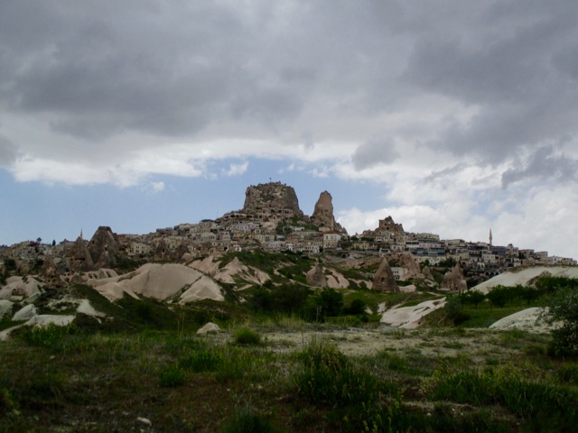
End of the trail is the village of Çavuşin.
If you haven’t yet seen enough Church caves — you might want to visit the World Heritage site Caveusin Kilisesi.
From Çavuşin you need to get to the Love Valley trailhead. Ask in town. It’s about 1km up the highway towards Goreme. (There are shortcuts.)
If walking the highway here’s the turn-off. These pink signs are the best of the admittedly poor and confusing trail signage in the area.
From there you can’t miss it.
Love Valley is the second best trail in my opinion.
Why they call it Love Valley I can’t imagine. 🙂
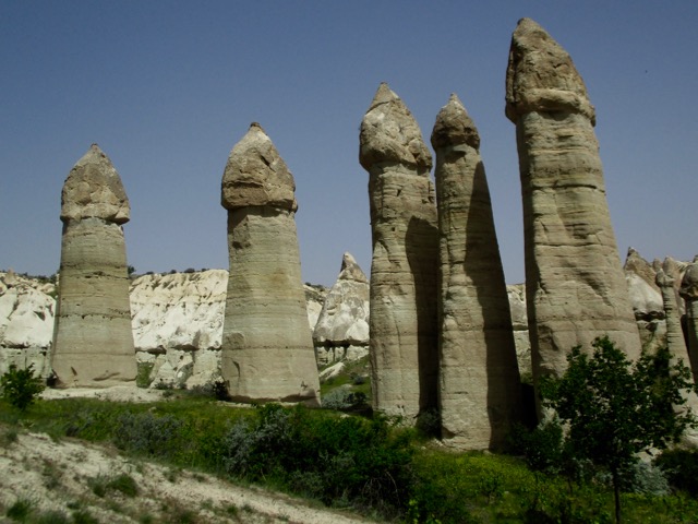
You can see here how those columns erode away from the valley wall.
It’s about 4km uphill to the end of the Love trail. If not lost you’ll finish at this tourist trap.

Bus tours stop and parade their unwilling passengers through the souvenirs.
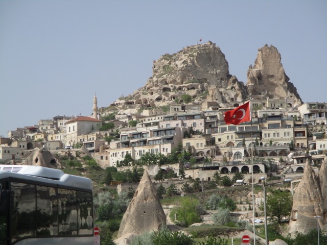
Cross the highway and make your way up to the top of impressive Uchisar Castle. There’s a small entry fee.
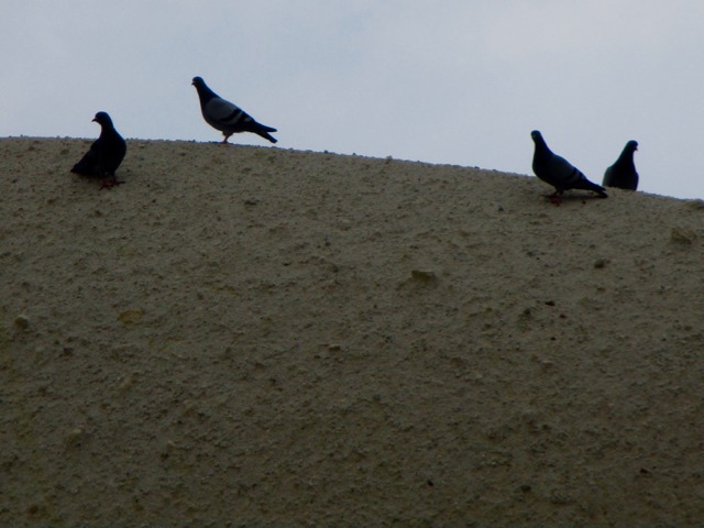
Exiting on your way down ask for the Pigeon Valley trailhead. Look for these pigeons. It’s not difficult to find.
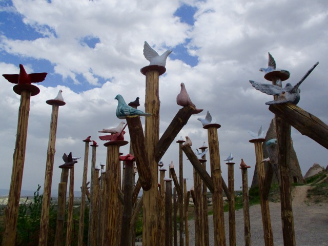
Some have reported seeing no pigeons in Pigeon Valley. We saw plenty.
Historically farmers built roosts for pigeons in the valley wall in order to later collect their guano.
It’s downhill to Göreme. A nice but often crowded walk.
Looking back to the Castle.
You might spend 4-6 hours including stops on this best hike.
Panoramic viewpoint > Rose Valley > Çavuşin > Love Valley > Uchisar Castle > Pigeon Valley > Göreme
___
A shorter alternative would be to loop Pigeon to Love Valley. It’s a 2km walk up the highway back to Göreme, however.
We really need someone to put together a decent map of trails out of Goreme. Hundreds of thousands visit every year and almost all do some hiking.
related – Hike Bike Travel – 21 Photos That Will Make You Want To Hike In Turkey’s Rose Valley
