
Quite famous in 2019 is the Dientes de Navarino Circuit out of Puerto Williams, Chile.
It’s billed as the most southerly established hike in the world.
HOWEVER the Lago Windhond hike also out of Puerto Williams goes further south. But it’s far less popular.
From Here to Nowhere:
… Now, after failing to reach the Windhond trail from the Dientes Circuit a few days before due to dangerous snow conditions, my plan was to reach the lake via the Rio Ukika valley and, if time permitted, walk around the eastern edge of the lake to truly reach the southern end of Isla Navarino. Beyond that point Cape Horn is the only land before Antarctica. …
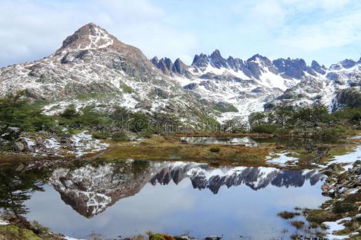
For the first half of the day the Windhond trail follows the Ukika valley, gradually climbing to its head, passing several pretty lakes which are the source of the Rio Ukika, and offering magnificent views of the backs of the mountains I walked along only a few days before on the Dientes Circuit.
Ahead, the Dientes de Navarino slowly come into view – and to be honest, the views of the mountains were better than those from the Dientes Circuit. …
Compared to the Dientes Circuit there was very little elevation change involved, and after my experience on that circuit I decided not to be too fussy about following the path exactly when the markers disappeared because of beaver damage. …
Solo Hike to Lago Windhond, Isla Navarino
related – An Outdoors Family did it coming from the day 1 route of the Dientes Circuit.
I believe this trail is now available free on the Maps.me app.
However … it’s a route, not a trail. You’ll be mucking through beaver damaged, wet meadows for long sections.
