
trip report by besthike editor Rick McCharles
First off, I declare this the second best hike I’ve done in the American Rockies. (Only the North Circle in Glacier National Park ranks higher.)

The Cirque of the Towers is located in the Wind River Range Wyoming …
… the cirque is a very popular destination for technical rock climbers. Climber Orrin Bonney gave the area its current name in 1941 after his survey of the cirque. Prior to this, few if any visitors had ventured into the cirque due to the remote location. The cirque is an almost circular hole or valley carved by a glacier that retreated over 8,000 years ago. As is true with the rest of the Winds, the mountains are composed almost entirely of granite. The Continental Divide spans the crest of the main peaks. …
From Pinedale, Wyoming it’s a long, pretty 55mi (88km) drive, partly paved and partly gravel, to the Big Sandy trailhead.

After being near bugged to death on my previous hike, I was worried about mosquitoes. … Happily, in early August, they were not bad. Not an issue.

Many complain that this hike is crowded. It wasn’t while I was there.

Lunch at the Cirque was a hiker’s paradise. Surreal.
I spotted this waterfall from the top of Jackass Pass 10,800ft (3,290m) and couldn’t resist the sidetrip.

Most hikers finish at Lonesome Lake in the Cirque, then backtrack.
Instead I climbed over Texas Pass:

I placed a Summit Stone atop this spire to the west of Texas Pass.

The vista over to the far side of Texas:

I saw only 2 other hikers cross the pass on this day, peak season.

It’s actually quite pretty from the backside.

At my campsite near Shadow Lake, I jammed my bear canister between a tree and a boulder so no critters could roll it away down the hill.

It’s a long, mellow walk out if you do the full circuit.
The only downside to this hike is that you must share the trail with tourist cowboys.

Horses really muddy the trail.

more photos from my Circuit of the Towers
If you’re interested in planning for this hike yourself check Lonely Planet Hiking in the USA. It lays out the Circuit (sometimes called “Circle Route”) … though it was obvious to me that the authors had turned back before Texas Pass. (They got the map wrong.)
And check out our besthike information page – CIRQUE OF THE TOWERS
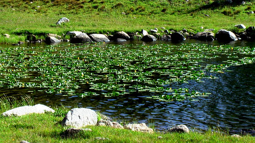
Anglers will love it.

Dang, brings back memories! No argument about this being one of the best!
Lots of big loops possible. We went north out of Big Sandy, crossed the Divide, then looped back down into the Cirque. I stopped for half a day to climb Wolfs Head; Lisa scared a bear out of our camp while I was out.
http://gallery.me.com/buzzburrell#100086
Great destination and thanks for sharing those photos.
What’s a bear cannister?
One of those bear proof containers for food. You leave it lying on the ground rather than hanging it in the air.
I love your report of the Cirque and the loop you made.
I have a group of experience backpackers who would like to enter the Cirque via Texas Pass and out via Jackass Pass. Do you have any further advice for us? We appreciate every bit!
Thanks,
Heio
No worries. It’s just as good in the opposite direction. No navigation problems.
ENJOY