Trip report by site editor Rick McCharles.
I’ll post a photo trip report of my superb 17 day trek in the Everest region of Nepal, over the next 17 days.
The highlight of the day was flying in to Lukla Airport 9,380ft (2,860m), officially named Tenzing-Hillary Airport since 2008.
That landing is enough to get your heart rate up above 200.
The safety statistics are comparatively good for a short takeoff runway. Comparatively good means planes have only crashed 3 times recently, 1991, 2004 and 2008. Everyone was killed except for the pilot in 2008.
(Actually, the taxi ride from Kathmandu to the Airport is likely statistically more dangerous.)
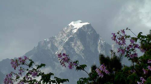
Immediately the mountain views are stunning. Is that Everest?
The mantra out of Lukla is SLOWLY, SLOWLY. It takes some time to acclimatize to the 2800m elevation. We did not walk far day 1.
This elevation is still surprisingly warm and lush considering the date, Nov. 11th, 2009.
A group of us hiking independently (no guide, no porters) stayed together until the village of Phakding. I checked into a room (less than $1 / night) and crashed for the evening without dinner.
I was altitude sick … complicating my KathmanFlu.
more photos from Everest trek – day 1
… on to day 2

This is an incredible, once in a lifetime adventure. I’m sorry to hear you got altitude sick! Were you forewarned this might happen? How do you prepare to prevent that from happening?
Almost nobody gets altitude sick at Lukla. I was sick on arrival with something from Kathmandu. The altitude merely complicate it.
Everyone is well informed about altitude sickness in the Himalaya. The only completely safe way to acclimatize is to hike up to Lukla, 5-7 days. I would have done this, actually, had I had enough time.
Trekking in Everest region is really awesome……………..
How ever I found this page very helpful. I really like the trek in Everest Base camp. I think this Himalaya are the home of mighty God. I suggest to every one to visit my site. Global Adventure Trekking
Excellent post for Nepal Trekking.
Hello Rick,
This is an excellent report for anyone interested in doing this hike on their own, well done. I find that when I was in Nepal everyone tried to steer me towards organized hikes.
I did a similar independent trek to EBC in May/June 2011. My wife and I had lots of time so we took a bus from Kathmandu to Jiri and started the hike from there. This adds another 8 days hiking from Jiri to Namche Bazzar but one gets the advantage of climbing up to altitude slowly and without any crowds.
I found the trails well marked and easy to follow with lots of guest houses and other tourists to consult for directions. The only parts that were tricky were the high passes (Kongma La, Cho La, and Renjo La). I found good GPS tracks for these on OpenStreetMaps.org that can be downloaded to a handheld GPS.
I’ve posted a brief description of my Everest hike on EveryTrail at:
http://www.everytrail.com/view_trip.php?trip_id=1488437
Best regards,
Sebastian Irazuzta
You really live a amazing life.
Wow, what a start to your Everest trek! Lukla and the views look incredible, and your “slowly, slowly” tip is perfect for acclimatizing. Can’t wait for the next updates!