Following my Kilimanjaro climb starting Feb. 14, 2026 — I’ll be travelling for a couple of weeks in Tanzania.
It looks spectacular.
Click PLAY or watch it on YouTube.

Best hikes, treks, tramps in the world.
Following my Kilimanjaro climb starting Feb. 14, 2026 — I’ll be travelling for a couple of weeks in Tanzania.
It looks spectacular.
Click PLAY or watch it on YouTube.
Trip report by BestHike editor Rick McCharles.
No A.I. was used in this post.
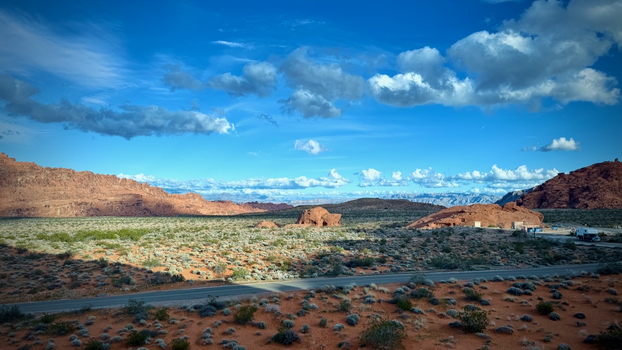
Less than an hour from Vegas is incredibly gorgeous Valley of Fire State Park.
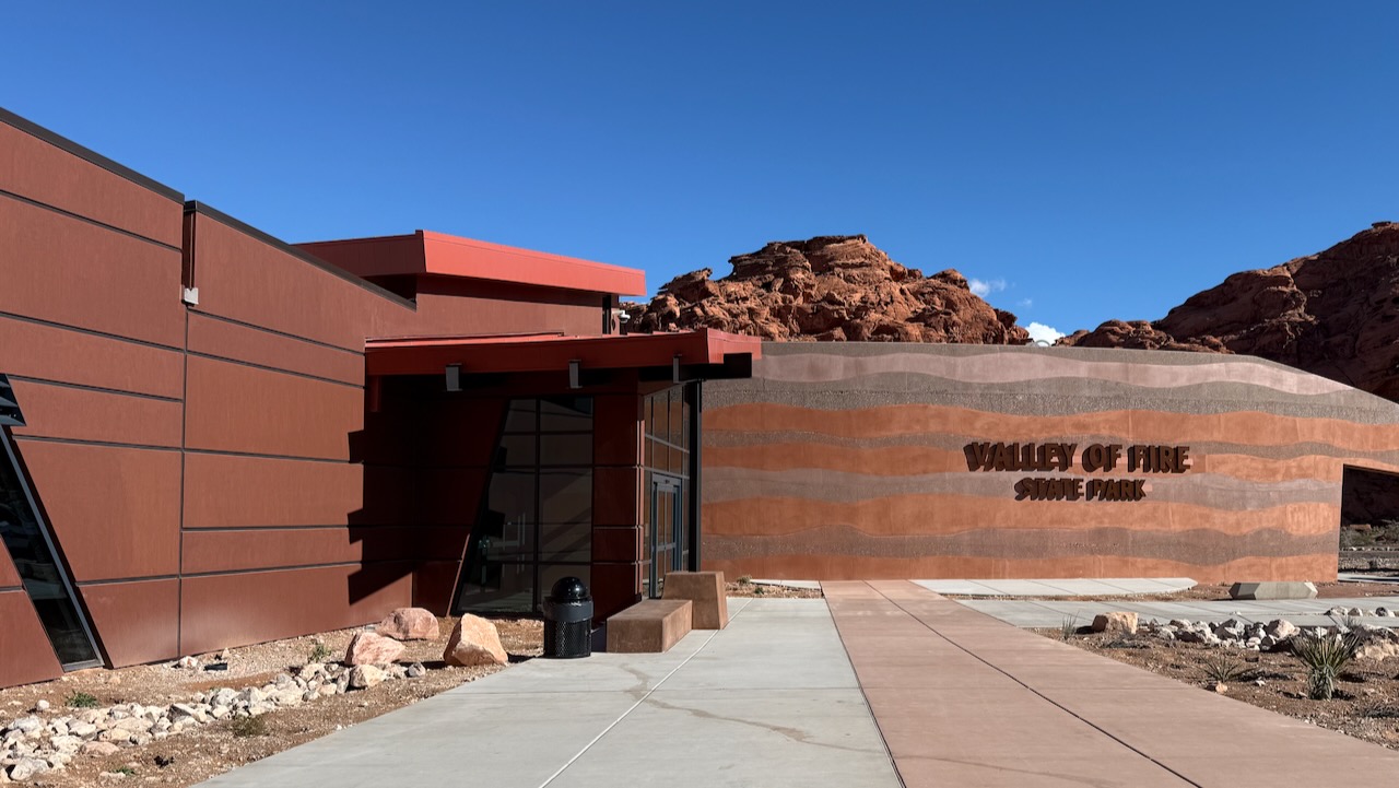
We stopped by the new (and under construction) visitor centre
Ranger recommended Fire Wave and Seven Wonders Loop.
We could decide whether or not to add the White Domes trail when we got to the turn-off.
From the parking lot, we had to decide which direction to hike. The signage is minimal in this park, for good and bad.
Most people seemed to be going clockwise (looking from the top) so we joined them.
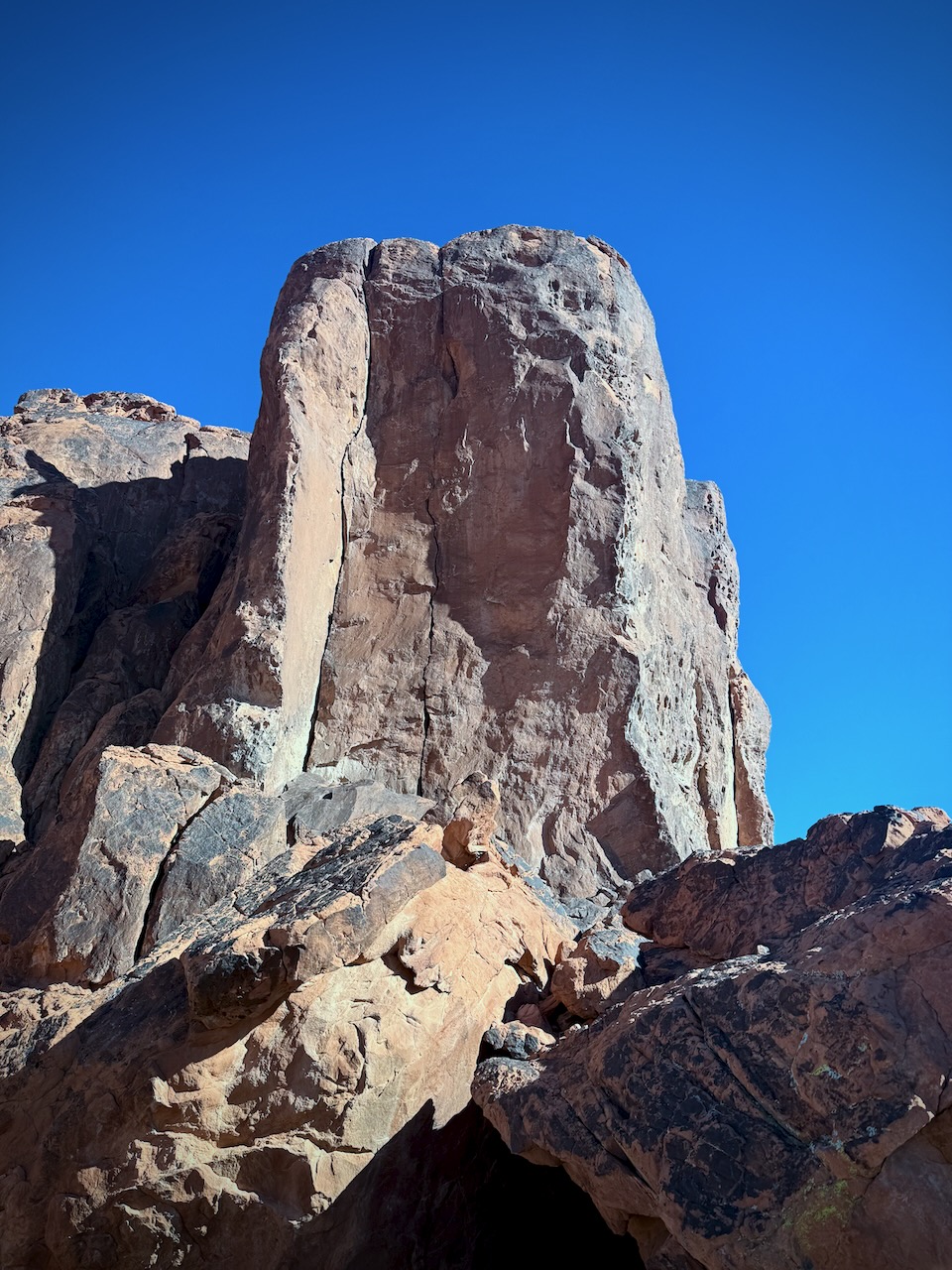
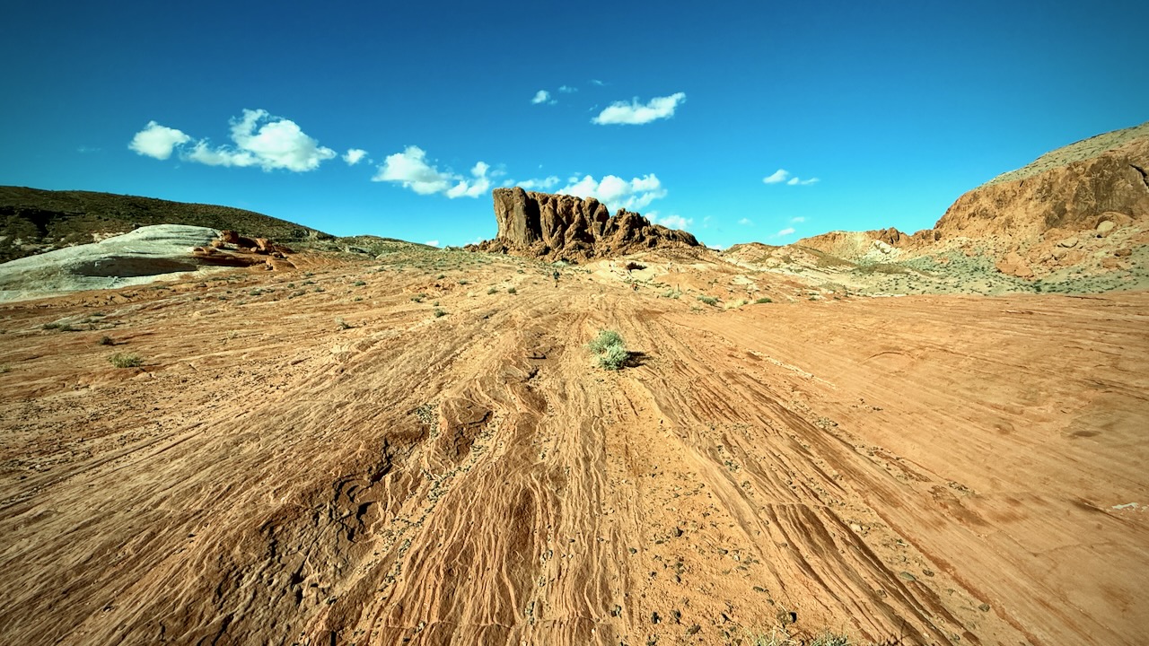
It’s ALL good. Endless impressive desert vistas.
Temperatures moderate in early January. Winter is an ideal time to hike the Nevada deserts. This trail was busy with tourists.
(Note that I try not to post photos & videos of people without their permission.)

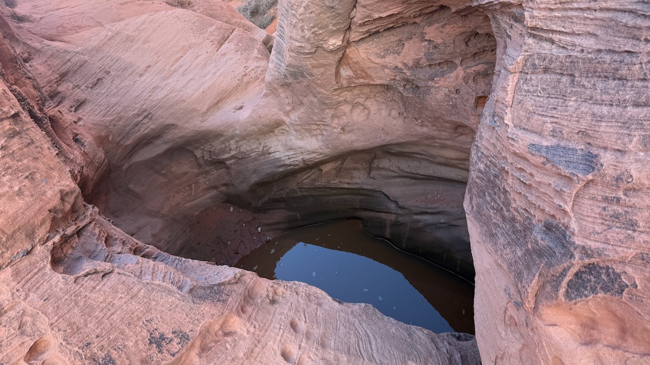
Slot canyons are almost always dry. But over Christmas / New Years 2025, this area had rains for several days. We had water in some of the canyons.
… Somehow we missed the turnoff to White Domes. Oops.
Next drove to Petroglyph Canyon via Mouse’s Tank Trail.
Here’s the Mouse’s Tank.
Finally we stopped at Atlatl Rock Viewpoint for lunch.
Stairs take you up close to some of the best petroglyphs in the park.
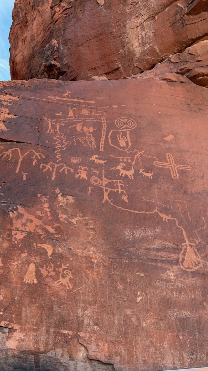
How did they get up there 40,000 years ago?

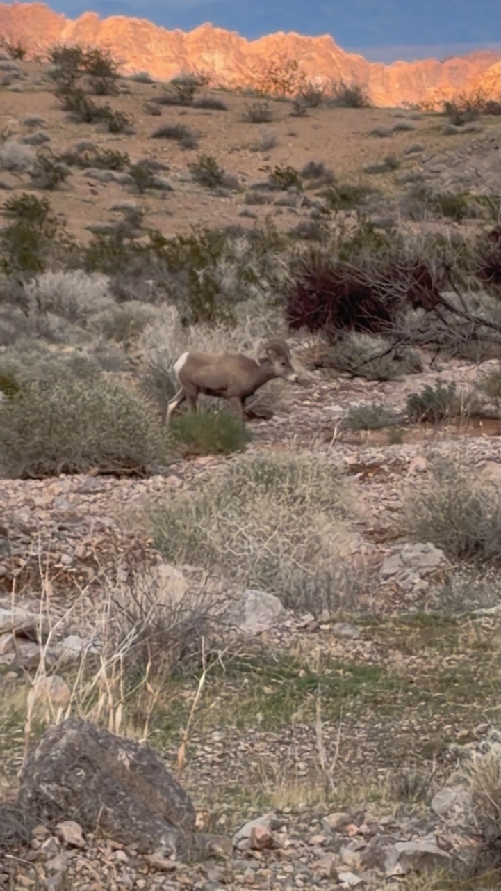
On the way out, we saw a large herd of Bighorn Sheep. They seemed entirely nonplussed by tourists.
We’re already planning future trips. The campgrounds here are excellent.

Click PLAY or watch it on YouTube.
60 Minutes has much been in the news of late. New CBS News editor-in-chief, Bari Weiss pulled a segment on President Trump’s deportations just hours before broadcast. It was widely seen as political pandering to Trump. His move to deport people from the USA to the El Salvador prison CECOT, is likely a human rights abuse and potentially criminal.
If you believe in Freedom of the Press as guaranteed by the U.S. Constitution, know that the episode showed on Global TV Canada and was widely available around the world. By trying to protect the President, Bari Weiss ended up bringing even more attention to the potential criminal act.
BUT their feature on the Sherpas of Everest is quite good, bringing public attention to these important guides and porters.
Click PLAY or watch it on YouTube.
Halfway Anywhere posted the JMT Trail Hiker Survey (2025). 459 hikers.
Here are a few of the GEAR details:
Click through to read the rest:

Durston gear is killing it.
Sale price$250.00 USD
A montage of some of our best photos from the past year.
Canada, Indonesia, Vietnam, Singapore, Taipei, Philippines, USA.
Click PLAY or watch it on YouTube.
Click PLAY or watch it on YouTube.
One of our BEST hiking videos on the BestHike.com YouTube channel.
Subscribe if you can. Thanks.
Click PLAY or watch it on YouTube.
Happy trails in 2026.
One of our BEST hiking videos on the BestHike.com YouTube channel.
Subscribe if you can. Thanks.
Click PLAY or watch it on YouTube.
One of our BEST hiking videos on the BestHike.com YouTube channel.
Subscribe if you can. Thanks.
Click PLAY or watch it on YouTube.
