Thomas Coldwell documented his summer 2022 adventure, along with 4 others. And put together this VERY useful document for anyone wanting to plan a Traverse for themselves:
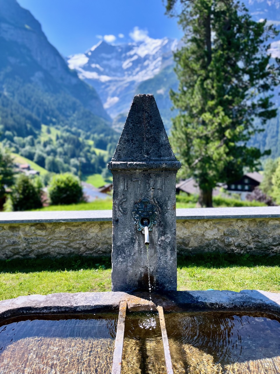
I stayed at the excellent and inexpensiveGrindewald hostel. It’s a fair walk uphill from town. But you can take the hourly bus for free.
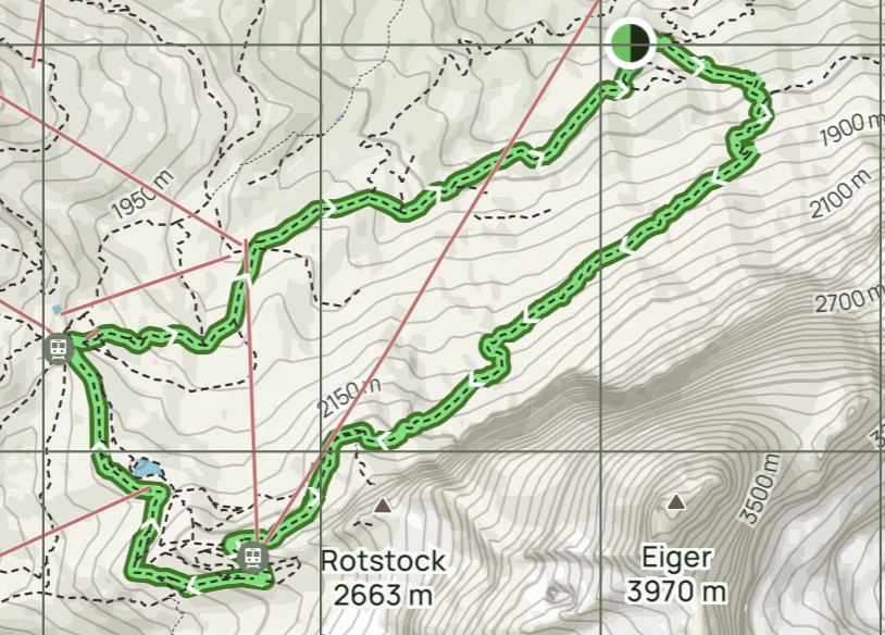
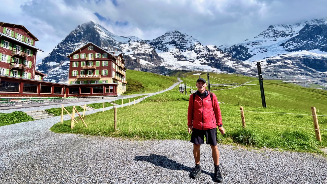
Of many excellent day hike options, I decided on the Eiger Trail starting in Alpiglen, climbing 800m. Lazy this time, I took the expensive Jungfrau Railway up to Alpiglen. (A woman I’d spoken with had hiked it to and from Grindewald the day before — MUCH tougher.)
My route was only a 12.9-km loop — but it might take 5 hours as you stop so often for the fantastic vistas both UP and DOWN.
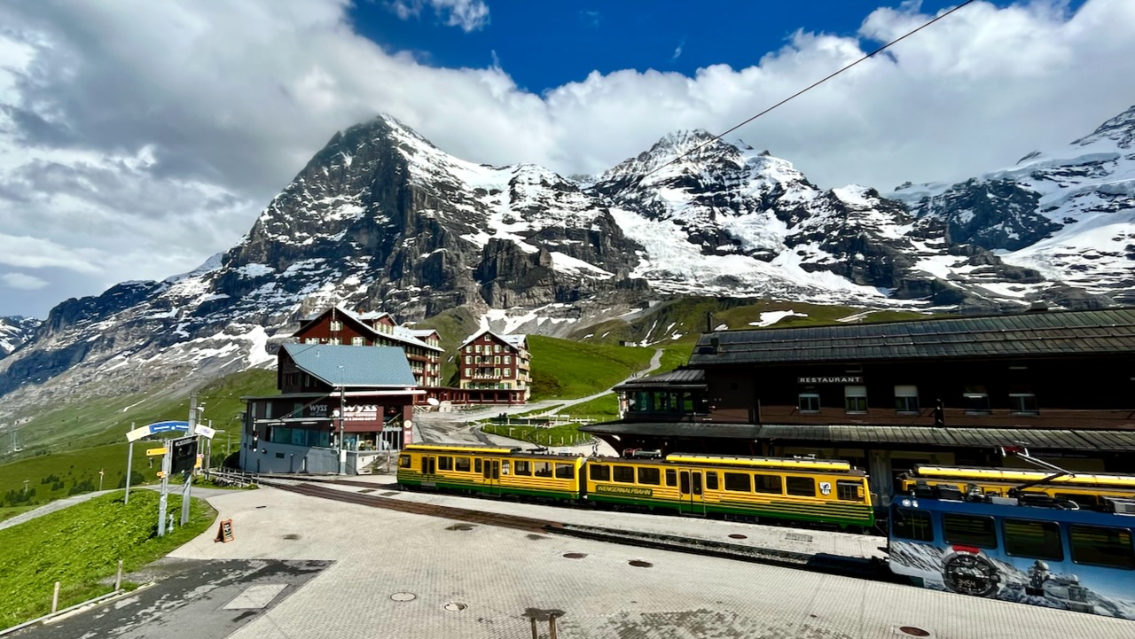
Unfortunately, the typical afternoon rainstorm broke just before I sprinted into Kleine Scheidegg near the top.
I ended up buying an expensive train ticket back down to Grindewald. And enjoying Swiss soup at Kleine Scheidegg while I waited out of the rain.
Weirdly, the weather broke right after soup. I could have easily hiked down — but could not get a refund on the train ticket as it came out of a machine.
I do feel the Eiger Trail is the best hike out of Grindewald.
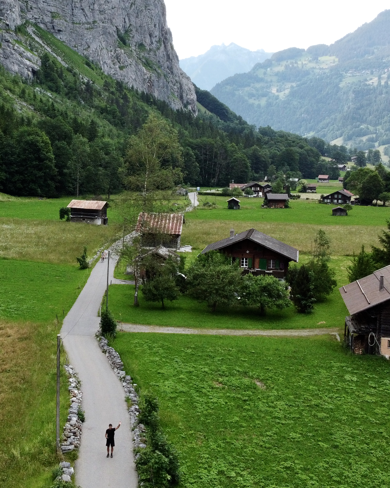
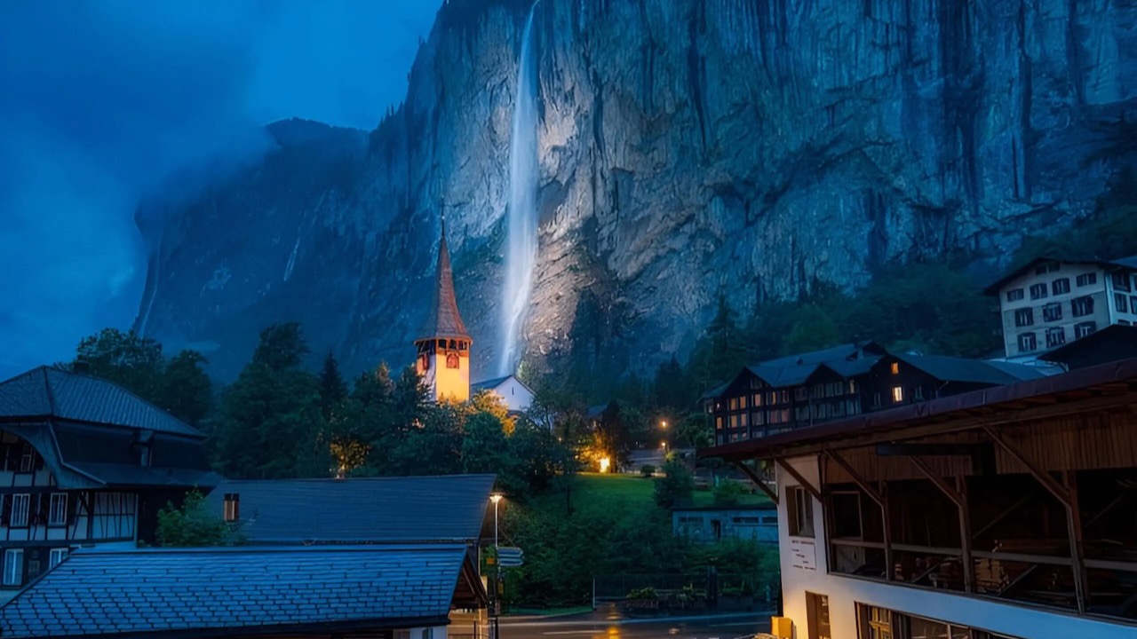
In fact, this unique U-shaped valley, (German: Lauterbrunnental), is what I remember most fondly. In places the cliff walls are up to 1,000 m (3,300 ft) high. It’s very popular with all the action sports where people jump off cliffs. 😀
On this trip I walked the valley 3 times. Back and forth in the evening. Then next day as part of my major hike. Lovely.
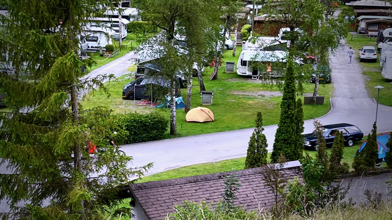
I tented at Camping Jungfrau near town. An excellent campground.
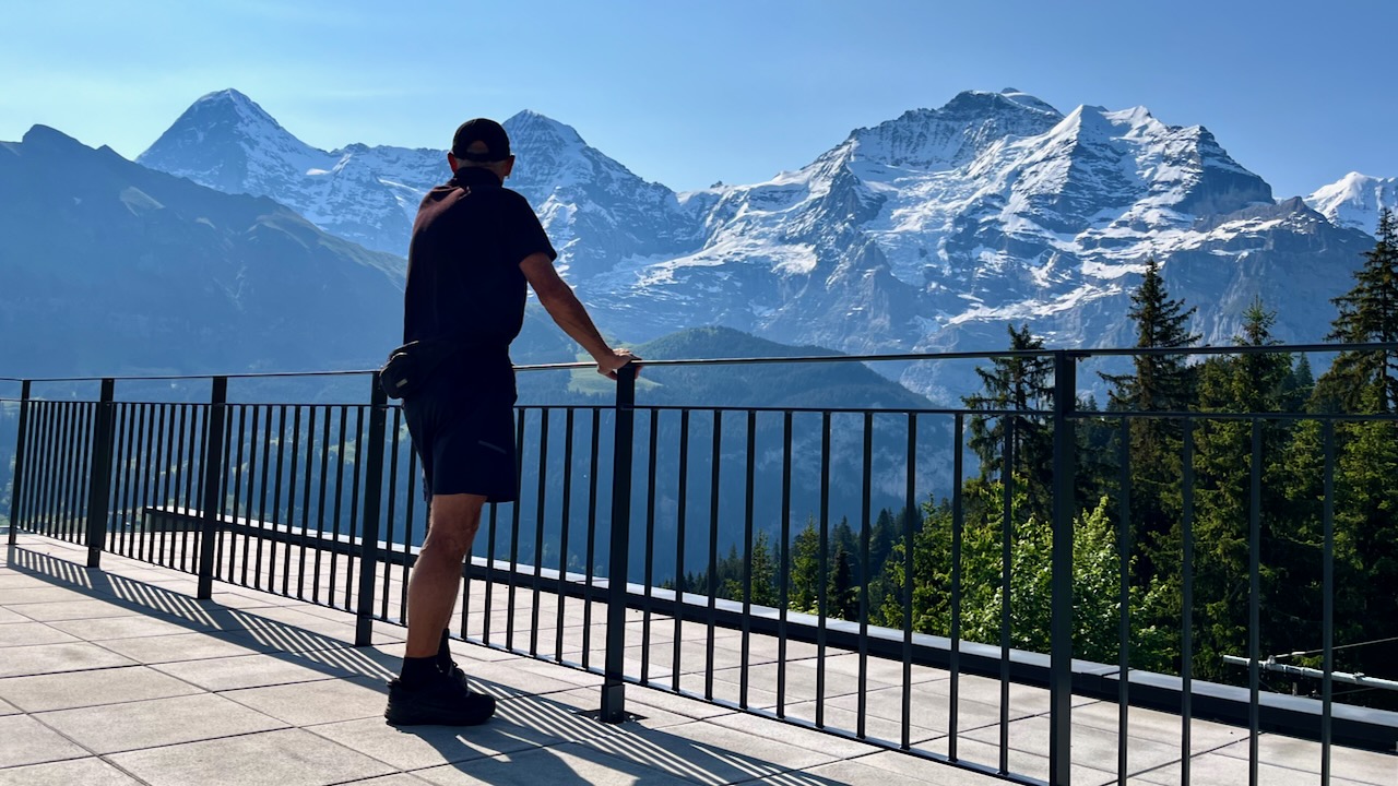
There are no bad hikes out of Lauterbrunnen. But I did one version of what’s probably the most popular. Lauterbrunnen ➙ Mürren ➙ Gimmelwald ➙ Stechelberg ➙ and back down the valley to Lauterbrunnen. A loop. You could do it in either direction.
There are many ways to do it. I took the cable car up to Grütschalp, to start.
There are terrific views of the Eiger, Mönch, Jungfrau, and many other high peaks from up on those cliffs.
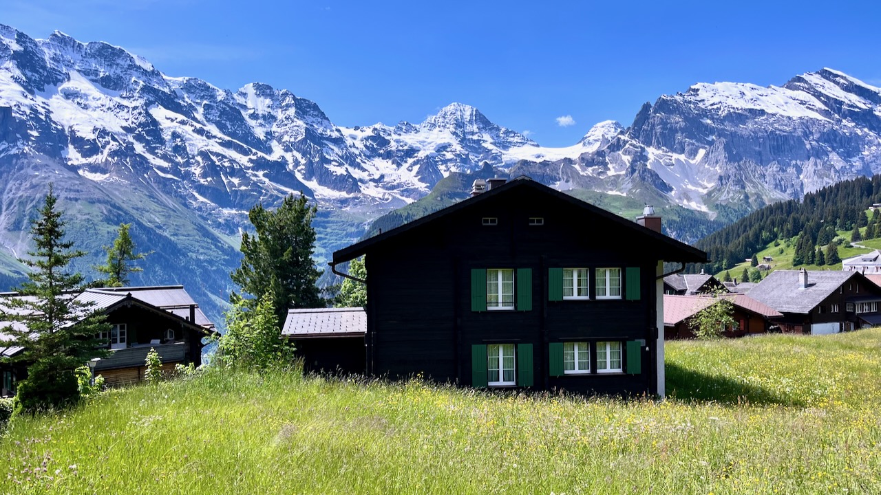
Tourists are all happy here. All impressed that the culture is being somewhat preserved. Farmers are working as they have been for hundreds of years.
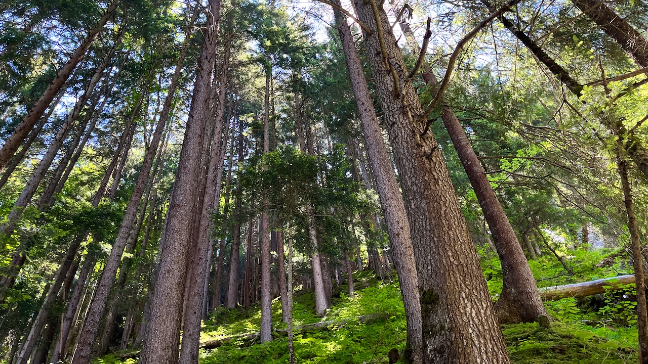
I was surprised too that it’s quite possible to find spots with no people. Huge trees.
There are dozens of impressive waterfalls. I liked best Staubbach Falls, close to the village of Lauterbrunnen.
This area has 136 days of rain or snow per year. Be prepared. Sunny. blue sky in the morning can develop into a serious lightning storm in the afternoon.
… the first person to visit both the North Pole and South Pole by surface means and the first to completely cross Antarctica on foot. In May 2009, at the age of 65, he climbed to the summit of Mount Everest.
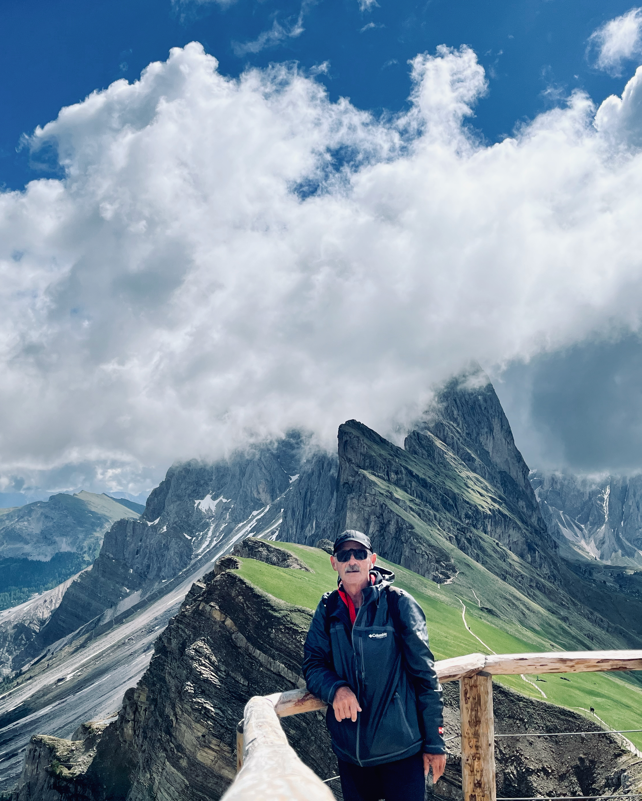
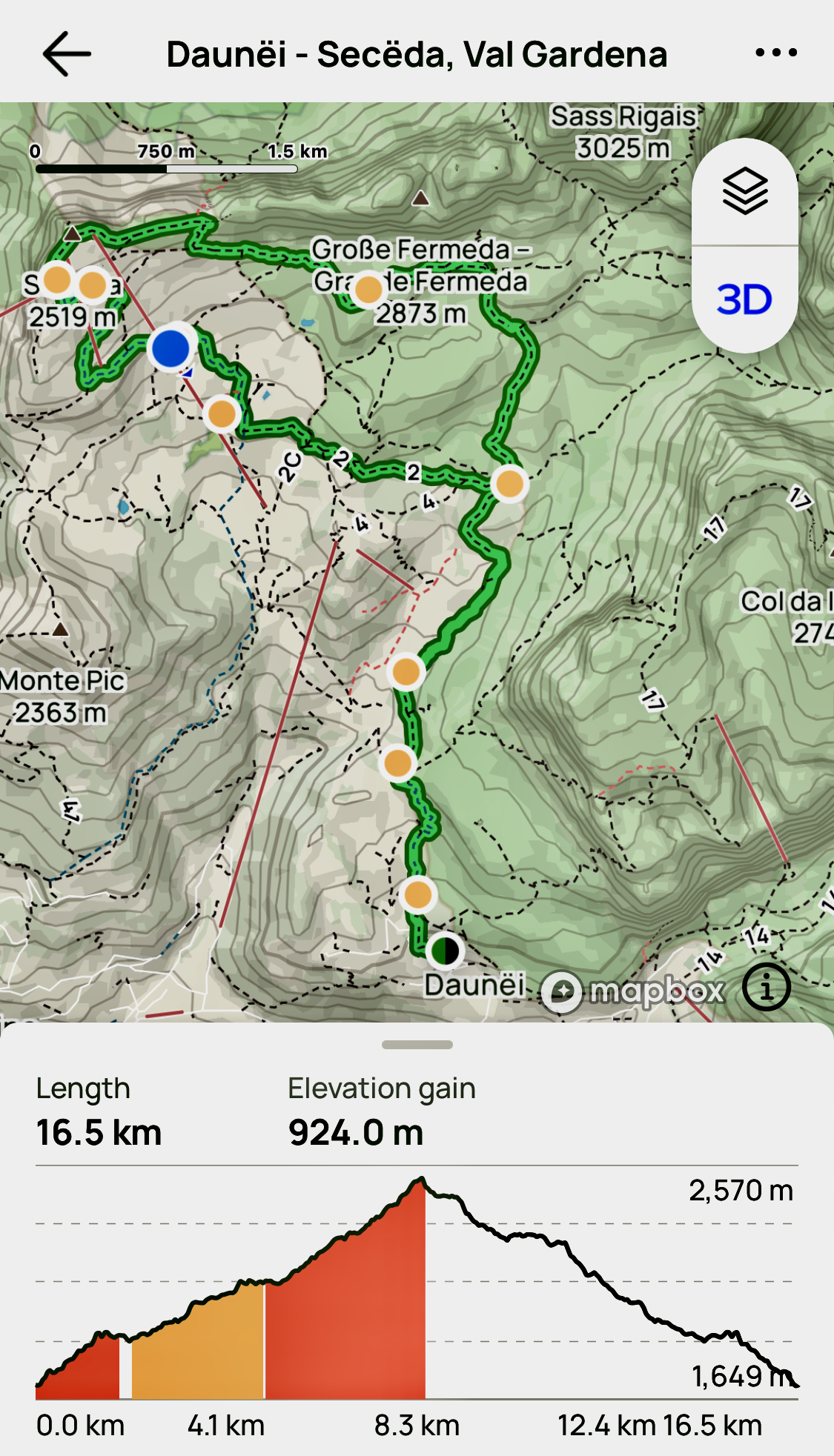
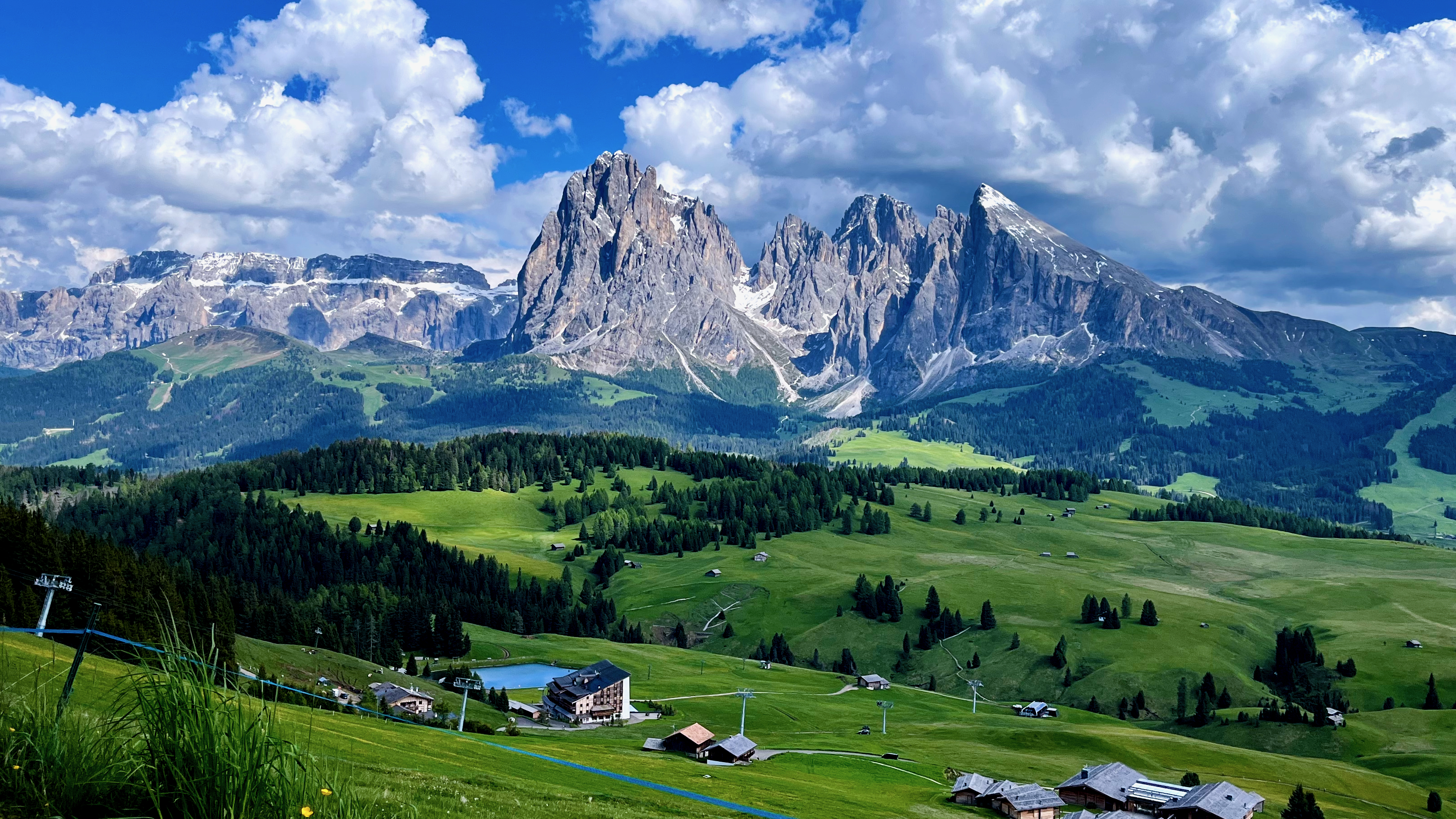
There are no bad hikes out of Val Gardena. But the highlight for me was getting to the famed ridge vista of the Odles/Geisler Group from Secede (2518m).
I hiked up early, the first person to reach the ridge on this morning. I wanted to beat the cable car day hikers. That expensive lift started up at 8:30am in 2023.
Here’s that famed vista on a clear day.
Amazing views in the Dolomites mountains. Views from Seceda over the Odle mountains are spectacular.
Another good option is to stay late in the day, after the cablecar stops at 5:30pm.
Of course it’s a long steep descent. 😀
There’s heated debate in the Dolomites whether or not you should use the cable cars. Personally, I’m OK with them — if you have the money.
But on this one I climbed down over a vertical kilometre back to the valley. Step by step.
I’d started with a plan. BUT — as usual in the Dolomites — I ended up changing it en route. Easy to do when there are so many clearly marked alternatives.
Another day I took the cablecar from Ortisei to the Alpe di Siusi up to what’s claimed to be the largest high altitude Alpine meadow in Europe. It is high, huge, and green.
You can’t lose hiking Val Gardena. It’s fantastic.
Be ready for afternoon thunder and lightning, however. Don’t get stuck up high in a storm.
Hiking holidays in Peru are hot right now. More popular than ever. Political stability since the leader of the Shining Path terrorist group was captured in 1992 resulted in a booming tourist industry.
The second highest mountain range on Earth is fantastic. Broad valleys and endless vistas. You are always above the tree line. Arid desert to the west, Amazon jungle to the east.
Our contributors have hiked most of the major treks in Peru the past few years. The peaks, glaciers and canyons are outrageous. Everyone is thrilled with the Andes.
Unfortunately, management of treks is atrocious, the Peruvian government seemingly bent on ruining their fantastic tourist draw. Do your homework before booking a flight to Lima. Or sign on with a trekking company with which you have had a strong, recent recommendation.
Ruminahui in Cotopaxi National Park, Ecuador
The weather in the Andes can be deadly, of course, but sometimes you get weeks of sunny blue skies, especially in the Cordillera Blanca out of Huaraz, Peru. The best weather for the high peaks out of Huaraz (the best jumping off point for hikers in the Central Andes) is the drier “Andean summer”: May-Sept.
In fact, there are good hikes somewhere in this region year round.
Our favourite hike in the Central Andes is the little known Ausangate Circuit in Peru, our #4 best hike in the world. Quite a few trekkers have decided on Ausangate (instead of the over-hyped Inca Trail) based on our recommendation. And all have been happy with that decision.
Note that Bolivia is not nearly as popular as it should be due to lack of infrastructure for tourism, security concerns and political instability. Honestly, unless you know the language and culture well, it’s better to hike Peru. Or much neglected Ecuador.
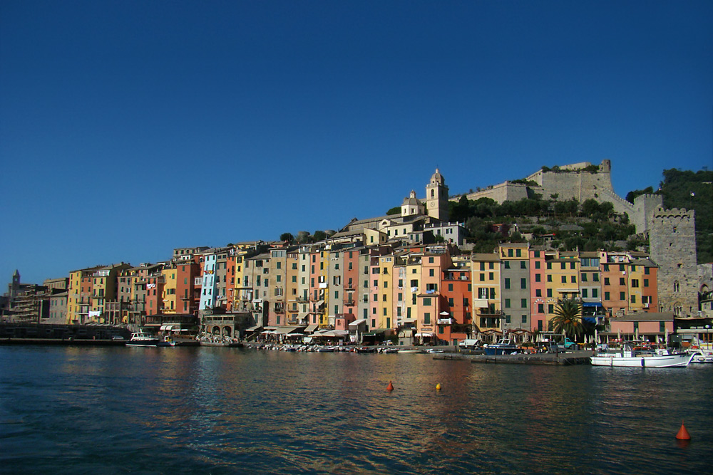
Took the train to La Spezia. Then the local bus to Porto Venere.
A pretty town.
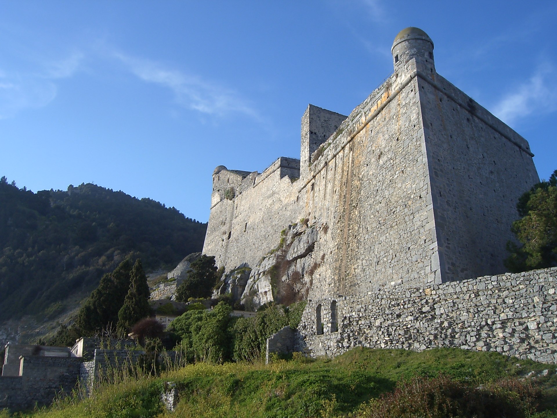
Starting the hike north, immediately you find the impressive Doria Castle.
EPSON DSC picture
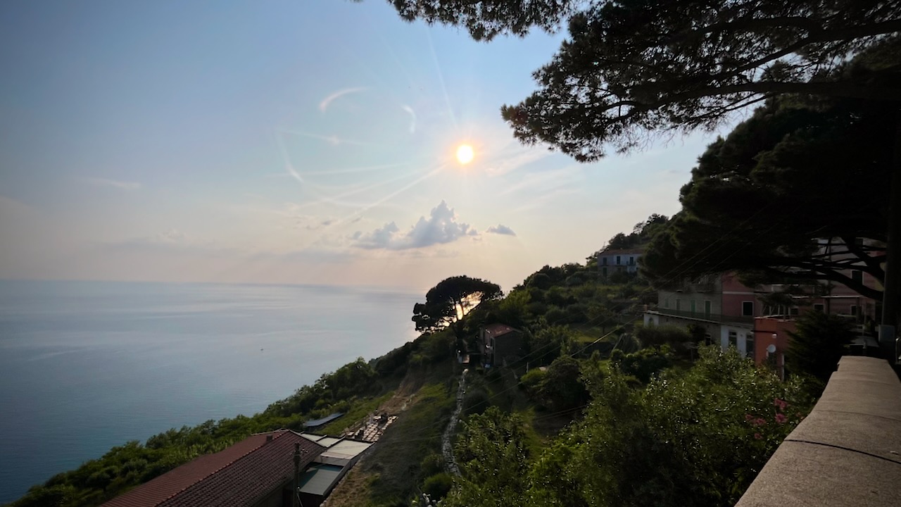
The trail takes you high above the ocean with terrific views in each direction. There are some very narrow pathways, but no real exposure.
I found a quiet spot, just before dark, to put up my tent.
Early next morning I arrived at the impressive Santuario di Montenero. The priest came out, interested in my drone. I showed him how it worked and later sent him this video.
Montfort Castle Loop from הפצמ הליה, Upper Galilee, Israel
Cecilia Waterfall via Cecilia Forest, Table Mountain National Park, Cape Town, South Africa
Inca Trail (Mollepata), Aguas Calientes, Peru
Huayna Potosi, La Paz, Bolivia
Mt Rosea Loop, The Grampians, Halls Gap, Victoria, Australia
Dschelada Pavian Loop from Gich, Simien National Park, Ethiopia
Annapurna Circuit, Besi Sahar, Nepal
Kilimanjaro, Lemosho Route, Arusha, Tanzania
Like most of these meaningless lists, it’s effective in getting me thinking about future hiking trips. I looked up the Birtvisi Canyon Viewpoint and Ruins Hike, for example, but found it’s only 1.8-km long.