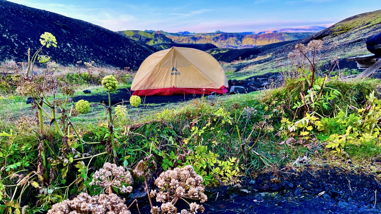
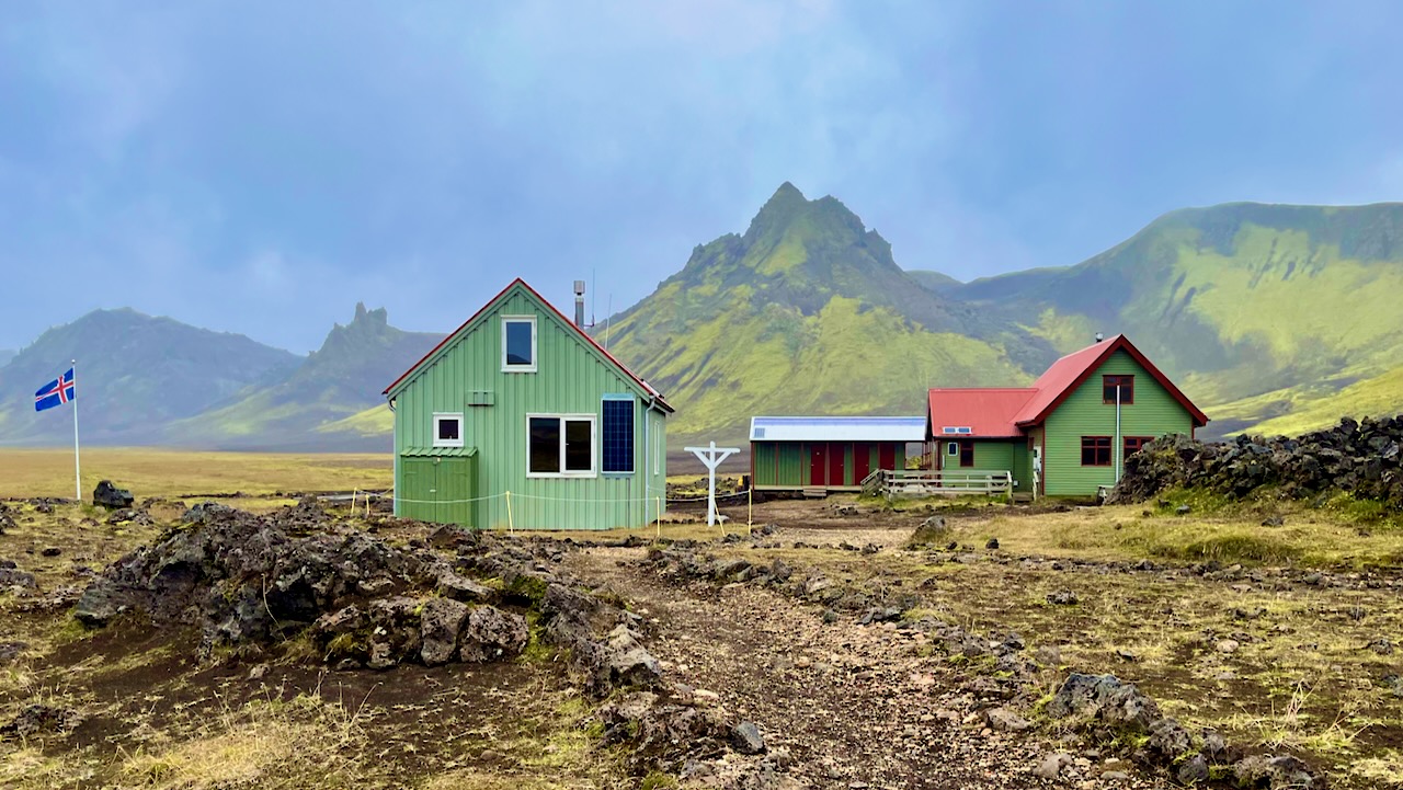
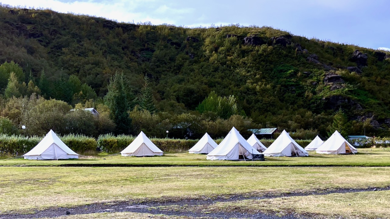
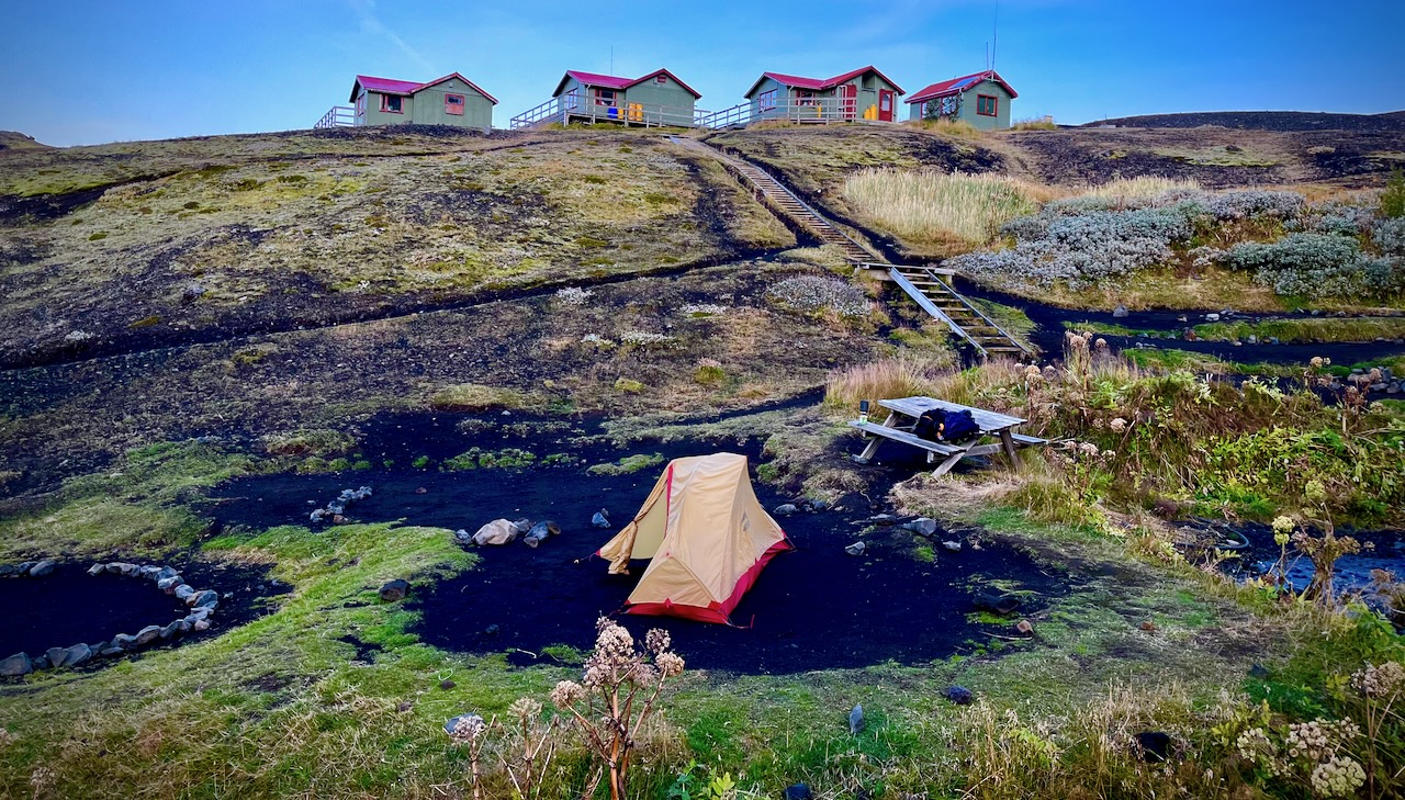
Volcano hut offers these luxurious rental tents. Glamping. 😀
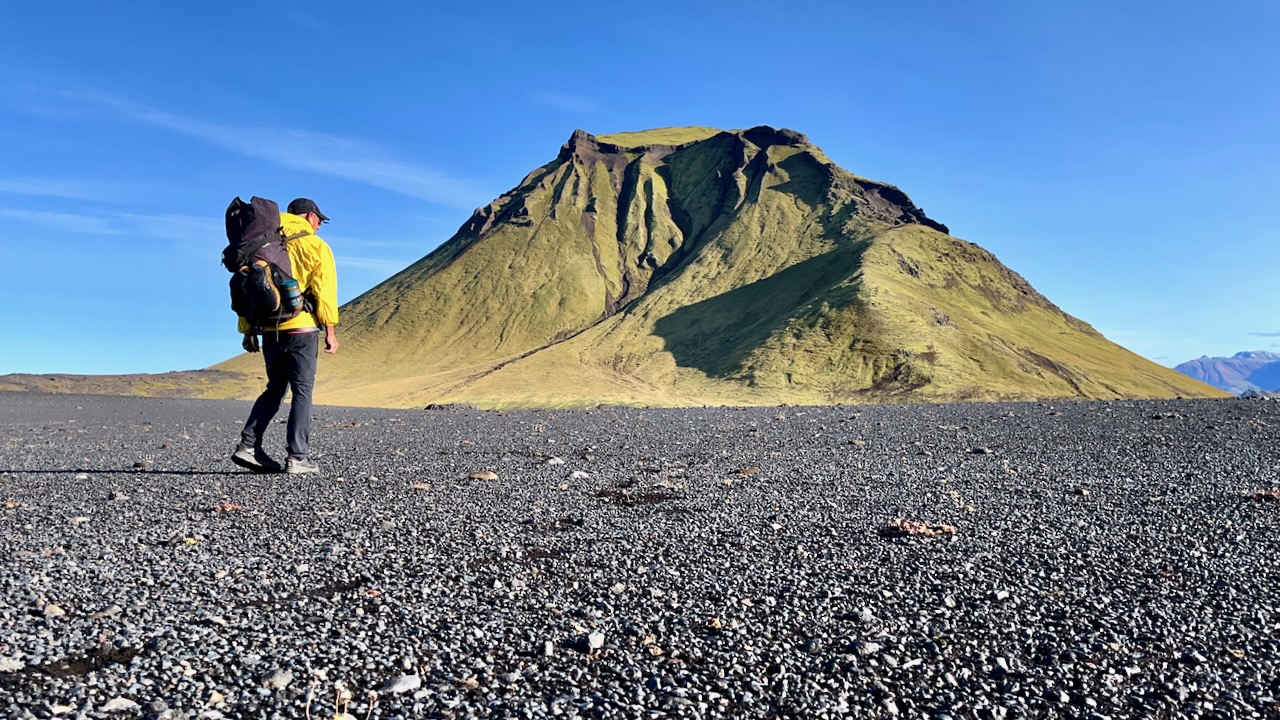
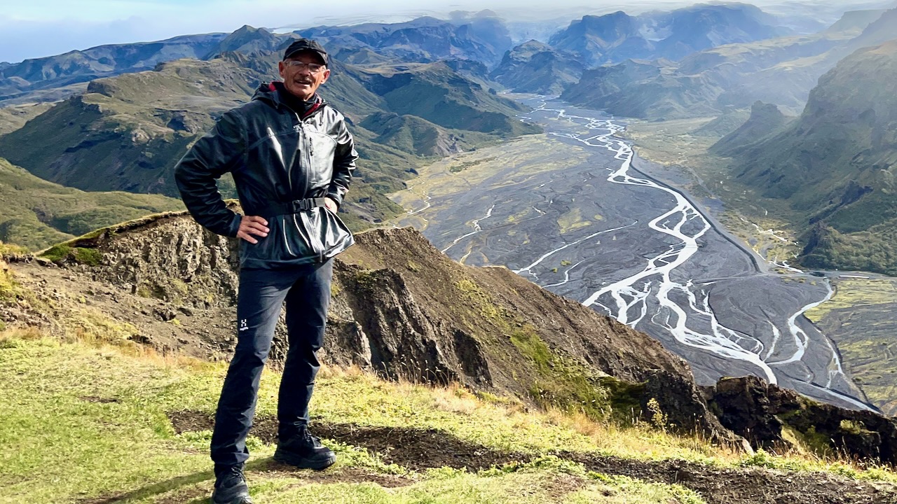
I dropped my pack and — as the weather was good — hiked up the closest viewpoint with most everyone who had arrived with me.
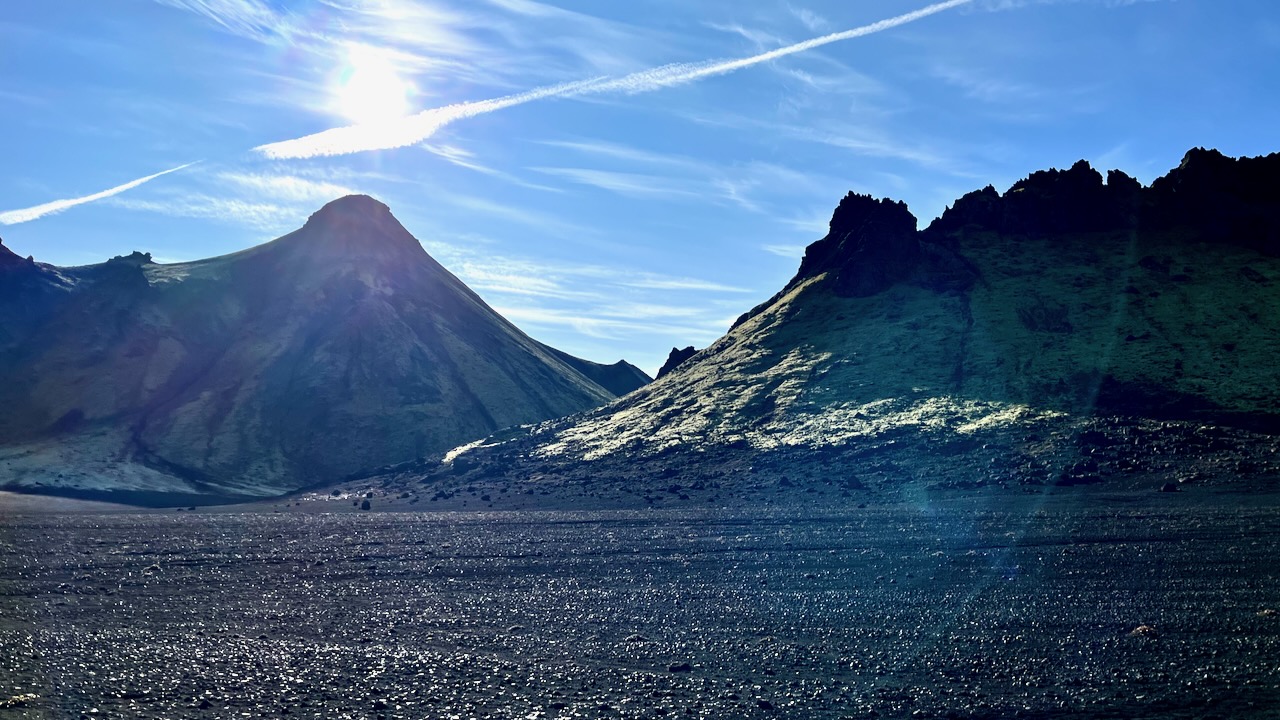
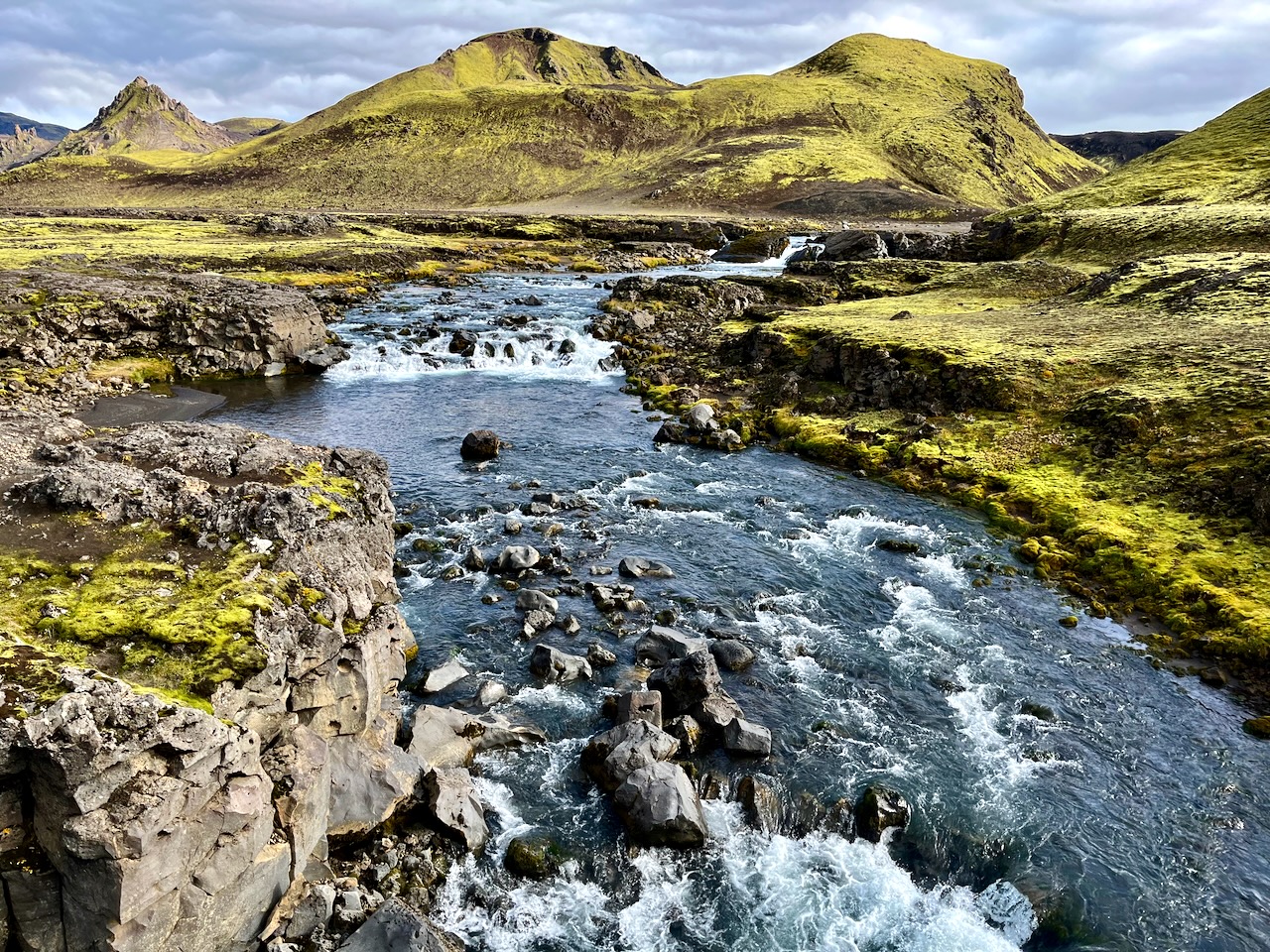
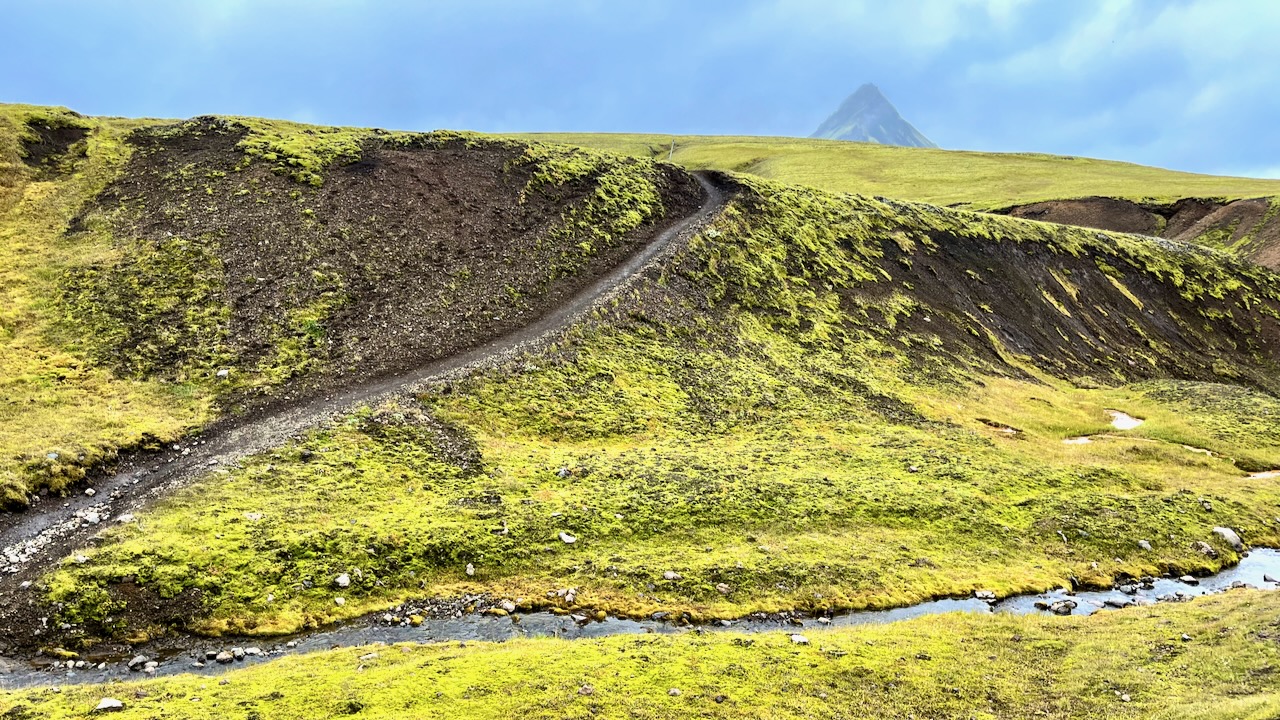
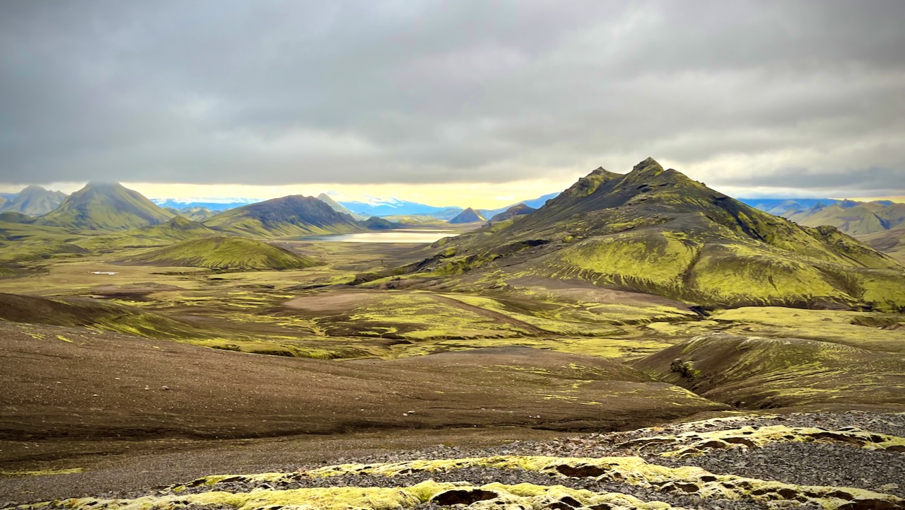
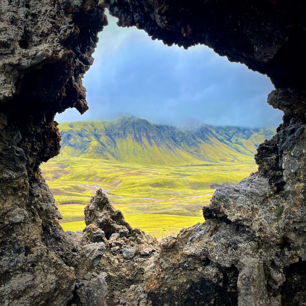
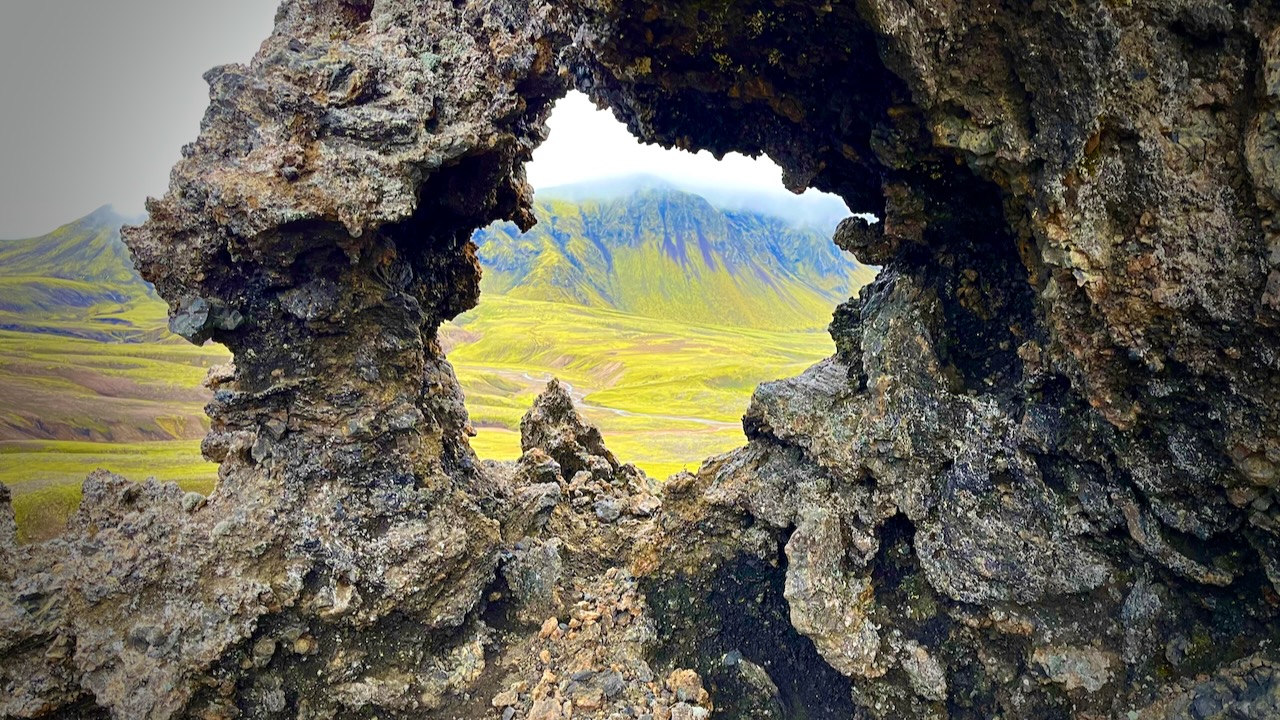
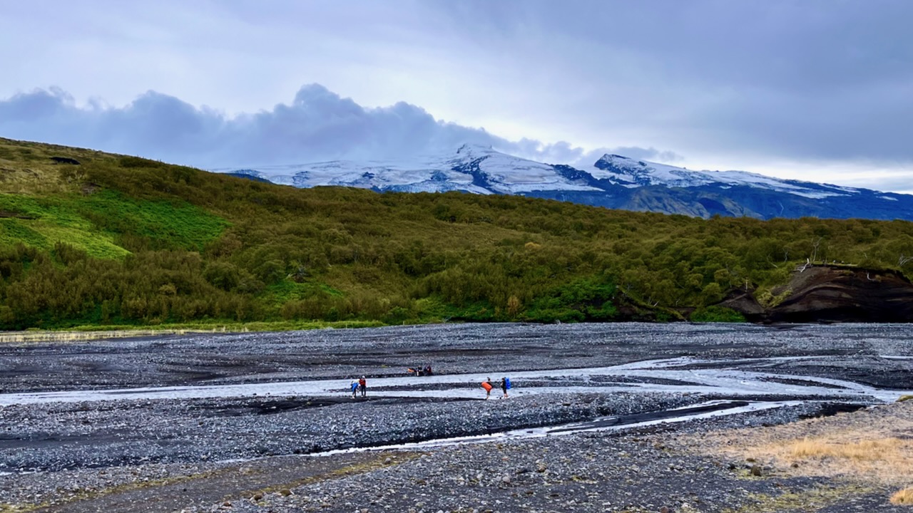
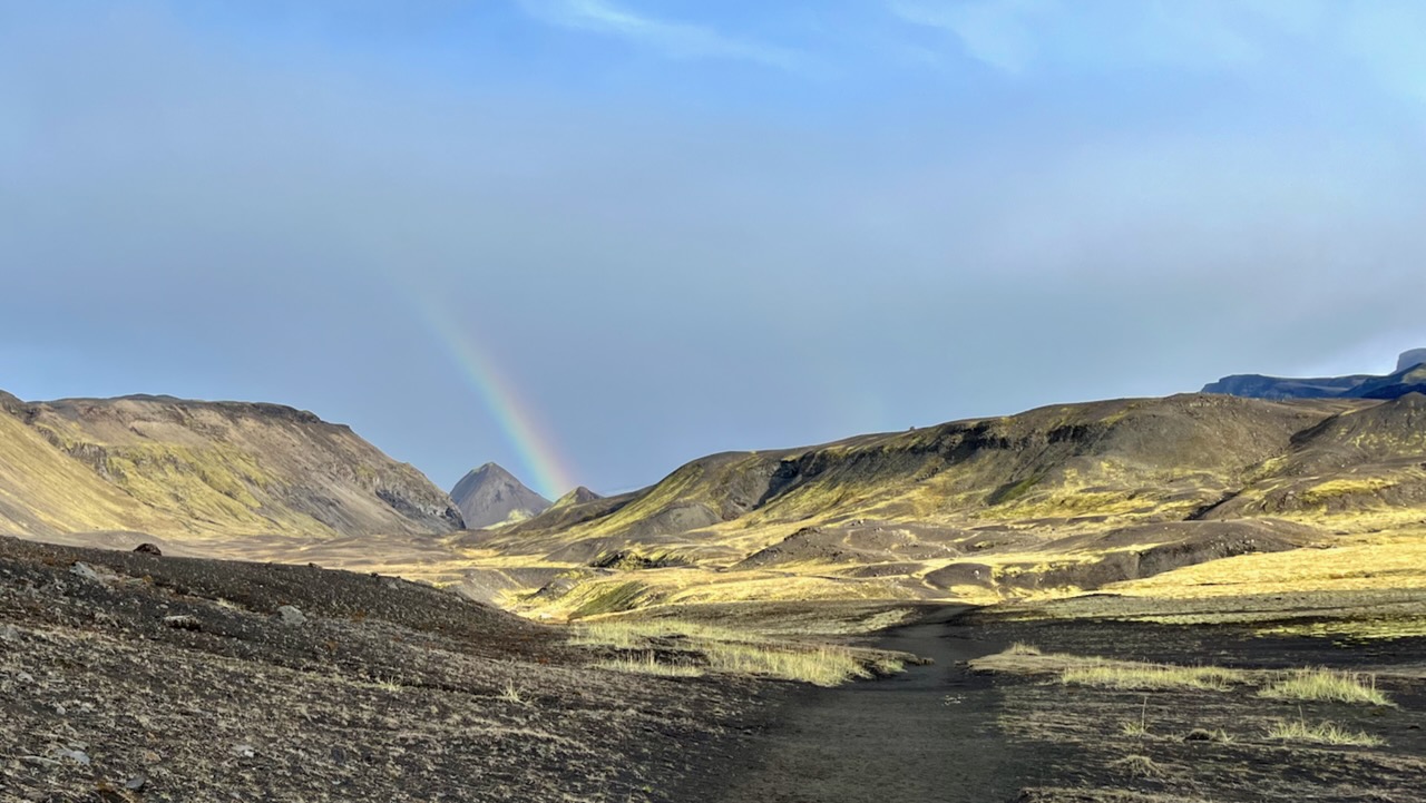
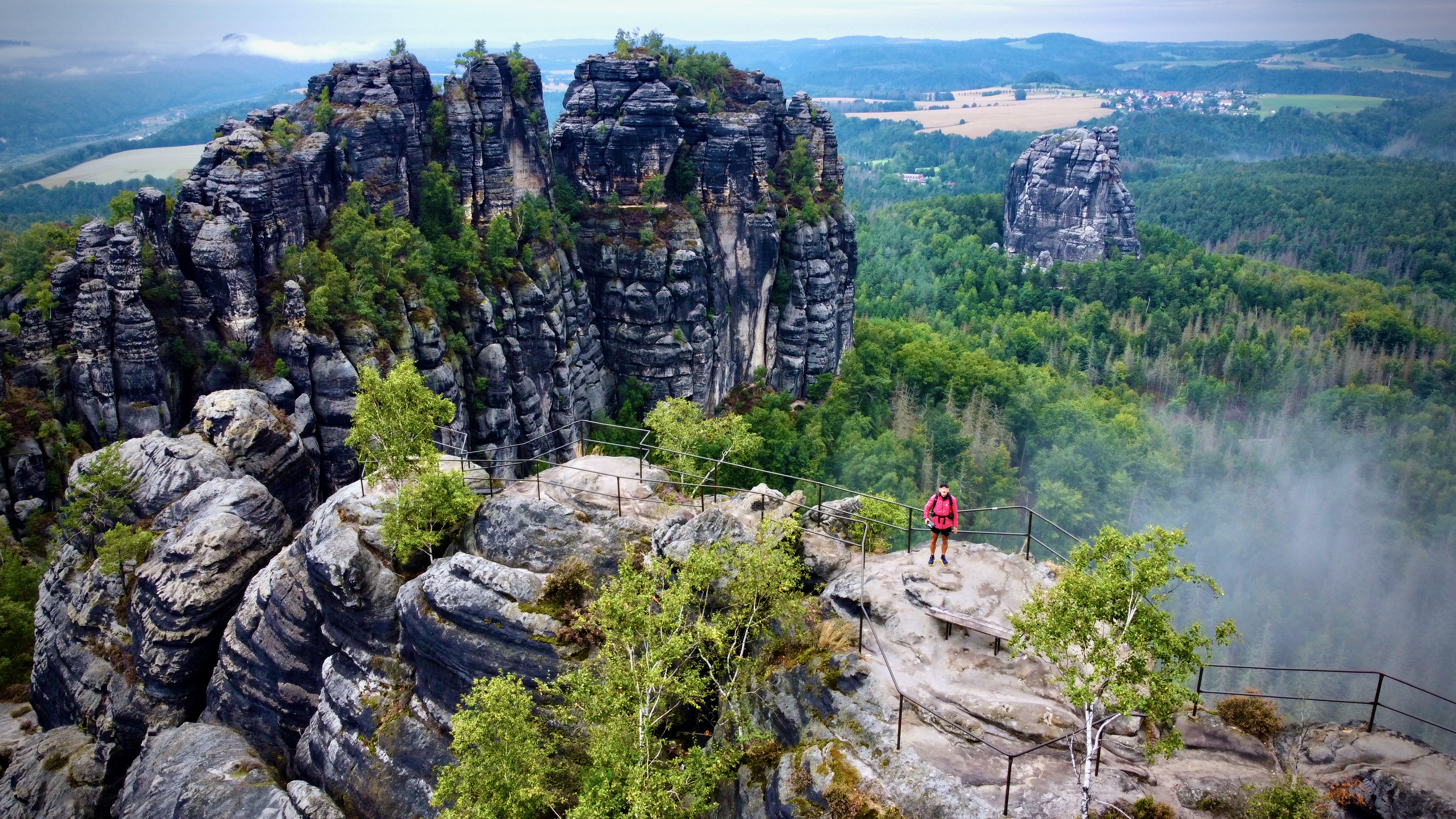
Wow. This is the Iceland I remember.
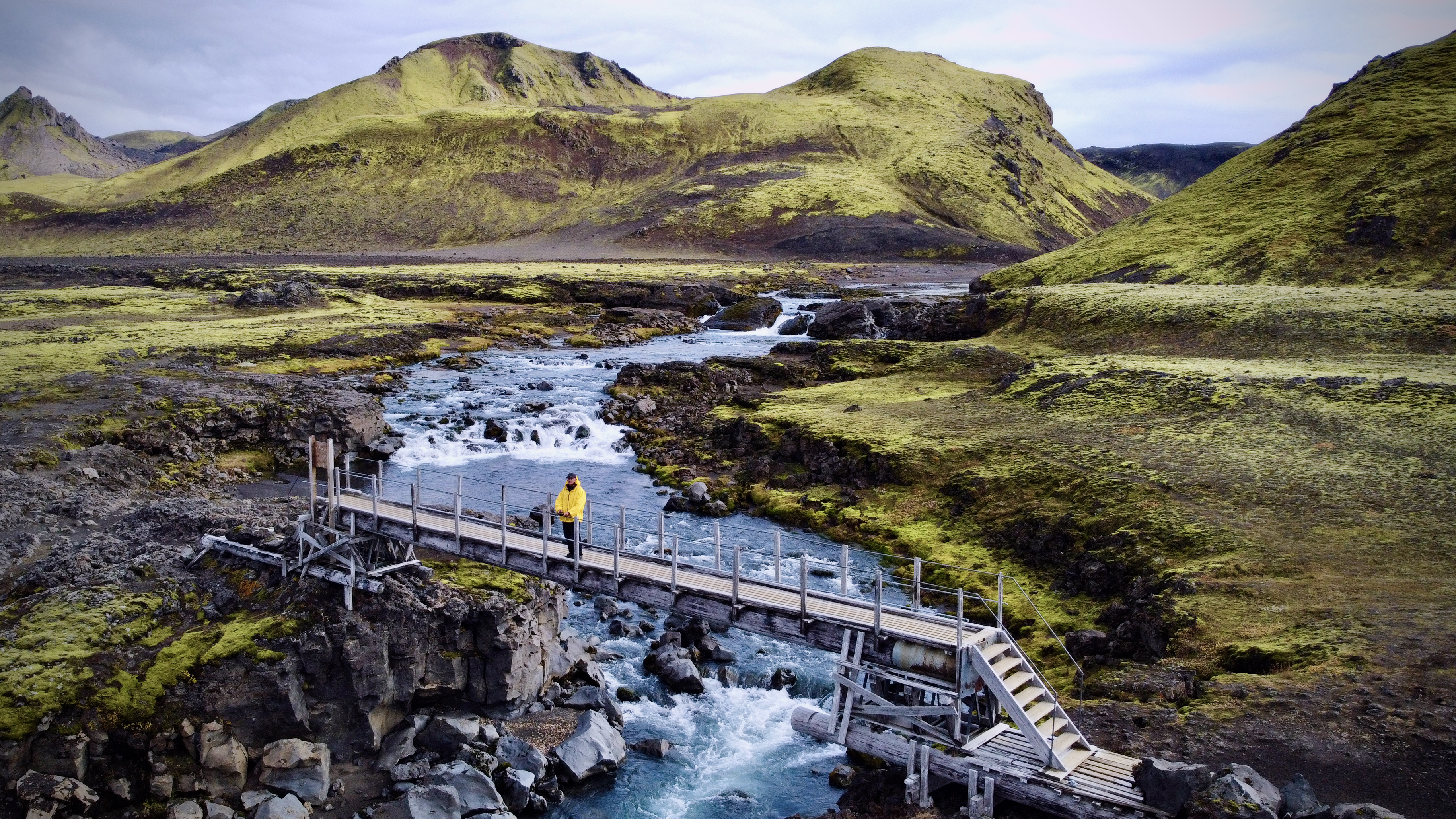
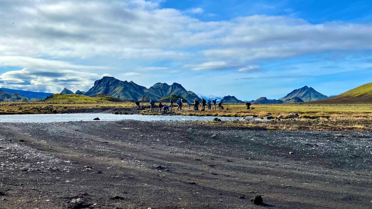
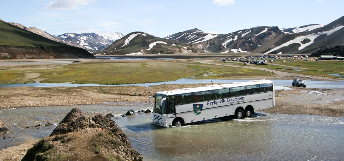
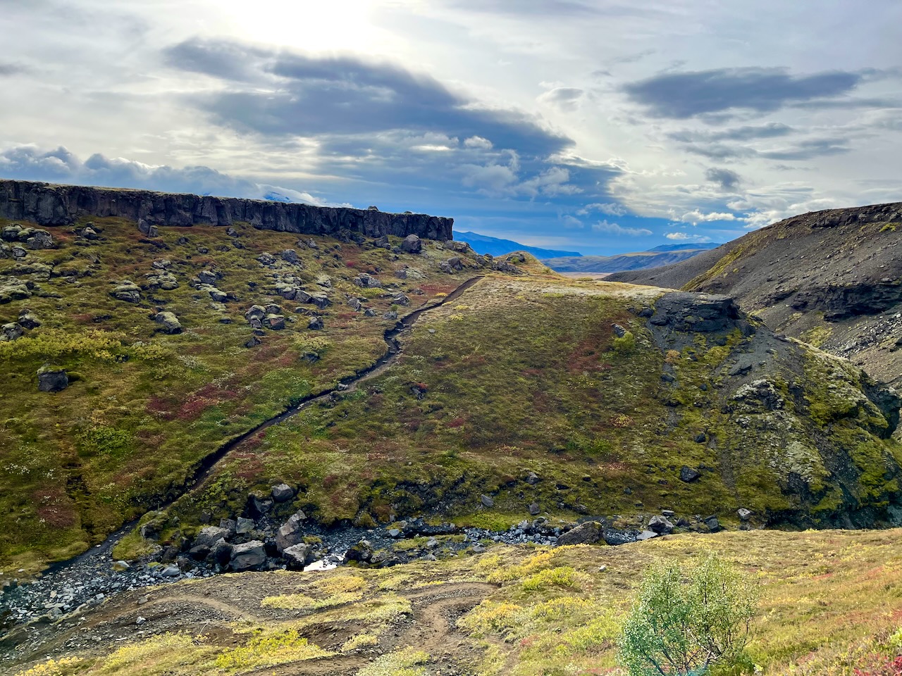
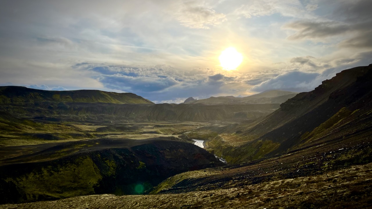
I planned to cross this river on foot when I returned.
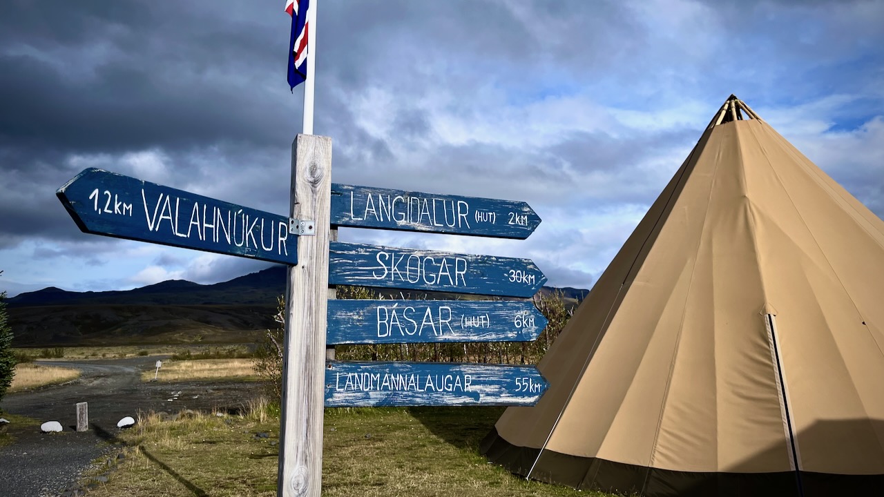
We took a different trail down to Langidalur camp. Then hiked around the mountain back to Volcano.
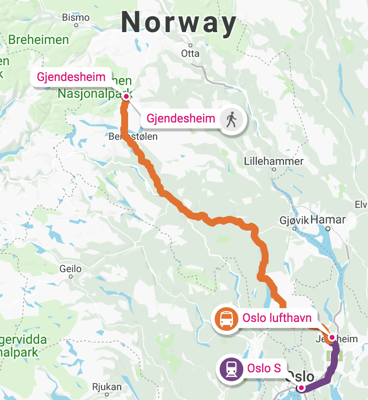
It was only 13.5km to the first official campsite Emstrur / Botnar so I was in no rush.
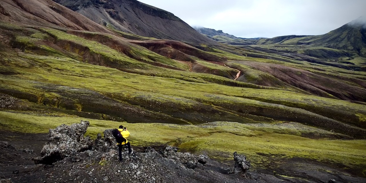
I took a lot of photos. Shot plenty of video.
River Crossings
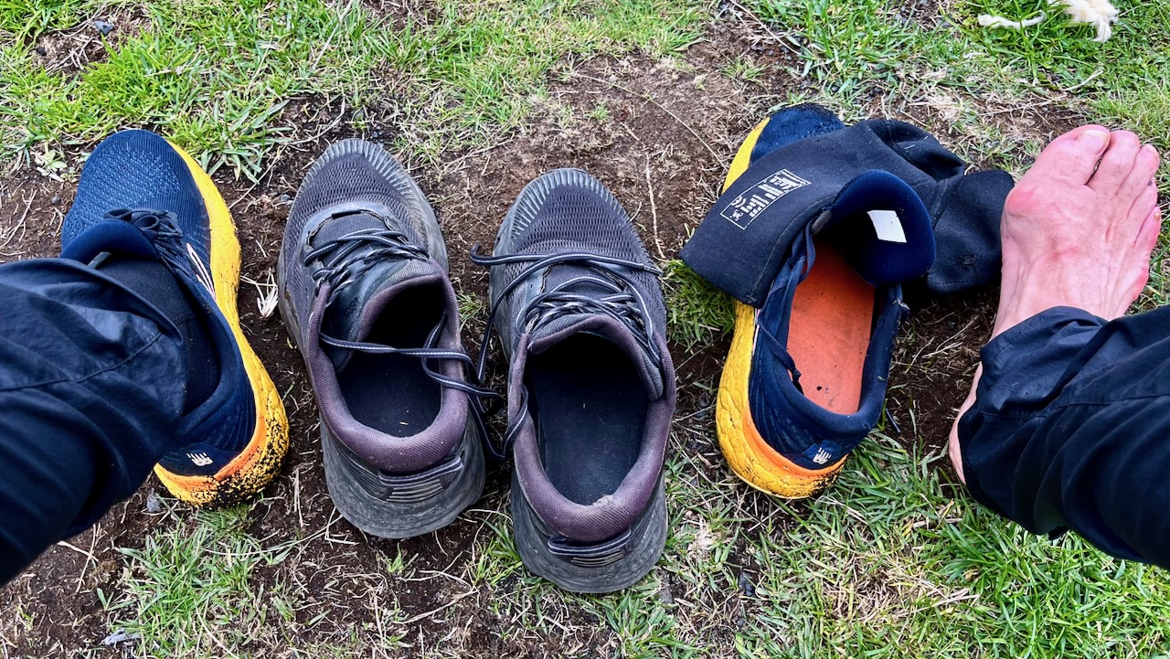
The most dangerous part of hiking Laugevagur are the river crossings. Plan carefully what footwear you want for wading slippery stones in (potentially) a thigh high. strong current.
I hiked in approach shoes. Used trail runners with neoprene booties for the river crossings and around camp.
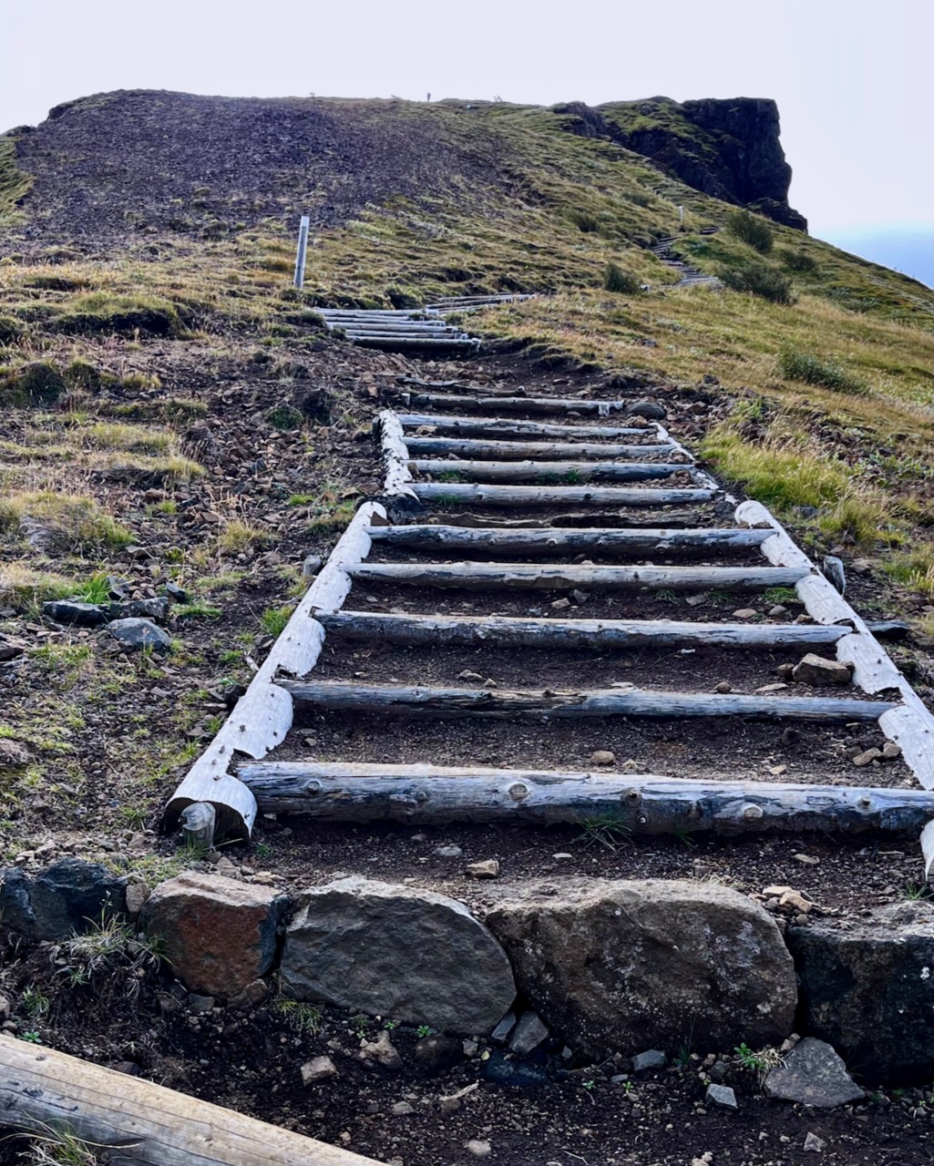
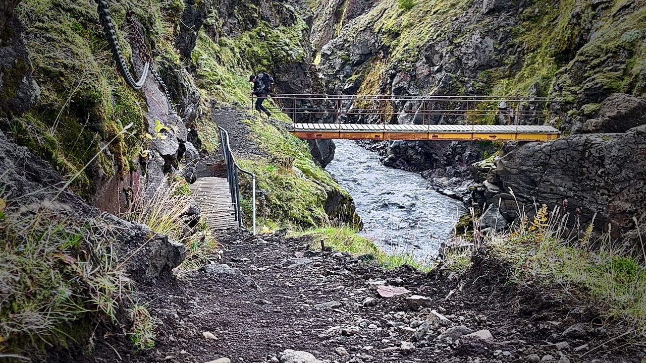
Once in a while you have the luxury of a bridge.
Most available bridges are across gorges too steep to wade.
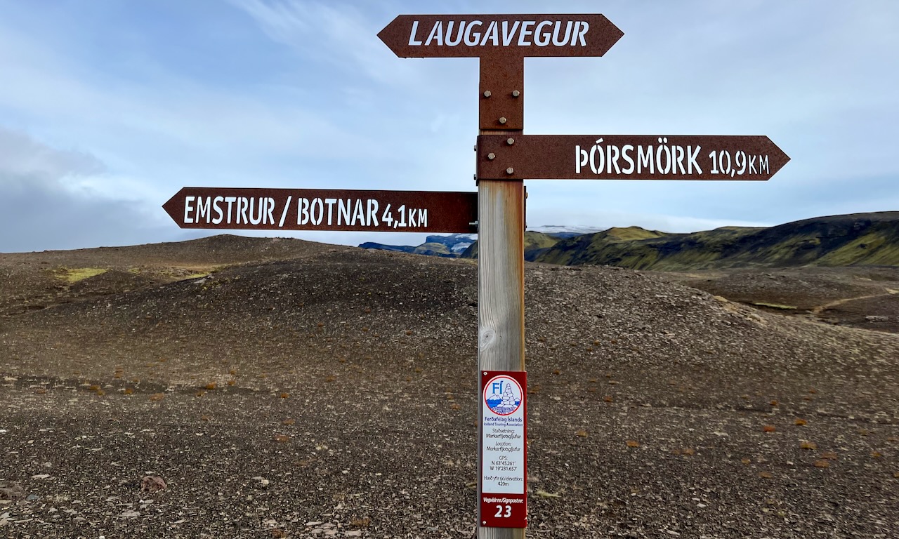
The trail is fairly well signed.
IF you have good visibility, it’s not easy to wander off trail.
Weather changes frequently. Sometimes drastically.
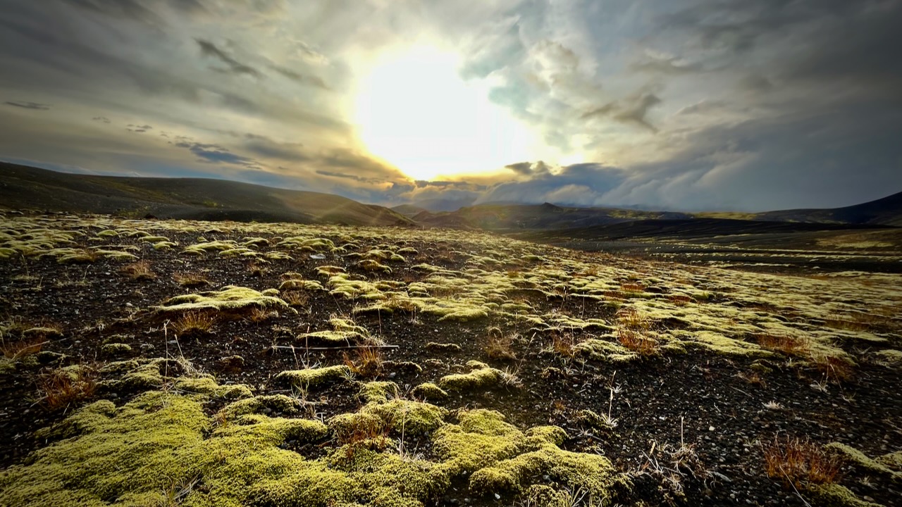
I love the bleak, treeless landscapes when the sun is low.
I’d camped at Emstrur Botnar 5 years earlier and liked the tent sites, somewhat protected from the wind.
I was probably making a mistake going so late in the season. Laugevagur could shut down any time after Sept. 11th due to weather.
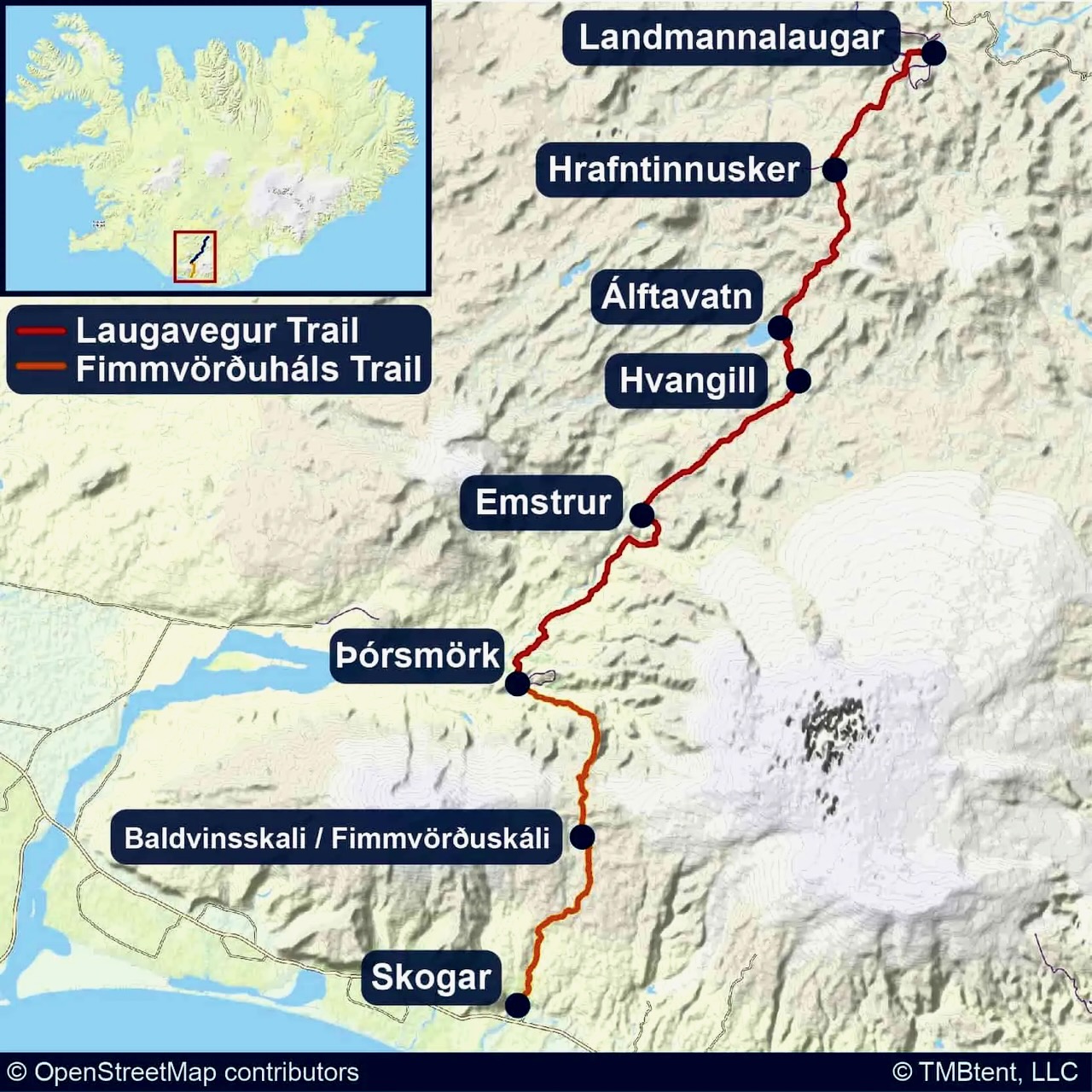
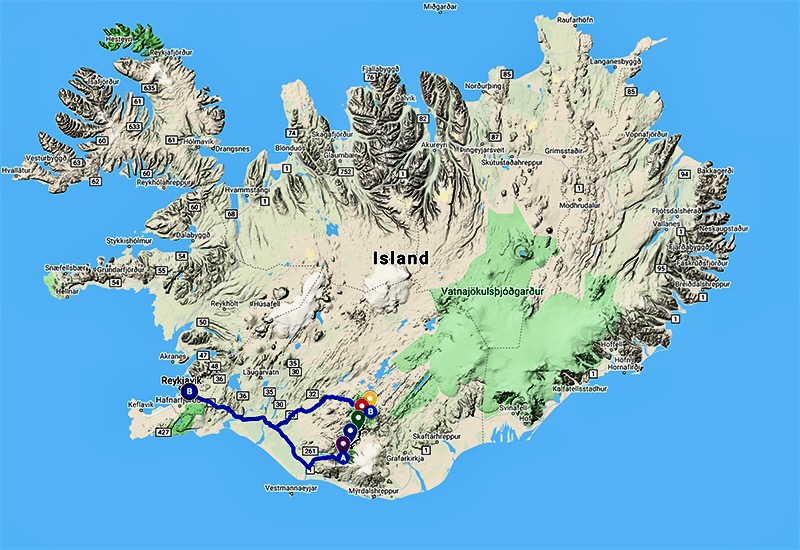
All agree that Laugavegur is the best hike in Iceland. It’s fairly close to Reykjavik. There are a number of transportation options to get to the trailheads.
Cost
For me as a tourist, Iceland has been by far the most expensive nation. And I’ve been to over 90 nations.
Bring. Money. $$$$$
You probably don’t need any Icelandic currency as they accept credit card almost everywhere. The notable exception is local buses that only take cash or payment by their own app.
Food & Fuel
Knowing that food is expensive and limited in variety, I brought quite a bit of camping grub with me on the plane.
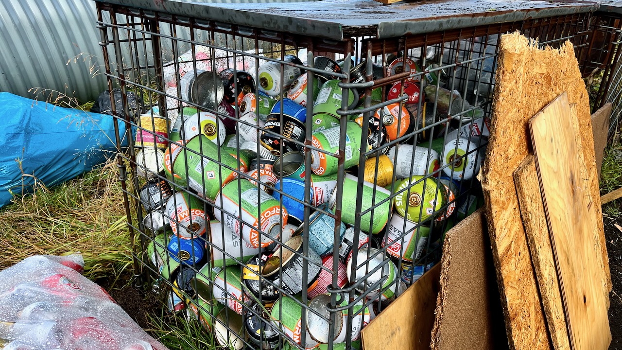
I bought the rest in Reykjavik. And bought a small canister of very expenisve fuel.
Of course there are hundreds of partial containers at the trailheads, but I didn’t want to risk not having fuel.
Fuel canisters left behind at Langidalur, Sept. 2023
Transportation
Deciding on this adventure last minute, I was excited to do it late in the season when there would be fewer hikers. Of course, bad weather is a greater risk.
What I didn’t realize until arrival is that bus service to the trailheads started shutting down Sept. 11, 2023.
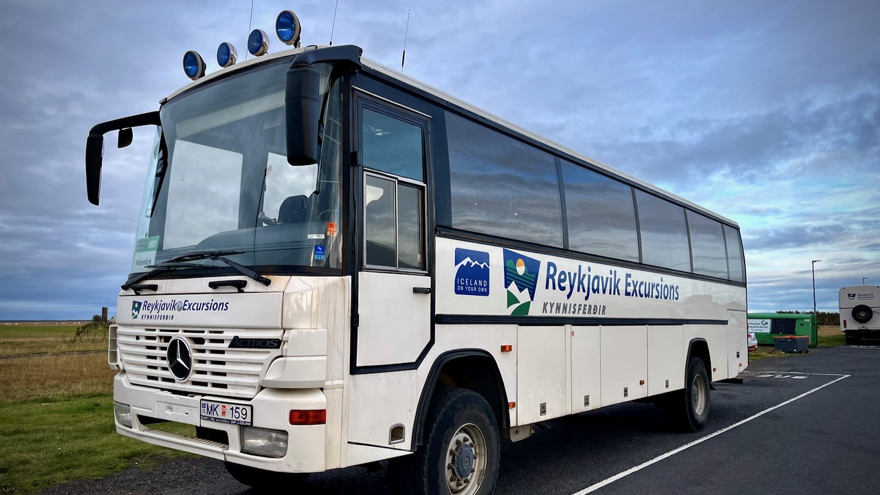
I decided to take the Reykjavik Excursions bus to Þórsmörk on Sept 13.
I’d YOYO the Laugavegur — hiking it both ways back to my starting point. Then continue over the Fimmvörðuháls pass to Skógar on the coastal highway. From there it would be easy to find transportation back to Reykjavík.
I did carry a paper map as back-up, but mostly used the free Maps.me app offline whenever I wanted to check that I was on track. It’s excellent for Laugevagur and most major hikes worldwide.
The one time I really needed Maps.me was coming in to camp in the dark with headlamp. It’s very easy to get confused when you can’t see the next post in the distance.
Electronics
There’s no access to power on the trail. In order to keep your devices working, bring enough power bank batteries. I brought two 20000mah batteries on my hike.
Be sure to carefully store your electronics in waterproof ways. It’s difficult to keep the rain out.
It’s well documented that walking is good for your health.
Researchers from the University of Sydney and the University of Southern Denmark found that 10,000 steps each day is the “sweet spot” to help lower the risk of disease and death. They also found that a faster pace, such as a brisk power walk, can have even greater benefits. …
Sam has some tips for those who want to get into walking for fitness.
The official guide spits the trail to 8 stages / days. This is a very easy-going pace which allows for lots of options for side trips or drinking delicious German beer (or both for the ones who dare). I found 4-5 days just enough for a fully-loaded hiker who wants to enjoy hiking, not rush too much but also not sit in pubs for too long either.
Get in
It’s fairly easy to get to the trail or to any of its sections. There are many train connections from Dresden or Prague and public buses or trams operate within the area itself in some sections.
Eating & drinking
Resupplying food is not easy. The trail goes through very touristic places with many pubs and cafes but there aren’t any groceries. … The only food stores we found were a tiny bio bakery in Schmilka (very pricey – but great – pastries and bread) and a small grocery shop in Kroppen …. It’s not hard to make a bus trip to a nearby town to visit a supermarket ….
Navigation
Navigation is easy. Even though the trail is well marked with painted Ms, there were still some crossroads where we weren’t sure which way to go. Not having GPS or printed maps, we used only the mobile app Mapy.cz – it’s free and it has a tourist offline map of Germany with great resolution and precise, visible trails. …
My Medium (20.5 in wide) weighs 16.4 oz so I don’t take it for multi-day hiking — only car camping and bikepacking where weight is less an issue.
I got the heavier rectangular shape to completely cover the bottom of my 1-man-tent.
Exped offers 1R to 7R. I’m a warm sleeper and — so far — the 3R option has been plenty warm enough.
After about 30 nights on the mattress, I’ve already had 2 punctures. Happily, they are easy to repair with the included glue. The system does not require a patch on top — only the glue. So it’s quicker to seal the hole.
The Schnozzel Pumpbag does not work nearly as well for me as in the Exped video. 😀
I do use the Schnozzel as a waterproof dry bag, as well.