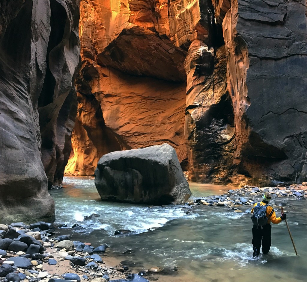
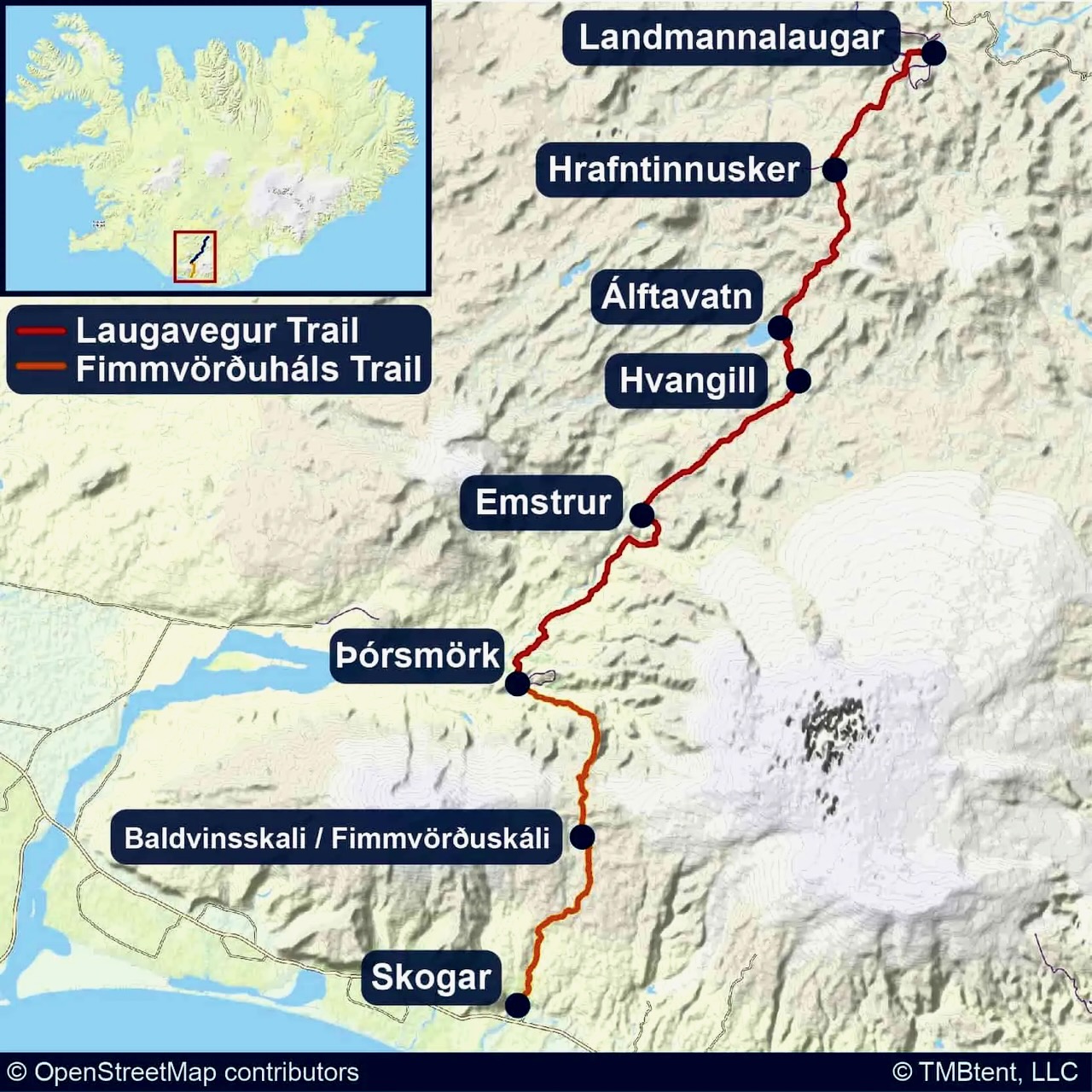
16 miles (25 km) from Chamberlain’s Ranch to Temple of Sinawava in the Park
June through October best months
usually closed from mid-March to mid-May due to spring snowmelt and runoff
in places chasm up to 1,968 ft deep and 20 ft wide
about a 1500 ft descent
walk in water up to half the time
9 – 13 hours. Confirm the time of the last shuttle out of the park!
a long, tiring day or you can camp overnight. Be aware that there are only 12 campsites available and they book quickly. Start as early as possible if you are doing it in a day.
Many North American hikers pooh-pooh hiking in Europe as “too civilized and too expensive”. The ones who have never hiked there.
With advanced planning you can get to some of the best wild scenery in the world and not go bankrupt in Europe.
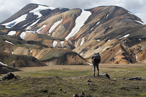
Iconic peaks reflected in tranquil mountain lakes, sweeping hillsides blanketed in wild flowers and dramatic, sprawling glaciers characterize the Alps. Discover why this mighty range, the birthplace of modern mountain walking, has enthralled walkers for centuries. – LP
The culture and history of Austria, France, Germany, Italy, Liechtenstein, Slovenian and Switzerland are an added bonus.
Travel is easy in Europe, of course, but the hiking window is short. You want to be there Jun-Sept, the same high season as North America.
Our favourite trip in the Alps was the Tour of Mont Blanc. But after besthike editor found the TMB crowded with hordes of tour groups the summer of 2009, we changed our “favourite hike in Europe” to the more challenging Walker’s Haute Route, Chamonix to Zermatt.
Both long hikes are in the same region, sharing sections of trail near Chamonix. Both are great, truth be told.
… By cross-referencing the number of photographs on stock imagery libraries tagged with “walking trail” or “hiking trail” for over 500 locations, we found which destinations yielded the highest number of photos, thus emerging as the places in the world with the most scenic trails.
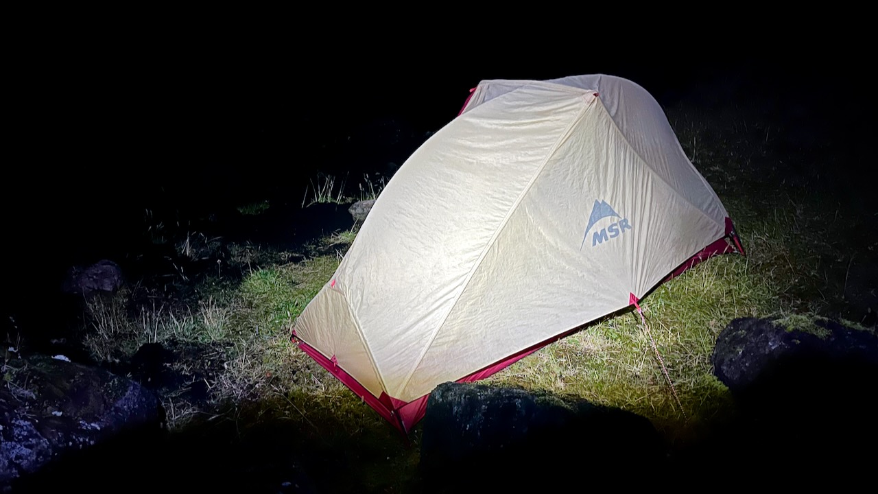
Shortly after packing up the tent Sept. 16th, the rain began. 💧
I put away the camera and took not one photo nor video for the entire day.
It was head down. One foot after the other for about 34 tough kms.
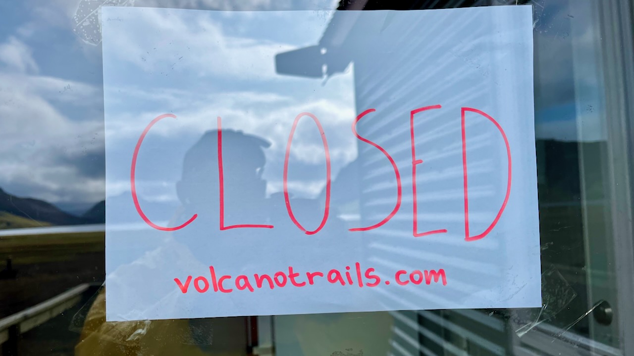
I was only able to get shelter from constant rain and high winds for late lunch at Emstrur / Botnar. It was still open as the American guided group was there that night — and provided a cook tent.
Hiking Laugevagur leaves you almost entirely unprotected from the elements. There is no place to hide.
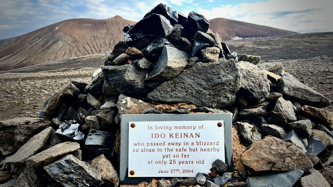
I’d seen the monument to Ido Keinan who died, lost 1 kilometre away from the hut in Hrafntinnusker. Exposure during a late June storm.
I used the free Maps.me app offline to confirm I was on the trail. This works in the dark or the middle of dense cloud.
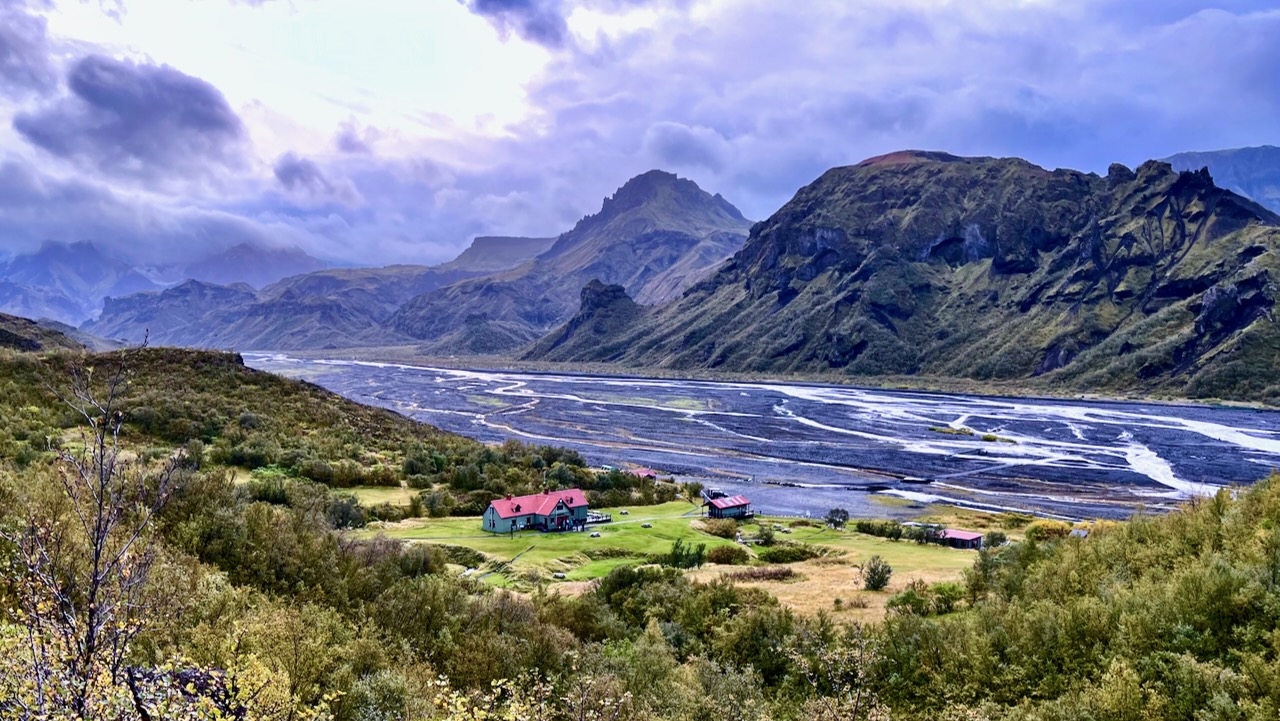
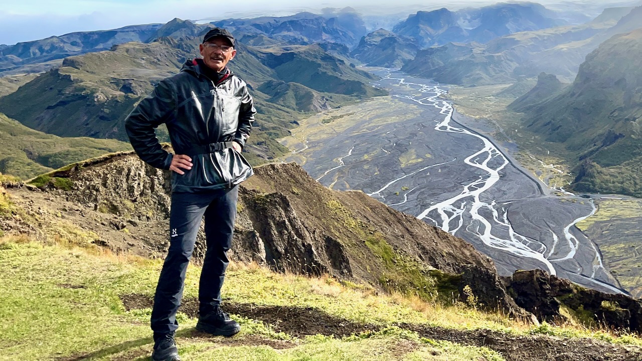
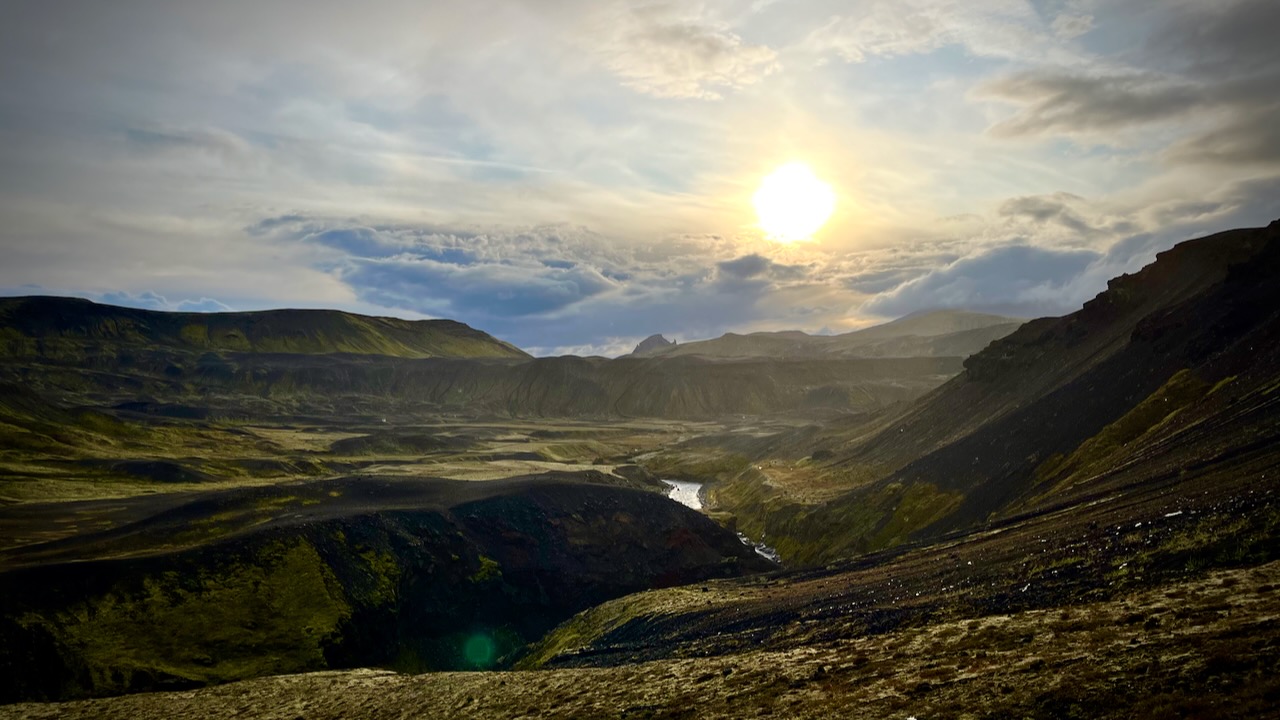
… After about 11 hours with very few breaks, I made it to Langidalur hut in Þórsmörk.
In fact, I HAD to keep walking all day to stay warm!
I marched past, trying to cross the river to Basar campsite, closest to the start of next day’s Fimmvörðuháls hike. I’d heard the hut had been closed most of the summer, but that the campground was open.
The wardens were having dinner. Called me over. And explained that they’d taken out the bridges due to the continuous rain. The river was impassable.
I had a choice to be a wet rat in a wet tent for the night. Or check in to the hut at a cost of about $90.
Another fun guided group convinced me to join them inside. Gave me $5 hot shower tokens. And offered me dinner and wine. It was perhaps the best $90 I ever spent.
Sept. 17, 2023
I was still hopeful the rain would break and I’d somehow be able to cross the river. And continue to the coast.
BUT the wardens and tour group offered me a chance to get a lift with them back to Reykjavik. I couldn’t say no.
Morning did arrive with better weather.
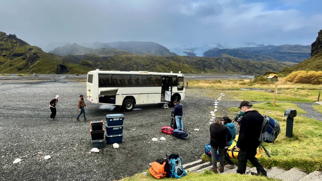
We did some day hiking.
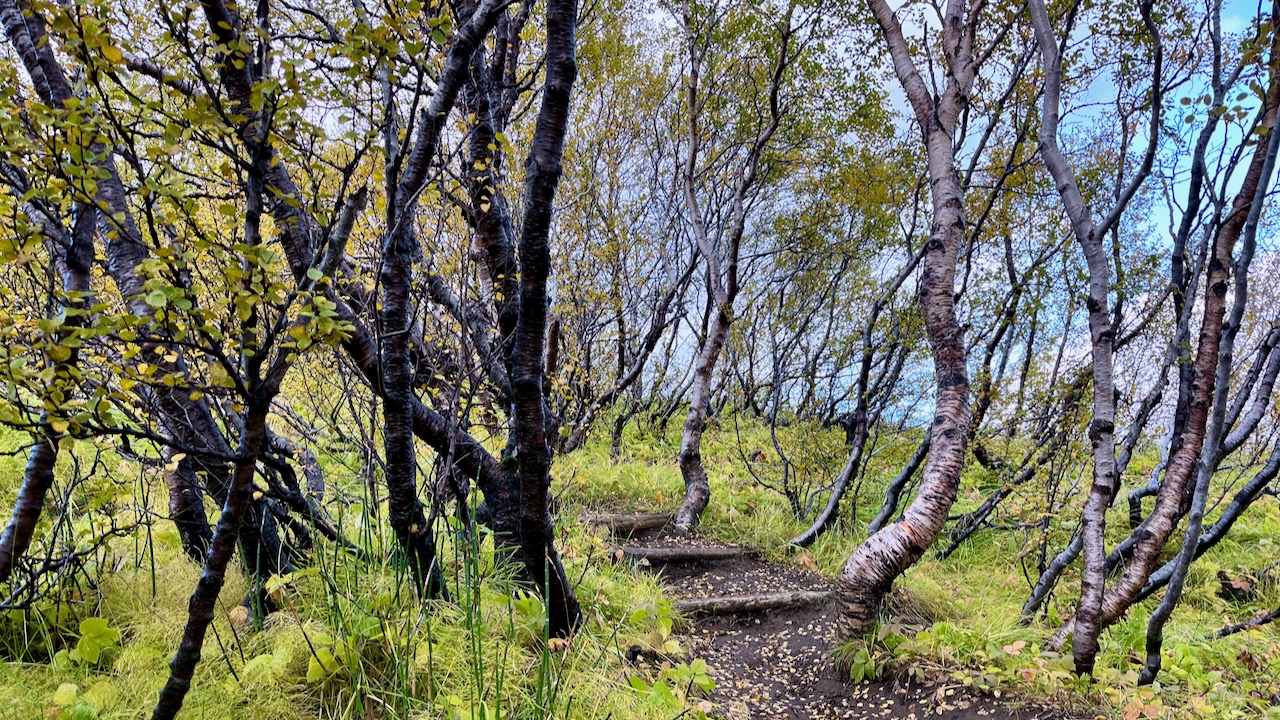
Þórsmörk (Thorsmork – the Valley of Thor) is an area where trees are protected. And there are some surprisingly large trees.
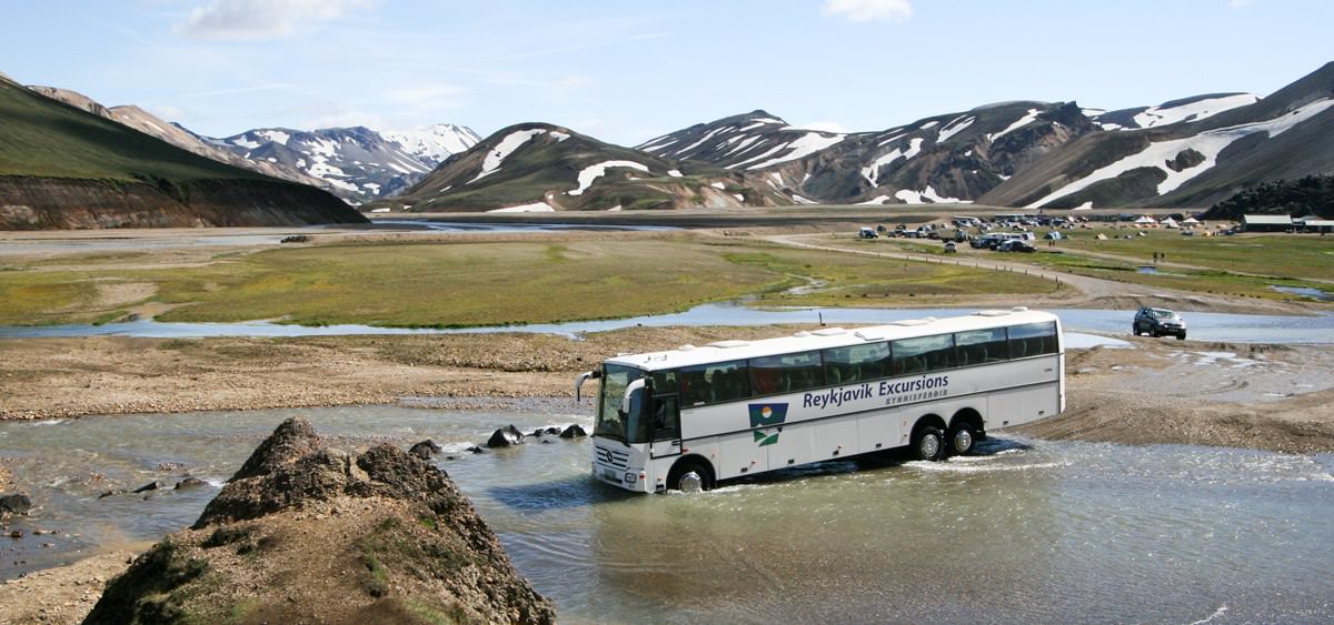
Our bus did get stuck crossing the river for rendezvous. But the wardens have a tractor for flattening the river bed and even towing the bus, if needed.
The driver did not look worried. This is situation normal for him.
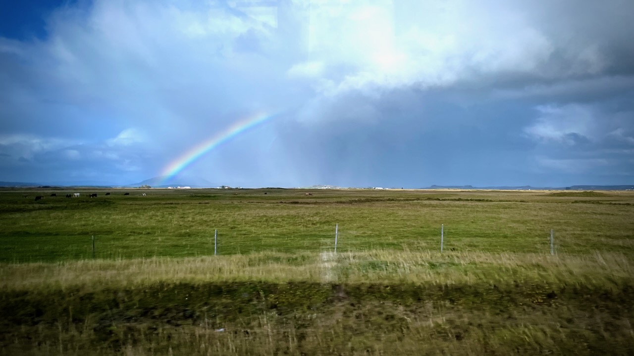
I enjoyed the ride back to Reykjavik with the tour group. Weather mixed, but improving.
Overall I was thrilled with the hike. Happy to have done the YOYO. Happy to have had only one day of bad weather in September.
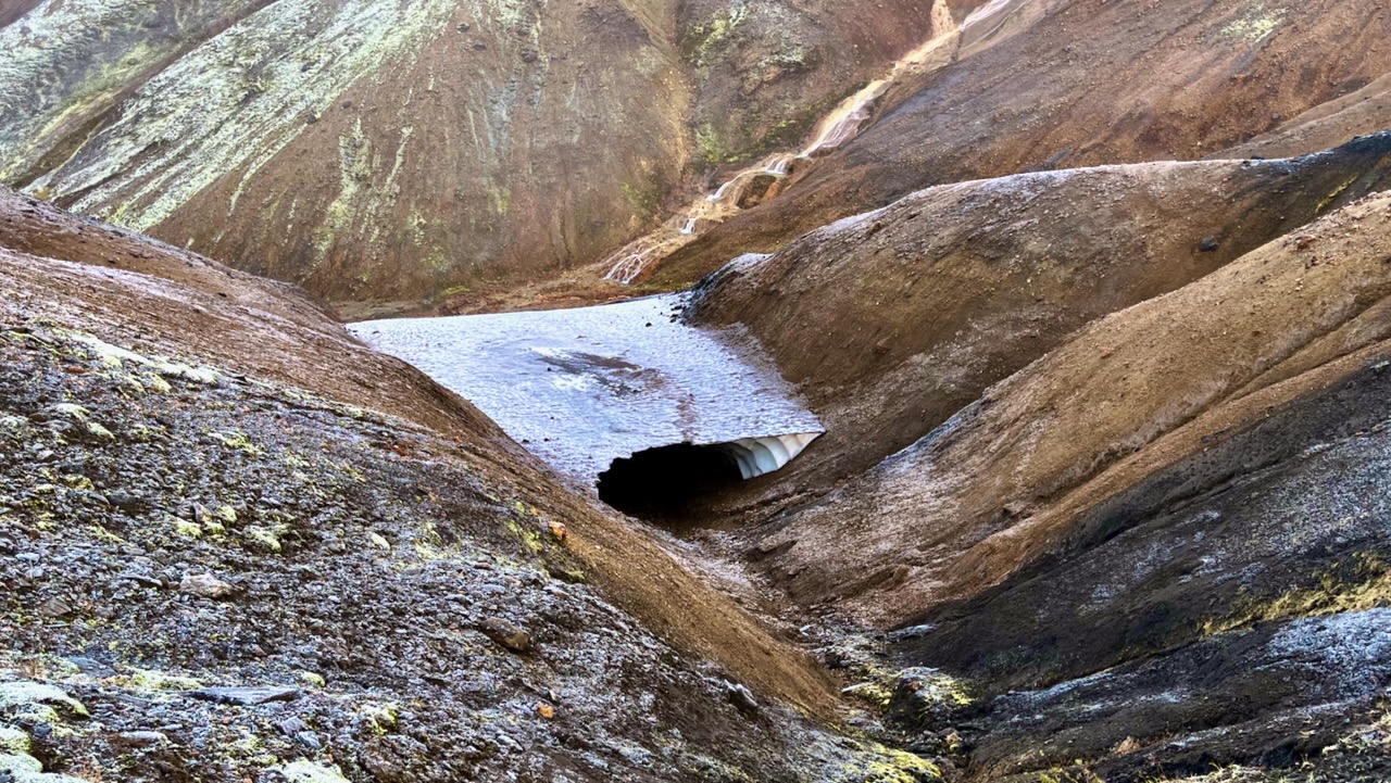
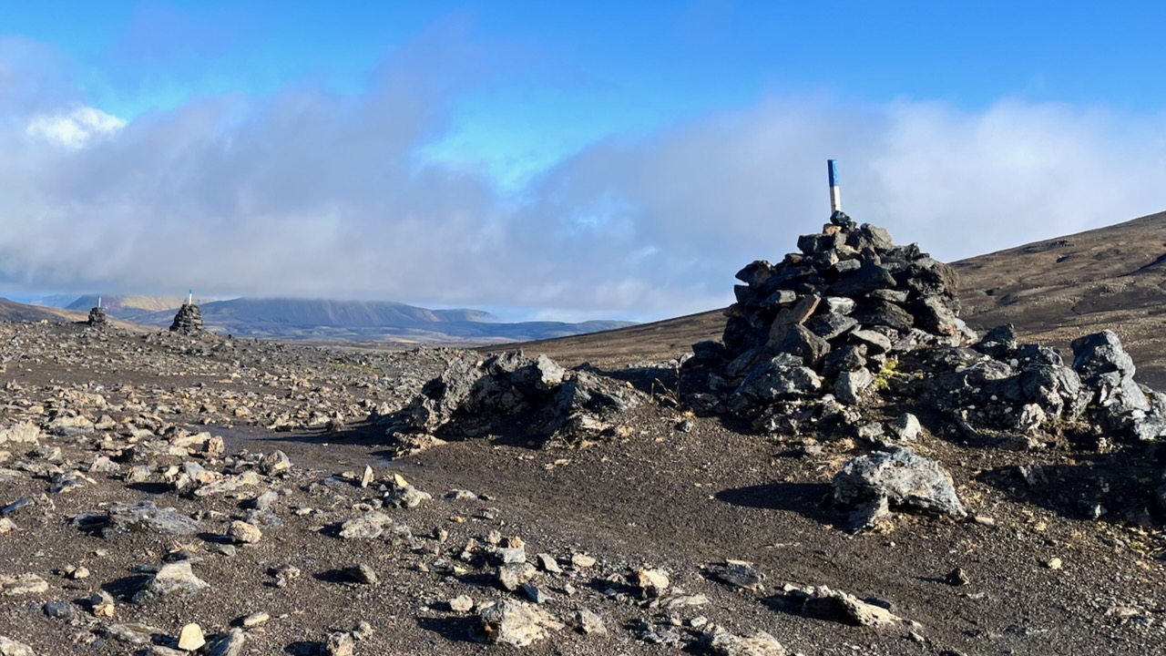
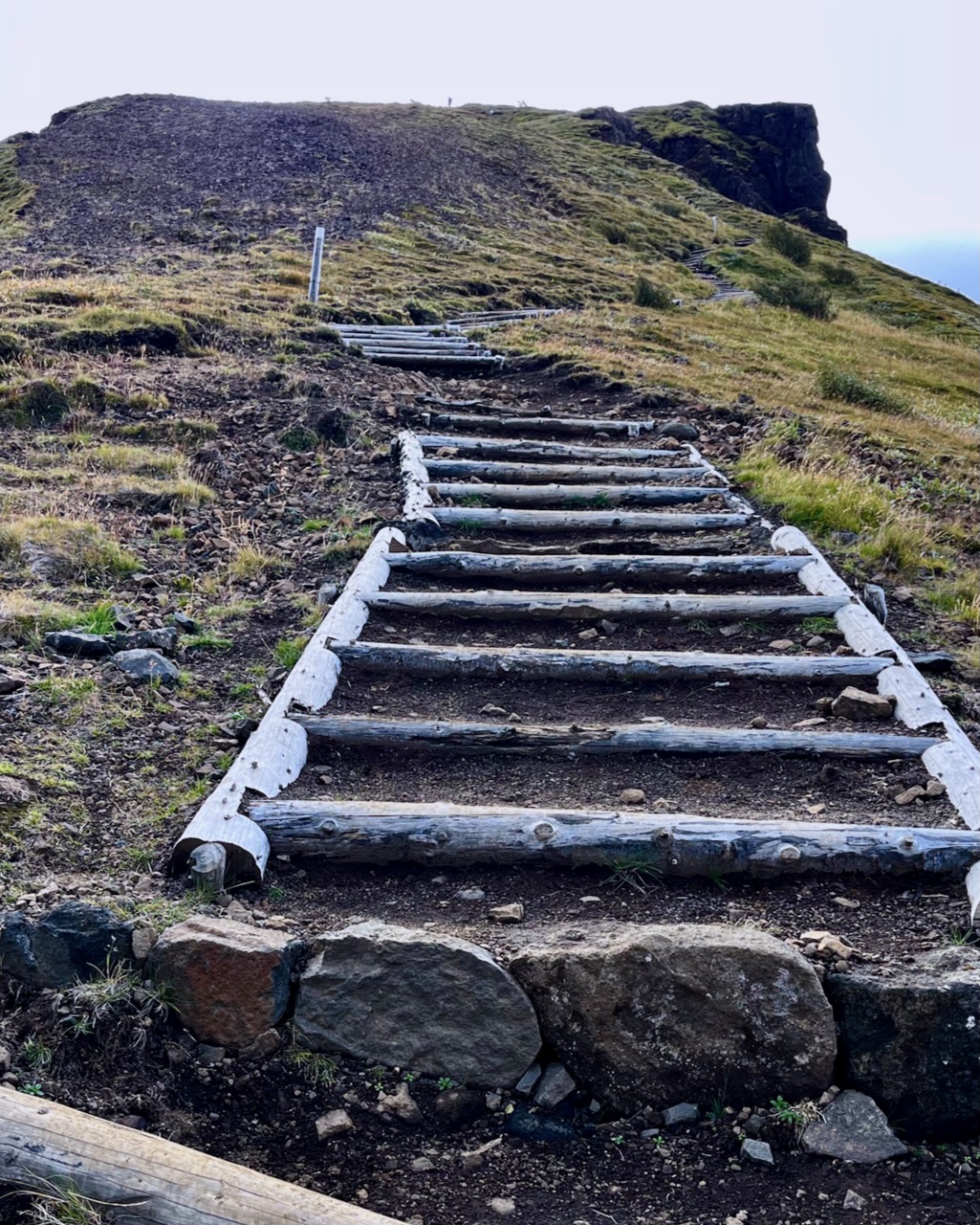
It’s in this high section in a snow storm where people might most easily lose the trail. Therefore it’s better marked with cairns and posts than anywhere else on the trail.
I had lunch at Hrafntinnusker. Met a fun American guided group who I would bump into several more times over the next 2 days.
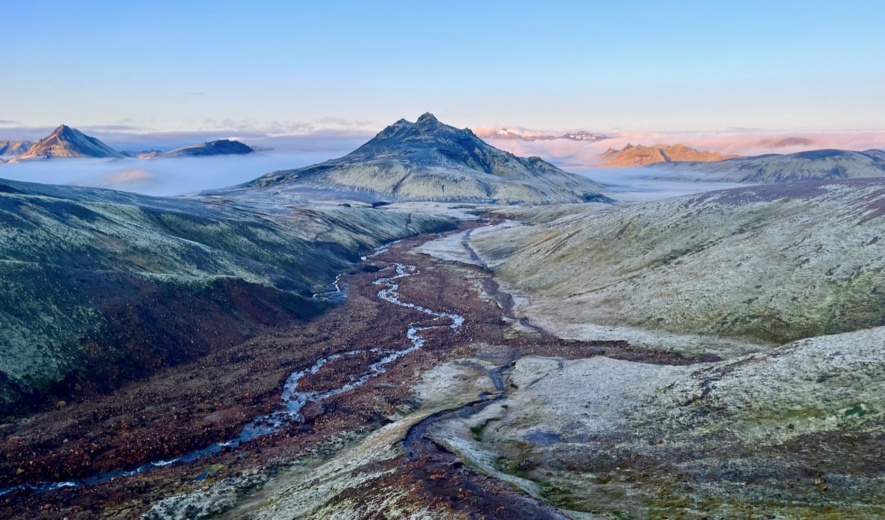
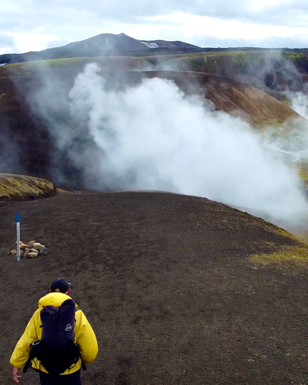
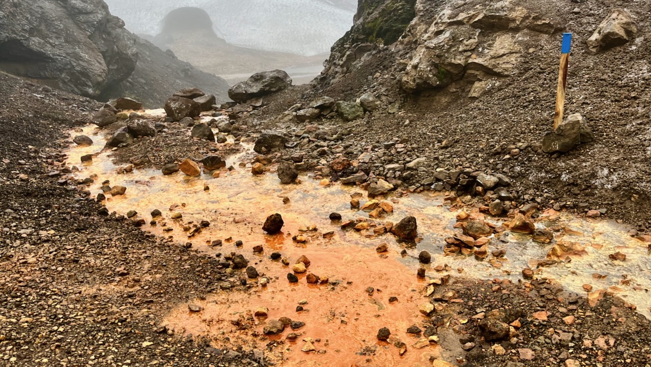
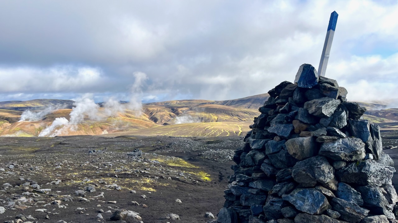
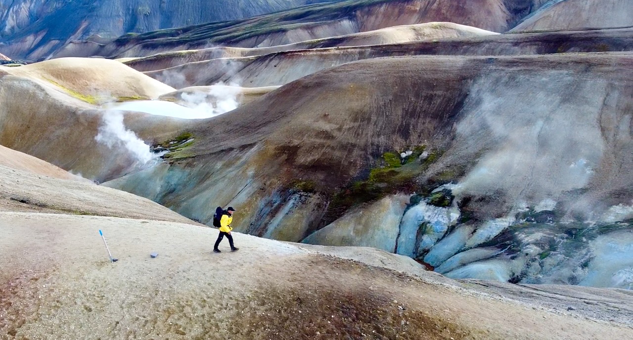
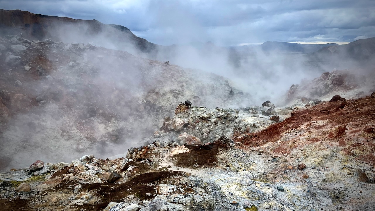
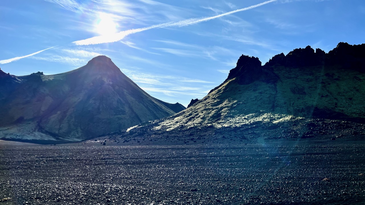
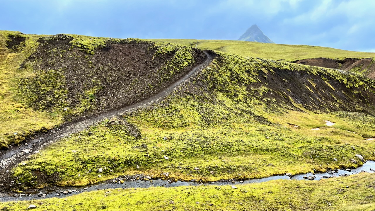
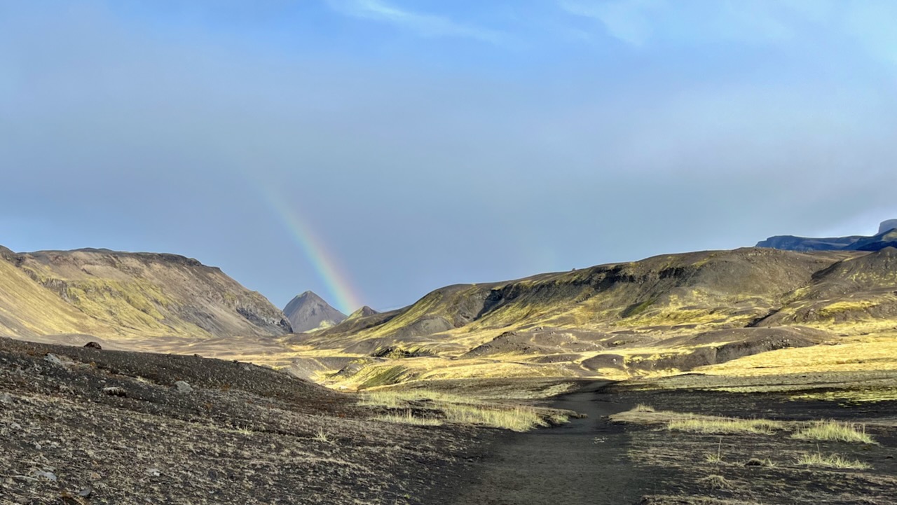
As you approach the end, there’s more and more volcanic activity.
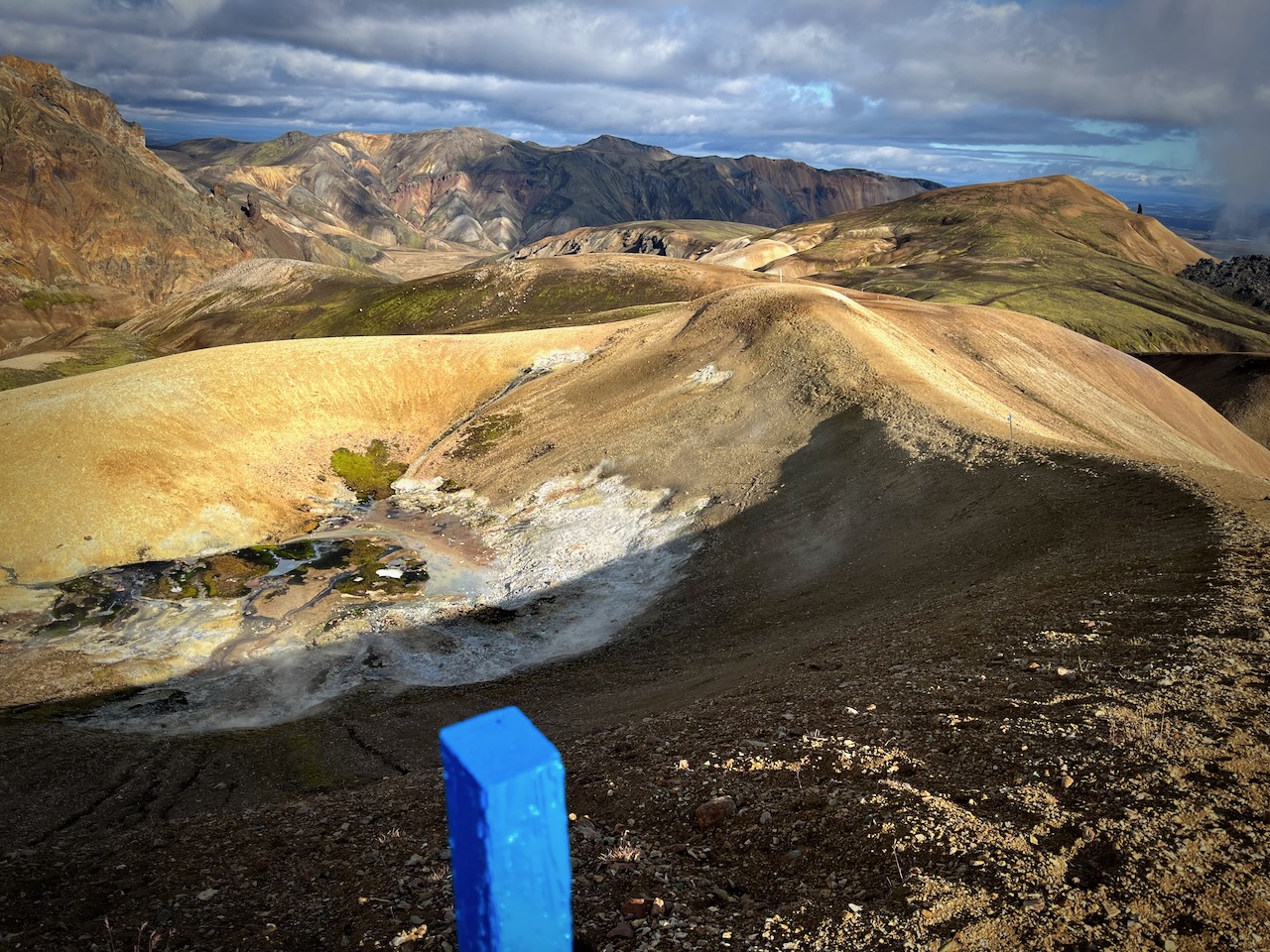
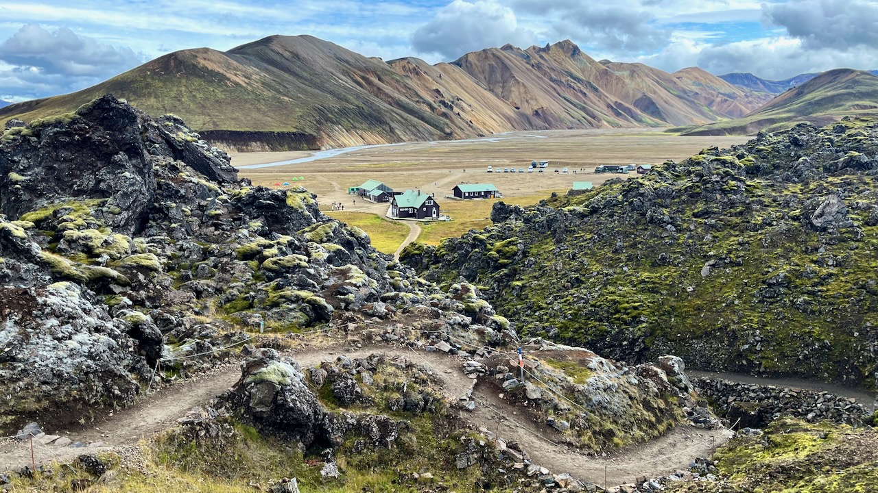
Landmannalaugar came into sight. My half way point for the day.
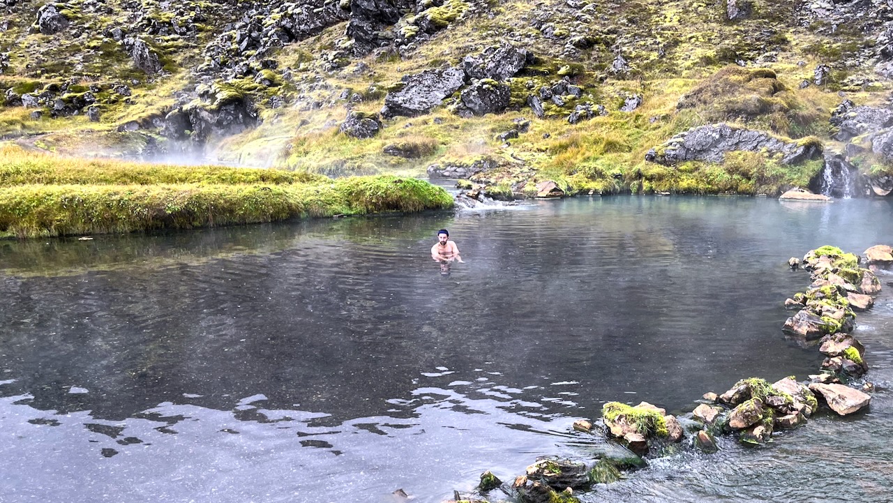
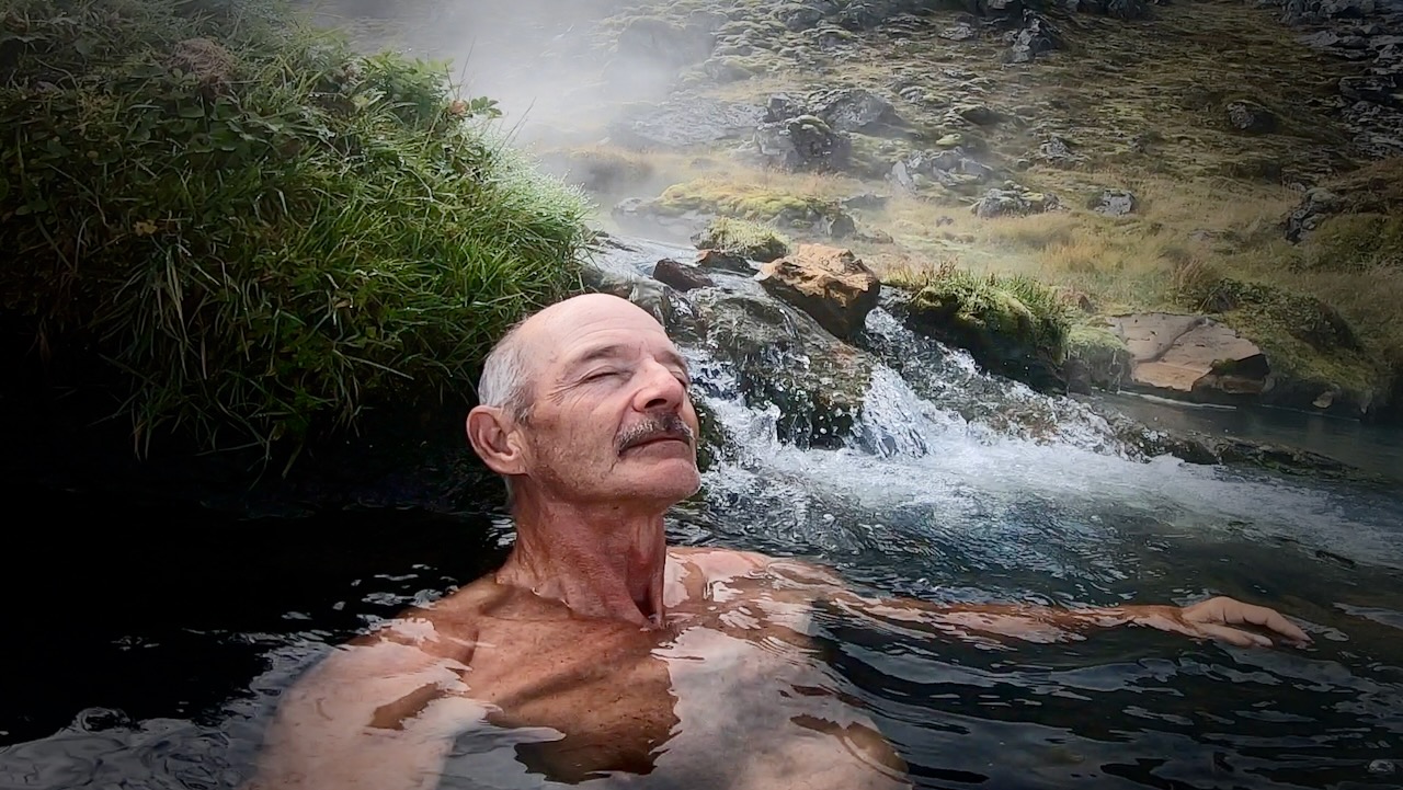
In August, the hot springs at Landmannalaugar are typically crowded.
But in mid-September there were only a few people enjoying a huge pool.
It’s hot. You can easily get scalded so positioning yourself carefully is critical. This was my best spot.
I had lunch. Then started back the way I had come. STILL confident I could get to my tent before dark. 😀
The return trip was equally good. But different in that you are facing the opposite direction with much different light.
Happily, no rain the rest of the day.
There’s the lake. One more descent and I’ll make it.
Unfortunately, It WAS dark before I got home. Days are already getting short in Iceland in September.
Even with a good headlamp it was easy to lose the trail. I had to rely on the GPS via Maps.me in order not to get lost.
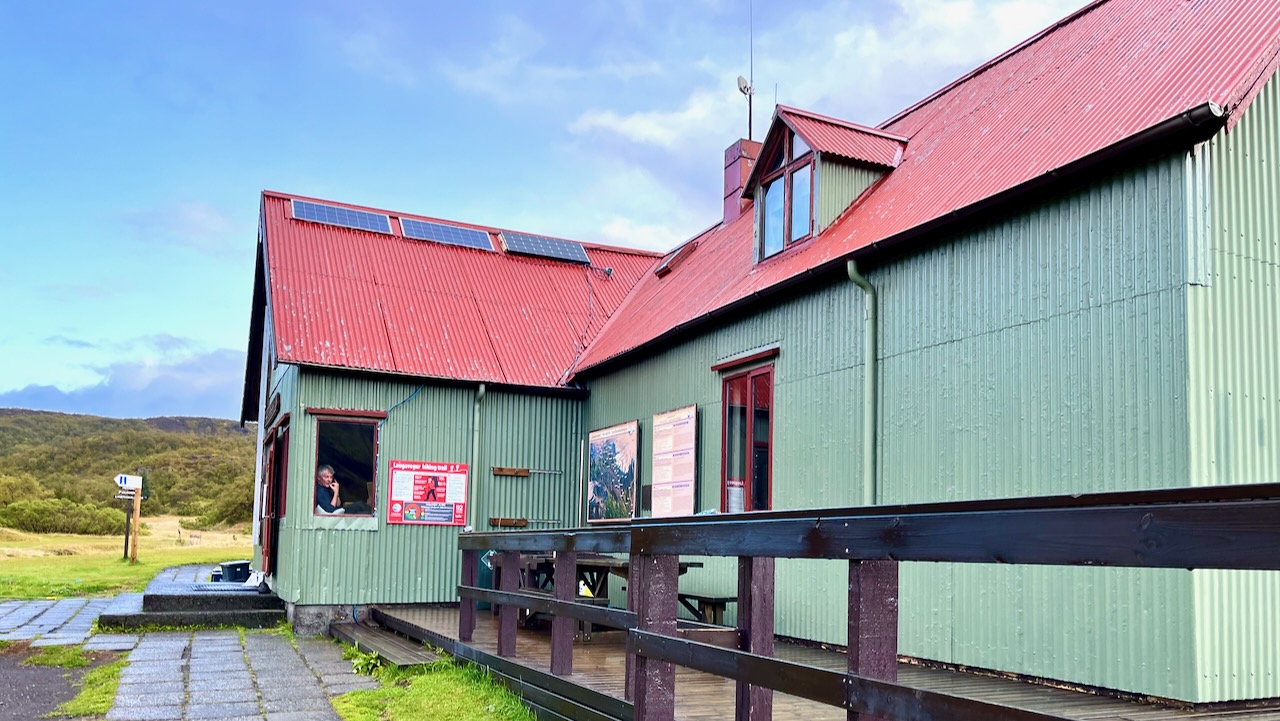
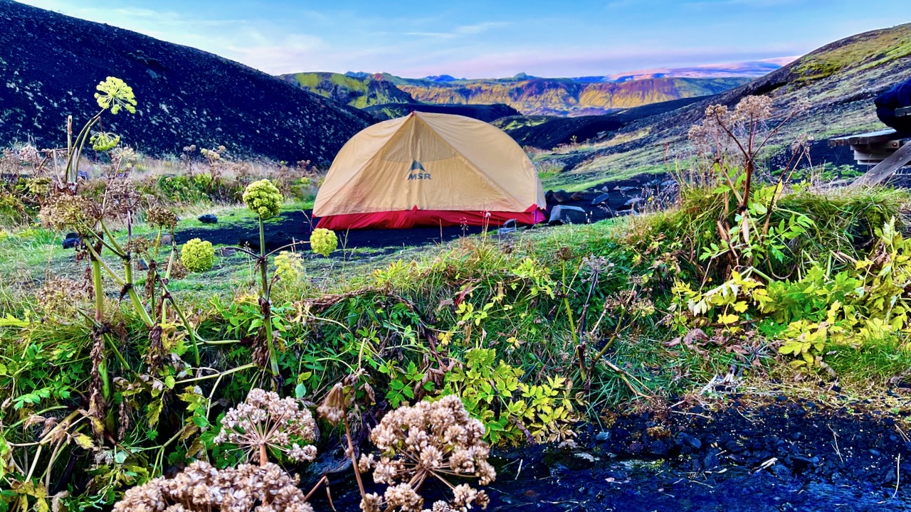
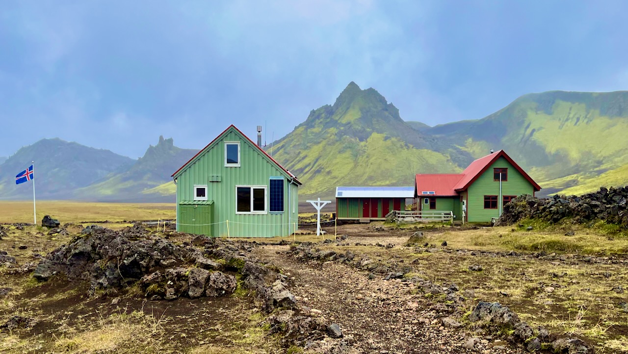
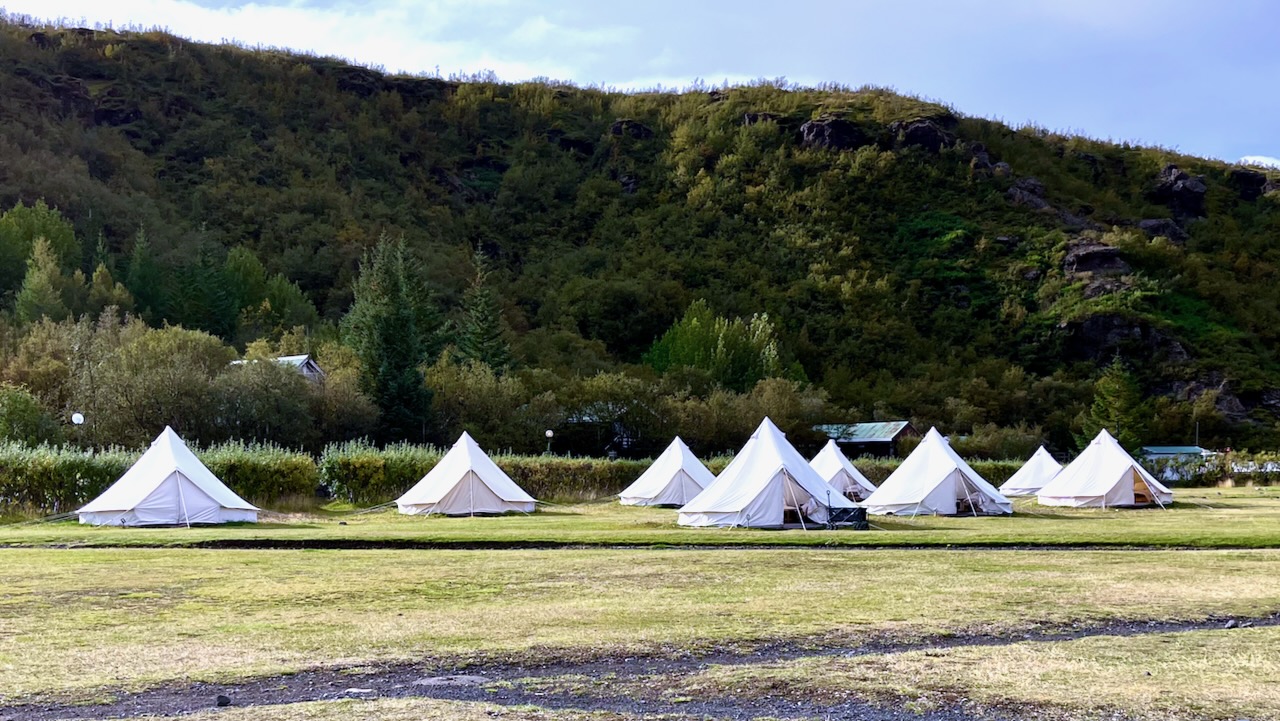
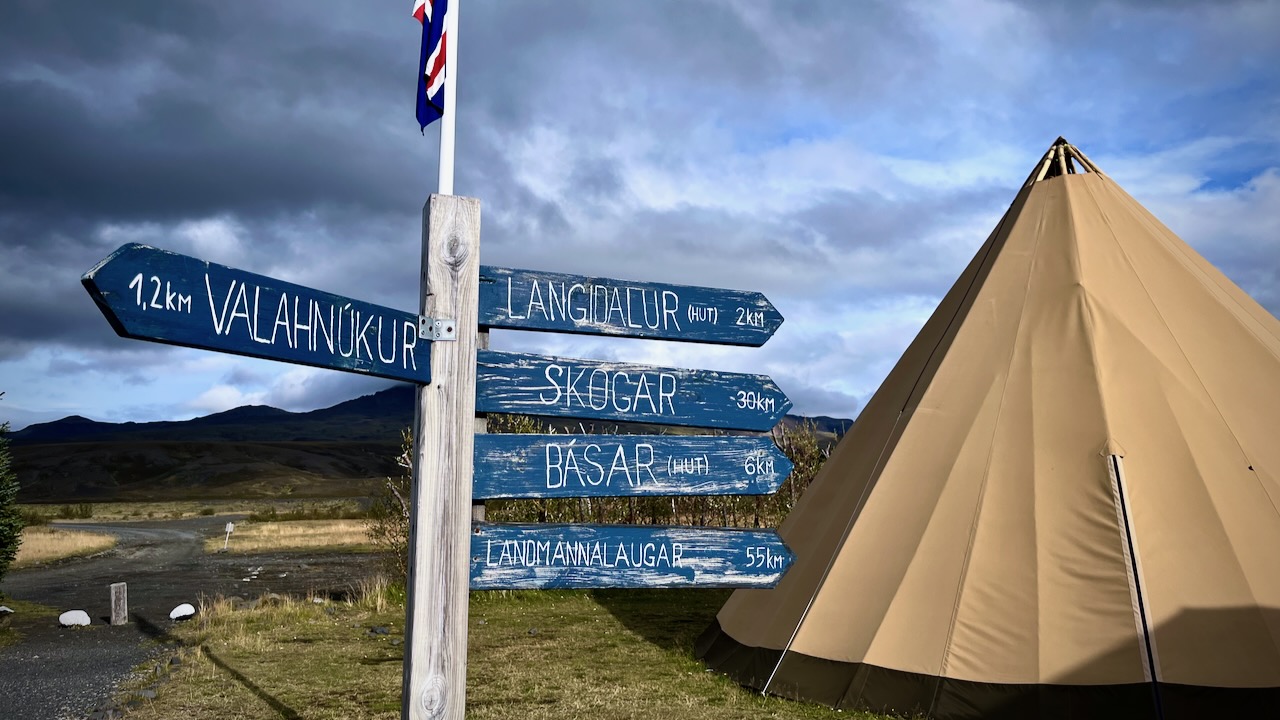
Volcano hut offers these luxurious rental tents. Glamping. 😀
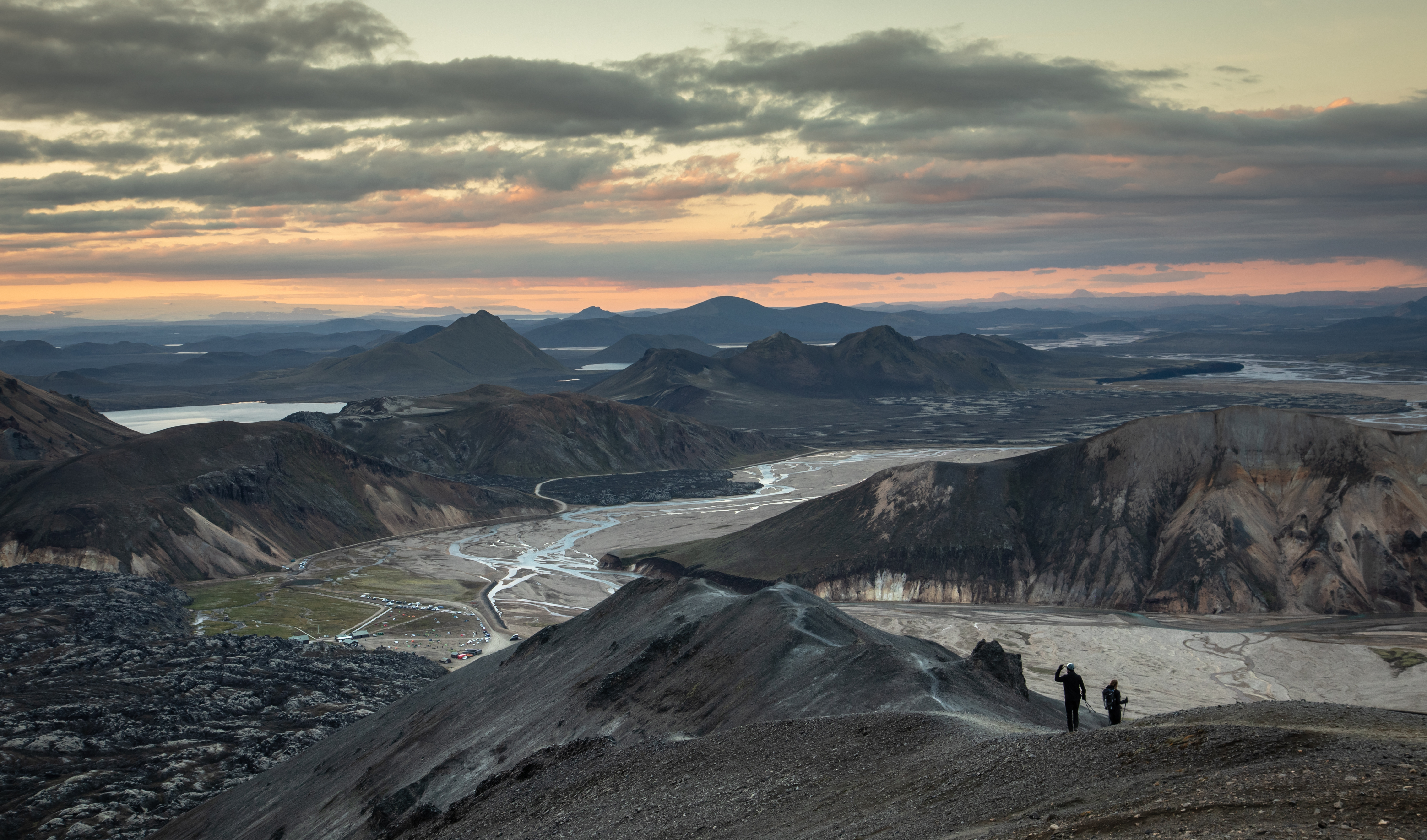
I dropped my pack and — as the weather was good — hiked up the closest viewpoint with most everyone who had arrived with me.
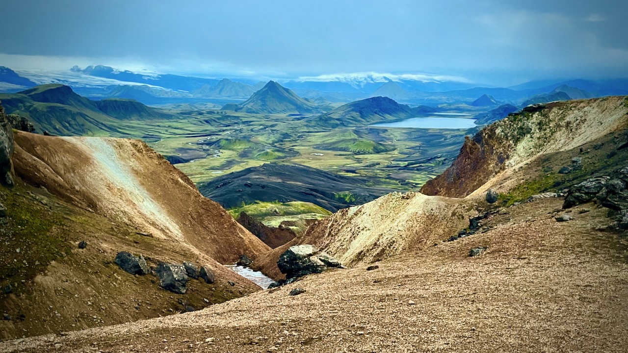
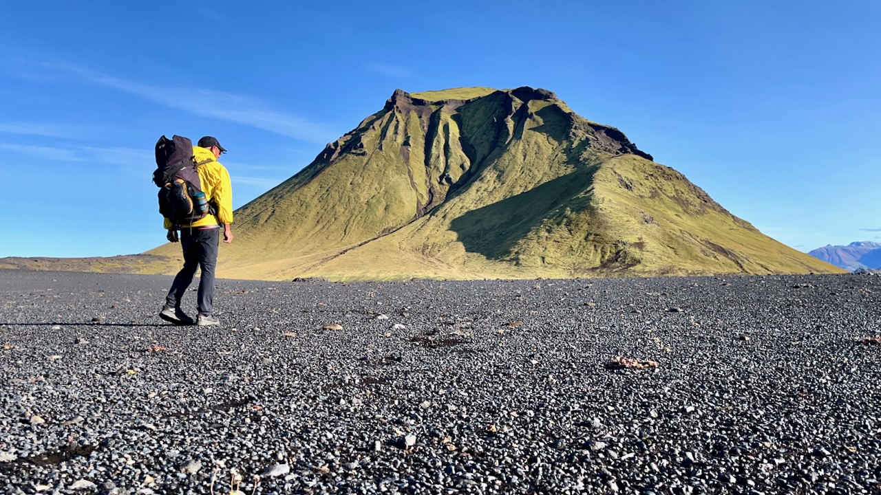
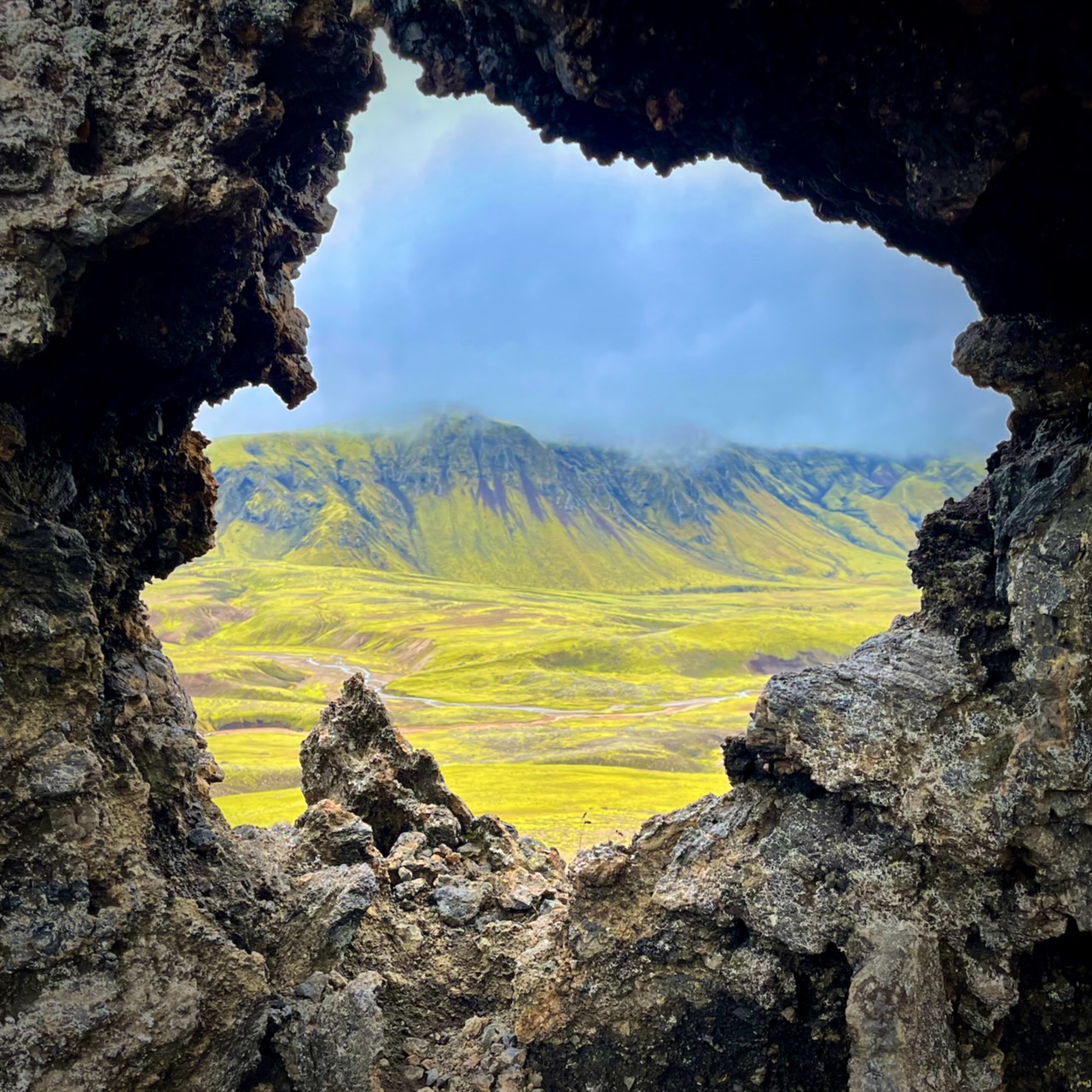
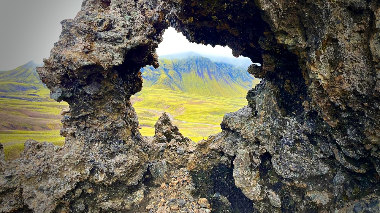
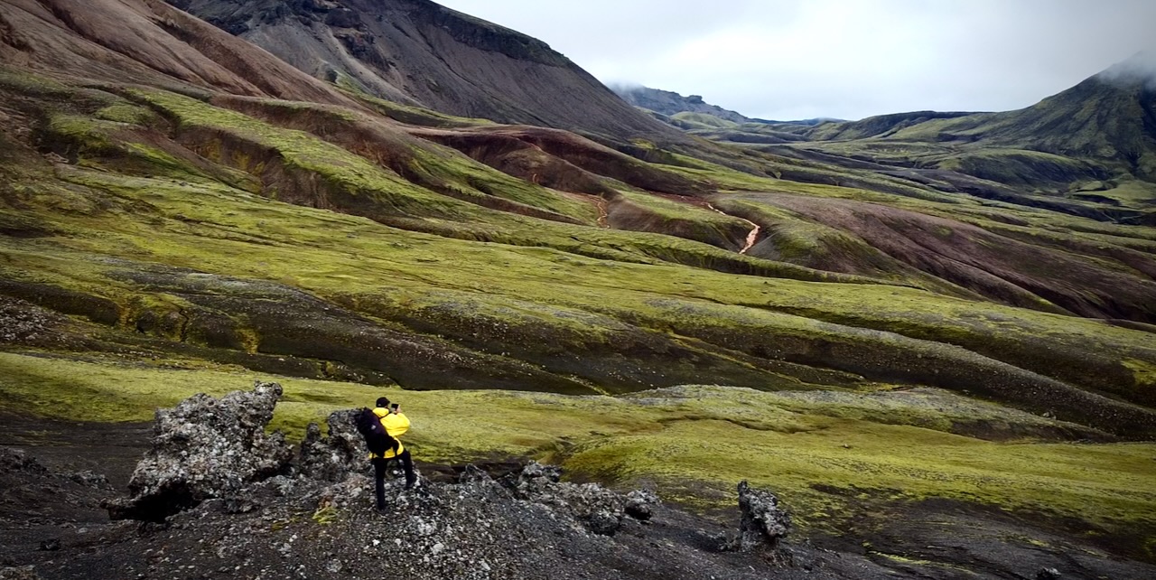
Wow. This is the Iceland I remember.
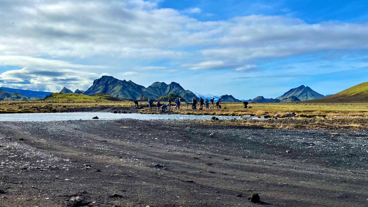
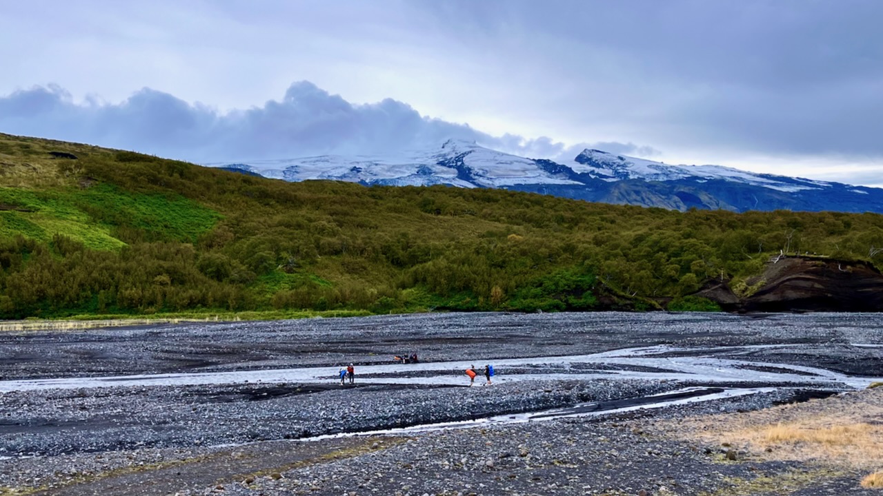
I planned to cross this river on foot when I returned.
We took a different trail down to Langidalur camp. Then hiked around the mountain back to Volcano.
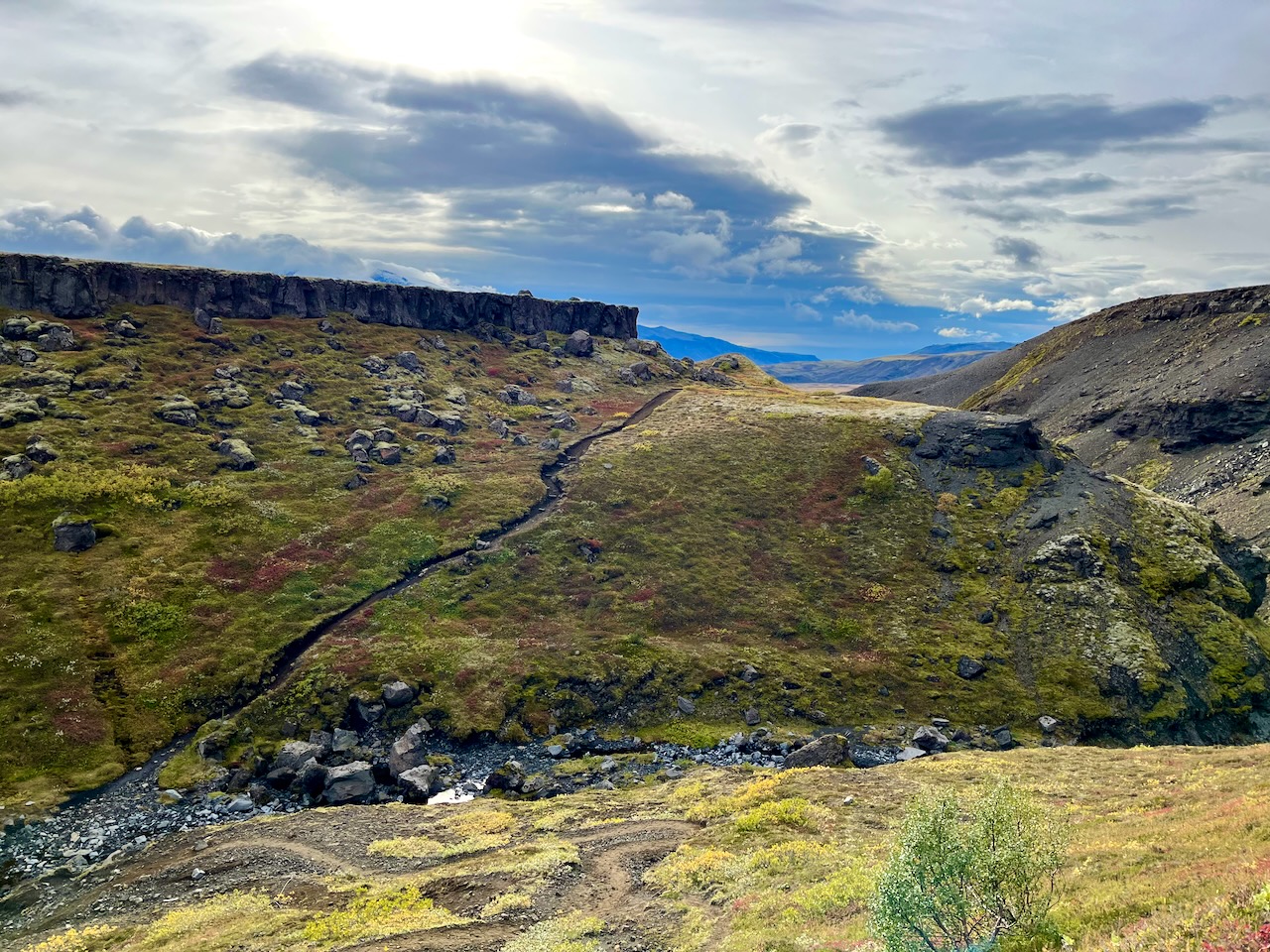
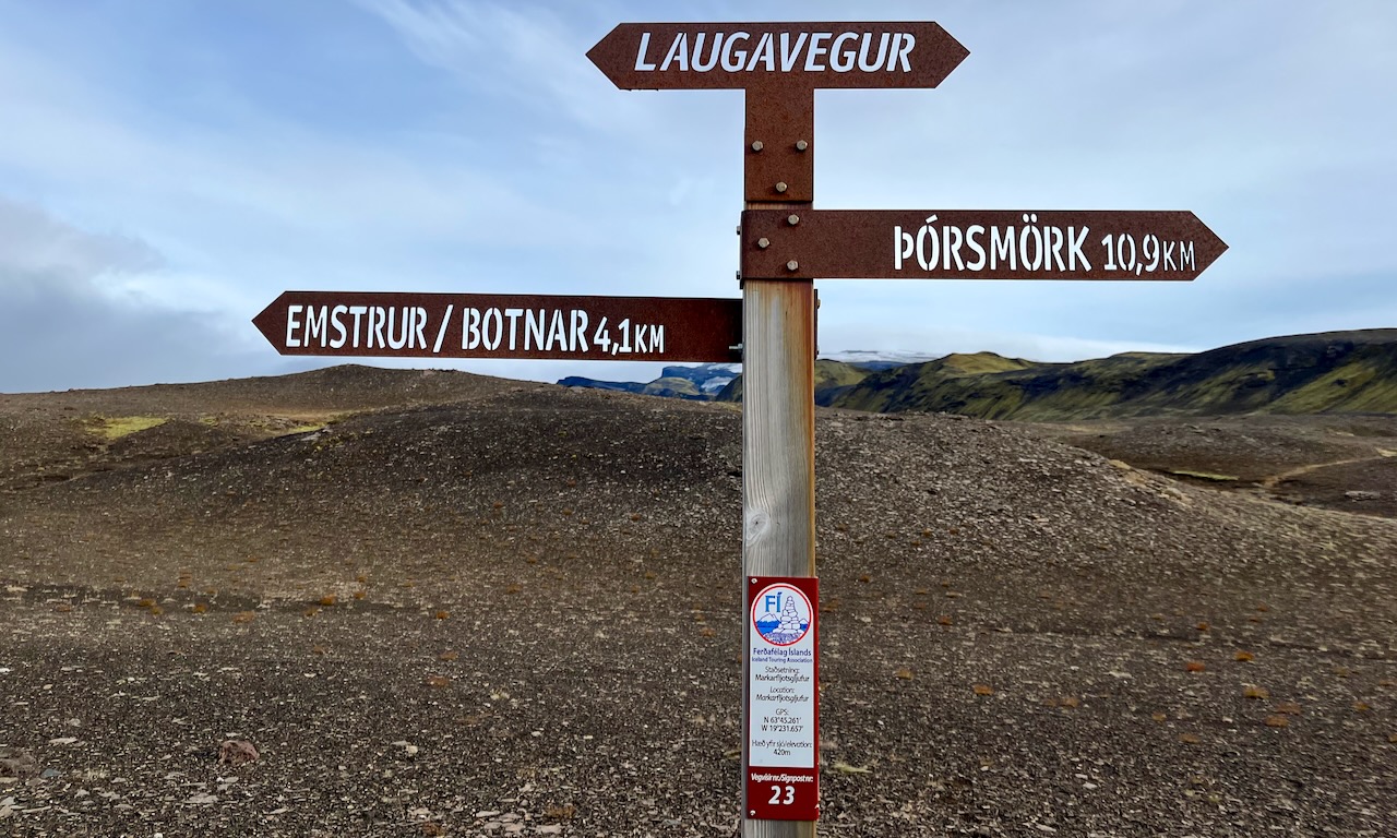
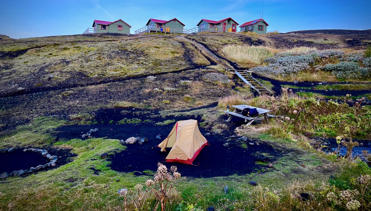
It was only 13.5km to the first official campsite Emstrur / Botnar so I was in no rush.
I took a lot of photos. Shot plenty of video.
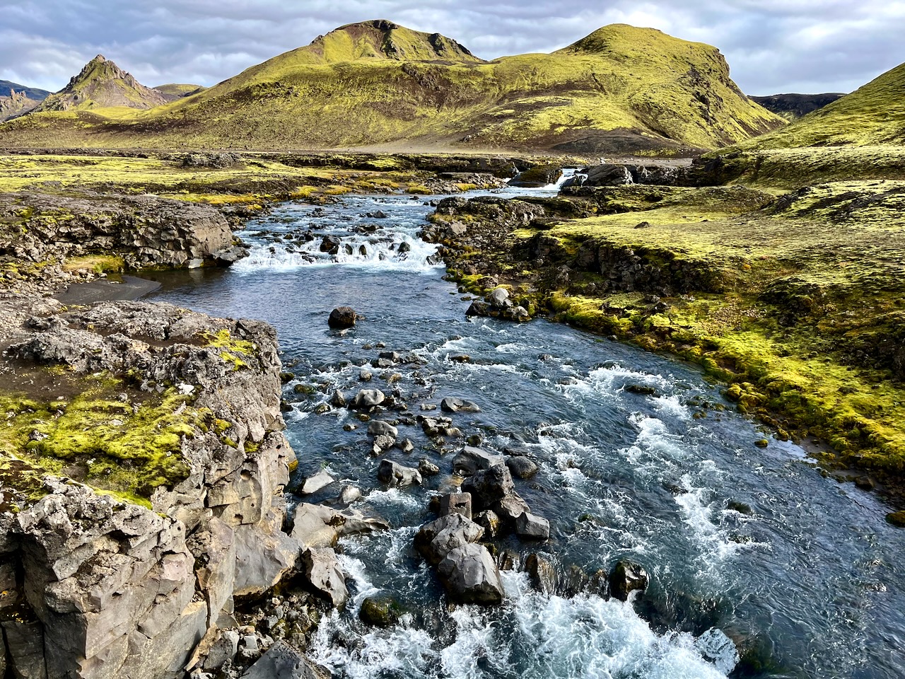
River Crossings
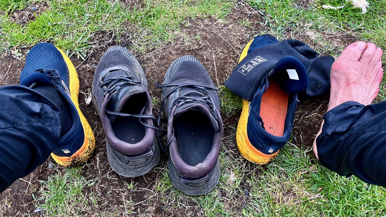
The most dangerous part of hiking Laugevagur are the river crossings. Plan carefully what footwear you want for wading slippery stones in (potentially) a thigh high. strong current.
I hiked in approach shoes. Used trail runners with neoprene booties for the river crossings and around camp.
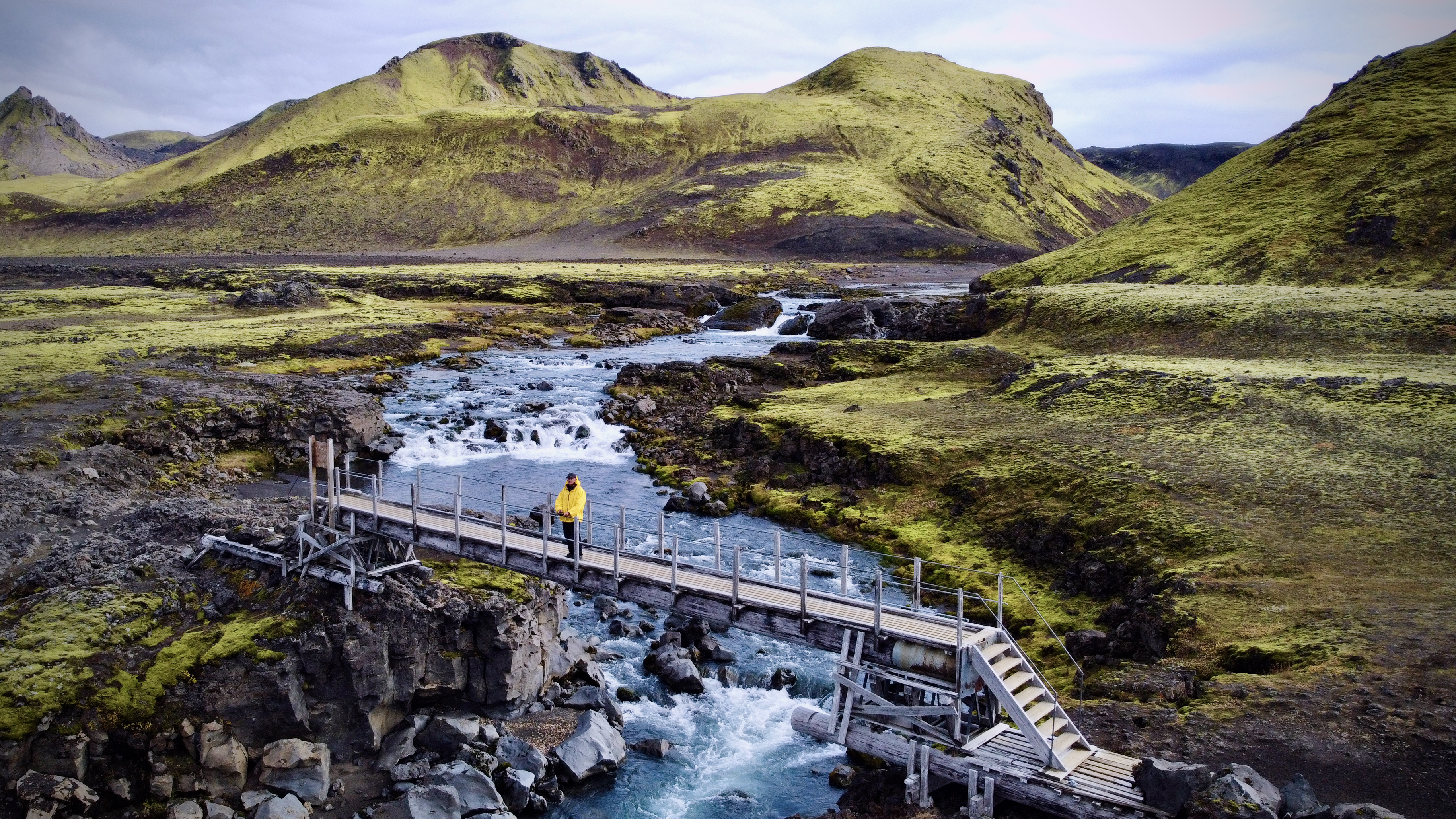
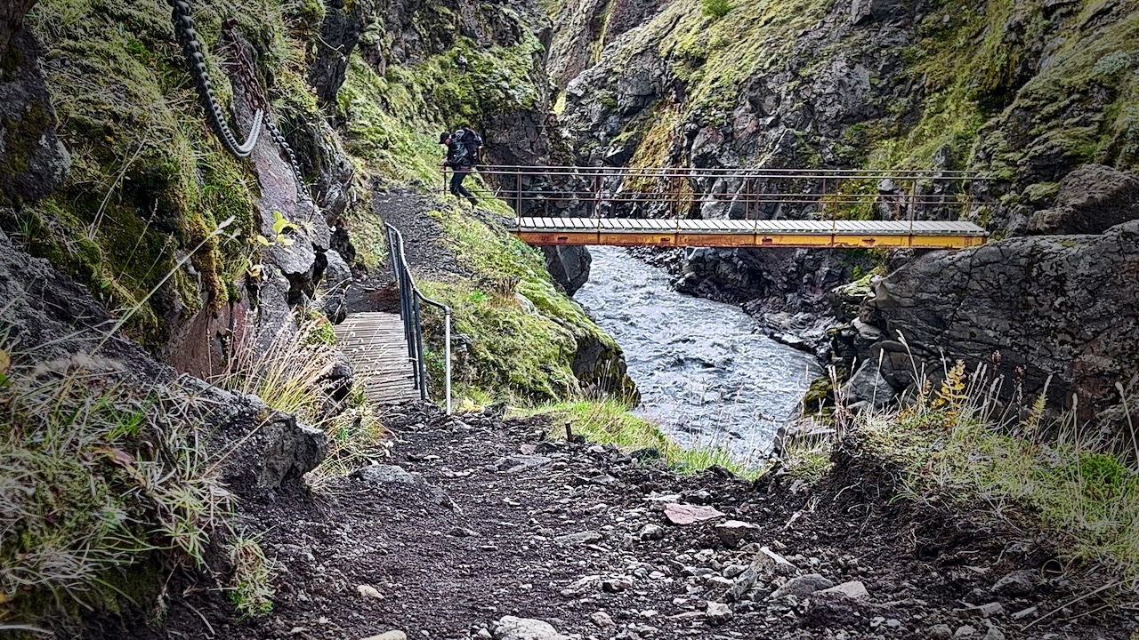
Once in a while you have the luxury of a bridge.
Most available bridges are across gorges too steep to wade.
The trail is fairly well signed.
IF you have good visibility, it’s not easy to wander off trail.
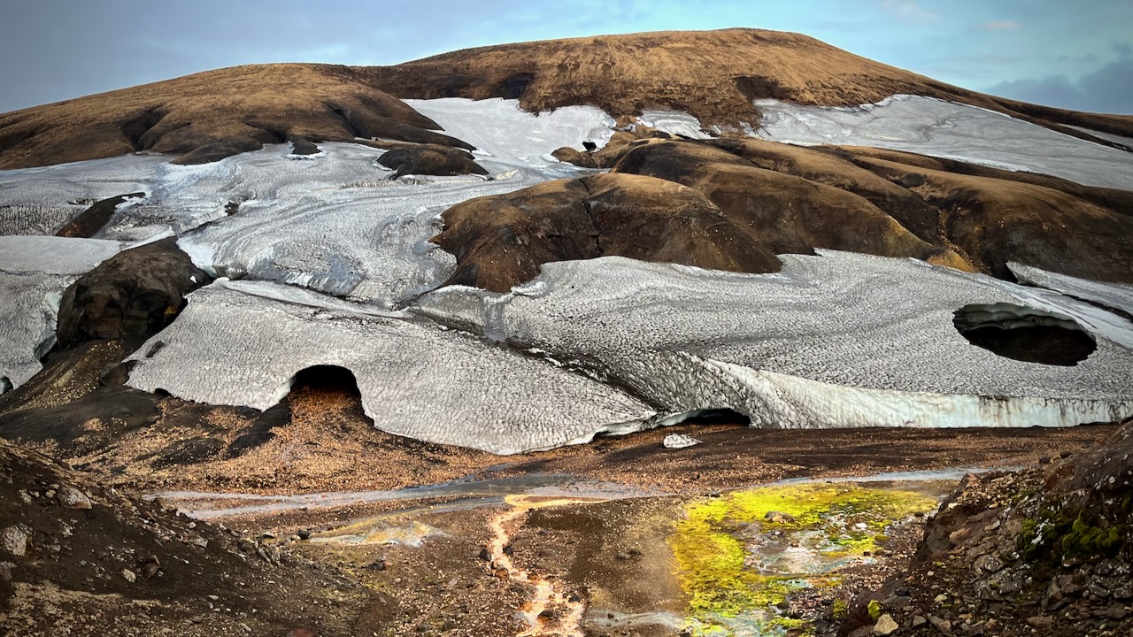
Weather changes frequently. Sometimes drastically.
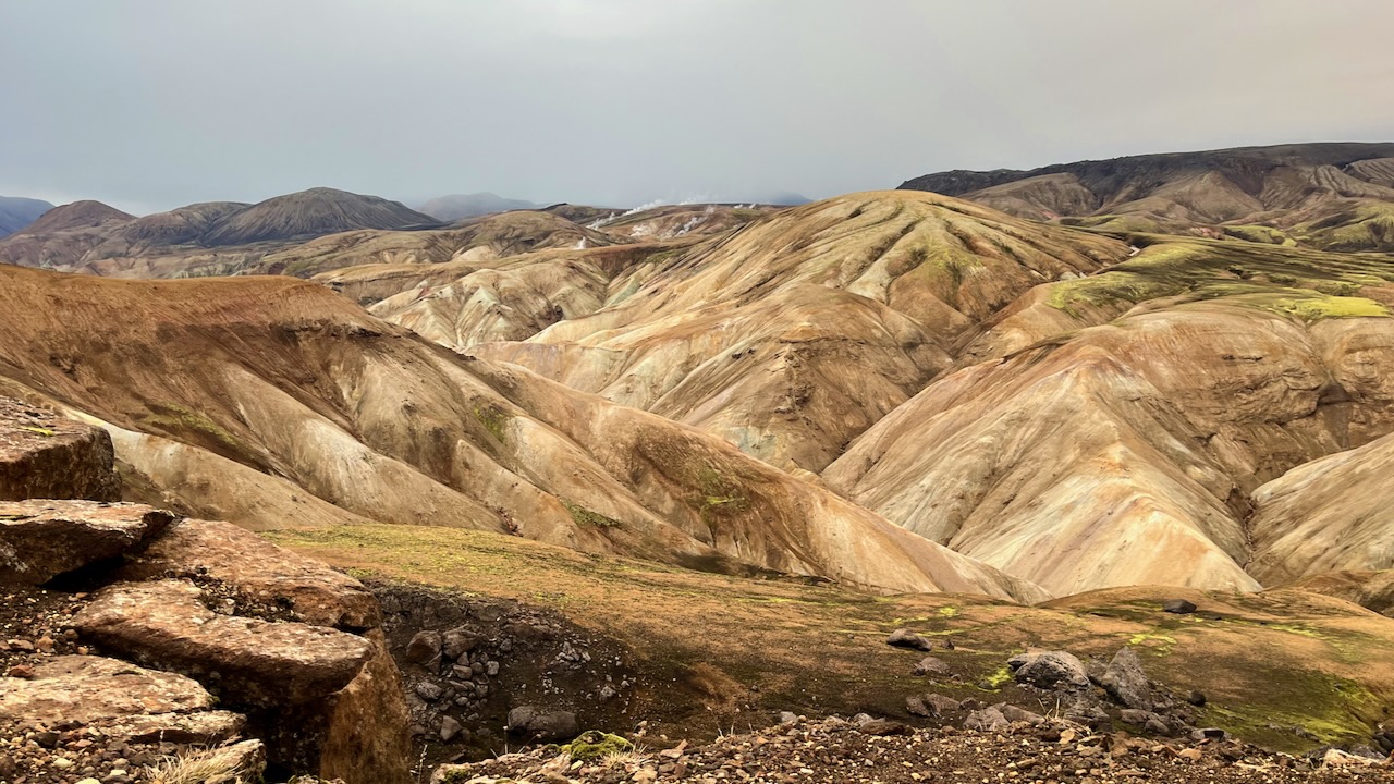
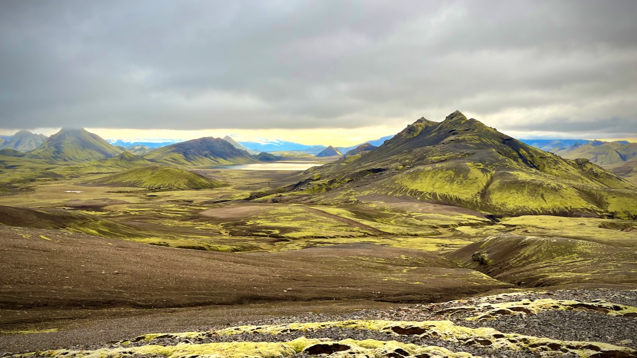
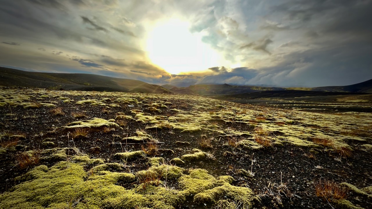
I love the bleak, treeless landscapes when the sun is low.
I’d camped at Emstrur Botnar 5 years earlier and liked the tent sites, somewhat protected from the wind.