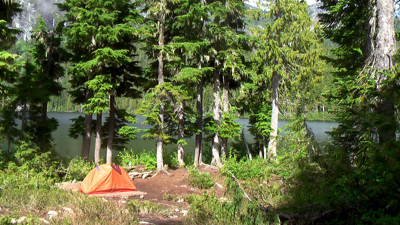
hike Isle Royale National Park, Michigan

Brian recommends an adventure I’ve never heard about.

Even getting there is a bit daunting:

Isle Royale is different than most national parks in that it requires real planning and preparation to visit. The park, actually an archipelago of 200 islands, is quite remote. Just getting to one of its three ports of departure — Houghton, Michigan, Copper Harbor, Michigan, or Grand Harbor, Minnesota — requires some planning. Once visitors arrive in their chosen port town, they take a passenger ferry or a seaplane (from Houghton only) to the narrow, 45-mile-long island. …

GORP

The Greenstone Ridge is the longest and most popular of Isle Royale’s “long” trails. The trail runs along the spine of the island, spanning some 40 miles from the northeast at Lookout Louise to the southwest at Windigo. “The Greenstone,” as it is called by hikers, winds through forests of maple and birch, past swamps and bogs, and up 1,394-foot Mount Desor, the highest point on the island. …

GORP – Onto the Greenstone Ridge

atop-mt-desor-on-isle-royal-np-overlooking-lake-superior.jpg
atop Desor – photo from Johnny Molloy’s trip report

Moose are one of Isle Royale’s main attractions. The “infamous blackflies and mosquitoes” the main reason to stay home.

Wikipedia used my photo of Bamfield

Nice.

I had no idea that one of my Creative Commons licensed pictures was being used on the Bamfield, British Columbia Wikipedia page.

bamfield.jpg

That’s cool. They linked back to the original photo.

The only problem was that the caption on the photo was incorrect. I simply went into Wikipedia and deleted the wrong caption.

That’s cool too. Thank’s Brooke Cameron.

Bamfield is one of the trailheads for the West Coast Trail, by the way.

recommended – Powermonkey Solar Power Charger

George bought a solar power charger over the winter. So far, he’s very impressed.

powermonkey.jpg

The official weight listed is 1.4lbs. But that’s with EVERY piece. If you are only hiking with an iPod and a phone, it would be far lighter than 1lb.

You hang the solar charger anywhere on your pack. It stores a charge for later juicing your camera, phone and other electronics.

I’m convinced. I’ll get one for longer trips this summer. Cost is $130 from Amazon. George got his for less than $100.

Powermonkey Solar Power Portable Charger

Powermonkey Solar Power Portable Charger – Amazon

10 best day hikes in Ontario

Explore magazine lists 10 great walks in Ontario, Canada:

1. High Falls Trail, Petroglyphs Provincial Park

2. Gibson Lake Trail, Frontenac Provincial Park

3. Baker Trail, Massasauga Provincial Park

4. Fire Tower Trail, Restoule Provincial Park

5. Under the Volcano Trail, Neys Provincial Park

6. Brent Crater Trail, Algonquin Provincial Park

7. Bluff Trail, Awenda Provincial Park

8. Cobre Lake Trail, Mississagi Provincial Park

9. Spicebush Trail, Rondeau Provincial Park

10. Awausee Trail, Lake Superior Provincial Park

2005-10-08_12-06-26_color.jpg
Awausee Trail. First look out. – Picassa

(via AOL travel)

trekking in Darjeeling Hills and Sikkim

An excellent Himalayan hiking option in Northern India:

… Although Sikkim is only 65 miles long and 45 miles broad, yet it contains some fo the finest mountain and ravine scenery in the world. The Kanchenjunga range is viewed in all its splendour, while the Everest massif can be seen from many advantageous points. …

sikkim.jpg
Sikkim (in orange)

The jumping off point for Sikkim is Darjeeling. Several hikes are recommended:

1. TO PHALUT AND BACK
2. TO PAHLUT AND RETURN via JHEPI
3. PHALUT AND PEMIONGCHI

Number 3 sounds great:

… The march, though long has few equals in the variety and beauty of the scenery that is met with. Leaving Phalut the road takes a short climb to the Singalila Ridge (12, 200 feet at Singalila Point) along which it travels for 3 miles. The grassy, boulder strewn mountain side, gay with flowers, and with the snows always in view, presents a pretty picture. Plunging downwards for 11 miles the road drops 8,000 feet, passing through a variety of vegetation shortly how cold it is up in Phalut, at the start of the march, it is very warm in Dentam. There is a small bazaar in the neighbourhood.

The climb to Pemiongchi, 6,920 feet, begins with the next day’s trek. The 11 miles march is enlivened by some very beautiful scenery, including scenery, including cascading waterfalls and gorgeous orchids. The full beauty of the Sikkim forests strikes one during the march to Pemiongchi.

Pemionngchi is remarkable for its monastery and different angle at which Kanchenjunga is viewed. The monastery of Sanga Choling is the older and largest in Sikkim and it means “The Sublime Perfect Lotus”. A beautiful view of the surrounding country-side can be obtained from the monastery and it is itself of great interest.

The return journey is via Rimchenpong (6,300 ft), Chakung (5,100 ft) and Badamtam (2,500 ft). The route however, can be shortened by 1 day by making a double march of 20 miles from Chakung direct to Darjeeling via Singla, Barnesbeg and Takvar Tea Estates. …

read more – Hot Stimulating Treks and Tours

kanchendzonga.jpg
original – flickr – Gateway to Singalila National Park – Kanchendzonga

Singalila National Park – Wikipedia

GORE-TEX® – the fabric of deceit

Who was it that coined the truism? Author Tim Cahill, I believe.

I’ve never had any faith in the so-called waterproof material or any of it’s competitors.

Frank and Sue in Australia are similarly suspicious:

We are a skeptical pair here at “Our Hiking Blog” and the concept of waterproof hiking boots has been high on our list of “urban myths”. We have always accepted that our feet will get wet and have usually blamed it on water running down our legs into the boots or that the boots were, well, just not waterproof.

After one particularly soggy outing, Sue was given a refund by Snowgum for her faulty GORE-TEX boots. Nice customer service!

Now Frank is checking his boots for … “leaks”.

Men\'s Merrell Moab Gore-Tex XCR

Men’s Merrell Moab Gore-Tex XCR

recommended hiking book – The Cactus Eaters

How I Lost My Mind-and Almost Found Myself-on the Pacific Crest Trail

Traversing broiling deserts, snowy mountain passes and dank rain forests on its crooked way from Mexico to Canada, the Pacific Coast Trail is an epic challenge for die-hard backpackers. White and his girlfriend, Melissa, set out, late in the season and bereft of experience, to tread all 2,650 miles of it, leaving behind lousy reporting jobs and hoping to find self-definition and a deepened relationship. (They call their trek the Lois and Clark Expedition.)

How I Lost My Mind-and Almost Found Myself-on the Pacific Crest Trail (P.S.)

Hilarious greenhorn misadventures ensue—including the author’s ill-advised chomp, while dizzy with dehydration, into a reputedly moisture-laden prickly-pear cactus—that tested their survival skills and commitment as a couple. The trail becomes less an itinerary than a world unto itself, full of squalor, discomfort and majestic scenery, and peopled by charismatic misfits and an austere cult of ultra-light speed-hikers, as the couple rely on arcane camping gear and bizarre gummy-bear-and-marshmallow diets. The wilderness authenticity the author seeks proves elusive; all journey and no destination, the story itself eventually trails off with the hero even more callow and confused than when he started. Still, White’s vivid prose and hangdog humor make readers want to keep up.

The Cactus Eaters – Amazon

Thanks Peter Spiller of Outside San Diego for the tip.

It’s jumped to the top of my MUST READ ON THE TRAIL list. Sounds like A Walk in the Woods crossed with A Blistered Kind of Love.

public transport to best hike trailheads

Do you hate parking a rental car at the trailhead?

glacier-wiki.jpgThanks JTownshend for pointing us to a website which clearly explains transportation options from my home town — Calgary, Alberta, Canada — to Waterton National Park on the U.S. border.

Why is this such valuable information?

Because that’s how you can most easily access our #6) best hike in the world: Glacier North Circle, Montana, USA, at least from Canada.

If you do not have your own vehicle, here’s how to get to one of the trailheads from the Calgary airport:

calgary-waterton.jpg

Airport Shuttle ExpressCalgary to Waterton

(I’d skip the airport taxi, instead taking the public bus downtown for $2.50.)

If you have not yet decided on what BIG hike to do this summer, consider the North Circle. It’s awesome.

And — as a bonus — out of Calgary you could add our #5 best hike in the world — Sunshine to Assiniboine — in the Canadian Rockies. No personal vehicle needed for that adventure either, assuming you start and finish at the Sunshine Village trailhead.

Another great option is our #2) best hike in the world — the John Muir Trail, in California.

hiking in Taiwan

I’m scheduled to take a trip to Cambodia in July. (A volunteer position working with sport coaches there.)

It’s too hot and humid in summer for hiking, I fear. But what if I stopped over in Taiwan on the return? What are the best hikes there?

RESEARCH:

taiwan1.jpg

… the island is covered with remote and beautiful mountains, which are laced with hundreds of hiking trails. These are the emerald peaks that visitors see from their plane windows, just before they descend into a factory city on the west coast.

Taiwan is home to the highest mountain in east Asia – at 3,952 meters Yushan (Jade mountain), is taller than Japan’s Mt. Fuji – while dozens of peaks soar above 3,000 meters. Protected by national parks, and home to black bears, salmon, rare birds and other wildlife, the mountains are Taiwan’s most compelling attraction.

Trekking in Taiwan is not for the faint-hearted. The Central Mountain Range is steep and wild, and much of it is covered with thick forest. Summer thunderstorms rise unseen, temperatures can drop below zero, and facilities are few and far between. But for those willing to carry their own gear, the treks are among the most beautiful in Asia.

The top hikes in Taiwan – Chilai Ridge and Yushan – require a reasonable level of fitness and the proper equipment, which includes a tent and stove, food and water, a sleeping bag, good boots, and warm clothes.

To really get away from it all, try the Chilai Ridge trail, a rugged walk straight down the mountainous spine of Taiwan. The trail begins at Ho Huan Shan hostel, on the northern cross-island highway (#14) about 60 kilometers from Puli.

From the hostel, it takes four hours and a lot of legwork to reach the 3,200-meter summit of Chilai Ridge. The ridge trail then proceeds due south, over a succession of rocky outcrops that is regarded as the most dangerous trekking walk in Taiwan, but one that is unrivalled in beauty. In some places the ridge is sharp as a knife, with cliffs on either side, and it is composed of leaves of shale that crumble underfoot like rotten cake. …

Out of Thick Air: Taiwan’s Mountain Highs – Time magazine – BRENT HANNON

Sadly, in the end, my flight was routed via Hong Kong instead.

Hmmm. Perhaps I should do one of the big urban hikes while in transit.

hiking performance art

Jim Denevan made the world’s largest freehand drawing a few weeks ago on a dry lake in Nevada. How big is it? Three mile across, which took 100 miles of walking to draw the pattern:

hiking-performance-art.jpg

… The artist says: “My drawings are made totally freehand – large, then shrunk (if photographed).” “At low tide on wide beaches Jim searches the shore for a wave tossed stick. After finding a good stick and composing himself in the near and far environment Jim draws– laboring up to 7 hours and walking as many as 30 miles. The resulting sand drawing is made entirely freehand with no measuring aids whatsoever.” …

measuring-the-line.jpg

The Art of Jim Denevan – official website

(via Dark Roasted Blend – The Largest Human-Made Art on Earth)