best S.W. USA desert peak scrambles

From Branch Whitney of the excellent Hiking Las Vegas blog:

I am not a big fan of the typical desert peaks. Most have boring approaches, crappy rock, and long drives. I do not consider the peaks in Red Rock or Mt. Charleston as desert peaks. The rock there is much different. So I “cherry pick” the desert peaks I do climb. Here’s a list of my favorite:

Mopah and Umpah Points

Eagle Mountain

Moapa Peak

details – My Favorite Desert Peaks

All of the routes to these peaks and another 350 routes are available for members of HikingLasVegas.

Moapa

hiking the Tour de Mont Blanc

Carol gives a shout out for Alpine Exploratory, a company specializing in walking and trekking holidays in the Alps.

They did the “self-guided” version of the tour.

I think self-guided is a nice compromise. You don’t need to follow behind your group (like sheep). But you have experts who speak the local languages setting your itinerary for you.

+ Trek all the stages, completing the whole route
+ Start on any day you choose
+ Expert, unlimited advice on all the options

The Tour du Mont Blanc is a trek of superlatives: the most famous trek in Europe, forming a circuit of Western Europe’s highest mountain Mont Blanc (4,808m). Our circuit takes the standard 11 days, starting and finishing in the Chamonix valley. …

Tour du Mont Blanc – Self-guided trekking holiday

tourdumontblanc-map

What does all this cost?

14 nights, staying in:
3-star hotels (4)
2-star hotels (5)
Auberges (2)
Mountain huts (3)

Included
Accommodation and itinerary
Breakfasts and 6 evening meals
Expert and unlimited advice
Routecards, maps, local info
Emergency card, language card

Dates
July to mid-Sept 2010 …

Prices
£860 per person
(Single supplement £140)

£860 = US$1,410

===

UberFit is blogging their TMB from this past summer. Great photos. (Especially food pics.)

MBT Stage I – Chamonix to Les Contamines

MBT (Stage 2: Les Contamines to Bonhomme de la Croix)

TMB-guidebook

besthike TMB information page

Black Butte Trail, California

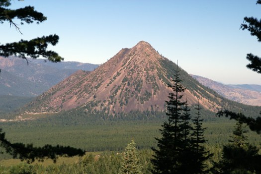
I love the look of this volcanic scramble

Black Butte Trail

Length: 5.2 miles round-trip

Hiking time: 4 hours

High point: 6,325 feet

Total elevation gain: 1,850 feet

Difficulty: moderate

Season: mid-May through mid-November

Water: none; bring plenty …

Black Butte from the west slope of Mount Shasta. (Photo by John Soares)

The Black Butte Trail is Hike 45 from 100 Classic Hikes in Northern California, third edition. I discuss the same route in Hike 63 of 75 Hikes in California’s Mount Shasta and Lassen Volcanic National Park Regions, revised edition.

Click through to John’s site, Northern California Hiking Trails, for links to his guidebooks.

Waimoku Falls / Pipiwai Trail, Maui

Trip report by site editor Rick McCharles.

Most tourists in Maui drive a rent-a-car to Kipahulu Visitors Center in Haleakala National Park, the end of the famed Road to Hana.

The main attraction are the so called “Seven Sacred Pools“, a name invented by some overzealous tourism marketer. In reality, the ʻOheʻo Gulch has dozens of pools and a number of waterfalls, a few very welcoming of swimmers.
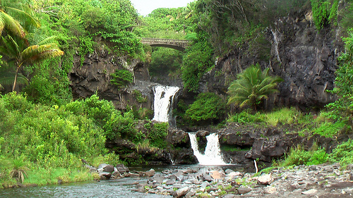
Oheo-Gulch-pools

Welcoming if you’re not scared off the warning signs posted everywhere.
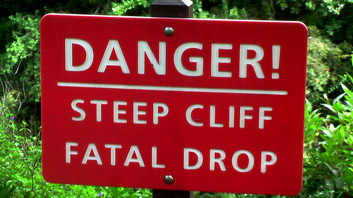
warning-sign

warning-sign-2

I spent only a few minutes at the pools, instead quickly beginning the climb up Pipiwai Trail. I knew it would be fantastic as Trailspotting calls it their “favorite hike on Maui”:

Distance: 4 miles
Type: Out & Back
Difficulty: Medium
Elevation gain: 900ft (from 200 – 1,200ft)

Beginning at the rugged and remote eastern Maui coastline follow the Pipiwai stream inland and you’ll soon be surrounded by dense jungle, heading towards a series of waterfalls each increasingly more impressive than the last. En route you’ll cross bridges and streams, and negotiate an unforgettable boardwalk journey through a dense bamboo forest that towers so far above your head that daylight struggles to reach you. And since the Hawaiian islands are some of the wettest places on earth, you’re sure to be impressed with the towering 400 foot wall of water at the end of the trail that is Waimoku Falls. …

Pipiwai Waterfalls & Bamboo Trail

The bamboo was the highlight for me, too.
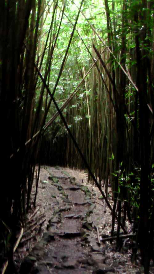
bamboo-forest

Actually, this kind of bamboo is one of those dread invasive species. But it’s an invasive species I love. I’m an invasive species, myself.

You’ll be warned about mosquitos. I never saw even one during 2wks on Maui in October.

Pipiwai gets better and better the closer you get to Waimoku Falls.
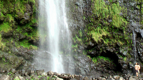
Waimoku-Falls

Click that last photo to see a larger version of a true Hawaiian paradise.

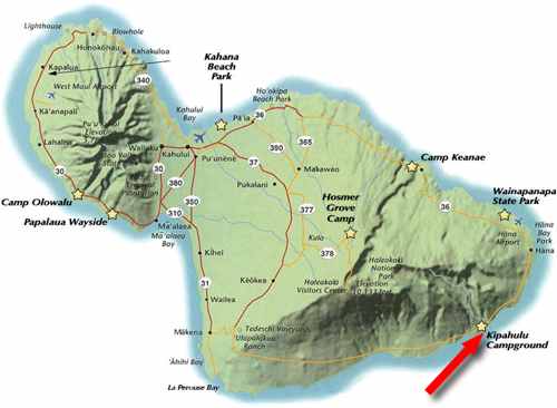
The other highlight of this hike for me was tenting at Kipahulu Campground right at the trailhead.
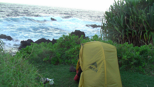
campsite

Waimoku Falls Pipiwai Trail map

I spent two nights. It’s free after you pay for your National Parks pass. Authorities are frantically improving the visitor center right now. I expect the primitive campground will be improved, as well.

Walking the shoreline here is highly recommended. A half mile stretch is called the KAHAKAI TRAIL.
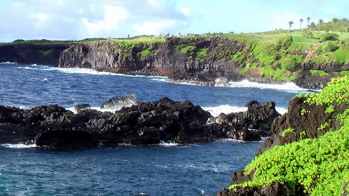
Kipahulu-campground

See all my photos from Pipiwai, one of the very best hikes in the world.

Or, better, check out Stuart’s photos – Trailspotting: Hawaii, Maui: Pipiwai Waterfalls. Click on his trail map for a larger view.
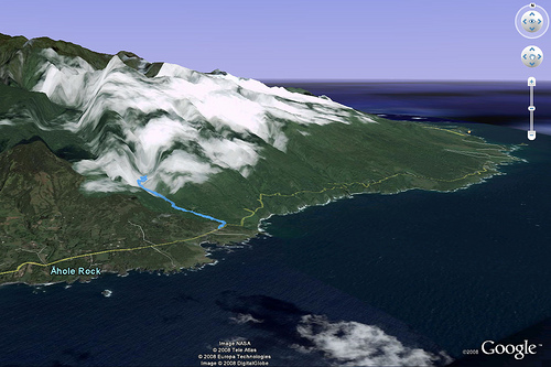
Pipiwai-trail

Leave a comment if you’ve done Pipiwai and have something to add.

Hoapili Trail, Maui

Trip Report by besthike editor Rick McCharles.

I first heard of this hike on Trailspotting.

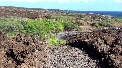
… the Hoapili Trail will take you across … 200 year old lava beds to a secluded beach.

From the trailhead hike through patches of kiawe woodland and beaches scattered with sand and white coral, contrasting starkly with the black of the lava outcroppings. Eventually and suddenly the vegetation stops – a telling sign that you’re on the newest of the lava beds – and take a sharp left turn through a gate before proceeding on through fields of barren lava formations. …

I was intrigued.

Hoapili-coastline

You can see how far the lava had to flow from the volcano to the sea.

lava-volcano

This is part of what is called the Hawaiian “King’s Highway”.

Kings-highway

Past the beach I saw a four-wheel drive truck and people camping. One reference tells that wild camping is allowed there. Tempting.

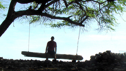
Instead I only enjoyed a short break on the log swing at Keoneoio Beach.

Rick-log-swing

All the Maui hiking guidebooks include Hoapili. But many references wrongly calculate the distance from La Perouse Bay to Kanaio Beach as 5.5 miles. It’s about 2mi (3.2km) one way.

I’ll not include Hoapili on our list of the best hikes in the world. I liked it. But many would find it too hot, too desolate. The jagged lava is tought on the feet, as well.

There’s definitely no water or other facilities. If you are hiking the Hoapili, you must be self-sufficient. Like this guy.

feral-goat

more photos from this hike

Hoapili-map

57 signs you might be obsessed with hiking

A funny post by Frank Wall on Our Hiking Blog:

It’s a repost of a thread from Trailspace.com forum.

17. You use your 90L pack to carry the groceries

18. You sleep on a thermarest

19. Your keychain is a Swiss army knife/fox40/flint combo on a biner/ climbing loop

You get the idea. You’re a hiking MANIAC.

geocacher

57 signs you might be obsessed with hiking, backpacking or bushwalking.

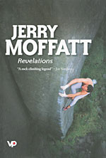
Banff Mountain Book winner – Revelations

book-moffat-revelations-150Grand Prize

Revelations — Jerry Moffatt
by Jerry Moffatt and Niall Grimes

Phyllis and Don Munday Award, sponsored by the Alpine Club of Canada

Vertebrate Publishing (UK, 2009) 978-1906148119

Amazon

Check the rest of the Winners of the 2009 Banff Mountain Book Festival.

Mostly mountaineering titles, as usual.

7 great hikes in 7 days

Why would anyone do 7 New Zealand Great Walks in only 7 days?

Day 1 – November 29th – 42.7km – Lake Waikaremoana Great Walk

Day 2 – November 30th – 41km – Tongariro Northern Circuit

Day 3 – December 1st – 51.9km – Abel Tasman Coast Track

Day 4 – December 2nd – 78.4km – Heaphy Track

Day 5 – December 3rd – 32.1km – Routeburn Track

Day 6 – December 4th – 53.5km – Milford Track

Day 7 – December 5th – 60.1km – The Kepler Challenge*

Total distance – 359.7km

The Runner, 49yr-old Malcolm (Mal) Law.

malcolm … My brother Alan died of Leukaemia back in 1969. Ever since then I have harboured the idea of doing something amazing to raise funds for research into a cure for this cruel disease. …

Click through for the details – It’s going to hurt!

(via Adventure Blog)

new thru hike in Australia

… We hope to develop a walking trail network of some 2,000 kilometres (about 1,250 miles), which will pass along the Eastern Cape York Peninsula.

Cape-York-map

This is one of the last pristine tropical regions in the world. It is wild, beautiful and presently largely trackless and inaccessible. The coast has many stunning tropical beaches lapped by the azure blue Coral Sea, with the Great Barrier Reef running the closest it gets to the Queensland Coastline. ….

You can help with this project by filling out a short, fairly painless survey linked from the home page. (click the survey START button)

Eventually the network of trails could be connected into one of the greatest long hikes anywhere.

Dreaming-Trails

DreamingTrails.com