See what I mean.
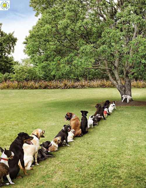
Thanks Michelle.


Best hikes, treks, tramps in the world.
See what I mean.
Thanks Michelle.
trip report by site editor, Rick McCharles
In 1931 a railway was built, 30mi connecting Boulder City with the Hoover Dam used to transport construction materials.
Today hikers and bikers can enjoy a Rails to Trails path along those former tracks.
I certainly did.

There are spectacular views over Lake Mead.

The highlight is a series of tunnels.

You might read that the trail dead ends after the last rail tunnel, for security reasons. Not so when I was there April 2010. I continued riding all the way to the parking lot for the Hoover Dam tour.
My most vivid memory of the morning is bad signage. The National Parks are so broke and disorganized, that there is no obvious sign where you should turn left towards the Lake Mead National Recreation Area when driving from Boulder City.
More evidence that governments cannot do anything efficiently.
The Hoover Dam is 30mi (48km) southeast of Las Vegas, Nevada.
Bird and Hike has a succinct webpage:
This easy, 1.5-mile loop trail starts at the Visitor Center, wanders east and south down a sandy wash, heads west around the south side of the Hole-in-the-Wall hills, climbs up through the Hole-in-the-Wall cleft on the Rings Trail, and then follows the road for 0.2 miles back …
Almost every tourists stops at Hole-in-the-Wall. But not all are willing to try the assisted scramble.


I’d call it a perfect little day hike for a confident walker. The scenery is desert classic.


Add on the “Nature Trail” to the campground. Desert vegetation is signed, … all the bushes looking somewhat similar. With unlikely names like: Paper Bag Bush, Hedgehog Cactus, Horsebrush, etc.
Tent caterpillars were everywhere when I was there.

… Mojave National Preserve, at 1.6 million acres, is the third largest National Park Service managed area in the Lower 48; only Death Valley and Yellowstone are larger. …
It’s so close to Vegas, I’m surprised more tourists don’t visit. There’s no Park entrance fee. And “wild camping” is allowed almost everywhere.
trip report by site editor Rick McCharles
Only 2 hikes in Mojave National Preserve are recommended by Moon Hiking California:
• Kelso Dunes
• Teutonia Peak
In the morning I did the Dunes. Then drove on to do a climb. A great hiking day in the desert.


The highlight for me were the Joshua Trees, but a different species than those in Joshua Tree National Park.

At 5,755 feet, Teutonia Peak offers great views of Cima and the surroundings. This four mile round-trip trail heads south from Cima Road and crosses the desert through part of the world’s largest Joshua tree forest. A half mile from the summit the ascent becomes more earnest as the maintained single track now tackles the bulk of the 700 feet in elevation between the trailhead and the peak.
Despite the minimal effort, the views from the top are splendid. …
read more – Hike Speak

Actually, to “summit” Teutonia is a class 3 scramble. Most people don’t do it.
No fees. No hassles. You can tent free nearly anywhere. Mojave National Preserve is a great destination for hikers.
see all my photos from this short day hike
trip report by site editor Rick McCharles
Only 2 hikes in Mojave National Preserve are recommended by Moon Hiking California:
• Kelso Dunes
• Teutonia Peak
As also recommended, I arrived at Kelso Dunes at dawn. (Sunset is very popular, too.)
It was overcast, rain threatening.

Not nearly as impressive as Eureka Valley Sand Dunes, I still enjoyed this short hike.
Basically you climb up the spine of the highest dune, 650ft (200m) …

Plant a Summit Stone, painted by DSD … (The next hiker to the top would collect it. Or, … perhaps it will be covered by sand for ages.)

… and slide / run down as fast as possible.
No fees. No hassles. Mojave National Preserve is a great destination for hikers.
see the rest of my photos from this short day hike
Half Dome is one of our best hikes in North America.
I loved Hank Leukart’s hilarious trip report. Check the excerpt:
… It’s a surprisingly strenuous cardiovascular workout, battling gravity to reach the top of Yosemite’s most recognizable rock formation. The normally unflappable Laura looks petrified as she slowly inches toward the peak. Finally, the three of us reach the summit, breathing heavily and sweating with adrenaline rushing through our bodies. Laura, finding that she has suddenly become terrified of heights, sits safely in the middle of the Dome’s surface, not wanting to get anywhere near the edges, though they are at least 200 feet in every direction. The three of us eat a lunch of turkey sandwiches as we look out from a height of 8,836 feet above the dramatic expanse of Yosemite Valley, with its complex granite rock formations, pine tree forests, and sprawling meadows. The epic views make us feel dizzy and drunk.
“I want to stay here forever,” I say, looking down into the Valley below.
“I never want to leave,” Justin agrees.
“I want to go down, right now,” Laura pleads. …
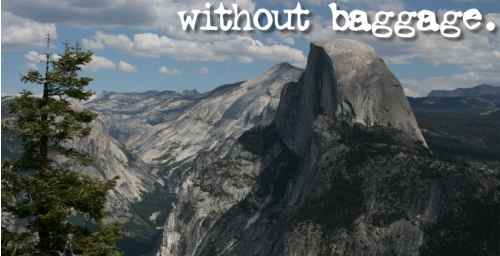
read the article – Without Baggage – living yosemite.
after climbing half dome, i can’t bear to leave yosemite.
by site editor Rick McCharles
Each June in Northern Idaho, Adventure Sports Week offers 10 days of racing, training, clinics, gear demos and more. ASW features triathlons, mountain biking, trail running, adventure racing, open water kayaking and swimming.
2009 was our inaugural year and we’re gearing up for 2010. One of the best new adventure sport races in the U.S.A.
details and registration is available at www.adventuresportsweek.com
What do rollercoasters, a great rappel, fantastic scenery, a first class event and “10-24-1” have in common?

Hosted at beautiful Farragut State Park in Bayview, Idaho (just north of Coeur d Alene), ASW 2010 is promising to be one of the top festivals in the USA this year.
• official event home page
• Team Adventure Sports Week blog
Love it.
… This 30 second spot was shot in Vancouver, British Columbia, and shares some of the community and inspiration we’ve experienced while hiking. . ..
Click PLAY or watch on YouTube.
(via the adventure life … smacking down writer Dan Neil of the Los Angeles Times)
I can relate. I’m still boycotting linking to the LA Times because of some long forgotten idiot opinion piece.
Frank ties together some very interesting and entertaining links on this topic.
Just one of those is a book by Richard Louv:
… Last Child in the Woods is the first book to bring together a new and growing body of research indicating that direct exposure to nature is essential for healthy childhood development and for the physical and emotional health of children and adults. …

Click through for the details and more links – Our Hiking Blog – Nature Deficit Disorder? Kids at risk without “wild places”?
This is 11yr-old Zach Bonner finishing his 600mi trek from Atlanta to Washington, DC on July 9, 2009
[picapp align=”center” wrap=”false” link=”term=children+hiking&iid=5340834″ src=”9/9/3/4/11YearOld_Finishes_Walk_c8bb.jpg?adImageId=12608288&imageId=5340834″ width=”500″ height=”351″ /]
trip report by site editor Rick McCharles
For years I’d been trying to find the Lost Coast of California, listed by all one of the best Ocean walks in the world .
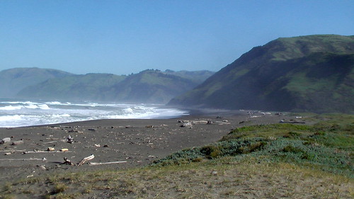
… The Lost Coast is a section of the California North Coast in Humboldt County, which includes the King Range. The steepness and related geotechnical challenges of the coastal mountains made this stretch of coastline too costly for state highway or county road builders to establish routes through the area, leaving it the most undeveloped portion of the California coast. …
Logistics are challenging:
• 25mi one way
• Mattole trailhead south to Shelter Cove
I arrived at the Bureau of Land Management office in Arcata, California after closing. One of the staff unlocked the door, answered all my questions on the hike, got me tide tables and the booklet called “What You Need To Know Before Backpacking The Lost Coast”.
Thanks BLM !!
A quick summary:
• camp anywhere you like, but in established sites
• beware Bear visits
• severe storms typical
• no bridges, many creek crossings
• be forewarned about ticks and Lyme disease
• all water must be treated
• don’t be surprised to find a rattle snake in a pile of driftwood
• mobile phone coverage unlikely
• it’s remote, rescue slow and difficult
A free self-service permit is required. Get it at either trailhead.
Hike the “low tide” sections while the tide is dropping. If you get “stuck”, you can simply wait for the beach to open.
We talked about the tragedy of 2000 when 2 student hikers and a parent were drowned. Terrible. The rip tides and so-called “rogue waves” are a real hazard here.
My insane plan to park at the North end, then mountain bike with full pack to the South, was … laughable.
Alternatives?
LostCoastTrail.com offers a one way shuttle. Cost about $100 and the vehicle is not always available.
Quickly I decided to hike in and out the North trailhead, doing only part of the Trail.
BLM advised I camp the night prior at Mattole campground. Pit toilets and potable drinking water.

Within minutes I was enjoying the tranquil California coast.

Minutes after that I was questioning my tolerance for hours of trudging in the sand.

Happily, there are often bypass trails higher up on the bluff. I walked a combination of beach and trail.
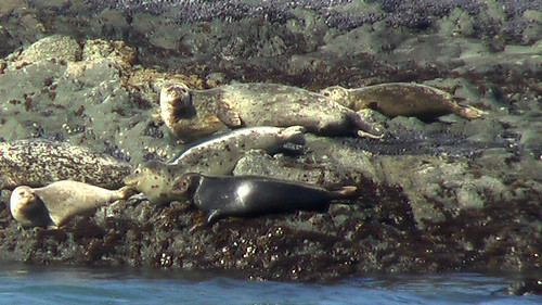
There is a lot of bird and sea life. I saw no sign of the world’s smartest bears while I was there. Bear vaults are mandatory.
The biggest “challenge” are the creek crossings. I brought a second pair of shoes for water but, in the end, did not use them. On some I simply tramped through. On others I went bare foot.

This ship must not have seen the Punta Gorda lighthouse.

About 3.5mi into the morning I spotted a fantastic campsite just being vacated by other hikers. I grabbed it.


Paradise.
After establishing my base camp and tying my tent down securely against the North wind, I spent the rest of the day with only a light pack. My turn around time was 3:30PM.

A gorgeous day on the Lost Coast. I’ll need to hike the south end next time.

See all 50 of my photos from this hike.
UPDATE from Buzz:
The BLM station at Shelter Cove is easiest info stop. Shuttle service works well tho the tides weren’t right for me to do the Coast in a day using the Shuttle, so I contrived a great loop starting at the S end. Ran up the fire roads and trails to the top of King Peak – highest in the range, old fire lookout, incredible views – then cranked down to the beach where strangely, someone owns a remarkable house accessible only by boat or small plane. Single bottle fanny pack was fine – all the water is drinkable.
related:
• GORP – Lost Coast Romance

 besthike.com