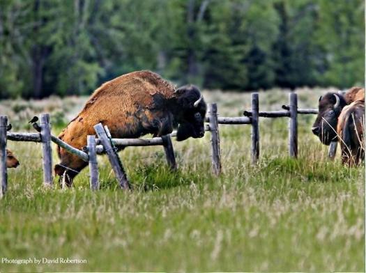
Montana – man in tent killed by Grizzly

A few days before my solo Beartooth High Lakes hike, nearby a camper was killed and eaten by a bear.

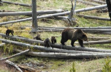
Montana Department of Fish, WIldlife, and Parks (MFWP) officials have captured a 300 – 400 lb. grizzly sow that went berserk in a Montana campground, fatally mauling Kevin Kammer, 48, of Grand Rapids, MI. Two other people were injured in the attack, which took place around 2 a.m. Wednesday, July 28 in Soda Butte Campground on the Gallatin National Forest northeast of Yellowstone. Witnesses said the sow was with three yearling cubs.

MFWP officials say Kammer was by himself in a tent when the attack happened. He was found at around 4 .M. about 25 feet from his tent by a team of state park investigators dispatched to the area on a report of a bear attack. He was a husband and father of four children, ages 8,9, 15 and 19 and he was alone on a fly-fishing vacation. …
Island Park News

The mother bear was euthanized, the cubs sent to a Zoo.

… I saw no bear sign on my own trek.
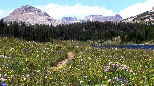
Beartooth High Lakes, Wyoming

trip report by site editor Rick McCharles

35mi (57km) on the Continental Divide

This lollypop loop circuit, as recommended by Lonely Planet Hiking in the USA, starts and (supposedly) finishes at the Island Lake trailhead on the intensely scenic Beartooth Highway, an access to Yellowstone National Park.

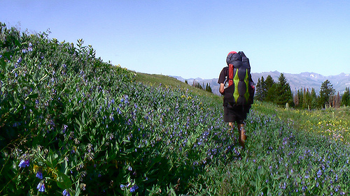
The wildflowers here in early August are insanely great.

Unfortunately, the horseflies and mosquitoes are insanely awful. Fish food, I guess.

For all the wildlife in nearby Yellowstone, I was surprised to see nothing larger than this marmot. … Perhaps the mosquitoes drove them out.

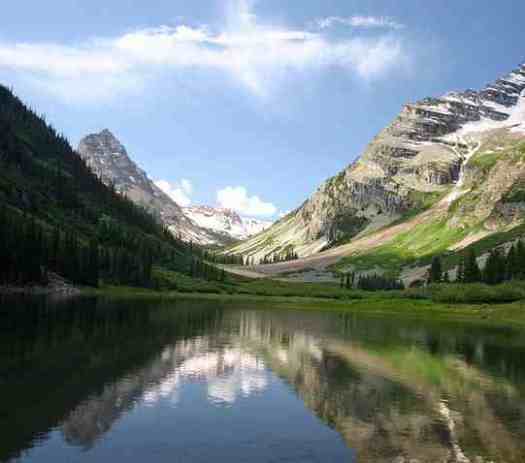
The High Lakes hike is aptly named. You trek from one remote lake to the next. With all the granite, at times it reminded me of the Sierra Nevada.

You are going to get your feet wet, for sure. But normally there is a way across the widest streams.

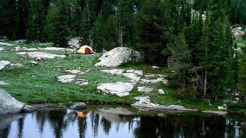
Many love this wilderness for the remote tenting options. Set up wherever you want.

Lonely Planet rates this adventure easy-medium, the worse misranking of any hike in the book. It is correct here:

… Waymarkings and signposts are unreliable. …

The Beartooth High Lakes circuit is very challenging due to the many rocky and wet scrambles. The snow that stays into late July. The lack of signage. Trails that often fizzle out completely.

In fact, I’d not recommend you try it without a good topo and GPS. One lake looks like the next up here.

Here I am wandering out through charming alpine meadows, looking for a good spot to leave a Summit Stone.

Though I was blissfully unaware at the time, I was far lost.

I ended up at the Clay Butte lookout tower, miles from my vehicle. … It was a long highway walk back to my car.

I loved the High Lakes hike. But I’d never do it again until after the mosquitoes are mostly gone. Perhaps September.

The best day hike is the section up to Becker or even Albino lakes.

See all photos from my High Lakes hike.

climbing Kilimanjaro

by site editor Rick McCharles

Of our top 10 hikes in the world, the only one I haven’t done myself is Kili.

Price is one concern. Getting to Africa, another.

You cannot do Kilimanjaro independently.

Bobby Tours has 6 day climbs starting at $1100.

Bobby Tours – Kilimanjaro

Leave a comment if you’ve a recommendation for other good companies.

Beartooth Wilderness, Wyoming – BUGGY

When I checked with a Ranger in Yellowstone National Park regarding conditions in Absaroka-Beartooth Wilderness he looked up sharply:

There’s a lot of mosquitoes up there, you know!

I laughed it off. How bad could it be compared with the Canadian Rockies?

… There are 700 miles (1,100 km) of trails in the wilderness, hundreds of lakes, a few dozen streams and a similar number of small glaciers can be found in the wilderness.

… The Beartooths have the largest unbroken area of land in excess of 10,000 feet (3,000 m) in altitude in the U.S. outside of Alaska. Animals found in the wilderness include bald eagles and the threatened grizzly bear, lynx, bull trout as well as the endangered wolf. …

Here’s the Beartooth itself, as seen from the Montana side.

Wikipedia – Absaroka-Beartooth Wilderness

… We’d recommend you wait until September to hike here. Or take a shotgun to disperse the bugs once-in-a-while.

Arizona – Paria Canyon guided hike

42 miles (67km) plus side trips – 5 days

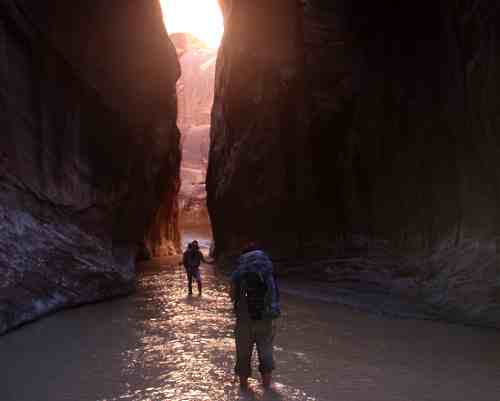
Our favourite hike in the S.W. United States is Paria Canyon.

Logistics are a problem, however. Only 20 permits are issued each day, one of the most difficult to acquire anywhere.

… Also, it’s a 2hr drive between the trailheads.

… Also, there’s a slight chance of flash flood !!

You can do Paria independently, … but it’s far easier to sign on with a guiding company like Just Roughin It:

On the first morning, we will pick you up from your hotel in Phoenix or Flagstaff and drive to the trail head at White House Ruins. Once at the trail head, the group loads up and hikes along the Paria River from there.

Our goal on the first t day is to reach the Paria Narrows and eventually camp at the confluence of Buckskin Gulch and Paria River. The hike is 7.5 miles long with very little change in elevation and usually take about 5 hours to complete.

The next day we will set aside time for a 3 mile side hike up the narrow Buckskin Gulch, one of the most famous, and longest, slot canyons in the world. From here we will move further down river to one of several campsites to choose from.

From here, the itinerary is open except for the being at Lee’s Ferry on the 5th day. Along the way to Lee’s Ferry, time permitting, there are opportunities to explore other slot canyons and sites in the area – including petroglyphs, historical sites and Wrather Arch which is one of the largest spans in the world. …

The price for this trip is $1,225 per person from Flagstaff and $1,275 per person from Phoenix.

official website – Just Roughin It Adventure Company.

Wonderland Trail in 63hrs

Dr. Jeni McNeal and Dave Adlard, founding members of Team Adventure Sports Week, along with an unofficial support crew of Rick McCharles of BestHike.com completed the 94 mile/47,000 feet elevation Wonderland Trail in 63:03, June 25 – 28.

The two carried their own gear, and took only a few hours sleep time in completing what some have said is one of the fastest unsupported, July circumnavigations yet. Almost 10% of the trail was still snowed in, requiring route finding and snow travel. Most hikers completing the trail require 8 – 12 days to finish.

They climbed and descended more than 20 peaks on the famously difficult trail, with elevation changes equivalent to climbing and descending Mt. Rainier from Paradise Visitor Center almost three times. They also encountered bears along the trail.

The two burned almost 33,000 calories each, and drank more than 50 liters of fluid total in temperatures ranging from 33 – 89 degrees.

Their journey began at Reflection Lake on July 25 at 10:40 am, and finished at 1:43 am on July 28.

“This was one of the most psychologically and physically demanding tests I have done since starting Adventure Racing,” said Adlard. “This is a really tough trail that demands a lot from all participants.”

The trail is notoriously uneven, with steep, overgrown and narrow sections that make forward progress difficult in many places.

Team Adventure Sports Week is training for the five day Desert Winds Expedition race in Lake Mead, Nevada, Sept 18 – 25.

Read Dave’s detailed trip report & gear list (PDF)

best hikes Rainier – Burroughs Mountain

trip report by best hike editor Rick McCharles

Mt. Rainier is an outdoor playground scary close to Seattle.

… Although Mount Rainier is an active volcano, as of 2010 there was no evidence of an imminent eruption. However, an eruption could be devastating for all areas surrounding the volcano …

… a mudflow might also reach down the Duwamish estuary and destroy parts of downtown Seattle, and cause tsunamis in Puget Sound and Lake Washington. According to USGS, about 150,000 people live on top of old lahar deposits of Rainier …

Of all Mt. Rainier day hikes, I like Burroughs Mountain best, 7mi (11.3km) return.

You start high at Sunrise trailhead. This is 6400ft (1,950m), the highest point in the park accessible by vehicle.

Mt Rainier (Sunrise - Burrough's Peaks - Granite)

Mt Rainier (Sunrise - Burrough's Peaks - Granite)

The approach is via a gorgeous ridge walk. … We LOVE ridge walks.

Mt Rainier (Sunrise - Burrough's Peaks - Granite)

Mt Rainier (Sunrise - Burrough's Peaks - Granite)

If conditions allow, you can side trip up one, two or three Burroughs Peaks. Here’s the start:

Mt Rainier (Sunrise - Burrough's Peaks - Granite)

Check with Rangers at Sunrise (not open until 10AM) on local conditions. The day I was there, many turned back at this point:

Mt Rainier (Sunrise - Burrough's Peaks - Granite)

Mt Rainier (Sunrise - Burrough's Peaks - Granite)

Rainier looks awesome from the top of Second Burroughs (7402ft).

Mt Rainier (Sunrise - Burrough's Peaks - Granite)

Of course if the weather is terrible, as it normally is, don’t bother. You won’t see a thing.

more photos of this day hike on Burrough’s Peaks

best hikes Rainier – Camp Muir

trip report by site editor Rick McCharles

Mount Rainier is a large active stratovolcano, Washington, USA, located 54 miles (87 km) southeast of Seattle. It towers over the Cascade Range as the most prominent mountain in the contiguous United States …

The mountain and the surrounding area are protected within Mount Rainier National Park. With 26 major glaciers and 36 square miles (93 km2) of permanent snowfields and glaciers, Mount Rainier is the most heavily glaciated peak in the lower 48 states. …

This quote greets the hiker at Paradise trailhead, Mt. Rainier, Washington:

hike to Muir Camp, Mt. Rainier

hike to Muir Camp, Mt. Rainier

hike to Muir Camp, Mt. Rainier

Wild flowers are terrific on Rainier. But …, I’d love to take John Muir to Waterton/Glacier and the Canadian Rockies during wildflower season. … To compare.

Wildlife is another highlight of the Rainier alpine meadows:

hairy varmint, Mt. Rainier

hike to Muir Camp, Mt. Rainier

The 5000+ft climb to Camp Muir (10,080′) begins on the excellent Skyline Trail 5.5mi (8.9km), a good alternative to Muir if conditions are not safe for the snowy ascent up high on the volcano.

We find it troublesome to recommend Skyline, however, as it’s so busy. It’s ideal, though, for children and visitors who have not seem much snow. Rainier is one of the snowiest places in the USA!

The maze of trails out of Paradise are confusing. Get advice and a free map from the Ranger’s desk.

If the weather is GREAT, as it was the day I was there, best hike is to scramble up to the historic base camp, the most popular for those climbing Rainier.

hike to Muir Camp, Mt. Rainier

You’ll often need an ice axe for this scramble. But not in ideal conditions.

It’s hard to imagine a better place to be than Camp Muir on a sunny day like this.

Rick at Muir Camp, Mt. Rainier

hike to Muir Camp, Mt. Rainier

Here are some climbers, prepping for the ascent:

hike to Muir Camp, Mt. Rainier

I descended 2mi in 40min on a plastic bag toboggan like this. Great FUN.

hike to Muir Camp, Mt. Rainier

more photos from this hike to Camp Muir