I’ll be hiking in Asia for about 2 months this Fall.
Where should I go?
Hong Kong is my home away from home in Asia. I’ve hiked there before …
Tim Cheung just posted the best article I’ve seen yet on hiking Hong Kong:
… Tourism campaigns for Hong Kong rarely champion its hiking trails and yet 300 kilometers of designated trails, varying in length and difficulty, traverse the territory and many locals hike religiously.
Rachel Tynan is a hiker who loves Waterton National Park in Alberta, as I do.
She posted at terrific trip report on their scramble of Vimy Peak:
Mt. Vimy is one of my favourite mountains in Waterton as it is the one you always see from the town site. I went online to get information and they SAY it’s a 4 mile bike ride to the trailhead and a 3 mile hike up with the last mile being a scramble. Let me warn you now, they are WRONG! …
… on the Wishbone Trail you can walk or bike this trail for approximately 4 miles (6.5 km) where you will encounter the Vimy trail which is a steep trail up a valley and onto the mountain. …
… about a mile to climb. There is no trail, you have to create your own. By this point I was so tired and had been stopping every 5 minutes, I really didn’t know how I was going to scramble up this steep peak. But we took our time and up we went! …
Myriam Guillot and Jacky Boisset from France are Adventure Racers. Here’s their home made, minimalist 4-person tent used for emergency shelter from weather and bugs.
Captain JASON MAGNESS put together a superb documentary on the ups and downs their team experienced at our week long expedition Adventure Race, a MUST SEE …
The top teams transported themselves over 500mi of rugged north Idaho and Montana. Here’s a vastly simplified map of the route.
Mostly on foot, mountain bike and paddle, Dave added dozens of other challenges. Personally I liked “build a raft” and “light a fire” (without matches).
It’s hard on the body. My friends took significant damage moving constantly for 6 days.
Andy TuckerJeni McNeal
… but talk about a life altering experience. Expedition Adventure Racing makes Ironman look trivial.
Though I’m personally not a fan of Twitter, it was our best mode of communication during this race. Multiple people logged in to our account to update from the mountains by mobile phone.
The SPOT devices were almost more trouble than they were worth, working semi-reasonably perhaps 30% of the time. Multiple points of failure: human error, SPOT failure, battery failure, weather interference. The satellite network is unreliable too, it seems.
The one time we really needed SPOT to work, it didn’t. The team needed to climb to elevation to use a mobile phone to call 911 for air evacuation after a bike fall.
My $9.50 Trakfone was far more reliable in the wild than SPOT.
Here’s my favourite photo from the week, nighttime navigation – Team Bones.
A few clips from my 3 day double traverse. (Trip report to come.)
Fish wanting to jump into your fry pan, the weirdest waterfall you’ll ever encounter and FRIENDLY MOUNTAIN GOATS. … They’ve habituated to humans, craving the salt in our urine. One followed me for an hour.
One of the best hikes in Washington State out of Leavenworth.
… Don’t let this hike’s bad reputation dissuade you from reaping its good views. Sure, it’s one of the snakiest trails in the Icicle Valley-save it for a cool day. And yeah, it’s one of the steepest trails in the valley-hottest too-best to save it for a cool day. And total vertical feet-oh boy, you’ll gain plenty-so save it for a cool day when the serpents are sedate.
Are you getting the picture?
But the views are amazing: from the Chiwaukum to the Entiat to the Stuart ranges and beyond-savor the panorama on any day! …
With warnings like this, I decided to start late in the afternoon on a hot August day. Temperature turned out to be no problem.
I parked my vehicle at the Icicle Ridge trailhead on (the paved) Icicle Creek Road (Forest Road 76) and cycled from there to the 4th of July trailhead, perhaps 7mi further into the mountains.
I saw no snakes.
Steepness was not really a problem, either.
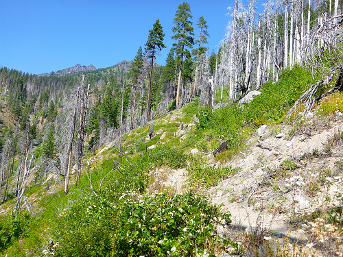
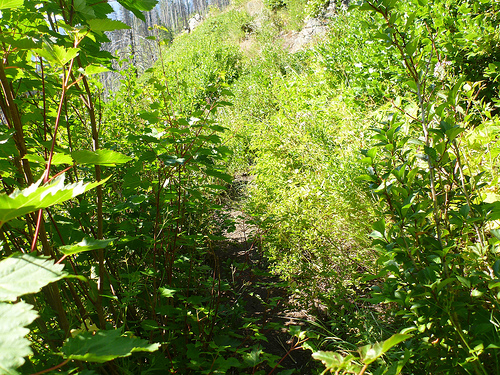
Sections of the two trails were overgrown in places, though. 4th of July is a nice grade.
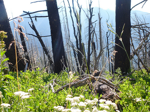
Once intersection with the Ridge, it’s plenty pretty. Often wide open with big views. Lots of flowers, even in August.
It was a pleasure working my way back down the ridge towards Leavenworth.
I underguestimated my slowness this day, finishing in the dark (PHOTO) without headlamp. Oops.
No shout out for the busy, grumpy (and even misinformed) staff at the Leavenworth Ranger station. Only one, a younger female, I found helpful and pleasant.