Paklenica National Park, Croatia

 
Davor:

Paklenica is one of the most beautiful places in all of Croatia, and it’s a place to be for anyone who’s into hiking, climbing or mountain biking, or any other form of adventure sports like kayaking or snorkeling.


Click PLAY or watch an intro on YouTube.

details – An Invitation To Adventure In the Paklenica National Park

Trek Everest Base Camp: The Ultimate Preparation & Survival Guide

Jason Weise author.

trek base camp

Jason was frustrated organizing his own trek, unable to find all the information he wanted in one place. The book took him over a year to write, research and has been professionally edited.

Cost is only $9.50 in PDF format. Carry it on any portable electronic device.

details – trekbasecampeverest.com

Amathole Trail, South Africa

The 6 day 100km long Amathole Hiking Trail starts near Kings Williams Town and ends at Hogsback in the Amatola Mountains. This trail has been voted the best in South Africa by Getaway Magazine, and is undoubtedly one of the toughest trails as well as one of the most beautiful, descending and ascending through steep, lushly forested valleys and up to the flower strewn grasslands and peaks of the Amatola Range …

The trail is rated as difficult, although there are various paths that can be taken within the overall hut to hut routes, some easier than others. …

Show Me – East London

waterfall hikers

trip report – Amatola Hiking Trail

Vancouver, British Columbia DAY hikes

1. Dog Mountain

2. Stawamus Chief

3. St. Mark’s Summit

4. Mount Cheam

5. Mount Baker Recreation Area

6. Garibaldi Lake

7. Diez Vistas

8. Crown Mountain

9. Mount Seymour

10. The Binkert Lions

10 Amazing Day Hikes Near Vancouver, British Columbia

Garibaldi Lake
Garibaldi Lake

Thanks Molly.

Tarkine Coast – Tasmania

Mark posted a trip report on a Tasmanian hike I’d never considered before:

I honestly haven’t seen a better coastline for hiking and camping than this.

… great walking country and I will definitely return in the future to do the full one way walk from Temma to the Pieman River.

Walking the Tarkine Coast – Tasmania

tarkine6

walking Safari – Zambia

Mosi-oa-Tunya National Park is an UNESCO World Heritage site that is home to one half of the Mosi-oa-Tunya — ‘The Smoke Which Thunders‘ — known worldwide as Victoria Falls on the Zambezi River.

The river forms the border between Zambia and Zimbabwe, so the falls are shared by the two countries, and the park is ‘twin’ to the Victoria Falls National Park on the Zimbabwean side. …

The wildlife section of the park is tiny but popular. Popular because half day walking safaris are offered.

This is rare in Africa due to the risk of tourists being injured. Or eaten.

It was very early. Very rainy when I was picked up — alone — at my hostel.

P1270709

We rendezvoused with a British couple alongside the Zambezi.

Everything was about to go wrong. You had to laugh.

P1270710

P1270719

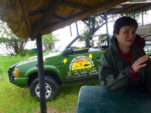
The husband had 2 new hips, 1 new knee. He could not walk.

Improvising, we decided to take a quick driving safari before setting out on the promised “walk”.

P1270735

P1270721

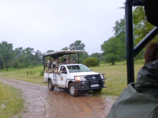
African guides are normally super entertaining. Very knowledgeable.

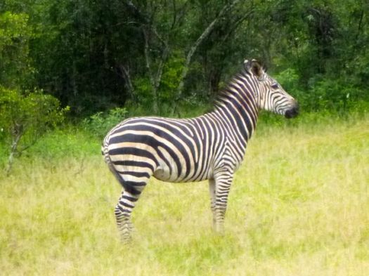
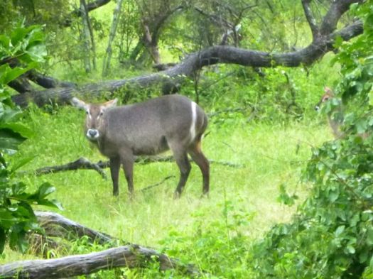
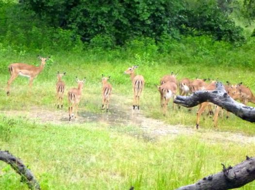
We saw baboon, vervet monkey, giraffe, zebra, warthog, sable, impala and many other antelope.

P1270767

P1270756

P1270745

P1270731

When the British couple departed, I was alone for the walking Safari with a support team of up to 4 men.

I walked with a guide and an armed guard.

P1270785

There’s no shortage of wildlife in Mosi-oa-Tunya National Park. But the main attraction is white Rhino. Though not indigenous, they are the most talked about wildlife in Africa.

You cannot see rhino from the road. They are understandably very shy.

Already an hour or more late, we roamed far and wide in the wet mud looking for rhino sign. The guard checked his phone constantly for an update on where we might find them.

Finally, the highlight of Mosi-oa-Tunya. A mother Rhino and her new baby, less than 2 weeks old.

IMG_1885

IMG_1892

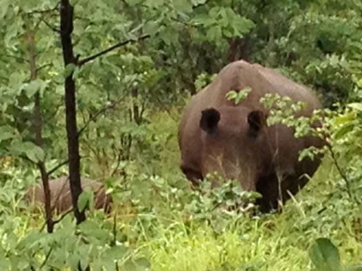
The rhino in Mosi-oa-Tunya were poached to extinction in 2007. 😦

I was told they are no longer worried about poaching here. The Park is now fiercely defended. 5 adult rhino and 5 youngsters, including this newborn.

On the other hand, the enforcement officer spoke longingly of Botswana where guards can (reportedly) shoot poachers on sight.

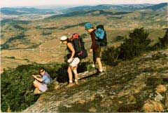
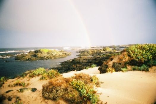
more of my photos from the day

Victoria Falls, Zambia

While it is neither the highest nor the widest waterfall in the world, it is classified as the largest, based on its width of 1,708 metres (5,604 ft) and height of 108 metres (354 ft), resulting in the world’s largest sheet of falling water.

… In height and width Victoria Falls is rivalled only by Argentina and Brazil’s Iguazu Falls. …

The spray from the falls typically rises to a height of over 400 metres (1,300 ft), and sometimes even twice as high, and is visible from up to 48 km (30 mi) away. …

Though a jerk and inept leader, David Livingstone was one of the first Westerners to make a transcontinental journey across Africa. And might have been the first non-African to see Victoria Falls.

statue near the Falls

Although Livingstone is known as “Africa’s greatest missionary,” he is only recorded as having converted one African. That might be to his credit, actually. 🙂

New York Herald reporter Henry Stanley could not convince Livingstone to leave. The great explorer died of malaria and dysentery.

IMG_1856

The baboons look bored. But I was thrilled to finally reach Victoria Falls, one of the great tourist destinations of the world.

From the Zambia side, you get an unbelievable distant photo vantage.

IMG_1826

First Gorge, from Zambian side

IMG_1824

Walking the Knife-Edge Bridge during high water is something like walking through the waterfall. It’s not always easy to see the Falls.

IMG_1847

Drenched anyway, I made the wet descent to the river on the Boiling Pot trail.

IMG_1863

IMG_1862

That day I didn’t see anyone bungie jumping from the Victoria Falls bridge. But I hear it’s awesome. (VIDEO)

My photos don’t do this natural wonder of the world justice. Nobody leaves disappointed. Victoria Falls are magical.

Click PLAY or watch a video on YouTube.

I’d love to return, just to visit from the Zimbabwe side.

IMG_1816

Paine Circuit, Chile

Mike Howarth posted another of his terrific adventure photo journals, this time the famed Paine Circuit in Patagonia.

… Away from the majesty and spectacle of the W circuit, the southern half of the Paine Massif offers something completely different, a peaceful beauty. As the trails widen and birds chatter I remember why I am here. …

Paine

We stumble over the Paso John Gardiner like two drunkards buffeted by the wind. Laughing and whooping at the ferocity.

Glacier Grey

Afforded amazing views down to Glacier Grey and the Southern Patagonian Ice Field stretching off in to the distance.

Justin

read the trip report – Torres Del Paine – The Full Circuit

Trail Therapy – Steve Fugate

The Journey Continues

Backpacker TV:

In 1999, Steve Fugate lost his son to suicide. A few years later, he lost his daughter to a drug overdose.

At sixty-four years old, he has walked across the United States seven times to raise awareness for depression and suicide and to inspire people he meets to “love life.” After fourteen years and 34,000 miles of walking, Steve continues his quest to heal his heart and the hearts of those in need one step at a time. …

Click PLAY or watch it on Vimeo.

Earl—the Rugged, Revolutionary Tablet

Leave the iPad at home.

Outside:

This new backcountry survival Android tablet works where your smartphone or iPad would fail. The rugged tablet can forecast the weather, determine your location, elevation, and let you communicate with folks back home.

About the size of an iPad mini, Earl is one tough gadget. It’s waterproof, dustproof, shockproof, and it will work in temperatures from 32 degrees to 122 degrees Fahrenheit. You can submerge it in three feet of water for up to 30 minutes with no ill effects.

Earl’s GPS uses an internal magnetometer, accelerometer, and gyroscope to track your position. It’ll guide you even if you’re navigating dense vegetation or an urban jungle without a line of site. It also gives you access to more than 300,000 trails through the site everytrail.com and high-resolution topographical maps of North America. With Earl in your hand, you have no excuse to get (unintentionally) lost. …

earl-survival-tablet_fe

Outside