HANK LEUKART – Without Baggage – To the End of the World
Hiking the 540-mile Camino de Santiago across Spain with an unlikely group of friends.
Click PLAY or watch it on Vimeo.

Best hikes, treks, tramps in the world.
Click PLAY or watch it on Vimeo.
trip report by besthike editor Rick McCharles
day 0 | day 1 | day 2 | day 3 | day 4 | day 5 | day 6 | day 7 | info page
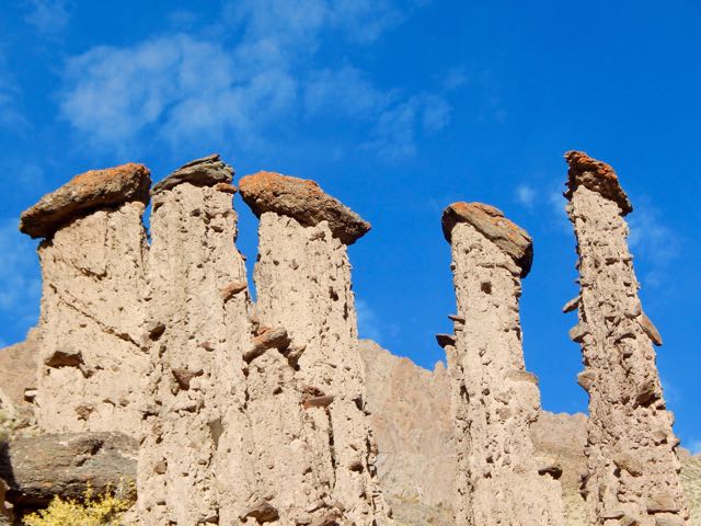
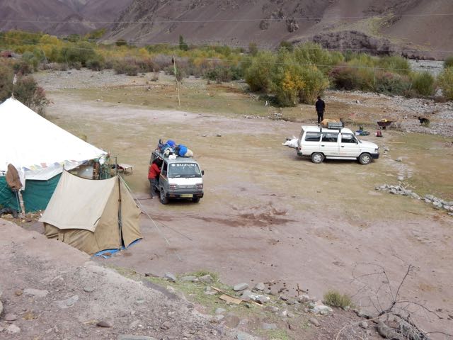
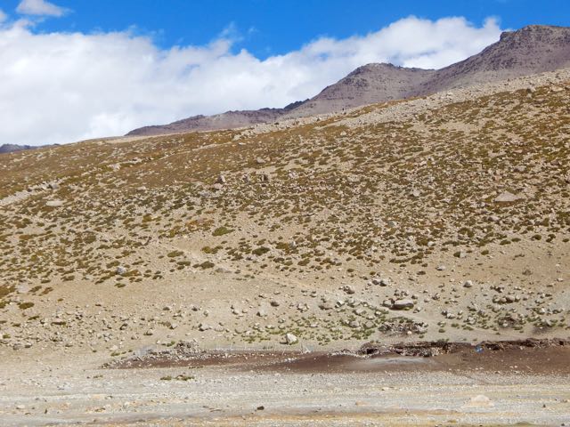
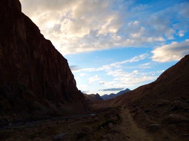
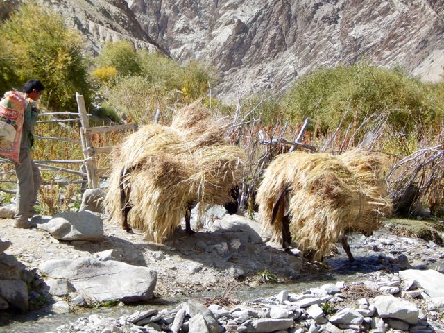
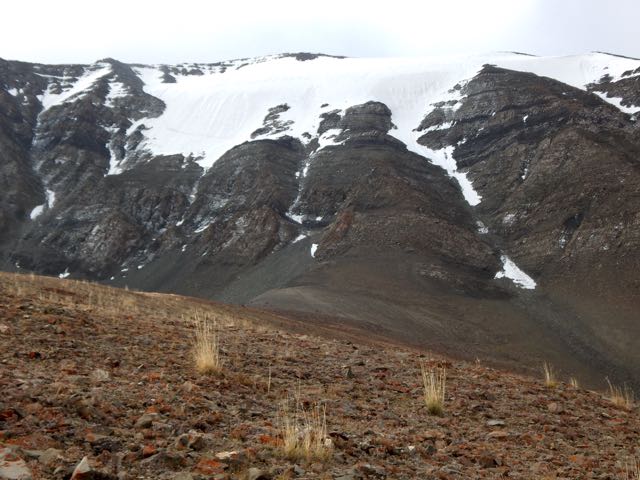
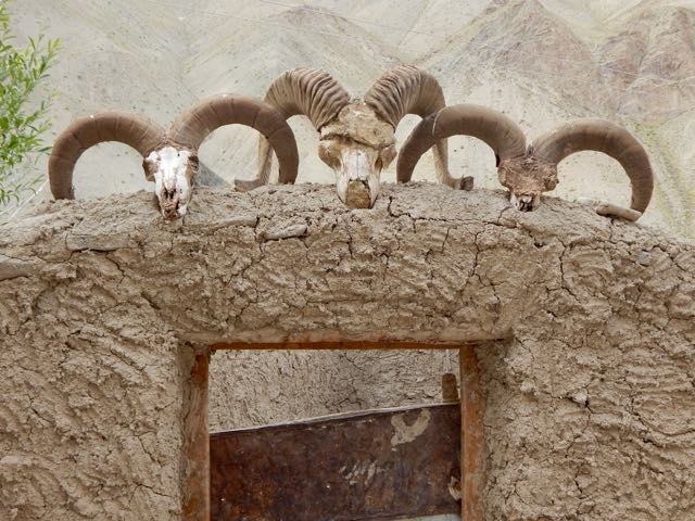
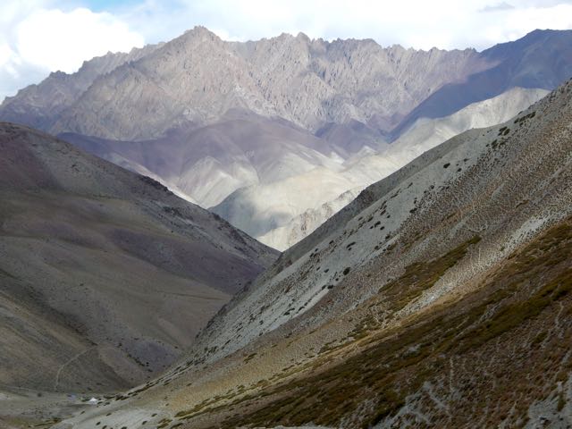
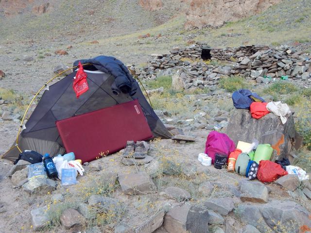
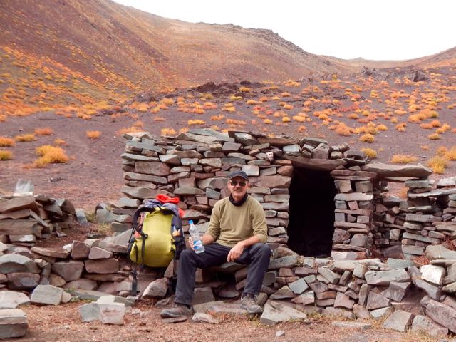
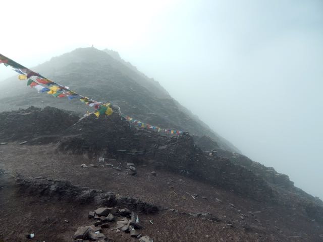
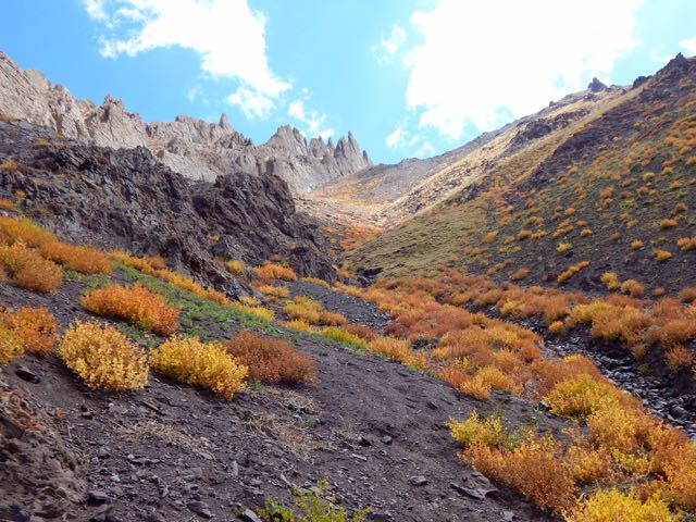
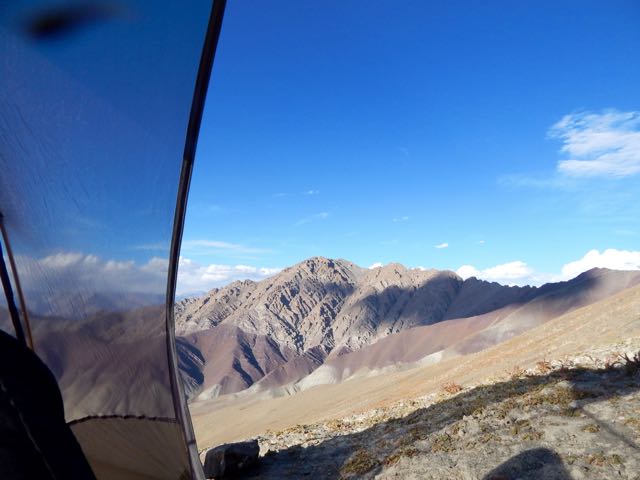
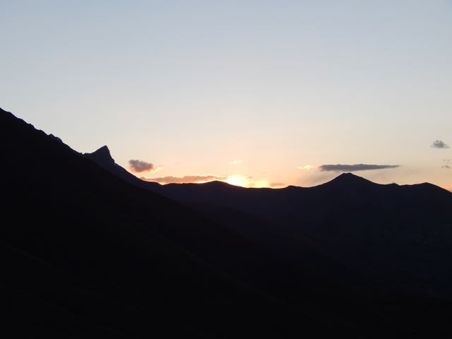
Good morning.

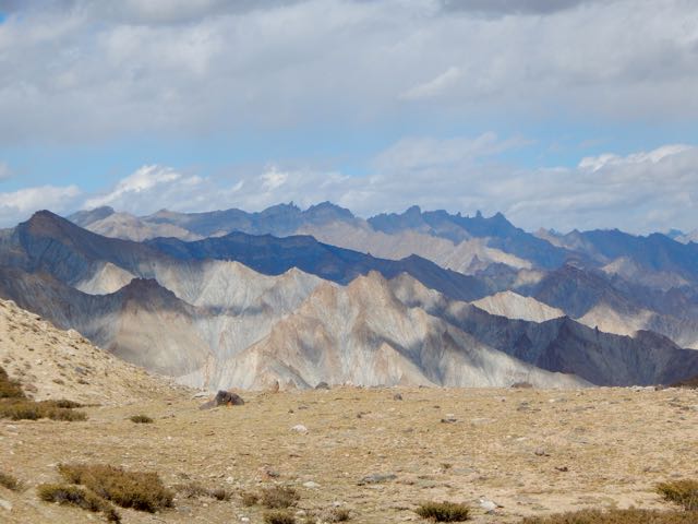
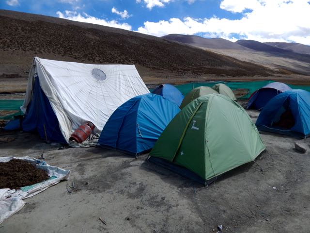
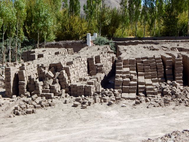
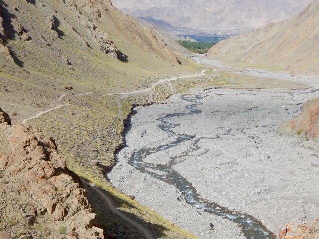
After 2 pots of coffee in a totally empty campground, the first sight of my hiking day was … these.


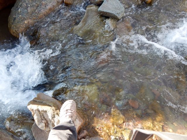
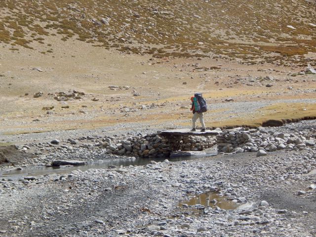
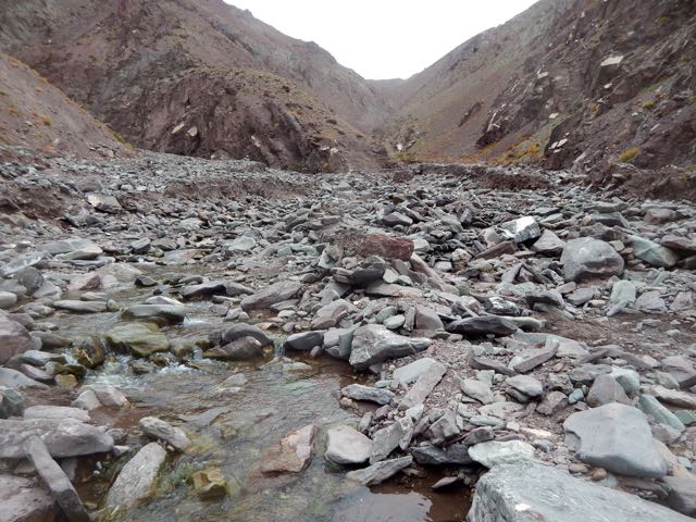
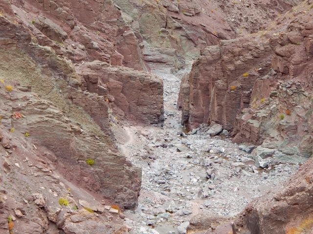
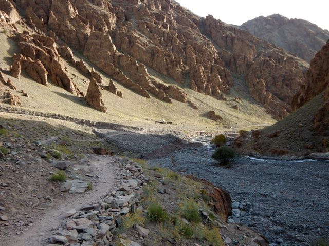
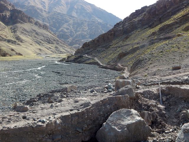
The river valley continued rocky requiring many boulder hops.

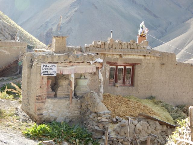
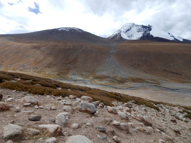
Chockdo 3985m is a pretty place.
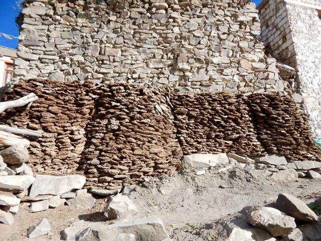
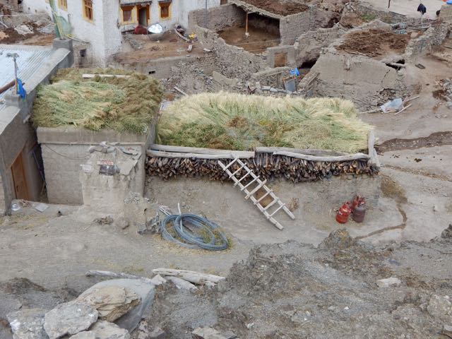
Well stocked with dung fuel for winter.
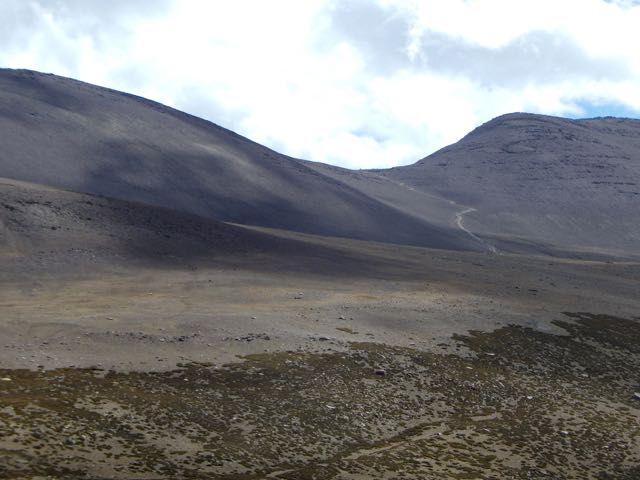
Unfortunately electricity has reached Chockdo. If I see electrical lines or motor vehicles, I quit hiking ASAP.
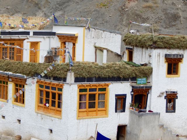
The homestays here actually look appealing.


Compared with yesterday, this descent was a piece of cake.

I was a little fried, but – like the horses – happy to be reaching the finish line.
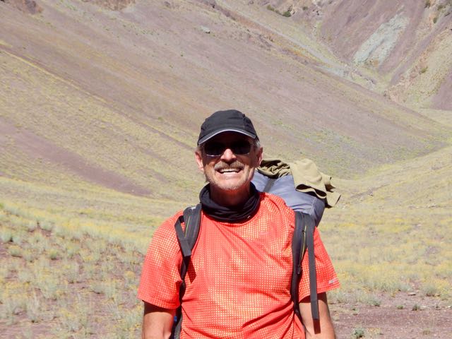
At Shang Sumdo I found 2 jeeps packing up. One was already full. The other agreed to drive me back to Leh for $8.

I said goodbye to the Markha circuit.

And goodbye to Sergei.
He decided to walk to the highway. Then hitchhike to somewhere else. Somewhere with more trees. 🙂
Home sweet home. Hotel Chube in Leh.

Luke warm shower. Dosa and uttapam for lunch. 3 hours of internet. Then a celebration dinner with friends at Chopsticks, my favourite restaurant in town.
Astonishingly we watched professional wrestling on TV. It’s unbelievably popular in India.
See all my high resolution photos from this day on flickr.
day 0 | day 1 | day 2 | day 3 | day 4 | day 5 | day 6 | day 7 | info page
trip report by besthike editor Rick McCharles
day 0 | day 1 | day 2 | day 3 | day 4 | day 5 | day 6 | day 7 | info page
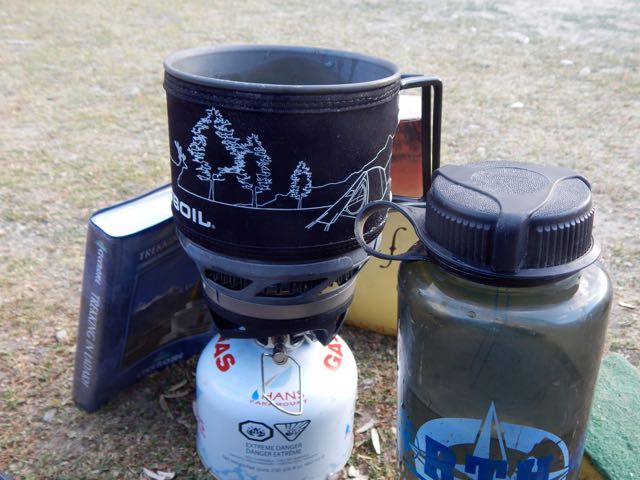
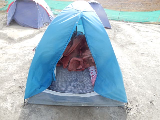
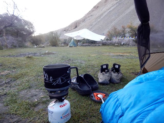
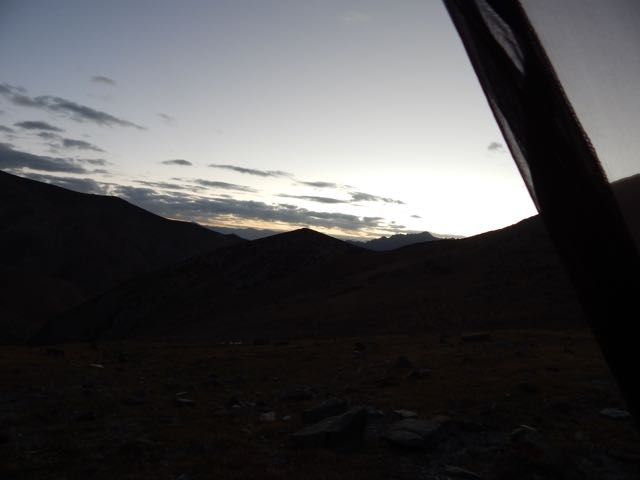
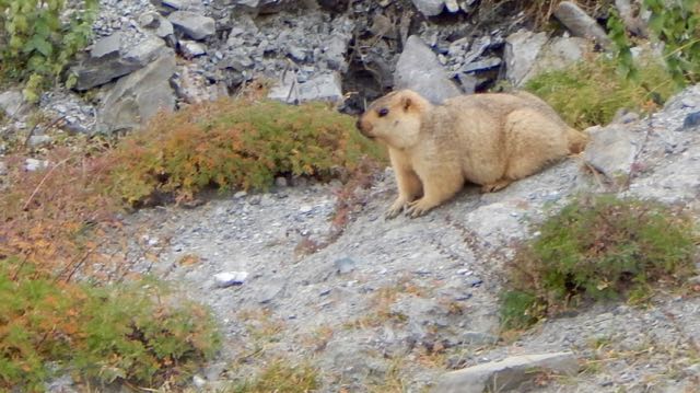
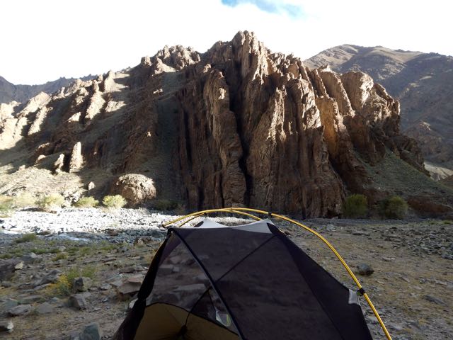
Coffee in the tent. Two pots.
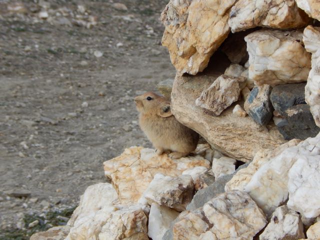
Nearby was a big marmot hole. Currently occupied by this pica.


I packed up sooner than anyone else in camp (aside from Sergei). Nobody arrived to collect my fee.
I’d never seen so many picas in my life as I did this day. The Ladakh population is quite fearless too.
It’s easy to see we were reaching high altitudes again.

Tsigu lake 4690m.
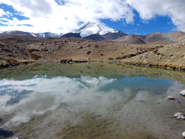
Here’s Kang Yaze peak 6400m.

Looking back down the Markha a gorgeous vista.
I caught a glimpse of Sergei, perhaps a half hour ahead.
He was en route to Gongmaru Pass. Which looks very easy from here.
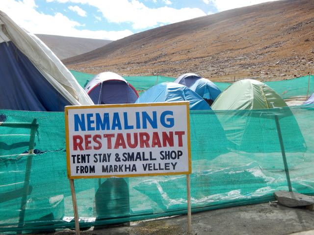
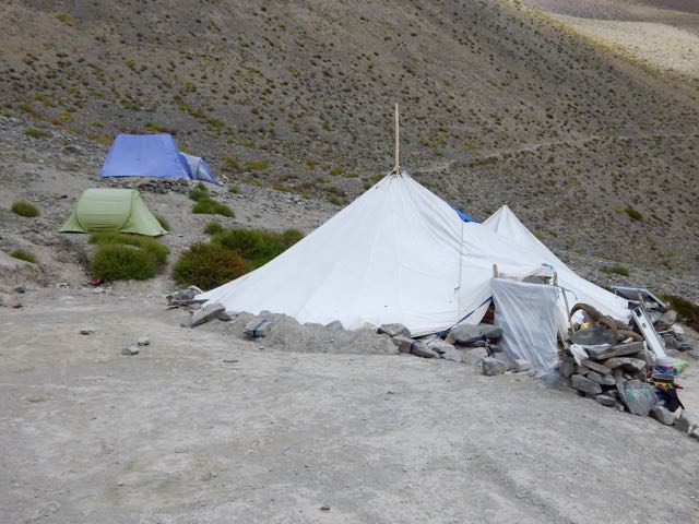
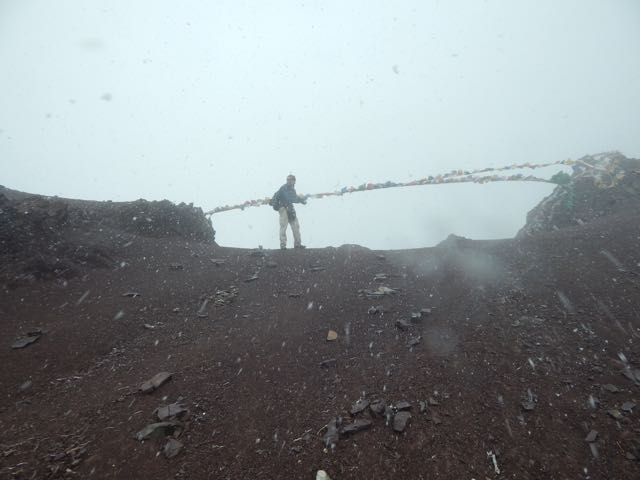
I stopped at the parachute in Nyimaling 4848m. (VERY high!) If you’re smart, you overnight here in these tents giving more time next day to get over.
I started up towards the pass at 11am.
Looking back to Kang Yaze mountain.
That’s Langthang Valley, the start of the difficult, remote trek to Pang. (My next trip to Ladakh.)
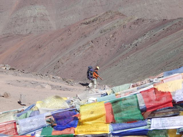
My climb looks easy. But it took a lot longer than anticipated to get to Gongmaru La 5287m.
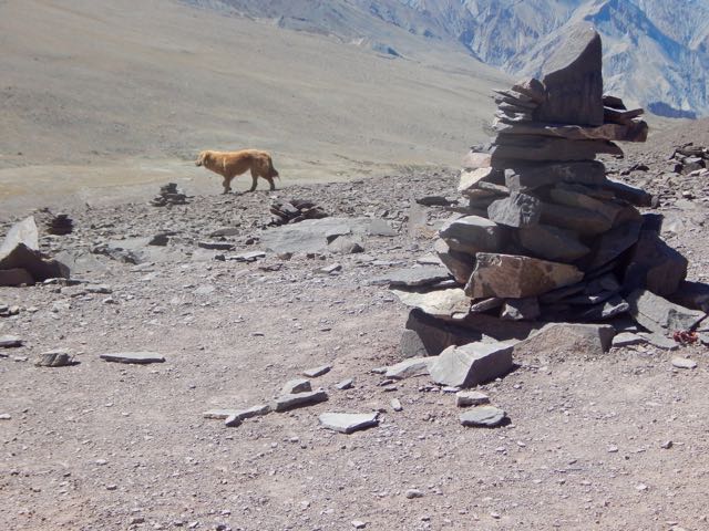
Surprisingly, I caught Sergei. And this dog.
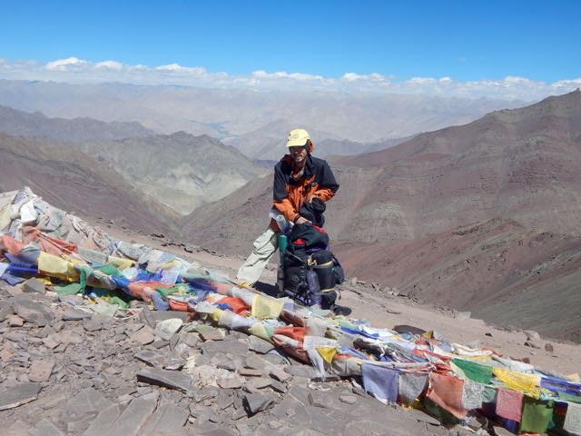
Sergei started down while I enjoyed the top for some time.
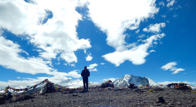
I like that last photo, using it for Facebook.
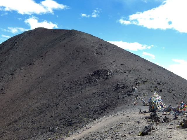
Every time you reach a high pass it’s worth checking both sides. In this case you could easily climb to 5500m or higher. I didn’t have the energy. Instead dropped down to the other side.
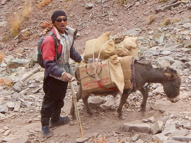
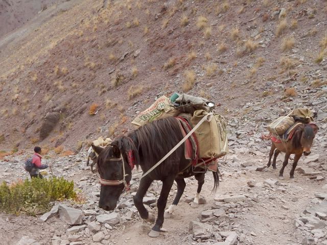
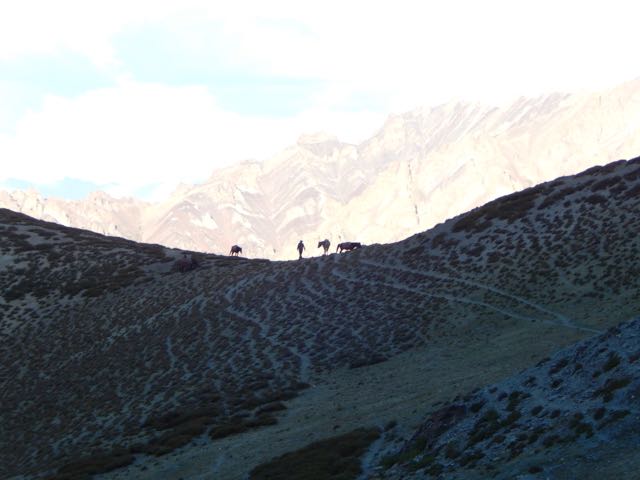
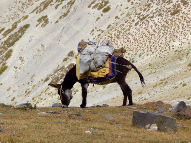
This guy and his horses coming up looked exhausted.
It would be easier to fly.
“It takes 3 1/2 hrs to Chuskyurmo from the pass.”
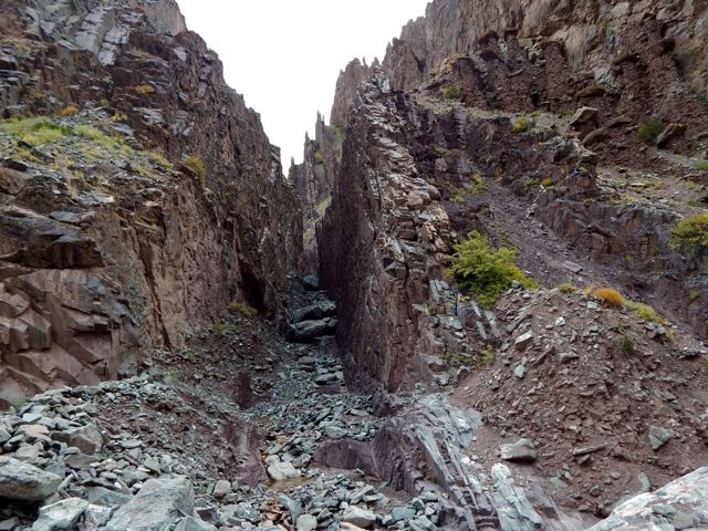
Kucharski – the author of my guidebook – bungled that estimate. It must take some people 6 hours to make this descent.
“ … steep, slippery, precipitous, stony, … “
Yep. And worse.
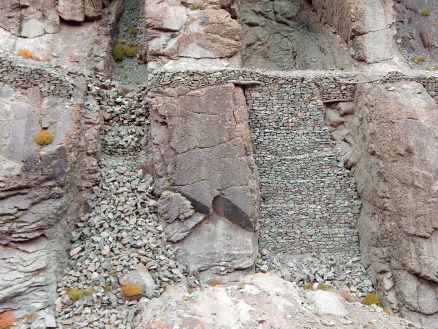
Engineers at various times have tried to make a safer trail. But landslides and washouts are difficult to predict.
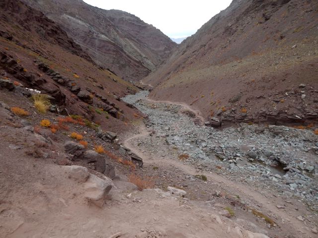
Boulder hopping is a necessary skill.
The trail seemed to get worse and worse.
I got fed up after this point. Stopped taking photos. When I finally reached Chuskyurmo I plunked down my pack at the first official campsite.
Good night.
See all my high resolution photos from this day on flickr.
day 0 | day 1 | day 2 | day 3 | day 4 | day 5 | day 6 | day 7 | info page
trip report by besthike editor Rick McCharles
day 0 | day 1 | day 2 | day 3 | day 4 | day 5 | day 6 | day 7 | info page
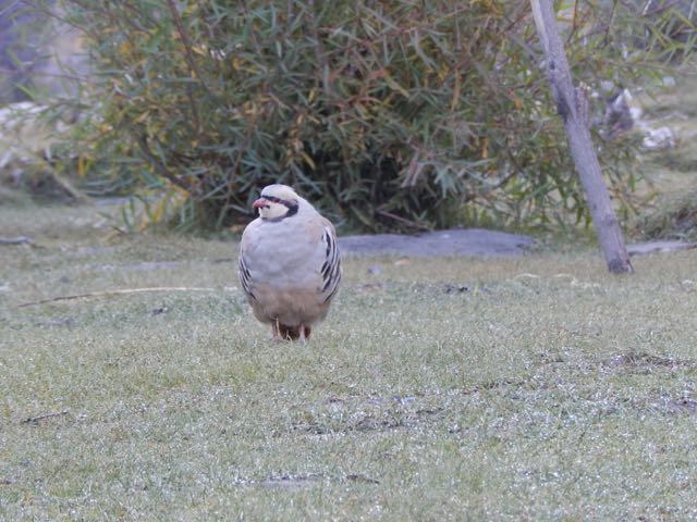
Morning coffee.
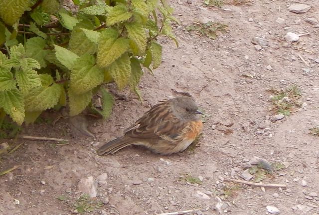
These curious (and common) ground birds dropped by. Are they Chukar partridge?
Sergei packs up his small cycling tent.
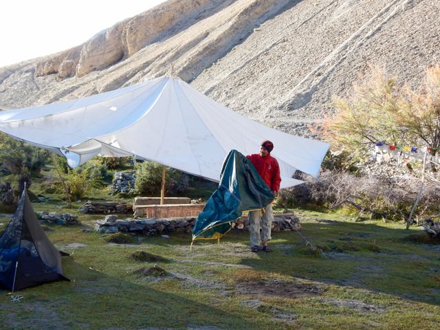
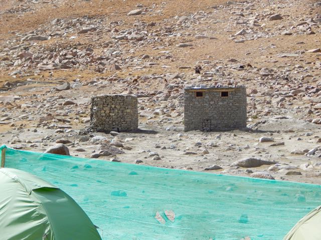
We were surprised when a Tibetan woman appeared asking for 150 rupees each. It had seemed the campsite (dirty and without a toilet) was closed for the season. Apparently not.
Official campsites seem to cost 600 Indian rupees in 2015. Unofficial ones 150 Indian rupee. Both overpriced compared with homestays, we felt. (900 rupees including 3 meals)
UP and off.


I tried to keep up with Sergei. It wasn’t easy. Especially since I had been exhausted the day before keeping pace.

On the other hand, we were fairly compatible. Both keen and very independent hikers.
I found the dry Markha valley gorgeous. Sergei missed trees.

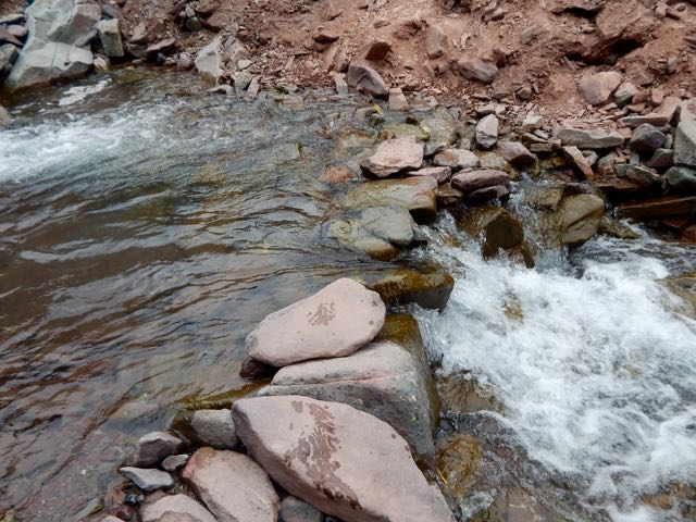
River crossings were actually a relief. Heat emergency is a real risk here.

I changed footwear. Sergei plunged through.
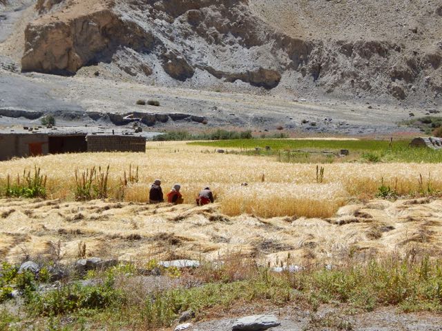
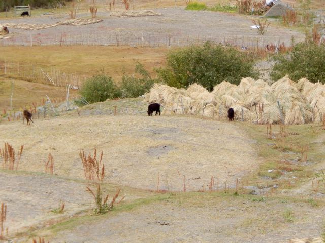
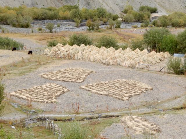
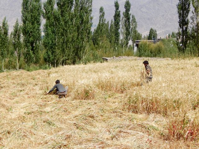
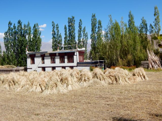
We’d anticipated Markha village 3806m to be somehow more impressive than the other villages. But it was very quiet. Harvest was in progress. Everyone in the fields.


So we continued.


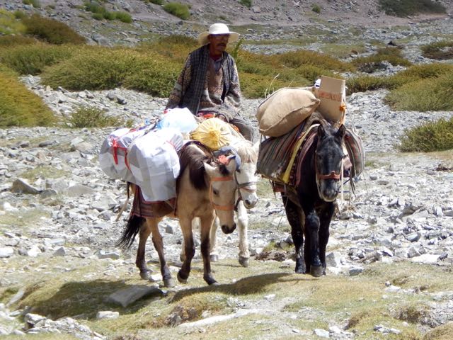
Horses are the most popular pack animal here. Followed by donkeys.

I didn’t once see a Yak or Yak hybrid used.
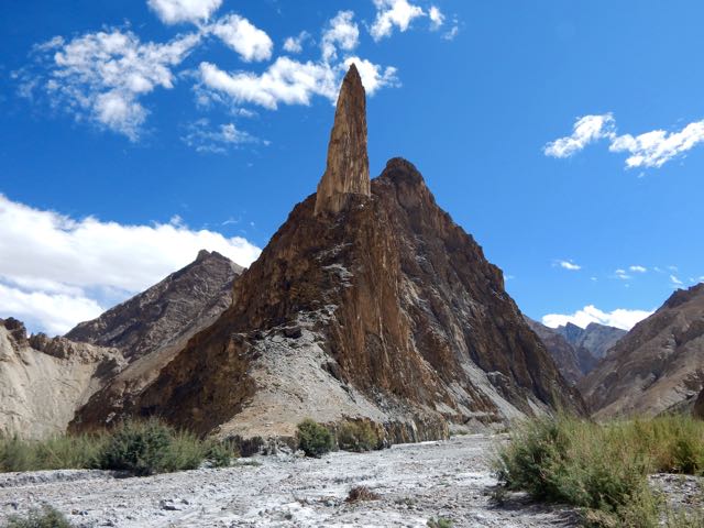
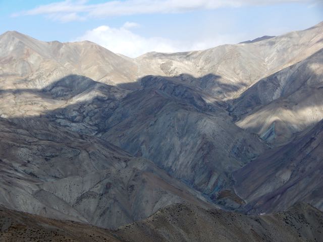
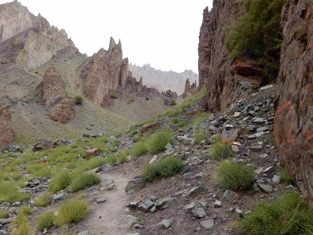
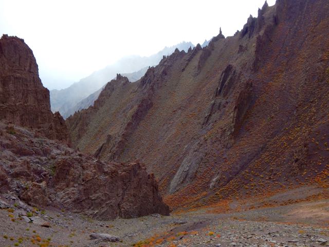
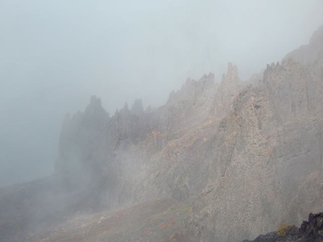
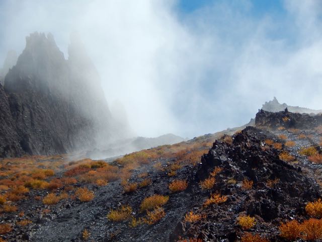
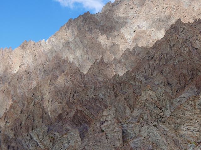
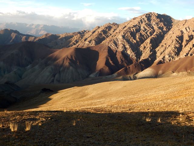
The geology here is stunning.

Sergei is an alpinist, having summited Lenin Peak. He was interested in these formations.


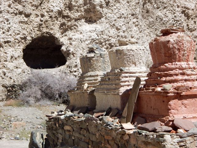
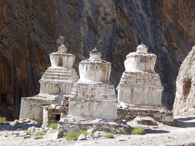
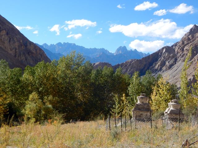
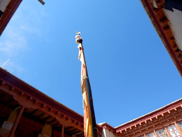
Though there are many impressive stupas and monasteries, it seems Ladakh does not have many monks.

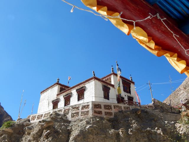
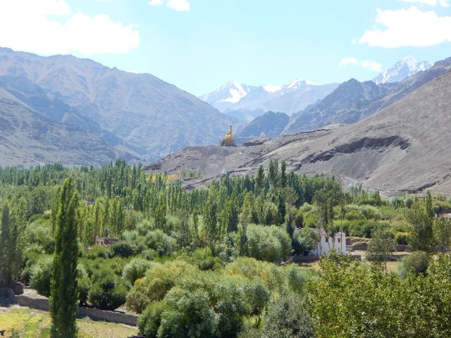
This particular monastery does impress, however. Umlung Gompa 3890m, impossibly situated.

The parachute camp was closed. So we carried on.

Seabuckthorn berries are everywhere. Used for jam and other local products.

Higher and drier.


We considered stopping near Hankar 3990m. But Sergei likes to walk until dusk. So he can set up his tent in the dark (for free) and not be hassled by passing locals. Everyone who walks past asks for 150 ruppee, even a monk … though the monk actually seemed to have “receipts” in his robes for the camping fee.
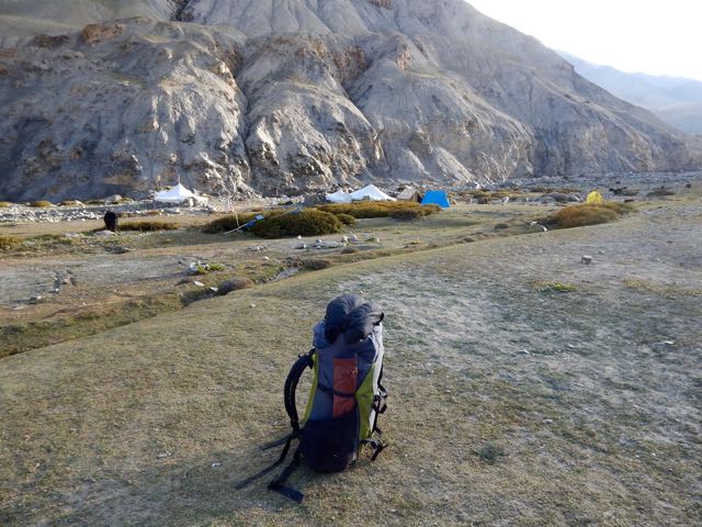
Exhausted and with sore feet, I finally put down my tent in the official camping at Thachungtse 4250m.
Sergei, lacking firewood to cook his dinner, decided to stay as well and use my gas stove.
See all my high resolution photos from this day on flickr.
day 0 | day 1 | day 2 | day 3 | day 4 | day 5 | day 6 | day 7 | info page
trip report by besthike editor Rick McCharles
day 0 | day 1 | day 2 | day 3 | day 4 | day 5 | day 6 | day 7 | info page
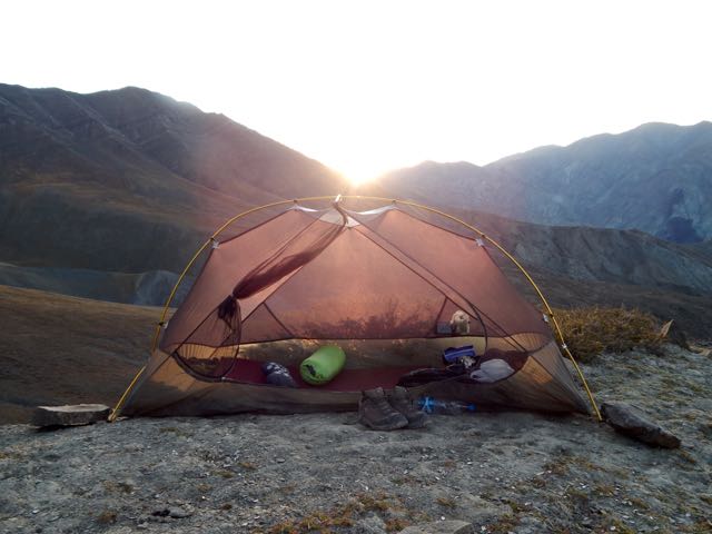
Like every other night on Markha, I slept under mesh. No fly needed.
That typically means I awake at first light.

With the moon setting early, I enjoyed dark nights. Bright stars. Milky way.
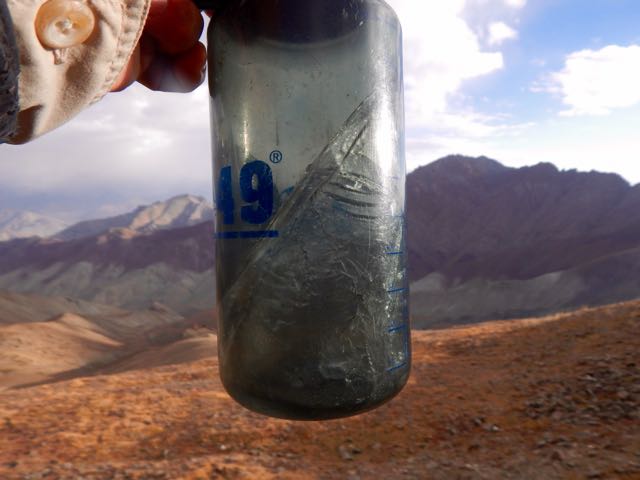
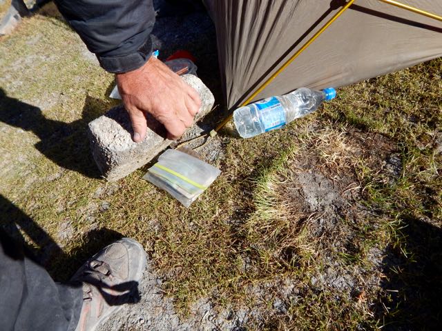
Clean water for coffee. Just as soon as the ice melted.

Rabbits and partridge watched me pack up.


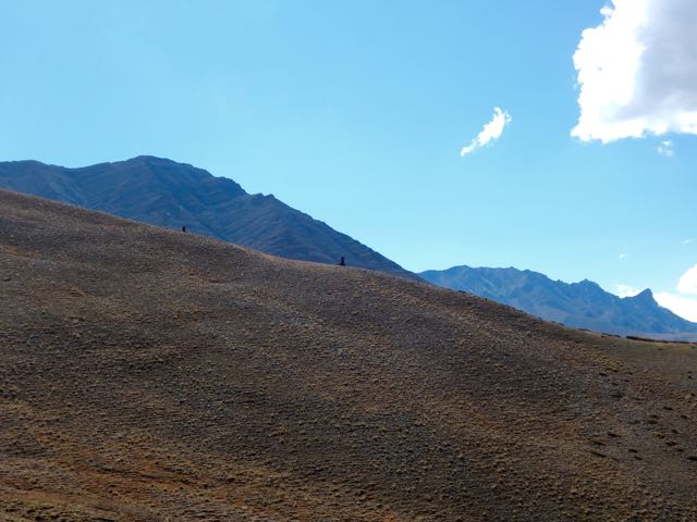
Kanda La 4973m was an easy crossing.

Holy shit.

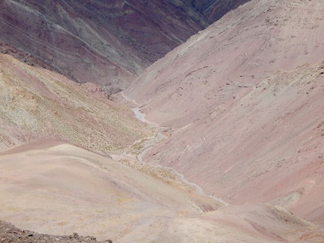
It’s always a treat to see over the other side of the mountain.


Down. Down. Down.

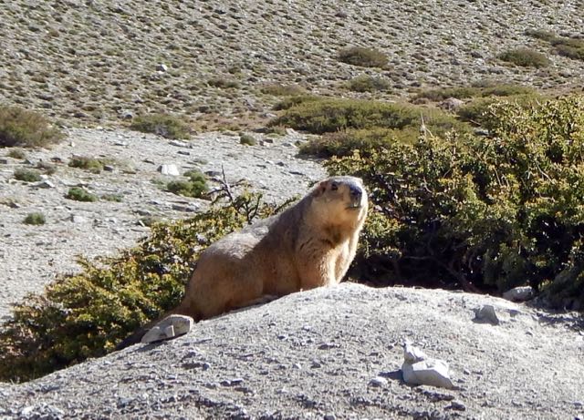
The marmots here are huge.
Before long I was back in the fields. Harvest in progress.
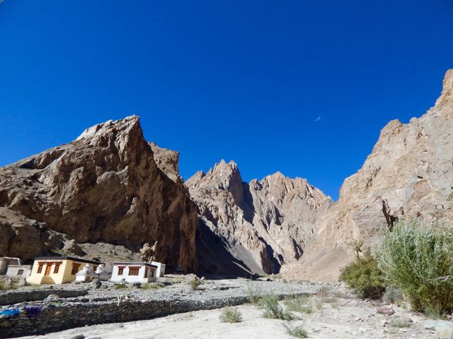
This is Shingo 4128m.
When you get low enough. Dry enough. Hot enough. Lizards appear.

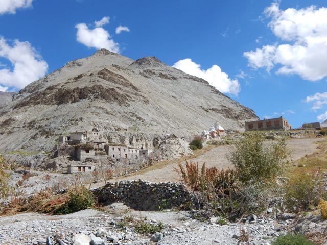
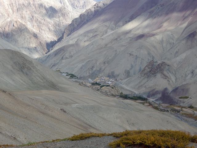
I finally reached the Markha river at Skyu 3430m.


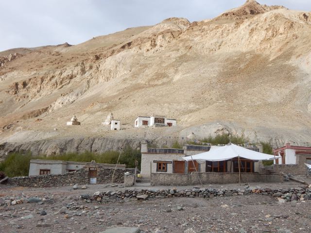
The monastery in Skyu is impressive. The parachute camp clean and organized.

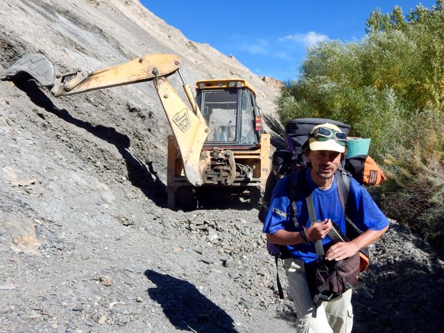
In fact, Skyu has electricity in the evening. And road building has been attempted.


Seems to me the Markha valley will one day be ruined for trekking. 😦
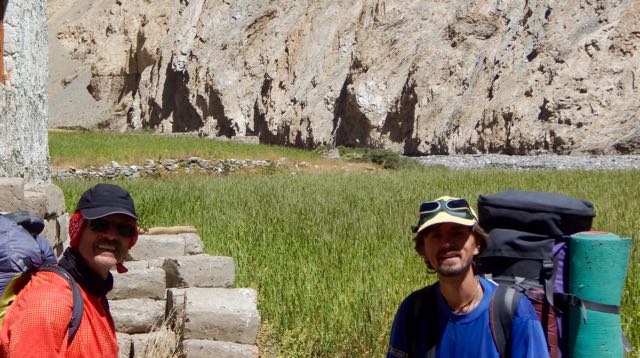
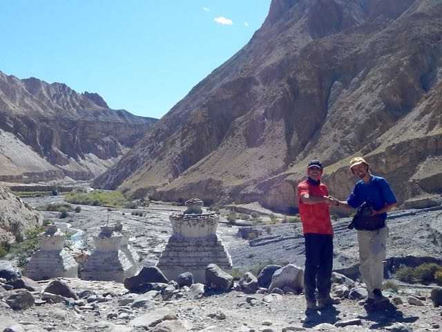
It was here I joined Sergei.
An alpinist and hiker from Russia, nobody on the trail carried a bigger pack. Nor walked as far each day. He was tenting, as was I.
Sergei cooked over an open fire each day. His own food brought from home. He needs wood, a rare commodity in Ladakh.
Happily there are many trees along the river in the lower Markha valley.
We continued up river.
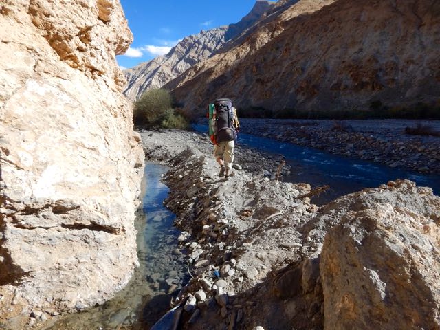
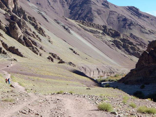
The Markha is beautiful. Rugged in places.

It was getting dark before we finally settled on a (dirty) closed campsite.
But it had a fire pit. Wood. And clean water. We were happy with the spot.

See all my high resolution photos from this day on flickr.
day 0 | day 1 | day 2 | day 3 | day 4 | day 5 | day 6 | day 7 | info page
trip report by besthike editor Rick McCharles
day 0 | day 1 | day 2 | day 3 | day 4 | day 5 | day 6 | day 7 | info page
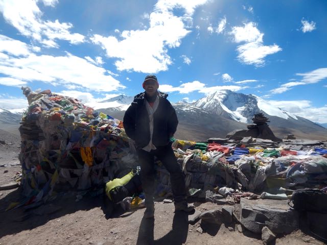
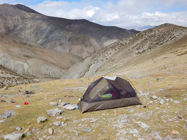
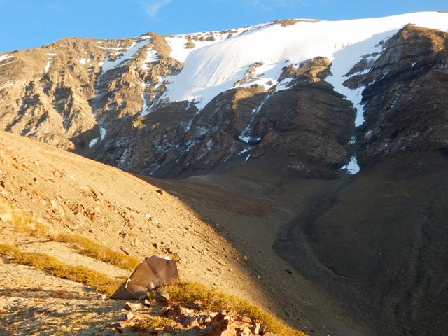
I had a peaceful night camped above 5000m close to the rocky face of the big mountain – Stok Kangri.
What little water I had left was frozen.
My challenge today was to scramble “Rick’s ridge” back to the trail.

You could say I was lost. On the other hand, I could see the official route many kms below.

In fact I loved the ridge walk. One of the highlights of the week.
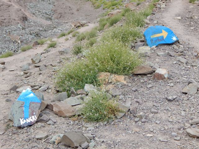
The only difficulty was the last scramble down to Rumbak 3847m.
Rumbak turned out to be a pretty, interesting town. Everyone getting ready for winter.


Feed. Wood. Fuel.
These contraptions are used for melting snow.

These are used for gates and fences.
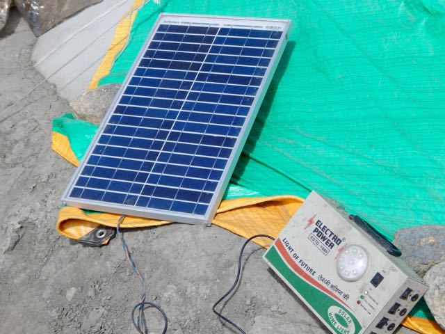
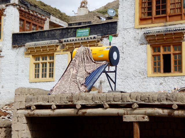
They use some solar power in Ladakh, but not nearly as much as in Nepal.
I carried on up to Yurutse 4150m.
And finally Kanda La “Base Camp” 4345m. (Calling these Pass jumping off points Base Camps is embarrassing, I agree.)
The young guy running the parachute was getting drunk on rum and beer. And looking forward to partying.
I left as quickly as possible after my Masala Chai.
I hiked up to about 4600m metres to a place that my guidebook called “Advanced Base Camp”.
It was me. The marmots. The partridge (?). And a horseman that stopped to let his animals graze and drink for a half hour.

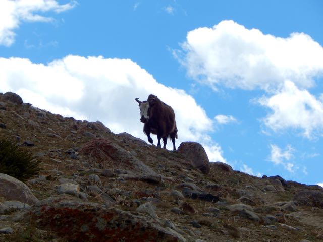
As always, you need watch the cattle and Yak hybrids. They like to snoop in tents for food.

I hid my passport and most of my money under a stone. Just in case.
Good night. 🙂

See all my high resolution photos from this day on flickr.
day 0 | day 1 | day 2 | day 3 | day 4 | day 5 | day 6 | day 7 | info page
trip report by besthike editor Rick McCharles
day 0 | day 1 | day 2 | day 3 | day 4 | day 5 | day 6 | day 7 | info page
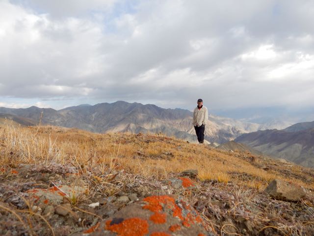
Though I managed to get myself lost for 8 hours, this was to be the best day of the trek. 🙂
Was I carrying too much? Missing anything?

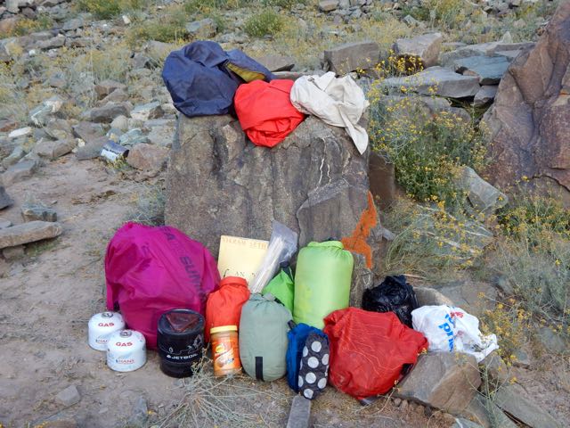
As it turned out, carrying 3 books was crazy. Instead I should have brought some sort of power supply for my iPhone. Audio books are best on the trail.
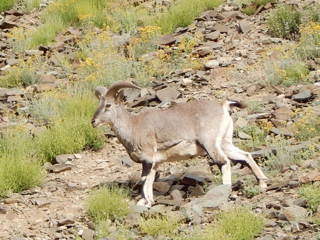
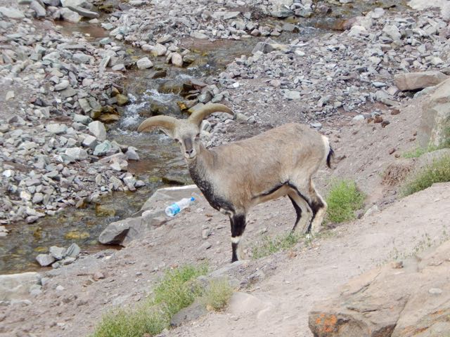
Around one corner I stumbled into a big herd of Blue Sheep.
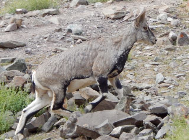
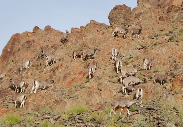
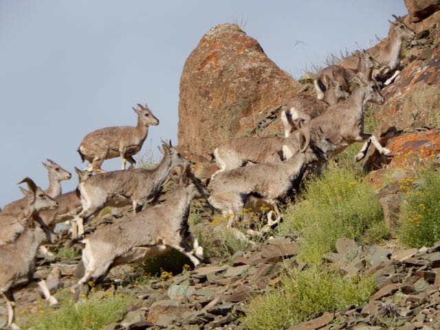
Lucky me.
Actually, the boys at this parachute camp were providing a salt lick.
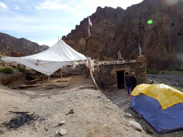
These parachutes are seasonal restaurants. They all serve hot and cold drinks. Few provide hot food.
I stayed some time snapping pics.

It’s here that you either ascend to climb Stok Kangri 6153m (20,182 feet) … or head for the Markha circuit via one of two passes.
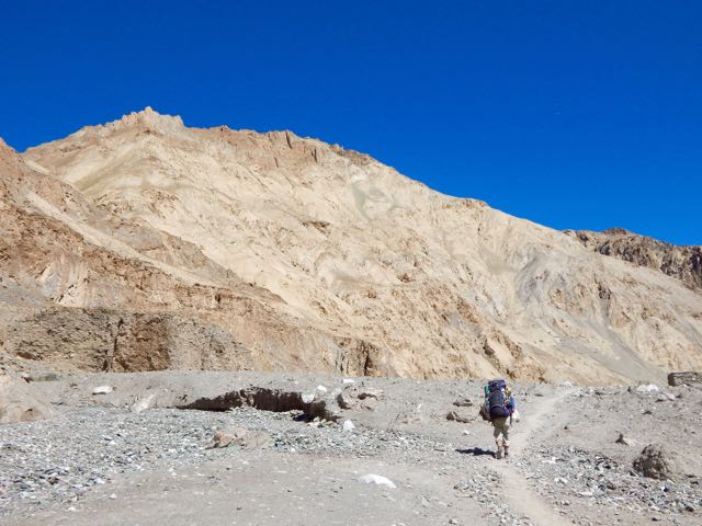
Up and up.
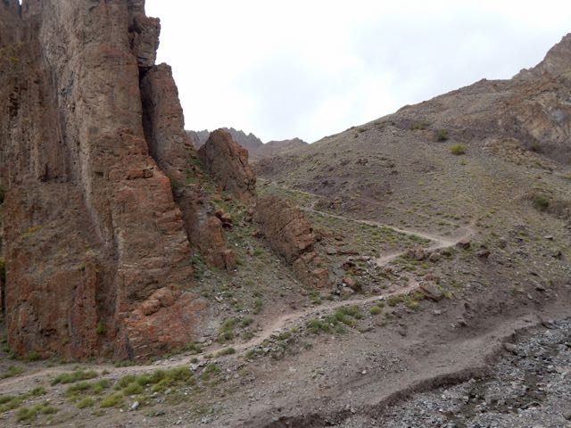
Beautiful and somewhat mystical.

My lunch for the first few days was peanut butter on Naan. I’d purchased these flatbreads from outdoor Muslim bakers near the mosques in Leh. Less than $1 for 10. They keep well on the the trail.

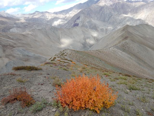
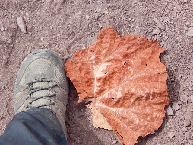
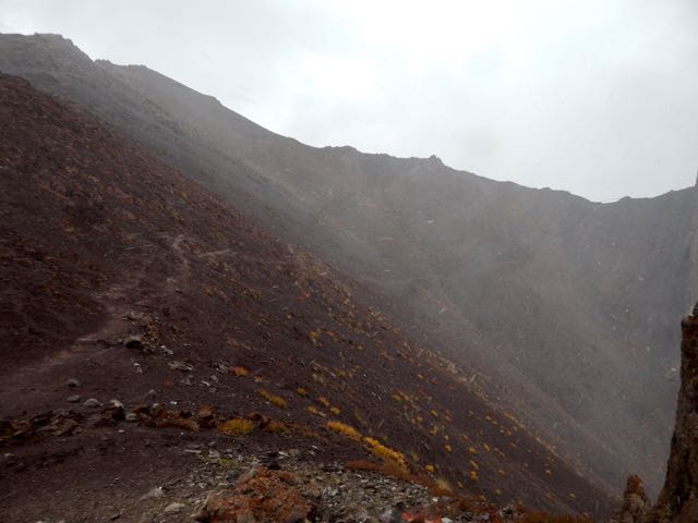
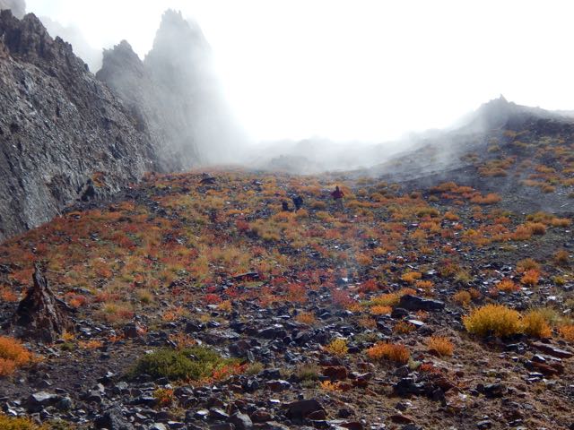
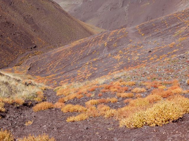
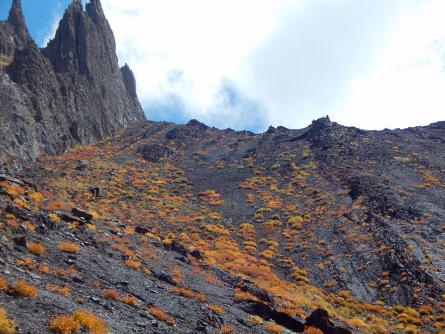
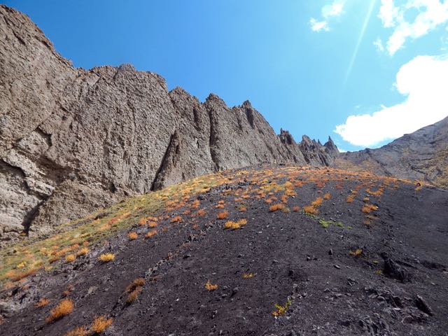
One very good reason to come to Ladakh end of season is to enjoy the autumn colours. It reminded me of Yukon in the Fall.

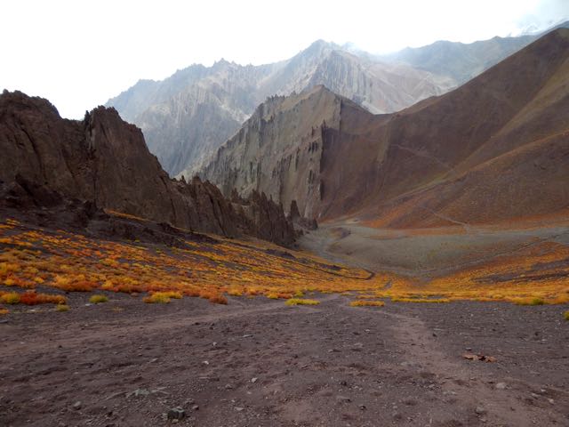
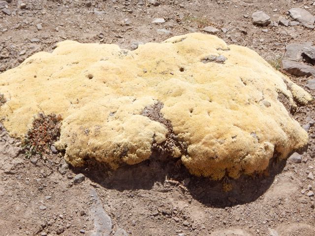
These odd high altitude plants are mostly leaf.
I finally reached Stok Pass. Alon from Israel arrived same time from the other side.
We were both happy to get some weather. It made the crossing more memorable.

Just behind Alon were 3 more hikers, not quite so enthusiastic about the snow.
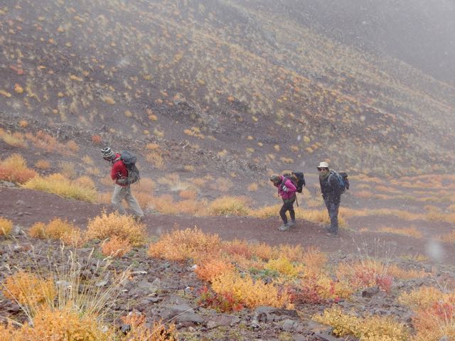
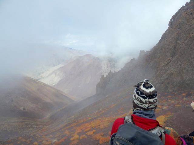
Gorgeous.
Dropping down the weather cleared.
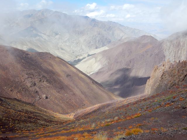
This is an extreme desert. Precipitation is rare.
I love desert landscapes.
Arriving to the other side my plan was to shortcut – skipping Rumbak village. Why descend when I could traverse the mountain?
A series of cairns seemed to confirm my off-trail route.
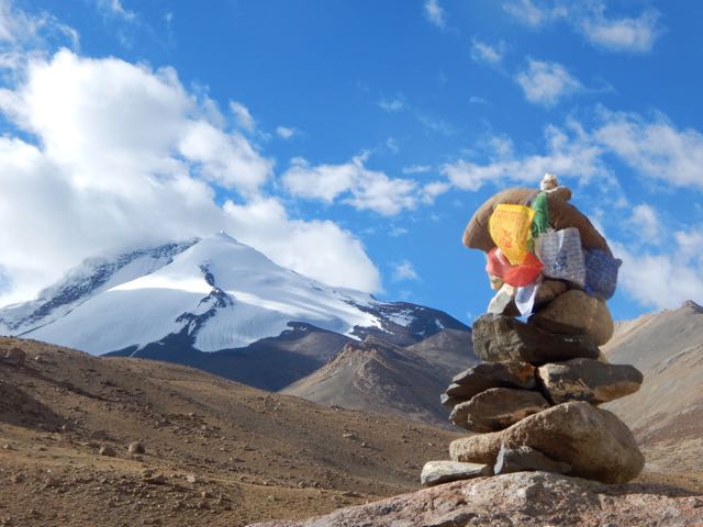
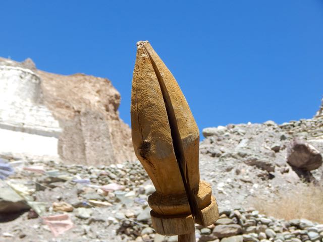
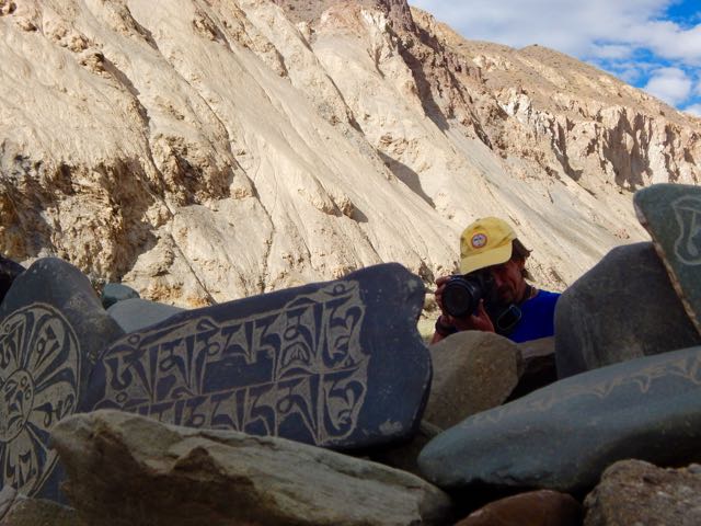
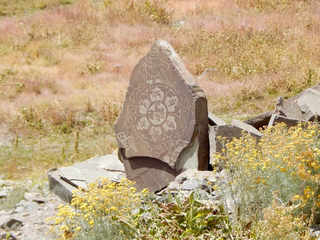
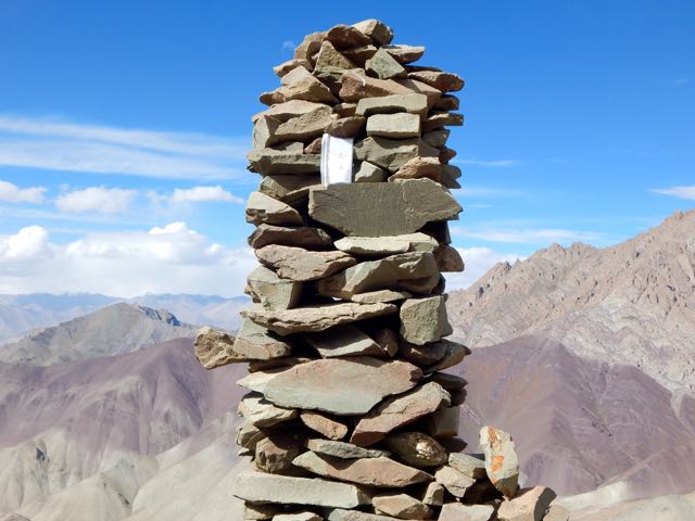
I left a Summit Stone in this sentry.
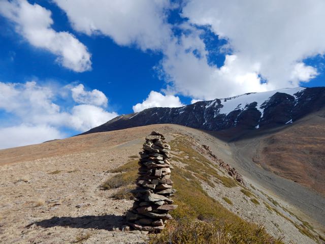
Climbing high I ASSumed I’d be able to traverse towards Kanda Pass in the next valley.

I ASSumed wrong. I was nowhere near Kanda. 😦
Daylight failing, all I could do was set up my tent well above 5000m.
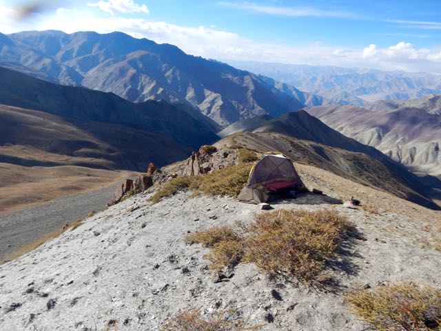
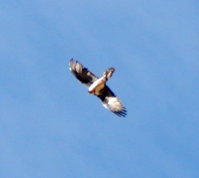
Nothing lives up there. But a couple of vultures did fly-bys. Hoping I was dead.
It was an impressive campsite.
If needed, I could melt snow.
I listened to Jack Reacher on audio through the night.
See all my high resolution photos from this day on flickr.
day 0 | day 1 | day 2 | day 3 | day 4 | day 5 | day 6 | day 7 | info page
trip report by besthike editor Rick McCharles
day 0 | day 1 | day 2 | day 3 | day 4 | day 5 | day 6 | day 7 | info page
The “normal” Markha Valley trek starts in Spituk. You take photos of the Buddhist monastery there. Then walk 16 hot, dusty kilometres to Zingchan.
That didn’t appeal.
Instead – in the early afternoon – I took a taxi ($8) from Leh to Stok.
The village is home to the Stok Monastery, a museum and gompa. Stok monastery is the current residence of the former royal family of Ladakh and the museum contains the shrines, crown, ceremonial dress and jewelry of the Ladakhi king.


The museum is well worth visiting.


Three Czech hikers (just finishing) gave me my first solid information on the high Pass. They told it was no problem. But that I should treat all water sources. They’d seen 2 dead horses in creeks over the past 2 weeks hiking.

I wandered through town up to the new Buddha statue.
Hoping to gain some sort of favour, unfortunately the big guy had no comment.


Sacred cows were equally mute on my proposed route.

Harvest was in progress. The local people busy.

At the end of the road I got more information from guided groups just finishing.

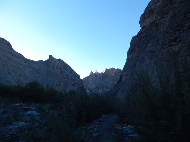
Finally I turned up hill following the creek. Up.
So far so good, here’s the trail looking back to Stok.
I actually didn’t get far. About 2 hours above town. At this point I still wasn’t sure whether I was acclimatized enough. Better safe than sorry.
See all my high resolution photos from this day on flickr.
day 0 | day 1 | day 2 | day 3 | day 4 | day 5 | day 6 | day 7 | info page
trip report by besthike editor Rick McCharles
day 0 | day 1 | day 2 | day 3 | day 4 | day 5 | day 6 | day 7 | info page
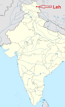
I flew Delhi to Leh in September (the best month) to circumambulate the most famous mountain in the area, Stok Kangri.
 AT A GLANCE
Nobody speaks about hiking distance in the Himalaya. Only altitude truly matters. Markha ranges from 3190m – 5287m.
Acclimation is critical.
I spent 3 nights in dusty, cluttered Leh. And a 4th day cycling from the highest road pass – 38kms back to town.
I was hoping 4 days would be long enough to successfully start from Stok, rather than the usual place – Zingchen.

I’ll leave my luggage locked up in a Leh hotel. And try for a solo, independent, tenting week in the high mountains.
Wish me luck. 🙂
See all my high resolution photos from this day on flickr.
day 0 | day 1 | day 2 | day 3 | day 4 | day 5 | day 6 | day 7 | info page
