A Swiss hiking buddy told me their Army hates sand. It gets in EVERYTHING. Ruins zippers.
Personally, I love sculpting the perfect sand platform and setting up with a water view.

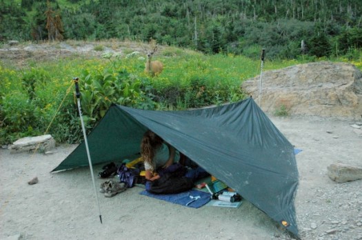
Outbound – 21 Beautiful Beach Campsites

Best hikes, treks, tramps in the world.
A Swiss hiking buddy told me their Army hates sand. It gets in EVERYTHING. Ruins zippers.
Personally, I love sculpting the perfect sand platform and setting up with a water view.
Outbound – 21 Beautiful Beach Campsites
Andrew Skurka :
Ten- or fifteen-thousand miles ago I believed fervently that “light is right” and “lighter is better.” I proudly considered myself a “lightweight,” “ultralight” or “super ultralight” backpacker, and I believed that the weight of my pack was linearly correlated with the quality of my experience — the lighter my pack got, the better the hiking became.
But in my blind pursuit to shed weight, I made decisions that compromised my efficiency, thus negatively impacting my trips. In other words, in an effort to “go light” I ended up going “stupid light.” (Special thanks to Phil Barton and Pat Starich for sharing this expression with me.)
I went “stupid light” by:
Not taking gear and supplies that were necessary given the conditions, and …
Taking gear and supplies that were too light.read more – “Stupid light”: Why light is not necessarily right, and why lighter is not necessarily better
… Cam “Swami” Honan has trekked more than 53,000 miles (85,295 km) in some 55 countries around the globe since the early 1990’s.
Hailing from Australia, Cam’s longest hiking journey took place in North America. Between July 2, 2011 and December 28, 2012, he completed an incredible trip which was called the “12 Long Walks.” Consisting of a dozen consecutive long distance hikes and totalling more than 14,300 miles (23,014 km), Cam passed through 29 US States, 4 Canadian provinces and destroyed a whopping 28 pairs of trail running shoes!
Along the way he set records for the completion of a calendar year Triple Crown (Pacific Crest, Appalachian and Continental Divide Trails – 236 days), distance covered in a calendar year and the one of which he is most proud, dehydrated beans consumed in an 18 month period (123.7 lbs / 56.1 kg)! …

exclusive interview
besthike – What attracts you to any specific hike?
I don’t really have any specific criteria that I look for. Sometimes I’m drawn to remote wilderness areas. On other occasions I look for a combination of elements such as historical, cultural, culinary and even libational (e.g. country pubs in the UK/Ireland or Italy’s wine growing regions)!
besthike – What were your favourite short (week or less) hikes all time?
I get asked this question quite a lot and the answer has always been the same…….I don’t have any favourites. That being said, certain regions such as the Karakorum, Tibet, Lapland, Gobi desert, Alaska/Yukon, High Sierra, SW Tasmania, Patagonia, Colorado Plateau and Canadian Rockies come to mind.
besthike – Do you know of anyone else who’s hiked as extensively around the world as you have?
No one that I’m aware of. That being said, it’s not a question I’ve given any thought to.
besthike – How do you afford to travel so much?
Once the plane fares and all the equipment have been taken care of, hiking trips are generally very affordable. Accommodation is usually free, food often equates to $10 a day or less and your own feet take care of things on the transportation front.
besthike – Where would you most like to hike in the future?
There are quite a few different places I’m yet to explore. A couple that come immediately to mind are the Kimberley region of Western Australia and sub-Saharan Africa.

In more recent times, Cam has completed historic traverses of Mexico’s Copper Canyon region (2013 – together with fellow Montbell athlete, Justin Lichter) and Peru’s Cordillera Blanca (2014). When not wandering the wild regions of the planet, he can be found splitting his time between Australia, the US and his adopted homeland of Mexico.
His excellent website is called (appropriately) The Hiking Life. 🙂
The Dinaric Alps have 8,000-foot stegosaurus spines, fairy-tale meadows, and stone guesthouses. Decades of conflict made them tough to experience, but the area is amping up its tourist offerings, and access is improving on the new Via Dinarica.
… Hire a guide and take three days to walk the 40 miles from Bosnia’s 6,900-foot Prenj Massif to Vran Mountain …
Heindrik Morkel‘s trip report:
30°C Sunshine, 3.000 m of ascent and 30 km of ridge walking – a good day on the Via Dinarica!

related – Interview with Hendrik Morkel
I was in Spain recently, one of my main goals to hike the newly reopened Camino del Rey.
Unfortunately you can only access the trail after booking through the official portal page.

The portal shows up 3 months in advance. But it’s ALWAYS booked. 😦
I couldn’t get a reservation.
Update: It turns out that the Garganta Hotel, near the train station in Alora, will sell you an expensive lunch for 25 euro … with a “free” ticket for the hike. Other restaurants may do the same.
Here’s a May 2015 trip report (tickets from Garganta Hotel).
I wished I’d known. The official website does not mention this option.
El Caminito del Rey (English: The King’s little pathway) is a walkway, pinned along the steep walls of a narrow gorge in El Chorro, near Ardales in the province of Málaga, Spain. The name is often shortened to Camino del Rey.
The walkway had fallen into disrepair and was partially closed for over a decade. After four years of extensive repairs and renovations, the walkway re-opened in 2015. It has been known in the past as the “world’s most dangerous walkway” following five deaths in 1999 and 2000. …

trip report by site editor Rick McCharles
The night had been calm and MUCH warmer than the previous two. I actually got some sleep.

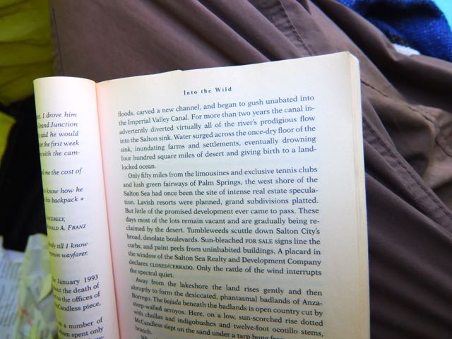
Josh was reading Into the Wild.
Civilization was in sight. We were confident of being able to catch the bus back to Granada, a day later than we had originally planned.

Once we no longer needed trail navigation, there were dozens of signs.

The promised clean water was finally available.

We were already starting to forget about the cold and wind.

In fact, sun and wind burn were our main concerns. We were back in southern Spain. 🙂
It was a treat to get to Lanjarón village.

Nearly out of food, we loaded up with treats. And enjoyed coffee at a pleasant restaurant until the bus arrived to return us to Granada.
Instead of the anticipated 45km / 3 day hike … ours was 65km over 4 days. We cursed Lonely Planet loudly.
Sadly, we never saw a single Ibex.
trip report by site editor Rick McCharles
Cold and clear morning at the Refuge.
I had no water left. We headed directly down to the tarns. For coffee. 🙂

Somewhat out of the wind, we enjoyed breakfast here.
Then it was back UP UP UP. Into the wind.
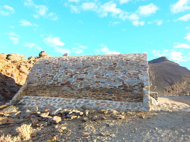
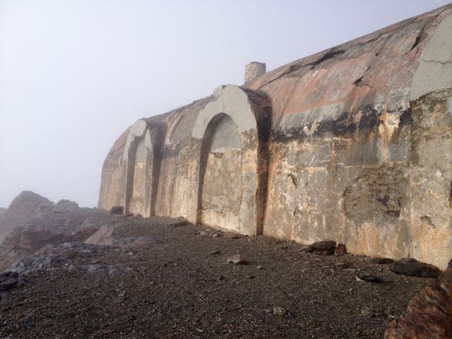
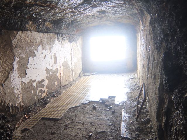
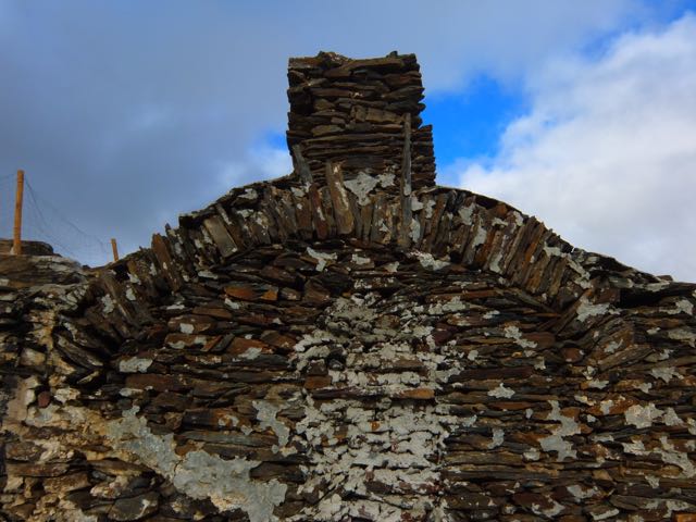
Here is the weird and wonderful Refuge we’d not been able to find at dusk the previous night. It’s pretty much a ruin. Though we may have had to set up our tents inside.
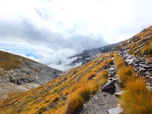
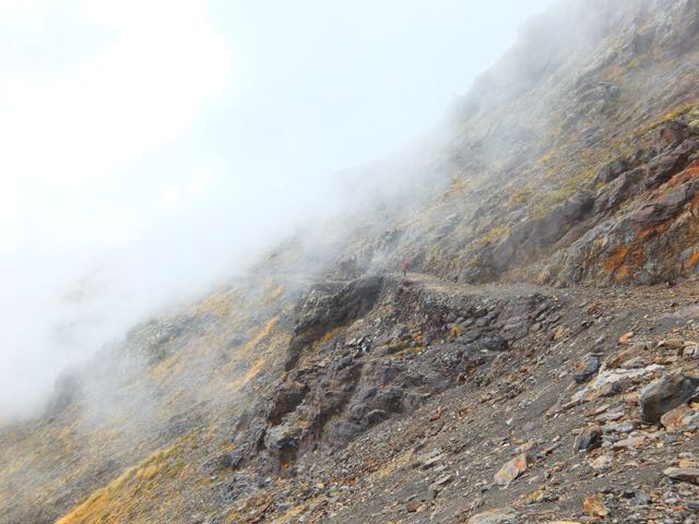
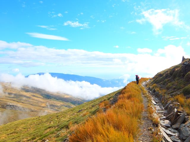
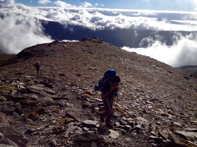
The Traverse continued high.

Here’s the crux. A short via ferrata section. Some exposure.

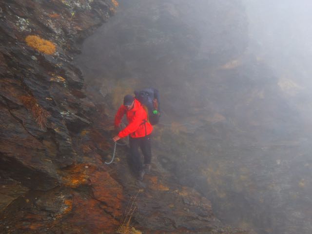
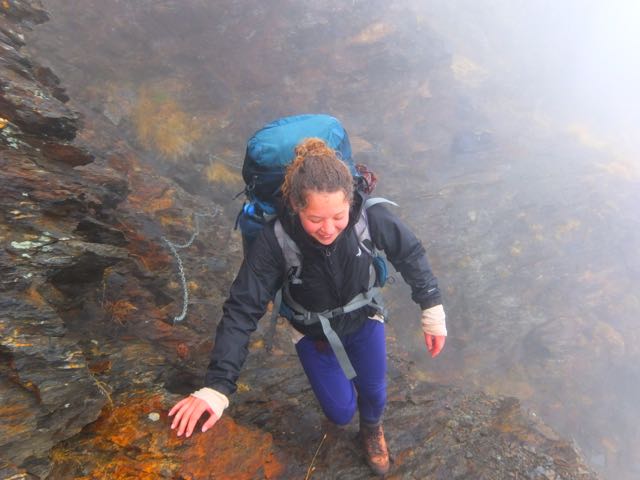
Actually, it was a lot of fun. 🙂

The instructions in our Lonely Planet guide unclear, we were next … lost.
A pretty area. But our descent was (eventually) blocked by a cliff.

We were forced partway back up the mountain.
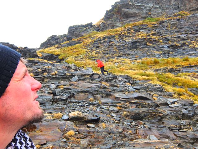
Then opted to give up on the official route, dropping off trail down to the river.
We could see the next couple of kms. It would go. … For a while, at least.
In fact – in the end – we agreed this was the prettiest section of all. Lost off trail.
Soon the river edge trail ended, however.
We traversed up along an old irrigation channel.
The guidebook said that the official trail would intersect this water course. All we had to do was find that intersection.
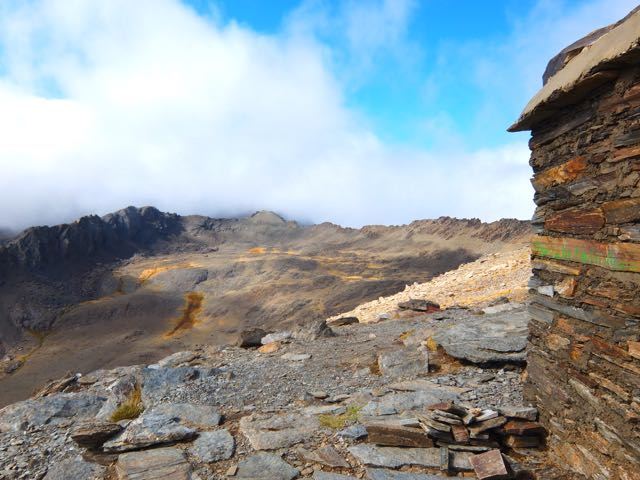
We found the official trail near the next Refuge.
Lonely Planet told that it was a functioning hut. But it had long been bricked up. A ruin.
Josh suspected that the LP author had never actually walked this section of trail. The information was long out of date.
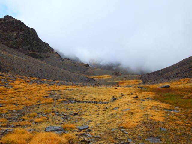
Daylight running out, we decided to tent on an alpine meadow well above civilization. We’d seen only one local person all day – a sheep herder.

trip report by site editor Rick McCharles
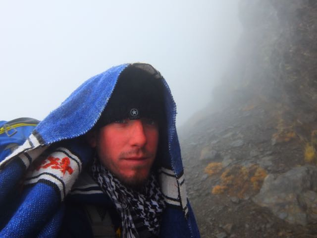
Happily the sun appeared around 8:30am. It had been very windy all night. (I’d not slept much.)
It was still windy. As you can see.

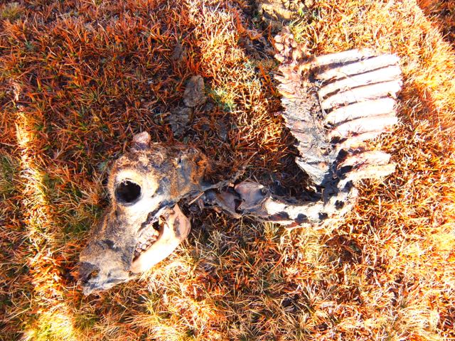
This guy didn’t make it.
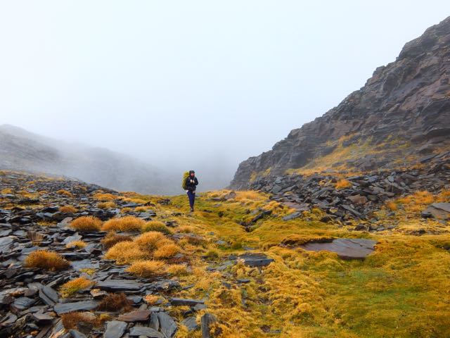
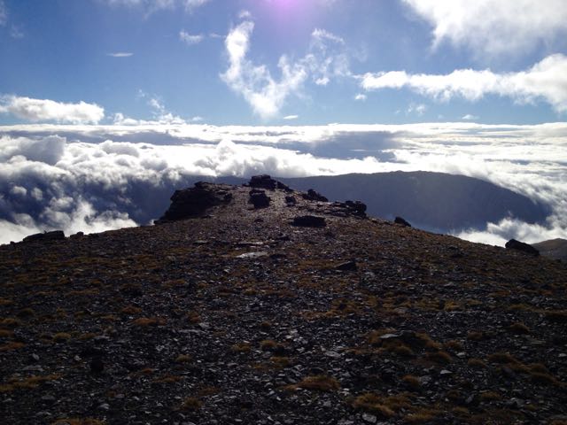
The scenery up here is otherworldly. Reminded me of New Zealand and Iceland.
Most of these photos were taken by Josh. I was impressed he managed to catch the rainbow. 🙂

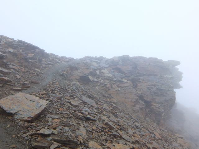
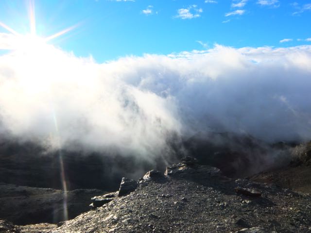
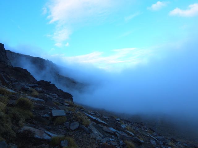
Once up on the cliff edge summit ridge, the wind was even more severe.
But it was fun to be well above some of the clouds.


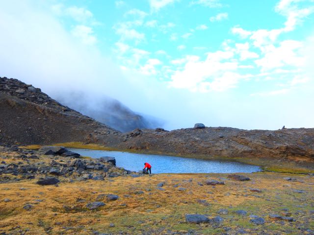
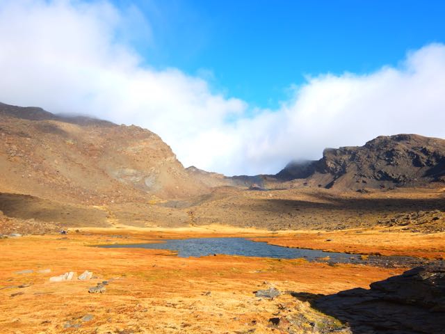
From up here we could see some of the other 7 lakes (tarns).

We managed to somehow lose this very well traveled pathway, sticking close to the cliff instead.
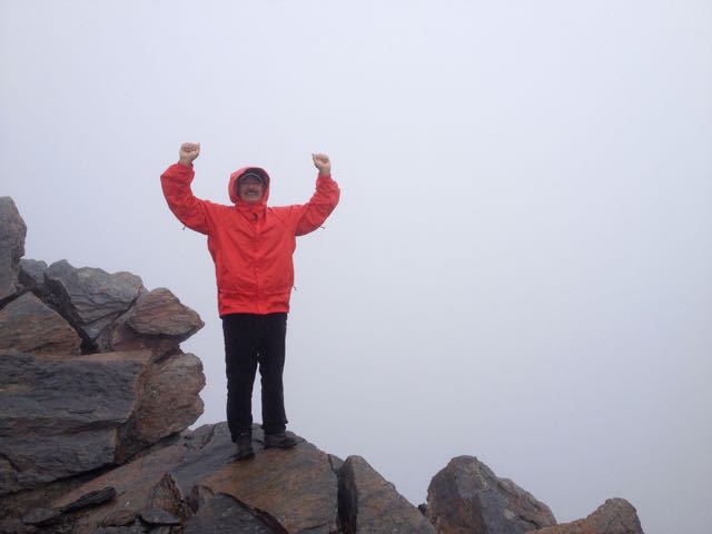
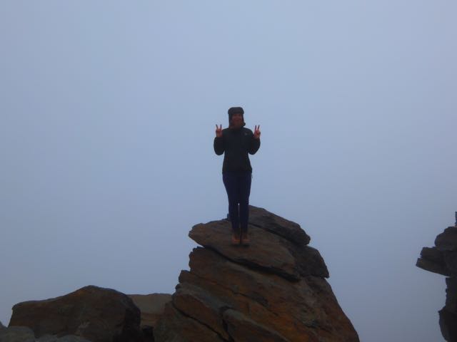
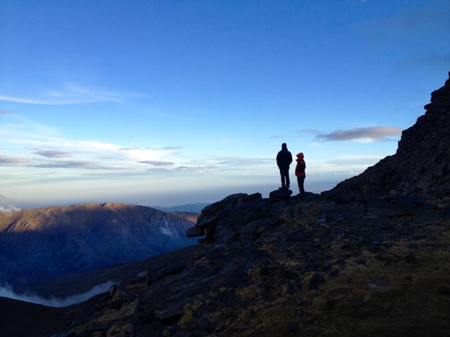
Josh had to keep moving just to stay warm. He and I pushed ahead over several false summits. To the top of Mulhacén.
We made it!

Josh huddled in the rocks at the top to warm-up while I rushed back to help Alisha. On the descent (somehow) I missed her coming up. So I rushed back up to the summit, missing her again. She’d been there already and seen Josh.
Unfortunately she’d left her backpack close to the cliff edge. And wasn’t sure exactly where.
The three of us – once finally reunited – went searching for it together. We asked one Spanish climber if he’d seen it. He had! And it was finally recovered.
In the end I summited Mulhacén 5 times that day!
Josh really needed to get down to some place warmer. Here’s the scramble down from Mulhacén on the Traverse route.


We had lunch at this crowded “Refuge”. Not all that warmer than the summit, to tell you the truth.

The route would stay above 3000m for the rest of the day, mostly along the Sierra Nevada Road. (Looks great for mountain biking.)
Lonely Planet recommended we sleep at the Cariguella Refuge atop the Sierra Nevada Ski Resort.

We had an hour of daylight left and thought we might make the next Refuge instead, shortening our day 3 back to civilization. That same Spanish walker who found our backpack happened past. He seemed to know where he was going. So we followed.
Big mistake. We ended up off route. Lost. Facing steep cliffs. Eventually we were forced to backtrack to Cariguella.
It was cold. But clean. We shared common bunks with about 6 other hikers who were planning to climb the 3rd highest peak next day.
Unfortunately a loud, obnoxious group arrived after 10pm. Absolutely no consideration for those trying to sleep. They left very early next morning, all their trash on the table. 😦
I dislike European Refuge huts. This was only the second time ever I’d tried to sleep in one.
Remind me never to sleep in one again.
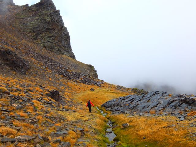
trip report by site editor Rick McCharles
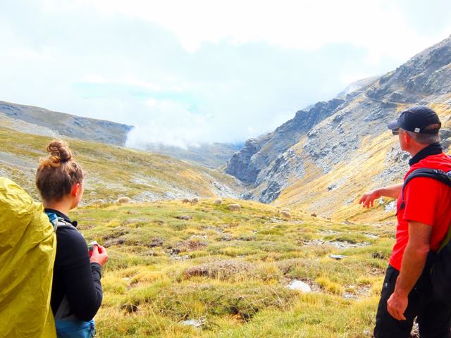
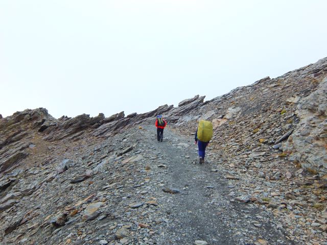
I wasn’t surprised to see Josh and Alisha climb on to the morning bus from Granada to Trevélez. We’d met at Oasis hostel in Granada and discussed the possibility of starting together.
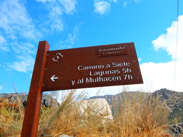
From this trailhead above Trevélez village many do the climb to Mulhacén and back in 10 hours. Having camping gear, we were in no such rush. I planned on 3 days, 2 nights.

Mulhacén is the highest peak in Europe outside the Caucasus Mountains and the Alps. It is also the third most topographically prominentpeak in Western Europe, after Mont Blanc and Mount Etna, and is ranked 64th in the world by prominence. …
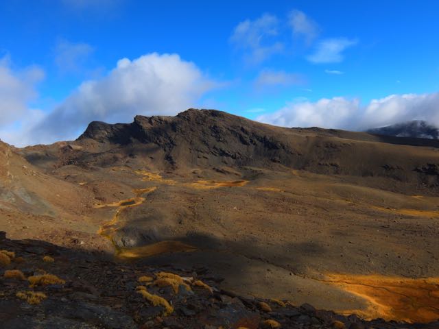
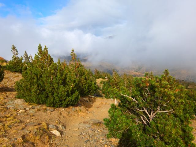
The scenery was dry, autumn. We were actually happy it was overcast. Heat emergency is just as real a risk on this walk as cold emergency. There’s no shade.

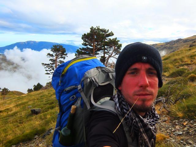
The elevation gain to our planned campground was about 1000m, a relentless climb. Alisha was already worried about her pack weight.

Josh was traveling very light. In fact, he had NO JACKET.

I was feeling terrific. Happy to be here. I ASSumed any mountains in southern Spain had to be much easier than those I’d just left in the Indian Himalaya. 🙂

How bad could it get? We could see the tourists beaches.

Every once in a while sunlight peaked through.
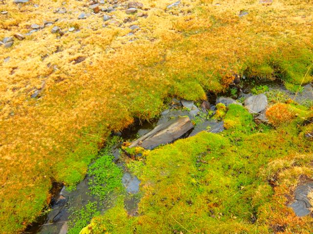
There was no water between Trevélez and this waterfall close to the top.

My Lonely Planet guidebook was quite wrong on this urgent subject:
“Plenty of water from springs, streams and tarns.” (p 279)
Water IS a constant concern on the Traverse late in the season.
We made it at dusk. The “Seven Lakes”.
Gorgeous.


Cold. Crowded. Windy. Josh was forced into his tent. Alisha and I stayed out in the wind cooking tea and food.
I was worried about the weather next morning. The forecast was not good. It could snow. 😦
UPDATE from Jan Dudeck:
During the last Patagonian summer I continued the investigation and publication of the Greater Patagonian Trail. The trail has now a total length of 1400 to 1500 km – depending on the options chosen – and the trail description contains may updates. I.e. section 17 and 18 were added this year and KMZ and GPX files with plenty of waypoints and several alternative routes are published for all sections.
Also the first hikers have completed the trail or parts of if base on this publication. One Israeli hiker walked sections 1 to 16 in about 50 days (all that was published at this time) and at least 8 more hikers did substantial parts of the Greater Patagonian Trail based on this trail description. …
This trail is not finished yet. There is plenty of terrain left till this trail finally reaches the southern tip of Patagonia and ends either on the shores of the Magellan street or even on Tierra del Fuego. But what is published so far can be hiked by a well experienced self-reliant hiker without much seek and search.
I also look forward that other hikers contribute to this trail by verifying some of the options and adding more sections. The publication on “wikiexplora” permits and facilitates such contributions because “wikiexplora” allows like “wikipedia” a collaboration of multiple authors.
Email: jan.dudeck (a) gmx.ch
Website: http://www.wikiexplora.com/index.php/Greater_Patagonian_Trail
___ original post from Sept 8, 2014:
… in South America leads right through the heart of the legendary Patagonian Andes. It’s a stunningly beautiful and diverse trail that crosses volcanic fields, idyllic Andean valleys, snow covered mountain ranges, lush green forests and deep blue lakes and rivers. …
The complete trail can be hiked in one summer season and requires approx. 90 to 120 days …
The generally recommended trekking direction is southbound …

The Greater Patagonian trail is not an official trail that is set up and managed by a government agency. Is simply a compilation of horse trails, minor roads and some cross country sections …
The trail is mostly unmarked, partly not visible and only smaller fractions are documented with maps. Therefore a GPS is essential for navigation. In addition an electronic topographical map is recommended. …


River Crossings are possibly the greatest hazard …
wikiexplora – Greater Patagonian Trail
I’m considering a trip to Patagonia starting January 2016. Certainly I’ll do a section of the GPT, if I can. 🙂
