
Site editor Rick McCharles will be mostly offline well into June 2026. He’s section hiking part of the Pacific Crest Trail in California out of Palm Springs.
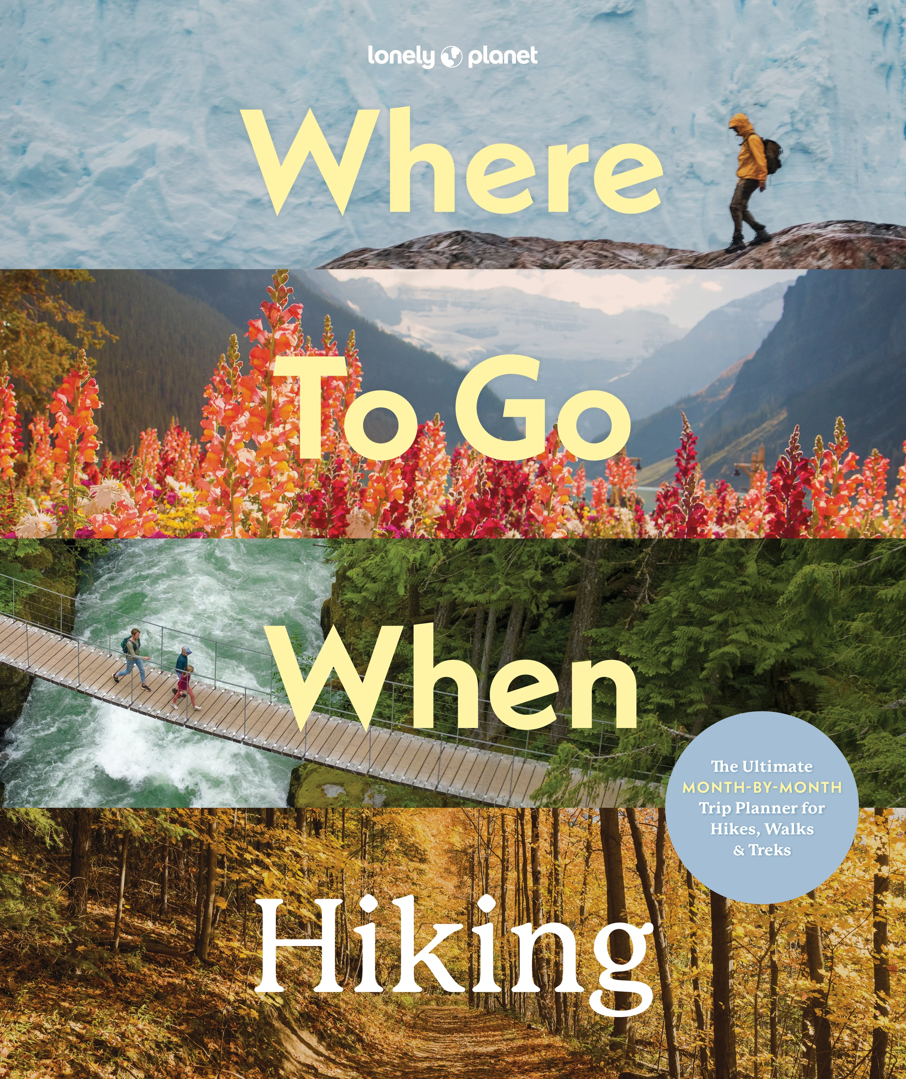
Lonely Planet – Where To Go When: Hiking
NEW Lonely Planet Hiking Guidebook published May 2026.
A month-by-month guide featuring 96 top-tier hiking trails worldwide, ranging from short walks to epic multi-day treks. … Spain’s Camino Francés, John Muir Trail, South Africa’s coastal Strandloper Trail and many more.
Each month highlights 8 hikes … route maps, breathtaking nature photography, and expert insights on what makes each hike unmissable
Covers essential details: start/finish points, distance, duration, challenge level, when to go, permit info, safety, getting there,accommodation, food and more.
Written by Sarah Baxter, author of A History of the World in 500 Walks, The Inspired Traveller’s Guide to Spiritual Places, and Lonely Planet’s Where to Go When; and Paul Bloomfield, a contributing author to numerous books about travel, hiking, cycling and treks in the UK and across the world
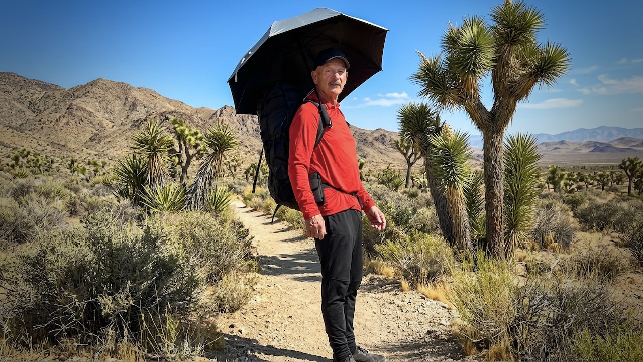
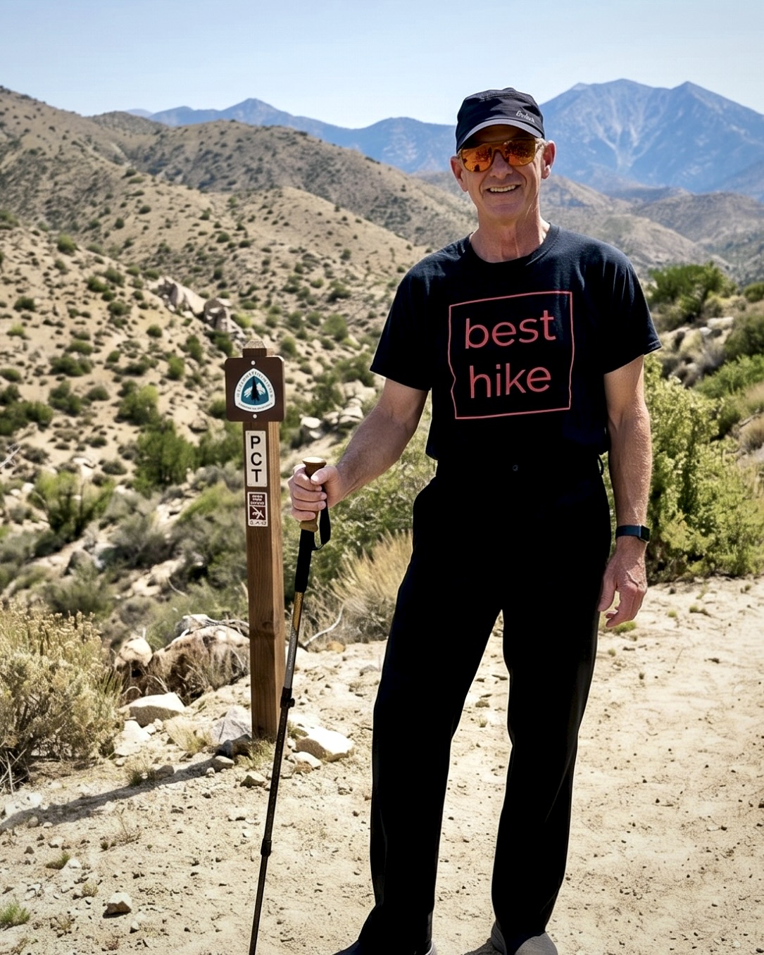
My GEAR for 500 Miles on the PCT
by BestHike editor Rick McCharles
I have a PERMIT for 523.0 miles from Idyllwild to Kennedy Meadows South in California.
Starting May 26, 2026.
I’m hoping to survive for at least 14 days of that. 😀
GEAR should be as light as possible.
Of course there will be resupply food and plenty of water to carry, as well.
For this particular adventure, my priorities are …
- Staying Hydrated
- Foot Care
- Avoiding Heat Emergencies
I’m trying a hiking umbrella for the first time. Plan to switch between shoes & socks several times each day. I once had to quit another section of the PCT due to blisters.
Sleeping
- MSR Hubba NX Tent
- 2x NeoAir UberLite Sleeping Pads (one is a pillow)
- Mattress Glue
- Enlightened Equipment Revelation Quilt
Walking
- Hyperlite Unbound 55 Backpack
- Iceline Trekking Poles
Clothing
- Janji Transit Tech Pant
- Red Sun Hoodie
- Swift Ultra Light Cap
- Swift Ulta Light Cap (long brim)
- Icebreaker Wool Blend t-shirt black
- North Ridge t-shirt blue
- red Nike quick dry t-shirt
- Hiking Shoe 1 – Altra
- Hiking Shoe 2 – New Balance
- Socks wool – medium x 2 Danish Endurance
- Sock liners wool – medium x 3 Danish Endurance
- Running shorts x 3
- Black summer Buff
- Black winter Buff
- Clip-on Sunglasses
- Frogg Toggs Rain Jacket
- Helly Hansen Red Hooded Puffy
Eating & Drinking
- PocketRocket Deluxe Stove
- Fuel
- Long lighters x 2
- Titan Kettle
- Pot scrubber
- GSI mug / bowl
- Metal Spoon
- Microfibre cloth for clean-ups
- Water Bottles (up to 8 litres)
- Sawyer Squeeze Water Filter
- Water Purification Tablets – Package of 30
Electronics
- Red Stuff Sack or zip lock?
- iPhone 16 Pro & cable
- FarOut PCT app (navigation)
- EarPods & cable
- iPhone 17 Pro Max & cable (camera)
- ULANZI MT-33 Phone Tripod
- USB-C storage for phone
- Neo 2 Drone
- Powerbank(s)
Ditty Bag
- Green Stuff sack
- Fingernail clippers
- Toothbrush & Toothpaste
- Tweezers (ticks)
- Prescriptions
- Aspirin
- Antacid
- Vitamin Gummies
- Creatine Gummies
- Sunscreen
- Hands Sanitizer
- Wilderness Wipes
- Toilet Paper
- Bandaids
- Denture tablets
- Duct tape
- Athletic tape
Other
- Hip Pack
- 2 Credit cards & bank card
- Cash
- 16L Matador ReFraction Packable Backpack
- Six Moon Designs – Silver Shadow Carbon Trekking Umbrella
- Gossamer Gear – Handsfree Umbrella Clamp
- AirTags
- Waterproof Passport Case & Passport
- Paper Maps
- Garbage Bag (green for dirties)
- Garbage Bag (clear for clean)
- 55 Gallon Garden Trash Bag (pack liner)
Food
- Bear Vault (I’ll use as a camp chair, as well.)
- Flash Frozen Meals x 10 to start
- Cashews
- Peanut Butter
- Coffee
- Tea
- Spice flavouring
- Protein Bars x 8
- Smoked Cheddar
- Raisins
- Dried Mango
NEW – 3,493 km Wolf Trail in Europe
Gear brand Jack Wolfskin recently announced the Wolf Trail — a 3,493 km (about 2,175 miles) thru-hike that meanders through six European countries. .
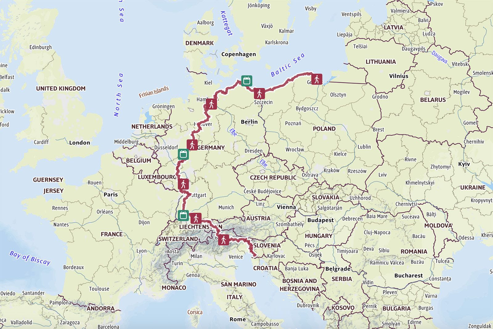
Poland, Germany, Austria, Switzerland, Italy, and Slovenia. Hiking the entire trail means climbing about 78.416 meters in elevation – equivalent to ten times the height of Mount Everest.
A full hike takes four to six months, but even the seven individual sections provide perfect opportunities for long-distance hikers who want to discover Europe, or for shorter day hikes for a quick escape.
- Section 1: Baltic Start (430 km) – Hel to Świnoujście: coastal forests and endless sandy beaches.
- Section 2: Rivers & Plains (530 km) – Usedom to Geesthacht: Mecklenburg coast and the Elbe Valley.
- Section 3: The Green Heart (480 km) – Geesthacht to Marsberg: Lüneburg Heath and gentle, forested hills.
- Section 4: Forests & Wine (572 km) – Marsberg to Bad Dürkheim: Rothaar Mountains and Palatinate wine regions.
- Section 5: High Watch (573 km) – Bad Dürkheim to Constance: through the Black Forest to the Alps.
- Section 6: Alpine Gateway (373 km) – Constance to Oberstdorf: entry into the Allgäu Alps.
- Section 7: Alpine Crossing (558 km) – Oberstdorf to Trieste: the most challenging section through the Dolomites and Julian Alps to the Adriatic.
I’m Hiking 500 Miles on the Pacific Crest Trail
by BestHike editor Rick McCharles
Well …
I have a PERMIT for 523.0 miles from Idyllwild to Kennedy Meadows South in California.
Starting May 26, 2026.
It remains to be seen just how many of those 523 miles I can finish. 😀
I’ll be happy with 14 -21 days.
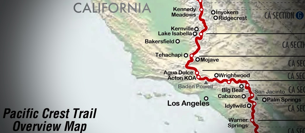
Wish me luck.
I’ll be testing some new gear. Hiking lighter than ever before — as there will be some major water carrying in the desert.
A.I. Video – Hiking on Another Planet
An experiment.
I’m still not happy with the quality, speed, and cost of creating A.I. video online.
These two short clips were free using miricanvas.com — but not what I was trying to create.
Click PLAY or watch it on YouTube.
Kanchenjunga Trek in Nepal
Looks fantastic.
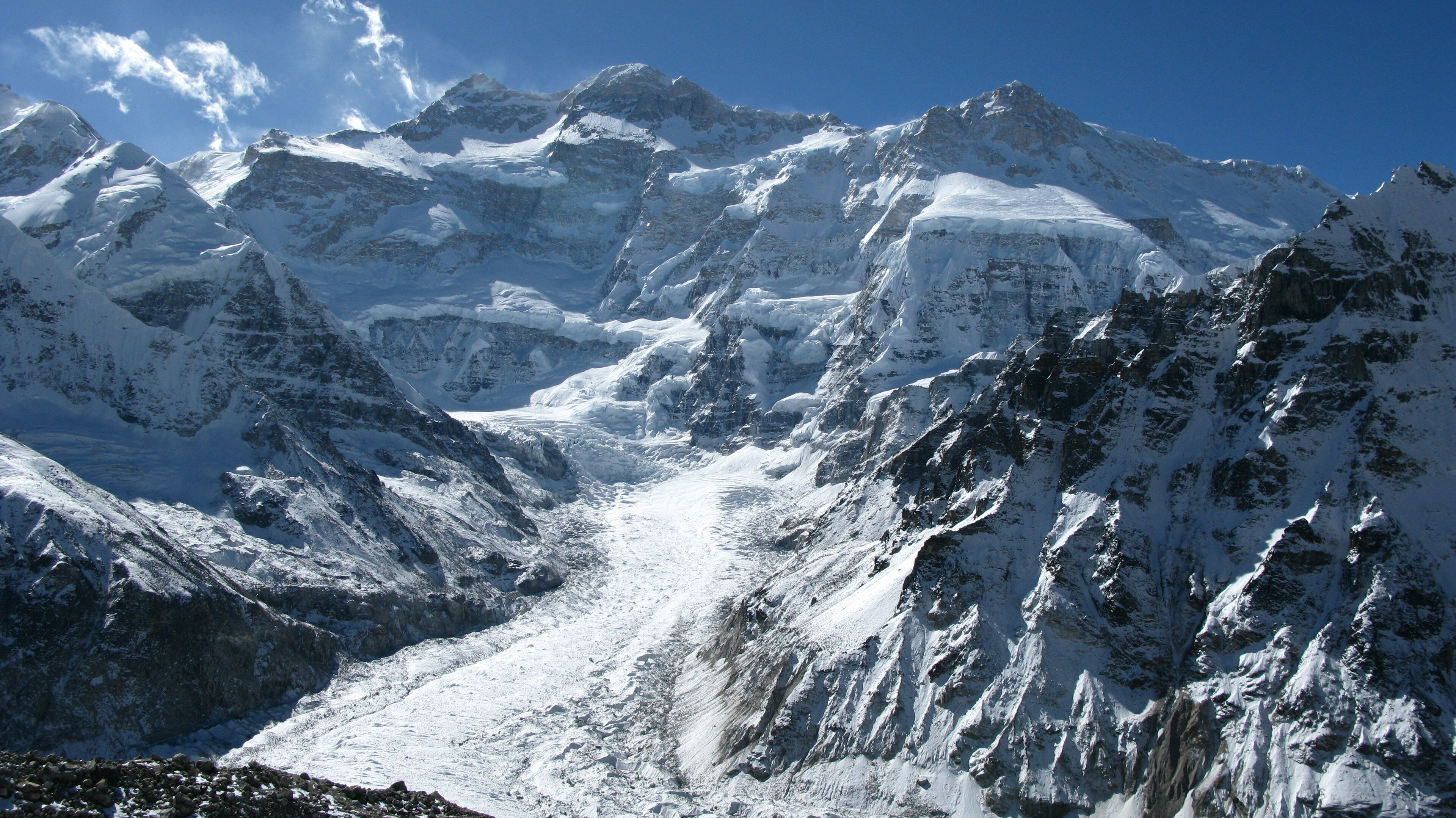
I watched Flora Gonning’s video of her Kanchenjunga adventure guided by Himalayan Masters. That’s the 3rd highest mountain in the world.
They had a lot of snow, changing their itinerary.
Click PLAY or watch it on YouTube.
I’m interested. But it’s a big commitment.
Here’s what Himalayan Masters offered in 2026 starting at USD $1900.
Kanchenjunga Circuit Trek Facts
- Duration of the trek: 20 days
- Distance of the trek: Around 200 Km
- Starting point: Amjilosa
- Ending point: Yamphudin
- Maximum elevation: 5,143 meters/ 16873.36 feets
- Best Seasons to Visit: Spring (March to May) and Autumn (September to November)
- Accommodation: Teahouses/ Hotels
- Transportation: Flight/Bus/Jeep
- Trek Category: Difficult
- Permits: KCAP and RAP
Highlights of the Kanchenjunga Circuit Trek
- Cultural Immersion with local Sherpa and Limbu communities
- Glacial Lakes such as Ghunsa and Kambachen
- Monastic Visits to Ramtang and Oktang Monasteries
- Challenging Terrain with varied landscapes
- Base Camp Adventures at Kanchenjunga North (5143 m) and South (4780 m)
- High Passes like Sele La (4290 m) and Mirgin La (4480 m)
- Rich Biodiversity in Kanchenjunga Conservation Area
- Traditional Villages showcasing local architecture and lifestyle
- Breathtaking Sunrises and Sunsets over the Himalayas
- Unique Trekking Routes through lush forests and alpine meadows
- Opportunities for Photography of stunning landscapes and wildlife
- Local Cuisine tasting traditional Nepali dishes along the trek
Is Bikepacking BETTER Than Backpacking?
Darwin on the Trail is one of the most influential hiking vloggers
BUT he’s slowly adding bike touring trips to his annual calendar.
AND Darwin argues that Bikepacking is even better — overall — than thru hiking.
Click PLAY or watch it on YouTube.
Gear guru Halfway Anywhere agrees:
10 Reasons Bikepacking Is Better Than Backpacking
Of course cycling requires more gear. Higher cost.
I bought my first touring bike about 10 years ago. As I age, I expect to do more and more cycling as it’s easier on the body.
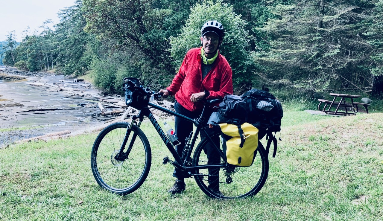
In 2026 I plan to do plenty of both.
Section hiking the Pacific Crest Trail. Section cycling the Tour Divide.
Mocking Arc’teryx
If you want to look cool — but kinda a douche — buy Arc’teryx.
Great stuff. But by far the most overpriced in the industry.
Though launched in Vancouver, Canada, I’ve only ever been able to afford one piece of Arc’teryx gear. A cap. 😀
It’s currently owned by Amer Sports, Inc., Finland. Which is owned by the Chinese company Anta Sports since 2019.
Click PLAY or watch it on YouTube.
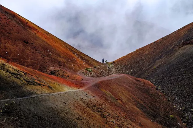
Sliding Sands to Halemau’u Trail, Maui
I loved my Sliding Sands day hike in 2009.
BETTER would be to continue to the Halemau’u Trail.
Click PLAY or watch it on YouTube.
