Click PLAY or watch it on Facebook.
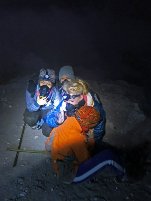
gas mask hiking
We’ve added Kawah Ijen Volcano, East Java, Indonesia to our list of best hikes in Asia.
The place is dangerous, however.
Click PLAY or watch it on YouTube.
If that doesn’t turn you off, check the THE COMPLETE GUIDE TO HIKE IJEN CRATER (KAWAH IJEN). It’s closes to Bali.
360 mile Bigfoot Trail, California
The Bigfoot Trail … begins in the Yolla Bolly-Middle Eel Wilderness and ends in Redwood National Park at the Pacific Ocean near Crescent City, California. …
Northwest California’s Klamath Mountains foster one of the most diverse temperate coniferous forests on Earth and this route is a celebration of that biodiversity. …
Due to the strenuous nature of the trail and the fact that some section have been un-maintained for many years it is not a trail that can be hiked quickly. Experience using map and compass as well as the ability to read the landscape are necessary for a successful thru-hike. The Bigfoot Trail was originally proposed by Michael Kauffmann in 2009 …

Get the map from the official website.

Sage Clegg hiked it in 2014.
Go outside and play
Anglesey Coastal Path, Wales
The Anglesey Coastal Path is a 200-kilometre (124 mi) long-distance footpath around the island of Anglesey in North Wales. The route is part of the Wales Coast Path. …
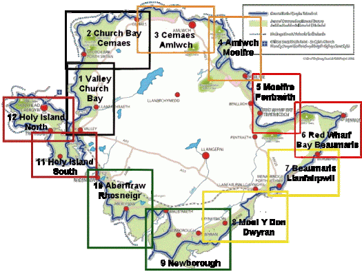
Or check the official map.

related – annual Walking Festival and Walkathon
Adventure Junkies – Huayhuash trek, Peru
… The snow-capped peaks here are really high (many well over 6.000 mts – 19,500 ft) and the feeling of remoteness is fantastic. …
The whole circuit takes anywhere from 8 to 14 days to complete as there are different routes available. There is only one small town where you can re-stock on supplies which means you will need to carry all your food for 7-8 days if walking independently.
For that reason, most of the hikers decide to go with an organized tour. But hey, we are the Adventure Junkies. We can’t let a donkey carry our stuff up the mountain!
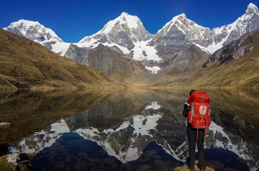
Check out our Huayhuash Circuit information page.
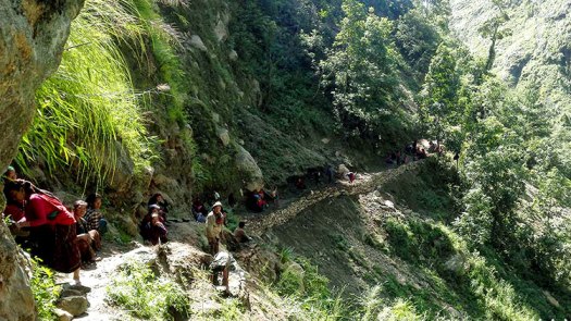
Manaslu Circuit after the earthquake
Nepal Explore Summit Treks reports Manasulu is back in business.
From Manaslu Conservation Area Project (MCAP) entry point Jaget, only 25 tourists made it to Manaslu circuit since the earthquake happened …
However, as the trail improved in the area, by middle of November (2015), this number already went up to more than 5000. And to date, based on statistics, approximately 40 trekkers enter the Jaget point on a daily basis. …
… Bridges wiped out by the landslides have been rebuilt by the villagers. The trail is open again for trekkers to explore. …
151 best Backpacking & Hiking sites
As chosen by Happy to Survive.
Some of my personal favourites are listed. As well as BestHike.com. Twice! 🙂
21. Florida Hikes
36. Hike Bike Travel
52. Our Hiking Blog
67. The Hiking Life
106. Trailspotting

(via Adventure Blog)
toughest hike of the year?
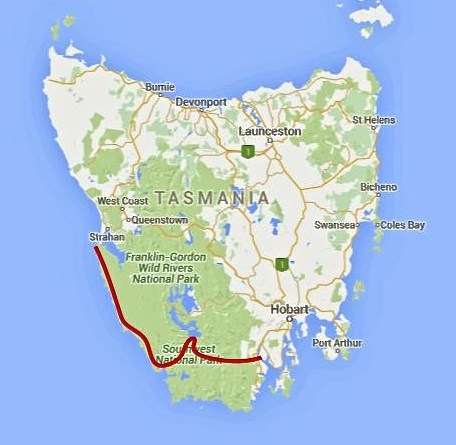
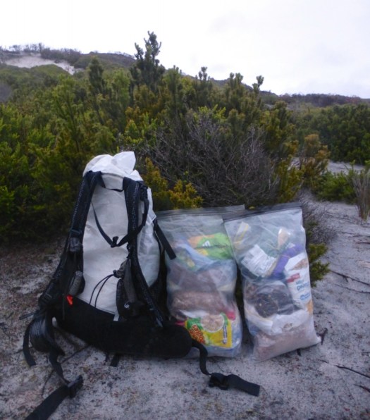
Southwest Tasmania Traverse
Cam Honan:
Between February 27 and March 22 of this year, I completed a traverse of the southwestern region of the state. One of the wildest, most pristine backcountry areas on the planet, it was a hike I had dreamed of doing for almost two decades. …
200 miles (322 km) approx. …
Time: 24 days
Daily Average: 8 miles (13 km) approx. This included one rest/resupply day. Hiking, scrambling, bushwhacking, climbing, paddling, crawling, swimming, rock hopping…………yep……..the terrain really was that challenging …