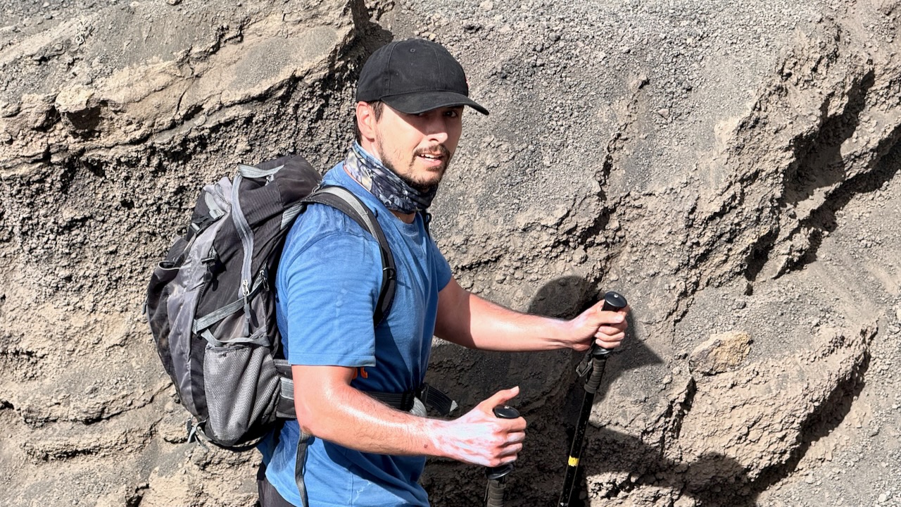
Mostly, I use my Apple Watch as a remote for taking PHOTOS and VIDEOS on the trail.
Most of the time, the watch shows a low resolution image so I can better frame the shot.
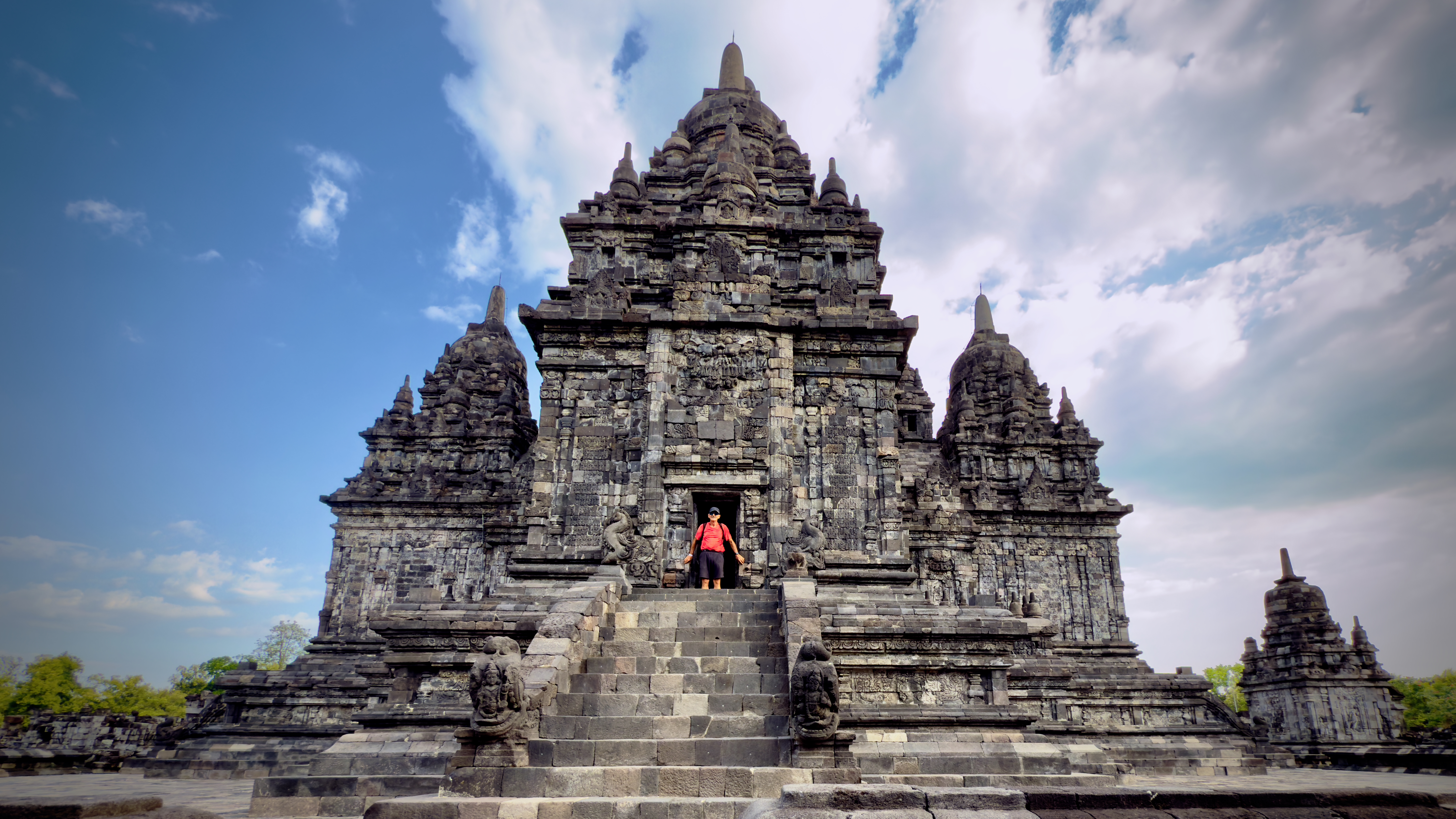
For example, I took this photo of myself in a Prambanan temple using the watch. Typical range is 33 feet (10 meters) — but I find it varies quite a bit.
One downside ➙ doing this does kill the watch battery quickly. MUST remember to bring the charging cable with me on the hike. 😀
I was inspired by Kurt Papke to better organize how I use my Apple Watch while hiking.
‘Sponsored by Heineken (1995) to reach the parts other explorers cannot reach, itinerant traveller Mark Eveleigh sets off on foot and by canoe across the heart of Borneo.
On the way he endures shipwreck, malaria, leeches and exhaustion, not to mention enforced alcohol abuse and barbecued mouse-deer foetus.
Such hardships, you would imagine, might be enough to put a man off his boiled fish and rice, but the author confronts each challenge with a spirit that is as understated as it is refreshing.
All too often travelogues dwell on the downside of discovery, but Mark’s unique blend of enthusiasm and humour is genuinely absorbing and immensely readable.’
– Global AdventureMagazine.
I really enjoyed the book while sailing between Indonesian islands, myself.
The most astonishing takeaway for me, however, is the narrator of the audiobook.
Excellent.
“Narrated by: Virtual Voice” indicates an audiobook that was not narrated by a human, but by an AI-generated voice created by a technology like Amazon’s Virtual Voice on KDP (Kindle Direct Publishing).
This computer-generated speech technology creates audiobooks from ebooks, offering authors a way to produce an audio version at a low cost or no cost.
The narration quality varies by title, and Audible (and other platforms like Amazon and Alexa) will clearly label these audiobooks and provide samples for listeners to evaluate before purchasing.
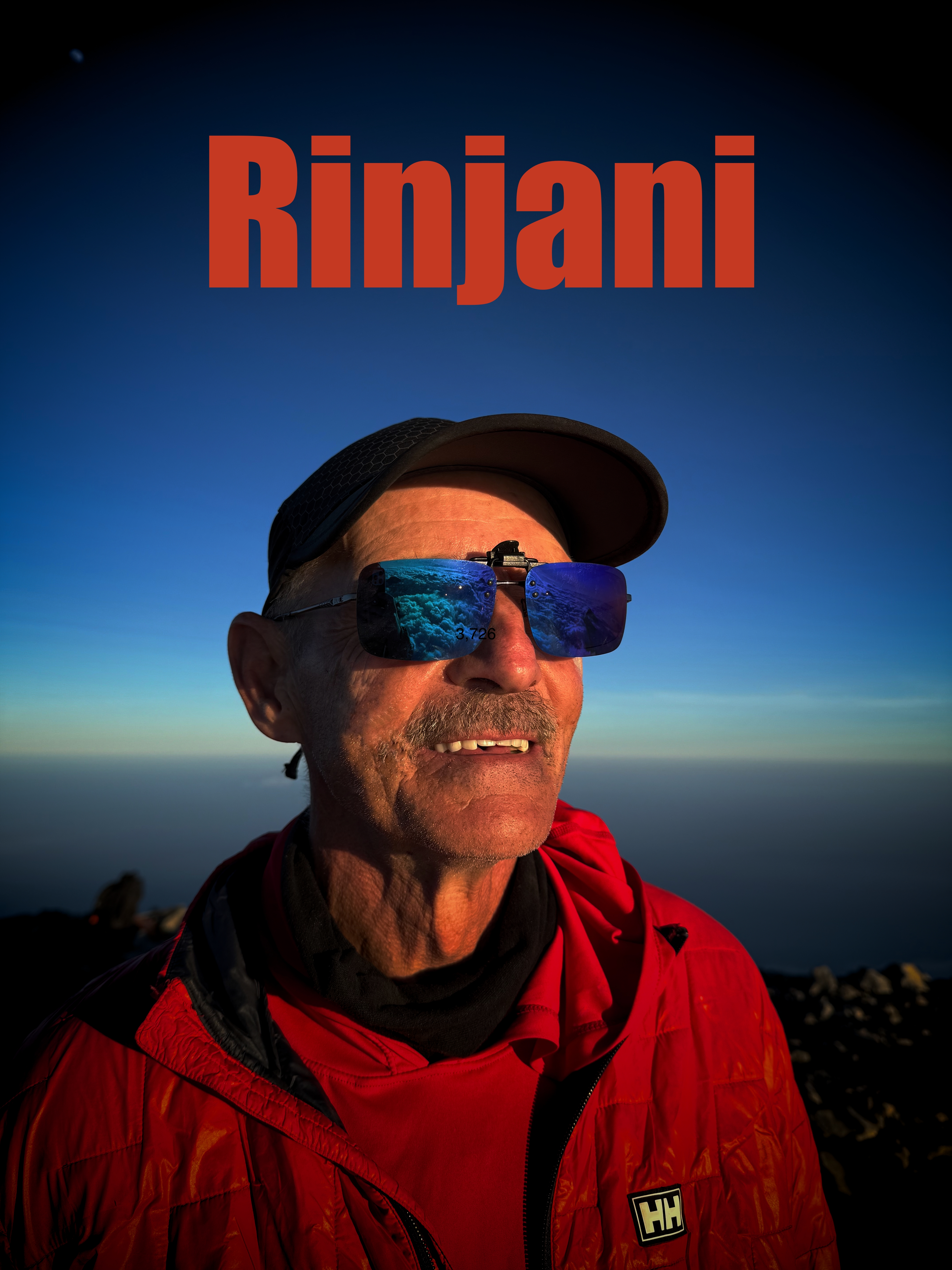
I’ve long wanted to climb astonishing Mount Rinjani not far from Bali, Indonesia.
I took the local boat from Gili Trawangan to Lombok island for the start of our guided climb of Rinjani. I could see it in the distance.
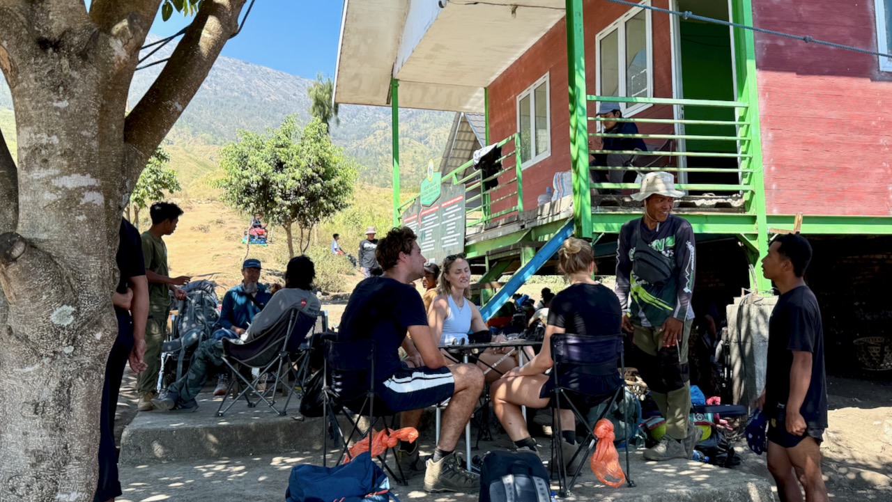
Our group met up at a local restaurant close to Bangsal Port ➙ then we were efficiently (if dangerously) driven up to Senaru village at 400m.
Screenshot
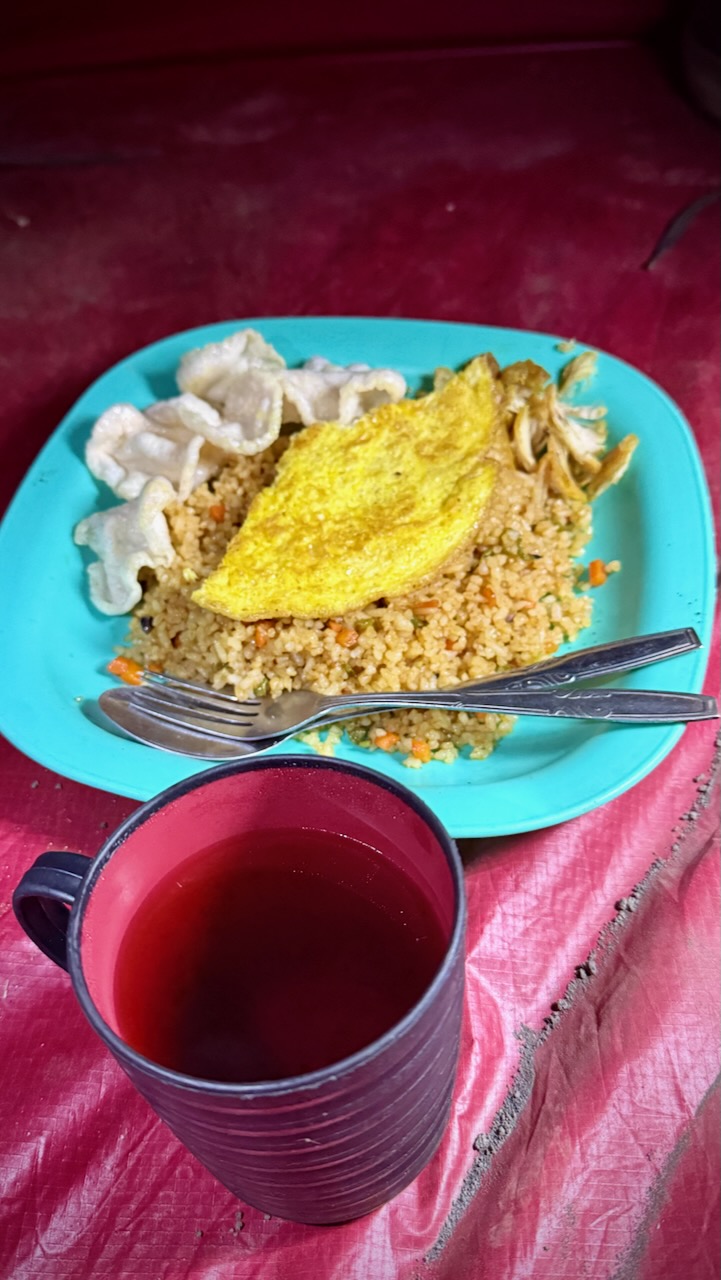
We had a typical Indonesian lunch based on rice or noodles.
We dropped bags in our surprisingly interesting rooms.
Then set off to see two local waterfalls.
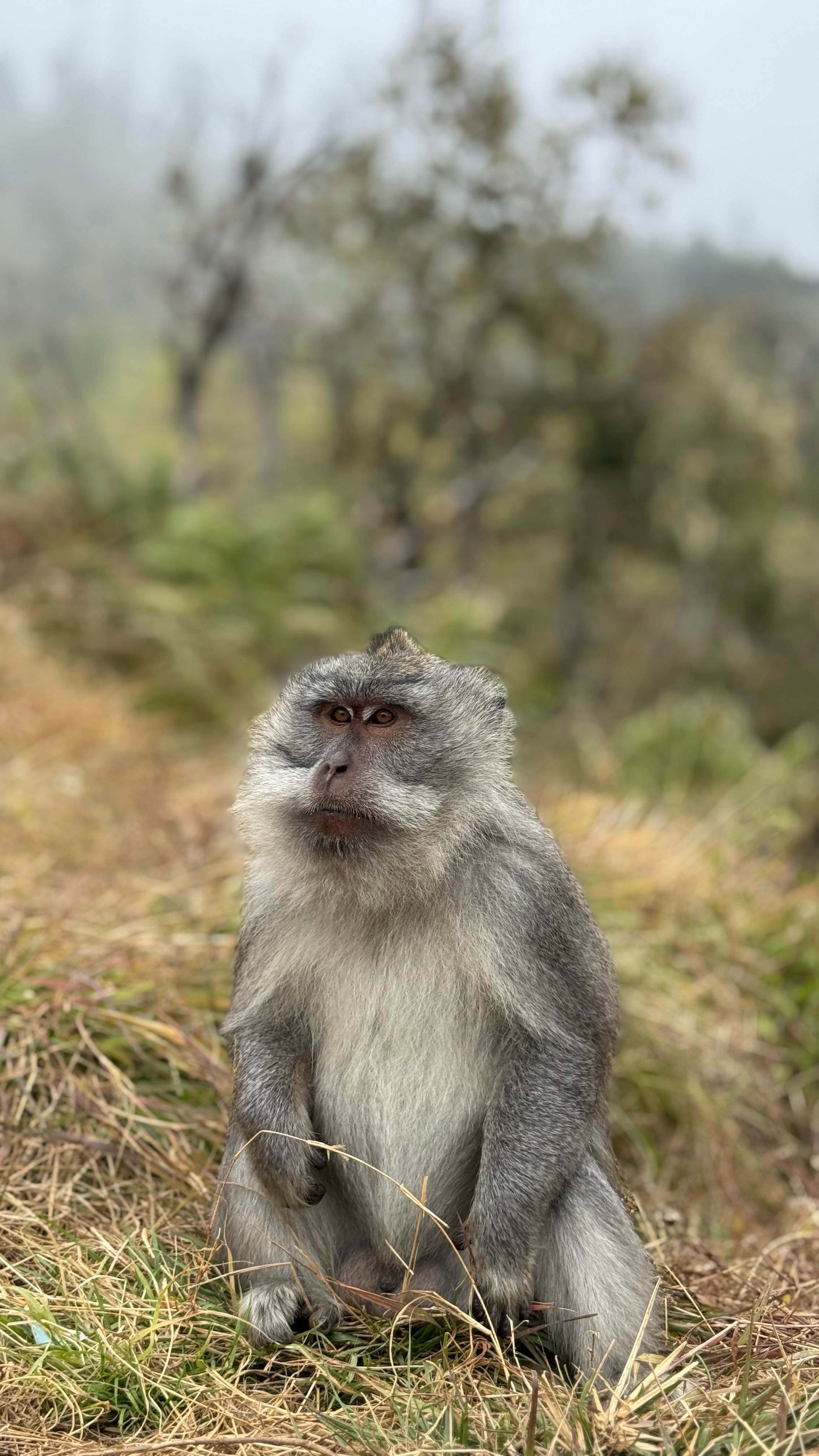
Plenty of macaques await ready to grab at your purse, backpack, or any kind of plastic bag.
Here’s the 1st waterfall.
MOST interesting here is a fun tire tube ride underground through the irrigation channel. I’d be too chicken, myself. 😀
Here’s the 2nd even more impressive falls.
Back at the guesthouse we did our introductory briefing on the volcano climb. We had hoped two more would join us. One was in hospital for some reason. The other cancelled last minute.
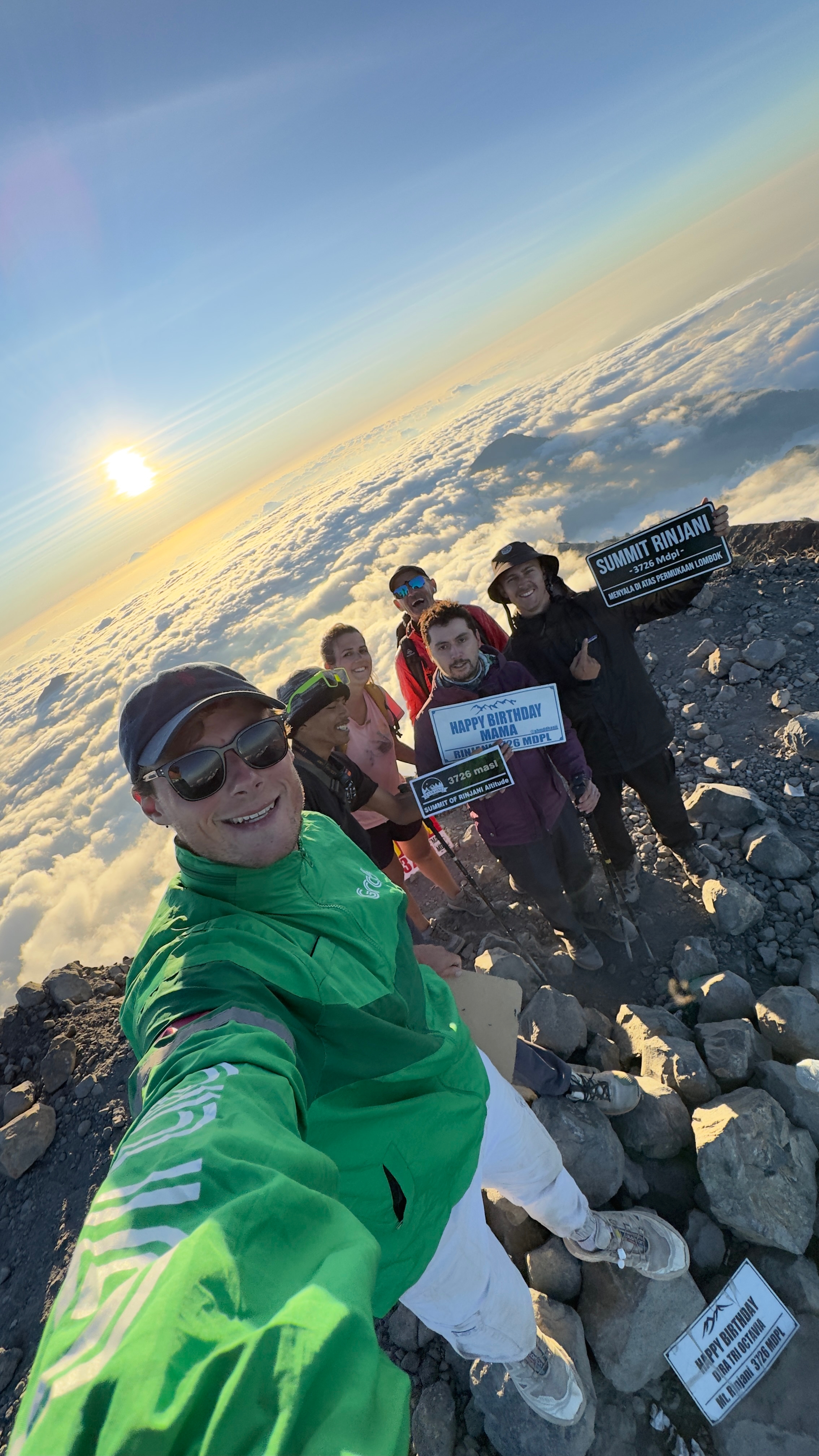
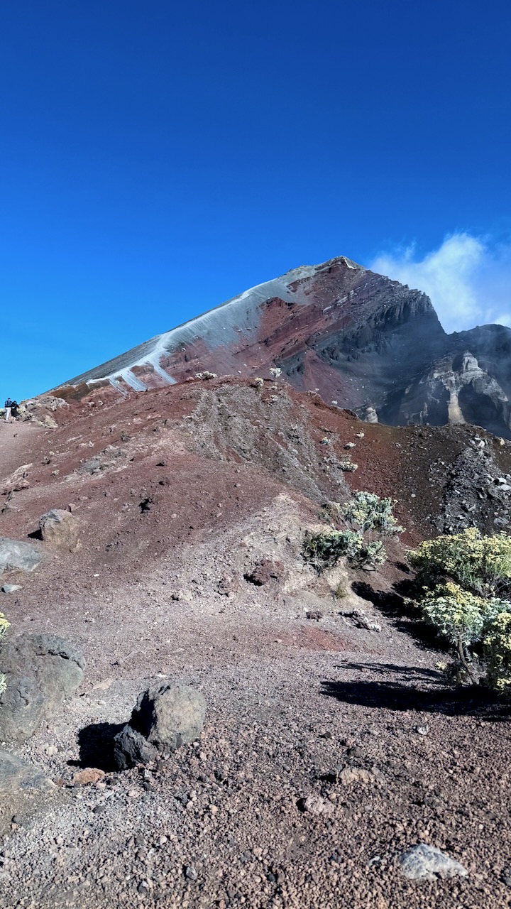
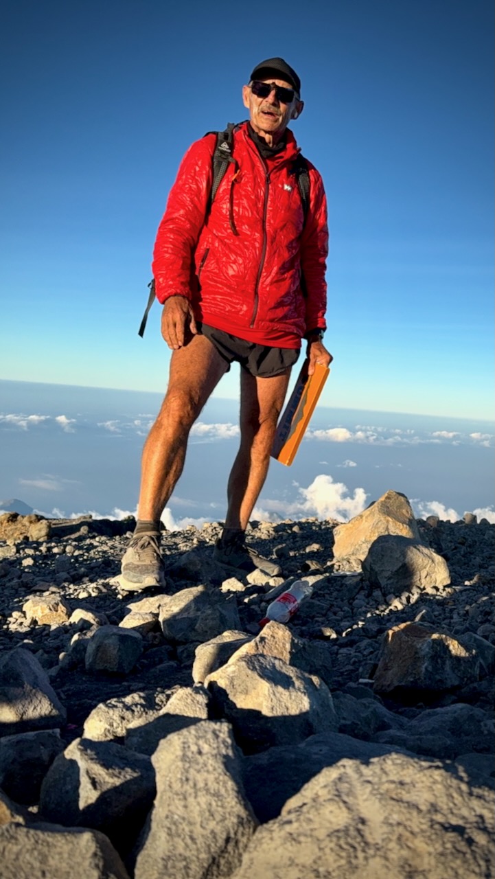
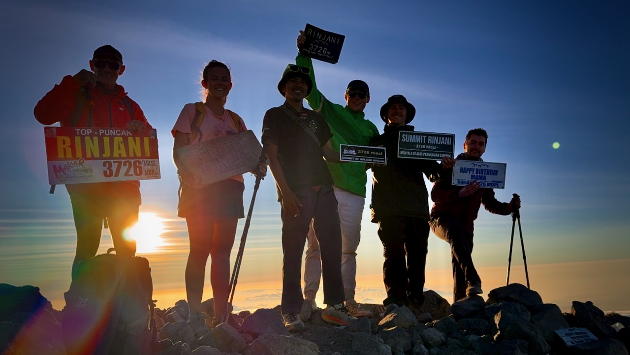
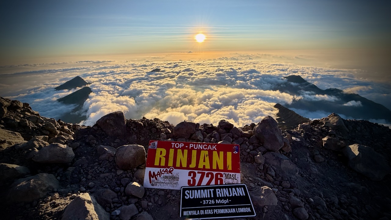
Rinjani is 3,726 metres (12,224 ft), making it the second-highest volcano in Indonesia.
We had signed up for the longer 3 days, 2 nights in the tent option.
That turned out to be the right decision. Our itinerary the BEST HIKE.
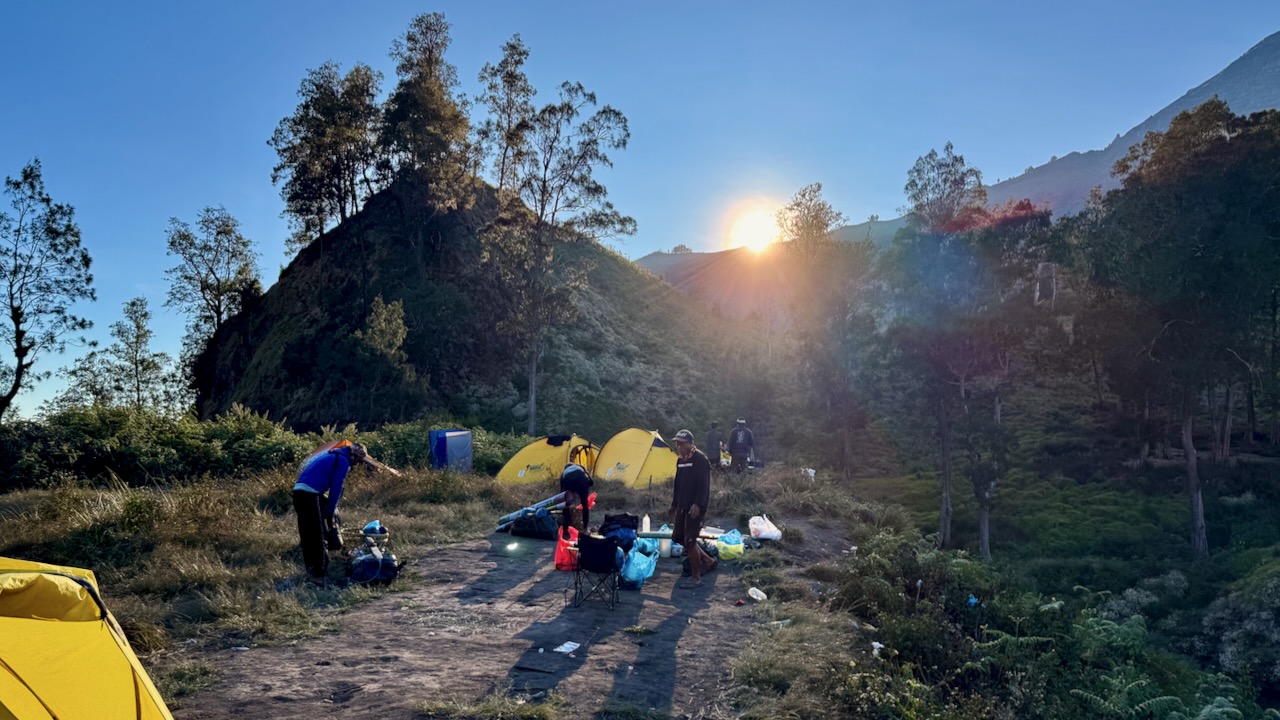
MOST groups on our itinerary camp on the 1st volcano ridge day 1. Our guide offered us the chance to descend 3 hours to camp at the lake, instead. Super tough 1st day — but we were all glad we did it.
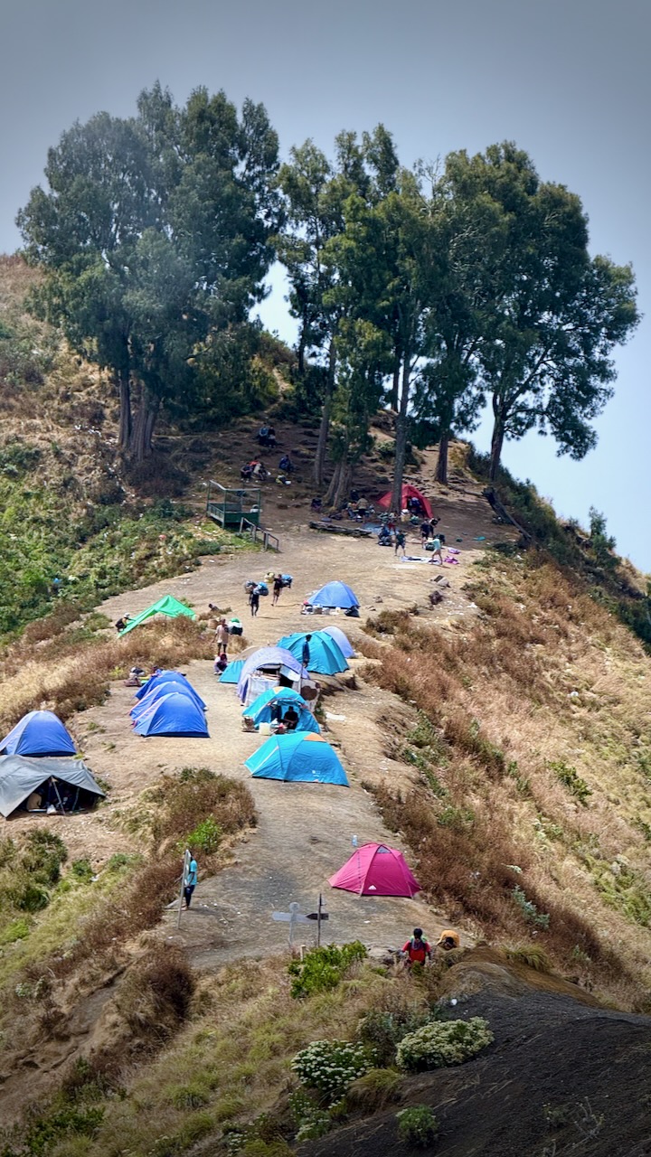
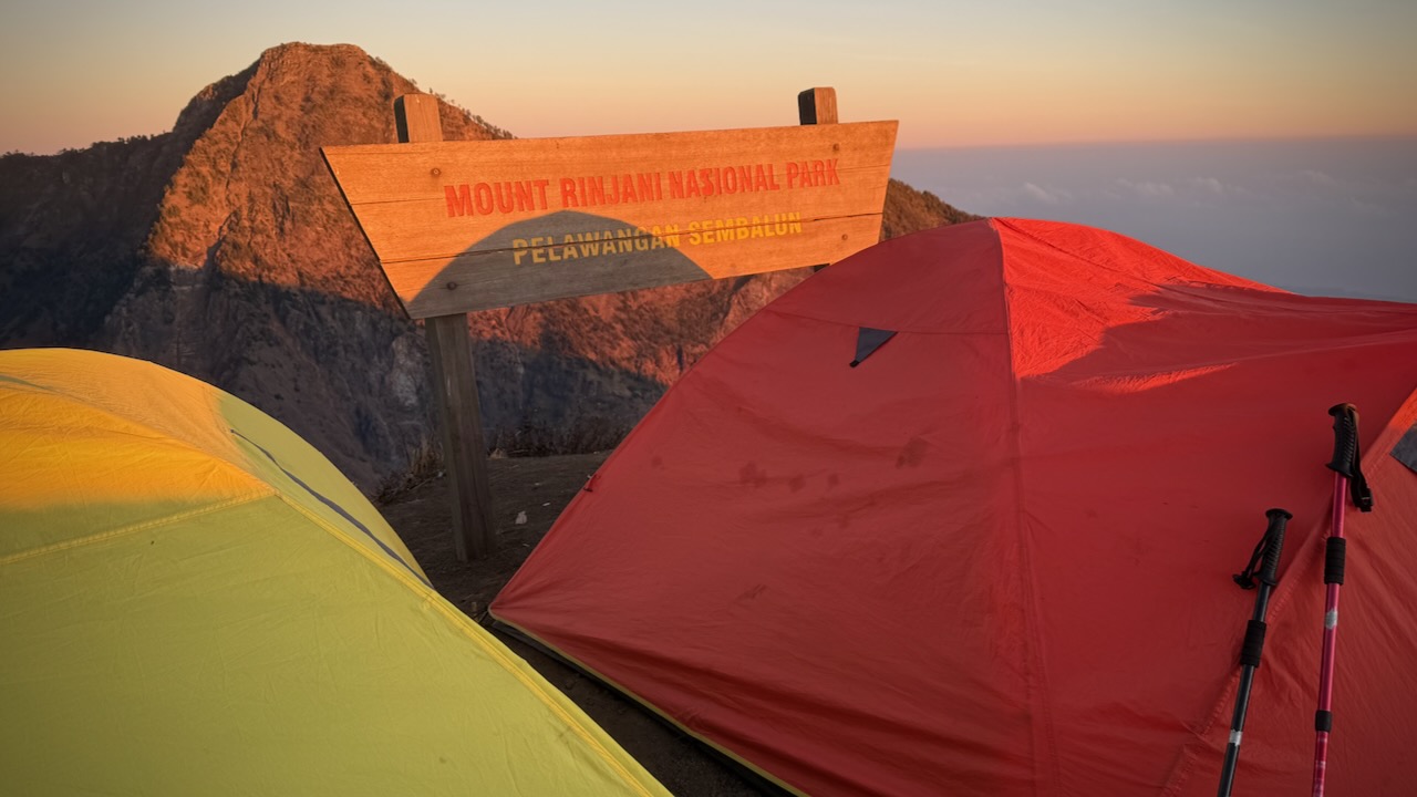
Mount Rinjani Crater Rim 1st night on the 3 day trek.
We were up for the dawn. I added milk powder to my brutal black instant coffee.
Banana pancakes excellent, as always.
Driving up to the start at 600m we stopped for a blessing. An important tradition with the local Sasak people as well as Hindus.
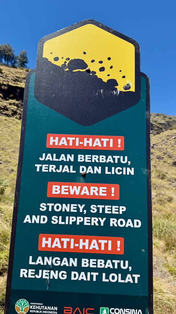
We each had to register with photo ID. The Gunung Rinjani National Park, established 1997, is trying to make this adventure safer — but they have a long way to go. It’s dangerous.
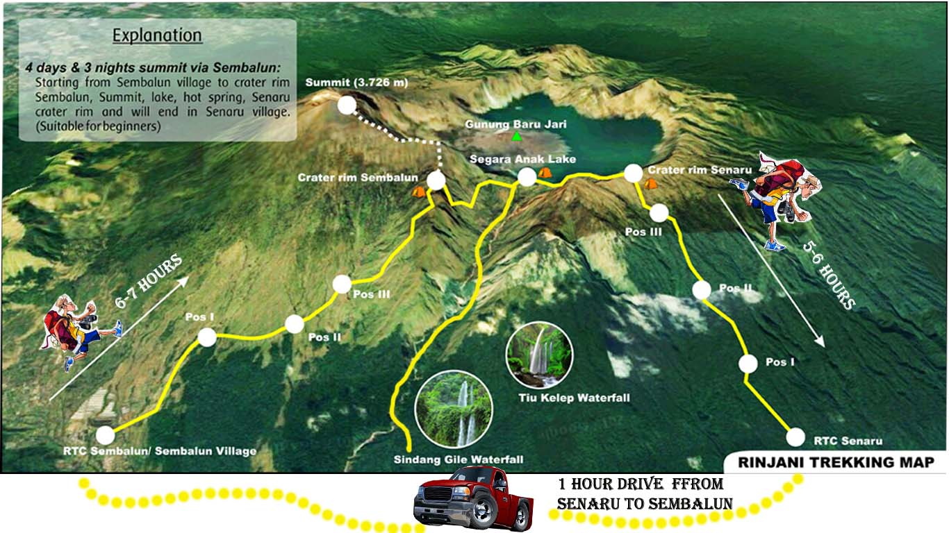
Our goal was the 1st crater rim — only 6.9km. Sounds easy until you calculate you need gain 2km in elevation over that short distance!
We started on the far right of this map.
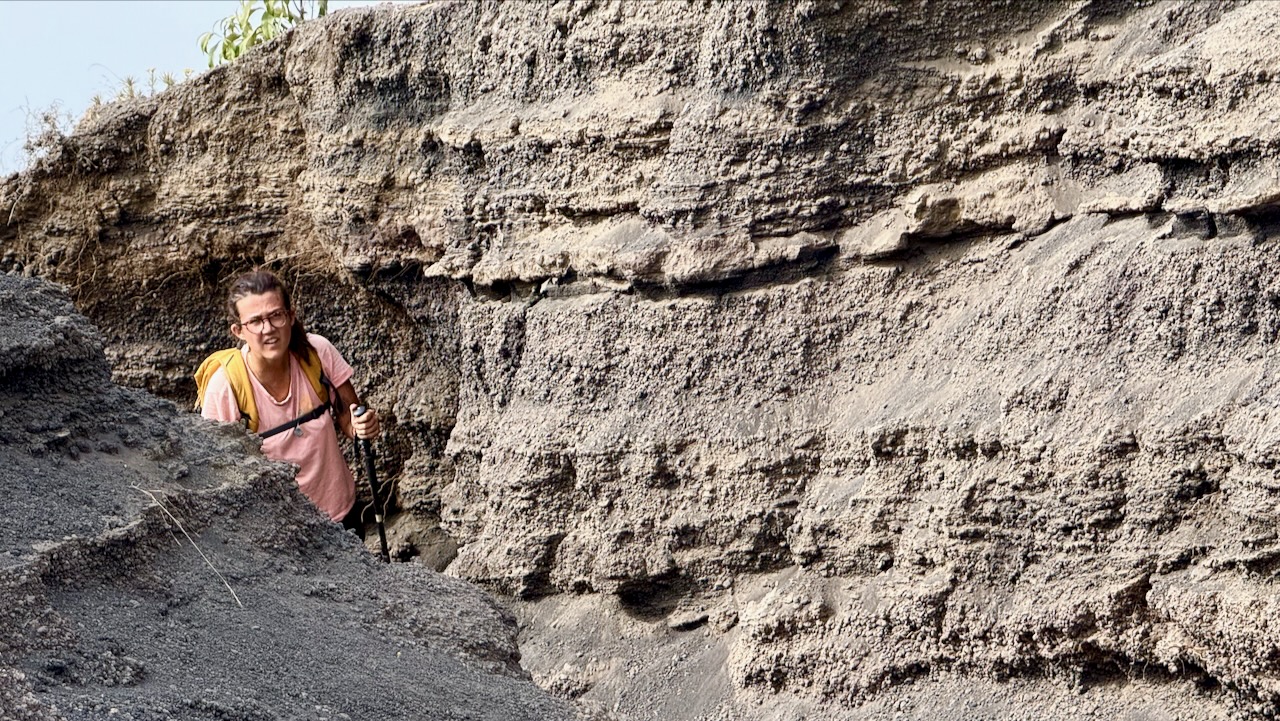
The start through jungle was relatively easy. THEN it got steep and challenging.
These wild cousins are more worrisome than the ‘tame’, well-fed ones in the Monkey Forest, Ubud.
Breakfast !
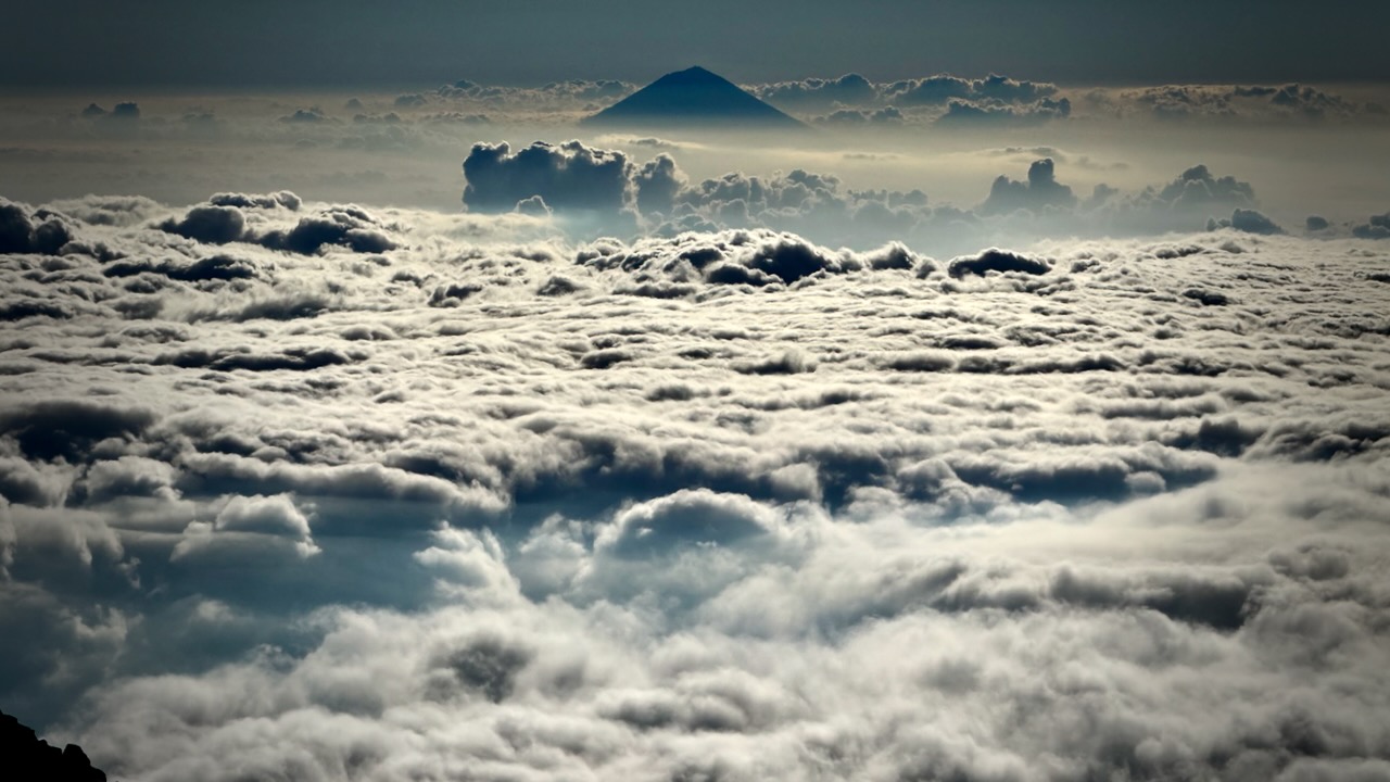
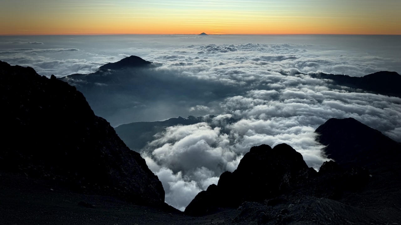
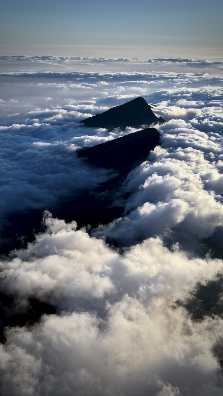
We hiked into and out of clouds.
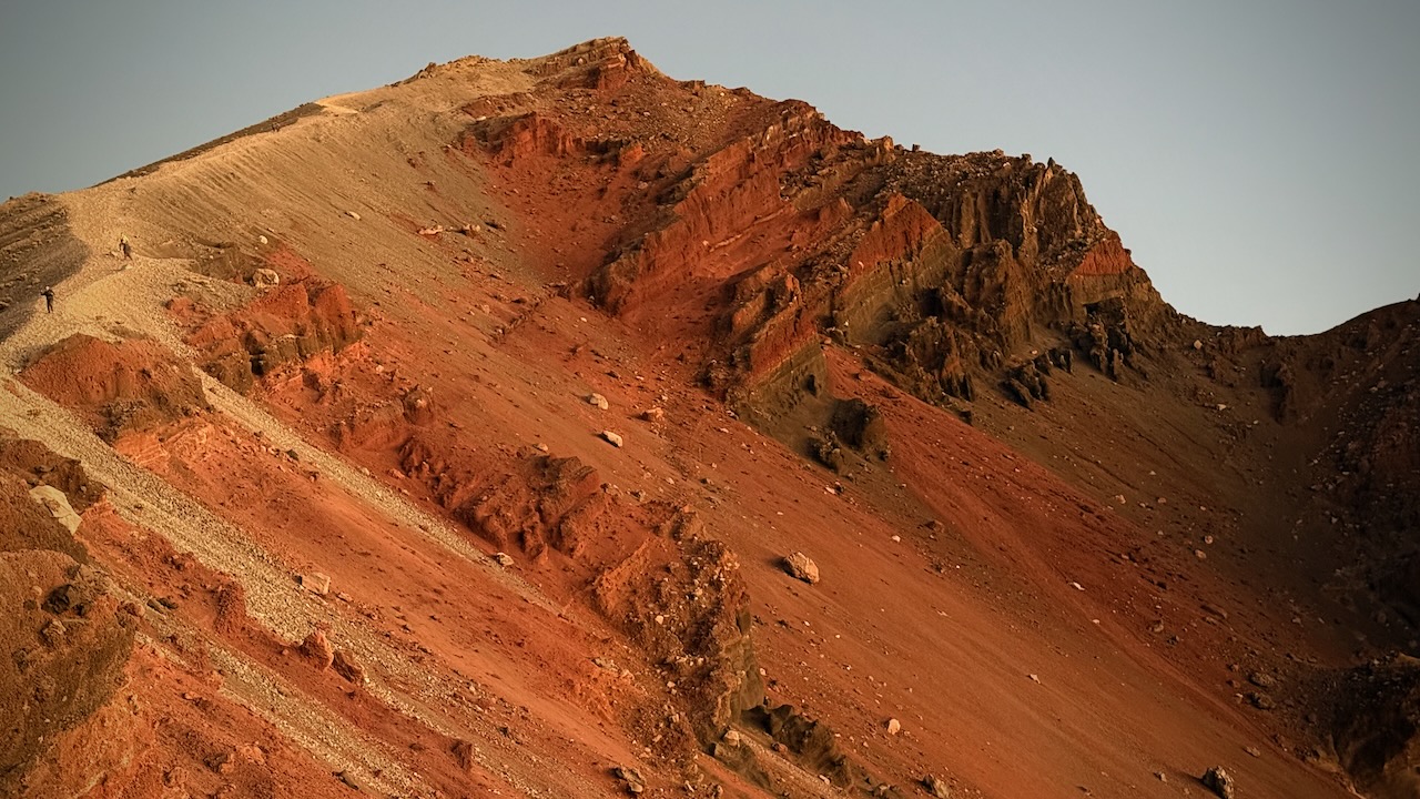
Crater rim beckons.
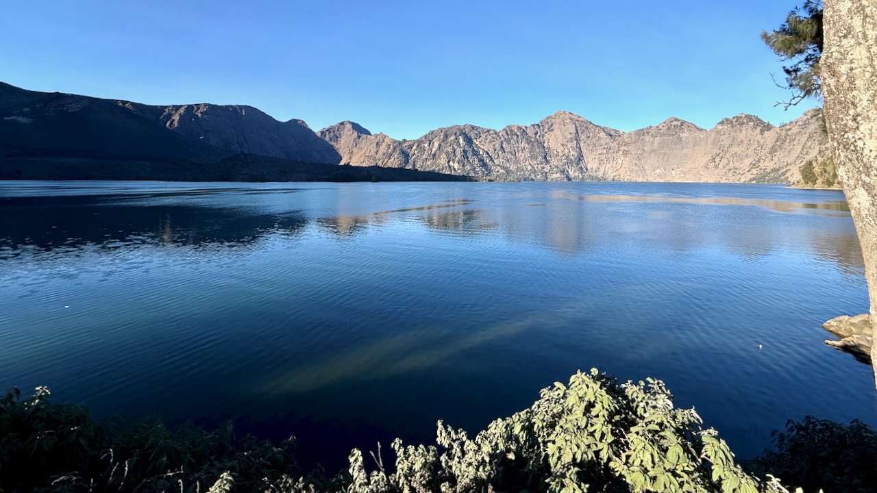
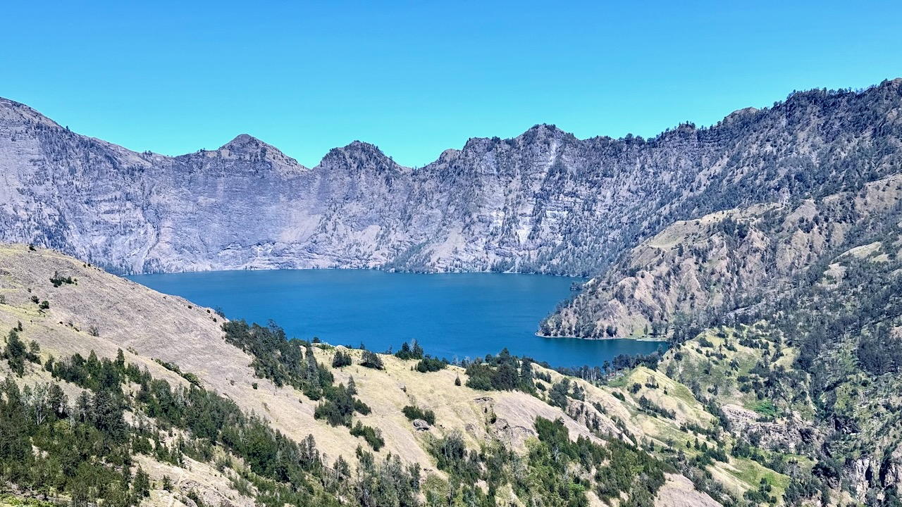
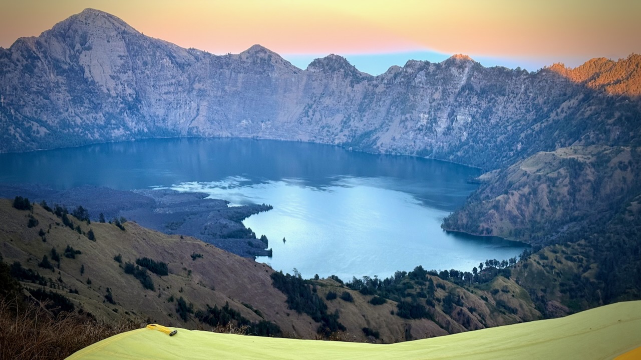
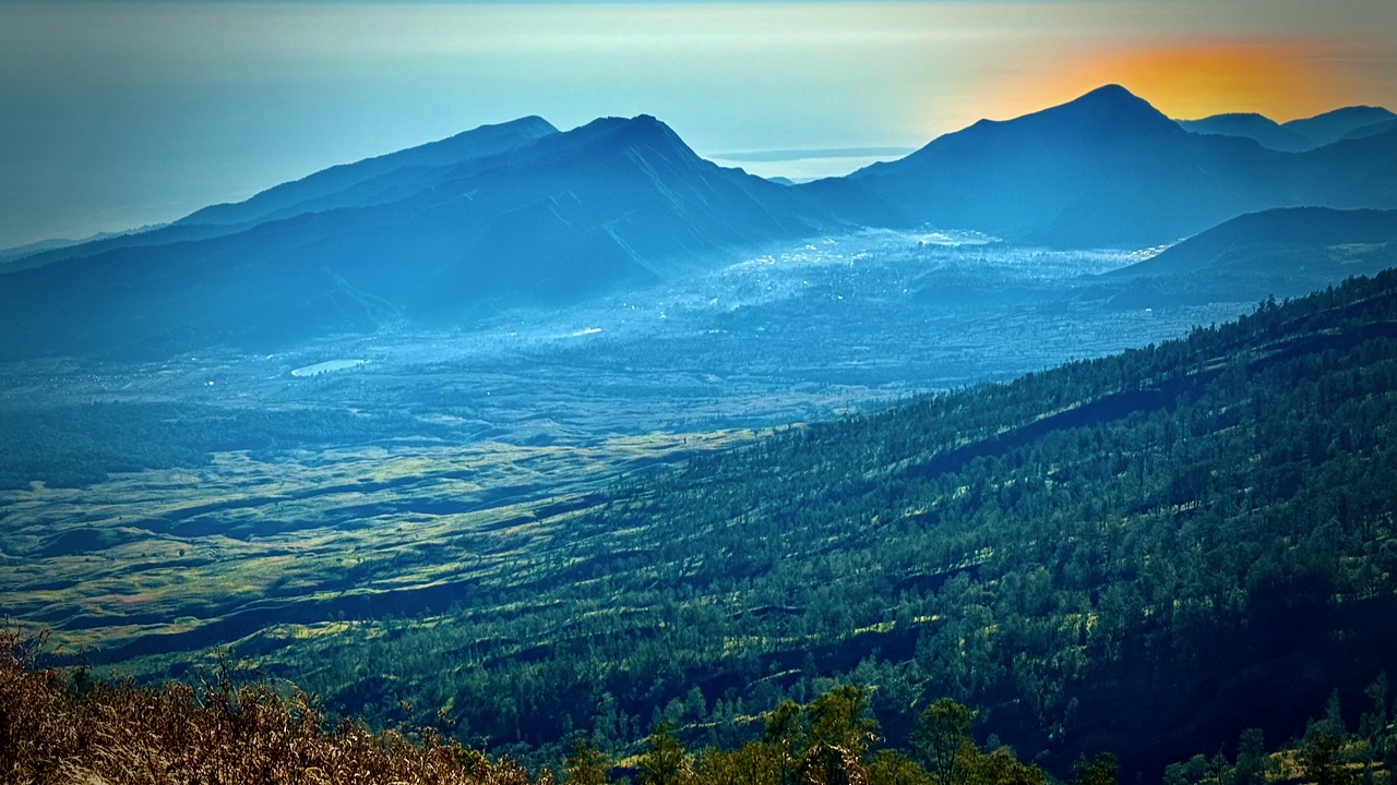
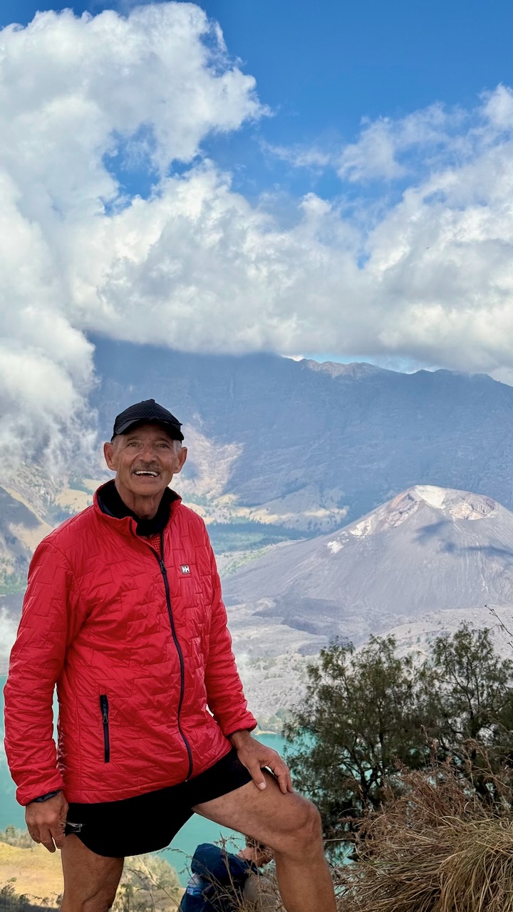
This — really — is the best vista on the hike. Crater lake Sagara Anak is huge, the colour unforgettable. The volcano’s eruption in 1257 is considered one of the most powerful global volcanic events of the last 2,000 years.
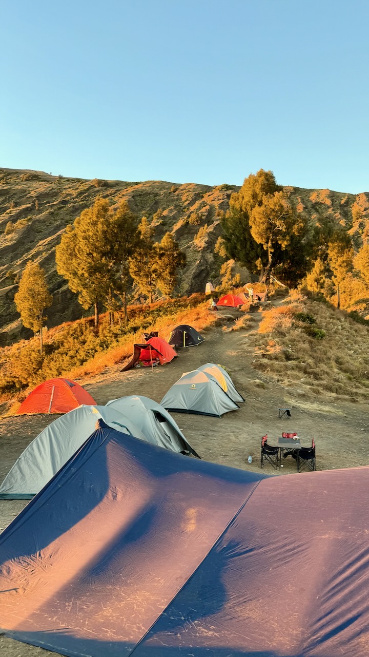
We were scheduled to set up our camp on the ridge here at 2,600m.
But we opted, instead, to hike down to the lake at 2000m, saving us 3-4 hours on day 2.
We all agreed to go for it.
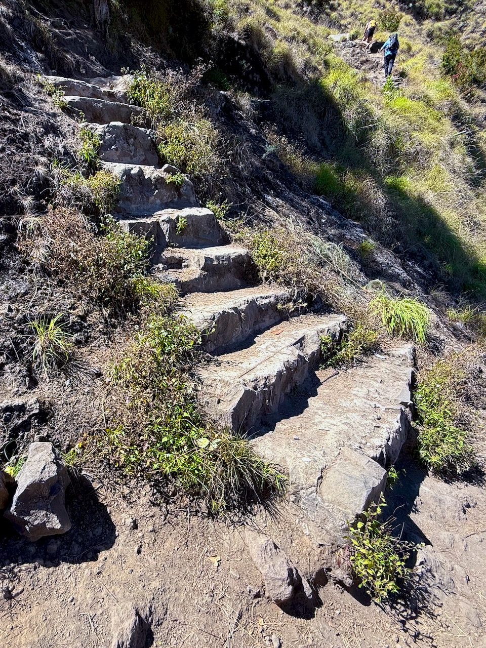
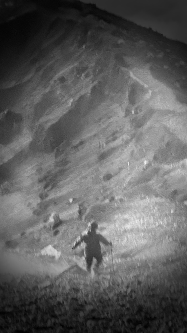
OUCH …
That decent is awful and dangerous. I took no photos. We had to concentrate on every technical step.
It was a relief to finally get to the lake. This one of my toughest hiking days of all time.
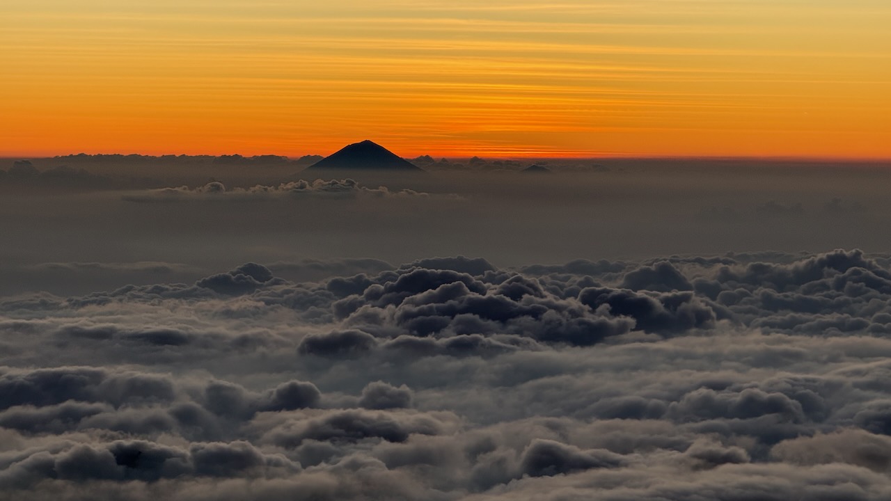
We arrived just before dusk.
Alpenglow time.
Each group has their own toilet tent.
The alternative at major camps are these good looking public toilets. This one was filthy! But some are quite new. Fairly clean.
Major camps have emergency shelters. I don’t doubt they are used frequently. The trek is risky.
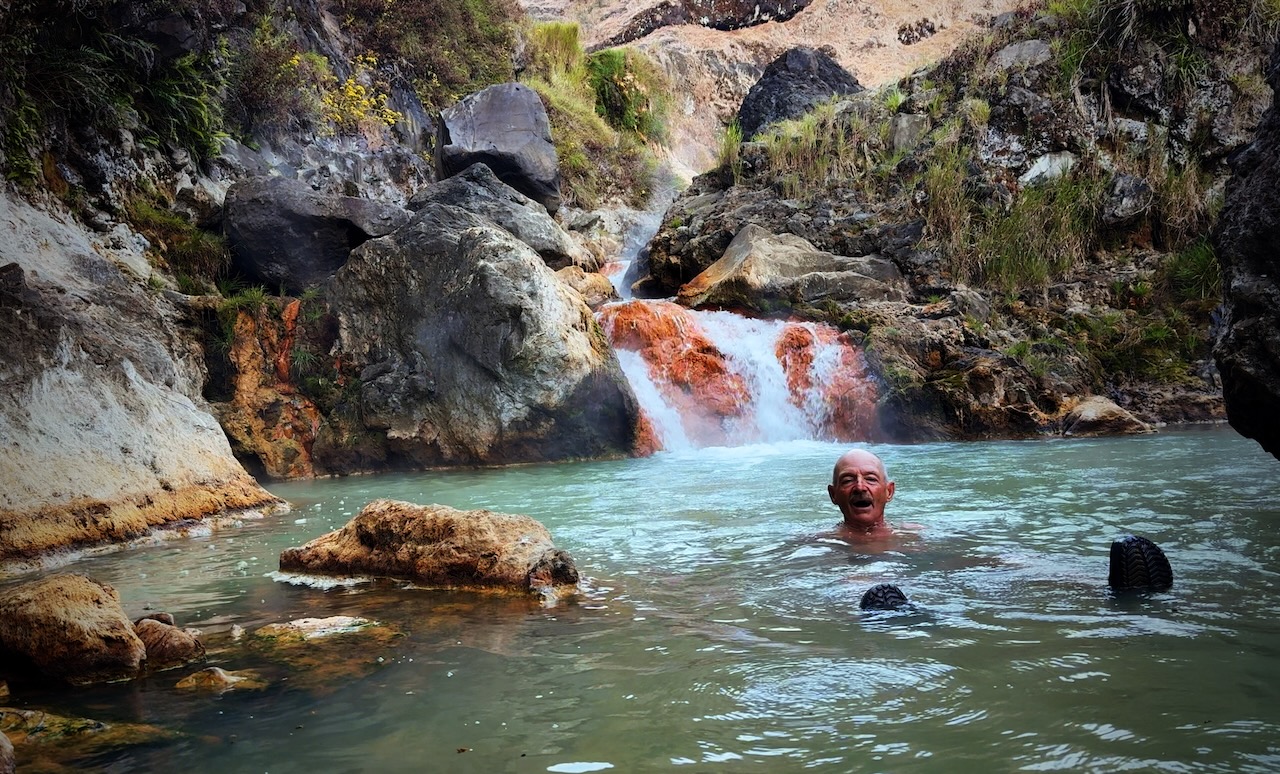
Our guide sent us to the hotsprings with one of the porters. Fantastic. A highlight of the entire trip.
Tim (tim_de_bruijn on Instagram) was a full-time social media manager for a major Dutch soccer team. He showed us fantastic photography tips on his iPhone, including these two. It was pitch dark at the hotsprings!
Pitch dark at camp, as well.
tim_de_bruijn
Most amazing of all was his capture of the night stars. Very few of these were visible to the human eye. This from an iPhone 16 Pro Max.
I actually carried my own tent on this adventure. Air mattresses in the provided tents were not good. 😀
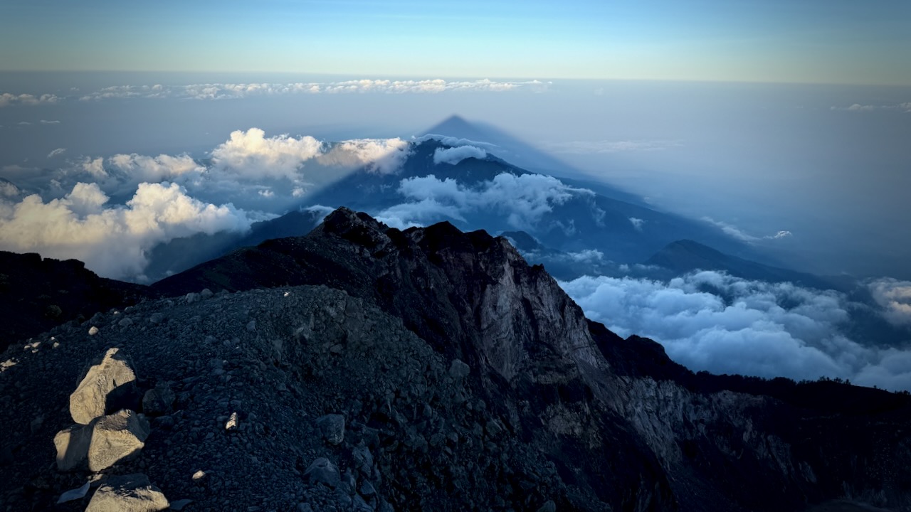
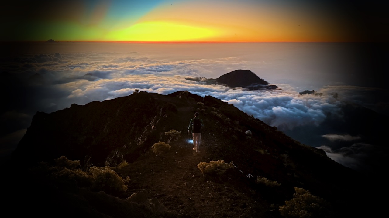
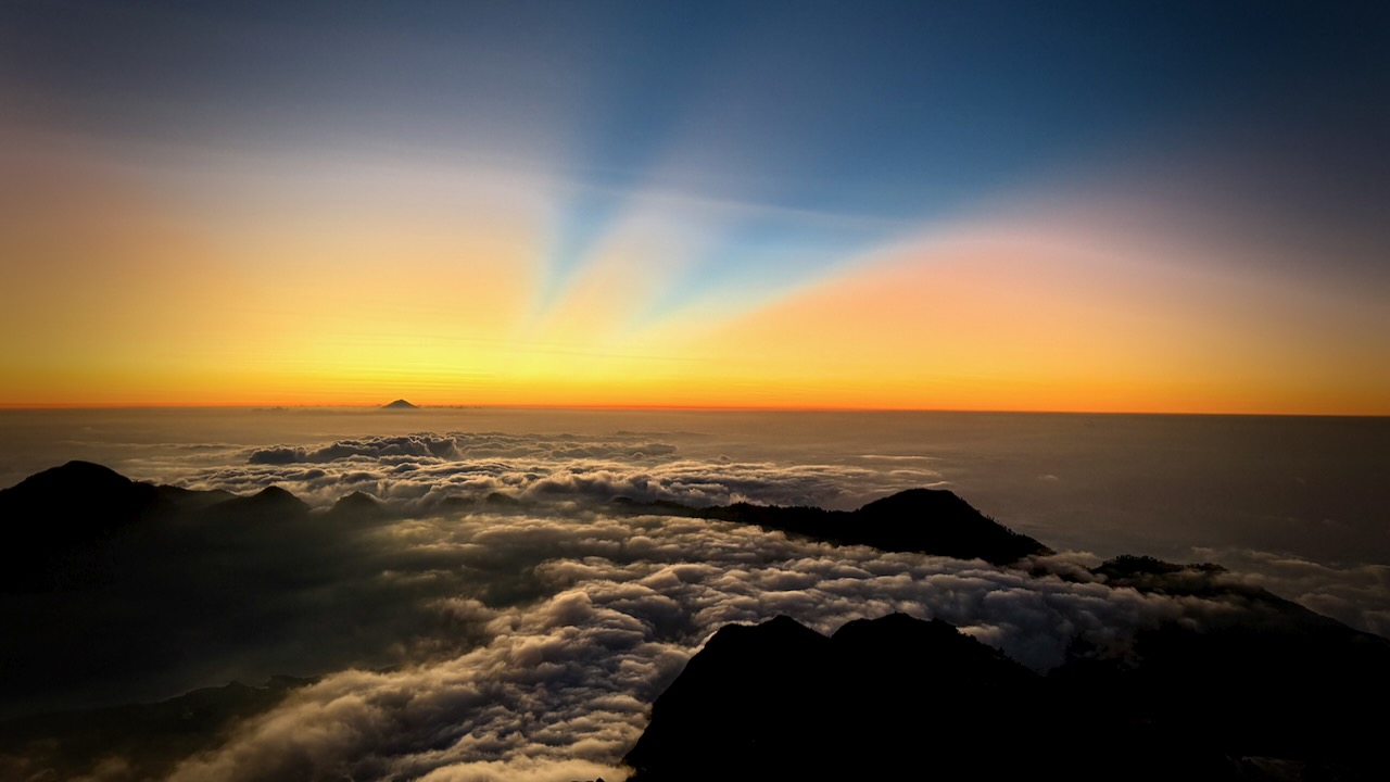
The crater rim vistas really are superb.
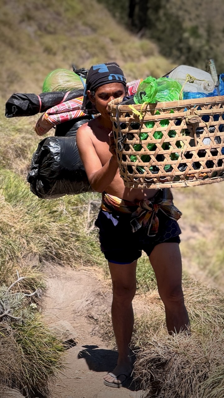
The biggest takeaway from this trip for everyone is being impressed with the porters. Rather than use the more efficient tump system, they balance these loads on one shoulder while doing big step-ups and step-downs.
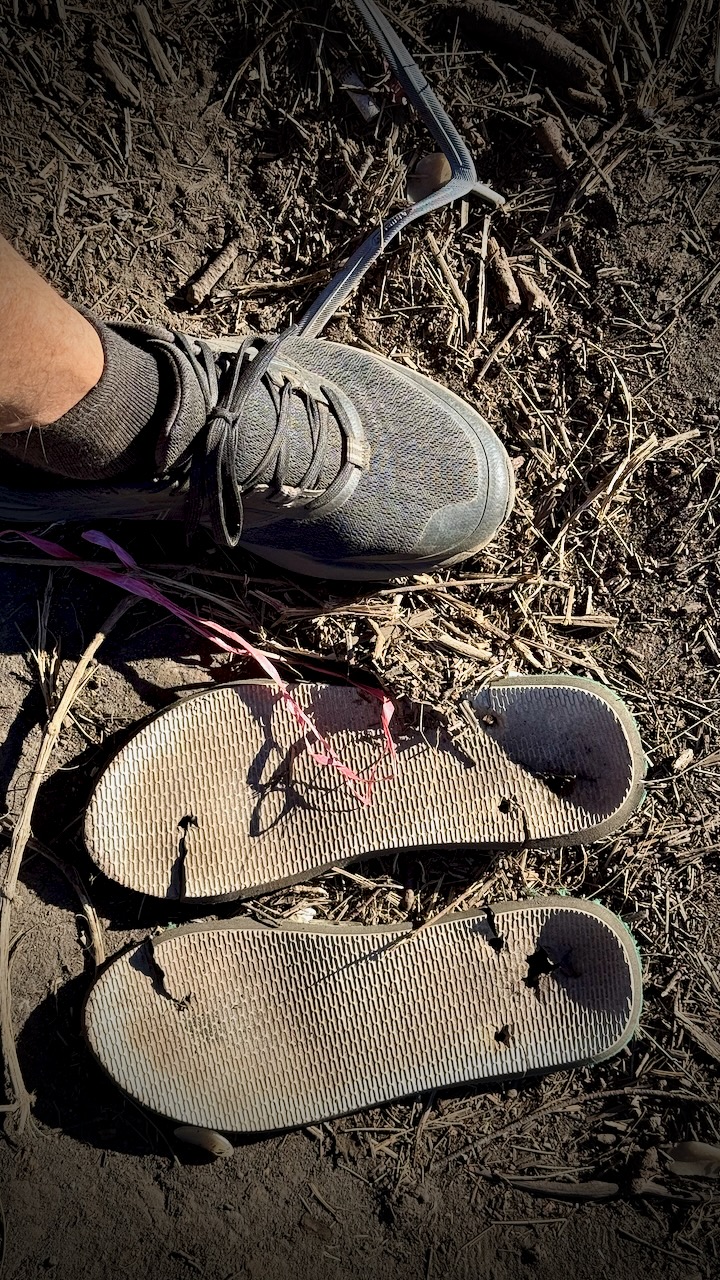
They all wear flipflops. Until they break.
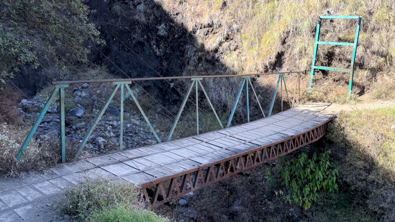
We were headed down, back to civilization.
Somewhat slippery — but overall fairly easy.
We had lunch in a shady forest, monkeys and cows standing by to gobble down what leftovers they could get.
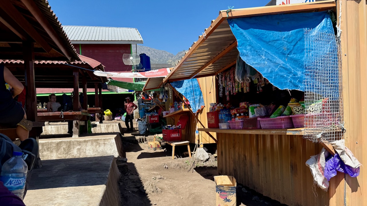
It was a shock to get to the trailhead. Noisy motor cycles.
Perhaps 120 people readying to start.
Those who sign up for 2 days, 1 night begin and end here close to Sembalun village. They miss the lake and hotsprings.
It took about an hour to drive back from Sembalun to our start at Senaru village. We returned rented gear and recovered our luggage left in storage.
TIPS
BEST HIKE is our itinerary (3 days, 2 nights in tent) with an afternoon ascent rather than the crowded, dusty line-up for dawn. Day 1 is long and hard, however.
WAIT for a good weather forecast, if you can
Green Rinjani looked one of the most professional companies at camp, to me. Modern tents. Tables and chairs.
Grippy and comfortable shoes are the most important piece of gear. Wear a size larger than normal so your toes aren’t crushed on the descent.
Protection from sun and wind is important. Sun screen. I brought a sun hoodie.
Porters provide as much water as you can drink.
I fell about 8 times over the 3 days. No injuries as I almost always landed on my backpack.
I didn’t bring trekking poles. And that was a mistake. Our guide gave me one pole for long down climbs.
It’s badly littered.
Sanitation standards are low. No water for washing up. Not even the expected containers of alcohol gel that I’ve had on similar trips around the developing world.
I completely enjoyed Rinjani. It could hardly have gone any better for our group with the afternoon ascent.
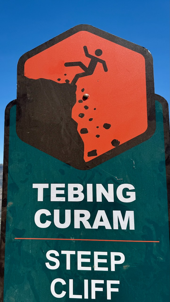
BUT ➙ Bottom line ➙ I can’t recommend this hike. It’s simply too dangerous.
During the July 2018 Lombok earthquake, multiple climbers and guides were killed by landslides triggered on Rinjani’s slopes.
March 2007, seven people died of exposure after illegally scaling the volcano during a ban.
Be sure to have evacuation insurance, just in case.
The scenery in the Dolomites may be just as good. And there are far, far more stunning jagged peaks in Italy than in all of South America.
Seceda – Odle mountains.
Many, many Europeans get out hiking during the Summer. Trails are crowded everywhere throughout the Dolomites and the Alps. There’s a great shared sense of community here.
Instant gratification. You can ride chair lifts up to the very tops of some of these peaks. How convenient is that? Almost anyone can find a best hike for themselves in this range.
WW I history in the Dolomites is sobering. German, Austrian and Italian soldiers were stuck digging tunnels through these mountains through several winters. This was the “Front”. Needless to say, far more young men died from the elements and falls than by fire fights. There are reminders of the Great War everywhere.
Here is the home of via ferrata (Italian for “iron road”). (In fact, our next trip to the Dolomites will be dedicated to doing some of the best of those assisted climbing routes.)
photo by Away On The Road
Not everything is perfect in the Dolomites. We prefer the Sierra Nevada mountains in California, overall.
In the Sierras I can put up a tent anywhere I want. Fantastic.
Unfortunately, in the Dolomites you are required to sleep in alpine buildings called Refuges. (Refugios – Italian). Their locations are stunning. Many people love them. But – personally – I prefer my tent over sleeping on the floor. Or in bunk beds.
Happily you can reach almost any place in the Dolomites by day hike. Public transportation in the valleys below is good!
The two regions – the Sierras and the Dolomites – are similar in that everywhere is a best hike.
I do like the food and drink at Refugios. Prices are regulated.
The main reason I had not hiked in Europe in 30yrs is cost. Italy can be expensive.
It’s possible to hike on the cheap. Putting up my tent in a campground in Cortina only cost 9€ (US$12.80) / night in 2009. Ryan tells us it’s up to 44€ / night summer 2023!
Bread, chocolate, soft cheese and wine are inexpensive. What more do you need?