Click PLAY or watch it on YouTube.
(via Adventure Blog)

Best hikes, treks, tramps in the world.
Click PLAY or watch it on Vimeo.
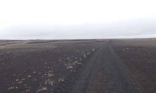
As exciting as that looks, first take a reality check – click over to the Across Iceland Journal Day 5.
(via tywkiwdbi)
In my experience there are few places with less horizontal ground than Rwanda, which truly earns its nickname of “Le Pays de Milles Collines” (the land of a thousand hills). The third-highest of those approximately thousand hills, at 3,711 meters (12,175 feet), is known alternatively as Mt. Visoke or Mt. Bisoke, and is the subject of this trip report. …
My experience in Rwanda was that a guide was always required. For everything. Car safaris, gorilla trekking, even short 2 mile hikes to see some waterfalls in the rainforest. While this goes very much against the independent, take-care-of-yourself-in-the woods attitude of myself and, I would imagine, the majority of the users of this site, there’s really not a lot you can do about it. Embrace it – even if a guide is completely unnecessary, they will certainly have more knowledge about the local plants, animals, and people than you can possibly hope to retain. So ask lots of questions, tip well, and enjoy. …


Summit Post – Hiking in the Virungas – Mt. Bisoke
related – A journalist’s gruelling hike to the summit of mighty Mount Bisoke (2015)
Veteran climbing guide Dave Adlard led some new mountaineers on a climb of Mt Adams, Washington.
Thousands climb it every year.


The weather went bad.
“If you haven’t figured it out already we’re not going up. We need to get the hell off this mountain alive.” as our guide and friend, David Adlard, said to us at six in morning.
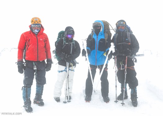
Read the entertaining trip report on Mtn Talk – Mt. Adams: Get Down Alive
GearJunkie:
The Greater Patagonian Trail (GPT) is 1,300 miles long and counting. It is a growing network of backroads and rutted trails stitched together to form an enormous route across South America, and almost nobody knows about it.
That’s because it’s been built quietly, the entire route put together by one couple who hope to share a love of hiking with the world.
At 1,300 Miles, Remote ‘GPT’ Is Longest Trail In South America
I met Swiss-German hiker and explorer Jan Dudeck and his Chilean wife Meylin Ubilla last January. And hope to get back to Patagonia again in 2017.

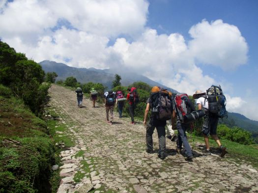
trip report by site editor Rick McCharles
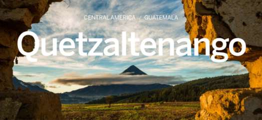
The best hike in the country. One of the best in central America. In fact, this is the highest point in central America at 4,220m (13,850 ft).
Click PLAY or watch a promo video on YouTube.
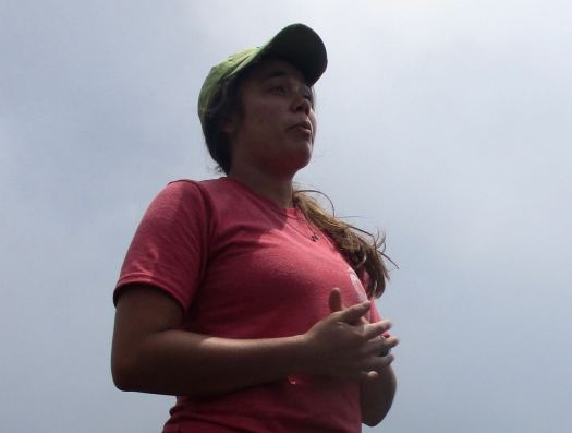
I was up at 3:30am to check out of my hostel in Xela and walk over to Quetzaltrekkers through dark streets.
4:45am rendezvous. Our group of 10 included two guides, hikers from Canada, the States, England, Switzerland and Germany.

At 5:15am we climbed into a pick-up to get to the hectic Minerva bus depot. We were first to get seats on the chicken bus.

Arriving about 7:30am, we ate a good breakfast at a San Marcos bus station comedor.

Next was an even more crowded bus to Tuichan. By around 10:00am we started up.
Quetzaltrekkers have no employees. Everyone is a volunteer.

All proceeds go to a children’s charity.
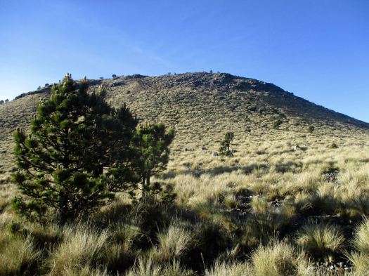
Being a volcano, I feared it would be an unrelenting slog at the same angle. Happily there is a fair bit of variation in the trail – though it is unrelentingly UP.

A highlight are the Hartweg’s pine, a very high altitude species


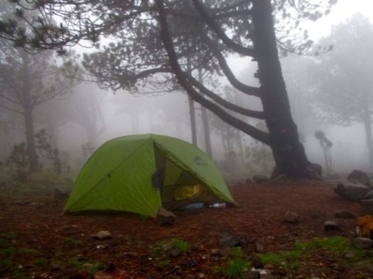
Spooky in the clouds.

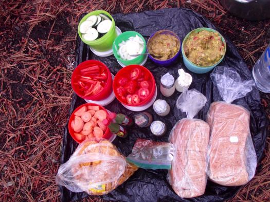
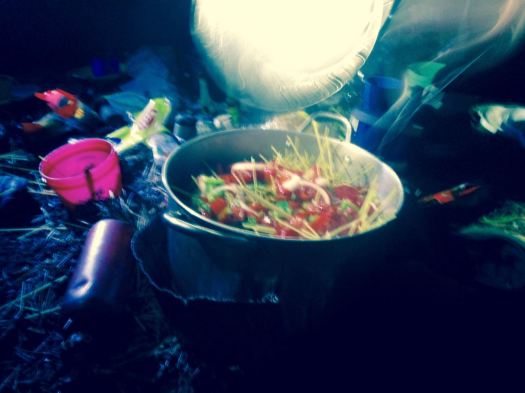
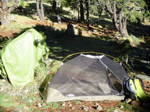
Finally arriving at “base camp” after 4-5 hours, we enjoyed a healthy lunch of local fare.
That was 1000m elevation gain over 4km. Sleeping at about 4000m (13100ft), there’s a real risk of altitude sickness.
Everyone slept in provided 4 person tents aside from Jordan (who slept in a hammock) and myself who brought my own gear.
We all crashed for siesta, knowing we wouldn’t get much sleep tonight.
We’d planned to climb up to Tajumulco’s second summit, Cerro Concepcion, for sunset. But afternoon rains had come. We stayed in our tents.
By 6:30pm the rain had stopped. We had dinner and hot drinks, hoping the morning would be clear. This was the second trip for one girl – her first summit clouded over.
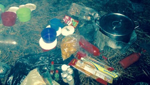
A brazen mouse ran around the cook area.
___ My alarm went off at 3:30am. I’d not slept particularly well.
Though we had clear skies and near a full moon, it was dark. My borrowed headlamp died quickly. I followed the lead guide closely to take advantage of her lamp.
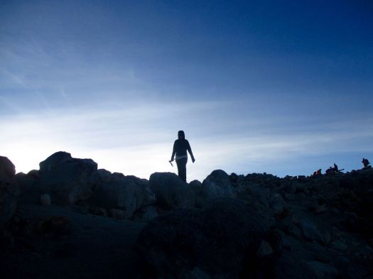
The final 200m is a scramble. Gloves are useful for grabbing stone in the dark.
It went well. All 10 of us at the top before dawn. We huddled in our sleeping bags.
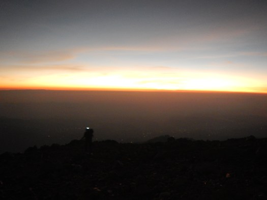
Dawn at 5:30am was gorgeous.


Everyone – at this point – was super happy they had joined the trip.

We stayed on top as long as we could handle the cold wind.
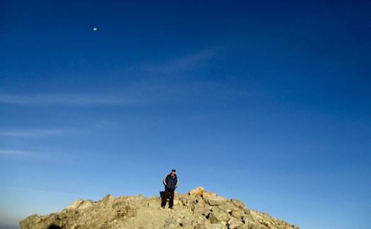
There are views to Mexico. And many other volcanos.

This is volcano shadow.

We descended by a different route, first circumambulating the crater.


Quickly into grassland, we started to get hungry.

The water was boiling for breakfast by the time we got back to camp.

This very popular hike is – sadly – quite littered and vandalized. Instead of leaving my Summit Stone at the summit, I left it in one of the excellent climbing trees at camp. 🙂

No rush. We dried the tents, the sun already very hot at 8am.
I was impressed with the toilets provided. Happily there are very few insects this high up.

The descent was relaxed. Our climb already a success.
It’s slippery, however. We had numerous falls on the way down. This could be treacherous in the rain.
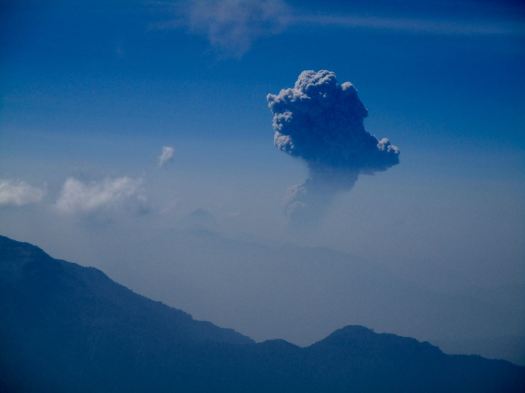
One highlight was seeing the eruption of another volcano – Santiaguito. It’s a near daily occurrence. In fact I’d climbed up another volcano, Santa María, to see that eruption on another hike, 10 years earlier.

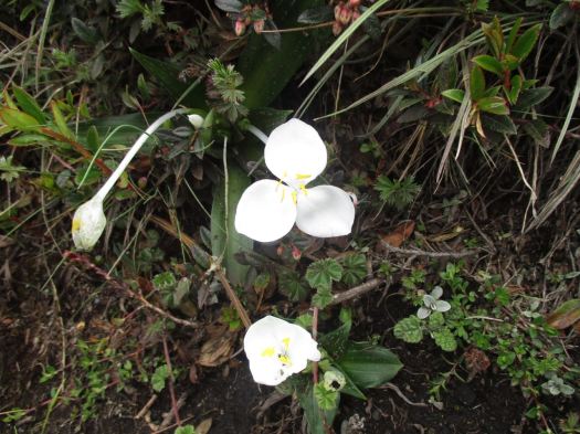
The National flower of Guatemala, Lycaste skinneri, are everywhere. Another highlight.
About Noon we got back to the road. The peak was already clouding up. No doubt it would rain again late afternoon.

We were hungry again for a big lunch at this village restaurant. Most had the fried chicken. And Gallo beer.


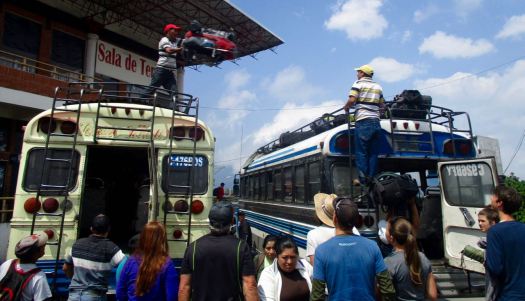
We reversed our route. First a bus back to San Marcos. Our driver parked close to our next so they could throw our packs roof-to-roof. (I’d never seen this before.)
In Xela we again climbed into a pick-up truck to return to Quetzaltrekkers by about 4:30pm

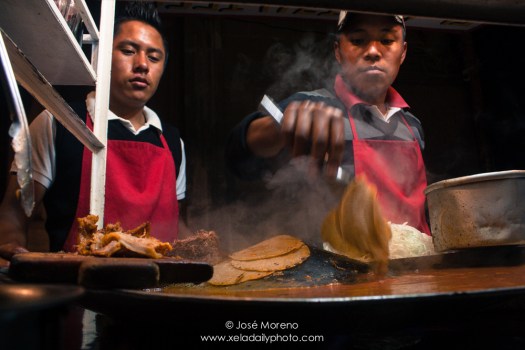
A shower. Some rest. To celebrate some of us got together for street tacos and cheap beer at the Plaza Central.
Tajumulco is highly recommended, so long as you have clear skies in the morning. You can do it on your own, but finding all right buses may be a hassle.
We’ve added this adventure to our list of best hikes in North America.
![]()
See all my full resolution photos on flickr.
by site editor Rick McCharles
I should have a few days hiking out of Quetzaltenango (Xela) May 22-26, 2016.
Leave a comment if you’ve any advice for me on that.
I was there once before in 2006 and am keen to return for more.
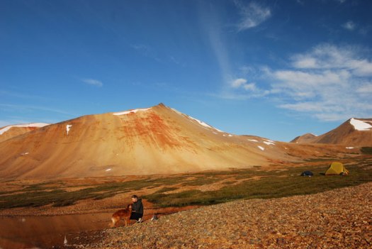
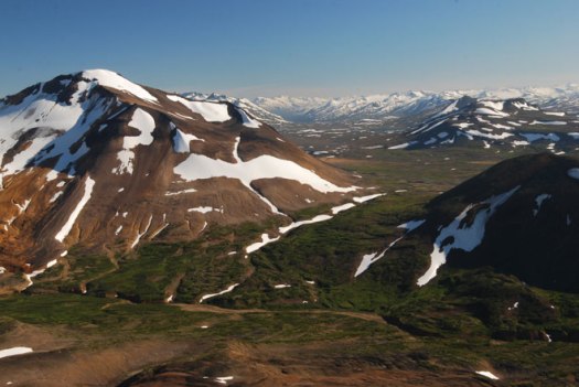
This is a relatively unknown trek in British Columbia, maybe receiving around 30 visitors each season.
Every day of the trek is different from the other, passing through mountain valleys of incredible orange and red mineralizations to volcanic plateaus littered with cinder cones and fine sandy pumice.
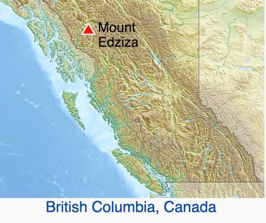
Mt. Edziza and the Spectrum range are located in the Mt. Edziza Provincial Park in the Tahltan First Nation territory of northern British Columbia, 35 km. west (by air) of Highway 37 at Tatogga Lake. From the air, you can see where the lava poured across the plateau and down through the trees to the lakes and creeks below. Normally, trekkers undertake one section at a time – either a 5-day trip along the Edziza plateau or a 5-day trip through the Spectrum range. For either one of these 5-day treks, most people fly out from Mowdade lake which is roughly the dividing line between the Edziza and Spectrum regions.
Trekking Partners – One of the most beautiful treks in BC
From the Vancouver airport you might be able to drive to Telegraph Creek, BC in 24 hours. This adventure truly is remote.
… Bisected by the equator and set between Peninsular Malaysia and the Philippines, Borneo is the third-largest island on Earth. Three countries share this landmass — Indonesia, Brunei and Malaysia …
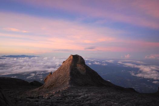
I’ve joined a G Adventures group for their 10-day Borneo-Sabah Adventure. With wildlife-seeking along the Kinabatagan River, a visit to an orang-utan preserve and touring Turtle Islands National Park on the horizon (see sidebar), I’m now primed for the premier alpine hike in this storied region of Asia — a setting that’s still very much a frontier, yet on the cusp of tourism greatness. …
Kinabalu is climbed in two legs — the first is a 1,270-vertical-metre ascent to Laban Rata, a guesthouse at 3,270 metres …
Explore – Travel: Climbing Malaysian Borneo’s Mount Kinabalu
related:
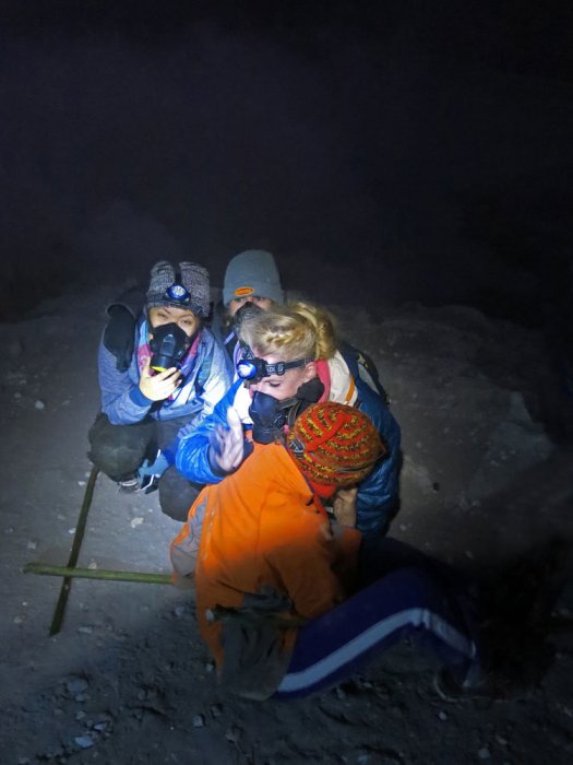
We’ve added Kawah Ijen Volcano, East Java, Indonesia to our list of best hikes in Asia.
The place is dangerous, however.
Click PLAY or watch it on YouTube.
If that doesn’t turn you off, check the THE COMPLETE GUIDE TO HIKE IJEN CRATER (KAWAH IJEN). It’s closes to Bali.