GR20 Trek Corsica – day 7

trip report by besthike editor Rick McCharles

» day 1 | day 2 | day 3 | cirque | day 4 | day 5 | day 6 | day 7 | advice |

Saturday, July 2nd, 2011

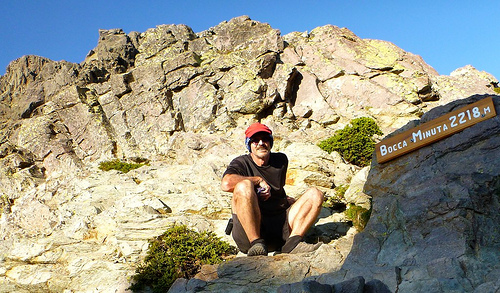
I was up early, following the rush of hikers up the mountain.

By now the 670m (2200ft) climb before breakfast was ho hum. It felt quite easy.

There’s no water (aside from snow) so everyone had bottles maxed out.
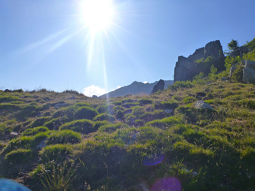
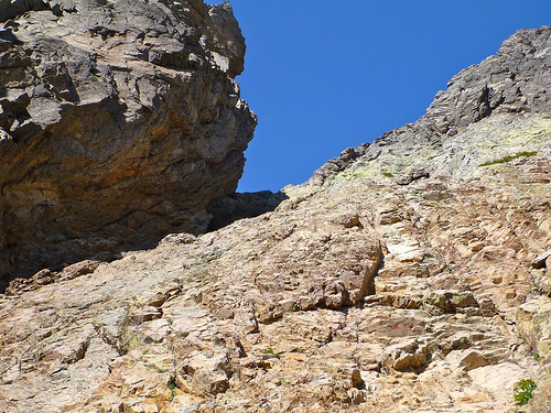
Simple. Follow the ridge. Scramble the peak on the left.

From here it’s only another 300m and some tricky scrambling to get to the summit of Monte d’Oro. On this perfect day, nobody opted for the lower (easier) route.
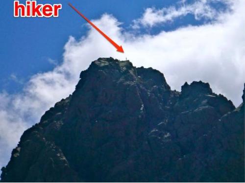
Soon I was caching a Summit Stone.

And enjoying the big view from 2389m.

All I talked to agreed the ascent was surprisingly easy that day. All dreaded the 1469m (4800ft) descent to the train station at Vizzavona.

I managed to find the steeper, shorter route. Knees and ankles feeling strong, it was not all that bad. My motivation was high knowing that I was going to finish today.

A couple of glisadding sections saved time. That’s the famed pyramid of d’Oro directly behind.

Arriving back in civilization, I joined fellow trekkers for an overpriced glass of wine in a restaurant. They had checked in to a hotel for one night, a splurge before continuing south on the GR20.

I, instead, tried to wash up at the (crappy) campsite.

And caught the next train to Ajaccio, birthplace of Napoleon.
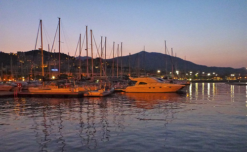
By luck a ferry was leaving that night to return me to Nice, France. I enjoyed the nightlife (VIDEO), had a few too many Gelato cones and got on the boat. …

See more annotated photos from day 7.

Tomorrow I’ll post a wrap-up of the GR20 with advice for anyone who wants to test themselves on the “toughest hike in Western Europe”.
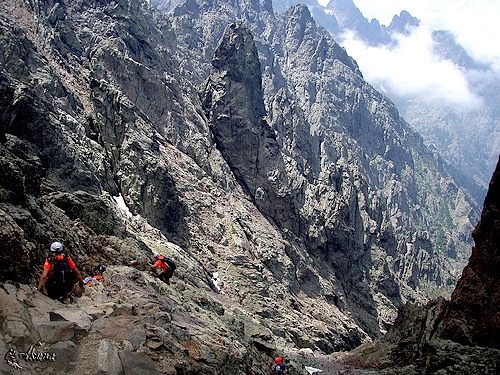
solo in the Cirque of Solitude

by Rick McCharles, editor of besthike.com

» day 1 | day 2 | day 3 | cirque | day 4 | day 5 | day 6 | day 7 | advice |

The Cirque de la Solitude is the crux of the GR20, one of the best and toughest hikes in the world.

Certainly it was the toughest trek of my life.

Tom Fordyce in The Guardian:

… The Cirque de la Solitude is the most notorious single section of the entire GR20. People are so scared of it that they huddle in petrified groups the night before, exchanging horror stories …

The Cirque turns out to be both gorgeous and terrifying at the same time. After 800m of rope-free climbing up, there’s 300m of straight down – straight down as in sheer rock-face, without even any pretense of a path. As a sop to the cowardly, there are some old chains bracketed into the smooth granite. … there’s nothing but the occasional spiky outcrop between you and the valley floor 1,200m below. …

Europe’s toughest trek: Corsica’s GR20

See more Cirque photos on Flickr.

Yet the feared Cirque of Solitude turned out to be the highlight of my GR20.

Tuesday, June 28th, 2011

I arrived late afternoon, the last 3 hikers (rock climbers) of the day having just finished crossing from the opposite direction. Each warned me of the seriousness of the traverse … in multiple languages.

Finally, alone, I dropped into the chasm.

descending into the Cirque

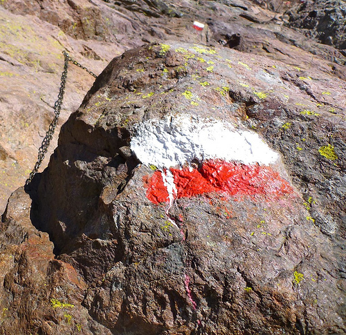
Chain assistance is essential when the rock is wet.

chains

In perfect conditions, I didn’t need them.

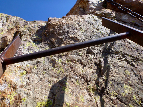
But I did need this on the ascent of the far side cliff, a steel ladder.

ladder

Moving slowly, carefully, I took about 2hrs to make the crossing, arriving at the far side just in time to ‘turn out the lights’.

author survives

Relieved to have achieved and survived, I was even more elated to have done it solitary.

Hikers joke about the name — Cirque of Solitude — as there is normally a log jam of folks bottle-necked at critical points. The main risk, in fact, is rock fall from someone above your fall line.

_____

This VIDEO gives a better idea of the challenge. Or this VIDEO (1min 30sec), in bad weather.

_____

Want to start planning your trek to Corsica?

Best Guidebooks in English:

• Trailblazer Corsica Trekking GR20 by David Abram (2008)
• Cicerone GR20: Corsica: The High-level route by Paddy Dillon (2010)

Sierra Crest Route, California

Ben Egan sends a link to an Adventure I’ve not heard of before. It parallels these two great hikes:

• John Muir Trail, 211 miles (340 km), our #2 hike in the world.

• Sierra High Route, 195 miles (314 km), is similar, but higher and harder.

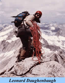
Now check out the Sierra Crest Route as documented by Leonard Daughenbaugh.

If the John Muir Trail is for the masses, Roper’s Sierra High Route is more of a mountaineer’s journey. Your Sierra Crest Route takes it to the next level.

—Bob Rockwell, Author and Sierra Mountaineer

I was definitely impressed with the concept and the research.

—Steve Roper, Author and Sierra Mountaineer

read more

The goal is to stay within a mile of the actual Sierra Crest, most often within a half mile.

Be clear. The SCR is not a “hike”:

Leonard Daughenbaugh:

Since the Crest Route is designed to be a mountaineering rather than a rock climbing route, the last requirement is that there be no individual move on the route that is technically more difficult than class 3.

Based on my evaluations, and, where available, ratings in various climbing and mountaineering guidebooks, all moves on the Route meet this requirement. There are, however, two crossings, “Jones Pass” and “Jones Traverse,” that, because of their exposure and route finding difficulties, travelers might feel are more difficult than class 3. …

Sounds great. But the Sierra High Route already is difficult enough for me.

If you are interested, the only place to get more information is SierraCrestRoute.org.

Castle Rock Trail, California

trip report by site editor Rick McCharles

After finishing the Cougar Crest Trail, California, I decided to hang around Big Bear.

On the advice of a couple of PCT thru hikers, I checked into the hostel. Sarge greeted me warmly, wondering if I qualified for special PCT hiker rates.

I told him, “Not until next year.”

After checking in I headed for the other essential local hike, Castle Rock.

Distance: 1.5 miles round trip
Elevation Gain: 700 ft

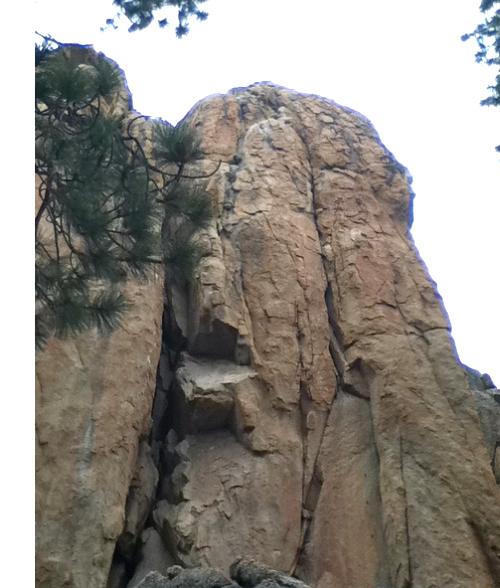
You’ve got to find a way to get up there:

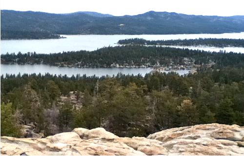
If you only have one hour to spend in Big Bear, this is the trail for you. It is actually less than 1.5 miles, but you may want to explore around the area just a bit. You get inspiringly incredible views of Big Bear Lake from the vantage point on top of Castle Rock.

The climb isn’t for the faint of heart though, and acrophobics should steer clear. The trail itself is very steep, and you gain 600′ in about half a mile. However, it is so short, it can’t be called anything but easy. To get to the top, you must scramble, and there isn’t an “easy” route up …

Local Hikes

Here’s the vista from the top.

more photos

… It snowed that night and next morning. Some sort of record cold spell for May 17th.

I enjoyed Castle Rock more than Cougar Crest. The final scramble is FUN.

Half Dome sells out in 23min

Yosemite, California.

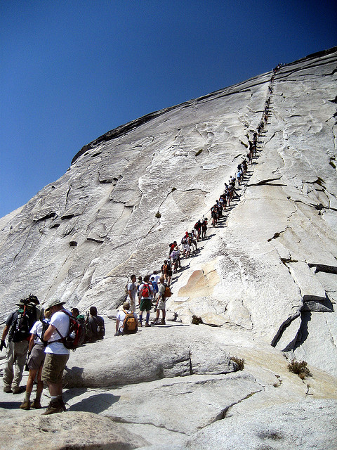
If you were planning on climbing Half Dome this summer, you’ll have to wait until the next batch of permits (for July climbs) become available on April 1. This year, permits for climbing Half Dome are required on ALL days, not just weekends and holidays like last summer.

The first round of permits (for May and June climbs) went on sale on March 1 and sold out in twenty-three minutes. And that was just the permits for weekdays. Saturday and Sunday permits sold out in only ten minutes. …

Daily Hiker

original photo on flickr

surviving a 1,000ft fall

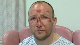
A climber who fell 1,000ft (305m) down a mountain and survived was found by his rescuers standing up reading a map.

Adam Potter, 36, lost his footing at the summit of Sgurr Choinnich Mor near Ben Nevis and plummeted down the near-vertical eastern slope.

Lt Tim Barker, from the helicopter rescue crew, said: “It seemed impossible… he must have literally glanced off the outcrops as he fell.” …

read more – BBC – Climber found reading map after 1,000ft fall

hike Kachina Peak, New Mexico

Claire recommends this adventure.

Summitpost:

Kachina Peak is a picturesque mountain located in the Wheeler Wilderness Area of the Sangre de Cristo Range. It is best known as the summit of Taos Ski Valley.

This peak is most often climbed during ski season when powder seekers can hike from the top of lift # 5 via Highline Ridge.

This peak is not crowded during hiking season due to it’s close proximity to Wheeler Peak. The ski area makes Kachina Peak easily accessible, but above timberline this mountain becomes quite challenging. The route along the ski area boundary is class 3+ climbing to the summit. …

Lake Fork Peak (left) and Kachina Peak (right) from Bull of the Woods Trail Oct, 2004 - vinnypapa

See a gallery of summer hiking photos.

#4 best hiking town is …

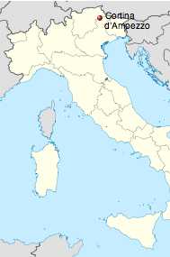
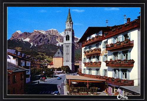
Cortina, Italy

You can see weird and wild limestone spires right from town. Convenient, efficient public transport makes for easy access to trails for hikers of all levels of ability.

Cortina d’Ampezzo (German: Hayden) is a town and commune in the southern (Dolomitic) Alps …

The city center is located at an altitude of 1,224 m …

Cortina is situated more or less to the center of the Ampezzana valley, encircled nearly completely on four sides by the high Dolomites. …

Population (2008) was 6150.

Shop at La Cooperativa di Cortina for gear and trekking food.

More interesting photos tagged Cortina.

La Baita

Our favourite hike hikes in the Dolomites, to mention just a few, are:

• Bocca di Brenta to Molvena
• Over the Nuvolau
• Sciliar through the Catinaccio
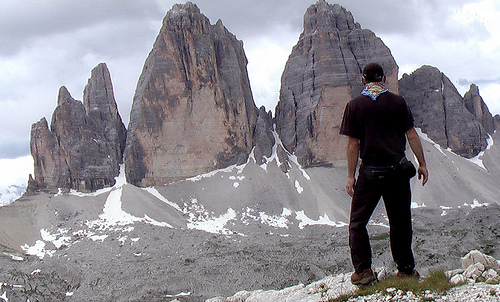
• Tre Cime di Lavaredo Circuit

Check our Dolomites information page.

besthike editor Rick McCharles - Tre Cime

Best months for hiking are mid-June to early October.

Start on our Dolomites information page.

scrambling Kelsey Peak, Utah

A new blog, HIKING SALT LAKE, has a great, modern look and feel.

The editor, Jonathan Wood, got lost in the Oquirrh Mountains, quite an ordeal.

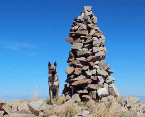
Three weeks later he returned to the same area, to prove he’s up to the big scrambles in that area. The only one he could convince to come along was his dog, Suki.

I planned to do a few things different from last time. First, I would hit a different peak, Kelsey Peak, which is right next to the one I hit before but maybe a hundred feet higher (it’s one of the highest peaks in the Oquirrh Mountains). Second, I would park closer the trail so I didn’t waste time walking before starting the climb. And, third, I wasn’t going to get lost! …

to see if he and Suki made it down, read on … Kelsey Peak, Butterfield Canyon

another death on Longs Peak

When I scrambled the 15th highest mountain in Colorado in August, I was surprised at how DANGEROUS it is:

… It gets hairy, quickly. Exposure. Potential rockfall. … Many have been killed on this mountain.
I slipped badly on black ice here, the rock still frozen. …

In fact, I slipped badly just past the Keyhole. (The sun had not reached the other side.)

climbing Longs Peak, Rocky Mtn National Park

According to the National Park Service:

A hiker along the Keyhole Route of Longs Peak has been killed in a fall of about 300 feet …

The was at least the third fatality on Longs Peak this summer, and the second that occurred near the Keyhole …

National Parks Traveler