BUT climbing one of the many alternatives might be better and far less expensive.
Eibhlis Gale-Coleman lays out some of the options:
Mount Kenya
Mount Meru, Tanzania
Mount Ololokwe, Kenya
Mount Ras Dashen, Ethiopia
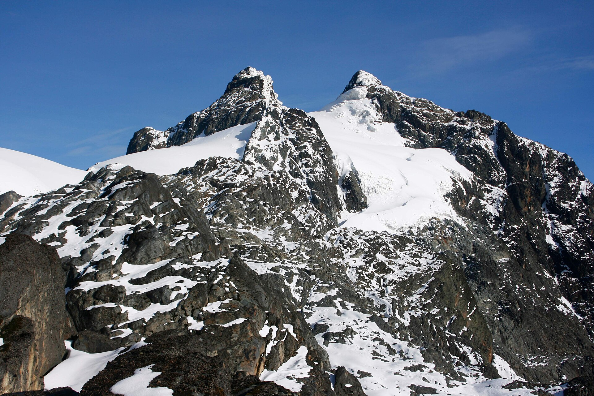
Mount Ngaliema (Mount Stanley), Uganda
Oldoinyo Lesatima (Mount Satima), Kenya
Mount Ngaliema is no mean feat. Perched in the Rwenzori Mountains National Park, it stands at 16,761 feet (5,109 meters), and is the third-highest peak in Africa. The terrain begins in rainforest and ends with a glacier traverse that necessitates crampons: Arrive expecting a pole-assisted trudge, and you’ll be overwhelmed. …
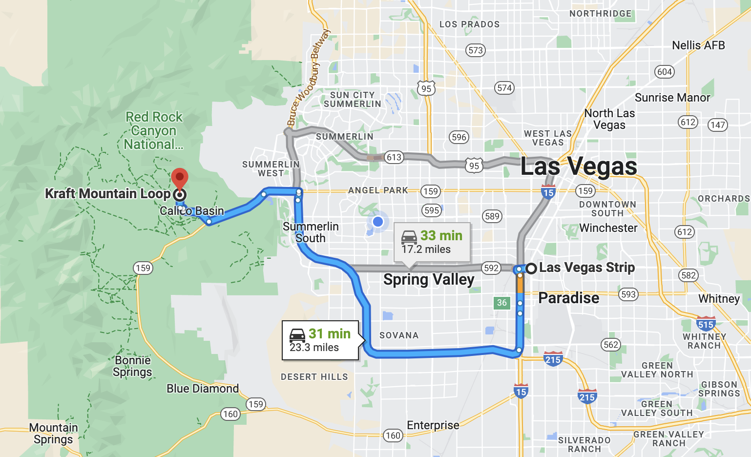
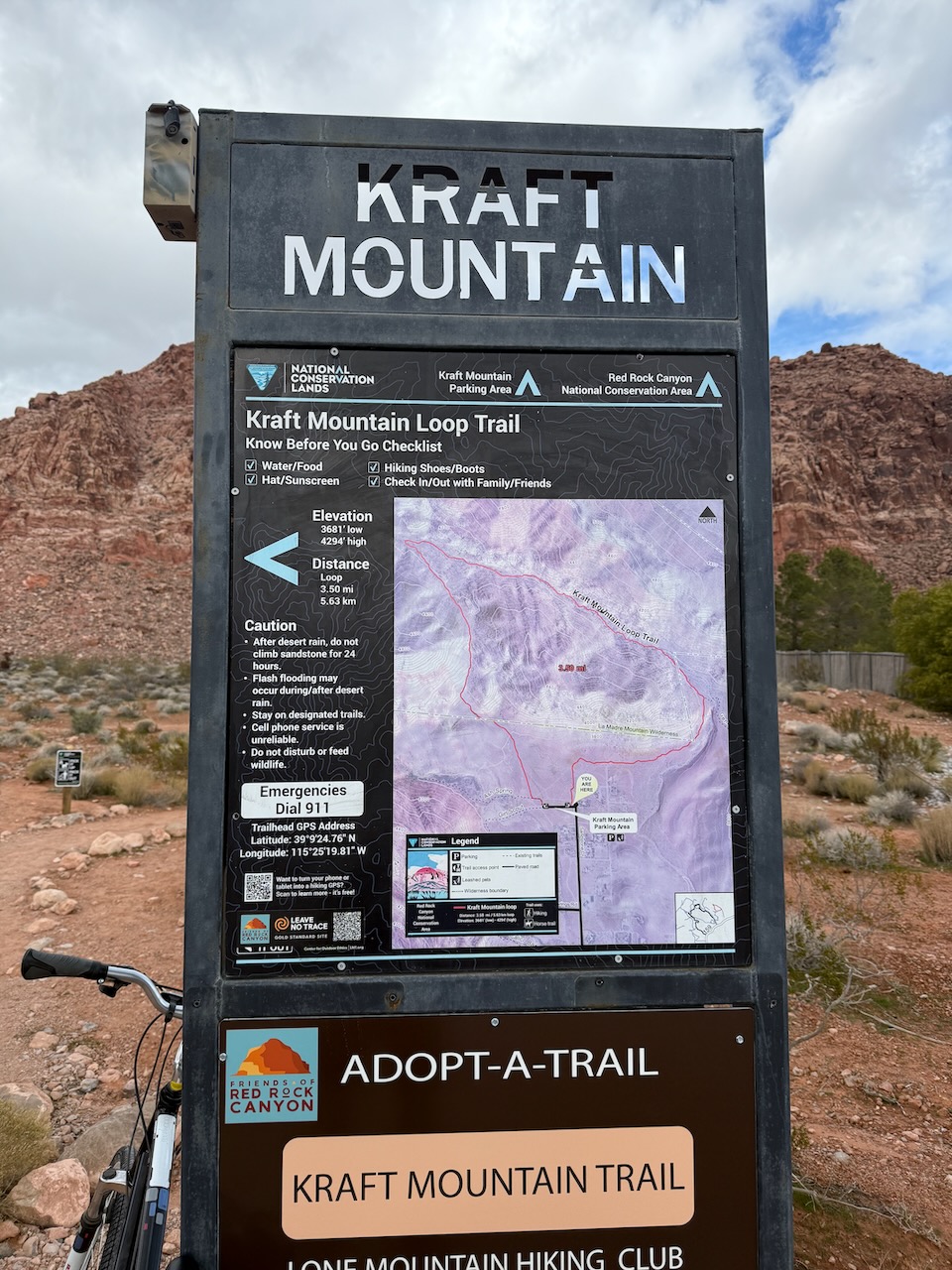
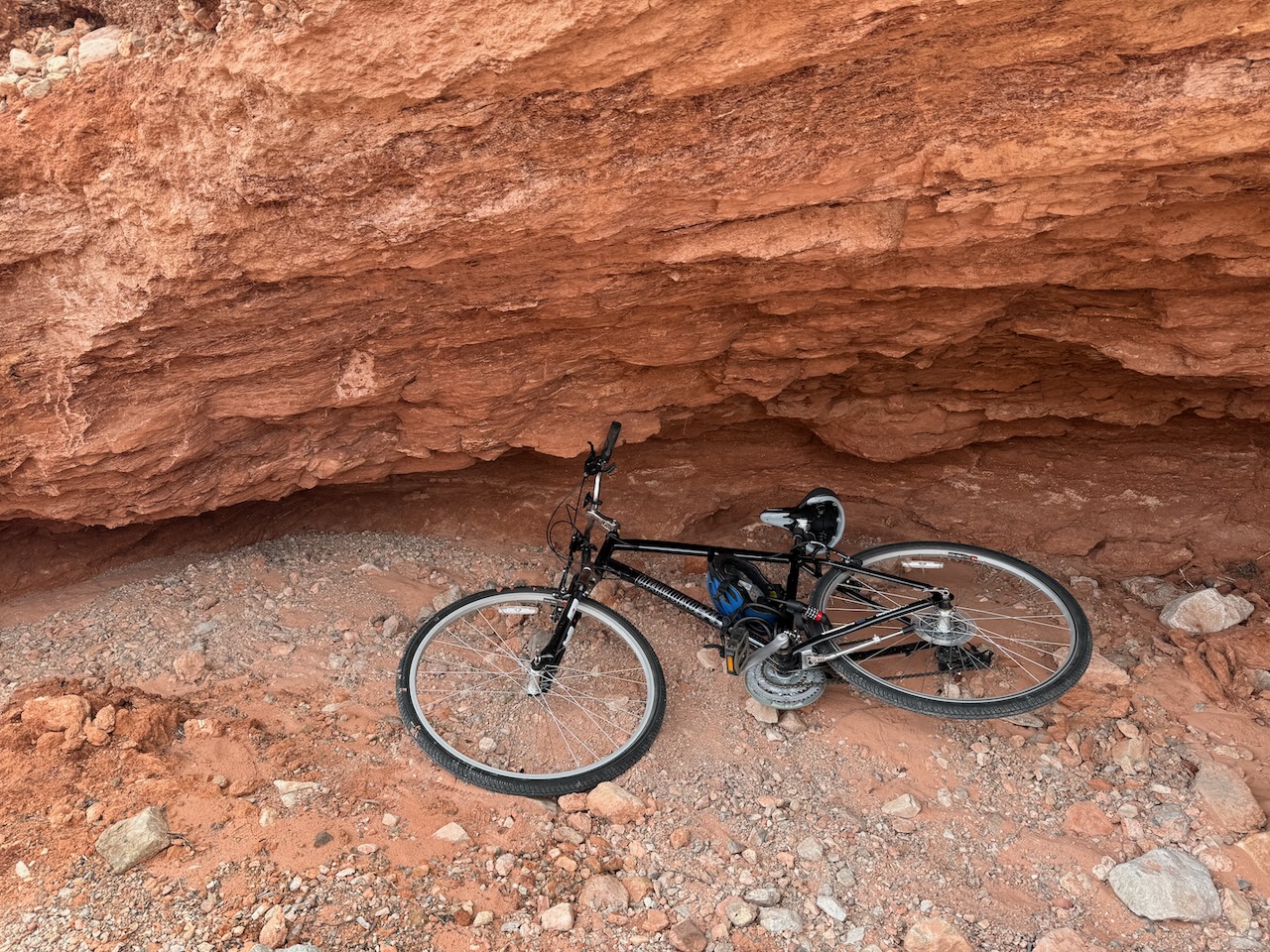
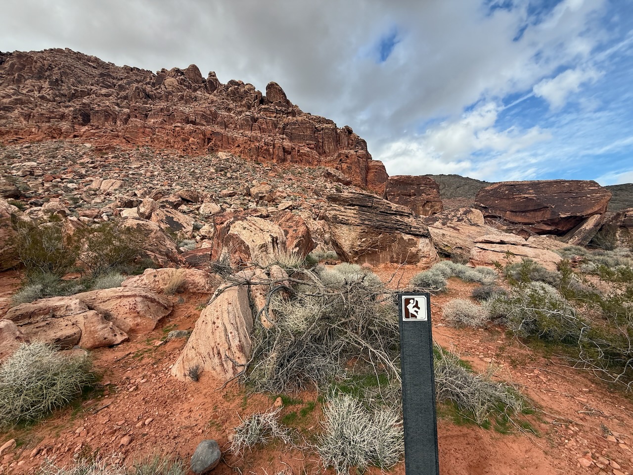
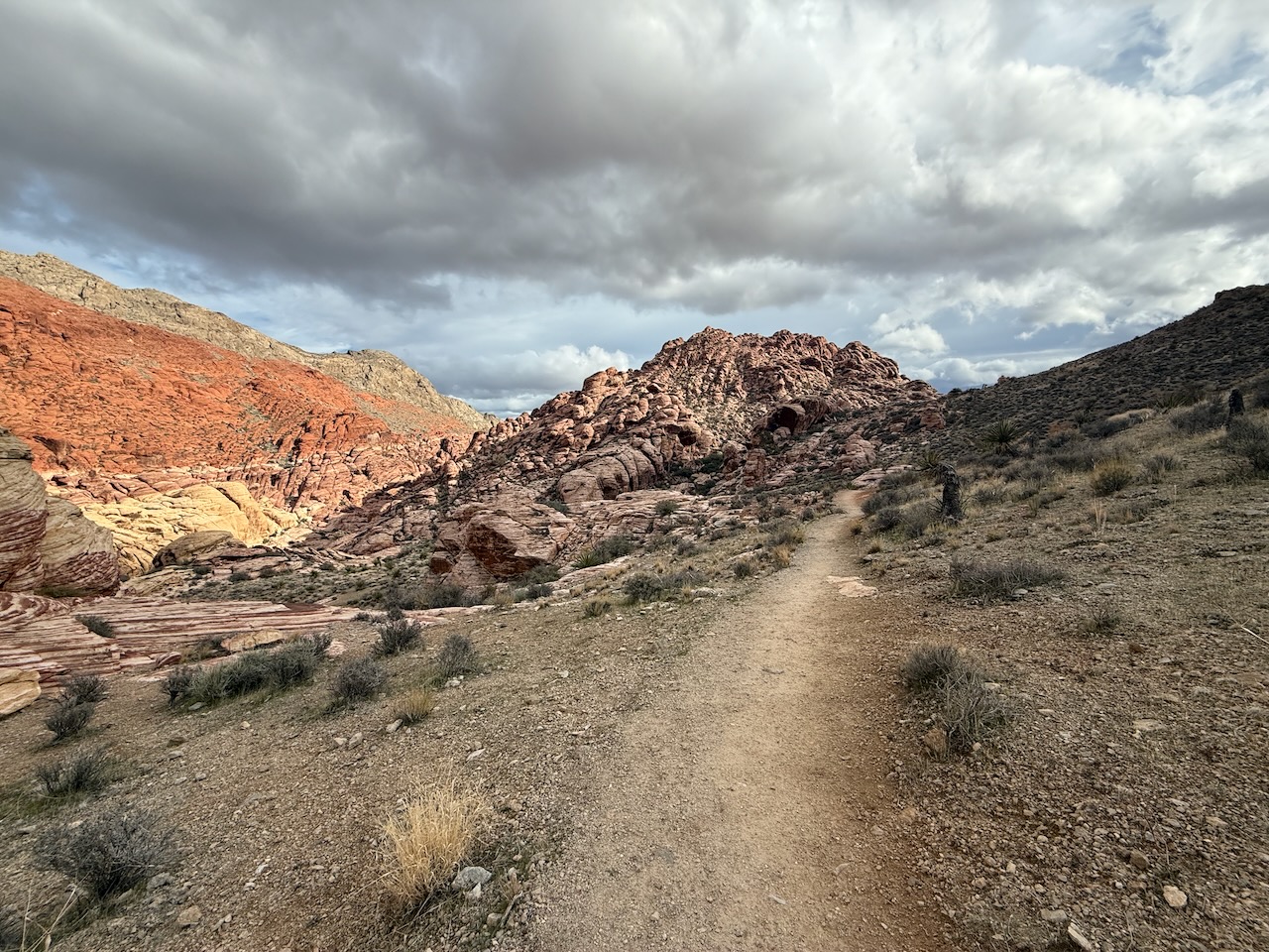
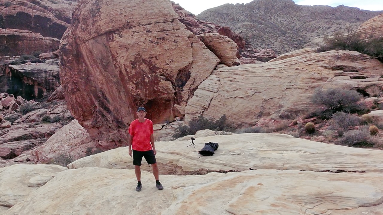
Some call it the ‘best free hike out of Las Vegas‘. I’d agree.
No need to pay entry to Red Rock Canyon, this adventure is right next door ➙ out of Calico Basin. Free entry. Free parking.
On a cool day in April, I did the the 6.9 km (4.2 mi) Kraft Mountain & Calico Hills Loop. With side trips and additional scrambles, it was longer for me.
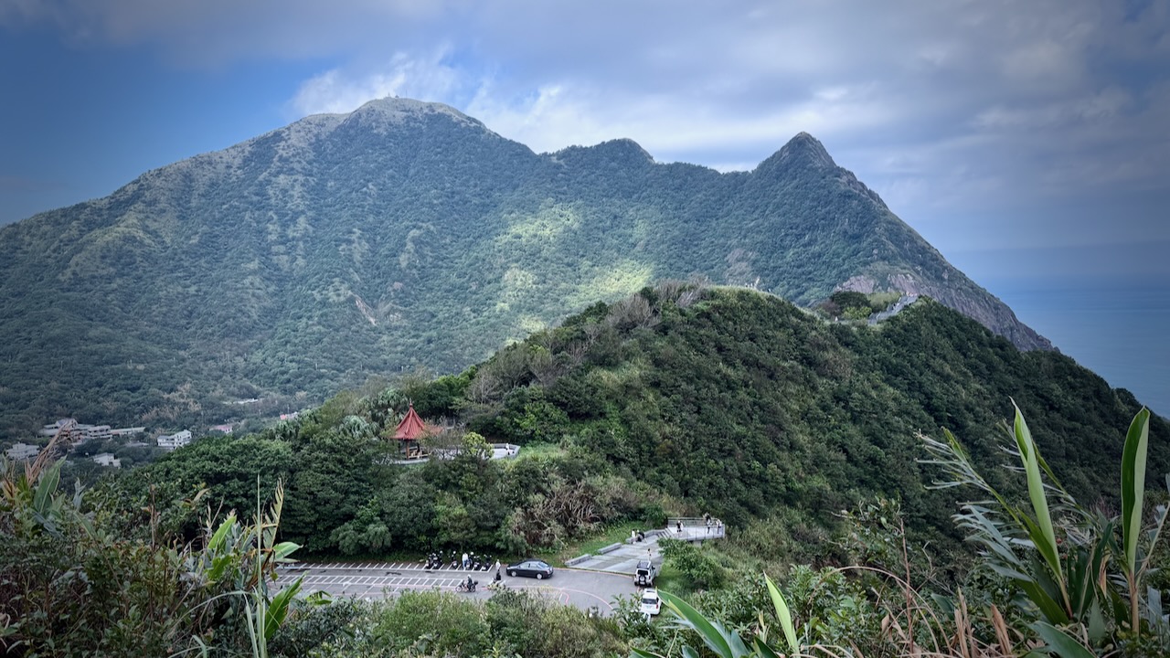
I’d heard good things about this short day hike —Teapot Mountain Trail — a final approach to the summit needing a fun scramble through a narrow passage in the teapot-shaped rock.
The hike begins with a steady ascent up a well-maintained stone staircase. With every step, breathtaking views of the Ocean and the rugged northern coastline improve. The path winds up the green, rolling hills that characterize this scenic area.
Click PLAY or watch it on YouTube. You can see the scramble. It’s short, not difficult, BUT very narrow. I had to take off my day pack.
3.2km out and back (though you can descend on different trails and extend the hike)
283m elevation gain, mostly on good stone steps
slippery coming down in the rain. GOOD SHOES needed.
some road walking, depending on route
easy access by local bus from Jiufen, a super popular tourist trap.
There are a number of tunnels still open for exploration.
Screenshot
Up and down there are many rest stations, shrines, and temples.
John Marvin Raganas had the trail almost to himself. (It was crowded to the point of being dangerous when I was there. I spent as little time on the summit as possible.)
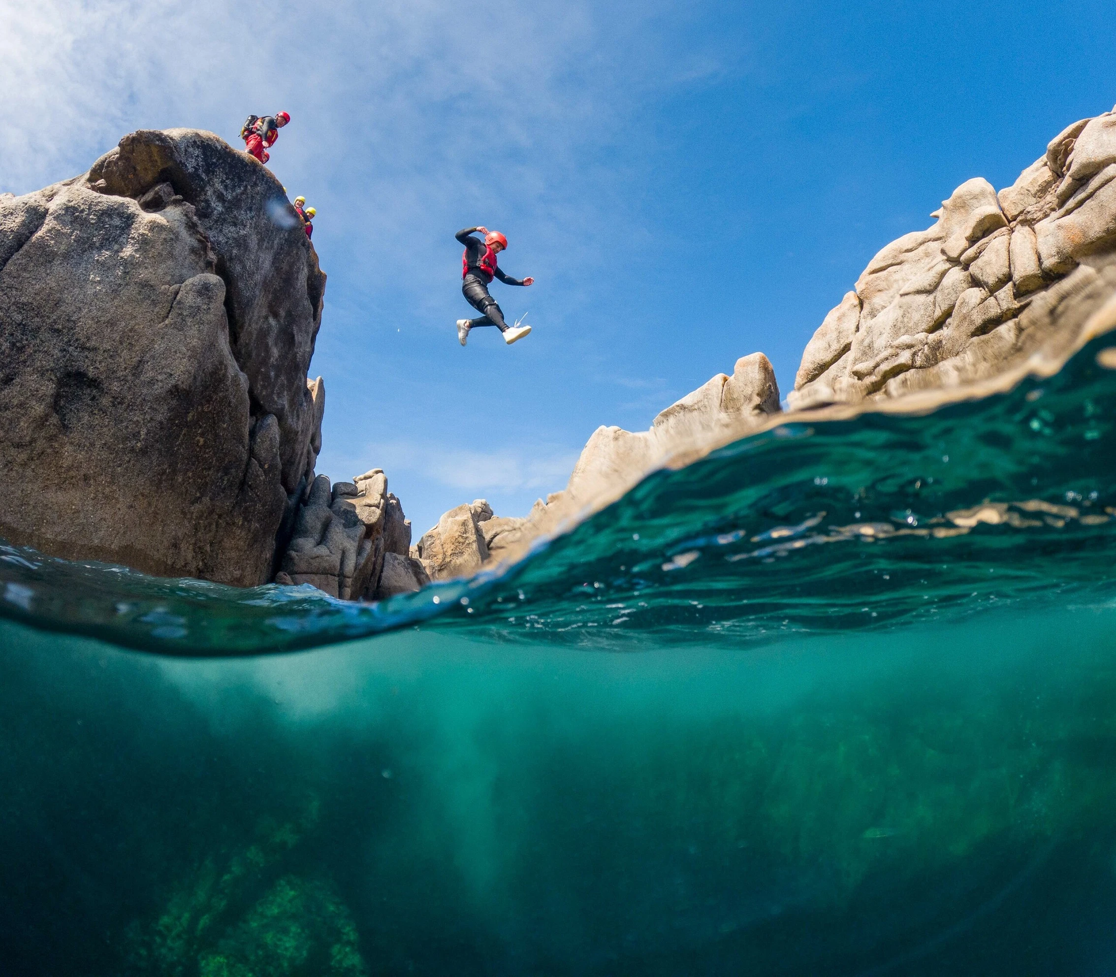
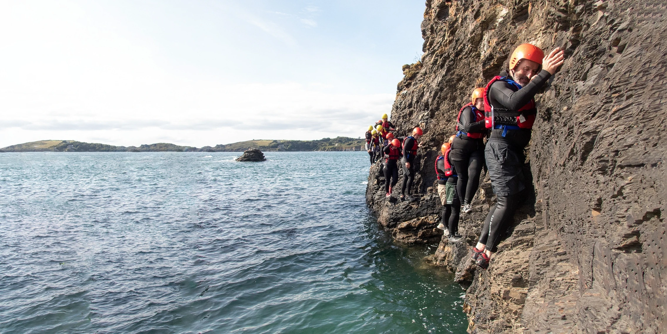
Coasteering is movement along the intertidal zone of a rocky coastline on foot or by swimming, without the aid of boats, surf boards or other craft.
Coasteering allows a person to move in the “impact zone” between a body of water and the coast where waves, tides, wind, rocks, cliffs, gullies, and caves come together.
The term was first used by Edward C Pyatt as the combination of the words “mountaineering” and “coast” and was adopted by Andy Middleton in Wales in 1985, who then made it a business idea. …
The rocky cliff coasts of western Britain provide the world’s principal location for organised guided coasteering, where it is available from over 100 activity centres. …
Coasteering may be included as one of the disciplines for a stage of an adventure race. …
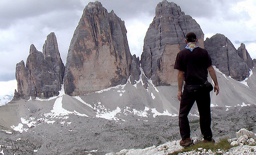
You can see weird and wild limestone spires right from town. Convenient, efficient public transport makes for easy access to trails for hikers of all levels of ability.
The scenery in the Dolomites may be just as good. And there are far, far more stunning jagged peaks in Italy than in all of South America.
Seceda – Odle mountains.
Many, many Europeans get out hiking during the Summer. Trails are crowded everywhere throughout the Dolomites and the Alps. There’s a great shared sense of community here.
Instant gratification. You can ride chair lifts up to the very tops of some of these peaks. How convenient is that? Almost anyone can find a best hike for themselves in this range.
WW I history in the Dolomites is sobering. German, Austrian and Italian soldiers were stuck digging tunnels through these mountains through several winters. This was the “Front”. Needless to say, far more young men died from the elements and falls than by fire fights. There are reminders of the Great War everywhere.
Here is the home of via ferrata (Italian for “iron road”). (In fact, our next trip to the Dolomites will be dedicated to doing some of the best of those assisted climbing routes.)
photo by Away On The Road
Not everything is perfect in the Dolomites. We prefer the Sierra Nevada mountains in California, overall.
In the Sierras I can put up a tent anywhere I want. Fantastic.
Unfortunately, in the Dolomites you are required to sleep in alpine buildings called Refuges. (Refugios – Italian). Their locations are stunning. Many people love them. But – personally – I prefer my tent over sleeping on the floor. Or in bunk beds.
Happily you can reach almost any place in the Dolomites by day hike. Public transportation in the valleys below is good!
The two regions – the Sierras and the Dolomites – are similar in that everywhere is a best hike.
I do like the food and drink at Refugios. Prices are regulated.
The main reason I had not hiked in Europe in 30yrs is cost. Italy can be expensive.
It’s possible to hike on the cheap. Putting up my tent in a campground in Cortina only cost 9€ (US$12.80) / night in 2009. Ryan tells us it’s up to 44€ / night summer 2023!
Bread, chocolate, soft cheese and wine are inexpensive. What more do you need?
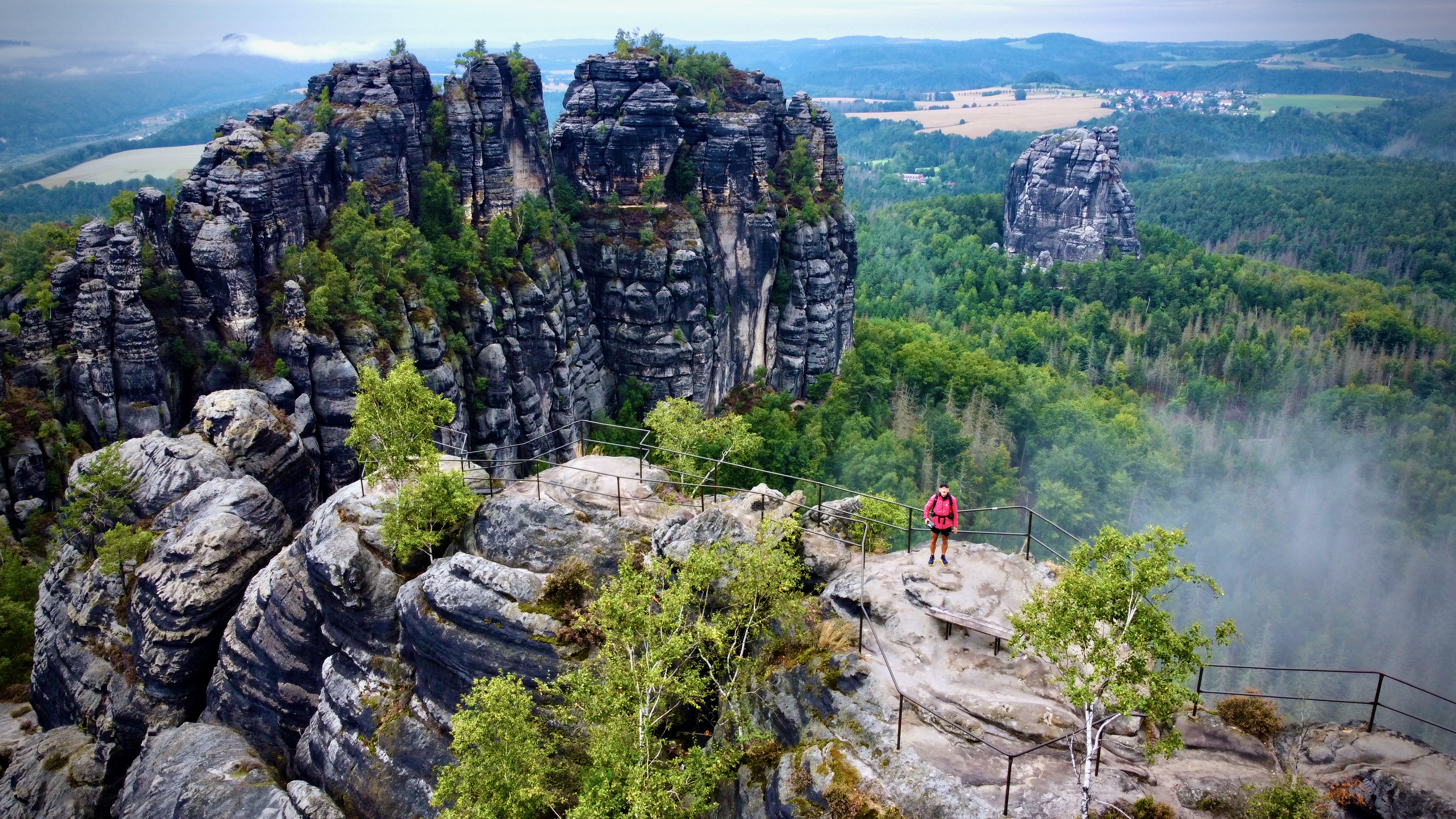
You can see weird and wild limestone spires right from town. Convenient, efficient public transport makes for easy access to trails for hikers of all levels of ability.
The official guide spits the trail to 8 stages / days. This is a very easy-going pace which allows for lots of options for side trips or drinking delicious German beer (or both for the ones who dare). I found 4-5 days just enough for a fully-loaded hiker who wants to enjoy hiking, not rush too much but also not sit in pubs for too long either.
Get in
It’s fairly easy to get to the trail or to any of its sections. There are many train connections from Dresden or Prague and public buses or trams operate within the area itself in some sections.
Eating & drinking
Resupplying food is not easy. The trail goes through very touristic places with many pubs and cafes but there aren’t any groceries. … The only food stores we found were a tiny bio bakery in Schmilka (very pricey – but great – pastries and bread) and a small grocery shop in Kroppen …. It’s not hard to make a bus trip to a nearby town to visit a supermarket ….
Navigation
Navigation is easy. Even though the trail is well marked with painted Ms, there were still some crossroads where we weren’t sure which way to go. Not having GPS or printed maps, we used only the mobile app Mapy.cz – it’s free and it has a tourist offline map of Germany with great resolution and precise, visible trails. …