Suspension Bridge, Lookout Trail, South Africa

by site editor Rick McCharles

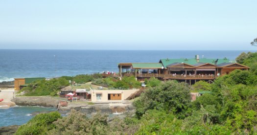
Storms River Mouth Rest Camp, one of the best campgrounds I’ve ever seen, is the trailhead of two multi-day hikes: Otter Trail and new Dolphin Trail.

Almost every visitor — including me — does a Mouth Trail day hike out past the restaurant. It’s the start of the Dolphin.

restaurant

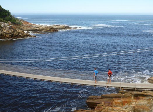
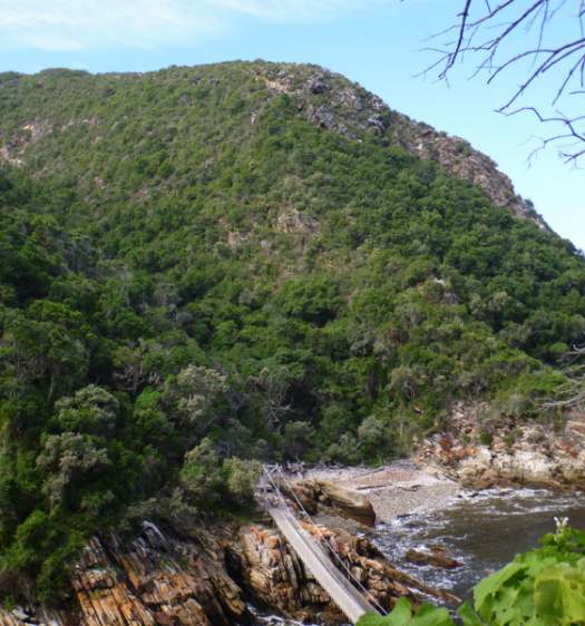
The Suspension Bridge and Lookout Trail is an easy stroll that leads along the western side of the river mouth, past the Strandloper Cave to the suspension bridge (aka “Mouth Trail“) across the Storms River.

suspension bridge

On the other side of the main bridge there is a short but very steep climb to a lookout point (aka “Viewpoint Trail“).

lookout

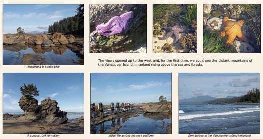
See the rest of my photos on flickr.

I ate three delicious meals at that restaurant, by the way. Free WiFi.

The Tsitsikamma National Park is a protected area on the Garden Route, Western Cape and Eastern Cape, South Africa.

… On 6 March 2009 it was amalgamated with the Wilderness National Park and various other areas of land to form the Garden Route National Park. …

TORRES DEL PAINE – photo trip report

Keiko and Dave trekked Chile’s famed W from west to east.

Fantastic pics. Plenty of FOOD. 🙂

This slideshow requires JavaScript.

See the rest on the full trip reportMini Guide for 5 days in TORRES DEL PAINE – CHILE – W trail

related – our Torres del Paine information page

Check a new book – Patagonia Chronicle: On Foot in Torres del Paine by Susan Alcorn.

Moonrise over Manaslu

2012 World Open of Photography Finalists

Moonrise over Manaslu – 45-minute exposure of Manaslu, the Earth’s 8th highest peak, in Nepal, the rotation of the Earth turning starlight into arcs. The onset of moonrise at the end of the exposure illuminates the mountain from the southeast.

Moonrise

click through to see a larger, high resolution version.

42 Beautiful Crater Lakes

Check out a terrific photo series from Love These Pics.

For example, this gem in the Pacific.

“After 3 hours of painstaking clambering up loose scree, I could see the whole of Lomok a volcanic island. The triangle shadow on the horizon is the shadow of Rinjani herself at sunrise. To the right of the shadow on the horizon is Bali again (very small). In the middle of the crater (which measures 20Km across) is the newer Gunug Baru on the lake (Danau Segara Anak),” wrote the photographer. Photo #22 by NeilsPhotography

crater lake

See the rest – 42 of the World’s Most Beautiful Crater Lakes

I’m astonished at how few of these lakes I’ve hiked. Most on that list are remote and difficult to visit.

13 scenic toilets

Simone Preuss:

When you gotta go, you gotta go. And answering nature’s call – any time, anywhere – is certainly what the builders of these remote outhouses seem to have had in mind. Often situated in incredibly scenic locations, some of these outhouses also seem highly precarious, looking like they’re about to topple over a cliff at any minute! Was this positioning chosen in the name of ventilation? Who knows.

Regardless, we hope you’ll join us as we marvel at 13 of the loneliest latrines on earth! …

4_outhouse_0.img_assist_custom-600x410

That post doesn’t include the “Long Drop” to a glacier in New Zealand. 🙂

Photodiary of a Nomad in Canada

I’ve been following Photodiary of a Nomad for years.

This couple have documented 6200km+ of walks and over 12000 photos.

Summer 2012 they started on the Pacific Coast, worked their way through the Rockies, and finished amongst the magnificent colours of the eastern forests in autumn:

Prologue

West Coast Trail (Gordon River to Walbran Creek)

West Coast Trail (Walbran Creek to Pachena Bay)

Vancouver Urban Fringe Walk

Skyline Trail – Jasper National Park

The Icefields Parkway

Assiniboine Day-Walks

Assiniboine-Sunshine Meadows Trail

Banff National Park (Two Teahouses and Larch Valley Hikes)

Yoho National Park (Iceline Trail and Lake O’Hara Circuit)

A Tale of Two Cities (Montreal and Quebec City)

Mont Tremblant by foot and canoe

La Mauricie National Park

Saguenay Fiord Trail

Hopewell Rocks (Big Tide in the Bay of Fundy)

Cape Breton Highlands National Park

Wanderings in New Brunswick

Canada page

Not all of those trip reports are live yet. They are still being uploaded.

They walked our #1 hike in the world, the West Coast Trail.

Their words — never before spoken — about the WCT:

… The clear morning skies were becoming a bit monotonous, as dawn arrived with a pink glow on the eastern horizon. …

That’s a great trip report for anyone planning for the West Coast of Vancouver Island. In fact, I’m hoping to get back again summer 2013. 🙂

related – some of their best photos from past trips around the world