Ash makes a long, tough trudge look like it’s adventure sport.
Click PLAY or watch it on YouTube.

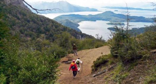
Best hikes, treks, tramps in the world.
Click PLAY or watch Ryan Van Duzer on YouTube. (2016)
Click PLAY or watch it on Twitter.
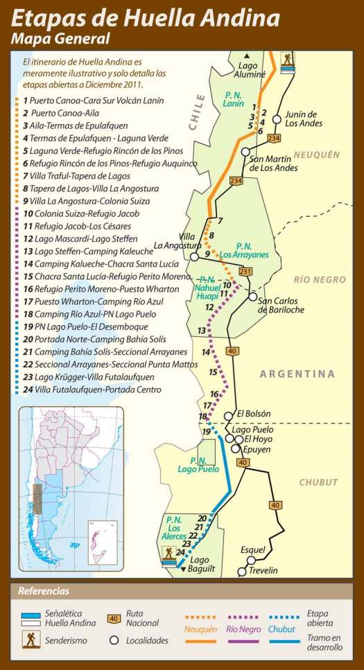
UPDATE from Mariano Rezk:
I walked it myself in January 2017. It is true that the government stopped the funding, but I must disagree about the fact that “a large proportion of the trails are closed”. Only about 5 out of 43 stages are closed (that’s less than 15%).
There’s a lot of room for improvement but Huella Andina is still one of the best ways to hike-thru and discover the argentinean side of the northern Patagonia.
The Huella Andina is a series of routes totalling about 600km. They are not all connected.
Some sections are signposted and marked. Some are not.
There are numerous resupply points along the way.
Jan Dudeck:
In 2017 the government of Argentina officially stopped funding the trail project Huella Andina. Some national parks maintain some routes with other funds but a large proportion of the trails are closed and becoming quickly overgrown. Several parts of the Huella Andina were not traversable since the season 2016/2017.
I checked in person with Club Andino Bariloche and the Nahuel Huapi National Park Office about their section of the Huella Andina. It exists. But is far less popular than the other hikes.
They gave me a free map of the Huella Andina showing about 27 hours of hiking over 4 sections. Difficulty of those sections was rated easy to severe. In fact, a parks officer recommended hiring a guide for the 10 hours between Refugio Jacob to Los Cesares.
In addition, there’s a section of road walking.
Click PLAY or watch 18 days of highlights on YouTube.
___
Huella Andina connects to the Greater Patagonian Trail on the shore of Lago Puelo. Adventurers might try to loop sections of the two new long distance hikes.

If you want to know more check Wikiexplora – Huella Andina (Spanish)
1. Appalachian Trail
2. GR10
3. Greater Patagonian Trail
4. Te Araroa Trail
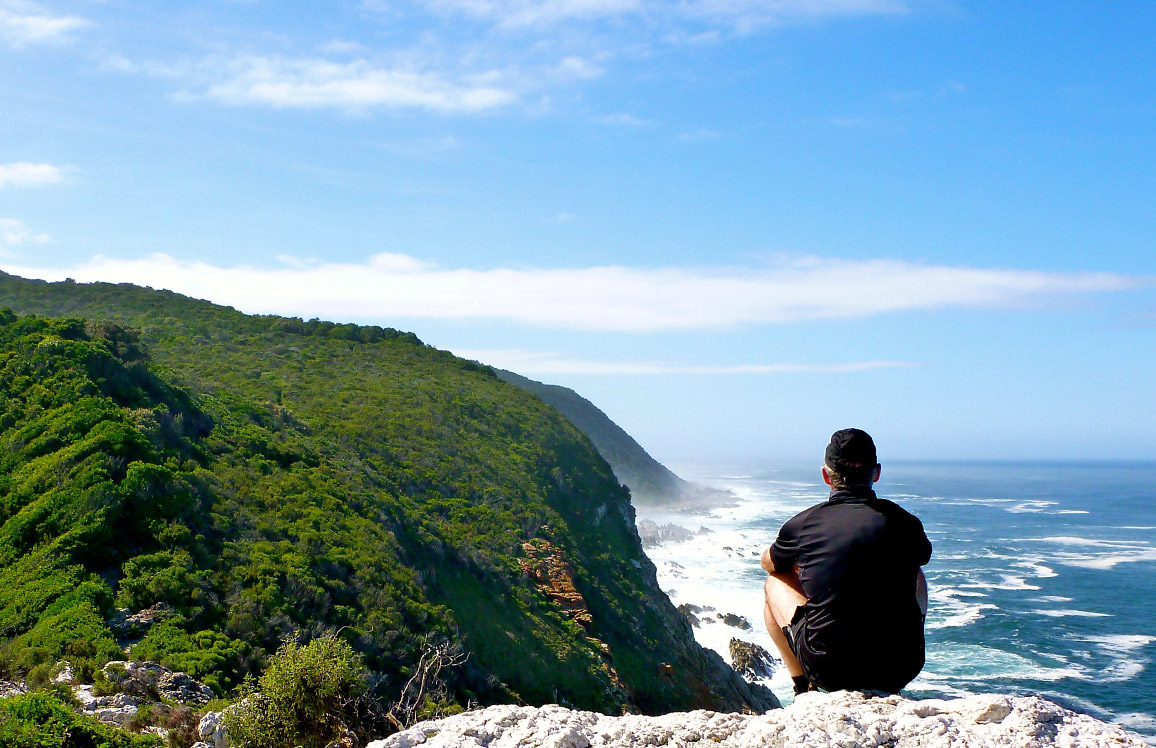
5. Rim of Africa Trail
6. Tokai Nature Trail
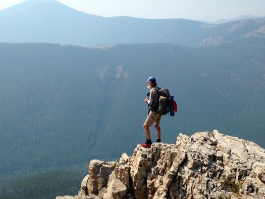
7. Great Divide Trail
8. E1 European Long-Distance Path
9. South West Coast Path
10. Great Himalaya Trail
Long-distance hiking trail from around the world to tackle in 2018
The article uses one of my photos from the southern coast of South Africa on hike #5.
I’m soon headed for Patagonia where I hope to do more sections of #3 – Greater Patagonian Trail.
Thanks George.
Craig Fowler hiked AT, PCT, and Continental Divide and pedaled Tour Divide, the Colorado Trail Race, and the Arizona Trail Race.
It’s here.
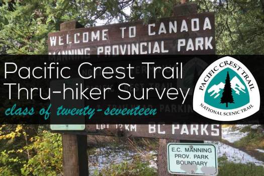
Mac’s annual resource compiled from Pacific Crest Trail hikers.
Essential reading if you are planning a PCT hike.
If not the most interesting statistics are on gear.
Deux Pas Vers L’Autre (2PVA)
That translates as Two Steps Towards Others.
Marie and Nil:
Excluding any means of transportation, during 530 days we will travel 10,600km through 17 countries: Portugal, Spain, France, Italy, Switzerland, Slovenia, Croatia, Bosnia and Herzegovina, Montenegro, Kosovo, Macedonia, Albania, Greece, Bulgaria, Serbia, Romania and Turkey. …
… we will document this experience for 17 months …
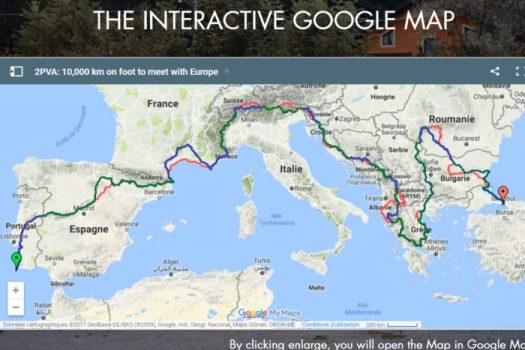
(via The Trek)
THE NORTH COUNTRY TRAIL (4,600 MILES)
THE APPALACHIAN TRAIL (2,178 MILES)
THE PACIFIC CREST TRAIL (2,650 MILES)
..AND THE CONTINENTAL DIVIDE TRAIL (3,100 MILES)
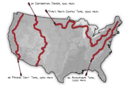
Breanna Cornell and Sophie are going to try it continuously, self supported, back to back to back to back.
Target Start Date: 20th September 2018
details – allintrek.com
Click PLAY or watch it on Facebook.