Construction began on the trail in 1963 and the area was designated as a National Recreation Trail in 1982. There is a self-guided interpretive tour along the 3.3-mile (5.3 km) trail.
Summit of Mineral Ridge, 2,400ft (730m). Elevation gain is 600ft (180m).
We hiked it January 3rd after a snowstorm. With a 5yr-old. Late in the afternoon, slipping and sliding back to the trailhead in the dark.
A bit more adventurous than usual. 🙂
Here’s a more typical lake view from the ridge.
americantrails.org
Each winter from November through February a migrating population of up to 150 bald eagles visit the area to feed on spawning Kokanee salmon. An interpretive viewing program is offered annually from Christmas through New Years during peak migration.
Photographers know that some of the BEST photos from the developing World are of local people.
I’m always reluctant to ask to take these kinds of photos, but Joshua and Nadine have been living in rural Africa the past two years. They have a good feel for whom to ask, whom to leave alone. Here are a few of their photos from our hike in the Ethiopian highlands.
There seems to be some invisible line off the hiking trail behind which the kids must stay.
Three teens from Calgary SOMEHOW had never been to Waterton Lakes National Park, even though it’s only 3hrs drive from their homes.
Almost immediately we came upon 4 bears grazing the hillside.
Like adjacent Glacier National Park, Waterton is a great place to see wildlife.
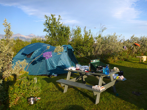
Due to bear problems in the National Park campgrounds, tenting was not allowed at Crandell Mountain Campground in 2013. We decided to stay outside the Park at Crooked Creek.
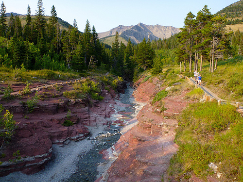
The Crypt Lake Trail is one of the premium hikes in Waterton Lakes National Park in Alberta, Canada. It is accessed by a dedicated ferry service operating from the Waterton Park Townsite. …
Voted “Canada’s Best Hike” in 1981 …
This slideshow requires JavaScript.
The crux comes at the top.
… ledge is about 50 cm wide, and continues over to a steel ladder and access to the tunnel. For nearly 100 ft you crawl through a natural mountain tunnel before arriving at the cable traverse. This section of the hike involves a scramble along a sheer cliff, with the assistance of a steel cable. …
The hike is a total of 17.2 km round trip, with a gradual 2,300-foot elevation gain. …
… a new study of nearly 9,000 U.S. children found that almost half of preschool-age kids are not getting outside at least once a day with their parents.
Girls were even less likely to be taken outside than boys, and some families reported not taking their young children outside more than a few times a month. The findings are in Archives of Pediatric & Adolescent Medicine. [Pooja S. Tandon, Chuan Zhou and Dimitri A. Christakis, Frequency of Parent-Supervised Outdoor Play of US Preschool-Aged Children]
After kayaking marvelous Isla Espiritu Santo off La Paz, Baja in 2006 … I created a website promoting the kayak/hiking adventure.
For fun.
This kid had an even better time than I did. 🙂
Check out Diego as he snorkels with amazing sea life at Espiritu Santo, an island in the Sea of Cortez. While diving or snorkeling there you can see whale sharks, mobula rays, groupers, snappers, turtles, sea lions and numerous species of fishes and crustaceans.
Many people are now calling for increased protections at Espiritu Santo from harmful fishing practices such as gill nets. In this short film, Diego shares his love for the sea life at Espiritu Santo and his desire to help protect it for future generations.
Click through to islaespiritusanto.org if you’d be willing to support a campaign to ban gill nets around those rich reefs:
CONANP Letter in English
Dear. Mr Bermudez.
On behalf of present and future generations of Pacenos and visitors to Baja Sur, I am requesting the government ban use of gill nets on inshore reefs around Isla Espiritu Santo in the new management plan.
The plan documents a decline of fisheries, due in large part to the ongoing use of gill nets, yet allows those same gill nets to remain on inshore reefs around the island. In fact, this plan offers no substantive decrease in fishing effort, gear types used, nor areas fished and is not consistent with the plan’s vision to protect and restore the marine ecosystem.
As a result, this plan guarantees further fisheries degradation and will do further damage to the recreation and tourism economy of La Paz.
Thank you for protecting the ecological integrity of the marine environment around Isla Espiritu Santo with the sustainable use of the fisheries resource.