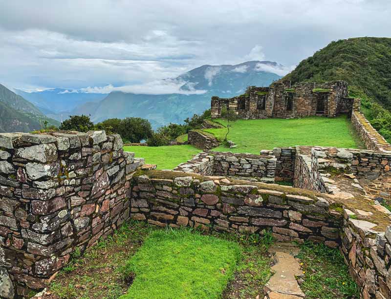
The official guide spits the trail to 8 stages / days. This is a very easy-going pace which allows for lots of options for side trips or drinking delicious German beer (or both for the ones who dare). I found 4-5 days just enough for a fully-loaded hiker who wants to enjoy hiking, not rush too much but also not sit in pubs for too long either.
Get in
It’s fairly easy to get to the trail or to any of its sections. There are many train connections from Dresden or Prague and public buses or trams operate within the area itself in some sections.
Eating & drinking
Resupplying food is not easy. The trail goes through very touristic places with many pubs and cafes but there aren’t any groceries. … The only food stores we found were a tiny bio bakery in Schmilka (very pricey – but great – pastries and bread) and a small grocery shop in Kroppen …. It’s not hard to make a bus trip to a nearby town to visit a supermarket ….
Navigation
Navigation is easy. Even though the trail is well marked with painted Ms, there were still some crossroads where we weren’t sure which way to go. Not having GPS or printed maps, we used only the mobile app Mapy.cz – it’s free and it has a tourist offline map of Germany with great resolution and precise, visible trails. …
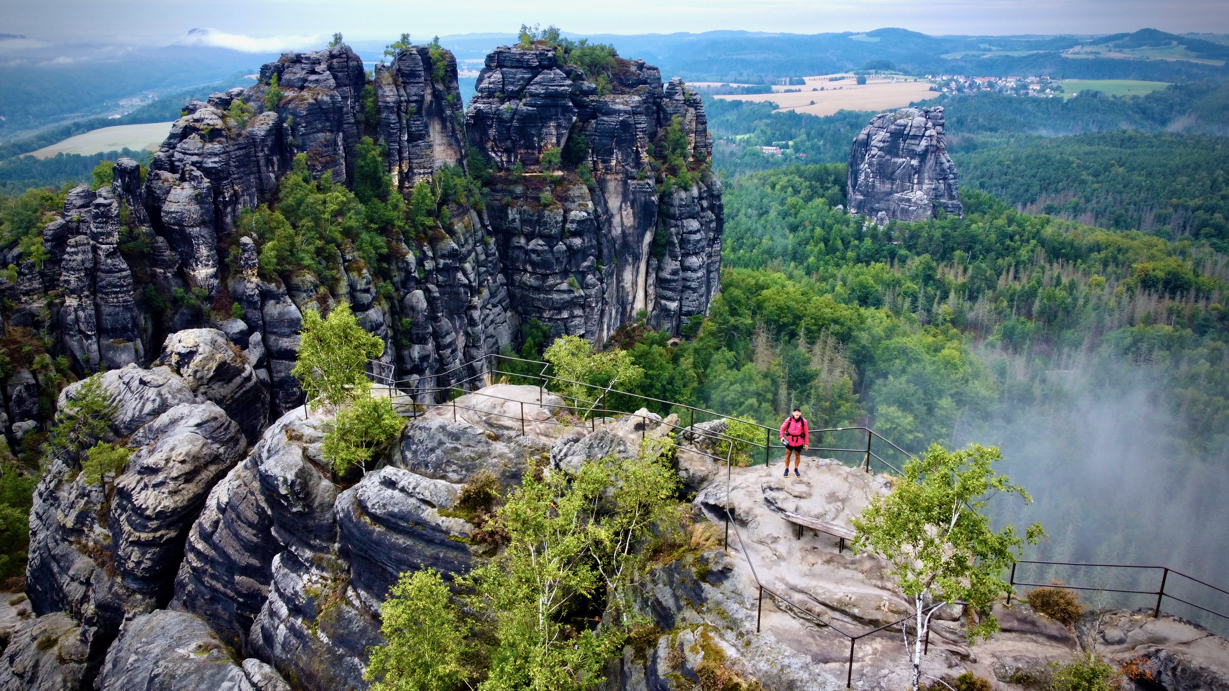
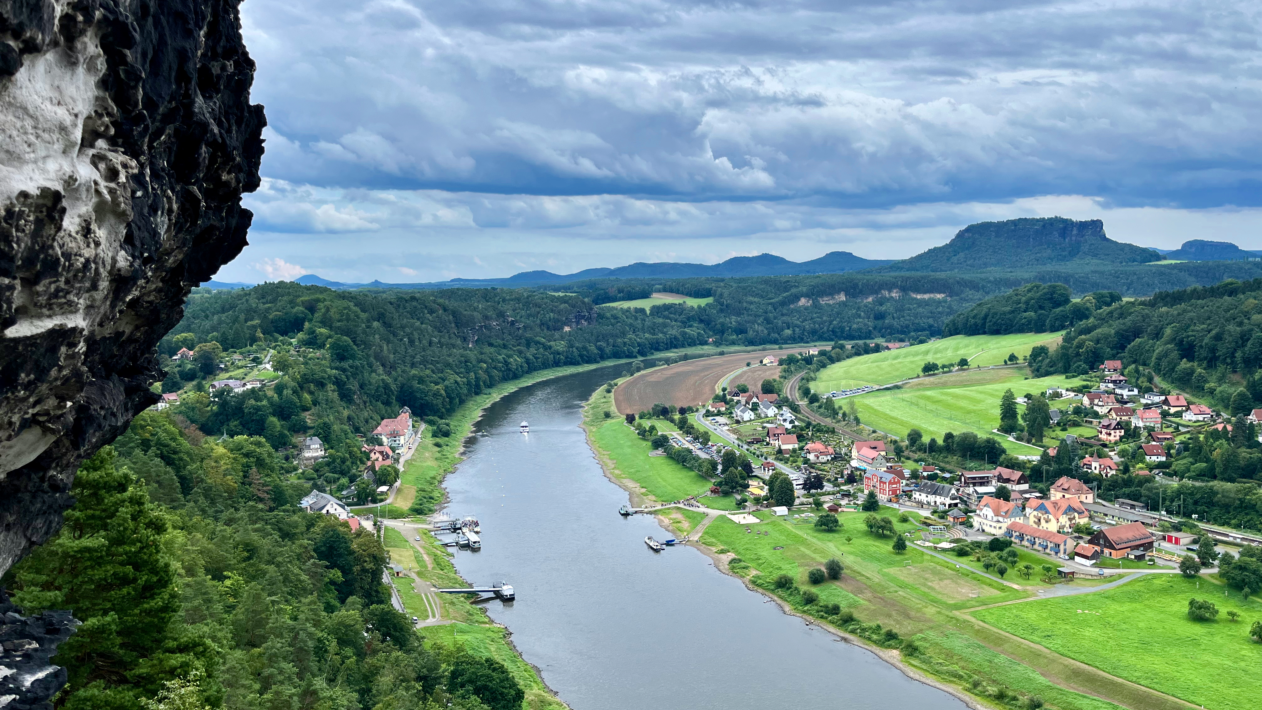
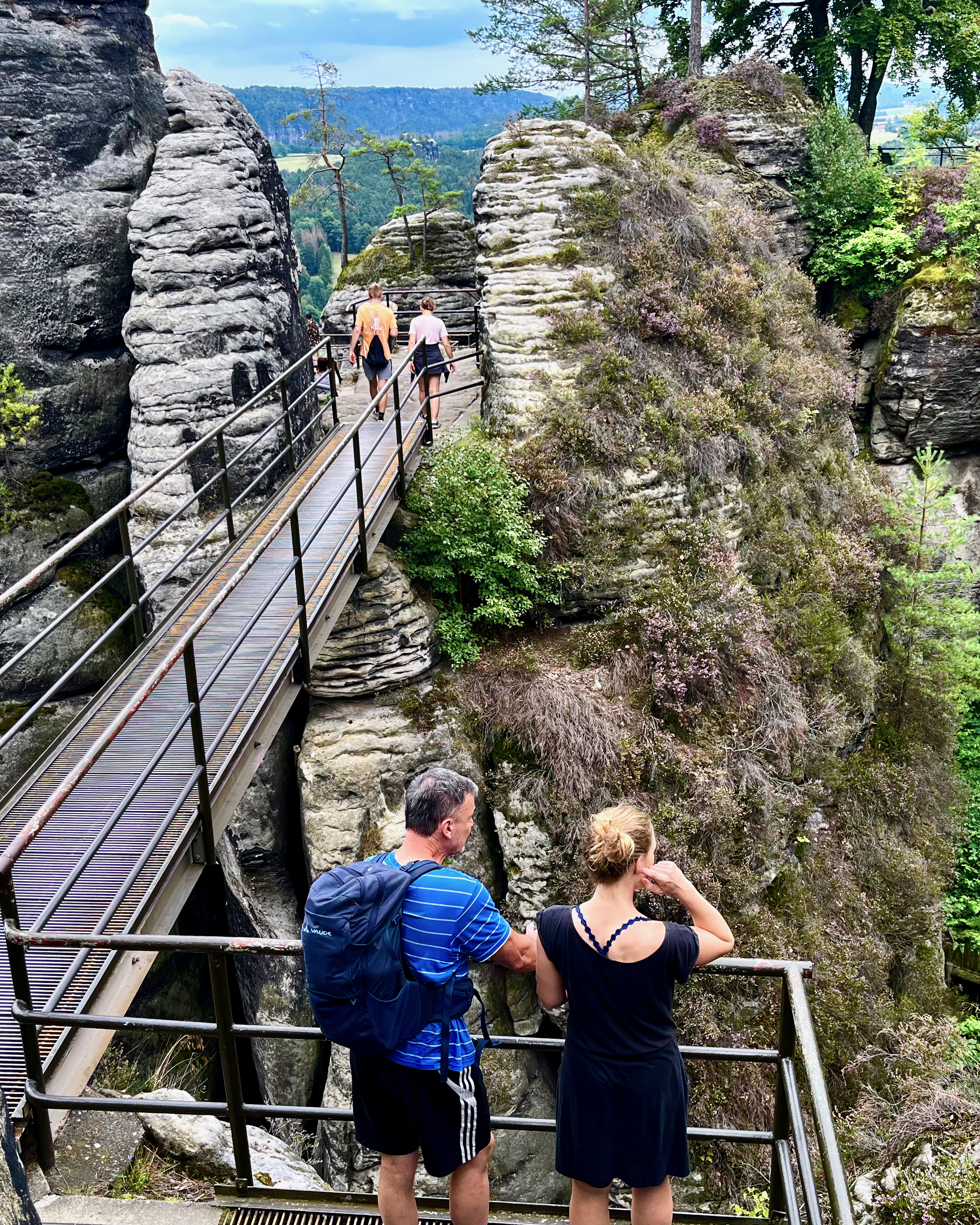
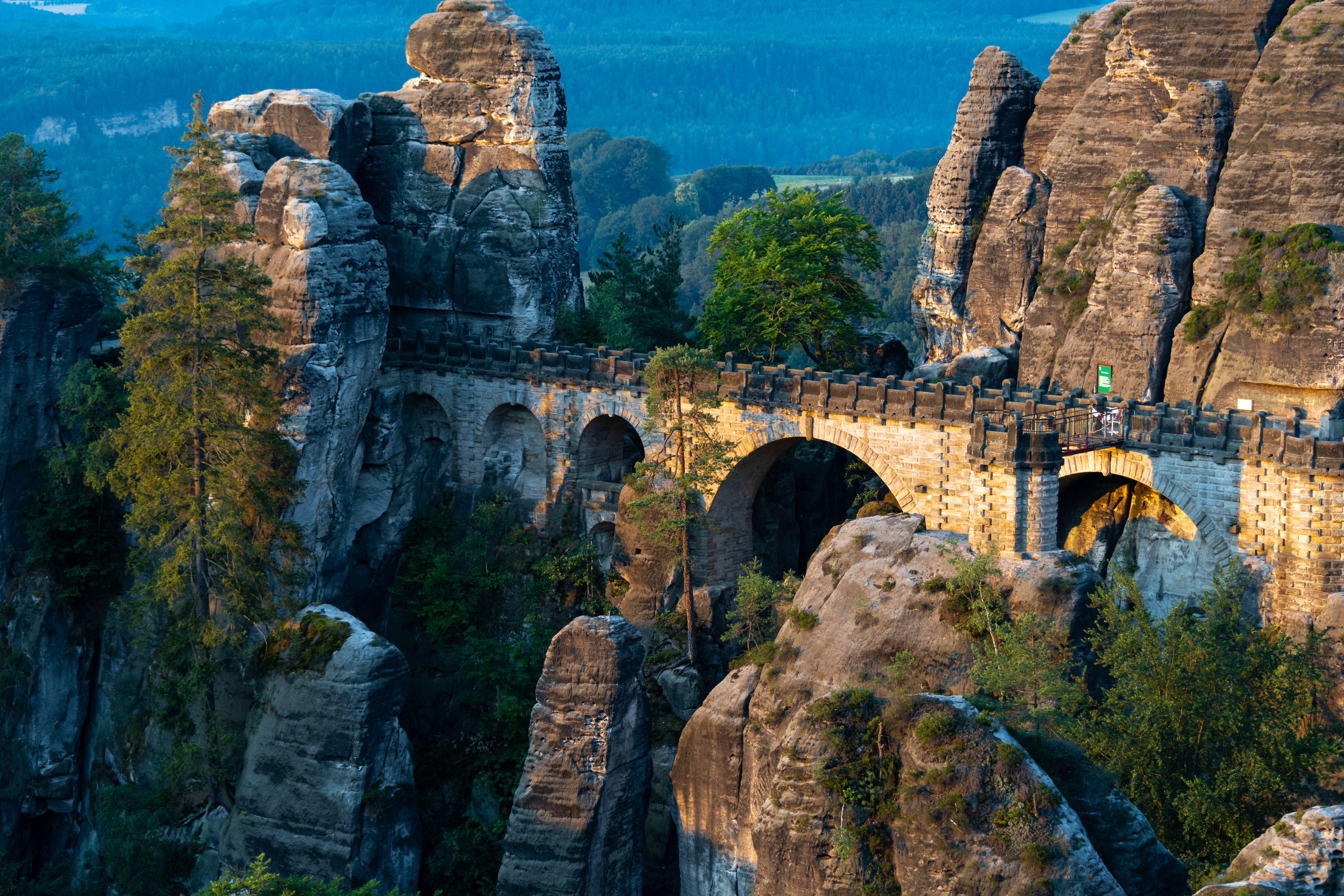
The Bastei (“bastion”) has been a tourist attraction for over 200 years. In 1824, a wooden bridge was constructed to link several rocks for the visitors. This bridge was replaced in 1851 by the present Bastei Bridge made of sandstone. …
I took the train one way to Rathen. Cycled the other.
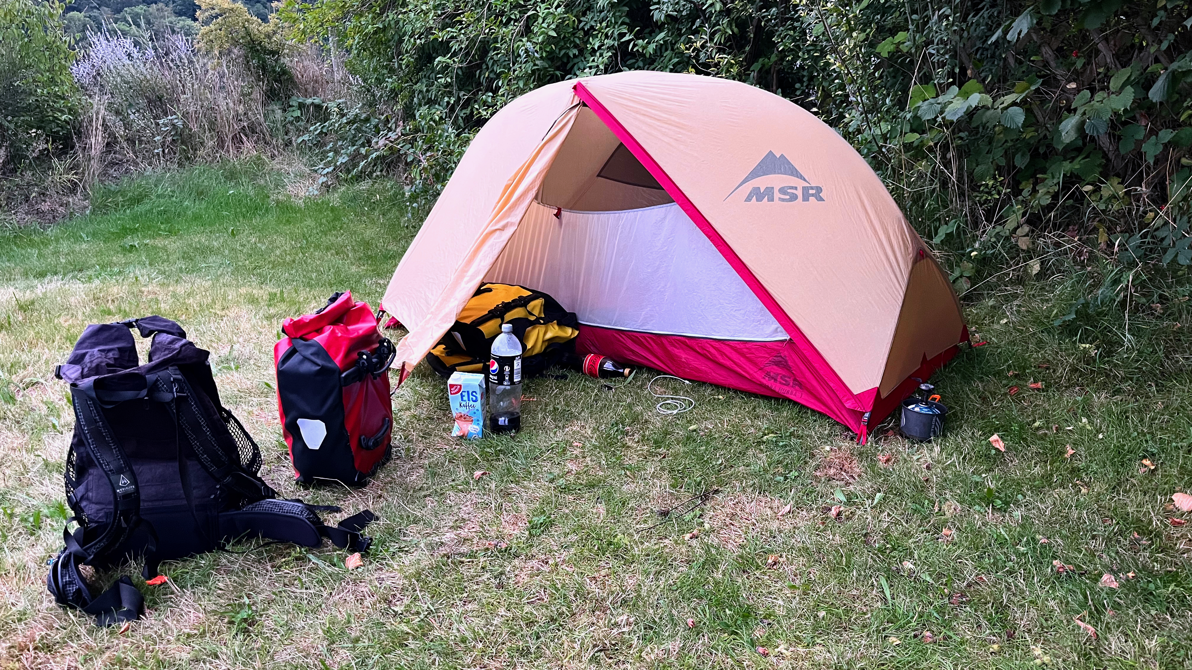
Camped at the very convenient hostel.
My tent is my home away from home. Protection from the elements.
You take a short ferry across the river to reach the Bastei trailheads.
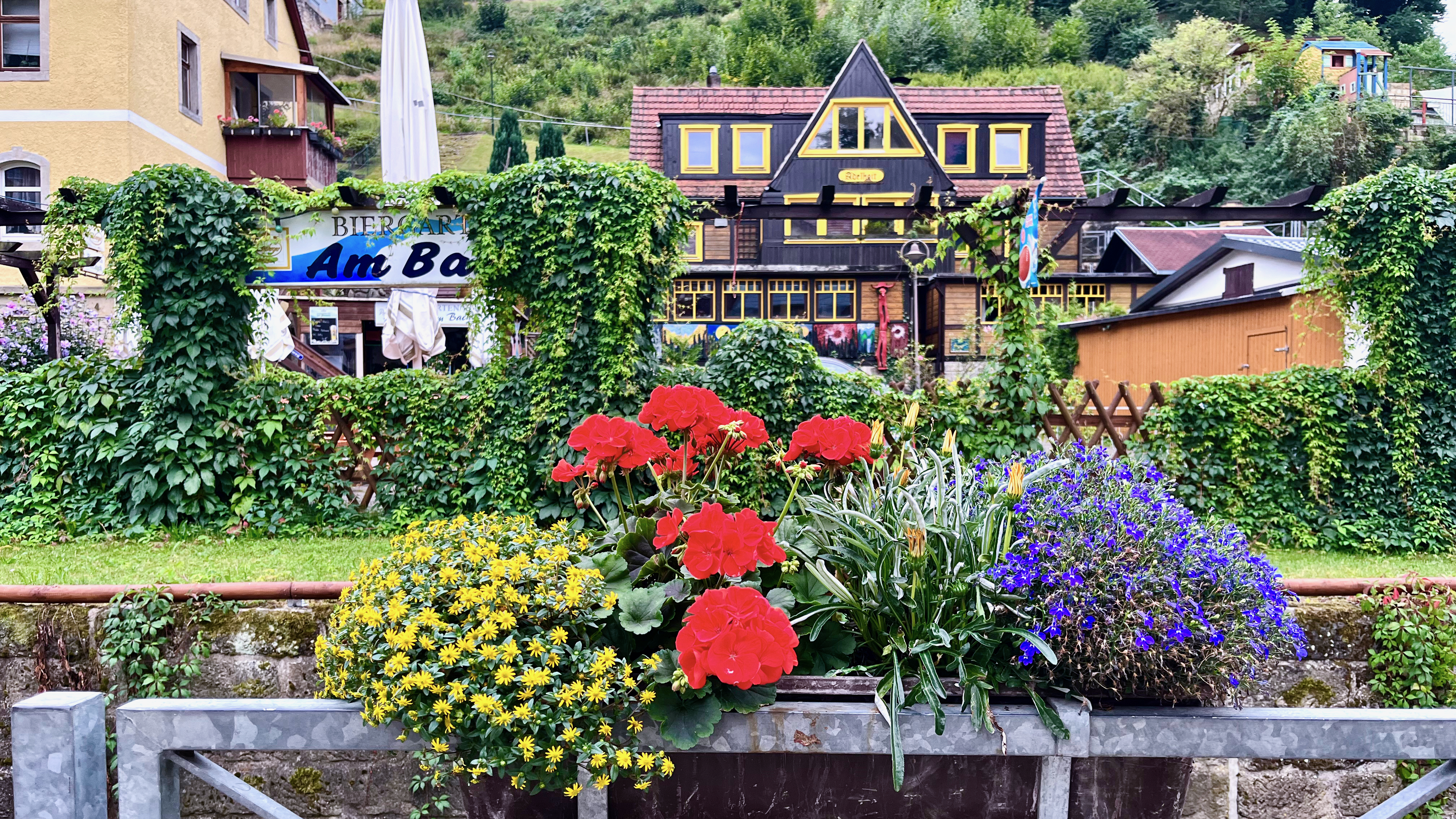
I do love the German country homes. Many are spectacularly colourful and well maintained.
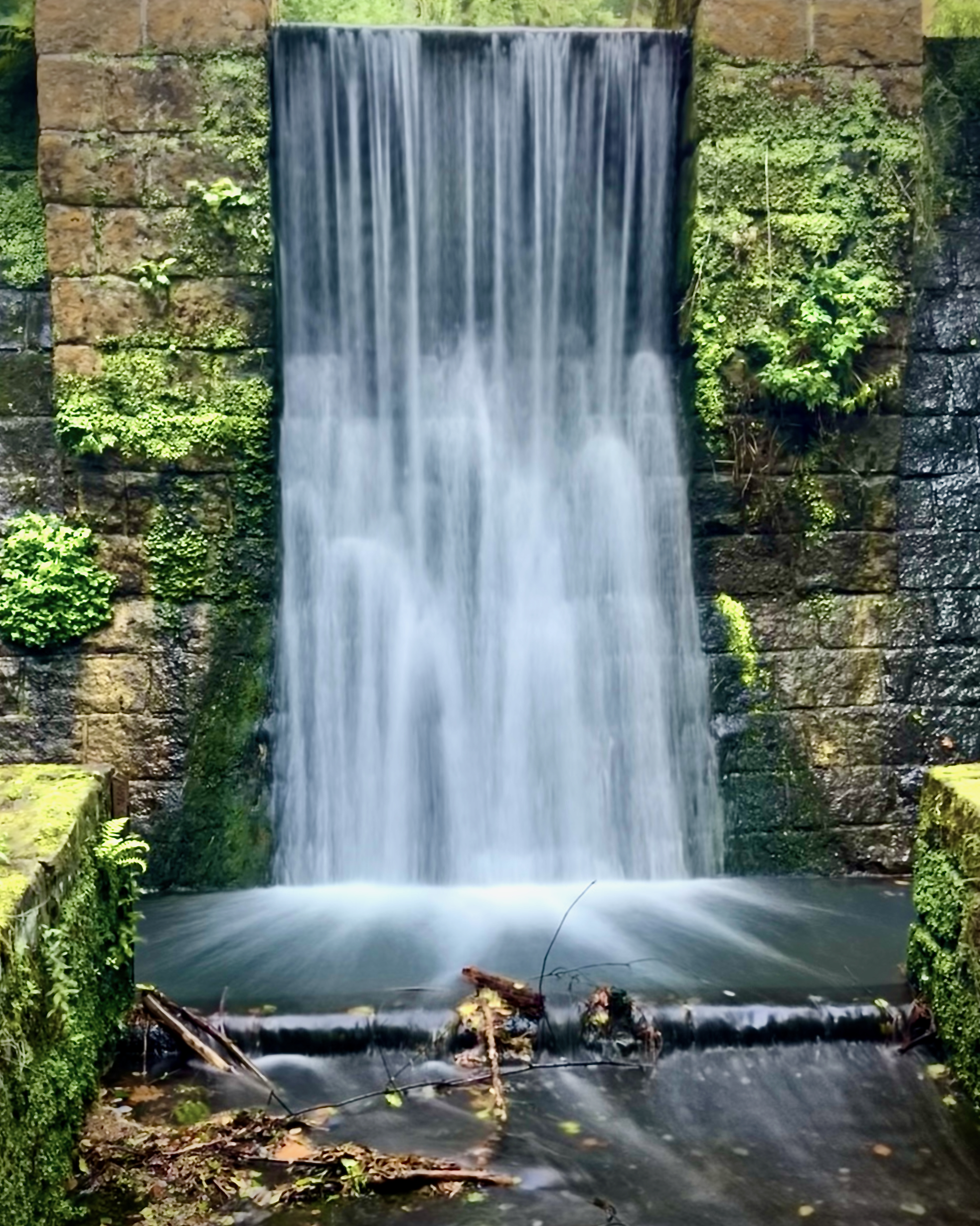
There’s a scenic walk along waterways …
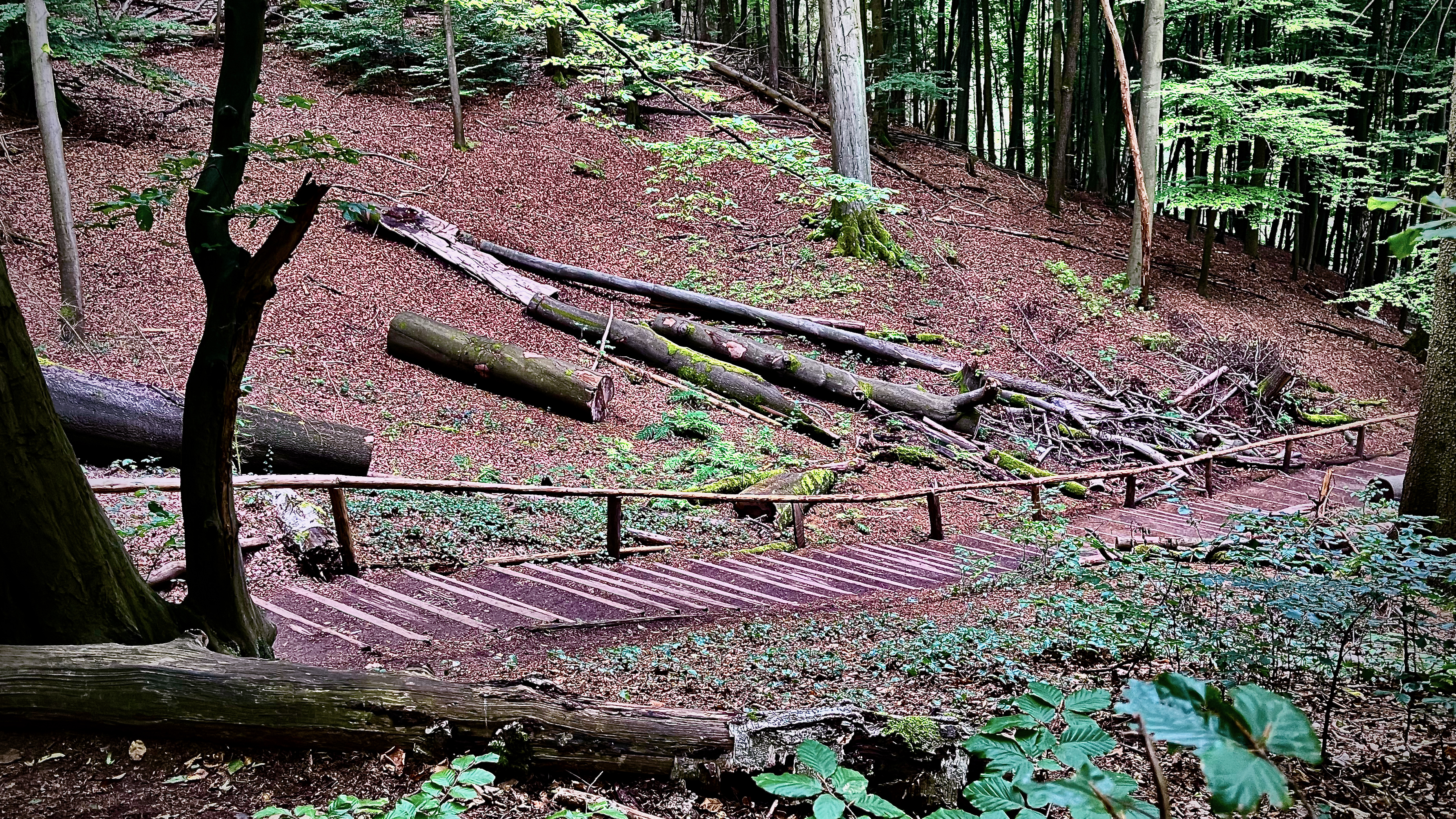
… then several steep ascent trails to get to the bridge.
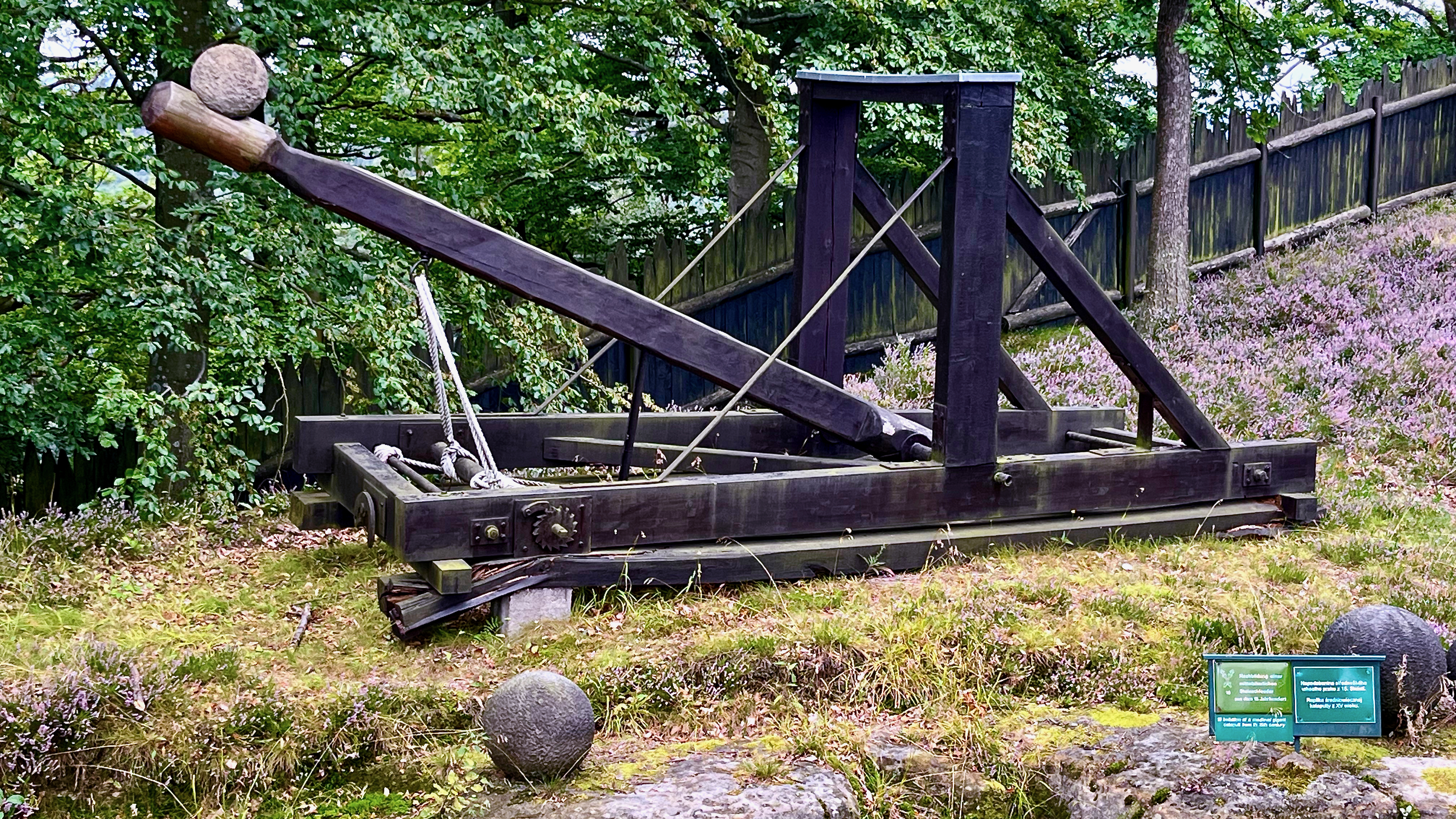
A medieval catapult and many of the boulders are on display.
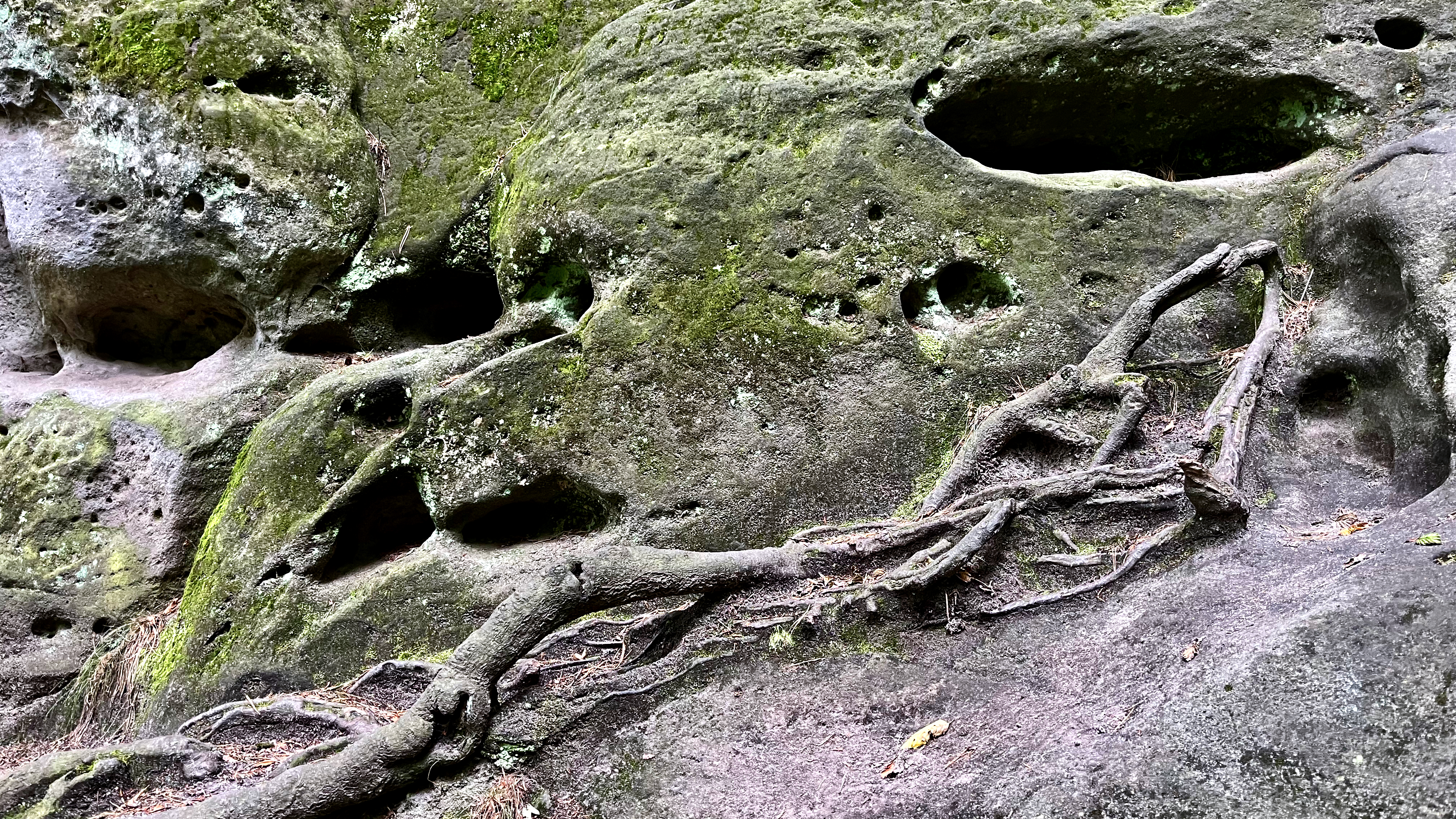
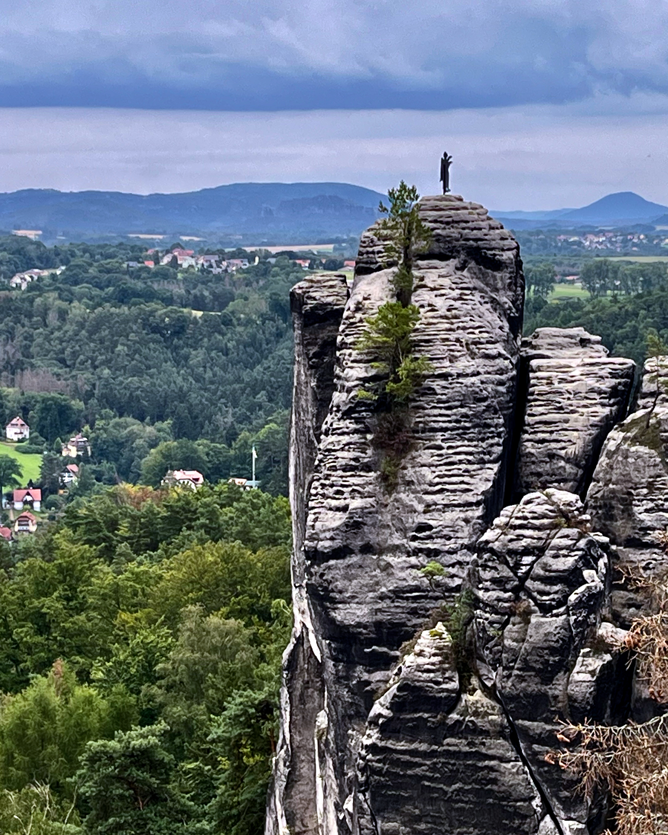
Of course the archeology of the eroded sandstone is varied and interesting.
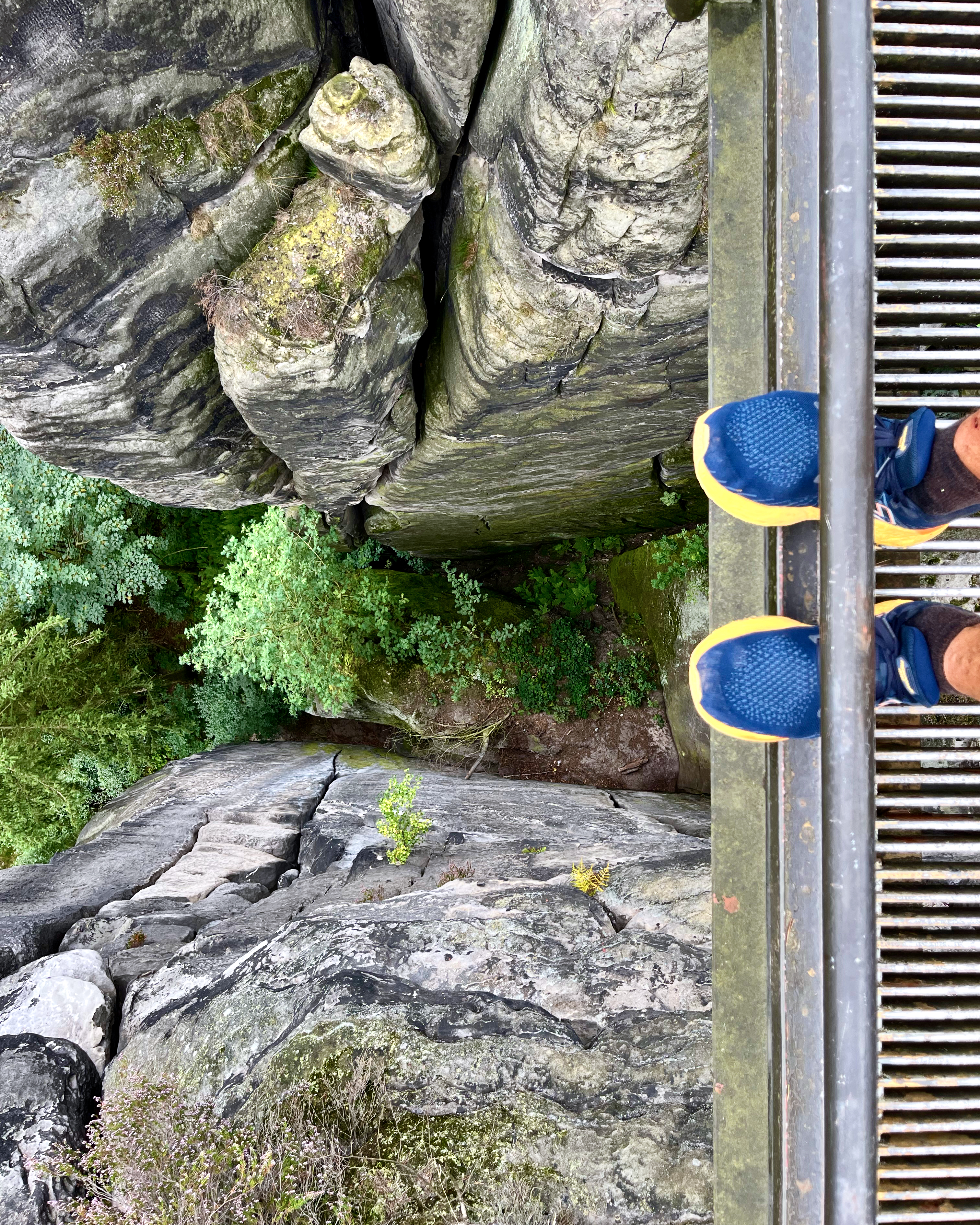
Once up high it’s all good. Most of the trails are free. But to walk across the bridge itself there is a small fee.
The views are just as good from the free trails, in my opinion.
It is high. If you have a fear of heights, this might not be the hike for you.
Don’t miss Bastei if you get to Dresden.
It is busy. If you don’t like crowds on high walkways, come earlier or later in the day.
If you have the time, consider doing more hiking in the area. One popular hike runs from Stadt Wehlen via Bastei to Kurort Rathen (or the other way round).
On this hiking tour, also called the “Golden Triangle”, sights such as the ruins of Wehlen Fort, Bastei Bridge and the Schwedenlöcher (Swede Hole) Trail can be discovered.
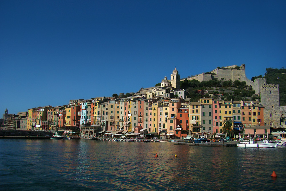
Took the train to La Spezia. Then the local bus to Porto Venere.
A pretty town.
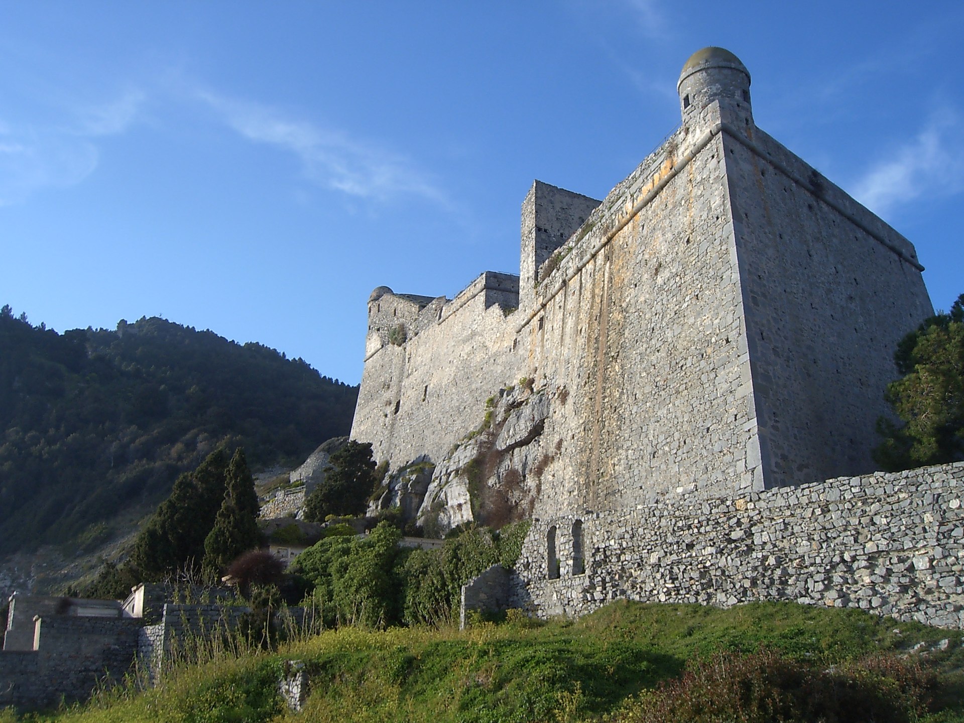
Starting the hike north, immediately you find the impressive Doria Castle.
EPSON DSC picture
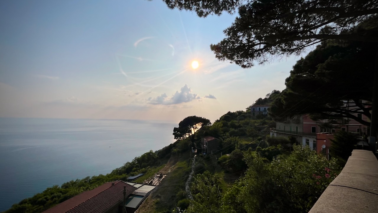
The trail takes you high above the ocean with terrific views in each direction. There are some very narrow pathways, but no real exposure.
I found a quiet spot, just before dark, to put up my tent.
Early next morning I arrived at the impressive Santuario di Montenero. The priest came out, interested in my drone. I showed him how it worked and later sent him this video.
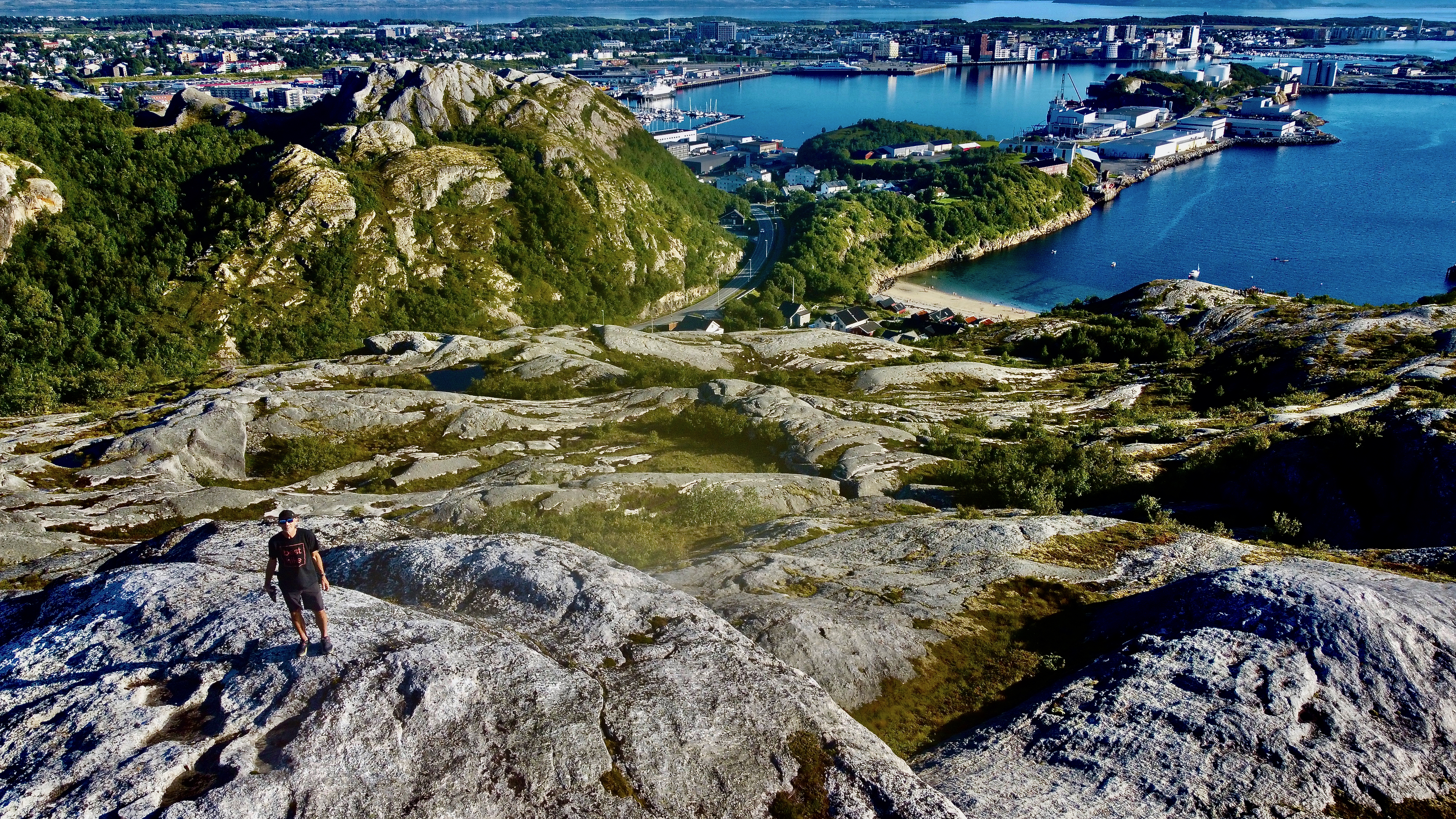
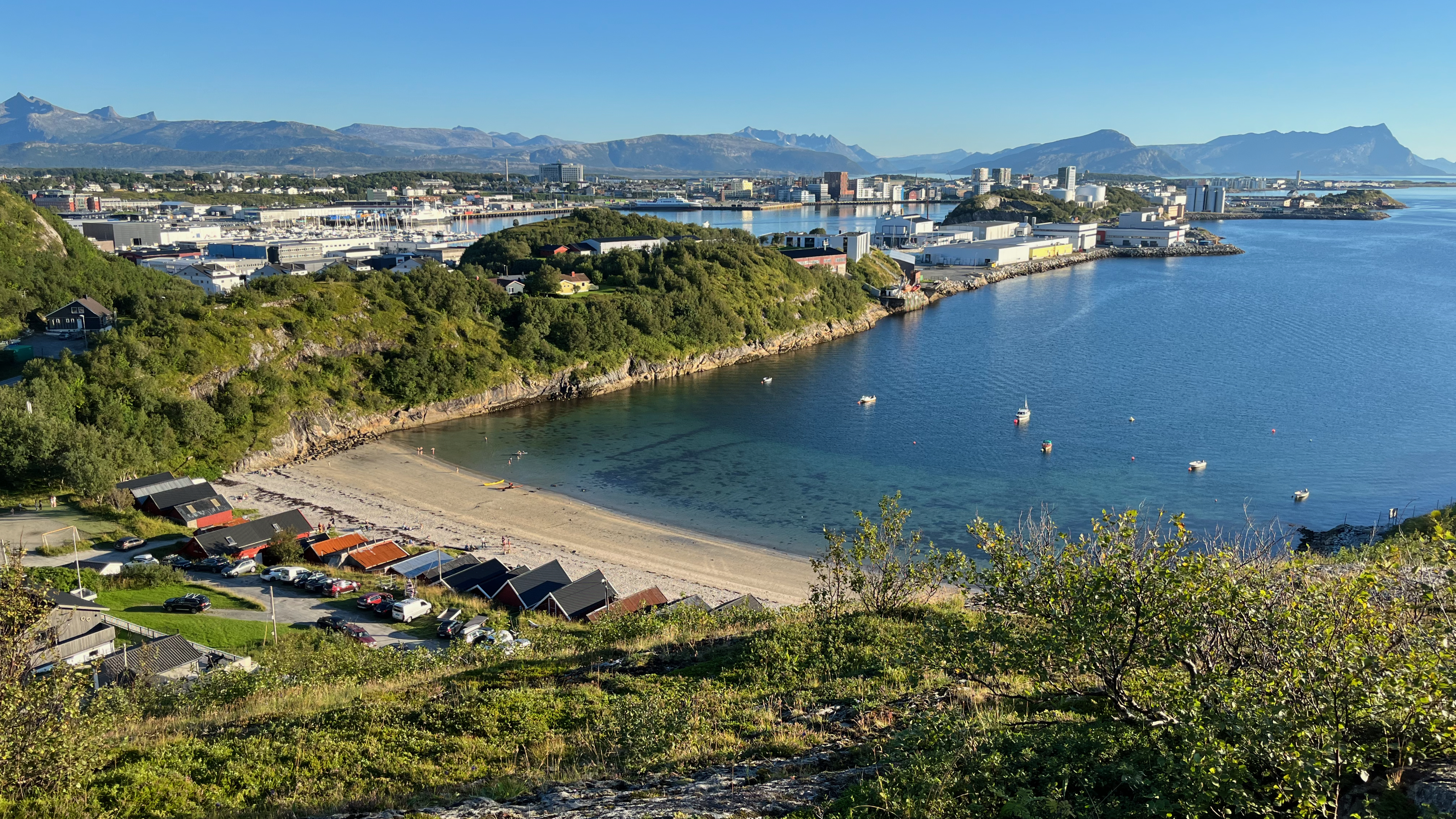
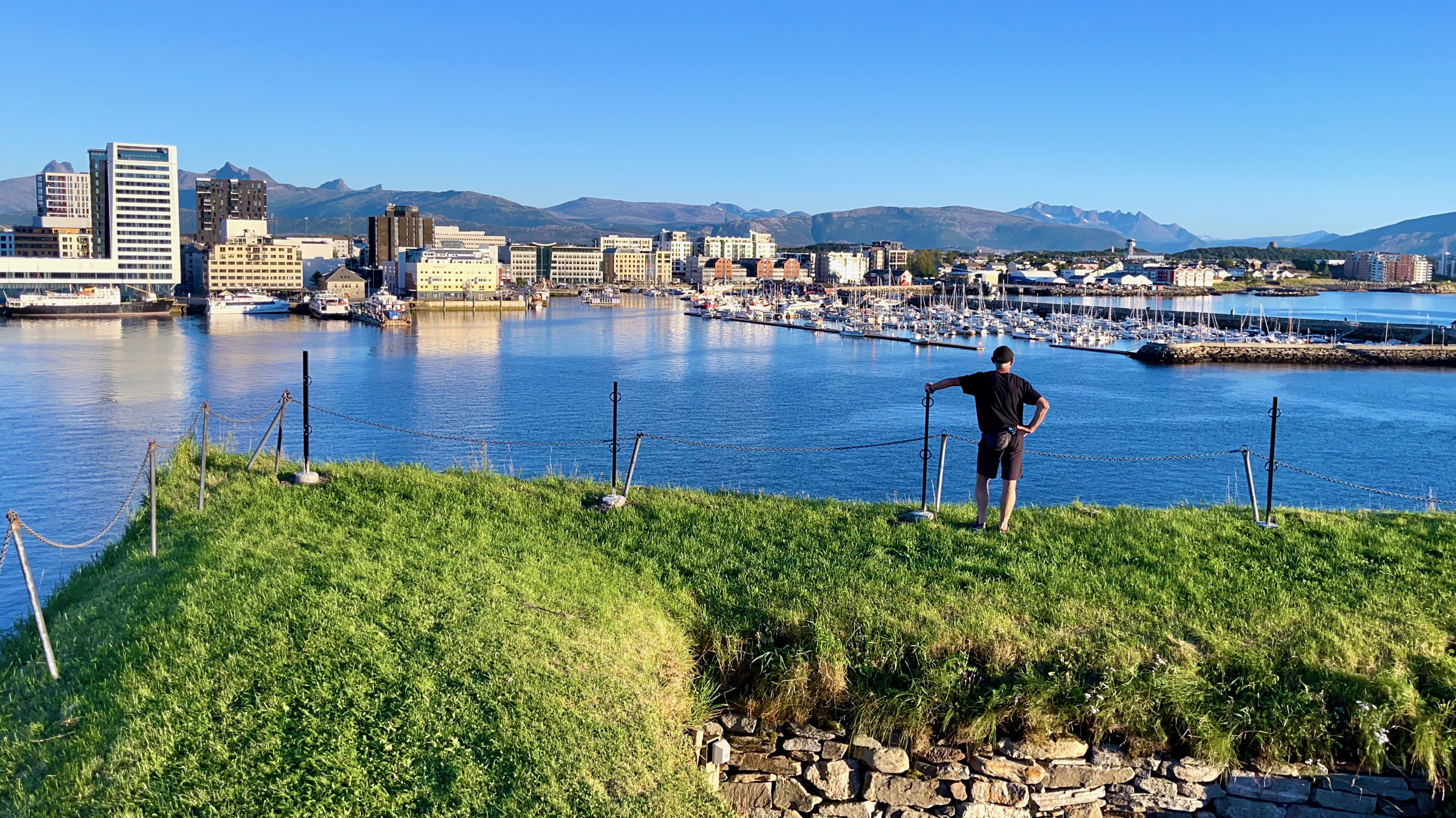
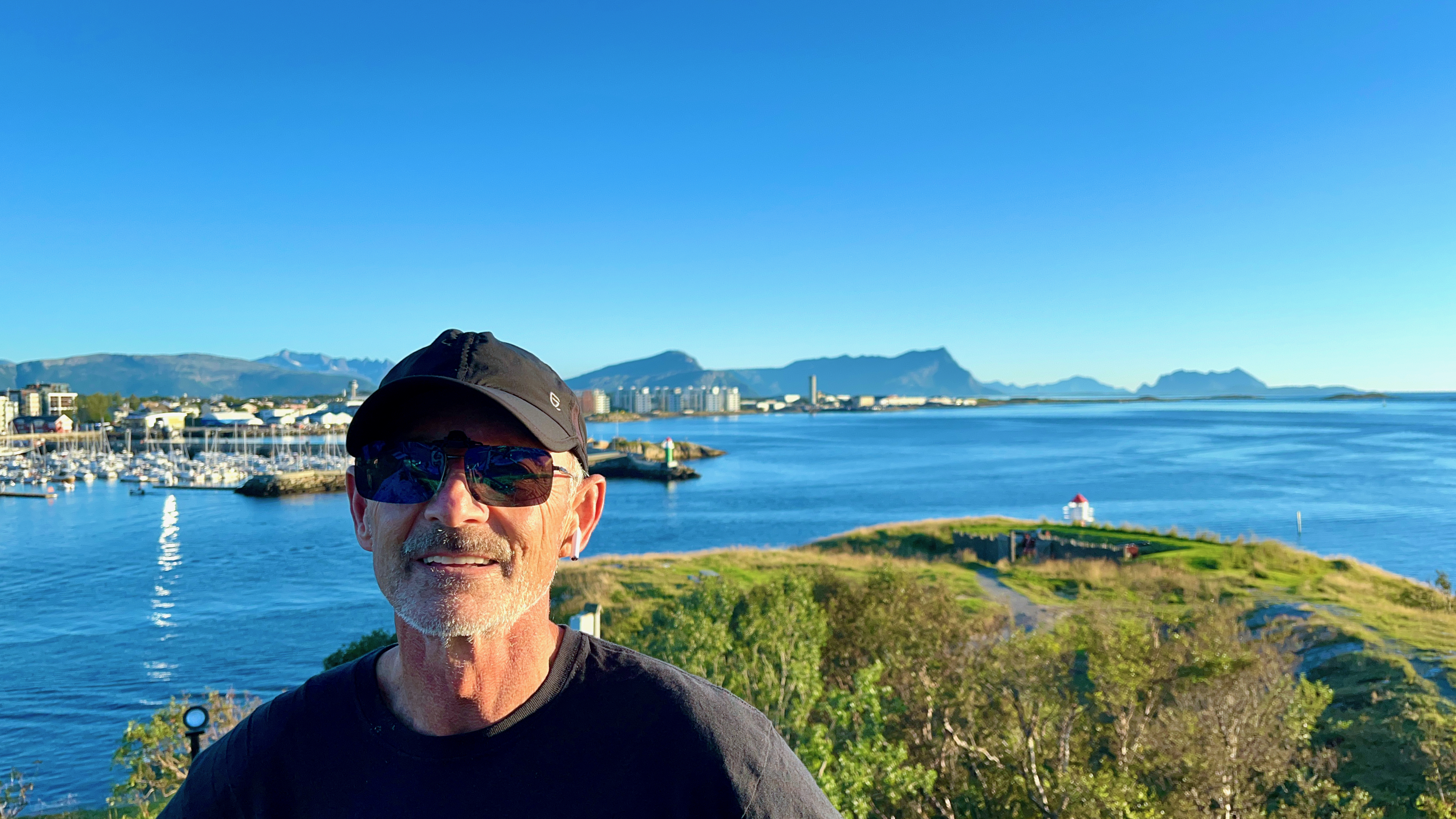
The gateway to the wonderful Lofoten archipelago is the town of Bodø, the end of the train line north.
It’s usually cheaper and easier to fly as the train is a 17 hour overnight journey from Oslo. The town is so compact that you can easily walk from the airport to the train station.
On my two trips to the awesome Lofoten hikes, I’ve spent quite a few days in Bodø — supposedly in transit.
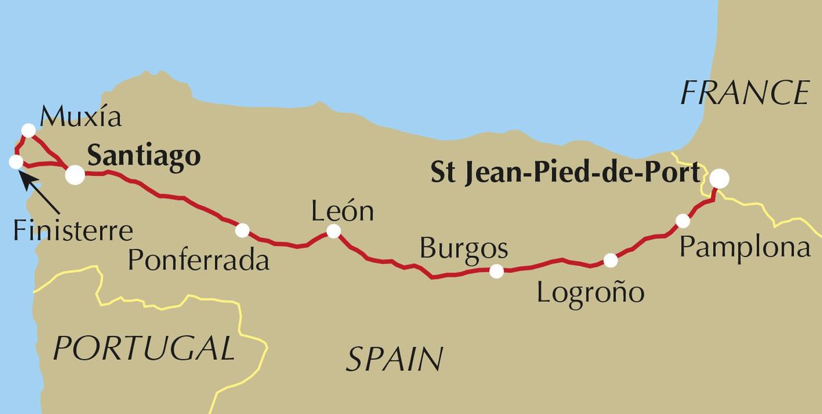
As with most hikes that can be cycled, I prefer to cycle. At least 10% of pilgrims cycle rather than walk or arrive on horseback. They are known as ‘bicigrinos’ or ‘bicigrinas’, bike pilgrims.
My PLAN is to ride León to the famous cathedral. About 325km. Perhaps a week. No rush.
The total length starting in France is 825km.
You need to cycle at least 200km in order to receive a Compostela certificate in Santiago (as opposed to minimum 100km walking).
Nearly 350,000 Compostela pilgrim certificates were issued in 2019. I won’t be lonely. 😀
The Camino Francés, or French Way, is by far the most popular of many routes. Roughly 60% of pilgrims choose this camino over other options.
Though no guidebook is needed, I picked up a paper copy of Mike Wells’ Cycling the Camino de Santiago (2019). I’d listened to a good interview with the author.
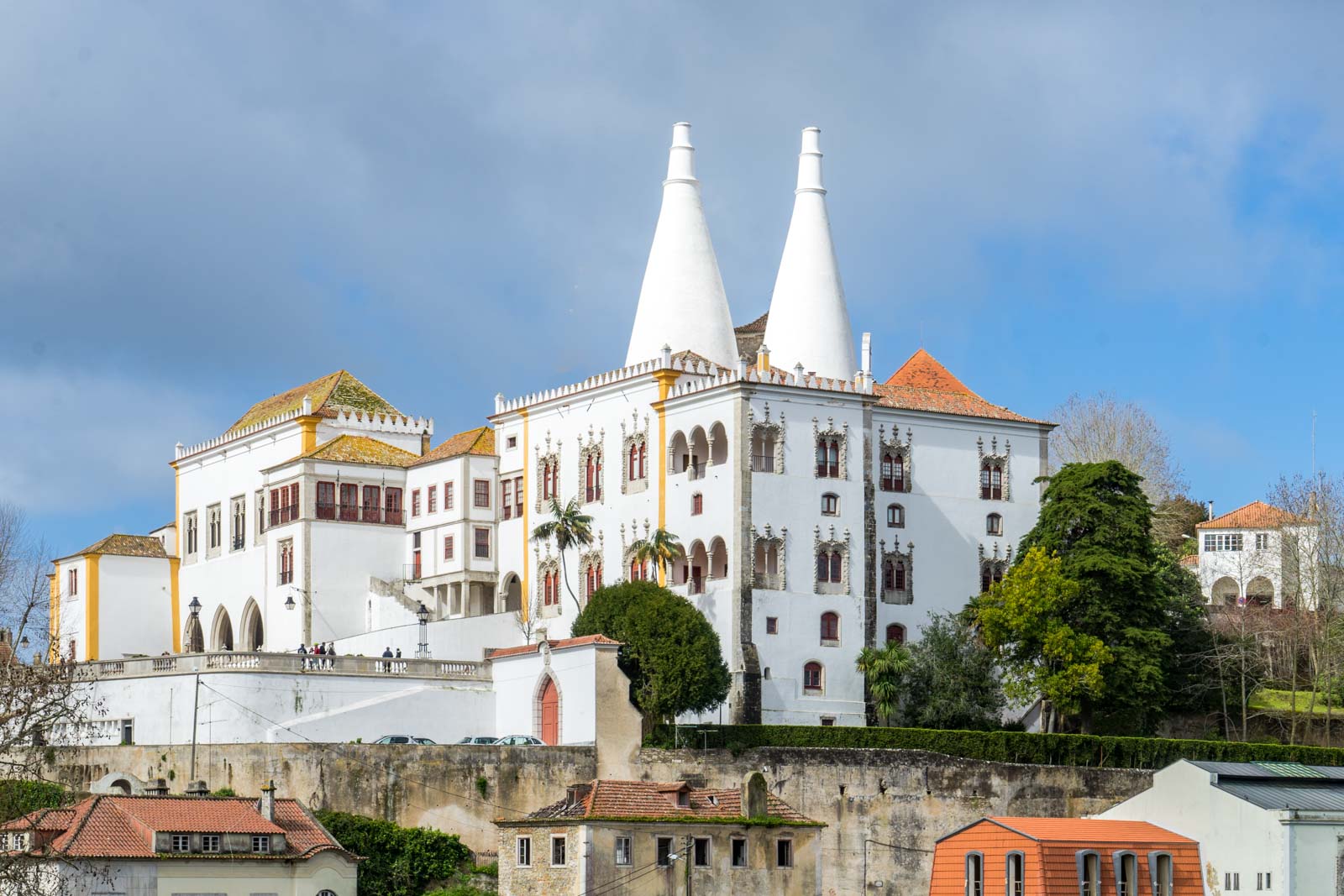
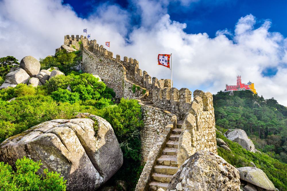
The historic center of the Vila de Sintra is famous for its 19th-century Romanticist architecture which resulted in the classification of the town as a UNESCOWorld Heritage Site.
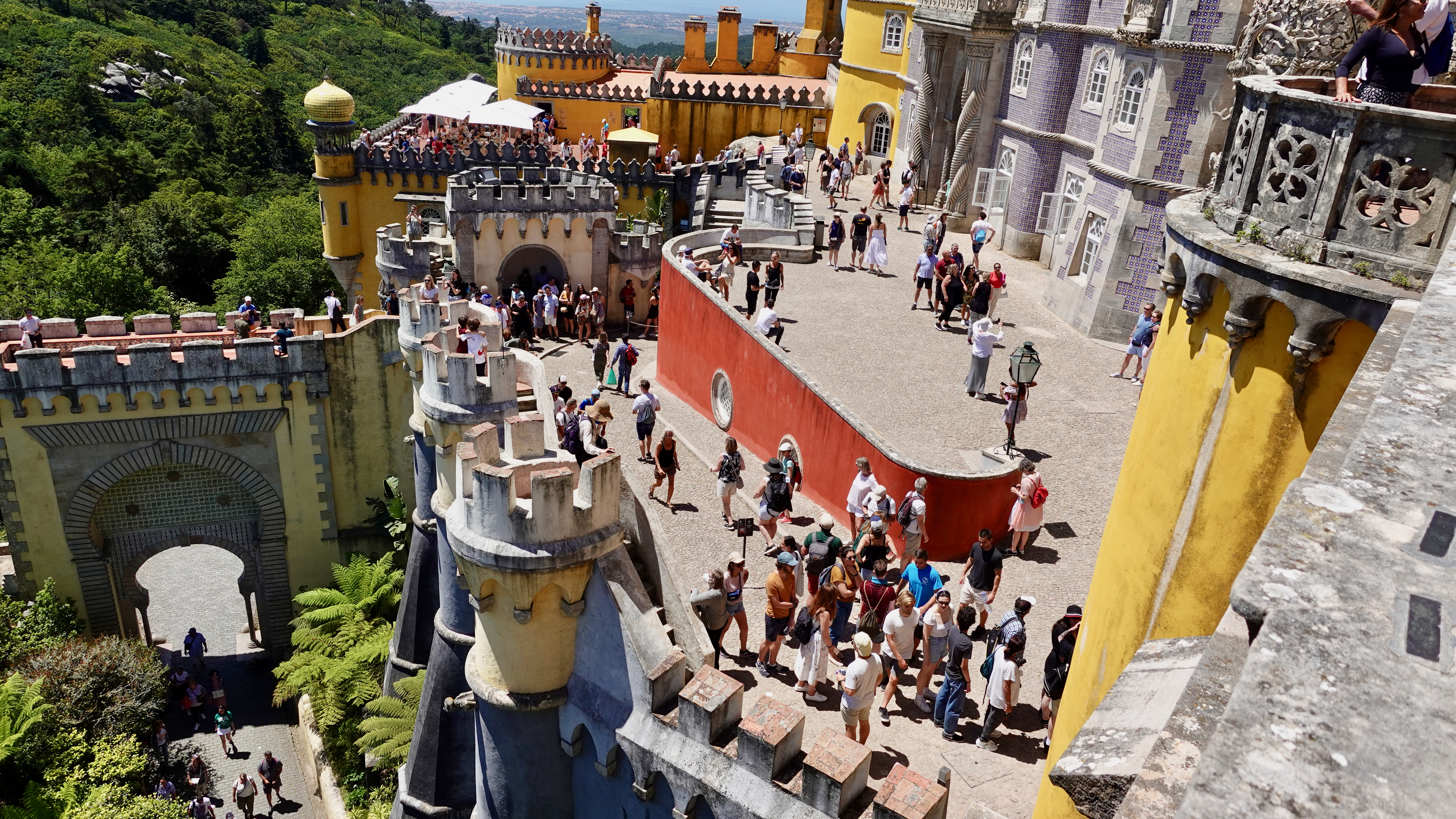
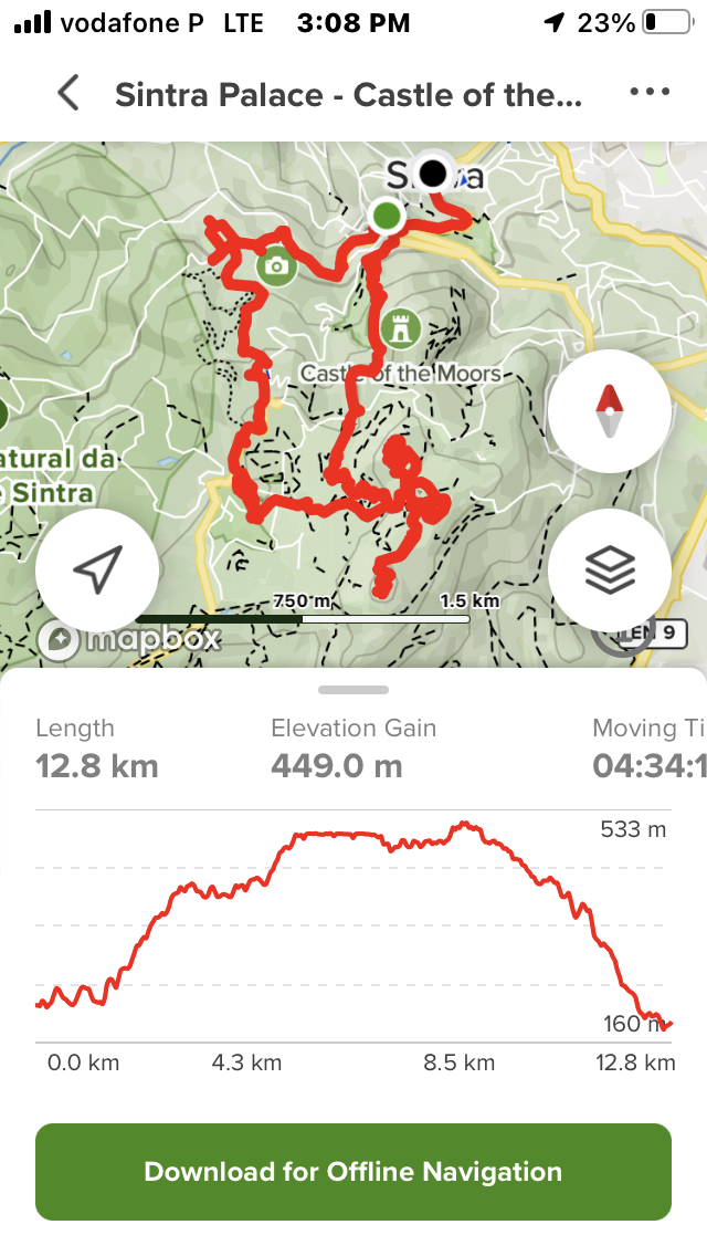
I stood in line for almost an hour to wander the Palace like every other tourist. But wished I’d spent that time — instead — hiking the lovely trails over 200 hectares of surround Pena Park. It’s a labyrinth and I was lost most of the time despite trying to follow a route on AllTrails.
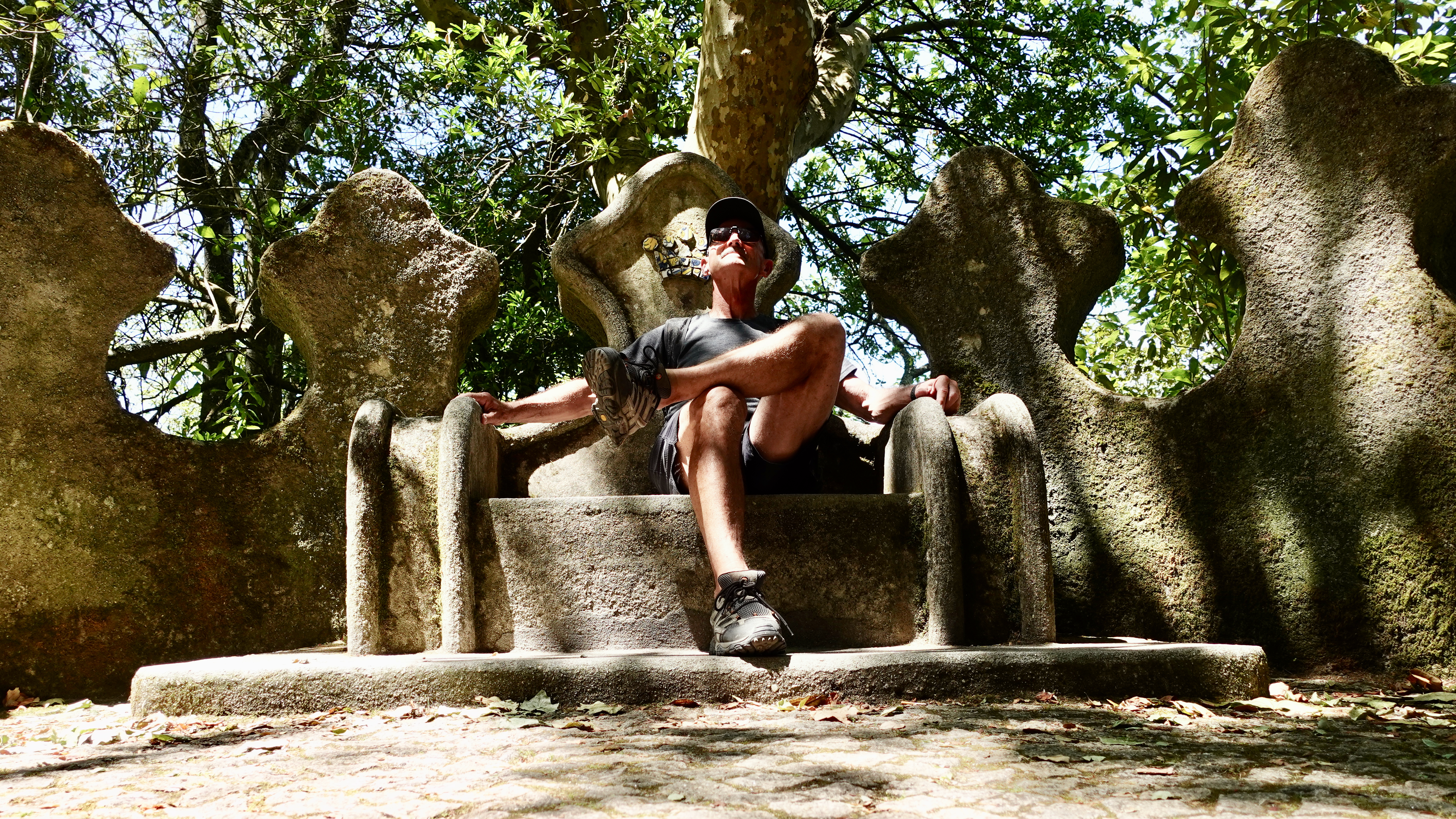
After escaping the Palace, I continued up towards a high crucifix.