another Inca Trail alternative – Moonstone Trek

First off, this adventure does not have you hiking into Machu Picchu.

It finishes 7mi away in (amazing) Ollantaytambo. From there you take the train to Aguas Calientes. Then the bus up to the ruins.

machu-picchu.jpg
larger version – flickr – FranUlloa

On the other hand, it does look pretty good compared with the over-popular, problematic Inca Trail.

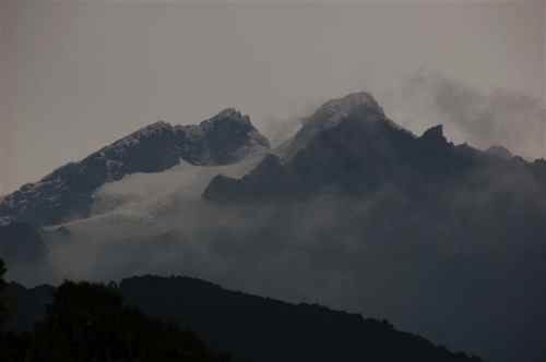
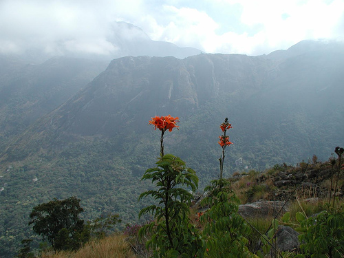
It passes through seldom-visited Andean villages, Inca and pre-Inca ruins and heads onto a beautiful altiplano plateau surrounded by glaciated peaks. Most groups won’t encounter any other tourists for the entire trek and the combination of stunning mountain scenery and wildlife, fascinating relics and real isolation is truly rewarding. …

Supported by horses rather than porters. It’s claimed to be a little tougher than the standard Inca Trail, as “it goes higher and covers slightly more distance”.

moonstone-altitude-chart.jpg

Exodus Guide Tours – Moonstone Trek

lamas.jpg
larger version – flickr – FranUlloa

(via The Adventure Blog)

The best alternative is still Choquequirao to Machu Picchu.

scrambling Annapurna Base Camp, NEPAL

My old hiking buddy from South America 2004, Canadian Grant Assenheimer, just climbed down from the high Himalayas. He was on a “holiday” between assignments for Doctors Without Borders.

From Grant’s email:

Just got back from ABC and had a fantastic time. The ‘scare’ tactics used by the tour companies almost had me convinced that I should take a guide but it is TOTALLY NOT NECESSARY. Pass the word! Even if you are only moderately fit, you can easily do any of the teahouse trekking without a guide or porter.

grant.jpg
larger version – flickr

My favorite day was a scramble up from the Annapurna Base Camp (ABC). Although most people stop at ABC, I rounded up a couple of New Yorkers and the 3 of us did this great day trip UP to the base camp for Tent Peak, one of the smaller ‘trekking peaks’ in the area. We started at 4100 m, went down and crossed the stone-covered glacier and then climbed to 4800 m via a steep morrain, icy river through a narrow gorge and finally a bit of a slog through steep high-altitude grassy slopes. This gave us GREAT views of the Annapurna Range, Machapuchre and some other ‘lesser’ 5 and 6 thousand meter peaks. The way UP was a bit challenging (ie. GREAT) because we didn’t see the PATH until we were already pretty much at the top. Lets just say that the way down was MUCH easier and didn’t involve navigating that icy river in that steep canyon or the 60 degree grassy slopes…

I also read Annapurna by Herzog during the hike. Wow. All I can say is that the Nepal of today is NOTHING like the Himalayas of the early mountaineers. I mean, they actually walked in from India. No apple pie or internet cafe waiting at 4000 m for them. What a story.

I started in Phedi, walked to ABC and then came out via Gorenpani and Poon hill. Truly spectacular and worth putting up with everyone else for the views. Definitely NOT a wilderness experience but if you go in without expecting one, its a great time.

nepal.jpg
larger version – flickr

Thanks Grant.

The Base Camp is the best side trip off the famed Annapurna Circuit.

superb West Coast Trail trip report

Photographer Hank Leukart penned one of the best trip reports I’ve yet seen on our #1 hike in the world

WEST COAST TRAIL, Vancouver Island, British Columbia — After our extraordinary Alaskan backpacking experience this past August, my brother and I had become addicted. For months following the excursion, we daydreamed, researched, and gushed about the possibilities for our next adventure. We considered a number of tempting options, including a Grand Canyon rim-to-rim-to-rim hike, a journey along the pristine Lost Coast of California, and even a long trek through remote Patagonia. But then, we read about the Graveyard of the Pacific. …

… When we arrived at the trailhead, Parks Canada gave us and the rest of the “West Coast Trail Class of June 2, 2008” a short presentation about the hike’s dangers. We were warned to use tide tables to time our coastal hiking and avoid being trapped by dangerous swells; we learned that if a helicopter flew overhead dropping tsunami warnings in bottles (seriously!), we would need to immediately drop our backpacks and sprint up towering ladder networks to avoid being swallowed by the sea; we were told to use the cable cars whenever possible to perform river crossings, which made us laugh due to “our extensive river crossing experience”; and we were urged, once again, never to run from a bear (or a wolf or a cougar).

After the park ranger sufficiently scared us, she sold us our trail permits. We donned our 50-pound backpacks (we were arguably overprepared for this trip, with more than two extra days of food and of course, the requisite board games we always take on backpacking trips) and stepped onto the ferry that took us to the beginning of our adventure. …

west-coast-trail.jpg

read the rest on Without BaggageBrothers tackle dangerous surge channels on the West Coast Trail.

The annotated photos are spectacular!

West Coast Trail: Days 1 – 3 Photography.
West Coast Trail: Days 4 – 5 Photography.
West Coast Trail: Days 6 – 8 Photography.

wct.jpg

Congratulations to Hank and his brother. That was some adventure!

I instantly subscribed to Without Baggage. And recommend you do too.

Survivorman – publish, not perish

… how do you like that headline, Tom?

From the sun-scorched sands of the Kalahari to the snake-infested jungles of the Amazon, Les Stroud has survived it all. Now, the creator, producer, and host of the hit television show Survivorman shares his field-tested expertise and gives you a no-nonsense look at the real world of survival. …

Survivorman.ca

Now he’s an author. I’m adding his new book to my Christmas wish list:

Essential Skills and Tactics to Get You Out of Anywhere - Alive

Survive!: Essential Skills and Tactics to Get You Out of Anywhere – Alive

I’ll add my thanks to the many others who love the reality TV show that Les Stroud did SOLO for three season. That’s impressive.

The first two seasons are available on DVD:

  • Survivorman
  • Survivorman: Collection 2
  • (via The Smoky Mountain Hiking Blog)

    America’s 10 Most Dangerous Hikes

    New on Backpacker:

    From a slippery Sierra catwalk to a treacherous Hawaiian paradise, we name the country’s 10 most hazardous hikes.

    The Maze, UT

    Bright Angel Trail, Grand Canyon, AZ

    Barr Trail, Pikes Peak, CO

    Mt. Washington, NH

    Muir Snowfield, Mt. Rainier, WA

    Huckleberry Mtn., Apgar Range, MT

    Kalalau Trail, Kauai, HI

    Buckskin Gulch, UT

    Abrams Falls, Great Smoky Mtns., TN

    Mist Trail, Half Dome, CA

    America’s 10 Most Dangerous Hikes

    Buckskin Gulch looked very dangerous, I thought, when I took a sidetrip hike part way in from Paria Canyon. No one has yet died there, though.

    The Maze really appeals to me. But rather than do the long, difficult drive to get there … I’m thinking of rafting across the river from the Needles. (I’m not sure that’s actually allowed.)

    cany_map.jpg

    The Maze is huge and sprawling. It would be difficult to see many of the rarely visited arches in one trip.

    tibbett.jpg
    Tibbett Arch – NaturalArches.org

    most hazardous walk to school

    The world’s remotest school

    Children in a remote part of China face a hazardous walk to school – because it is halfway up a sheer cliff.

    1449797.jpg

    The school in Gulu village, Sichuan province, lies halfway up a mountain and climbing up from the base takes five hours.

    The elementary school has only one teacher who has been there for 26 years, reports the West China City Daily.

    Villagers say going to school is very dangerous for the children, since the path is only 1ft 4ins wide at the narrowest point and has a sheer drop on one side.

    Walking along the narrow, zigzagging path also makes the children feel dizzy, they say.

    1449798.jpg

    The school has five concrete buildings and a playground with a basketball hoop made of two wooden poles and a broken blackboard.

    However, the children are allowed to only pat the balls, as if they throw them and they go over the edge of the cliff, it would take half a day to retrieve them.

    Shen Qijun, 45, the teacher, has threatened to quit several times, but each time the villagers plead with him to stay as there would be nobody else to teach their children. …

    Ananova

    (via Dark Roasted Blend)

    Check, too, their “Most Dangerous Roads in the World” Series.

    Annapurna Base Camp, Nepal

    My buddy Grant Assenheimer just emailed:

    Leaving tomorrow for the Annapurna Base Camp.  Have to get my permits today, pick up a sleeping roll and sleeping bag and some chocolate and I’m good to go.  Haven’t managed to find anyone to go with me yet but I’m not going to let that slow me down.  Should be able to find someone in Pokara and, if not, surely on the trail!  No guide or porter…I agree with you and don’t think it is needed at all!!
     
    I’ll send you a pic!

    abc.jpg
    larger version – flickr – mikemellinger

    more interesting photos of Annapurna Base Camp

    My own solo trek to ABC in Nepal was one of my personal best hikes.

    Here’s an excerpt from my 1998 trip report:

    … Access to the Sanctuary is via an intensely scenic gorge; a narrow, winding trail through dense bamboo and huge trees. You scramble over river boulders; gnarled, polished hardwood roots; traverse the most recent avalanche tracks; climb bamboo ladders.

    There are no permanent settlements here. This is the only major trekking route in Nepal subject to serious avalanche risk. Occasionally backpackers are trapped at basecamp when tons of snow collapse into the gorge from the unseen. On November 11, 1995 a freak early winter storm resulted in the death of 63 people in Nepal. This caused a bit of unease when it started raining, hailing, and snowing while I ascended to the notch of the Sanctuary gate.

    The basecamp itself is bleak. An eerie calm. No wind, though clouds swirl in every direction up on the mountain tops. The scene is dominated by huge, white, vertical Annapurna — one of the most difficult faces ever climbed. On Christmas day 1997 an avalanche here killed Anatoli Boukreev, the Tiger Woods of high altitude, and subject of the best seller, The Climb. …

    Annapurna Sanctuary – trip report

    annapurna.jpg
    original – flickr – Gianni Scopinaro

    related: besthike Annapurna Circuit information page

    trek the Pakistan / India border?

    The Indian army has gone ahead with plans to allow trekkers to visit the disputed Siachen glacier, despite protests from Pakistan. Three civilians were among 42 members of an expedition which left Leh in Ladakh on Wednesday for the glacier area, an army spokesman told the BBC.

    It is not the first time that civilians have been to Siachen, between Pakistani and Indian-administered Kashmir.

    But new Indian plans for “adventure tourism” there have angered Pakistan.

    The two sides have fought and argued over the 5,500m-high glacier – described as the world’s highest battlefield – for decades. …

    The expedition has been made possible because of a ceasefire agreement between India and Pakistan which has held for almost four years. …

    Officials say that India has decided to open 200 peaks, including four on Siachen, to climbers as part of a national “adventure park” project to attract more tourists.

    BBC

    ‘Adventure park’ is the term being used now by India. But some dreamers have called the proposal a “peace park“.

    This looks more like posturing to me. I doubt I’ll be heading for the Kashmir border — the World’s Highest Battle Field — any time soon.

    India has perhaps 5,000 troops on the Siachen glacier, while Pakistan has fewer than half that number. Harsh weather in claims many more lives than fighting.

    siachen.jpg
    original – flickr – more photos from this set

    It must be a beautiful, but boring, military outpost.

    The beautiful coincidence point of Siachen and Baltoro glaciers (75 km & 64 km respectively).The two longest non-polar glaciers in the world.More than 60 peaks (above 7000 metres) of Karakoram mountain range are clustered around the both two.Baltoro glacier contains 28 peaks above 7000 metres with 4 even above 8000 metres & the Siachen glacier contains 32 peaks above 7000 metres.

    glaciers.jpg
    larger version – flickr – Heartkins

    more interesting photos tagged “Siachen glacier” on flickr

    beautiful Mt Sanqingshan, China

    Mount Sanqingshan National Park was recently added to the World Heritage List.

    The photos are beautiful.

    … a unique array of forested, fantastically shaped granite pillars and peaks …

    saningshan.jpg
    larger original – flickr – Genek´s cards

    It has some crazy cliffside pathways similar to those of Mount Hua (Hua Shan).

    china.jpg
    larger original – flickr – Vincent H P Liu

    more interesting Sanqingshan photos on flickr

    Mount Sanqing (Chinese: 三清山; Pinyin: SānqÄ«ng Shān) or San Qing Mountain – Wikipedia

    (via The Adventure Blog)

    trip report – Ausangate Circuit, Peru

    Ausangate is our #4 best hike in the world.

    That’s a demanding 70km (43.5mi) plus sidetrips recommended only for confident hikers acclimatized at high altitude.

    The best trip report I’ve seen yet was posted on Photodiary of a Nomad. That’s a couple who have documented “4000km of walks, with detailed descriptions and over 8000 photos”.

    From Ausangate Circuit (part 1):

    ausangate.jpg

    At 6372m, Nevado Ausangate is the highest mountain in the Cuzco Region.

    The mountains were sacred to the Andean people and Apu Ausangate was considered one of the most important deities, the origin of alpacas and llamas and the source of many legends. It stands somewhat isolated from the rest of the Cordillera Vilcanota, a massif with several distinct peaks and many glaciers lining the hollows and slopes between them.

    To circumnavigate this massif, you need to cross four major passes, two of which are over 5000m, while the valleys that head off in different directions are home to quechua-speaking mountain people whose daily lives have changed little in centuries. To trek the Ausangate Circuit provides not only the opportunity to experience the alpine landscapes of the high Andes, but to see how life was, and still is, like in its harsh environment. …

    ausangate3.jpg

    The scenery is stunning.

    ausangate2.jpg

    I highly recommend you click through to check it out: Ausangate Circuit (part 1)

    What to hike Peru yourself?

    Check our besthike Ausangate information page.