world’s SCARIEST hikes

As selected by Stephen Regenold, the Gear Junkie:

1. Half Dome’s Cable Route, Yosemite National Park
2. West Coast Trail, Vancouver Island, Canada
3. Mount Huashan Trail, China
4. Rover’s Run, Anchorage, Alaska
5. El Caminito del Rey, Spain
6. Devils Path, NY
7. Peekaboo Gulch, Utah
8. Kalalau Trail, Kauai
9. Pacaya Volcano, Guatemala
10. Kokoda Track, Papua New Guinea

Travel & Leisure – World’s Scariest Hikes

(Thanks for the link HikingintheSmokys.com)

hiking Slim’s River West, Yukon

humerous trip report by site editor Rick McCharles

An attempt to be funny:

My original plan was 45km (27.4mi) return to the Glacier. And perhaps on to the Observation Mountain lookout, camping one night at Canada Creek.

I’d read the official Parks Canada description – A’äy (SLIM’S) WEST TRAIL & ROUTE

Arriving at the Tachàl Dhäl (Tachal Dhal) Information Centre, I was surprised to find it already locked up for the season. Nobody in Whitehorse had warned me about that.

Never mind. … Who needs to get updated on local conditions before setting out on a multi-day hike?

Check the trailhead map. And GO.

hiking Slim's River West, Yukon (A'äy Chù)

Amazing. A super highway through the mountains to the toe of Kaskawulsh Glacier. The elevation gain is less than 100m over 22km.

Within an hour I came upon this memorial to a hiker killed by Grizzly in 1996.

hiking Slim's River West, Yukon (A'äy Chù)

Why didn’t someone warn me there were Grizzlies in Kluane National Park?

… Aren’t the males hungry for a meat feed just before hibernation?

Oops. All this flat tundra is pretty soupy. This was the only boardwalk across the marsh.

hiking Slim's River West, Yukon (A'äy Chù)

Why didn’t someone warn me to bring a second pair of footwear for water?

The Autumn scenery was other worldly. I felt lucky to be there on Sept. 11th.

hiking Slim's River West, Yukon (A'äy Chù)

hiking Slim's River West, Yukon (A'äy Chù)

A few hours in I ran into this river crossing:

hiking Slim's River West, Yukon (A'äy Chù)

In the Fall water levels should be very low. … Right?

I backtracked to a ridge and relaxed watching 3 other hikers try to find the best place to cross.

hiking Slim's River West, Yukon (A'äy Chù)

Eventually (tiring of that entertainment) I set up my tent and took an afternoon nap in the bright sunshine.

hiking Slim's River West, Yukon (A'äy Chù)

My Slim’s River hike was over. I wouldn’t make it to the Kaskawulsh Glacier.

Next day I returned to my vehicle early, on to more Yukon adventures.

more photos – hiking Slim’s River West, Yukon (A’äy Chù)

Andrew Skurka 4700mi in the North

Sunday, Sept 5th Andrew Skurka completed 4,700mi in 7 months via skis, foot, and a packraft.

Congratulations.

CheapTents.com: What part of the Alaska-Yukon route provided the most spectacular scenery?

AS: The Alaska Range was the most majestic, and my route through it was spectacular. The Chugach Range is equally impressive but my route was further away from it. The Brooks Range is a backpackers’ dream, especially Gates of the Arctic National Park in the Fall.

read the interview – Adventurer Andrew Skurka on his latest expedition

(via The Adventure Blog)

NEW New Zealand hiking site

New Zealand Track Profiles (NZTP)

nzTrackProfiles.com

Outdoor route planning made easy

New Zealand Track Profiles (NZTP) provides a comprehensive solution to route planning for the New Zealand outdoors:
Elevation profiles for ALL walking tracks in New Zealand

High resolution 3D topography covering the WHOLE of New Zealand with all the essential details and features normally found only in printed maps. Each map sheet has equivalent area coverage as the corresponding commercial paper map.

Comprehensive track statistics which describe the characteristics of each track and its level of difficulty.

Navigation aids in the form of GPS and Google Earth files, for each track in the map sheet.

Each map sheet is available as a set of two ZIP files which can be downloaded independently.

Some of the 12,000 tracks are free. The rest cost a maximum of $2. … Cheap.

I’m thinking of returning to New Zealand for hiking next year. It’s our #1 hiking destination in the world.

another June Tour de Mont Blanc

Richard Tulloch’s amusing summary of his early season trek on one of the very best hikes in the world.

The full circuit of Europe’s highest range is some 170km long and takes about 60 hours of walking. Most people do it in 8-12 days. ….

It’s staggeringly beautiful terrain – or is that my pack making me stagger? …

Doing it in June is risky:

… We’re in a bit of trouble on our hike, high on Switzerland’s Col d’Emaney. It’s blowing a gale and there’s frozen snow on a treacherously steep slope. My Dutch companions are carrying ice axes, but I’m not roping myself to anyone who learned their mountaineering below sea level in Amsterdam. …

Click through to see how they got out of this situation

TOUR DE MONT BLANC – the Swiss section

And while you’re there, click through on HIKING for Richard’s adventures in New Zealand, Australia, Europe and more.

→ besthike TMB information page

lightweight collapsible hiking poles

I find hiking canes too inconvenient. My hands need to be free to take a photo … or blow my nose.

But if I had poles that retracted mechanically whenever I wished, … I’d consider them.

Technology is getting closer. Shannon Davis reporting from the Outdoor Retailer show 2010:

Black Diamond’s Ultra Distance Z-pole. These things are unreal–eight-ounce carbon-fiber poles. They will be pricey ($149), and they will come in four fixed-length sizes. The poles fold like a tent pole with a protected inner bungie cord, and they snap to rigidity like an avalanche probe. The Distance model will be $20 cheaper, adjustable, and about and ounce heavier. …

Backpacker

Update: Similar technology in a walking stick. Thanks Daniel.

Survivorman returns with new TV show

The Adventure Blog:

… Les is about to return with an all new show for the Discovery Channel.

The new show is called Beyond Survival, and it will begin airing on Friday, August 27th. This time out, Les will be venturing into the remote corners of the globe once again, but he’ll be living amongst the indigenous people

Survivorman Les Stroud Returns with New Show!

Click PLAY or watch the preview on YouTube.

Montana – man in tent killed by Grizzly

A few days before my solo Beartooth High Lakes hike, nearby a camper was killed and eaten by a bear.

Montana Department of Fish, WIldlife, and Parks (MFWP) officials have captured a 300 – 400 lb. grizzly sow that went berserk in a Montana campground, fatally mauling Kevin Kammer, 48, of Grand Rapids, MI. Two other people were injured in the attack, which took place around 2 a.m. Wednesday, July 28 in Soda Butte Campground on the Gallatin National Forest northeast of Yellowstone. Witnesses said the sow was with three yearling cubs.

MFWP officials say Kammer was by himself in a tent when the attack happened. He was found at around 4 .M. about 25 feet from his tent by a team of state park investigators dispatched to the area on a report of a bear attack. He was a husband and father of four children, ages 8,9, 15 and 19 and he was alone on a fly-fishing vacation. …

Island Park News

The mother bear was euthanized, the cubs sent to a Zoo.

… I saw no bear sign on my own trek.

Beartooth High Lakes, Wyoming

trip report by site editor Rick McCharles

35mi (57km) on the Continental Divide

This lollypop loop circuit, as recommended by Lonely Planet Hiking in the USA, starts and (supposedly) finishes at the Island Lake trailhead on the intensely scenic Beartooth Highway, an access to Yellowstone National Park.

The wildflowers here in early August are insanely great.

Unfortunately, the horseflies and mosquitoes are insanely awful. Fish food, I guess.

For all the wildlife in nearby Yellowstone, I was surprised to see nothing larger than this marmot. … Perhaps the mosquitoes drove them out.

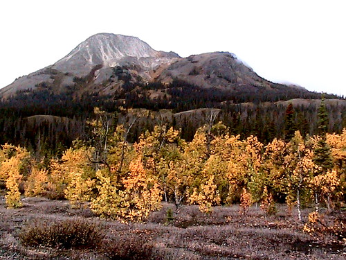
The High Lakes hike is aptly named. You trek from one remote lake to the next. With all the granite, at times it reminded me of the Sierra Nevada.

You are going to get your feet wet, for sure. But normally there is a way across the widest streams.

Many love this wilderness for the remote tenting options. Set up wherever you want.

Lonely Planet rates this adventure easy-medium, the worse misranking of any hike in the book. It is correct here:

… Waymarkings and signposts are unreliable. …

The Beartooth High Lakes circuit is very challenging due to the many rocky and wet scrambles. The snow that stays into late July. The lack of signage. Trails that often fizzle out completely.

In fact, I’d not recommend you try it without a good topo and GPS. One lake looks like the next up here.

Here I am wandering out through charming alpine meadows, looking for a good spot to leave a Summit Stone.

Though I was blissfully unaware at the time, I was far lost.

I ended up at the Clay Butte lookout tower, miles from my vehicle. … It was a long highway walk back to my car.

I loved the High Lakes hike. But I’d never do it again until after the mosquitoes are mostly gone. Perhaps September.

The best day hike is the section up to Becker or even Albino lakes.

See all photos from my High Lakes hike.

Arizona – Paria Canyon guided hike

42 miles (67km) plus side trips – 5 days

Our favourite hike in the S.W. United States is Paria Canyon.

Logistics are a problem, however. Only 20 permits are issued each day, one of the most difficult to acquire anywhere.

… Also, it’s a 2hr drive between the trailheads.

… Also, there’s a slight chance of flash flood !!

You can do Paria independently, … but it’s far easier to sign on with a guiding company like Just Roughin It:

On the first morning, we will pick you up from your hotel in Phoenix or Flagstaff and drive to the trail head at White House Ruins. Once at the trail head, the group loads up and hikes along the Paria River from there.

Our goal on the first t day is to reach the Paria Narrows and eventually camp at the confluence of Buckskin Gulch and Paria River. The hike is 7.5 miles long with very little change in elevation and usually take about 5 hours to complete.

The next day we will set aside time for a 3 mile side hike up the narrow Buckskin Gulch, one of the most famous, and longest, slot canyons in the world. From here we will move further down river to one of several campsites to choose from.

From here, the itinerary is open except for the being at Lee’s Ferry on the 5th day. Along the way to Lee’s Ferry, time permitting, there are opportunities to explore other slot canyons and sites in the area – including petroglyphs, historical sites and Wrather Arch which is one of the largest spans in the world. …

The price for this trip is $1,225 per person from Flagstaff and $1,275 per person from Phoenix.

official website – Just Roughin It Adventure Company.