Warren Long sends a link to this odd and magically entertaining edit.
Published on Dec 2, 2012
Japanese polar explorer Yasu Ogita’s video “Walking on the Thin Ice”
Extreme Arctic expedition solo on foot
Click PLAY or watch it on YouTube.

Best hikes, treks, tramps in the world.
Warren Long sends a link to this odd and magically entertaining edit.
Published on Dec 2, 2012
Japanese polar explorer Yasu Ogita’s video “Walking on the Thin Ice”
Extreme Arctic expedition solo on foot
Click PLAY or watch it on YouTube.
Bad news.
… a new study of nearly 9,000 U.S. children found that almost half of preschool-age kids are not getting outside at least once a day with their parents.
Girls were even less likely to be taken outside than boys, and some families reported not taking their young children outside more than a few times a month. The findings are in Archives of Pediatric & Adolescent Medicine. [Pooja S. Tandon, Chuan Zhou and Dimitri A. Christakis, Frequency of Parent-Supervised Outdoor Play of US Preschool-Aged Children]
Scientific American – Kids Fail To Get Outdoors
Children Spend 56 Days A Year Playing Videogames And Watching TV!
How often have you, or someone you know, eschewed a bicycle helmet to look cool at the expense of safety?
Well, gamble with a traumatic brain injury no more. Two Swedish inventors created an invisible helmet called Hövding …
The helmet is actually a thick collar — like one you might see on a heavy winter jacket — with an airbag hood underneath that deploys should you get in an accident. …
Great idea. But it’s single use, $450.
Click PLAY or watch it on YouTube.
BBC and Lonely Planet posted an article on one of the best hikes in the world:
Most first-time visitors to Peru make a beeline for the ruins of Machu Picchu, without realizing that they are passing within a bus ride of the epic Colca Canyon.
Slicing through the High Andes like a giant fissure for more than 100km, Colca is the world’s second deepest canyon, approximately 3,400m at its deepest point — a shade shallower that the nearby Cotahuasi Canyon and nearly twice as deep as the US’ Grand Canyon. …
With a few days to spare and minimal planning, it is easy to shoehorn Colca Canyon into a wider Peruvian trip. The area is best accessed via Arequipa, Peru’s second largest city …
The Calera hot springs are an acclimatizing 3km walk up the valley to a scenic spot by the Colca River. Once there, recline in a simple alfresco pool as screaming zip-liners slide terrified across the canyon overhead. The zip-line stretches for 600mbetween the canyon walls simulating the flight path of an Andean Condor. …
read more – Exploring Peru’s epic Colca Canyon
Check our Colca Canyon information page.
Consider climbing 5822m (19,101ft) Misti Volcano on the same trip.
You need enough time for acclimatizing to altitude, of course.
A plane carrying trekkers to the Mount Everest region hit a bird and crashed just after takeoff Friday in Nepal’s capital, killing the 19 Nepali, British and Chinese people on board, authorities said. …

I took that flight in 2009.
You can bus, instead. Then walk. But I reckon the bus journey is just as dangerous.
Update: This adventure is tough. If you are not 100% confident consider booking a guided hike with MB Guiding.
Don’t hike the “standard” NCT without a GUIDE.
by site editor Rick McCharles

One of the best hikes in the world is the …
North Coast / Cape Scott Trail, Vancouver Island, BC
It’s PARADISE … so why are we NOT recommending it?

Read on …
The NCT is a “backcountry adventure“, not a hike. There’s a reason some groups manage only 1km (.6mi) / hour on some sections.
On the other hand …
Our #1 hike worldwide is the nearby West Coast Trail.

The North Coast Trail is the newest (2008) of the WCT alternatives. An alternative way to spend time in this wild coastal temperate rainforest. It’s billed as “the WCT circa 1970“.
Was the WCT this bad in 1970? … Probably.☹️
STANDARD ROUTE:
• the North Coast Trail is a 43.1km extension to the original Cape Scott Trail. The total hiking distance Shushartie Bay (from water taxi) to San Josef Bay & Cape Scott Trail parking lot is a minimum of 59.5km (37mi).


• the only ways to get to the NCT are by logging road (64km from Port Hardy), water taxi or float plane.
• actually, a few masochists have bushwhacked in to Shushartie from Port Hardy. Dumb idea.
• best hike is to decide as you go where you want to camp. An “open” itinerary. Base your decisions each day on tides, weather and how you feel.
• many do 7 days, 6 nights on the standard NCT trail but — if you — instead — start at the parking lot, any number of days works. If you have serious problems, walk out.
• often you can choose between an inland path or a coastal route. The coast is almost always better. Certainly more scenic.
• the most detailed route report of the STANDARD NCT was posted in Wild Coast (2008) Shusartie to Laura Creek:
1. Shusartie overland (Shusartie to Skinner)
2. The Nahwitti Stretch (Skinner to Cape Sutil)
3. The Sutil Scramble (Cape Sutil to Irony)
4. Christensen Coast (Irony to Laura)
5. Nahwitti Cone (Laura to Nissen)
… walk out via the easy Cape Scott Trail
Though I had a challenging, terrific experience Sept 2012 (see trip report) … my recommendation is NOT to do what I did. Don’t hike the STANDARD NCT (minimum 61km). You can do better on Vancouver Island.
The new trail is extremely difficult where you start in the east. And gets easier as you head west and then south.

The beaches and trails are “better”, too, I felt, in the older western & southern parts of the Park.
Instead of the standard North Coast Trail: water taxi to Shushartie to Cape Scott Trail parking lot, better itineraries are:
• hiking the easier West Coast Trail, instead
• hiking the much easier Juan de Fuca Trail, instead
• or — best of all — hiking the North Coast Trail, differently:
_____
HIKE DIFFERENT – option 1 of 2:
~ start Cape Scott Trail parking lot (getting there by personal vehicle or Shuttle Van) -> hiking as far into the North Coast Trail as you wish -> then backtracking to the parking lot.
That in-and-out hike gives you many, many options. You can decide what you want to do, as you go. Keeners in your group can go further east, while others in your group relax on a favourite beach.
The very worst section, in our opinion, is Skinner – Shushartie. You can stop when you get to Skinner, if the going is rough.
Downside?
Some hikers hate backtracking. No worry, in this case. The Trail looks completely different walking in different directions. It changes, too, with the tide. Trust me — you won’t be bored.
If you don’t have your own vehicle, you’ll somehow have to arrange the Shuttle to come pick you up.
_____
HIKE DIFFERENT – option 2 of 2:
Start at Skinner. Or even Cape Sutil.
… Why doesn’t everyone do that?
“Park Facility Operators” by email:
Shushartie is by far the safest and most reliable place to drop off hikers. It can be reached at all tides by most boats. I completed a survey of the coastline with the Coast Guard and they also recommended keeping Shushartie Bay as the primary access point strictly from a safety perspective. It is also a hardened area that is not negatively impacted by constant boat landings. …
Though more materials for boardwalk has been airdropped alongside the Trail, I heard money had run out. There has been some controversy regarding the funds expended, too.
_____
If I was going again next year, I’d start at the Parking lot. Not Shushartie.
… Are we being too hard on the Skinner – Shushartie slog?
“Park Facility Operators” by email:
It’s unique due to its rare vegetation and tree species, its endangered (and protected) fish and amphibian species and its ability to positively affect the rest of the park’s functioning ecosystem. All rare and unique. These types of ecosystems are often referred to as the lungs of our environment.“Park Facility Operators” felt that it was very important to represent this ecosystem as part of the hike. It is very unique and like I say, one of the primary reasons this part of the park was created, from a conservation perspective.
Those upland bogs are interesting.

But visiting them requires one day of your life.
WHY WE LIKE THIS HIKE:
• North Coast Trail is like the West Coast Trail without the hassle of getting a “Trail Use Permit”
• west coast of Vancouver Island is fantastic. This truly is one trek that could change your life.

• NCT camping is only C$10/person/night. May to Sept. You can buy backcountry permits online, or pay cash at the trailhead. Honour system.
• no quota on number of hikers (WCT allows only 60/day)
• no reservations needed
• you can hike NCT / Cape Scott year round, weather permitting, while the full WCT is only officially open 5 months a year. (However, the Water Taxi stops running around Sept. 15th each season.)
• gorgeous beach campsites with sunset views. Nel’s Bight beach is 2.4km long and 210m wide at low tide. Sweet.
• some old-growth forest including giant Sitka Spruce & Western Red Cedar
• pretty sea stacks and other fascinating coastal geology
• tidal pools, bogs, riparian areas, …
• good tent pads, far better than on the West Coast Trail
• campfires allowed. Plenty of drift wood.

• chance to see whales & other marine mammals, bald eagles, river and sea otters, mink, deer, elk

• everybody loves Guise Bay & Experiment Bight
• few biting insects on the coast (you will find mosquitoes inland out of the wind)
• possibly a few horseflies inland (not to mention millions of weird, but non-biting, beach hoppers on the coast)
• creek crossings are only an issue when in flood.
• two new cable cars propel you over the only major rivers
• theft and vandalism of parked vehicles is normally no problem at Cape Scott trailhead, San Josef. No parking fee.
• wild (dispersed) camping is allowed
• many set up tents protected within “fortresses” (temporary beach shelters made of drift logs). “Park Facility Operators” asks that you dissemble those, when finished
• beach-combing is fascinating, look for wreakage from Japan
• the Cultural Heritage of this area is fascinating. Signage explains the history of native peoples and the failed Danish colonies
• you’ll see BEARS and WOLVES in the wild 🙂

CONSIDERATIONS:
• you’ll see BEARS and WOLVES in the wild 😦
• bears and hikers both love: berries, low tide, trails

• it’s MUDDY, … really, really MUDDY
• did we mention it’s MUDDY?
• prepare for slippery rocks, roots and logs. Eyes blinded with rain, you’ll need to scramble up, over and between giant stumps. With a full pack.
• most wear waterproof hiking boot with high gaiters. It’s a gamble to wear anything else — 5-10 water shoes, for example.
• most hikers get blisters. Bring moleskin, or whatever works best for you
• most hikers bring a second pair of footwear for camp
• consider bringing one or two hiking poles. There are many wooden walking sticks to be found in the campsites, as a back-up
• you must scramble fallen trees, steep slippery slopes sometimes assisted by muddy rope
• expect to fall on your face. Most often at a moment when you’re not paying attention to your footing.
• so far “Park Facility Operators” has recorded more injuries on the “cobble beaches” than any other terrain. Slippery boulders can be ankle busters.
• bring a first aid kid. There are 3 Ranger stations, but many parts of the trail are not regularly patrolled. Plan to be self-sufficient in any emergency.

• water is a problem in this Park, sources few and far between. By end of season some sources are reduced to a trickle. Or seep. Boil, filter or treat. Collect rain water with a tarp, if you get the chance.

“Park Facility Operators” by email:
Perennial streams on coastal trails, including the NCT, are hard to predict. With such little relief and few lakes to store runoff, it all comes down to recent rain fall. Even the big streams like Nahwitti and Stranby are tidally influenced and are brackish near their mouths. …
• best bring more water carrying capacity / person (perhaps 4 litres / person)
• if you do decide to go, get the only dedicated guidebook
• signage is terrific on the Cape Scott Trail, but minimal on the new NCT. Most hikers are working off the $10 Wild Coast Map
• when the NCT was built, the signage was combined with the Cape Scott Trail for consistency. Makes sense.
• fishing is permitted as per provincial and federal fishing regulations. Nobody was catching anything when we were there.
• leashed dogs allowed — but NOT recommended. There’s a chance they’ll run into wolves. UPDATE – we’ve heard dogs are no longer allowed on the trail.
• no emergency phone. No phone coverage. (Marine radios can be rented from North Coast Trail Shuttle. If you call, evacuation costs about $1000 … IF they can get to you.)
UPDATE from George of North Coast Trail Shuttle:
Only 2 injured hikers picked up in 2012. at no cost, 1 heli 1 coast guard. We picked up 2 on different days that called in to say they were done. 1 pooped 1 mild knee strain. They paid seat price as we were in the area.We have only had one group pay the charter rate of $1000.00 in 5 years. Most get picked up next morning for discounted rate after we drop off others.
• bring your own satellite phone if you want to maximize safety. VHF radios are going to work. SPOT locators are fairly unreliable, in my opinion.
• sections of the trail are impassable or very difficult at high tide. Check tide tables posted at most official campsites. Get tide tables in advance, as a back-up, in Port Hardy. Jot them down from signs (if posted) in campgrounds, as they may be slightly different
• May to October are the best months
• we like August and early September best of all
• off-season this part of the world is very cold and rainy
• some consider Cape Scott Lighthouse a bit of a letdown. It’s not on the sea.
• rogue waves can knock an inattentive hiker into the sea
• expect torrential rain and wind. You need a good waterproof tent and tie-downs. And clothing for those conditions.
• keep a dry set of clothes in a waterproof bag, for wearing inside the tent
• summer highs around 14C (57F)
• risk of hypothermia
• bring parachute line to hang food from a tree as a back-up, in case you don’t make it to an official campsite, for any reason. There are bears everywhere.
• bear-proof metal food caches are widely available, actually. Near essential in this bear country.

LOGISTICS:
• almost everyone arrives Port Hardy by the only lonely highway. It’s 499km from Victoria, 412km from Vancouver (plus ferry).
• a terrific alternative, would be to arrive or depart by BC Ferry from Prince Rupert. (From Rupert you can catch the Alaska Marine Ferry, something I did once. A superb trip up the Inside Passage.)
• bring stove fuel with you to Port Hardy as stores may be closed
• public transport is convenient
~ one Greyhound bus a day
~ walk a couple of blocks to one of two hostels. There are many hotels, too.
~ walk to the North Coast Trail offices at the Marina, morning of transit
• both the hostel & North Coast Trail Shuttle will store a small bag for you, while you are gone. Your small bag with CLEAN clothes.
• the city of Port Hardy maintains an updated list of transportation options.
• no reservations are needed to hike the North Coast Trail. But you must book both van shuttle (San Josef) and/or water taxi (Shushartie) in advance. To get a good price you need a number of hikers taking that transport at the same time. North Coast Trail Shuttle rents VHF marine radios too ($50+tax).
You can prepay your $10/night/hiker to North Coast Trail Shuttle, as well. Very convenient.
BEST TREKKING GUIDEBOOKS:
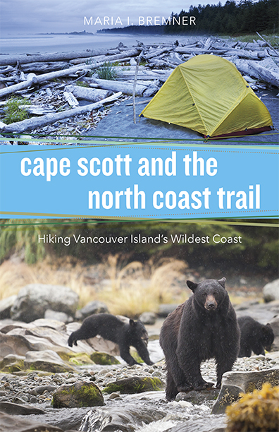
Cape Scott and the North Coast Trail by Maria Bremner (2015)
HIKING TRAILS 3 – Northern Vancouver Island (9 pages) – $31
OTHER RECOMMENDED BOOKS:
• Plants of the West Coast Trail – Collin Varner
• Back Country Bear Basics – David Smith
• A Guide to West Coast Hiking in British Columbia and Washington State – Philip Stone
BEST MAPS:
• most used map by far is FREE online from Wild Coast. You can buy a hard copy via that link for $14.95.
You might be able to buy it in Port Hardy, as well..
• BC Parks – map (PDF)
• National Topographic Series Maps, Scale 1:50,000, Index No.102, Sheets 1/9 and 1/16, cover the Cape Scott area. Available at most map retailers in British Columbia.
BEST VIDEOS:
Cape Scott Park has a Flash-based Virtual Tour. Click around to discover highlights.
Mikecyclone 2012 – HIKING THE NORTH COAST TRAIL
MrPortsider 2012 – Wolf pesters Bear North Coast Trail
GUIDES:
Coastal Bliss – The North Coast Trail and Cape Scott Park
9 days-Strenuous – CDN$1,799 + 12% HST
Sea to Sky – The North Coast Trail and Cape Scott Park
CDN$1799 + 12% HST [Federal Tax]
BEST WEBSITES:
After this page, the best links are:
Wild Coast Publishing – Explore the Best: The North Coast Trail, a primer
BC Parks – Cape Scott Provincial Park (est. 1973)
BC Parks – Hiking in Cape Scott Provincial Park
~ The North Coast Trail by paddle
~ The North Coast Trail versus the West Coast Trail
BC Parks – Bear Safety
BC Parks – Wolf Safety
BC Parks – Park User Fees
Port Hardy Transportation options
Wikipedia – North Coast Trail
Wikipedia – Cape Scott Provincial Park
North Coast Trail Backpacker’s Hostel (Trip Adviser)
C&N Backpackers Port Hardy (Trip Adviser)
There are many hotels & motels in town, all within walking distance.
BEST PHOTOS & TRIP REPORTS:
Wild Coast Magazine – Route details
Cape Scott and the North Coast Trail guidebook – photos
RichSo’s trip report has fantastic photos

Smile With Your Heart – 2011

Sam Yeaman – North Coast Trail – 2012
Club Tread – North Coast Trail with GPS Waypoints
Jeff Hunt and Bob Wall’s 60k Trail Run – May 10th, 2008 (Opening Day)
David Crerar & 3 others Trail Run – May 2008
Rick McCharles – North Coast Trail photos – 2012
Trees Rocks Dirt – trip report – 2010
Joyce Peralta – North Coast Trail photos – 2009

Leave a comment if you have feedback. Thanks!
But don’t say you weren’t WARNED.
more photos shared by Sam Yeaman
Sept 2012 trip report by site editor Rick McCharles
» day 1 | day 2 | day 3 | day 4 | day 5 | day 6 | day 7 | ★ recommendations ★
Nel’s to San Josef Bay
Despite the werewolf attack of the previous night, I was reluctant to leave my ideal campsite in perfect weather.
(Moma wolf had swung by early morning, to make sure I wasn’t still angry.)

I left one of my partial stove fuel canisters for the next desperate hiking group. Beside it is a tent pole repair splint I’d found. Actually I found two over the week, leaving both at Nel’s for future emergencies.

Often I dislike and avoid pit toilets on hikes. But I have to admit those in Cape Scott Provincial Park are pretty good. Kept clean. Many with toilet paper.

To sidetrip to Hansen lagoon, we threw out packs up atop this sign. To deter wolves. 🙂

Unbelievable. Flat fields reclaimed from tidal flats look like prairies.

The sad history of failed Danish settlements here is fascinating. One of the highlights of my trip.
Here’s the abandoned settlement telegraph wire.

This final long day is much different. Tranquil. Change is as good as a rest.

On the longer established Cape Scott Trail, the walking is mostly easy.


This fallen tree on Fisherman’s River impressed. Though nearly horizontal, it is thriving.

There are banana slugs on this part of the island, but far fewer and smaller than on the WCT.

Eric Lake is BIG. And a bit of a surprise after all that coastal scenery.

The girls had leapfrogged me. I found them set-up in the sprawling Eric Lake campsite. Have you ever seen tent platforms this elaborate?

Typical for me, I pushed on to San Josef Bay to beach tent for the 6th night in a row. The weather was perfect.
It seemed I’d arrived San Josef at low enough tide to skirt the headland and reach the far side of the beach — the side with water.

Nope. I ended up doing the Spiderman traverse above crashing waves at dusk. … Kind of fun actually. At this point I knew I was going to survive the trip. 🙂
I had dinner with the only two other hikers on the beach. And enjoyed my last, wonderful sunset.

» day 1 | day 2 | day 3 | day 4 | day 5 | day 6 | day 7 | ★ recommendations ★
Sept 2012 trip report by site editor Rick McCharles
» day 1 | day 2 | day 3 | day 4 | day 5 | day 6 | day 7 | ★ recommendations ★
Nissen to Cape Scott Lighthouse
Mornings are often foggy on this coast. It burns off after a couple of hours on a sunny day.

Here’s a fog bank, for comparison, dissipating later in the day at Nel’s Bight.

Departing Nissen, you find that your North Coast Trail is now also the older (1973) Cape Scott Trail. In much better condition.
Very cool. Unique, so far as I’ve seen, is this broken up wooden ship hulk, sunk as a breakwater, slowly being overgrown by vegetation.


The Earth reclaiming. 🙂
From 1897 until 1910, Danish settlers tried to establish a fishing community near San Josef Bay. Due to the harsh climate and lack of governmental support, the community failed …
… another attempt was made at Hansen Lagoon, similarly failing by 1917. Alfred Spencer, the last resident, left in 1956.
Some artifacts can still be seen in the park, including a three-metre-tall granite tombstone, several corduroy roads, many ruins (that look like anonymous mossy mounds), and rusty farming implements. …
Wikipedia – history of Cape Scott
Of those relics, the most impressive to me is this crude tractor abandoned jammed between trees near Hansen Lagoon.

Nel’s Bight is gorgeous. My favourite stop. The most popular beach in the Park is reasonably easy to access from the parking lot. No need to hike the NCT to get here.

I set up my tent early in the day, for the first time. And walked the 2km long beach barefoot in bright sunshine.


I’d pushed to get here early to have time to side trip to the Cape Scott lighthouse. (minimum 13.6km)


It’s a pretty, varied and well maintained trail. I love log bridges made of materials available on site, this style in particular.


Some find the manned light house a bit of a let down. It’s immaculate, however.


The weather was marvelous. With views over to the island north of the north tip of Vancouver Island.

The letdown is the location of the light station, far from shore atop a hill. Somehow it’s not as exciting as those on the West Coast Trail.
Locals love grass fringed Guise Bay en route.

And unique Dune Neck to Experiment Bight.

Natives formerly dragged their boats across this sandy stretch rather than risk the circumnavigation of Cape Scott in dangerous seas.
FEAR the WOLVES

By the time I got back to the tent, it was late. I was tired.

My food, as always, was carefully locked away in the campsite cache.

🙂 Fortunately, I’d found stove fuel left behind by departing hikers.
😦 Unfortunately …, there was a pack of wolves close to the water source at Nel’s beach.
Why?
They were feasting dawn and dusk on a sea lion carcass dead directly in front of the Ranger’s cabin. Here a photo I took the next day.

The water — however — was close to the Ranger’s cabin, as well.

So wolves, be damned. I marched directly to get water. The beasts dissolved into the trees.
…
It was quite dark by the time I finished dinner. Instead of cleaning the pot, I used an old trick — filling it with sand and sea water. That prevents critters from coming to visit during the night.
But the tide was low. I had a long walk barefoot to reach the surf.
When I turned around, there was the alpha wolf, about 25ft away. They’d trapped me!
I SHOUTED. I raved. I waved (my pot).
I grabbed KELP and snapped it like a WHIP.

The wolf mother finally realized I was some madman. And finally trotted off with her brood. … At least my THEORY is that this is a mother with young ones. Some speculated the leader is the Alpha Male with 3 or 4 followers.
Here’s a wolf, perhaps the same wolf, on the same beach Aug 10th, 2012, a month before I was there.
Click PLAY or watch it on YouTube.
It was much, much later before I realized she was only coming out to see where I dumped leftovers in the sea.
Wolves almost NEVER attack humans. The are among the least threatening beasts anywhere for their size and strength.
The Vancouver Island Wolf is a subspecies of grey. They will attack dogs and, indeed, there were at least two dog encounters this season in the Park. Don’t bring your dog here.
Their main prey on this Island are Columbian black-tailed deer and Roosevelt elk. While I was on the Trail, one hiker captured video of a wolf chasing a deer through the surf.
P.S.
I’m adding a line to my résumé:
Once pursued by wolves.
» day 1 | day 2 | day 3 | day 4 | day 5 | day 6 | day 7 | ★ recommendations ★
Sept 2012 trip report by site editor Rick McCharles
» day 1 | day 2 | day 3 | day 4 | day 5 | day 6 | day 7 | ★ recommendations ★
Shuttleworth to Nissen Bight
My German friends were first out of Camp. Again.

Often I’m slow to depart, hoping trying to dry my gear before packing up.

A pretty morning.

I crossed the Strandby River cable car with the girls.

Many have painful feet by this point in the adventure. Mine were still OK, lucky since I only wore low cut approach shoes without gaiters.

With all this mud, next time on the NCT I’d wear Water Walking Shoes. Like these Five Ten Canyoneers.

Those worked well for me in Paria Canyon, Virgin Narrows and the West Coast Trail.
Downside?
Risk of puncturing them on a sharp branch or rock.
But aside from the rocks, most everything in this climate is soft, rotting, rounded or blunted.
I found only one thorny plant in a week.

Not much flora can harm you on this trek. There is some Cow Parsnip, which might cause skin irritation.
Unless you know what you’re doing, don’t eat any of the amazing lichen or mushrooms.

The walking gets easier and easier as you go West, as promised. You enjoy more coastal sections, less in the trees.

This was my favourite surface — dried sea weed.

You end up walking many beached logs. As a former gymnast, the balance required doesn’t intimidate. 🙂

I wish they could reroute more muddy sections over fallen logs.

Hard packed sand makes for excellent footing, too. You test each beach to find the best sand.

Personally, I try to stay on the coast, even if the walking’s more difficult. On this section I happened upon some nice tidal pools.

Though the North Coast Trail is more difficult, for some reason I fall more on the West Coast Trail.
WCT (3 times) = average 1 fall to the ground / day
NCT (1 time) = fell only twice over 7 days
… perhaps the sample size is too small. 🙂
Best advice — when you fall, pull in limbs, try to land on your pack. You want the pack to take as much of the impact as possible.
The Germans and I decided to skip Laura Creek. And go all the way to Nissen Bight.

For me that was 9hrs on foot. A long day.

At Nissen the water source is at one end of the beach, 900m away from the pit toilet. … Who’s stupid idea was that?
After traipsing back and forth, I ran out of stove fuel in any case … No hot dinner for me. Sheiss.

I really need to get one of the “twig” stoves.
» day 1 | day 2 | day 3 | day 4 | day 5 | day 6 | day 7 | ★ recommendations ★


